|
Activities | Camp
| Camping |
Destinations
blm.land.field office
BLM Ranger: Bureau of Land Management
desert camping, hiking, slot canyons, off road areas
           
BLM (Bureau of Land Management)
Federally managed public lands BLM, in California are broken down into three different districts:
California Deserts
Central California
Northern California
 The California Bureau of Land Management calls their stations "field offices", instead of typical forest ranger station.
You can also find INTER-AGENCY visitors centers around California, where BLM, National Forest and National Park are represented in a convenient one-stop shop location. Maps, books, permits, info, bathrooms, picnic areas, stretch-your-legs rest break kinda place.
The Eastern Sierra Visitor Center is one such example. Located at a busy highway junction, south of Lone Pine, California in the Eastern Sierra region. US Hwy 395 @ Highway 136. High desert meet mountains - where Death Valley National Park, Inyo National Forest and BLM lands are abundant, and the tallest peak, Mount Whitney, is within view. Well worth the stop!
Below is Total Escape's simplified version for finding BLM information. Listed are direct contacts to regional district office and the rural, field offices. Links and email addresses are provided, but be warned, these may change at any time.
BLM State Headquarters
California Bureau of Land Management
2800 Cottage Way Suite W1623
Sacramento, CA 95825
Hours: 8:30am-4:30pm
Phone: 916-978-4400
Fax: 916-978-4419
TTY/Federal Relay System: 916-978-4419
Email: BLM_CA_Web_SO@blm.gov
Northern California District
Redding BLM Office
Bureau of Land Management
6640 Lockheed Drive
Redding, CA 96002
Phone: 530-224-2100
Email: BLM_CA_Web_RE@blm.gov
Applegate Field Office
708 West 12th Street
Alturas, CA 96101
Phone: 530-233-4666
Email: BLM_CA_Web_AP@blm.gov
Arcata BLM Office
1695 Heindon Road
Arcata, CA 95521-4573
Phone: 707-825-2300
Email: BLM_CA_Web_AR@blm.gov
King Range BLM Office
768 Shelter Cove Road
Whitethorn, CA
Phone: 707-986-5400
Eagle Lake Field Office
Susanville BLM
2550 Riverside Drive
Susanville, CA 96130
Phone: 530-257-0456
Email: BLM_CA_Web_EL@blm.gov
Central California Districts
Mother Lode Field Office
El Dorado BLM
5152 Hillsdale Circle
El Dorado Hills, CA 95762
Phone: 916-941-3101
Email: BLM_CA_Web_ML@blm.gov
Bakersfield BLM Field Office
3801 Pegasus Drive
Bakersfield, CA 93308
Phone: 661-391-6000
Email: BLM_CA_Web_BK@blm.gov
Bishop BLM Field Office
351 Pacu Lane, Suite 100
Bishop, CA 93514
Phone: 760-872-5000
Email: BLM_CA_Web_BI@blm.gov
Ukiah BLM Office
2550 North State Street
Ukiah, CA 95482
Phone: 707-468-4000
Email: BLM_CA_Web_UK@blm.gov
Central Coast BLM Office
940 2nd Avenue
Marina, CA 93933
Phone: 831-582-2200
Email: BLM_CA_Web_CC@blm.gov
California Desert Districts
Mojave Bureau of Land Management
Barstow BLM Office
2601 Barstow Road
Barstow, CA 92311
Phone: 760-252-6000
Email: BLM_CA_Web_BA@blm.gov
El Centro BLM Office
1661 South 4th Street
El Centro, CA 92243
Phone: 760-337-4400
Email: BLM_CA_Web_EC@blm.gov
US BLM Conservation Dept.
22835 Calle San Juan De Los Lagos
Moreno Valley, CA 92553
Phone: 951-697-5200
Email: BLM_CA_Web_CD@blm.gov
Needles BLM
1303 South Highway 95
Needles, CA 92363
Phone: 760-326-7000
Email: BLM_CA_Web_NE@blm.gov
Palm Springs BLM
South Coast Field Office
1201 Bird Center Drive
Palm Springs, CA 92262
Phone: 760-833-7100
Email: BLM_CA_Web_PS@blm.gov
Ridgecrest BLM Office
300 South Richmond Road
Ridgecrest, CA 93555
Phone: 760-384-5400
Email: BLM_CA_Web_RI@blm.gov

Additional recreation and camping information, listed by regional district: RV camps, off-roading, sand dunes, trailheads, developed campgrounds, open camping areas, indian petroglyphs and scenic backroads.
BLM NorCal Recreation
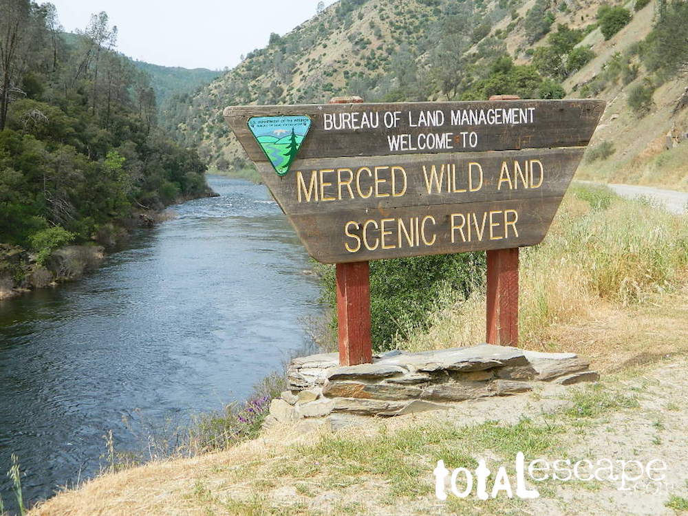
BLM Sierra River Canyons
BLM Mojave Desert Recreation
BLM Eastern Sierra Recreation
BLM 4x4 West of Death Valley NP
BLM Southern California Deserts
- Blythe Intaglios, Blythe, CA
- Turtle Mountain Road, Hwy 95, South of Needles, CA
- Yuma Arizona BLM Camping
Interstate 8 - AZ @ CA
- Imperial Sand Dunes
CA Highway 78 near Brawley, CA
619-353-1060
- Yuha Desert BLM
Interstate 8 @ Ocotillo, CA
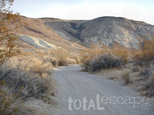
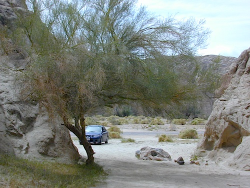
- BLM Box Canyon @ Mecca, CA
Hiking, Biking, RV Sites, Car Camping, 4x4 Camping
Located a few miles off Interstate 10 @ Cottonwood exit. Joshua Tree National Park is on the north side of the freeway, and Box Canyon leads south to the small farmtown of Mecca. Designated roads into slot canyons, trailheads, wildflowers, open camping w/ campfires allowed. Region is filled with slot canyons, washes and wildflowers. Totally worth exploring, on foot, on bike or in a capable vehicle.
Official BLM of California
gov web site
 
|
Total Escape California Camping
Advertisement
|
|