a d v e r t i s e m e n t s

Activities | Camp | Camping | Destinations | Mountain

trail.pacific.crest

California Pacific Crest Trail

Hike the PCT. This is the famous hiking trail that runs the entire length of the Western United States of America. From the Mexican desert to the Canadian border this route winds thru the best forest scenery & mountain scapes along California, Oregon & Washington state. 
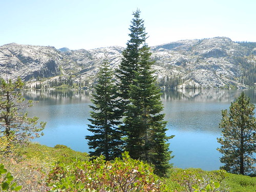
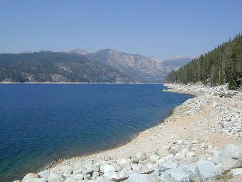
Backpacking the PCT is a 'once of a life time story' for most folks who try it, altho John Muir spent a good portion of his life in these gorgeous, scenic, upper elevations of alpine bliss. Starting from the south near Tecate Mexico, the path travels north into the rugged Sierra Nevada high countrty, then proceeds up thru the Cascade Ranges of CA, OR & WA.

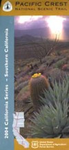
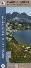
Pacific Crest Trail Topo Maps / PCT trail maps

PCT Trail Maps
PCT MAP #1
- Southern California
PCT Trail Map
PCT MAP #2
- Traverse Ranges
PCT topo maps
PCT MAP #3
- Southern Sierra
PCT Oregon Map
PCT MAP #8
- Northern Oregon
PCT Maps
PCT MAP #9
- Southern Washington
Sierra Maps
OVERVIEW
- Sierra Nevada Map

Many backpackers make their dreams come true each year as they traverse segments of this popular route. A few try the whole thing.. but it may take a full year to do it right. Weather is a concern in winter months, as snow gets hella deep in the High Sierra. Plan your route accordingly.

www.flickr.com

Pacific Crest Trail Association

Pacific Crest Trail of the Sacramento Valley Region

Search : Lone Pine Region Recreation Topo Map & Guide: Inyo National Forest, Kings Canyon National Park, Sequoia National Park, Tinemaha Reservoir, Owens River, Owens Lake, Sierra Nevadas, Inyo Mountains, Mount Whitney, Long Lake, Big Pine, Lone Pine, (Fresno County, Tulare County, Inyo County, Owens Valley, Interstate Highway 395, Intrastate Highway 136: Camping, Fishing, Hiking, Ohv, 4wd, Off-road, Climbing, Skiing, Mountain Biking, Street Maps, Campground Finder, Waterproof Topo Lines 3d Relief, Sierra Maps Eastern Sierra Series 2008)
Lone Pine Region Recreation Topo Map & Guide: Inyo National Forest, Kings Canyon National Park, Sequoia National Park, Tinemaha Reservoir, Owens River, Owens Lake, Sierra Nevadas, Inyo Mountains, Mount Whitney, Long Lake, Big Pine, Lone Pine, (Fresno County, Tulare County, Inyo County, Owens Valley, Interstate Highway 395, Intrastate Highway 136: Camping, Fishing, Hiking, Ohv, 4wd, Off-road, Climbing, Skiing, Mountain Biking, Street Maps, Campground Finder, Waterproof Topo Lines 3d Relief, Sierra Maps Eastern Sierra Series 2008)

Search : 100 Classic Hikes in Northern California: Sierra Nevada/ Cascade Mountains/ Klamath Mountains/ Coast Range and North Coast/ San Francisco Bay Area
100 Classic Hikes in Northern California: Sierra Nevada/ Cascade Mountains/ Klamath Mountains/ Coast Range and North Coast/ San Francisco Bay Area

Amazon.com's Price: $14.93
Search : Sierra North: Backcountry Trips in Californias Sierra Nevada
Sierra North: Backcountry Trips in Californias Sierra Nevada

Amazon.com's Price: $12.89
Search : Best Short Hikes in California's Northern Sierra: A Guide to Day Hikes Near Campgrounds
Best Short Hikes in California's Northern Sierra: A Guide to Day Hikes Near Campgrounds

Search : Alpine Sierra Trailblazer: Where to Hike, Ski, Bike, Fish, Drive from Tahoe to Yosemite, 5th Edition
Alpine Sierra Trailblazer: Where to Hike, Ski, Bike, Fish, Drive from Tahoe to Yosemite, 5th Edition

Amazon.com's Price: $17.95


California Weekends
Copyright © 1996-2010 Total Escape, www.totalescape.com / All Rights Reserved.

home | lodge | recreation | destinations | journey | forum | trips | advertise | site map | outside | maps | gear


knitted sweaters for children