

Keough Hot Springs
Keough Hot Tubs, Eastern Sierra
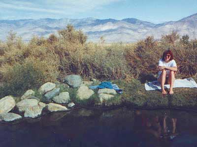
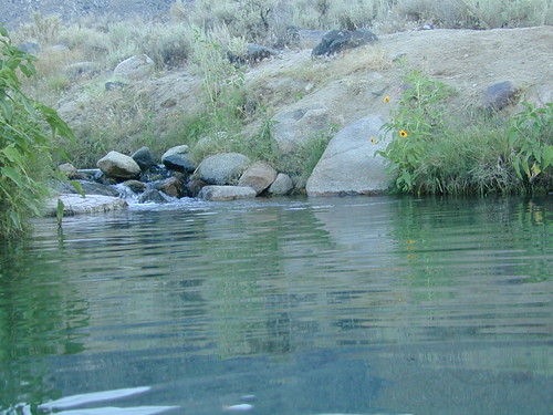
Keough Hot Ditch
7 miles North of Big Pine & 7 miles South of Bishop;
on the west side of Hwy. 395
Keough California is comprised of two soaking spots – a small resort and the primitive tubs below. An Eastern Sierra rustic Hot Springs Resort w/ campground, tent cabins rentals and nice landscaping. Big, clean hot pools at the top of the road. Entrance fees, trees and vegetation, next to the mountains. Seniors and families frequent this place. Swimsuits are required.
Keough’s Hot Springs Resort
800 Keough Hot Springs Road
Bishop, CA 93514
760-872-4670
The Ditch
Below the resort and above the highway, are some primitive, free hot pools that require dirt road driving. Public nudity is common. Open 24/7 w/ several brush lined pools on the eastern slopes of the Sierra Nevada Mountains overlooking the high desert of the Owens Valley. Quite impressive for being just off the highway. Buzzing, huge powerlines overhead are one of the only drawbacks of this soak spot. This place can get crowded at certain times.
Posted: No overnight camping allowed at these lower hot springs.

US Highway 395:
Look for the turn off in between Bishop and Big Pine, California. Take the Keough Hot Springs Road up hill until the second dirt road, turn right and the primitive hot springs will be on the left, just beyond the cold stream crossing. Sometimes a high clearance might be needed. Cars should park and walk the if unsure of the terrain. Do not park right next to the soaking tub, as the ground is too weak and vehicles have been known to slide in, unexpectedly. No kidding!
![]() Plenty great camping all around the Eastern Sierra region. For campsites with cooler temps, higher elevation, pine trees & creeks: Head for the Glacier Lodge Rd – Inyo Road #9S21, West outta Big Pine.
Plenty great camping all around the Eastern Sierra region. For campsites with cooler temps, higher elevation, pine trees & creeks: Head for the Glacier Lodge Rd – Inyo Road #9S21, West outta Big Pine.
Adventurous 4x4s can try super remote Coyote Flat, a super high elevation pinyon plateau that overlooks Bishop. Also Highway 168 W outta Bishop will lead to primitive camping areas like The Buttermilks, a rock climbing area. Further up the hill is alpine lake and creek camping in aspen groves.
Many developed Campgrounds in the region.
View Keough Hot Springs in a larger map
also nearby:

