An early Spring can bring Deserts as well as mountain foothills to full bloom anywhere from FEB-MAY. By summer, JUNE- AUG expect to see the mid elevations
bursting with color. After the big snows melt at higher elevations, JULY-SEPT meadows
are the place to be!
An early Spring can bring Deserts as well as mountain foothills to full bloom anywhere from FEB-MAY. By summer, JUNE- AUG expect to see the mid elevations
bursting with color. After the big snows melt at higher elevations, JULY-SEPT meadows
are the place to be!
All wildflowers are protected
by California law with a $500 fine for violation. For every
one wildflower picked, one hundred less will bloom next year.
What Time of Year When is the bloom?
This is a chart for best chances of viewing flowers in the
state of California
|
regions
|
jan
|
feb
|
mar
|
apr
|
may
|
june
|
july
|
aug
|
sept
|
oct
|
nov
|
dec
|
|
high deserts
|
|
|
|
|
|
|
|
|
|
|
|
|
|
low deserts
|
|
. |
. |
. |
|
|
|
|
|
|
|
|
|
central
valleys
|
|
|
|
|
|
|
|
|
|
|
|
|
|
mtn.
foothills
|
|
|
|
|
|
|
|
|
|
|
|
|
|
high sierra
|
|
|
|
|
|
|
|
|
|
|
|
|
|
coastal
|
|
|
|
|
|
|
|
|
|
|
|
|
|


|
towns with incredible wildflower displays close by:
|
|

Wildflower Hikes
Hot Springs Mountain
(Off Highway 79)
5.5 miles RT/ strenuous
elevation gain/loss =1,250 feet
near Warner Springs, East of Temecula
/ 10 miles northeast of Lake Henshaw
- From Temecula Interstate 15, take Highway
79 East to Warner Springs
- Drive up Los Coyotes' Indian Reservations
main road, past the intersection of Middle Fork Borrego Palm
Canyon (6.1 miles past the entrance gate )
- Turn left (west) and drive up the valley
on a sandy road to reach a saddle above the valley 2.2 mi. farther
- At Nelson's Camp, on the left side of the
road, Park at the camp
- Begin hiking southwest up along a small tributary
stream that flows north & west into Agua Caliente Creek.
- Follow an old Jeep trail up, gaining more
than 500 feet in just over a mile.
- At the top, you'll meet a better road that
runs up the south slope to Hot Springs Mountain
- Turn left (west) on this road and climb another
1.6 miles along the ridge line to the tower.
- Pass through dense forests of black oak,
Coulter pine and white fir,
- Meadows dotted in late spring with wildflowers.
- Lookout tower, dilapidated and seemingly
on its last leg, sits on the west shoulder of the mountain
- Go a bit higher on the ridge by following
a faint trail through thick brush and around boulders to the
true summit. A flat concrete platform caps the summit block.
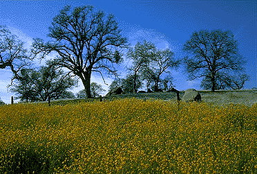
Photo Credit © Chris DiNenna
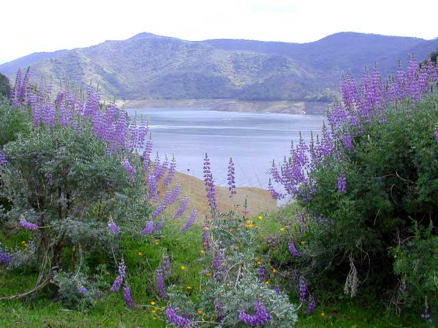
Early Spring bloom in March - Tollhouse Rd. east of Fresno
|
Wildflower
Hotlines
Favorite Links
Links to other websites dedicated to California Wildflowers
Cal Flora - SoCal wildflowers reference site
Cal Photos - UC Berkeley flora search & photo site
Wildflower Search - Wildflowers by Color
Wildflower Triathlon - at Lake San Antonio
California Wildflower Seeds