all towns by county coastal deserts urban mountains countryside snow towns parks & forests cali maps
Advertisement


Destinations | Mountain

town.avery

Photo Credit Copyright DanaMite

Small town on Sierra Nevada Highway 4, Ebbetts Pass

avery, California

elevation: 3387'
population: 672
zip code: 95224

Mountain

mountain
terrain
:
Sierra foothills with oaks & pines


View Larger Map

Avery

location:
Calaveras County
NE of Angles Camp & Sonora
on Hwy.4

lodging

Avery
lodging

recreation

recreation:

  • mountain biking
  • snow skiing (Cottage Springs)
  • wineries
  • Historic Gold Country
  • caverns & caves
  • Leach Field
  • golfing
  • hiking
  • fishing
  • bird watching
  • parks, forests, rivers & lakes

    parks, forests, rivers & lakes:

  • New Melones Lake
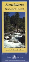
  • Stanislaus National Forest
  • Mokelumne Wilderness
  • Hunter Reservoir
  • Crescent Cove Picnic Area
  • Stanislaus River
  • description:
    Central Sierra, western foothills, Gold Rush California, near caverns & caves, forests and rivers.

    Calaveras Ranger Station
    USFS Stanislaus NF
    5519 CA Highway 4
    Murphys, CA 95247
    209-795-1381

    nearby towns
    nearby towns:
    Angels Camp
    Arnold
    Sonora
    Murphys
    Dorrington
    San Andreas
    Columbia
    Bear Valley
    local links
    local links:

    Calaveras County Chamber of Commerce
    7 Main St, San Andreas, CA 95249
    209-754-5400
    https://www.calaveras.org/

    California Caverns
    Day-O Espresso
    Avery Hotel
    Go Calaveras


    Park Big Tree

    North Fork Stanislaus River
    Total Escape California Camping

    Advertisement


    California Weekends


    Total Escape has been an AmazonAssociate for 20 years!
    Earnings from purchases keeps this site alive.


    Copyright © 1996-2024 Total Escape, totalescape.com / All Rights Reserved.

    classic | lodge | recreation | destinations | journey | ads | sitemap | outside | maps | gear | mobile