a d v e r t i s e m e n t s

Destinations | Desert

town.death valley

Death Valley

lodginglodging reservations in Death Valley

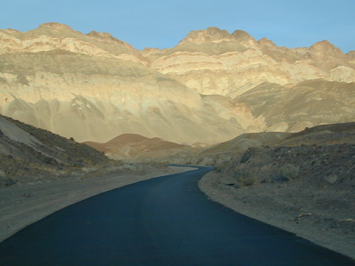
The highs as well as the lows. Take it all in good stride. Sometimes, when you need to break away from the city life & urban grind, you find the warm California deserts calling your name. This is North Mojave Desert terrain, harsh as can be. The region will make your ears ring - it's so quiet! Plus all the time & sky & stars to ponder your life, breathe again, sigh again.

LIFE or DEATH WARNING: Be overly prepared for anything, this remote desert land can be a killer.
"A map in that case may have been a lifesaver for them."

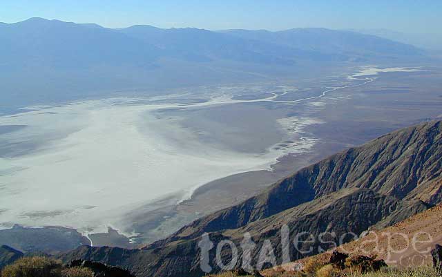
Don't plan on seeing all this vast beauty in one trip. No way possible, unless you have a year off to explore. Off-roaders in Panamint Valley, mining camps, ghost towns, cool geology, and discovered the Manson hideout cabin. Saline Hot Springs and sand dunes, stargazing, castles and craters, palm oasis golf course, canyon hikes, abandon mines, stone cabins, plus so much more. Plan on spending a week or more, with 4x4 back routes - if your time is of leisure.

DUH: Death Valley is the hottest spot on the Western Hemisphere. It is common in the summer for temperatures in the valley to reach 120 °F (49 °C). Temps 130 °F or higher have been recorded as recently as 2005. The average July temperature in Death Valley is 101 °F (1961–1990).

elevation: 11049' population: 500 zip code: 92328

Desert

terrain:
Highest & lowest desert terrain in the entire western region, with historical mining camps, colorful erosion, sand dunes


View Larger Map

location:
Inyo County
Death Valley National Park
Hwy 395 or Interstate 15

maps


recreation:

  • Back Road Exploration
  • Backpacking
  • Barker Ranch
  • Camping
  • Fossil Falls
  • Hiking
  • Hot Springs
  • Telescope Peak Hike
  • The Race Track
  • Trona Pinnacles
  • parks, forests, rivers & lakes:

  • Furnace Creek
  • Stovepipe Wells
  • Death Valley National Park
  • Darwin Falls Wilderness BLM
  • Panamint Valley
  • Dumont Dunes OHV
  • Eastern Sierra Nevada Forests Map Set
    Eastern Sierra Nevada Forests Map Set

    death valley campgrounds

    Lone Pine Campground
    Ballarat Ghost Town
    Panamint Springs RV DV
    Furnace Creek NP Camping

    tent camping

    description:
    Death Valley Park - the name alone intrigues us. This entire region made up of N Mohave desert is so beautiful & vast, a few days in an automobile tour hardly does it justice. Plan on spending as much time as possible here. Plan your days around a few activities in one region, make a loop & book lodging accordingly. Don't end up driving across the whole park twice, in 2-3 days, or you'll miss the real beauty of light & landscapes.

    nearby towns:
    Ballarat
    Lone Pine
    Olancha
    Panamint Springs
    Randsburg
    Shoshone
    Tecopa Hot Springs
    local links:

    Death Valley Chamber of Commerce
    Shoshone CA 92384
    760-852-4524
    http://www.deathvalleychamber.org

    Amargosa Opera House
    Amargosa Valley
    Christmas Road Trip w/ photos!
    Scotty's Castle Tours
    Ranch House Inn - China Ranch
    Death Valley Scenic Byway
    Death Valley Temp
    Death Valley - Badwater Hike
    Death Valley - Natural Bridge Hike
    Death Valley - Golden Canyon Hike
    Death by GPS

    Advertise on this site
    Death Valley NP Map
    Death Valley NP Map
    Inyo National Forest Map
    Inyo National Forest Map
    Mojave National Park
    Mojave National Park
    Mojave Desert Map
    Mojave Desert Map
    Death Valley Map
    Death Valley Map


    California Weekends
    Copyright © 1996-2012 Total Escape, www.totalescape.com / All Rights Reserved.

    home | lodge | recreation | destinations | journey | trips | advertise | site map | outside | maps | gear


    REI.com

    Vacation Rentals California


    Budget, National, Avis, Hertz, & Alamo!