


los alamos, California
![]() Country
Country
![]()
recreation:
parks, forests, rivers & lakes:
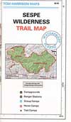
los alamos campgrounds
Santa Lucia Camping Los Padres
El Capitan State Beach
Refugio Beach Campground
Fremont Campground @ Cachuma
Upper Oso @ Lake Cachuma
Yurts @ Lake Cachuma
Jalama Beach County Park

description:
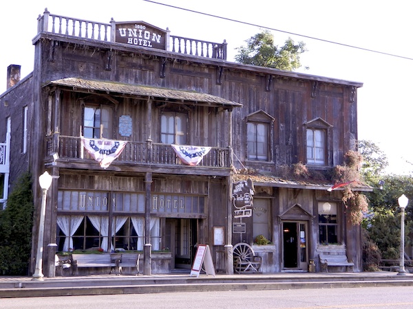
Old West Town of Los Alamos CA. Founded in 1876, Los Alamos is located along US Hwy 101 in the hills north of Santa Barbara. Many wineries nearby. Oak trees, cattle and countryside. Very small, historical town on the rural reaches of the Central Coast. For a great back roads drive, take the poorly paved road behind the county park. Drum Canyon Road will lead 8 winding miles, out to the 246 @ Lompoc.


Advertisement


Total Escape has been an AmazonAssociate for 20 years!
Earnings from purchases keeps this site alive.
Copyright © 1996-2024 Total Escape, totalescape.com / All Rights Reserved.
classic | lodge | recreation | destinations | journey | ads | sitemap | outside | maps | gear | mobile