


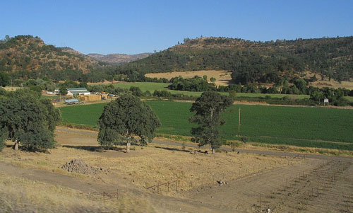
Tehama County is the gateway to Lassen Volcanic National Park. Mount Lassen is one of the few active volcanoes on the U.S. Lots of great fishing, hunting & outdoor recreation in these hills.
paynes creek, California
![]() Mountain
Mountain
![]()
recreation:
parks, forests, rivers & lakes:
paynes creek campgrounds
Gurnsey Creek Campground
Lassen Lakes
Hat Creek Camping Lassen
Dispersed Camping Areas
Lassen Forest Roads

description:
A small community of one general store; rural homes & ranches.
local links:
Paynes Creek Store & Tavern
29791 Paynes Creek Loop, CA 96075
530-597-2296
http://paynescreekstoreandtavern.com/


Advertisement


Total Escape has been an AmazonAssociate for 20 years!
Earnings from purchases keeps this site alive.
Copyright © 1996-2024 Total Escape, totalescape.com / All Rights Reserved.
classic | lodge | recreation | destinations | journey | ads | sitemap | outside | maps | gear | mobile