


town.storrie
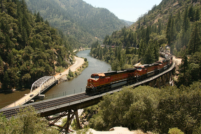
North Fork of the Feather River, Sierra Highway 70, Northern Sierra Nevada CA
Plumas fishing, camping and hiking trails. Wilderness access all around this major river canyon. Off roading back roads, camping, abundant creeks, small lakes, and mountain peaks. Plumas National Forest on the south side of the highway, Lassen National Forest on the north side.
storrie, California
![]() Mountain
Mountain
![]()
location:
Plumas County
NE of Chico
on Hwy 70
recreation:
parks, forests, rivers & lakes:
storrie campgrounds
Lake Almanor Camping
Hallsted Campground
Hutchins Group Camp - Bucks Lake
Lake Oroville Campgrounds
High Lakes 4x4 Camping

description:
Rural river community, with a closed resort situated right next to the highway in a granite canyon with railroad.
- nearby towns:
- Chico
- Oroville
- Twain
- Bucks Lake
- Quincy
- Greenville
- Tobin
- Chico


Advertisement


Total Escape has been an AmazonAssociate for 20 years!
Earnings from purchases keeps this site alive.
Copyright © 1996-2024 Total Escape, totalescape.com / All Rights Reserved.
classic | lodge | recreation | destinations | journey | ads | sitemap | outside | maps | gear | mobile