


This location has been evacuated due to the wildfire: CaldorFire 2021. Originally a Native American trail connecting the Sacramento Valley and Lake Tahoe, the Rubicon Trail was re-discovered by European immigrants in the 1840s. By the 1890s, the trail had become a road and was used to reach the Rubicon Mineral Springs Resort & Hotel. The first car into Rubicon Springs arrived in 1908, driven by a woman from Lake Tahoe. This historic drive received quite a bit of publicity from the San Francisco newspapers. More on the Rubicon 4x4 Trail
tahoma, California
![]() Mountain
Mountain
![]()
recreation:
parks, forests, rivers & lakes:
tahoma campgrounds
Sugarpine Point State Park
DL Bliss State Park Camping
Emerald Bay State Park
Meeks Bay @ Lake Tahoe
William Kent Campground
Tahoe SRA Camping
Meeks Bay RV Resort
Kaspian Campground
Silver Creek @ Truckee River
Rubicon 4x4 Camping

description:
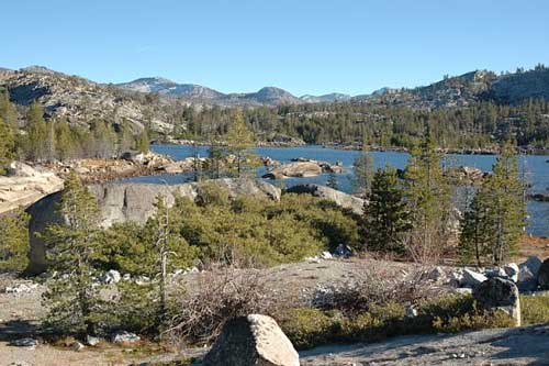
Located at the doorstep to the Desolation Wilderness & the infamous Rubicon 4x4 Trail, Tahoma California sits on the western shoreline of Lake Tahoe at Sugar Pine Point. Towering granite peaks behind it & forests as far as your eyes can see, the scenic Sierra backdrop is something out of a fairytale.
- nearby towns:
- Homewood
- Tahoe City
- Tahoe Vista
- South Lake Tahoe
- Truckee
- Homewood
local links:
Lake Tahoe Visitors Authority
4114 Lake Tahoe Blvd. South Lake Tahoe, CA 96150
530-542-4637
https://ltva.org
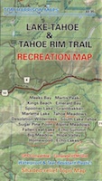
Tahoe Rim Trail
CalTrans Winter Driving
Rubicon 4x4 Trail
Lake Genevieve
Hellman-Ehrman Mansion
Chambers Landing Bar & Grill


Advertisement


Total Escape has been an AmazonAssociate for 20 years!
Earnings from purchases keeps this site alive.
Copyright © 1996-2024 Total Escape, totalescape.com / All Rights Reserved.
classic | lodge | recreation | destinations | journey | ads | sitemap | outside | maps | gear | mobile