


The Sequoia Park Bus Route departs Visalia, travels along Highway 198, picks up guests in Three Rivers, stops at the Ash Mountain Visitor Center, then continues up to Sequoia National Park. Once at the Giant Forest Museum, visitors are able to connect to the Sequoia Shuttle's two in-Park routes. The shuttle departs Visalia five times daily! see more info
visalia, California
![]() Country
Country
![]()
location:
Tulare County
SE of Fresno
on Hwy 198, E off Hwy 99
recreation:
parks, forests, rivers & lakes:
visalia campgrounds
Hume Lake Camping Sierra
Camp 4 & a Half Cabin Kings River
Island Park Campground
Big Meadows Cabin Reservations

description:
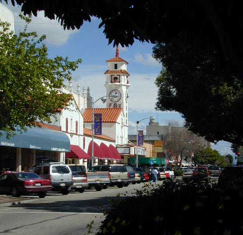
Large city for this agriculture valley. Quaint downtown area with tree lined streets, shops and restaurants.
- nearby towns:
- Badger
- Hanford
- Lemon Cove
- Orosi
- Three Rivers
- Badger
local links:
Visalia Chamber of Commerce
720 W. Mineral King, Visalia, CA
559-734-5876
https://www.visaliachamber.org/
Downtown Visalia CA
Happy D Ranch Worm Farm
Sequoia Park Shuttles
Bike Paths & Cycling Routes
Valley Air & Pollution
Historic Visalia
Farmers Market: SAT 8-11AM


Advertisement


Total Escape has been an AmazonAssociate for 20 years!
Earnings from purchases keeps this site alive.
Copyright © 1996-2024 Total Escape, totalescape.com / All Rights Reserved.
classic | lodge | recreation | destinations | journey | ads | sitemap | outside | maps | gear | mobile