


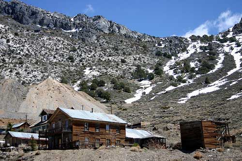
cerro gordo [ghost town], California
![]() Desert
Desert
![]()
![Cerro Gordo [Ghost Town]](/GIFS/maps/towns/Mpballarat.gif)
Cerro Gordo [Ghost Town]
lodging
recreation:
parks, forests, rivers & lakes:
cerro gordo [ghost town] campgrounds
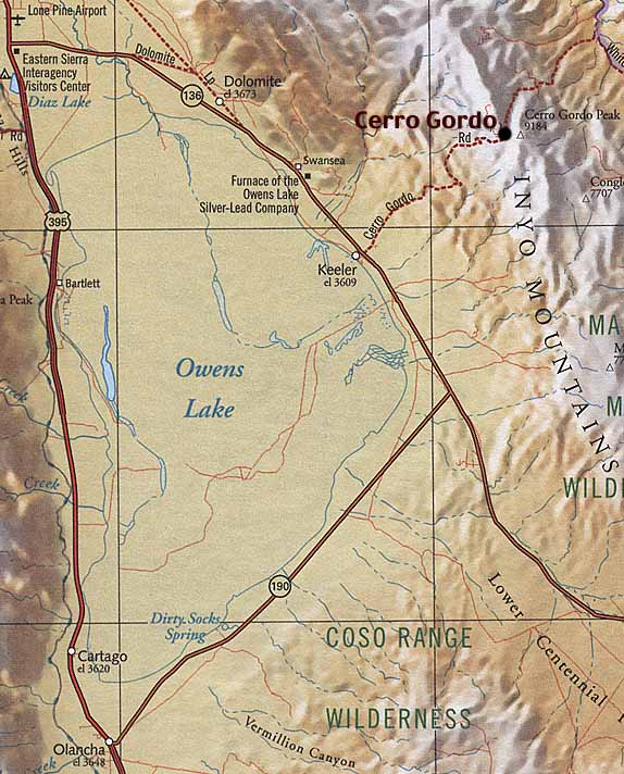
Overview Map - Owens Lake Area
Lone Pine Campground
Saline Valley Camping
Walker Creek Road #19S01

description:
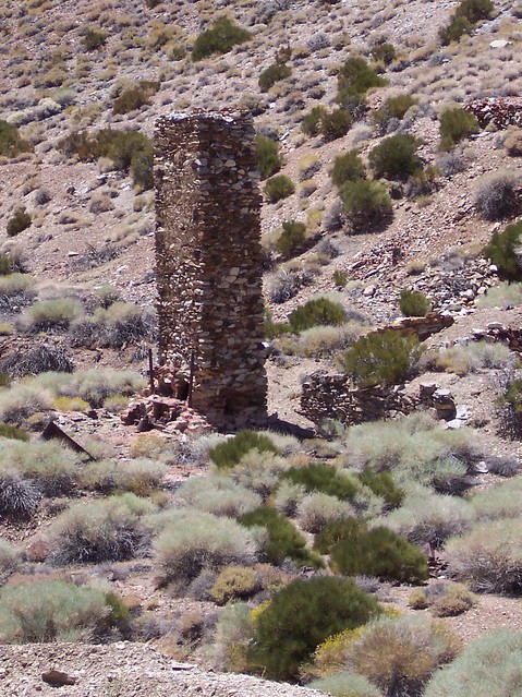
Historic and huge mining camp in the high deserts of Death Valley. Primitive ghost town on the edge of Death Valley NP border. A rugged dirt road leads 13 miles up to 8000' elevation, high in the Inyo mountains. On certain stormy or snowy winters 4x4 may be required to reach this location. Call for road conditions and reservations.
- nearby towns:
- Lone Pine
- Olancha
- Death Valley
- Darwin
- Panamint Springs
- Lone Pine
local links:
Cerro Gordo Mines
760-876-5030
https://cerrogordomines.com
Skidoo Story
Ghost Towns California
Saline Valley CA
Walker Creek Road #19S01
View of Cerro Gordo Peak
Eastern Sierra Interpretive Assoc.


Advertisement


Total Escape has been an AmazonAssociate for 20 years!
Earnings from purchases keeps this site alive.
Copyright © 1996-2024 Total Escape, totalescape.com / All Rights Reserved.
classic | lodge | recreation | destinations | journey | ads | sitemap | outside | maps | gear | mobile