a d v e r t i s e m e n t s

Destinations | Mountain

town.inskip

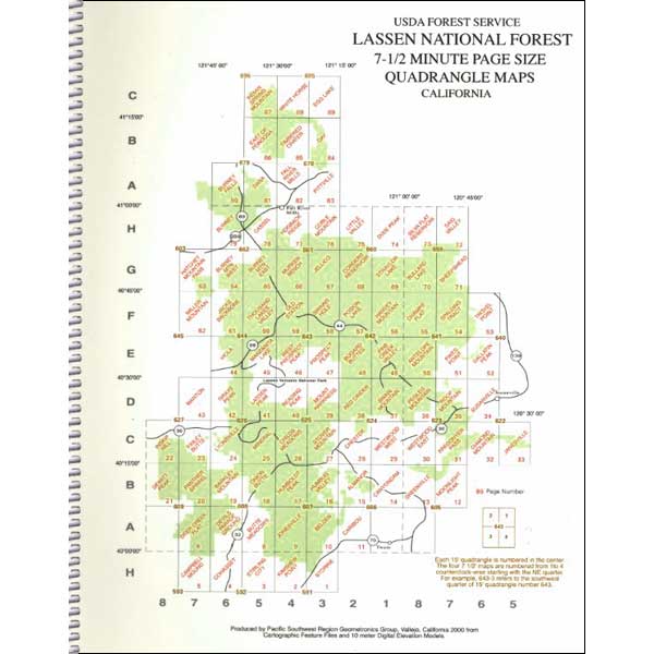
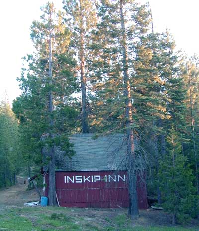
This is a great day drive out of Chico. It's any easy drive up the Skyway from Paradise California. You can make a loop back to Hwy 32, if you don't mind a little 10 mile dirt road from Inskip to Butte Meadows. Road conditions can change any season out this way. This lil place has no gasoline or store, so come very prepared if you're planning on staying the night. Camping (primitive style) may be the only option.
elevation: 4816' population: 2 zip code: 95978

Mountain

terrain:
pine forest with narrow paved road access

location:
Butte County
NE of Chico
off Hwy 32 via the Skyway

maps


recreation:

  • backpacking
  • camping
  • fishing
  • hiking
  • horseback riding
  • off-roading
  • parks, forests, rivers & lakes:

  • Plumas National Forest
  • Ishi Wilderness
  • Northern Sierra Nevada Forests
    Northern Sierra Nevada Forests

    Campgrounds campground reservations
    To make a campground reservation nearby click below

    Butte Meadows Campground

    tent camping

    description:
    Very rural & forested hide-away. A great little drive out there, in a sports car. Only passed one camper with a trailer. Lotsa of dirt roads nearby, with dense forest, firewood, some old trucks, a big red house & barn signed the "Inskip Inn"; but nothing looked 'open for business"

    nearby towns:
    Paradise
    Chico
    local links:

    Wikipedia - Inskip California

    Advertise on this site
    Caribou Wilderness, Ishi & Thousand Lks
    Caribou Wilderness, Ishi & Thousand Lks
    Topo Atlas Plumas Forest
    Topo Atlas Plumas Forest
    Plumas National Forest Map
    Plumas National Forest Map
    Sierra Nevada Topo Map
    Sierra Nevada Topo Map
    Search : Mountain Biking the Eastern Sierra's Best 100 Trails
    Mountain Biking the Eastern Sierra's Best 100 Trails

    Search : Lone Pine Region Recreation Topo Map & Guide: Inyo National Forest, Kings Canyon National Park, Sequoia National Park, Tinemaha Reservoir, Owens River, Owens Lake, Sierra Nevadas, Inyo Mountains, Mount Whitney, Long Lake, Big Pine, Lone Pine, (Fresno County, Tulare County, Inyo County, Owens Valley, Interstate Highway 395, Intrastate Highway 136: Camping, Fishing, Hiking, Ohv, 4wd, Off-road, Climbing, Skiing, Mountain Biking, Street Maps, Campground Finder, Waterproof Topo Lines 3d Relief, Sierra Maps Eastern Sierra Series 2008)
    Lone Pine Region Recreation Topo Map & Guide: Inyo National Forest, Kings Canyon National Park, Sequoia National Park, Tinemaha Reservoir, Owens River, Owens Lake, Sierra Nevadas, Inyo Mountains, Mount Whitney, Long Lake, Big Pine, Lone Pine, (Fresno County, Tulare County, Inyo County, Owens Valley, Interstate Highway 395, Intrastate Highway 136: Camping, Fishing, Hiking, Ohv, 4wd, Off-road, Climbing, Skiing, Mountain Biking, Street Maps, Campground Finder, Waterproof Topo Lines 3d Relief, Sierra Maps Eastern Sierra Series 2008)

    Search : Mountain biking in the Northern Sierra: The Crystal Basin Recreation Area of the Eldorado National Forest
    Mountain biking in the Northern Sierra: The Crystal Basin Recreation Area of the Eldorado National Forest

    Search : Mammoth Lakes & Mono County (Mountain biking the High Sierra)
    Mammoth Lakes & Mono County (Mountain biking the High Sierra)

    Search : Mountain biking in the Northern Sierra: The Donner Burn and Points North in the Tahoe National Forest
    Mountain biking in the Northern Sierra: The Donner Burn and Points North in the Tahoe National Forest


    California Weekends
    Copyright © 1996-2009 Total Escape, www.totalescape.com / All Rights Reserved.

    home | lodge | recreation | destinations | journey | forum | trips | advertise | site map | outside | maps | gear


    World Hand Made Gifts


    Marmot -Gear you can rely on at Altrec


    California Escapes