

Eastern Sierra
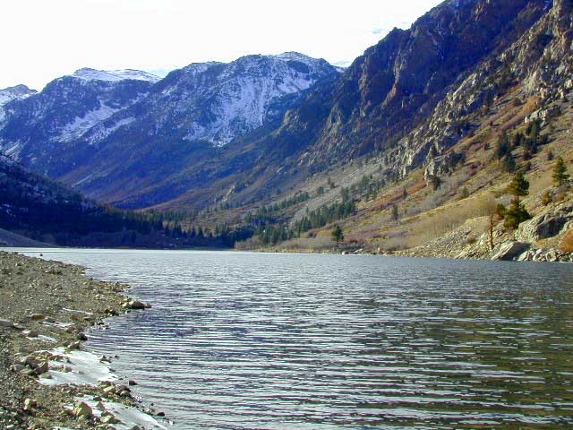
Lundy Lake
Lundy Canyon is located at the very northern boundaries of the Inyo National Forest, bordering the Humboldt Toiyabe National Forest & Virginia Lakes. Mill Creek flows down Lundy Canyon from the Sierra Nevada; Lundy is a small lake in a deep, rugged canyon with wilderness trailheads, East of Yosemite National Park.
Lundy Lake
West of Mono Lake, California
US 395
Lee Vining, CA
elevation: 7800′
Seasonal access, closed for winter
backpack, camp, canoe, fish, hike, kayak
aspen groves, autumn colors
wildflowers, waterfalls

Lundy Campgrounds
- Lundy Canyon Campground
Mono County Dept of Public Works
760-932-5440
36 camp sites w/ picnic tables, fire-rings & bear boxes
- Lundy Lake Resort
Bait, tackle, general store, fishing lake, boat ramp.
626-309-0415
21 camp sites, 8 cabins, 3 camp huts, 5 RV camp sites
![]()
![]() There is not any NFS Campgrounds in this Lundy Canyon, but plenty can be found nearby at Lee Vining Canyon, at junction US 395 & Hwy 120.
There is not any NFS Campgrounds in this Lundy Canyon, but plenty can be found nearby at Lee Vining Canyon, at junction US 395 & Hwy 120.
Mono Lake also has camping at the county park. And free camping (boondocking) can be found – all up and down US 395
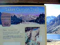
 Lakes Canyon Trailhead
Backpackers & Horse Packer Trains have excellent access to the Hoover Wilderness in the High Sierras. Plus this prime Lundy Canyon location is situated at the back door of Yosemite NP.
Mono County Tourism
800-845-7922
Lundy Area Maps:
Hoover Wilderness Trail Map (Tom Harrison)
Inyo National Forest Map (USDA)
Yosemite High Country Map (Tom Harrison)
Links for Lundy Canyon:
- Hoover Wilderness
- Inyo National Forest
- Humboldt Toiyabe National Forest
- Lundy Ghost Town
- Wiki on Lundy, California
- Hiking Lundy Canyon Trail
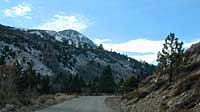
Lundy Lake Rd, the paved road up climbs the steep canyon to an elevation of over 7500′
