Bay Area Picnic

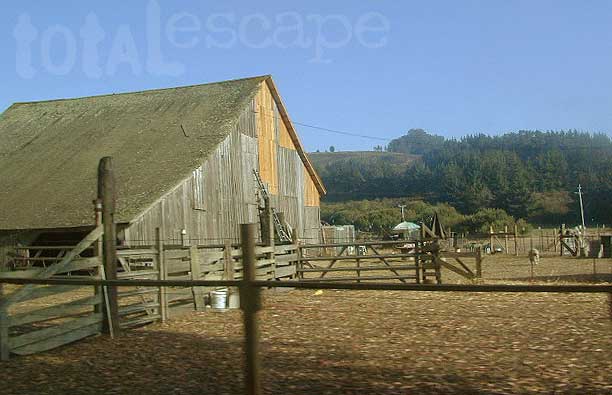
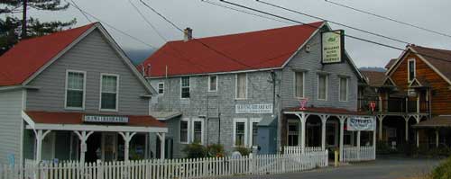
San Francisco Picnic Grounds – San Francisco Parks

San Mateo County Parks & Picnic Grounds

East Bay Picnic Parks

pescadero

Picnic destinations near San Francisco Bay Area
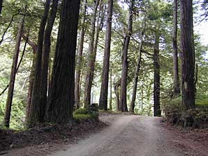

Utah Red Dirt Roads

Zion waterfalla

Zion National Park after a huge thunderstorm afternoon (late summer)


Hiking trails? That’s pretty much all we did in Zion & Grand Cyn.(N. Rim) Angels Landing…great 5-6 hour hike in Zion! Major elevation gain, but well worth it. Did a small Canyon overlook trail with spectacular views espcially at sunset. Hiked into the Grand Cyn. on the North Kaibab trail, but it was covered in mule poop & was a pretty stinky trip. Wish I could have spent the day differently. Next time I hike into the canyon, I’ll remember to pick a trail that is NOT used by animals.
 
Explored the Narrows a bit, before the afternoon thunderstorm. It was flash flood season & we didn’t want to be caught in a slot canyon. 2 California men (bodies) were pulled out earlier last month. Rangers are serious when they warn about the dangers of hiking in the afternoon or even the wrong season. It was weird weather. Sunny one minute, stormy the next. Couple of thunder storms dumped on us at night. EEEkkk. My tent held up fine. Good big ole Coleman condo style..I love it! Didn’t get wet, no leaking.
 
My favorite campground (just E of Zion , N.Fork Virgin River – Ponderosa-Zion primtive camp) was inaccessible due to slick, muddy dirt roads. We tried, believe me… we really tried, but the “dirt roads are impassable when wet” notes all over the maps aren’t kidding. I just wanted to find out for myself. Ended up at a convenient (but expensive) campground just outside Zions East entrance station.
 
That Utah red clay dirt is very slippery. I got about 2-3 mi. up the road, before I loss control. Fish tailin’ all over & stopping on the edge of a cliff. Those small oak trees wouldn’t have braced my Amigo if I did go over. Scarey! My BFGoodrich Mud Terrain tires were packed solid. No tread at all & you know me, NO 4 wheel drive either. Luckily, I had 2 very strong guys & a lot of patience. Using sticks to scrape some mud out, my friends pushing my vehicle & a tedious 11-point U-turn, we got outta that bad sitch. Headed down hill, slowly, cautiously & praying for gravel & pavement to start soon. A little dirty & a few minutes on cam-corder. It should be a fun experience to re-live through video later. Hey, whats that saying??….”that which does not kill us, makes us stonger”. I think I live by that motto.

Joshua Tree Desert Camping

4:00 AM–Thank God I packed up the car before going to sleep just six hours ago. Trying to hitch the bike rack up is a chore and a half but it’s before long that we find ourselves on the road to Joshua Tree Nat’l Park. Leaving this early makes the drive through the desert a little more tolerable. Soon enough we’re entering Twenty-nine Palms with its interesting murals with just a few more miles to go before the turn off. Then the wheel is turned onto a dirt road that takes us into the backside of the park through Bureau of Land Management acres. The trail proves that any 4X or skilled SUV driver can cruise on these bumpy and sandy roads. This area is known for the many mining sites that have either been abandoned or are still in operation along the hillsides and canyons. Some of them date back more than fifty years. Evidence to their boom years are evident everywhere, cabin structures with bullet marks, rusting steel laying all over the place, gapping holes in the earth partly filled in with boulders or covered up with strong steel mesh covering all entrance into the ground. This is done to prevent the novice climber from making the wrong mistake of even thinking about a descend into the earth. Here is where my girlfriend and I decide to set up camp on the edge of the park boundaries. Most of this area is completely desolate and even in the 90-degree heat proves to keep us searching for shade. There are plenty of trails to explore by foot or bike, but as you travel on the road through the park, the sandy bottom tests our endurance as it becomes harder and harder to petal along the road. Best bet if your head bent on doing 
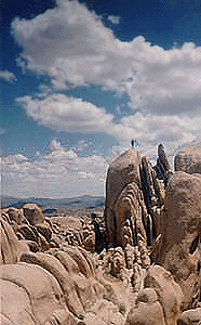
this is to start out earlier to avoid heat exhaustion or fatigue. The desert sky at night becomes envelopes into million of glittering stars with a noticeable satellite cruising the heavens on its pre destined course. A telescope will maximize this view which wouldn’t be so spectacular if observed in the city with its constant hazy glare at night. Driving through Joshua Tree gives the travelers the awesome feeling of desert tranquility. The Ocotillo trees sway in the afternoon breeze, lizards scurry in every walk of life, desert wildflowers adds color and diversity to such an dry, monotonous landscape. Even the mighty Joshua Tree forest astonishing the traveler with awe, realizing how many years it took for them to grow over the many hundreds of years to be the height they are here in this arid place.From our next campsite, White Tank, we climbed around the rock formations that had been weathered by the elements. A nice workout on Mother Natures Playground is what I like to consider it with tons of excitement for the naturalist and avid explorer-climber. Everyone getting his or her kicks hanging off some slab of rock some seventy feet off the desert floor. If you like to go off-roading, there are plenty of roads around the mining areas with some nice terrain that isn’t too hairy for travelling on. Within the park boundaries, there are nice vantage points to view the Palm Springs Valley from a far as well as Mount Jacinto in the distance. One such viewing point is called Keys View. Campgrounds inside the park can range between ten to a hundred-fifty sites so make sure you know which campsite you would prefer before settling for the first empty site you come across.

If you want some privacy, be sure you ask the ranger about availability before setting up camp. You could have to listen to families and yahoo chatter all night if you don’t plan ahead of the ruckus.

CA Hills

CA hillHow high is a hill?

Vague answer is 1000 feet (305 meters)
Only 1000′ elevation to make it to mountain status

Mountain terrain and hills occupy approximately 36% of the Earth’s land area. In California we have plenty of both. The San Andreas fault does a great job at making that happen along the coast where the Pacific plate is sliding against the North American plate. On the peninsula called Point Reyes in San Francisco, there are rocks on the cliff that match those of Tehachapi, in the Southern Sierra, some 300 miles away.

California is rising from the ocean; the Sierra Nevada mountains prove it, as one of the fastest growing ranges on earth. The lunar landscape of Mono Craters, up near Lee Vining, is the youngest mountain range on the whole continent. They are right next to Mono Lake & also close to Benton Hot Springs CA

If the flat landers are bummin’ you out & you need to head for the hills, use out mega list of small towns for California to find your desired altitude. Urban areas, deserts & the Central Valley are off limits. Experience & explore the unknown.
Search hidden California.

Sequoia Skiing

Sequoia XC Ski Areas – Park Skiing

Sequoia National Forest & Sequoia National Park do not have any major snow ski resorts. Shirley Meadows Ski Park in Alta Sierra is the closest thing to a facility that exists in the Southern Sierra Nevada.

Cross Country snowy terrain exist in the lower Sierras, you just hafta look to find it. The local rangers in Kernville can tell if there is any good snow on the 7000′ ridges & what places are plowed already & have trail head parking open. It’s quite a seasonal thing you know?

Sequoia National Park is open year round, permitting the snow plows can get thru on Hwy 198. Kings Canyon highway is closed for winter months. Excellent cross-country skiing & snow mobiling trails @ Big Meadows Rd.


Shermans Pass in April 2007
Originally uploaded by danamight

Camping in the spring on the Kern River can be wonderful, even as it snows nearby. This is the middle of the highway, well after the first snow gate.


Kern Rock Climbing

needles climb Sequoia

The Needles as seen from Dome Rock, on the Western Divide Highway.
Eastern Sierra’s Mount Whitney can be seen in the far distance on the right.

Sierra Nevada Rock Climbing – Sequoia National Forest

Good granite without the crowds! This Sequoia park is often passed by for the masses heading to the big walls of Yosemite or the bouldering of the Eastern Sierra Nevada.

Check out these Sequoia spots for some climbing options:

  • Dome Rock on the Western Divide (if half dome didn’t split & was smaller)
  • Kern River Gorge (deep in the heart of Kern River & the Rincon)
  • The Needles (granite spires at 8000′ elevation overlooking Kern River Valley)

Sierra Waterfalls in Sequoia

sierra waterfall

Sierra Nevada Waterfalls – Sequoia Regions

  • Alder Creek Falls on Western Divide Highway, near Ponderosa CA
  • Bone Creek Falls off Western Divide via Rd# 22S02, Ponderosa CA
  • Brush Creek Falls on Kern Sierra Highway, near Fairview CA
  • Buck Rock Creek Waterfall way out on Rd #14S11
  • Camp 4 waterfalls & swimming holes off Rd #22S82 – Forks of the Kern
  • Ella Falls near Sequoia Lake, California
  • Hidden Falls in Mountain Home State Forest, near Springville CA
  • Marble Falls inside Sequoia National Park; Trail @ Potwisha, Hwy 198
  • Salmon Creek Falls on Kern Sierra Highway, @ Riverkern CA
  • South Creek Falls on Kern Sierra Highway, N of Fairview CA
  • Tokopah Falls inside Sequoia National Park @ Lodgepole
  • Tule River Indian Reservation Waterfalls
  • swimming holes

    Redwood San Francisco

    Redwood Park San Francisco & Point Reyes

    The closest redwood trees to the city of San Francisco are those of the Point Reyes Peninsula. Samuel P Taylor State Park, Mount Tamalpais State Park & the Muir Woods National Monument all have coastal redwood groves.

    nearby redwood lodging can be found in –

    San Francisco redwoods

    If you are looking for the Redwood Forest near Santa Cruz & Highway 9 start here.

    Big Sur Redwoods

    big sur cabins
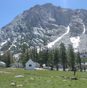
Big Sur Redwood Cabins & Riverside Cabins Big Sur

    Do you have visions of cabins perched on rugged cliffs, along the Central Coast? Well, sorry to say, there are none for rent. Those are all private homes.

    Most vacation cottages are secluded & tucked back, deep inside a redwood forest canyon nearby. Campground cabins in Big Sur span from yurt rentals on the cliffs, to rustic one room rentals in the fern forest.

    The Pfieffer Big Sur State Park has cabins available, several other coast resorts offer stream side cottages, plus Ventana has a luxury Campground inside a redwood grove.

    see all Big Sur lodging

    self guided redwoods tour on Big Sur back roads

    Gorda Cottages

    Campgrounds Cabins

    MORRIS high country
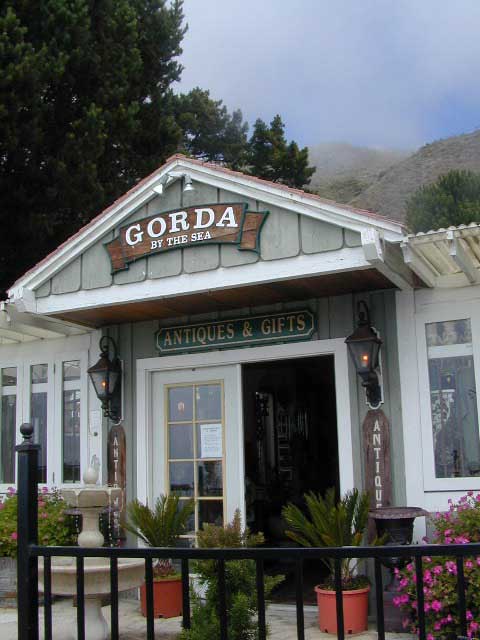
Yurt Rental, Tent Cabins & Outdoor Resorts in California

    Extremely developed public or private campgrounds will often have rental cabins for guests. Most all are large single rooms to share w/ sleeping cots. The miniature log cabin craze has spread from RV parks to County Parks, to private fishing campgrounds. Many have laundry, showers, cafes, store & are downright outdoor resorts.

    These California adventures are sometimes temporary seasonal cottages, that hafta be removed in winter due to heavy snow, like Yosemite. The coastal redwood forests seem to be popular places for these pseudo camping accommodations year round.

    These off-the-ground accommodations come in various setting like high country granite, rugged coastlines or dense fern filled forests. The access road or driveway to such camp resorts are likely to be dirt, so be prepared to rough it a little.

    Campgrounds Cabins in California, 3 varieties –

    Maybe a historic Sierra grand lodge? Or your own private cottage, next to a big river?
    If your searching for more luxury or accommodations, then try California Cabin Rentals here.

    Moab Camping Cabins

    All over Moab & most of southern Utah, mini log cabins are common.

    Canyon Roads in California

    California Scenic Drives – Canyon Roads CA

    Canyon roads are plentiful in California. From the lush coastal hillsides w/ mansions to the lunar like box canyons & slot canyons of the desert. We dig the back roads as much as you do, so get ready to explore this weekend. (GPS data is later dude!)

    SoCal Backroads

    What is the difference between a canyon & a valley?

    I can recall that canyons are tighter, smaller cracks in the terrain, most likely in lower elevations & rugged hillsides. Steeper walls, lots of rocks, some vegetation. A major desert wash, a creek or seasonal stream usually runs parallel to the paved road.

    Many canyon roads in California have been paved for urban development or for a major through-route access. These provide great quick “day trips” from the city.

    Valleys are larger open areas surrounded by mountains. Since the majority of Southern Cal is desert climate, you won’t be seeing many fern canyons or big open alpine meadows. Manzanita & sage brush meadows are the norm, for elevated valleys & mountains, such as the National Forest.

    Los Angeles County is a popular place to explore canyons for a “mind-unwind drive” or the half day picnic trip, away from work.

    California Scenic Drives listed below….

    PAVED Canyon Roads –

    • Big Tujunga Canyon (LA)
    • Bouquet Canyon, Palmdale
    • Brainard Canyon, Palmdale
    • Carbon Canyon (142) Chino CA
    • Death Valley National Park
    • Highway 33 N of Ojai CA
    • Hwy 39 – San Gabriel Canyon
    • Highway 76 (Ortega)
    • Lockwood Valley Rd, Frazier Park CA
    • Lone Pine Canyon Rd, Wrightwood CA
    • Malibu Canyon Rd, Malibu CA
    • San Antonio Canyon, Mt Baldy CA
    • Santa Anita Canyon (LA)
    • Santiago Canyon (S18), Orange CA
    • Soledad Canyon, Palmdale
    • Topanga Canyon Rd, Malibu CA
    • Wildcat Canyon, El Cajon CA

    UNPAVED Canyon Roads –

    desert canyons

    Goler Wash (aka Goler Canyon) in Panamint Valley. Barker Ranch is up that way.

    Trona Road

    Trona RoadThe North Mojave Desert is a sightseeing wonderland. These odd formations are inside the Trona Pinnacles, off of Hwy East of Ridgecrest CA.

    Trona Road is a red paved route that runs from Red Mountain @ Highway 395 east to the town of Trona, California, then thru Panamint Valley & on to the western borders of Death Valley National Park.

    Spangler Hills OHV Area is a popular off -roaders camp & a huge network of dirt roads can be found to the west of Trona Pinnacles. The access road to the bizarre dry lake is # miles long & graded dirt w/rocks. Passenger cars can handle it, but not recommended in rainy weather.

    Allegator painted rocks, old mining claims, dirt trails everywhere & a chemical plant in Trona. Keep driving north to connect with Death Valley  National Park. Wildrose Canyon, Panamint Valley & Ballarat ghost town are worth it.

    Southern California Backroads

    SoCal Backroads

    If you are seeking dirt roads in California, then congratulations. You have made it to the web site of your dreams, Total Escape. We love the back roads as much as you do, maybe even more. Honest!

    This entire 3000 page web site is a decade long dedication to the rural places in California, the trails, the canyons, the caves, the wildflowers, the scenery & even the old abandon mines. We have OHV maps, forest road maps, most regions, every trail map you might want. DanaMite has been researching these routes & documenting for years. And the GPS data is still to come!

    Since SoCal is majority desert, you won’t be finding many lush fern meadows, dense forests or huge waterfalls. There are a few Southern California National Forest that may have pine & oak trees, a creek half the year & great camping. SoCal has the desert back roads & there are literally thousands of them. Grab a map, get your rig tuned up & start exploring. Right here right now.

    SoCal regions for exploring Back Roads –

    joshua trees

    This joshua tree drive is located in Round Valley
    On forest road# 2N02 in San Berdu NF; W of Big Bear City.

    Check out CALIFORNIA CANYON ROADS

    Picacho Campground

    Picacho Park

    Picacho SRA, Picacho State Park & Picacho Camping

    Right on the Colorado River, this is a very nice desert park & campground. Most camp sites are large, some fairly private, & most lined with large Tamarisk trees or plenty of natural vegetation. Other camps back up against red rock walls w/ sky views.

    Old volcanic peaks surround this large park on the Colorado River – at the border of Arizona. Winter camping is great here. Hunters, fisherman & RVers alike, all know the best kept secret.. Picacho State Recreation Area on the Colorado River is prime spot for outdoor recreation & camping. Canoe, kayak, fish, hunt, mountain bike, hike & off road.

    3 hour drive from San Diego on I-8 E. Take the 20 mile access road north from Winterhaven @ Yuma AZ . The desert road to Picacho Campground is paved only a few miles. Last 18 miles is a graded dirt road that is passable for cars & motorhomes. In the summer months thunderstorms can cause flash flooding in the washes, making sections of the road impassable. Check rain forecast before traveling.

    nearby cities:

    Ozena Campground

    this campground is CLOSED Indefinitely, as per USDA National Forest

    Ozena Camp

    Los Padres National Forest: Ozena Campground

    3000′ elevation w/ 10  campsites

    Near Sheideck & Reyes Creek. Ozena Camp is on Lockwood Valley Road, just east of Hwy 33

    6S13 – San Berdu NF

    Thomas Mountain
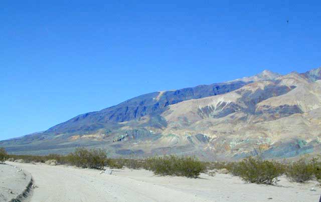
Thomas Mountain: Forest Road #6S13 – San Bernardino National Forest

    Camping 6 miles south of Idyllwild CA. Off of Highway 74 (the Palms to Pines Hwy) Thomas Mountain has a dirt road that follows a 5000′ pine ridge line, overlooking the pond of Lake Hemet. This route has several secluded, yellow post camp spots. High clearance or even 4×4 may be needed much of the year, due to rain & snow.

    2 Camp areas –

    • Thomas Mountain
    • Tool Box Springs

    4S01 – San Berdu NF

    Boulder Basin Rd: Forest Road #4S01 – San Bernardino National Forest

    9 miles N of Idyllwild on Hwy.243, right turn onto Forest Service Rd. #4S01. It’s Idyllwild camping on the back roads. Boulder Basin is compact dirt route around 6500′ elevation, perfect for the SUV, truck or Jeep who wants to stay outta the Campgrounds. Fire restrictions are sometimes tough, so check with the rangers on backcountry campfires. Boulder Basin has pinyon pines, boulders, & a few camp sites. Out in the Banning / Idyllwild portion of San Bernardino NF. 909-866-3437

    Good mountain biking, bouldering & back road exploration. Some secluded spots.

    3N14 – San Berdu NF

    Fawnskin CampingFawnskin Camping; Forest Road #3N14 – San Bernardino National Forest

    The best Big Bear camping is the back roads with the Yellow Post Sites. From the center of town in Fawnskin, head up the big hill, the graded wide dirt road, right behind the fire station; Forest Service Rd# 3N14 leads straight up to tall pines, pinyon forest & manzanita. You can find plenty primitive spots to camp in. Look for the yellow post sites.

    Along this route is also 2 popular Big Bear Campgrounds

    • Hanna Flat Campground w/ 88 camp spots
    • Big Pine Flat Campground w/ 17 camp spots

    Another dirt road #3N16 crosses this road & runs the length of the ridge. Great region for SUV forest exploring – for the first timer. Big OHV area, so be prepared for an occasional motorcycle or quad screaming by. You can find the best seclusion, on dead end routes, near old mines.

    This North Big Bear Lake forest area was affected by wild fires in 1999.