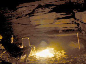
Primitive Camp San Diego

Fire Light Cove

Open car camping is allowed in several places inside Cleveland National Forest, although NO campfires are permitted in the backcountry (trailside or dirt roads) – due to the high fire danger. Your best for FREE, open, dispersed camping (with a campfire) is Anza Borrego Desert State Park. Lower elevations w/ summertime temperature can get very hot, so plan for higher elevation camps. The more you explore, the more you can find.

The Tom Harrison San Diego Backcountry Map can get you out there on the back roads.

Laguna Mountain (off Sunrise Hwy. S-1)
[south Cleveland National Forest]
East of San Diego; 40 miles E on Interstate 8

  • Pine Creek Road – with plenty of mountain biking trails
  • Noble Canyon – popular mountain biking trail
  • Kitchen Creek Road (warning, heavy use w/ US Border Patrol)

Palomar Mountain (off Hwy. 76)
[north Cleveland National Forest]
N of San Diego; 40 miles N on Interstate 15

Anza Borrego Desert Camping
East of San Diego CA

  • Dispersed camping nearly anywhere in Anza desert (w/ a metal fire bucket)

[higher elevations (1000-2000′) near Cleveland National Forest]

  • Oriflamme Canyon (off Road S-2)
  • Culp Valley (off Road S-22)
  • Blair Valley (off Road S-2)

[lower elevations (100′) near Hwy 78]

Cupl Valley Camp

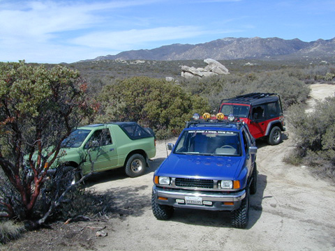
A winter day out exploring Culp Valley back roads.
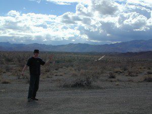
mortero trails

Maps Mountains / San Diego Maps
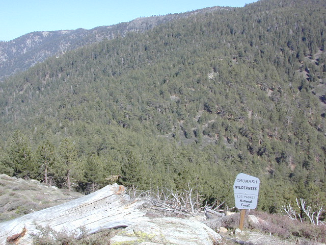
Chumash Wilderness

Chumash Wilderness
Los Padres National Forest

38,150 acres
Mount Pinos – 8831′ elevation
Cerro Noroeste – 8286′ elevation
Los Padres National Forest

Terrain consists of high mountain peaks, badlands of Quatal Canyon Wash & Lockwood Valley; Steep slopes of forests, rock outcroppings, sparse forest areas, on border of Kern County & Ventura County. This area is sacred to the native California Chumash tribe.

Quatal Canyon Rd #9N09

DSCN0042Mount Pinos, Mount Abel, Cerro Noroeste, Westside Park, Hudson Ranch Road, Mil Potrero Highway, Lockwood Valley Road, East Dry Canyon, Apache Canyon, Cuyama River

campgrounds nearby –

The Peak to Peak Hike is a 7 mile, high elevation, ridge line day hike that traversed 2 of the tallest peaks in Kern County – Mt Pinos (elevation 8831′) and Mt Abel (8286′). Day hikes, equestrian trails, backpacking, mountain biking areas nearby. Steep, granite, chaparral, lightly forested w/ ponderosa and Jeffrey pines. From this ridge trail you have a 360 degree view over the entire region. The cabin community of Pine Mountain Club is to the north side (and IF the skies are really clear, you can see the Sierra Nevada mountain range too); Lockwood Valley & Ozena Valley are located to the south; Cuyama Valley to the west and the Tejon Pass w/ Frazier Park to the east.

Off road use 4×4, dirt bikes, ATVs, and quads are common in Quatal Canyon, Apache Canyon, East Dry Canyon leading up to the wilderness edge. Rangers will ticket if they find you on the Chumash side of Quatal wash. The secluded yet inviting, wide, white sandy washes are just too tempting for some bad boys.

Chumash trailheads are located

  • about a mile before Camp-O-Alto Campground (Mount Abel)
  • along lower end of Quatal Canyon Wash (OHV areas parallel)

nearby towns –


DSCN0060


View Chumash Wilderness Area in a larger map

Garcia Wilderness

Garcia Wilderness, Los Padres NF

14,100 acres
Garcia Peak – 3146′ elevation
Los Padres National Forest
Huasna River
Pozo Creek

himtncampgroundcampgrounds nearby –

American Canyon Campground
Hi Mountain Campground
La Panza Campground
Lake Lopez Campground
Navajo Campground

trailheads for Garcia Wilderness

  • Hi Mtn
  • Santa Lucia
  • Garcia OHV

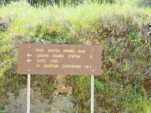
POZO ROAD is also known as

  • Pozo La Panza Rd
  • Hi Mountain Rd
  • Pozo Arroyo Grande Rd

San Luis Obispo’s Los Padres Pozo Rd is a 4×4 route that accesses the Garcia Wilderness; the dirt route connects Lake Lopez to Pozo Saloon, out near Santa Margarita. Los Padres National Forest 

Located inland from the Pismo Coast in south San Luis Obispo county.
Garcia Peak OHV Route, off Pozo Road behind Lake Lopez, Arroyo Grande, CA

  • backpackingLupine on Pozo Rd
  • camping
  • hiking
  • mountain biking
  • off roading
  • waterfalls
  • wildflowers

Steep lush coastal mountains, rugged, remote landscapes close to Central Coast San Luis Obispo.

Garcia Ridge Road #30S18

Garcia Ridge Trail #15E11

Hi Mountain Road #30S11


DSCN5297

also nearby – Machesna Mountains Wilderness and Santa Lucia Wilderness

Split Mountain Anza Borrego Desert

Split Mountain Road

Fish Creek Wash
Anza Borrego Desert State Park
Ocotillo Wells, CA

Fish Creek Wash @ Split Mountain

Explore Anza Borrego State Park desert deeper for the secluded hidden treasures. Find yourself traveling the east San Diego county desert, on Highway 78 eastbound on the way to the Salton Sea. Passing the turn offs for Borrego Springs, slow down and look for the intersection of off-roaders & ATVs @ Ocotillo Wells, California. Ocotillo Wells State Vehicluar Recreation Area is on the north (left) side of the highway and Split Mountain is on the right.

From highway turn south (right) on to Split Mountain Road, which leads to numerous back road destinations. Ranch homes and private property line the first mile of the road, neighborhood general store and a tiny saloon, RV park and an ATV rental shop.

Old Kane Springs Road is a main dirt road that parallels the highway from the narrows at San Felipe Wash to the Salton Sea. Old Kane Springs Rd intersect the Split Mountain route about 1 mile south of highway.


View Larger Map

Split Mountain ranger station is before the Elephant Trees nature trail. Near the railroad track, the paved road turns into Fish Creek Wash near Fish Creek Campground. If you have a low rider passenger car, you might wanna park it here and walk in to the canyon. Within the first few miles there is a lot to explore – fossils in walls, huge cliffs, wind caves, narrow canyons.

The actual “split in the mountain” section is located just beyond the campground on a sandy desert road.

Anza Borrego’s Split Mountain

Fish Creek Wash continues south, deep into the Carrizo badlands where 4×4 is definitely needed. The trail system eventually loops back over to paved S2 @ Canebrake, via Pinyon Mountain w/ the Squeeze, or Canon Sin Nombre. Unlimited primitive camp sites, found inside every other nook and cranny. Numerous hidden slot canyons, sandstone cliffs and wide sandy washes becomes a literal maze of off-road trails so you better carry a good back roads topographic map.