Hot Springs Hikes

Soaker

California Hikes to Hot Springs

California has many natural hot springs, most requiring a drive into the mountains. Some are rustic resorts, some are developed campgrounds, most are located on paved roads. The very remote tubs are the ones hidden in the secluded wilderness  – only accessible by foot.

campfires Plan to camp overnight? Fire Permits are required if you plan to build a campfire or use a camp stove.

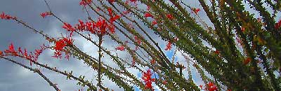
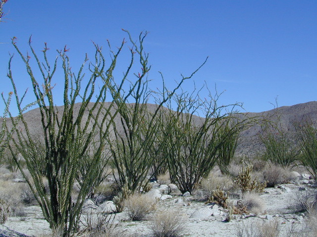
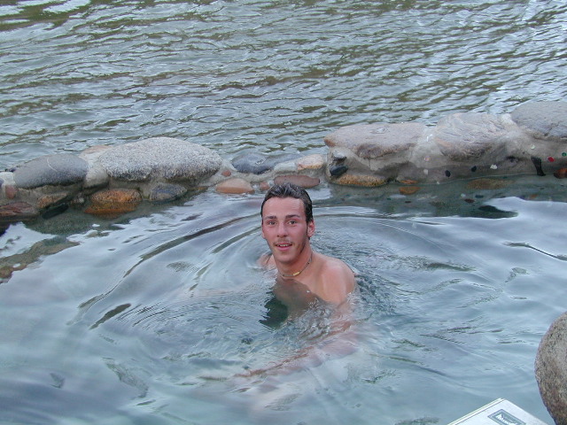
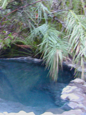
HIKE-IN ONLY HOT SPRINGS

hikes

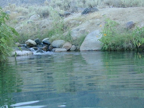
Buckeye Hot Springs requires a steep half mile trail down to the creek edge.  N of Bridgeport. Eastern Sierra @ Buckeye Creek Road #017.

Deep Creek Hot Springs is a SoCal favorite, but with that convenience comes the crowds. Located on the desert side of the mountains from Lake Arrowhead.

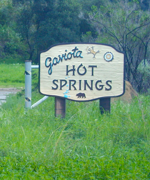
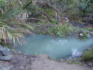
Gaviota Hot Springs is a short hike along a lush canyon. Close to US Hwy 101 and located in between Goleta and Solvang.

Kern River Gorge, Sequoia NF – Both Jordan Hot Springs & Kern Hot Springs accessible only by backpacking many miles, from Jerky Trailhead. Backpack and horseback access only. Golden Trout Wilderness.
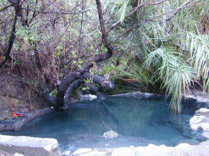
Remington HRemingtonot Springs requires a steep but short half mile trail down to the river edge. Lower Kern River. Old Kern Canyon Road @ Remington Trailhead# 32E51 – Remington Ridge Trail is a multi-use trail. Bike, hike, horseback on oaks hills. Wildflowers in Spring.

Sespe Hot Springs requires an 18 mile round trip hike. Usually enjoyed as an overnight backpacking trip. A very challenging and long trek as a day hike. Los Padres National Forest.

Sykes Hot Springs requires a strenuous 10-mile hike from Big Sur Station. Hike inside of Los Padres NF. Usually enjoyed as an overnight backpacking trip, or a very long day hike for the fittest of folks.

gaviota pools

California hikes

Kern Hot Springs
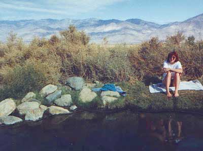
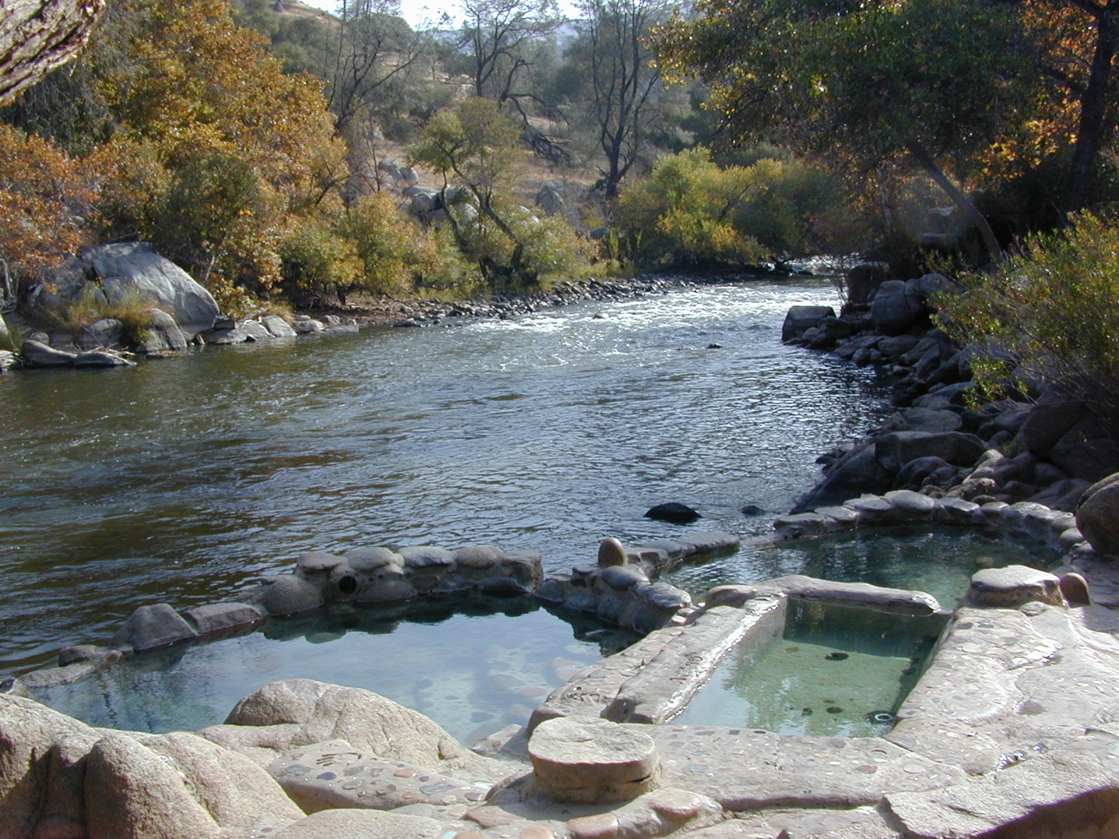
Remington tubs overlooking the Lower Kern River

Gaviota Hot Springs

Las Cruces Hot Springs
also known as Gaviota Hot Springs,
and as Gaviota State Park Hot Springs

Top Pool

W of Santa Barbara, W of Goleta, CA
North of Gaviota State Park

US 101

US Hwy 101 @ PCH 1 exit
follow frontage road on south side of the 101


View Gaviota Hot Springs in a larger map

This soaking spot is a convenient stop for those traveling the 101 on the California Central Coast. The hot pools are located in an overgrown canyon, about half mile up the hill from the parking area. The natural earthen pools tend to be warm, mushy, and smelly (like sulfur) but never super hot.

These are old, historic, volunteer built pools that are not maintained regularly, so keep that in mind when comparing this location to other well-manicured springs. Many of the locals that care for these sacred spaces only get paid back by reckless visitors with litter, graffiti and vandalism. If you want places like this to stay open, we must do our part to ensure that we leave it better tan we found it.

Parking fee, lot managed by California State Park. Gate closes at dark.

gaviota park signs

1 mile hike round trip

Poison oak, snake and ticks can be a problem at this location, so do be on the lookout.

swampy pool

hiking trails from here –
Gaviota Peak (fire road) and Campbell Trail (unmaintained)

Old Kane Spring Road

Kane Spring California

Quartz Wash Anza

Old Kane Spring Road parallels California SR Highway 78 a few miles from Ocotillo Wells, in east Anza Borrego Desert. A graded dirt road that can often gets sandy and you might need to keep you speed up certain soft spots. A few dead end canyons lead southward; hidden camp sites can be found out this way if you have the time to look. Harper Canyon, perhaps. See below for more on camp sites.

San Diego Desert Map

Anza Borrego Desert State Park Map

San Diego Backcountry Map

Spring Wildflowers can be quite spectacular out along this desert trail. Towering red-tipped ocotillo in some canyons serve as great backdrops to a perfect picnic lunch.

Ocotillo California

The Kane dirt route peels off the highway about a mile east of an area known as The Narrows. Marked on the highway as a small hiking trail, the highway curves at a narrow section of the canyon, as San Felipe Creek wash carves its way through the harsh landscape.

primitive campThe best primitive camping in this area is actually west of The Narrows. You might need a high clearance vehicle to reach some spots and a good map with the creek/wash names. Make sure to look for these – Free Camping

  • Nolina Wash
  • Pinyon Wash
  • Quartz Vein Wash

pinyonoco vcampoutpinyonwsh

On the opposite the highway is Ocotillo Wells SVRA, where off road enthusiasts can get their kicks. Wind caves can be found in Butte Canyon, where the 4×4 trails abound. Kane Springs intersects Split Mountain Road. The Elephant Trees, Split Mountain and more wind caves are south of the railroad tracks.

Anza Borrego Desert Map


View Larger Map

Keough Hot Springs

Keough Hot Ditch
HWY 395. Bishop. First Keough visit w/ Ted, 1990

Keough Hot Springs

Keough Hot Tubs, Eastern Sierra

Keough Hot Ditch

7 miles North of Big Pine & 7 miles South of Bishop;
on the west side of Hwy. 395

Keough California is comprised of two soaking spots – a small resort and the primitive tubs below. An Eastern Sierra rustic Hot Springs Resort w/ campground, tent cabins rentals and nice landscaping. Big, clean hot pools at the top of the road. Entrance fees, trees and vegetation, next to the mountains. Seniors and families frequent this place. Swimsuits are required.

Keough’s Hot Springs Resort
800 Keough Hot Springs Road
Bishop, CA 93514
760-872-4670

Keough Hot Springs

The Ditch

Below the resort and above the highway, are some primitive, free hot pools that require dirt road driving. Public nudity is common. Open 24/7 w/ several brush lined pools on the eastern slopes of the Sierra Nevada Mountains overlooking the high desert of the Owens Valley. Quite impressive for being just off the highway. Buzzing, huge powerlines overhead are one of the only drawbacks of this soak spot. This place can get crowded at certain times.

Posted: No overnight camping allowed at these lower hot springs.

Soaking at Sunrise

US Highway 395:
Look for the turn off in between Bishop and Big Pine, California. Take the Keough Hot Springs Road up hill until the second dirt road, turn right and the primitive hot springs will be on the left, just beyond the cold stream crossing. Sometimes a high clearance might be needed. Cars should park and walk the if unsure of the terrain. Do not park right next to the soaking tub, as the ground is too weak and vehicles have been known to slide in, unexpectedly. No kidding!

Plenty great camping all around the Eastern Sierra region. For campsites with cooler temps, higher elevation, pine trees & creeks: Head for the Glacier Lodge Rd – Inyo Road #9S21, West outta Big Pine.

Adventurous 4x4s can try super remote Coyote Flat, a super high elevation pinyon plateau that overlooks Bishop. Also Highway 168 W outta Bishop will lead to primitive camping areas like The Buttermilks, a rock climbing area. Further up the hill is alpine lake and creek camping in aspen groves.

Many developed Campgrounds in the region.


View Keough Hot Springs in a larger map
also nearby:

Inyo Forest Maps