Shopping Villages in California

Gold Country Village

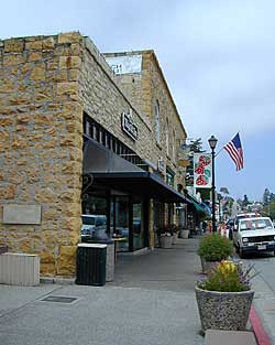
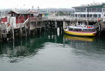
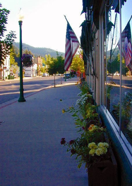
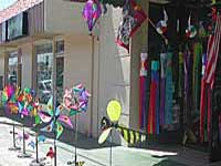
Shopping Towns and Downtown Villages

Men bored shopping
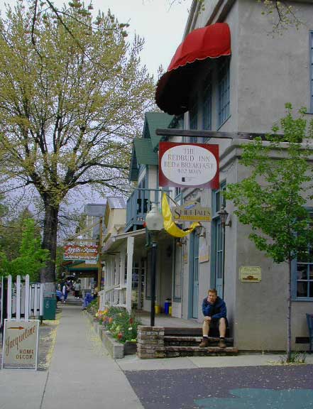
Listed on this page are California cities and towns that are well known for their shopping – downtown villages, boutiques, art galleries, gift shops, antique stores, shopping plazas, factory outlets, malls and restaurants.

Road trip weekends, all local – for super unique Christmas presents or romantic Valentine’s gifts.

Death Valley Hot Springs

Top Pool Volcano

Death Valley
Hot Mineral Springs


Shoshone InnNorth Death Valley  –

Saline Valley Hot Springs
primitive springs. Very remote desert wilderness area, 60 mile rugged dirt road – high clearance vehicle required; 4×4 access year round. Clothing optional. Nudity out in nature is the norm!

South Death Valley

Shoshone small hot springs resort camps. Swimsuits required.

Tecopa Hot Springs county park hot springs w/ bath house, rustic resorts & RV parks. Swimsuits required.

Furnace Creek, Stovepipe Wells and Panamint Springs are not hot springs destinations, although the names seems to imply they might be. The historic Inn at Furnace Creek in the center of the Death Valley National Park has palm trees and pure luxury – deluxe guest rooms, massage & spa services, pools and tennis, restaurants, but no mineral hot springs source. Death Valley Junction, home of the infamous Amargosa Opera House, does not have hot tubs, nor a pool, nor even a restaurant. South end of the park speaks more to the RV campers.

Small town of Shoshone is a little more appealing (visually) than Tecopa Springs, so keep that in mind when wondering what to expect. Cabin rentals at Delights Hot Springs Resort are old, rustic and the whole place is a little “rough around the edges”.

Shoshone Inn

Tecopa Springs RV Campers Winter
Tom Harrison Death Valley Map NatGeo Death Valley  Park


View Larger Map

Mason Valley Truck Trail

jeepinoriflamme

Mason Valley – Oriflamme Canyon

Mason Valley Truck Trail refers to a network of dirt roads on the west side of San Diego County Road S2, on the steep mountain slopes overlooking the desert badlands of Anza Borrego State Park. These primitive back roads lead up to the Pacific Crest Trail (PCT) on the edge of Laguna Recreation Area.

Oriflamme Canyon, Chariot Canyon & Rodriguez Trail are all in the area. Chaparral mountain trails lead off in many directions with dead end canyons and side routes. This high desert region consists of private property, ranches with gates, various trails and desert dirt roads – between 2400′ and 4000′ elevation.

A good portion of the lands on the west side of paved S2 are not inside the State Park boundary, but Oriflamme is the exception. The Anza Borrego Desert State Park borders includes this particular back road canyon, almost up to the Cleveland National Forest. Awesome locals little secret!

Laguna Recreation Area

  • Oriflamme Mountain @ 4611′ elevation
  • Chariot Mountain @ 4644′ elevation

San Diego Backcountry MapThe main access to Mason Valley Truck Trail is located near the bottom of Box Canyon (on Co. Rd. S2). The sign at the turn off reads Oriflamme Canyon. The first sandy mile or so gets kinda confusing, as the ranch road, dirt trails and natural desert wash merge with the seasons and rains. You might encounter locked gates if you take the wrong turn. In the wash look for signage for Oriflamme.

Approximately 2 miles from S2 the dirt road splits. To the left is Mason Valley Truck Trail, which continues up  Oriflamme Canyon and into wooded Chariot Canyon, eventually connecting with Hwy 78 (at Banner Grade). And the other choice on the right is a rugged 4×4 route called Rodriguez Truck Trail which is 7 miles long and meets back up with the main Oriflamme road about a mile from the highway. These back roads encircle the biggest peak around called Chariot Mountain.

Mountain bikers, hikers, horses and vehicles all use these routes, so be prepared to see others out exploring and please, always yield to equestrian traffic.

Mason Valley Truck Trail Anza Views

Several open, free camp spots lower in the canyon w/ large cottonwood trees. More hidden camps to be found higher up the mountain. A decent topo map, a campfire permit and a metal fire bucket is highly advised.

PCT: Pacific Crest Trail traverses the ridge line near 4000-6000′ and the desert valley below is nearing 2000′ elevation. The ambitious plan for the California Riding and Hiking Trail is still under construction and routed nearby as well.

Butterfield RV Ranch and the historic adobe Vallecito Stage Stop, are the closest thing to civilization you will find around these parts Don’t count on gasoline or cell phone coverage anywhere near here.

NEARBY TOWNS:Anza Borrego Desert Map

Desert / Mountains
SOCAL MAPS:


View Larger Map


California College Towns

Uni in Cali

San Diego Skies & Bay

came to California for college and never left
Some folks would argue that education through life experiences can be just as rewarding as following the traditional path of private schools or state education. The internet is fast replacing the need for formal education, as many entrepreneurs never graduate from college and still go on to become huge successes.

Going to university or college in California is a common path for many students, which is why there are mostly transplants living on the west coast. Many start at community colleges and transfer to a 4 year college.

California is the largest state in the union, as well as the most prosperous. California has the one of the largest economy in the world!

Below is a list of California cities and towns with a big student population. Some of these places have more than one college or university in town. IN and around town you will find abundant apartment living, cafes, coffee shops, mexican food, laundromats, bike paths, parks and public bus service.

Chico Bench Art

The New York Fed’s second quarter numbers are out for 2016 and it doesn’t paint a pretty picture for student loan debt. Officially, the nation owes $1.26 trillion in student loan debt. Realistically, we are probably over the $1.3 trillion mark when taking into account the fact that the Fall semester has just started…

Deep Springs CollegeBishop, CA

Heartwood InstituteGarberville, CA

University of Earth
Quincy, CA

23S01 – Los Padres NF

Big Sur Dirt Roads

Los Padres National Forest Road #23S01

Willow Creek Road
Los Burros Road

South Big Sur Coast Dirt Roads & super scenic US HWY 1 – North of San Simeon and Hearst Castle, north of Ragged Point and just past Gorda, CA a dirt shoulder, widens, a break in the bushes on the right side of the highway, a small wooden sign for the Yurt Resort called Treebones and the turn off to the back-country of Los Padres National Forest Road #23S01

Willow Creek is a steep coastal canyon w/ Willow Creek Trail #5E08 in the creek below and the dirt road 1000′ above. Willow Creek Day Use Area, the Willow Creek bridge and Willow Creek beach w/ restrooms, picnic tables, and paved parking lot near the highway.

DIRT ROAD, high clearance is recommended, but not required. 4×4 may be needed in wet weather. Motorhomes, trucks w/ trailers and RV campers are not gonna like this rugged, narrow, steep, dirt road and are advised to stick to the pavement. Camper vans and SUVs are be better suited for this terrain.

  • Both Thomas Bros. Maps & Benchmark Map’s California Atlas has this route listed as Los Burros Road
  • Google Maps has this route named Will Creek Road
  • Yahoo Maps has this route as Willow Creek – Los Burros Road
  • Mapquest has this one listed as Los Burros Rd – Fort Hunter Liggett (which is a military base,  on the opposite side of the mountain range near US Hwy 101)


View Larger Map


Free Camping in Big Sur

Willow Creek Rd

Several primitive camp sites can be found along this rugged dirt road, which climbs steeply and switchbacks thru redwoods, madrones, cedars, grass lands and oak hills. Sites within the first 3 miles  of this road offer the serene sounds of the ocean – waves, seals, sea lions as well as traffic on the busy highway. There are a few private properties back here in the boonies too, so read signs and don’t go exploring this region in the dark.

About 8 miles back on Willow Creek Rd is Alder Creek Campground – a small developed camp w/ only 2 camp sites and no piped water and no fees.

Prewitt Ridge  also has numerous ideal top-of-the-world, free camp sites, which do require a lot more dirt road driving and a very good backcountry map.

  • Sycamore Flat Road intersects @ 3 miles up
  • Alder Peak Camp is San Martin Top @ 12 miles up
  • South Coast Ridge Road is at the very top @ 14 miles
  • Lions Den Camp is 19 miles of dirt road driving
  • Three Peaks Camp is 21 miles way back there
Los Padres Monterey District Big Sur Map NatGeo

Cold Creek Campground

Cold Creek Camp

Truckee Campgrounds, Tahoe NF

Cold Creek Campground: N of Truckee, CA

DSCN0046

A small developed campground along forested Highway 89, with raging creek, fishing spots, and hiking trails and mountain biking trails nearby. Paved, level camp sites, small RVs okay w/ access to the numerous Sierra Nevada destinations with several lakes and reservoirs nearby.

This is a popular overnight stop “in route” for many campers and bikers traveling further on to the Northern Sierra Nevada mountains. You can exit off Interstate 80 @ Truckee, and be at this camp in minutes. Car camp, tent camping, a few spaces for small motorhomes. Plenty hiking and mountain biking trails.

Cold Creek Campground, California

on the Cold Stream;
Campground open May-October
(depending on snow)

High Sierra / Tahoe Truckee Camping

13 camp sites on Cold Stream @ 5800′ elevation; vault toilets, river and piped water, bear boxes; first come, first served camping

Max Camper Length: 22′

Rangers Office: 530-265-4531

The highway traffic noise makes this place a ‘short and sweet’ one nighter top pick, great for those camping in route to another destination. Another developed camp is on the opposite side of the highway, less than a mile north called Cottonwood Campground.

Free Camping nearby.
If you are seeking primitive camping near this area, start with Little Truckee Summit at the lakes turn off road on SR 89 – about 2 miles south of the Cold Creek Campground.

Tahioe USDA MapTake Tahoe Forest Road #5, a major paved road, approximately 12 miles back to the big meadows. Look for the unsigned dirt roads on left side of road nearing Webber Lake. The largest lake in the region, Independence Lake, is a paved side route off to the south. Further back on Road #5 the pavement ends at Jackson Meadows Reservoir. Very rough rocky road out to Bowman Lake w/ several developed campgrounds in the vicinity.


Tahoe trailheads lead out to –
alpine fishing lakes
mountain peaks
Treasure Mountain 7085′
Tahoe National Forest 
OHV Area @ Prosser Reservoir

NEARBY TOWNS:

ROAD CONDITIONS:

Tahoe and Truckee are known for their brutal winters and deep snows pack. Call CalTrans ahead of your departure if you are even slightly expecting any kind of precipitation. Truckee – winter road conditions


View Larger Map

Oregon Hill Road

oregon hil lroad

Oregon Hill Road –
Sierra Nevada scenic drives

also known as Challenge Road, driving from the lake up

Oregon Peak & Little Oregon Creek
Bullards Bar & North Fork of the Yuba River

2800′ elevation

Oregon Hill Road connects the rural residential community of Challenge to the recreation lake called Bullards Bar Reservoir, which is bordering on the Tahoe National Forest and Plumas National Forest park boundaries.

This bumpy, little, back road route is kind of a “short cut” for those driving from Nevada City to Oroville, CA.

From the Sacramento Valley, N of Marysville, take Hwy 70 N to Honcut, exit freeway and find your way east to La Porte Rd. Take LaPorte Road past Brownsville and up to the next neighborhood called Challenge; Turn right at the small, one room post office in Challenge and continue 14 miles down to New Bullards Bar.

Or, if coming in to this lake from Gold Country Highway 49, take Moonshine Road or Marysville Road. Two developed campgrounds are located at the lake shore, on the east side. Boat in camping is most popular at Bullards Bar. The closed campground on the ridge (west side, above the lake) is called Burnt Bridge and has been non operational for years now, due to numerous wildfires.


View Larger Map

bullardsbarrecr

New Bullards Bar Reservoir is a prime water sports recreation and house-boating destination, nestled in between the Gold Country and the Sacramento Valley near Yuba City, CA.