
California Golden Poppy
The official state flower of California is the POPPY
Spring usually means it’s warming up, to a great wildflower season in California. Time to get outdoors more! Hike, bike and picnic near the wildflowers and see some poppies.
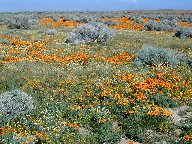
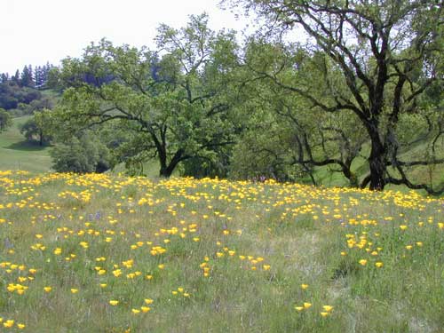
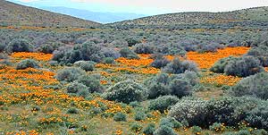
California Golden Poppies can be found throughout the state, in small patches near the roadways, rolling hills behind vineyards, in high desert flats (where wind gets whipping) or even out near a ranch, with oak hills and fields of golden orange.
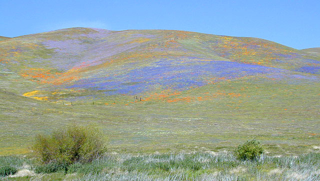
POPPIES can blanket hillsides, resulting in a show stopping event – which can be deadly on freeways? N of L.A. interstate 5 (the Grapevine) TEJON PASS (Lebec, Gorman, Junction 138) >> Please pull to nearest exit and stop the car. (It will be safest and well worth the 10 minute stretch break.)
Golden poppies can be found all over California. Flowers like lupine and owls clover can often be found nearby. Wildflowers may only last a few weeks, so go enjoy them while they last.
Bright yellow, gold, deep orange – or any shade in between!
best places to find poppies
NORTHERN CALIFORNIA
Table Mountain @ Cherokee Road
North of Oroville, CA
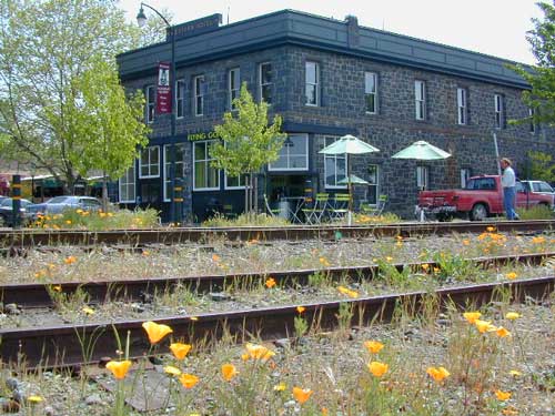
Wine Country NorCal
Alexander Valley Road
Railroad Tracks @ Santa Rosa, CA
Napa County
Sonoma County
CENTRAL CALIFORNIA
Fort Tejon State Historic Park @ I-5
Cerro Noroeste Road & Klipstein Canyon
Carrizo Plain National Monument BLM
Kern River Canyon
S of Walker Basin @ Caliente Bodfish Rd
North of Tehachapi, CA
Santa Lucia Mountains
Rock Front Ranch
Schoolhouse Canyon
Cottonwood
Hwy 166, West of New Cuyama, CA
Figueroa Mountain Road
Los Padres National Forest
East of Santa Ynez, CA
Pine Flat Reservoir
@ Kings River, Sierra National Forest
East of Fresno, CA
East Bay San Francisco
The rural hills out east are the best places to find poppies in the Bay Area.
Mojave Desert Preserve
Providence Mountain SRA
Interstate 40
East of Barstow, CA
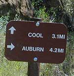
Auburn, CA
Central California Reservoirs
Located all around most rivers w/ dams (reservoirs) poppies can easily be found along highways, rural roads and on oak hillsides.
SOUTHERN CALIFORNIA
Boulder Creek Road (dirt)
Descanso to Julian, CA
San Diego Mountain Foothills
Lancaster Poppy: Antelope Valley Poppy Reserve
Poppy Hotline (661) 724-1180
Remember, stay on the trail! Getting a picture of that one really nice poppy will crush all the plants along the way, and compact the ground leaving lifeless bare dirt for the next year or longer. If someone else has started a trail, do not add to the damage. Please be a responsible park visitor and leave the park as nice as you found it.
Or you can avoid the crowds & tour buses at the Poppy Park to head off on your own adventure. All along both sides of high desert Hwy 138 you can find fields of California Poppies, from the small town of Neenach, CA east to Hwy 14. Plus the hills of Gorman are usually full of color.


 . The center of the parks is pretty much the town of Borrego Springs, where the State Parks visitors center is located. San Diego County Road S3 leads from Hwy 78 down the the town of