Reyes Peak

CA 33 N
Ojai Camping
North of Ojai, CA

Camp out among tall pines, well above the coastal fog.
Los Padres National Forest Road #6N06

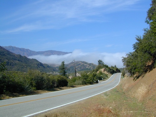
Ojai, CA – NORTH on HWY 33
a very scenic drive, in North Los Angeles County

Coastal Foothills

Near the Pine Mountain Summit (elev 5080′) on California Highway 33, the small sign only reads PINE MTN and points east, to a rugged side road. By far one of the worst paved roads around.

This Reyes Pine Mountain, should not to be mistaken for the golf course community of Pine Mountain Club, many miles north of here, around the other side of Mount Abel.

This is Reyes Peak, also known as Pine Mountain Ridge “north of Ojai”, on the sorta paved Pine Mountain Road. (Los Padres National Forest Rd # 6N06)
overozena
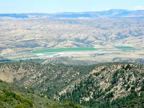
The view above is from one huge dirt pull out, on the left – over looking Ozena Valley, on the west end of Lockwood Valley Rd. Motorhomes, trailers, off-roaders and hunters like this as a last minute camp site, very close to the highway.

If your vehicle can endure 9 long miles of poor pavement, pot-holed roads, then maybe you can find seclusion back in the woods around here.

Six or more primitive campsites, spread out along a forested ridge line (around 5000′ elevation). Tables and fire rings only. No fees, no toilets. Bring a shovel and plenty water. No pipes, no running water up here.

The scattered camp sites are located far enough away from each other, that the location provides some privacy and still relatively close to town. Some sites are in forested settings, while others have big boulders, but are exposed to wind and sun. Although these few sky view camps are perfect for the stargazers.

Dark night skies can be okay, if the coastal fog stays low. Neighboring Mount Pinos is all paved – usually best choice for RV campers w/ telescopes, who need large areas of flat level ground.

reyespeakcamp

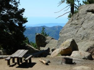
One particular camp site is located at a very decent view spot. Boulders, pine trees and mountain views to the south. Click the image above to expand.

PRIMITIVE CAMPGROUNDS
Campfire permits are required.

Launch Spot

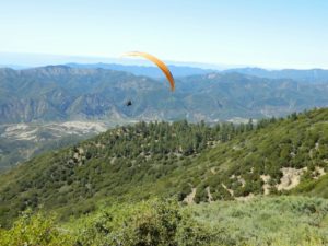
The end of the road is a top destination LAUNCH spot for hang gliders & para-sailers. Watch them jump on YouTube compliments of DanaMite.

Youtube


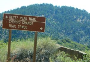
The hiking Trailhead for Reyes Peak and the Chorro Grande Trail #23W05 are also at the end of this dead end road #6N06. Reyes Peak Trail leads east, out to 7510′ elevation, overlooking the whole lower Los Padres region – Lockwood Valley, Ozena, Piedra Blanca, Sespe Gorge, Potrero Seco.

reyespeaktrail

Get outside this weekend. There are no more excuses!

MAPS: Los Padres National Forest Maps

NEAREST TOWNS:

Redinger Lake

redinger lake

Redinger Reservoir

south of Yosemite NP, Bass Lake, CA

dammed lake canyon NFS sierra river sierra mountains

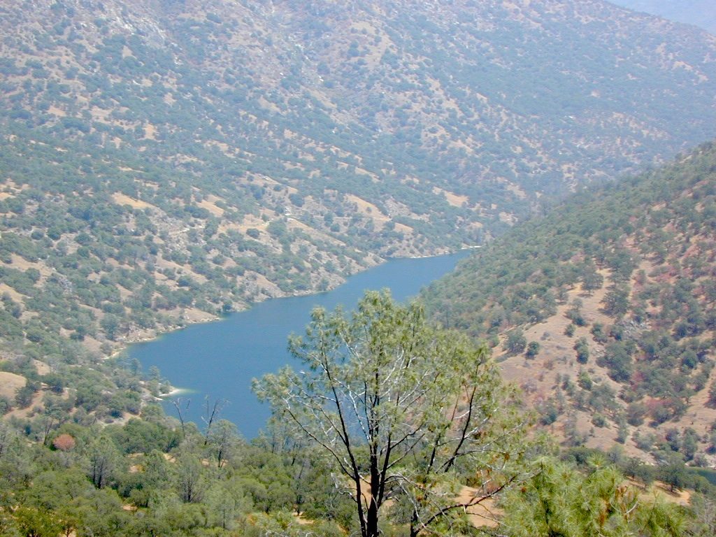
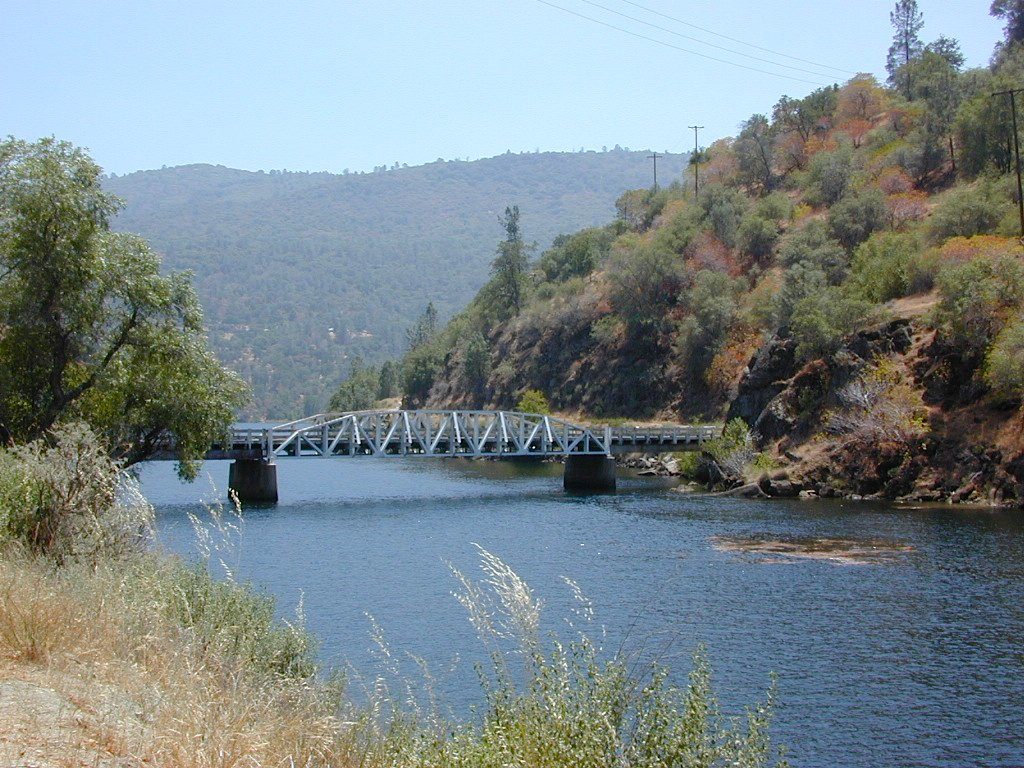
Officially this lake is actually a reservoir, located in the low lands of the Sierra foothills country. Narrow, winding back roads, a way outta the way kinda spot.

a long, narrow lake w/ steep hills, inside a tight canyon

  • canoe
  • fishing
  • hiking
  • jetski
  • kayak
  • waterski

The San Joaquin River flows west, down from the highest granite peaks of the Sierra Nevada and into the Central Valley foothills. If you find your way off the main highway 41, exploring way back behind Bass Lake, CA – then you may consider this scenic loop to Redinger.

off the beaten path

Truthfully, this place is usually an afterthought, sorta near Yosemite National Park. Not exactly a top destination for tourists, but it is very accessible most anytime of the year due to low elevation.

Spring wildflowers can be decent. Summers do get super hot here, so take that into consideration when planning your visit. Due to extreme wildfire danger, no campfires are allowed at any time.

redinger bridge

Lake, Reservoir, or a good wide section of the San Joaquin River w/ hydro-electric dam.

elev. 1000′

open camp no fires boating fish

public boat launch ramp
Camping is restricted to a large open area near the dam. No fee is charged. No campfires are permitted. Services limited, no drinking water or garbage pick-up available. Nearest town 7 miles away.

NORTH FORK, CA

Redinger Lake Road (Rd# 235) can be found south of the town of North Fork, CA. The paved route down is long, steep and winding. At the bridge crossing, the road loops to Joe Basin Road, which connects to the small community of Auberry, CA

Way up river, a dozen plus miles, is the utterly beautiful Mammoth Pool, only accessible half the year.

A few miles down river from Redinger, around the horse shoe bend, another neighboring reservoir called Kerschoff Lake (elev 971′) has a developed campground.

campSmalley Cove Campground NFS

Contact:
Bass Lake Ranger StationNFS
559-877-2218

https://www.fs.usda.gov/


BLM Sand Dunes

dumontdunes

Sand dunes are popular spots for tourists, travelers, RVers and off-roaders. Death Valley National Park has many large areas for dunes, Mojave National Preserve has the Kelso Dunes.

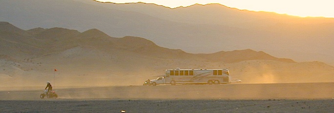
Fortunately, those places do not allow driving on the dunes, which is exactly what the off-road boys want to do. Sand flying, motors screaming, music blasting, bon fires blazing and no silence found until the wee hours of early morning.

Autumn, Winter & Spring are the busy months for ‘froaders in the deserts, since summer temps can soar into triple digits heat daily.

Camping out near “the dunes” is usually a big, freaking, free-for-all, outdoors with the latest in motorized toys. Recreation Vehicles encircling bonfires (camp formation for a large group), toy box haulers, trailers, families, and maybe a massive BBQ setup.

OHV (off highway vehicle)
Vehicular Recreation Area

California BLM Desert Sand Dunes

luxurycamper

Below is a list of California Sand Dunes overseen by the Bureau of Land Management.

Arroyo Salado / Ocotillo Wells
Motorcycle, 4WD, ATV, Dune Buggy / Sand Rail
Located 10 mi. west of Highway 86 on Highway 78. Rolling hills and sand washes. Designated “Open Area” consisting of 4,800 acres. Adjacent to Ocotillo Wells Vehicular Recreation Area. Near Split Mountain, Anza Borrego Desert

Dumont Dunes Mojave
Motorcycle, 4WD, ATV, Dune Buggy / Sand Rail
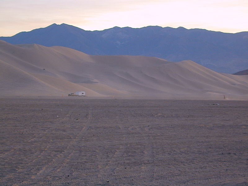
Located 30 mi. north of Baker on Hwy 127, off Dumont Dunes Rd. Steep and tall sand dunes. Designated “Open Area” of 8,150 acres. South of Death Valley National Park.

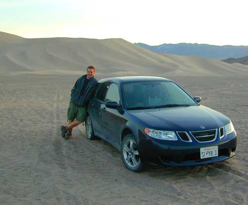
Dumont Saabaru AWD
Dumont w/ the Saabaru AWD

Glamis / Gecko Road
Motorcycle, 4WD, ATV, Dune Buggy / Sand Rail
Holiday weekends = NUTS!! Approximately 22,000 acres. Located 25 mi. east of Brawley on HIGHWAY 78. Sand Dunes. Designated “Open Area” Danger: Adjacent to military bombing range.  Contact the El Centro BLM

Imperial Sand Dunes / Buttercup Valley
Motorcycle, 4WD, ATV, Dune Buggy / Sand Rail
Approximately 11,000 acres. Located 10 mi. southeast of Niland on the Niland Glamis Rd. Sand Dunes are designated “Open Area”. Watch for closed area boundary at south end of area. CA Highway 78 near Brawley.  Contact the El Centro BLM

Mojave El Mirage / Shadow Mountains
Motorcycle, 4WD, ATV, Dune Buggy / Sand Rail
Located 10 mi. west of Adelanto on Crippen/El Mirage Road. Dry lake Bed. Heavy use area. many non-motorized and motorized recreation – including aircrafts. Area consists of 24,000 acres.

Olancha Dunes OHV
Highway US 395 @ jct 190
Thousands of acres w/ open camping, located 5 miles from Hwy 395. In between Eastern Sierra range, Olancha & Death Valley National Park. Contact the Ridgecrest BLM

Plaster City / Yuha Basin
Motorcycle, 4WD, ATV, Dune Buggy / Sand Rail
South side of Anza Borrego Desert State Park. 15 mi. west of El Centro. Located on county Highway S-80. Consists of 41,000 acres of rolling hills and desert flats. Military bombing range north of area is closed to entry.   Contact the El Centro BLM

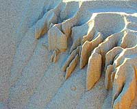
Sand Up Close and Personal
Superstition Mountain
Motorcycle, 4WD, ATV, Dune Buggy / Sand Rail
Located 15 mi. NW of El Centro via Highway S-8, Huff, and Wheeler Roads. Varied terrain consisting of 13,000 acres; dry lakes, badlands, rocky mountains, and sand dunes. Military bombing range north and south of area is closed to entry.   Contact the El Centro BLM

Rasor OHV Recreation Area
Motorcycle, 4WD, ATV, Dune Buggy / Sand Rail
Located 45 mi. northwest of Barstow, CA on Rasor Road. Sand washes and dunes, mesquite thickets. Designated “Open Area” consisting of 22,500 acres. Contact the Barstow BLM

Rice Valley Dunes
Motorcycle, 4WD, ATV, Dune Buggy / Sand Rail
Located 5 mi. south of Rice Valley off of Highway 62. Access is Santa Fe Road. Sand dunes. Designated “Open Area” consisting of 3,770 acres. Area of little use. Danger: Contaminated with unexploded ordinance.

Road to Kelso Dunes
Road to Kelso Dunes

BLM open camping hiking camping RVs 4WD

see also California Coastal Dunes at Oceano: Pismo Dunes


Bureau of Land Management

free desert washes

California BLM

desert figure blythe
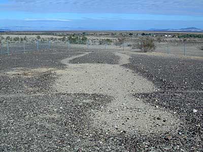
Giant figures INTAGLIOS, on desert floor, near Blythe, CA

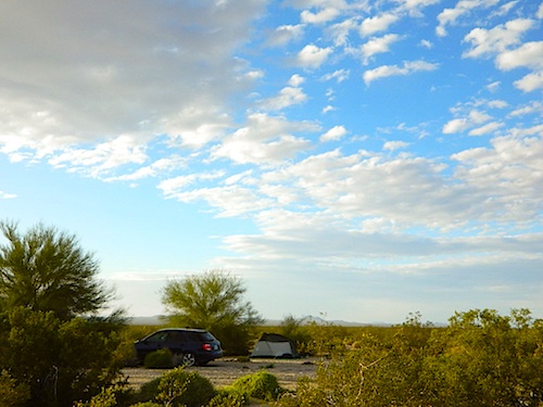
Camping while traveling. The east-west corridors across the California deserts are well traveled routes. If you plan to camp, get to know areas managed by the California Bureau of Land Management.

All BLM Offices in California BLM CA

  • 4×4
  • Back Roads
  • Car Camping
  • Canyons
  • Deserts
  • Dirt Bike Trails
  • Dunes
  • Hiking
  • Historic Sites
  • Hot Springs
  • Intagios
  • Mountain Bike
  • Off Road
  • Palm Canyons
  • Petroglyhs
  • River Camps
  • RV Camping
  • Slot Canyons
  • Tent Camping
  • Wildflowers

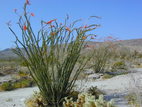
ocotilloBLM

BLM lands in California are often known as the ‘free camping’ option. freeway close campingNo charge camp sites, convenient, in-route locations, many areas along major highways or interstates. Campfire permits are always required for any open fires, BBQs and campfires.

BLM Field Offices in California located in neighboring towns can provide maps, information and campfire permits. 

giantcholla

DESERT WILDFLOWERS can be found annually, February – April in most of these areas. Springtime blooms draw the crowds, but few visitors actually camp out overnight.

When searching out premium camp sites – drive slower than 50 mph & look for the brown recreation signs. Since people like to drive fast in the desert, make sure to put your hazard lights or blinkers on, so traffic knows you are slow poking. Typically dirt roads are only marked with small, thin reflectors, maybe numbers or letters, if you’re lucky.

Traffic noise will be minimal if you camp away from the main drag at least ONE mile or more. Motorhomes may not have the luxury to travel that distance; they often prefer to stay in large, level, flat pull outs, right near the pavement.

If daring to venture more than 2 miles from the pavement, be prepared for rough conditions. 4WD drive may be needed in certain spots, or in the wettest of weather. Wind is always a factor in desert regions, so keep that in mind. Deep sandy washes, tow strap anyone? No facilities, no services, no toilet. Spotty cell phone coverage. Basically – the boonies!

BOONDOCKING
is the latest phrase for “open, free camping”

Palo Verde Washes


SEEKING QUIET CANYONS? stay away from the off-roaders. They usually congregate in dunes and specified OHV areas. Trails and dirt roads are for multi-purpose use, so a variety of recreation can be had. Many people use these public lands, so leave them clean and better than you found it. Boulder coves, palm gardens, primitive hot springs. There are plenty of hidden camp spots within the vast desert region of SoCal.

Several BLM lands are near Wilderness Areas. Camping is allowed close by, mountain biking & hiking are usually abundant. Off roading prohibited within Wilderness boundaries.

hikes tent camping 4x4

URLs within the official BLM site keep changing, which is why we are rebuilding our BLM pages. So you can find what you need, easily.

ca.blm.gov
blm.gov/ca

www.blm.gov/ca
https://www.blm.gov/california

road BLM