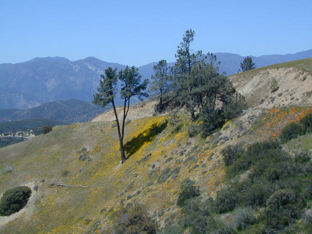
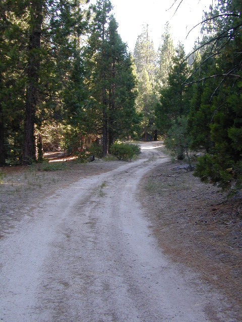
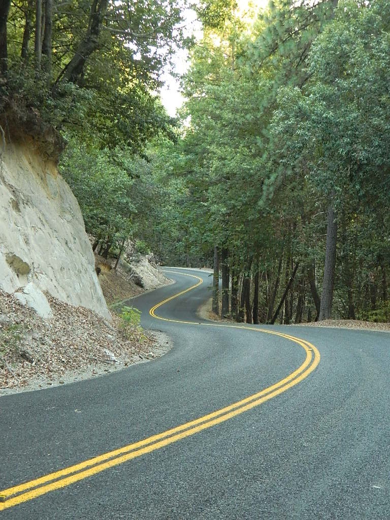
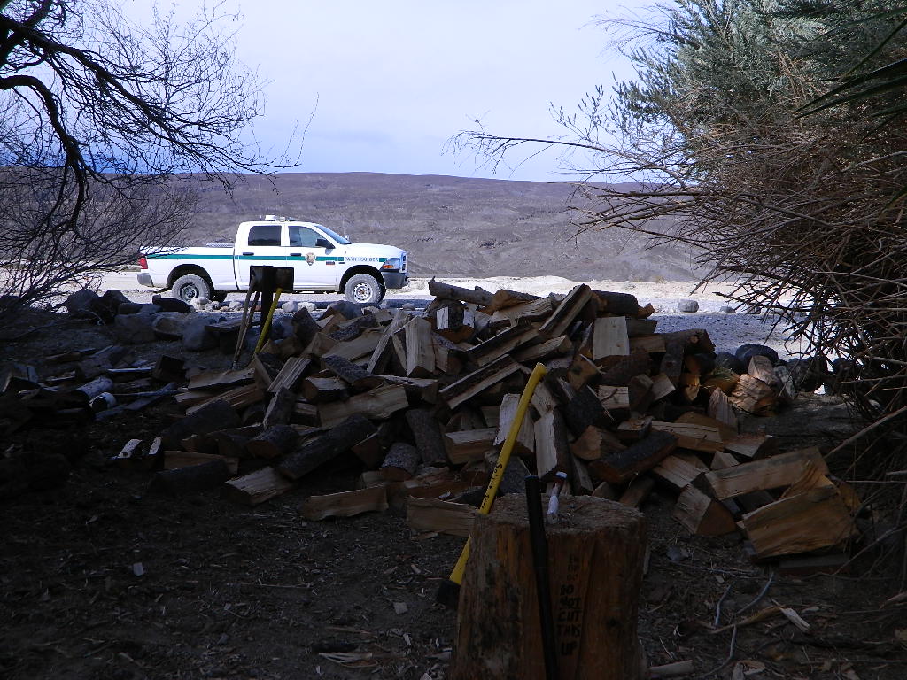
Sierra Madre Road Sierra Madre Ridge, San Rafael Wilderness
Los Padres National Forest Forest Road #32S13
off of Cuyama Valley Hwy 166
East of Santa Maria, CA – along Highway 166 (on the south side of the pavement) are several dirt roads that lead up to the main ridge road that access this part of Los Padres National Forest.
backpacking
camping
dirt bike trails
dirt roads
hiking
horse camping
mountain biking
off road routes
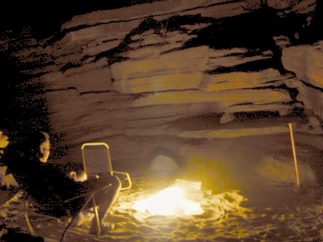
petroglyhs
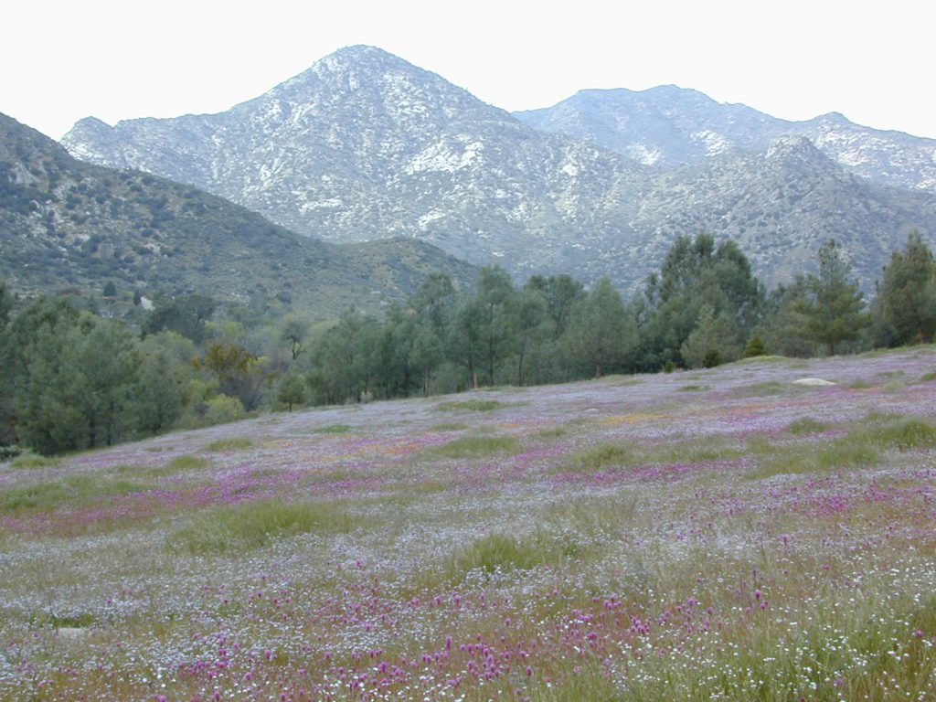
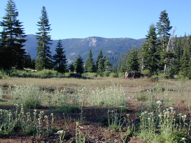
wildflowers
4WD not required, but high clearance is helpful. Open almost all year. Rainy season gate closures (at hwy) during winter months.
Sierra Madre Ridge is forest road #32S13, which parallels Hwy 166 (Cuyama River) for over 50 miles on the Sierra Madre Ridge at approx. 5000 feet elevation.
NOTE: A good stretch of this dirt road is closed to vehicle traffic. Although it connects to Santa Barbara Canyon near Ventucopa, you cannot drive it. Only hike or mountain bike!
NFS Gate locked at the HOG PEN trailhead, and from there you can bike or walk all the way the other end at Santa Barbara Canyon near Cuayama Fire Lookout @ Dick Smith Wilderness
Small campgrounds in the region:
off Highway 166 Miranda Pine Campground (on 32S13 @ 11N03) Bates Canyon Campground (via Cottonwood Canyon Rd) also known as White Oaks Campground Aliso Canyon Campground (via Aliso Canyon Road) not accessible by vehicle, from dirt road 32S13; only by trail
in the backcountry Painted Rock Camp (hike-in) Sycamore Camp (hike-in)
Angeles National Forest extends far north of Santa Clarita, CA. Way up Interstate 5, almost to Tejon Pass (4144′ elev). On the west side of the freeway is Los Padres National Forest and on the opposite side is Angeles National Forest. Both sides have abundant off roading and dirt roads, trails and camping areas.
A few developed campgrounds exist along I-5, but who really wants to camp out and listen to the freeway traffic? This route is a skinny dirt road, leading out to small remote campgrounds, often visited by off roaders. No facilities and no running water; you’ll be lucky if the picnic table isn’t shot up. Simple, bare bones, middle of nowhere for L.A. County.
Forest Road # 7N23
Long dirt road that begins at Three Points Road, off of Hwy 138 – the Antelope Valley freeway which connects the Grapevine and Tejon Pass @ I-5 to the Mojave Highway 14 out east.
USDA National Forest Map is advised, a high clearance vehicle is recommended – and free time needed to enjoy such a spot. 4WD may be needed during snow and really wet weather.
PCT access
The ever popular Pacific Crest Trail passes by this small NFS campground listed below. Backpackers, horse packers, dirt bikes and truck campers can all access this dirt road, but be warned it is WAY OUT THERE.
Yes, it snows up here (very infrequently) – terrain elevations range from 1000-5000′ around this region. Basic note: if Interstate 5 has snow warnings, this small, backcountry dirt road will get winter weather too. And sometimes that can be significant, during JAN-MARCH. If more than a few inches of snow are predicted, you best have a 4×4 and/or snow chains.
camping
dirt roads
hiking
off roading
wildflowers
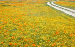
Wildflowers bloom in April, and will need a decent amount of winter rain/snow to display the vivid colors. This area is not too far from the California Poppy Reserve in the Antelope Valley.
Hungry Valley SVRA is a large, popular off road park, located to the north. On the edge of the Los Padres National Forest @ the GORMAN exit.
Bear Campground [2021 CLOSED, due to wildfire from 2020]
open all year
elevation: 5400′
7 camp sites
no toilets
no water
no fee
Oak trees, sage, chaparral w/ wide open sky views. Picnic tables, fire rings and fresh air. Well spaced sites, with lots of room to spread out. OHV trucks & trailers do frequent this spot, so be warned.
Far from everything, so no impromptu beer runs to the mini -market. Bring everything you will need for any overnight stay, including ice, food, drinking water, washing water, and campfire water. LOTS of water is always good. No creeks flow year round. Summer and autumn can be very hot in these hills.
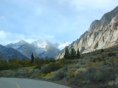
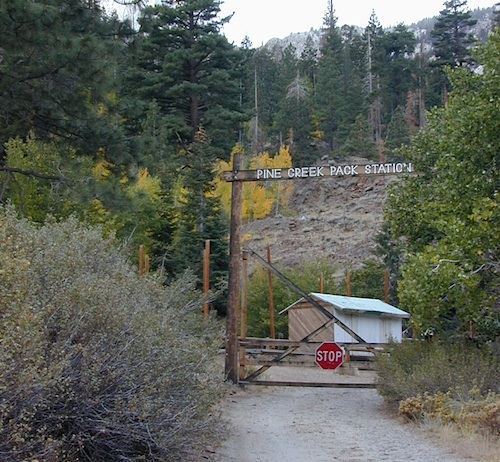
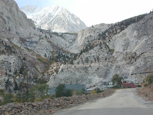
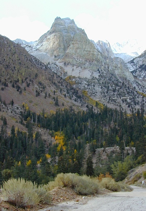
Paved route that dead ends at a huge, old tungsten mill. Impressive peaks and slopes, steep granite; spires and beehive shaped mountains. This region has a very ALPS FEELING, with an “Italy Pass” high above on the wilderness ridge lines.
Pine Creek Road has minimal camping and maybe a half day worth of sightseeing (at most). A few creekside camp spots, only rock dirt road access. Campfire permits required. No facilities. No developed campgrounds. Hiking trails, wilderness access and a horse pack outfitter.
PINE CREEK PACK STATION
85 Pine Creek Road
Bishop, CA 93514
760-387-2797
NO developed NFS Campground exist up here, so don’t think about bringing that motorhome up this steep incline.
Mount Tom (elev 13,652′)
Gable Lakes
Pine Lake (9942′)
Bear Creek Spire (13,713′)
Spire Lake
Scheelite Canyon
Lower Morgan Lake (10,708′)
Round Valley Peak (11,943′) Round Valley
Rovana, CA
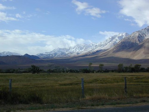
Sugarloaf Ridge, Greenhorn Mts
Alta Sierra, Kern River Canyon
Sugarloaf Road, above Kern River Canyon
SOUTH SIERRA: This route is located in between the Western Divide Highway and the cedar community of Alta Sierra, CA
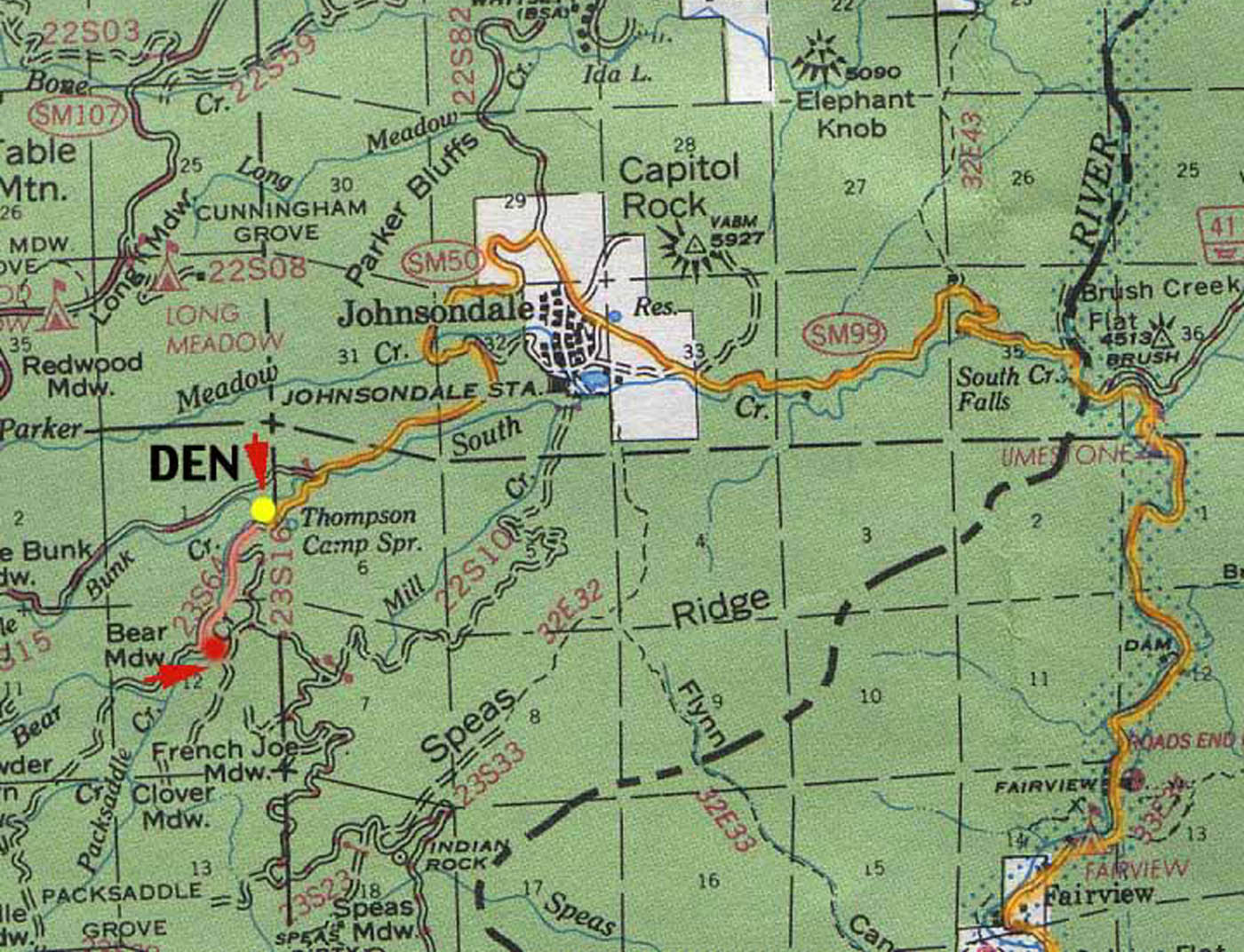
Sugarloaf Ridge: Forest Rd# 23S16 – Thompson Camp Spring, The Den @ Sequoia National Forest
Driving north on Sierra Hwy N of Kernville, California; Passing Fairview & the Johnsondale bridge; After the R Ranch @ Johnsondale, take the left fork on the main highway; After you climb in elevation, look for brown signs on right side of road & turn left on Forest Service Rd# 23S16. Primitive camp sites are located throughout this area along Packsaddle Creek. Do not turn left up Sugarloaf Rd. There are no good camp sites up that way (unless you wanna make one).
RV campers are very common at Thompson Camp Spring, as this road is paved up to this point. The paved road is windy & narrows after this point. It is not advised for trailers or long motorhomes past Thompson.
For the more adventurous, Bear Meadow & Packsaddle Mdw are located up the dirt road a bit on #23S64.
Paved Sequoia route# 23S16 continues to climb, which leads to the Speas Meadow, the Greenhorn Mountains & you best have a real good map if you are heading up this way. 20 miles of awesome open meadows, small streams, dense forest, wildflowers, some primitive camp sites & great viewpoints overlooking the Kern Canyon. All passenger car accessible! Elevations between 6000-7000′. Sugarloaf Peak has cross country skiing.
Side route #23S05 will take you to White River Campground w/ 12 spots. The paved road winds west down the mountain to Posey & eventually Glennville on Hwy 155.
Instead, to easily reach Hwy 155 – you’ll need to get on dirt for a few miles. While on 23S16, look for the Panorama Campground (@ 7400′ elevation w/ 10 sites). Take dirt road #24S15 to get back to civilization @ Alta Sierra, California.
Decimated forest at Bald Rock: Trail Closed 2020-2021
Bald Rock, North Sierra Nevada Mountains
Big Bald Rock
elevation: 3350′
2021: CLOSED due to wildfire damage
Bald Rock Trailhead, Berry Creek, CA Located above Lake Oroville and near the Middle Fork of the Feather River, this well known trailhead is a 1 mile (short, steep & sweet) climb on top of granite rocks – to a wonderful view over the North Sacramento Valley. Dirt parking lot w/ bathroom in a forested setting. Can get muddy during winter. Seasonal creek runs along first part of the hiking trail. Locals like to party here at night. Families hike during daylight and sunset hour. Trailhead sign is well marked on paved Bald Rock Road, about 6 miles from the Oro Quincy Highway.
The granite dome hike (above) is often confused with a neighboring trail to the south, called Bald Rock Dome, located at the granite gorge of the Middle Feather River. A much longer hike w/ a canyon view, switchbacks, and longer dirt road access…..
Another dome hike in the same area as above, but on the other side of the pavement; gravel parking lot, and trailhead via dirt road; a right turn off Bald Rock Road (when going north). Near the residential forest of Berry Creek, CA
The official map for Lake Oroville SRA has a granite dome marked as Little Bald Rock @ 3334′ elev. The USDA Plumas National Forest map has both a Little Bald Rock and a Bald Rock Dome (3509′) located on this side of Bald Rock Road.
As you can see listed below, giant granite domes or mountain peaks or river canyons often have the generic name of ‘bald rock’ There are also a heck of a lotta Bald Mountains inside the golden state.
also, in the vicinity –
Bald Rock Canyon is downstream from the big waterfall, Feather Falls, on the Middle Fork of the Feather River; This stretch of wilderness waterway is called Feather Falls Scenic Area which includes, Milsap Bar Campground; Maybe be accessible, by 4×4 and steep foot trail – from the opposite side of the river. Off Lumpkin Road, which is off Forbestown Road (@ 162 above Lake Oroville) 2021: CLOSED due to wildfire damage
Bald Rock Peak (elev 7166′) a mountain peak near Chilcoot Campground and Frenchman Lake, N of Hwy 70 in East Plumas National Forest
Bald Mountain (5780′) off the Skyway, next to Stirling City, CA
Fire Lookout CDF, weather cam & antenna site
On the north side of the lake is Grass Valley Bald Mountain (5906′ elev) in between Black Rock Creek and the northern shore.
The La Porte Bald Mountain Peak (5906′ elev) is located in dense forest, in Plumas National Forest; In between LGVR and the town ofLa Porte, CA 4959′
Area accessible via a long and curvy La Porte Road, which closes in winter on the north end (East Quincy). This Plumas County area is popular w/ snowmobiling due to the amount of snow they receive.
Bald Mountain Range, due north of Truckee and Stampede Reservoir. Near the CA / NV border. Babbitt Peak @ 8790′ is the tallest peak within this range. Historical Henness Pass Road passes through this area.
Bald Mountain Peak @ Sugarloaf Ridge State Park (2279′ elev) located in between Napa Valley and Sonoma Valley.
M22 Mendocino Forest, eastside Forest Route #M22 is on Valentine Ridge, east of South Yolla Bolly (elev 8092′) and near Bald Rock Mountain (7762′). Road M-22 is also known as Bald Rock Road. Mendocino National Forest – Two trailheads up this way are Ides Cove and Horsepacker. M22 wraps around south to Ball Rock @ 6663′ elevation, near Rocky Cabin Campground. Cold Springs Guard Station, Ball Mountain 6557′ and Whitlock Campground are on this route. Much this region has been burnt in recent wildfires of 2020 #ElkhornFire
Popular, local snow ski destination for “the southland”; south of Pasadena, near Rancho Cucamonga, in the San Gabriel Mountains.’
Bald Mountain Road, also known as Inyo Forest Road #01S05, near Indiana Summit and the Mono Craters. East of the Eastern Sierra & US 395; south of Mono Lake, California.
Bald Mountain Road, near Bummerville, California.
Gold Country Sierra Forests, East of Hwy 49 @ Jackson, CA
Bald Mountain Road, rural ranches & residential;
and Bald Mountain Nursery in Browns Valley, near Marysville, CA
Bald Hills Road, Redwoods NP
Bald Hills Road, Northern California
Well- traveled, graded dirt road connecting the Redwood National Park to the Klamath River @ Hwy 96. Primitive camping, but check on fire restrictions. Must have camp fire permit. Active logging roads on National Forest land, so weekdays could be busy: watch for equipment and big trucks.
The best free camping in California for RVs & motorhomes is NOT the WalMart parking lot in some random town, but the gems that you find here on Total Escape.
The California back roads is where it’s at. Star filled skies, fresh cedar scents & tall pines, plus the awesome views. Primitive camping at it’s best, with your kitchen sink. No hook-ups, no fees, no problem.
the back roads
So, if you are one of those that are terrified of driving your big luxury camper on dirt roads, these may not suit your taste. But if you crave the back country camps with your RV, then you might enjoy the list below.
Still many dispersed, primitive FREE camp sites to be found – but you’re not gonna find them on those big web sites, that everyone goes to.
no hookups, no paved stalls, no dump station
These are camping areas, that you can pull into anytime of the night or day & find a flat spot. Some places may have picnic tables or campfire rings, but not all. No OHV parks, no large developed campgrounds, just dispersed FREE camp sites on the back roads of Cali.
Gold Lake, Sardine Lake, Upper Sardine, Smith Lake, Packer Lake, Grass Lake, Sand Pond, Goose Lake, Snag Lake, Long Lake, Jamison Lake, Round Lake, Deer Lake, Tamarack Lakes, Young America Lake, Frazier Falls
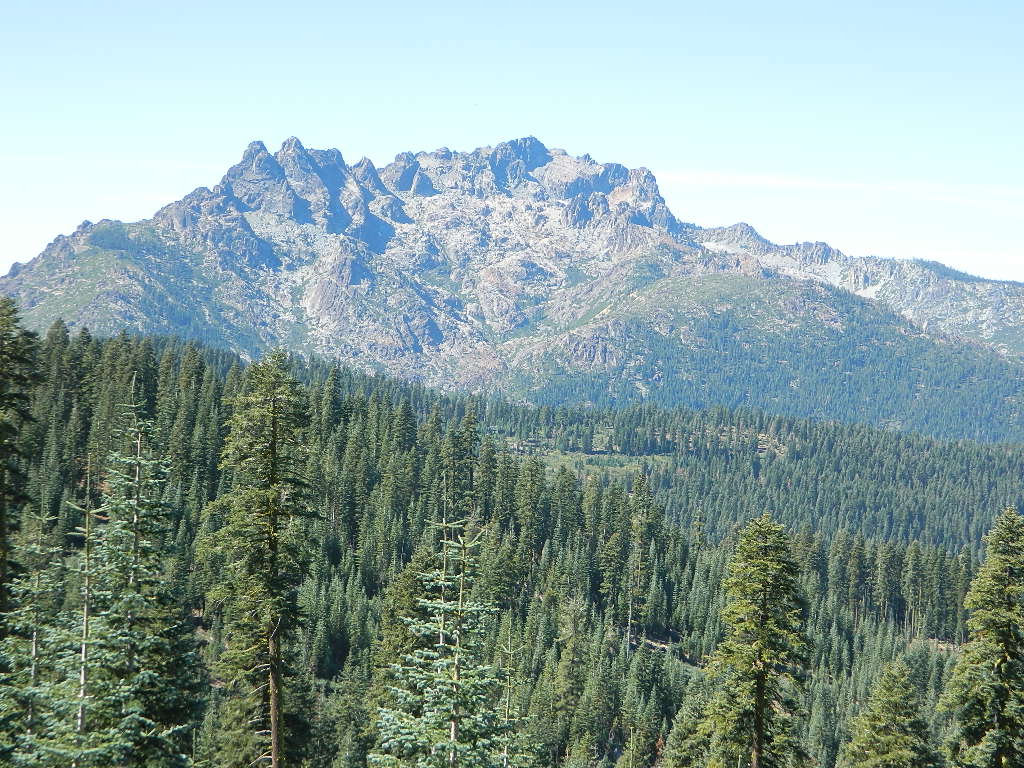
California is the land of granite peaks. Rocky, exposed mountains that stick up out of the landscape for all to see. Southern Cal has a few of them, but most granite peaks in California are found in the Sierra Nevada.
US 395 Eastern Sierra impressive ridge lines are the highest and most photographed and Lake Tahoe has plenty of big granite surrounding it. The farther you go north, the less granite you will see – not because it isn’t there, mostly cuz it is just buried with tall dense forests.
lakes basin day hikers
NORTH SIERRA – The Sierra Buttes are the impressive granite peaks located in between the North fork of Yuba River and Sardine Lake.
SE of Mount Lassen and NW of Lake Tahoe, at the tippy top of the historic gold country. Gold Lake Road #24 connects Gold Country Highway 49 to North of Tahoe Highway 89. Road #24 is often closed for winter snow, so most visitors enjoy this region in the summer months.
The infamous PCT (aka. Pacific Crest Trail) passes the peak and goes north through this basin of alpine lakes, so backpackers are often seen. Tent camping is very popular, as well as RV camping w/ numerous developed campgrounds and open camping as well. Some of the hard to reach primitive camp sites (next to lakes) can be accessed via 4×4 vehicle. Gotta have a good topo map.
Downieville is well known for the mountain biking trails, so this whole region is covered with amazing trails. Snowmobilers and cross country skiers love the area during a good winter snow and they can access this area from the north off Hwy 89.
Centerville is a popular place name inside California
Carson River CA SR 4
Centerville Flat Campground
Alpine Co.
@ California State Route 4 (Hwy 4 east Ebbetts Pass). Silver Creek meets the east fork of Carson River in the majestic Eastern Sierra, W of US Hwy 395.
4000 Centerville Road
Ferndale, CA
Contact: 707-445-7651
North Coast California, Humboldt County – This long steep coastline was the place of a historic event in 1860s, a ship wreck off the coast. In heavy seas, the ship beached 20 miles below the mouth of Humboldt Bay, near the village of Centerville. https://en.wikipedia.org/wiki/Centerville_Beach_Cross
Ferndale has tourism.
Northern Cal
Ferndale, CA – has dining, accommodations, local business, and maybe an RV park. Mostly residential. Rural farmlands, forests, and remote. Wild, windy, rugged coastline.
Shops in downtown Ferndale, CA
Centerville, CA
Butte Co.
In between Chico and the volcanic ridge (called Paradise), is the historic Centerville Road, which leads to oak lined canyon of the small community of Centerville. Mostly rural residential w/ a museum, schoolhouse, creek, covered bridge, maybe a winery, orchards and a oak canyon.
CAMPFIRE, Butte County– This particular area has been scared by the wildfires of 2018, so expect some back roads to be closed. Landslides and tree falls are quite common after a wildfire, especially on narrow mountain roads. Nearby Paradise got destroyed, but they are rebuilding. rebuildparadise.org
BELOVED BRIDGE
Located along Honey Run Road. Chico’s historic Honey Run bridge, was built in 1887, reconstructed in the late 60’s, and recently destroyed by wildfire in late 2018. Honey Run Road intersects w/ Centerville Road further up the canyon.
A major backroad (paved connector) in Modoc; connecting South Alturas @ US 395 to Canby @ Highway 299
a whole lotta nuthin’
Rural residential w/ farmlands and cattle grazing. California Pines (POA), Donovan Reservoir and the Pit River is along this route called Centerville. Portions of zoom on GoogleMaps has this Centerville Road listed as N West Street
Plumas Road #24N29, off Bucks Lake Road
East of Bucks Lake, California.
a six mile, one lane, dirt road is the only vehicle access into this high elevation, dammed reservoir, tucked back against the wilderness. Secluded lake campsites await, you’ll just need to get a little dusty first. The turn off, at a small brown sign reading “Silver Lake”, one which is very easy to miss – due to the amount of homes, cabins, fencing and driveways in the vicinity.
No swimming allowed at this Silver Lake, as it serves as a drinking water source for the neighborhoods below. Canoe & kayaking are allowed. Fishing is also popular at this location. Hiking trailheads at Silver Lake lead to the PCT (Pacific Crest Trail), Mount Pleasant, Spanish Peak and a small gem of a swimming hole, we call mini Gold Lake.
This small campground is actually set downhill from the rock earthen dam, which is something to ponder before/during a big earthquake. With sites 1-5 in a shady forest area and the others a bit closer to the lake, no campsite is too close to another. These are all well-spaced-out sites, providing decent privacy and minimal noise from neighboring campers. No campsites are located at the lake edge, as the rocky dam is a long structure and quite complex with water control measures.
All the campsites have new bear boxes for food storage, cuz ‘wilderness’ usually means black bears are roaming about. Deer tend to frequent campsites 1 & 2.
2020 update: overnight camping fees now charged at this campground
Silver Lake Campground NFS
• Elevation: 5800′
• Number of Sites: 9
• Vehicle Accessibility: RV 22′
• Campsite Reservations: No
• Camp Fee: Yes
• Toilet: Vault
• Water: No piped/potable
• Length of Stay: 14 Days
• Season: May – October
• Trailheads: PCT, Gold Lake, Rock Lake, Granite Gap, Bucks Lake Wilderness
As with most of the high elevation lakes in California, winter months can mean deep snow and dirt road closures. This campground is usually open through the end of October, but call head to the local rangers if in doubt.
Plumas National Forest
Mt. Hough Ranger District
39696 State Highway 70
Quincy, CA 95971
530-283-0555
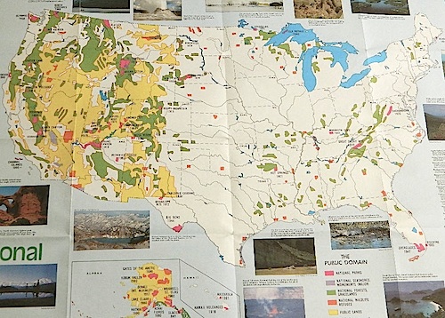
Access to wild land, open spaces, parks, forests, lakes, mountain peaks, public land – USDA National Forests, National Parks, State Parks, BLM. There is more public land available in the west half of the U.S., than anywhere else in the nation. This is one of the top reasons people relocate to the West Coast.
California’s Public Lands for Recreation
Federal lands, government managed parks, USDA National Forests, National Parks, National Wildlife Refuge, BLM, State Parks, State Forests, County Parks, Regional Open Spaces
California National Parks– most National Parks are so crowded you can’t even enjoy the experience in the summer time. Try the off-season times for your best stay. Neighboring National Forests are a much better bet for abundant space, privacy & less taxing on the wallet for fees. These popular (NPS) parks are subject to federal budget cuts and closures.
California National Forests– protected wilderness areas throughout state are surrounded by National Forests (NFS), and most National Parks (NPS) are surrounded by National Forests. Tons of small campgrounds & primitive spots for real seclusion. Get a free fire permit & camp almost anywhere you want. Use that SUV exploring the many dirt backroads & find that perfect camp spot (for free).
California State Parks – local California parks with a lot to offer the day hikers, picnicking family, tent camper or RV camper. From warm dry deserts soaking in a hot springs to the foggy coastal redwoods, these state run parks encompass a large section of California terrain. These parks are subject to state budget cuts and closures.
BLM: Bureau of Land Management – mostly desert regions on the east side of California. A few coastal redwoods, some river canyons in the Sierra Nevada, many off road areas (OHV) in various mountain ranges. These federal lands are open spaces, generally a free for all on recreation. Allowable = off roading, target shooting, open camping, campfires, bonfires. Geared toward OHV use, RVs and hunting.
Coastal California – Southern California beach camping is crowded & sparse, because of developed cities. Central Coast & Northern California offer many more choices in this category.
California Mountains – pine forest, mixed oaks & a variety of vegetation. Water sources such as lakes, stream & waterfalls make this choice the perfect camping spots. Granite peaks, high elevations wilderness areas throughout state & surrounded National Parks. Plenty backpacking options & dirt road primitive spots for the ultimate in privacy.
Countryside in California – coastal hills or mountain foothills. These rolling hillsides offer small creeks, oak trees & plenty of wide open spaces. Lakes & Reservoirs are located within these regions. Most campgrounds are fairly close driving distance to towns or cities. Wine country or gold country, California has it.
California Deserts – perfect for every season except summer, these vast spaces will humble just about anyone. Primitive camping galore & designated areas for real off-roading.
City CA / Urban Villages – not the best for really getting away from crowds, but can be an excellent opportunity to visit a city without spending big bucks on lodging. Or could just be a perfect one-nighter for getting familiar with camping. Most campsites are located in the foothill area behind suburbs, in county parks or even coastal.
California A to Z: Small Towns – 700 and counting; extensive list of destinations, focusing primarily on the back roads and outdoor recreation hubs
California by County – Find every county on Cali, and which towns are located inside of them
California has many different National Forest districts and each region has their own fire restrictions. State Parks & BLM also manages recreation areas & camping in the Golden State. Each agency & region has different rules, so blanket answers cannot apply to general questions on campfires.
CAMPFIRE PERMITS
Campfire permits are required for fires outside of designated recreation sites. During fire restrictions, campfires could be banned. Campfire Permit are available from Forest Service, CalFire or BLM offices or online, http://www.preventwildfireca.org/
Manter Fire [2000], Dome Land Wilderness, Southern Sierra Nevada
the new abnormal
California suffers more from wildfires now than ever before. Native tribes let lightning strike wild fires burn and they did not suppress wildfire. Residential development creeping ever higher and denser into the foothills, an abundance of roadways, with the overgrown forest make fire danger ever more real.
Closed off wilderness areas, impassable dirt roads, landslides, fallen trees everywhere. Utility services (power lines), plus high winds and overgrown forest also play a huge part in the current wildfire catastrophes. Drought conditions or record winter rains, the huge population on the west coast -along with many other factors – means more fire danger. Educate yourself and others on fire safety, forests and weather patterns. Heed the wind, while in the wild. Wind spreads fire easily!
By mid summer we have usually have several wild land fires burning, which means campfire restrictions are usually in place before JULY 4th weekend. When this happens – No open campfires are allowed in the backcountry or on the back roads.
Often in the driest of years, no campfires are allowed (even inside the campgrounds).
If you love to primitive camp outside of developed campgrounds, you need to plan more road trips for spring time & autumn. Or head further north, well above Redding – where the forest are moist and snow graces Mount Shasta year round. Or perhaps, go desert camping during winter months. Checking the National Forest web sites can be confusing and their online information could be outdated.
Each forest and area is individually managed. No concise, easy-to-read list or online map exist on which forests are allowing backcountry campfires – and which ones are not. Conditions seem to change so often and they aren’t great about updating those .gov web sites. Best to call a local ranger station and ask about any current fire restrictions. You know, actually “talk on a phone” to a USFS, BLM or CalFire official. If you can speak to a field ranger, they can tell you more on dispersed camping. Or you can navigate the USDA web site to find current ALERTS & RESTRICTIONS. Cryptic lingo may be encountered, and many clicks maybe needed; possibly forcing you to download a PDF of current fire rules.
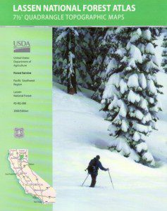
Lassen National Forest roads and trailheads, surrounding Lassen NP
Lassen National Park is completely encompassed by National Forest land with dirt roads, off road trails, serene lakes, secluded camp sites, hiking trailheads and wilderness access
California State Route 89 (highway 89) runs north/south thru the middle of the park and closes for months due to winter snow.
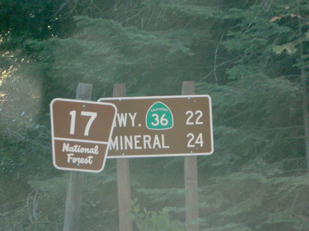
California State Route 36 (highway 36) runs east/west on the south side of the National Park, connecting Red Bluff to Susanville, CA
California State Route 44 (highway 44) runs east/west on the north side of the National Park, connecting Redding to Susanville, CA
East of Lassen National Park
Lassen Forest Road #10
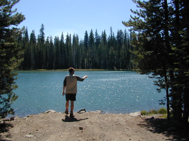
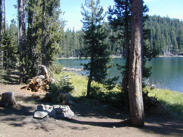
Echo Lake, Silver Lake, Caribou Lake. Campgrounds, trailheads, backpacking, day hikes, parking, equestrian.
Crater Lake on the north side of Hwy 44
Lassen Forest Road #318
Juniper Lake Road (aka Chester Juniper Lake Rd)
N of Chester, CA
paved first 5 miles, then becomes graded dirt road for another 5.
Benner Creek runs along the first half of this route w/ Banner Creek Campground: elevation 5562′ / 9 camp sites / open May-Nov
Juniper Lake at end of road w/ NPS campground
elevation 6792′ / 18 camp sites / open June-Sept
Lassen Forest Road #312
Warner Valley Road (aka Drakesbad Road)
N of Chester, CA
10 miles long, paved most of the way, then becomes graded dirt road out to Drakesbad meadow.
Wilson Lake Road, connects Hwy 36 to Road #312
Domingo Springs Campground: elevation 5060′ / 18 camp sites / open May-Nov
Lassen Road #29N18
W of Chester, CA
Loop route off Forest Road #311 w/ North Fork of the Feather River, leading to Elizabeth Lake trailhead
Lassen Road #29N19
W of Chester, CA
Graded dirt road w/easy access. Connects Forest Road #311 to highway, paralleling Hwy 36. Lost Creek runs along this route w/ Willow Springs Campground: elevation 5100′ / 14 camp sites / open May-Nov
West of Lassen National Park
Lassen Forest Road #17
W of Lassen NP
North-South dirt road that connects highway 36 to highway 44.
Heart Lake trailhead
At the south end on Hwy 36 is Battle Creek Campground: elevation 4800′ / 50 camp sites / open April-Oct
Lassen Forest Road #29N22
Mineral Road connects Hwy 89 to Viola on Hwy 44
McGowan Lake Winter Recreation Area at South entrance of Lassen National Park
Camping North Lassen
North of Lassen National Park
Lassen Forest Road #32N13 Lassen Forest Road #32N22 (PCT crosses this route)
Twin Bridges networks dirt roads @ Hat Creek.
near Old Station Visitors Center (junction Hwy 89 & 44).
Hat Creek and Cave Campground on highway 89, Big Pine Campground off highway; Numerous dirt back roads for dispersed camping, near the viewpoint on highway 44
Road #32N20 Road #32N56 – road just south of Subway Cave near Old Station, off SR Hwy 44 lead to small Baker Lake.
Road #32N92Y side route leading from Hwy 44 to Road #32N21 along Butte Creek.
Butte Lake Ranger Station and Butte Lake Campground: elevation 5600′ / 20 camp sites /open May-Oct
Road #32N09 connects Forest Road #10 to Widow Lake trailhead and Butte Lake. Road #32N60 is Bogart Winter Recreation Area, at Hwy 44
Hat Creek Lassen Road #18 runs north/south along Hat Creek Rim. Dirt road parallels Hat Creek Valley on the east side of Hwy 89 Road #22 connects Hwy 89 to Hat Creek Rim. A popular hang glider launch area after the University of California Radio Astronomy Observatory, then the road continues eastbound to cross Pittville Rd #111 and ends up at Little Valley
Lassen NF Road #111 is Pittville Rd, runs north/south paralleling Hat Creek Rim to the east side. This 30 mile long route connects Hwy 44 to Pitt River at Hwy 299 near Fall River Mills, CA
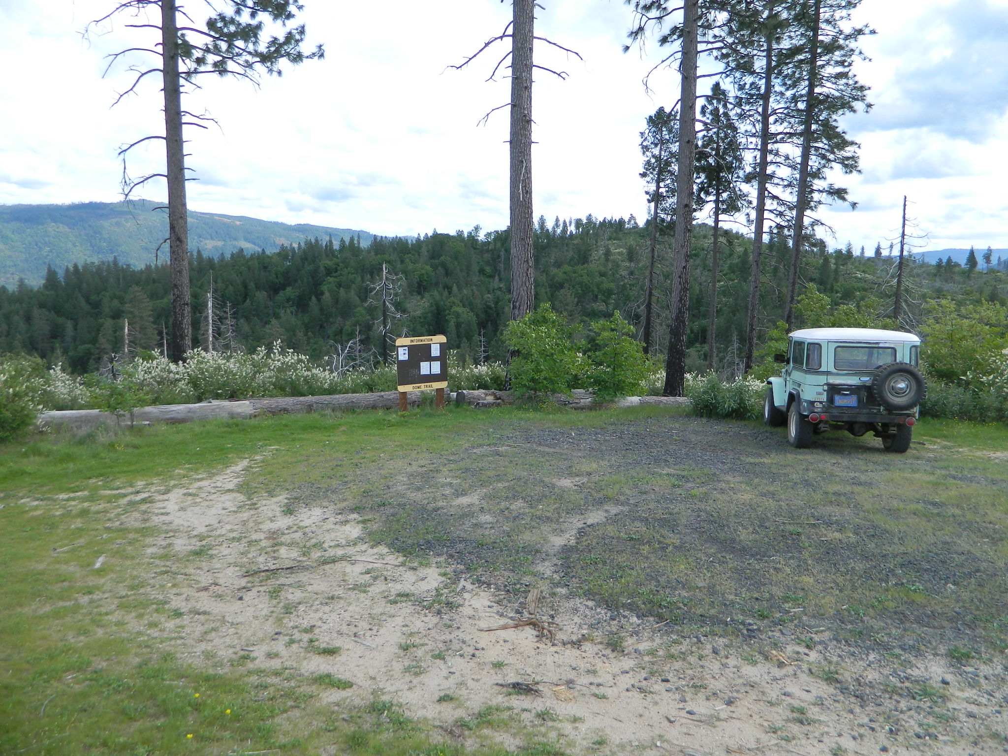
On paved Bald Rock Road a rusted metal sign reads “Dome Trail 3” which is where the fun begins, on the dirt.
3 mile drive to trailhead from pavement
4.6 miles RT hike
w/ a 2000 feet elevation drop to the river
Plumas Forest Rd #21N51Y is located in the forested community of Berry Creek – opposite from Upper Zink Road. Road 21N51Y becomes Bean Creek Rd #21N36: The forested route passes a few private properties and gates, the dirt road leads 3 miles down to an old wildfire (2008) burn area and eventually dead-ends at the Dome trailhead. The hiking trail descends down while overlooking the Bald Rock Canyon with the Middle Fork of the Feather River.
Rated as a moderately difficult hike: Steep hillsides, plenty switchbacks, downed trees across trail, boulder hopping, cliff edges, extreme heights and rock slides. Delighted by dozens of wildflowers, the old metal staircase still in use, steel pipe railings and the minimal fencing and of course, the big river deep inside an impressive rock canyon. Sierra Nevada spectacular!
Indian Creek spills down into Curtain Falls up the canyon, sometimes within view. Secluded Milsap Bar Campground is also up the river from here. The stretch of the whitewater river is popular with rafters and kayaks. Rock climbers gravitate to the big walls above. Bring a picnic lunch and water filter for this amazing all day hike.
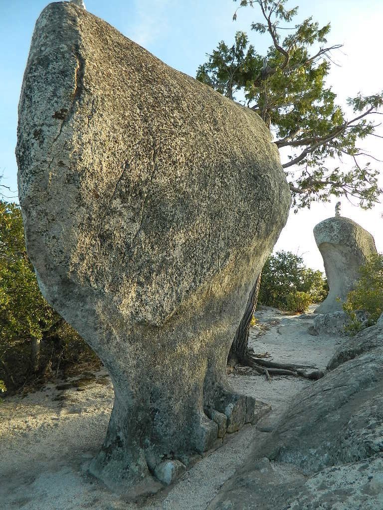
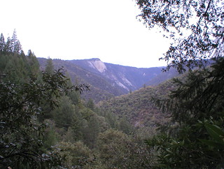
Granite Domes & Bald Rocks
There are numerous granite domes and bald rocks within the Plumas National Forest, most located near the big river canyons. This particular granite dome is situated overlooking the Middle Fork of the Feather River, and it is called Bald Rock Dome w/ 3509′ elevation.
Not to be confused with another shorter hike nearby on Bald Rock Road at a well marked trailhead for Bald Rock, which over looks the forest and valley to the west side. The official peak is named “Big Bald Rock” as listed on most maps.
Small campgrounds and secluded camps, accessible by dirt bikes or 4-wheel drive vehicles. Numerous dirt roads, sand dunes and canyons to explore, some with developed campgrounds, other areas w/ primitive camping. Self sufficient campers will enjoy this list.
4×4 camping in California
Okay, you got your 4 wheel drive vehicle dirty, it is now several years old & maybe you even have a scratch or two. Now is the time to finally start using that beast for real off road adventures. The real edge-of-wilderness trips you dream about when your sitting in your cubical wondering what life is really about. Fishing, camping, off roading and enjoying nature, of course!
4×4 camping in California is plentiful. California has trails for OHV use – which means ‘off highway vehicle’, that can accommodate your machine. These remote camps are always primitive camp sites, with picnic tables, fire rings & maybe a pit toilet (if you are lucky). You can find total seclusion on these back roads & trails, well away from the developed campgrounds & RV parks.
Anza Borrego Desert 4×4 Trails – pretty much everywhere in Borrego desert is off road heaven. Minimal pavement and maximum desert means dirt roads galore, white sandy washes, slot canyons, badlands, wind caves, wildflowers, petroglyphs, boulder outcroppings, old railroad trestles and so much more. The San Diego desert elevations range from near sea level to 4000′ on the eastern slopes of Laguna Mountain.
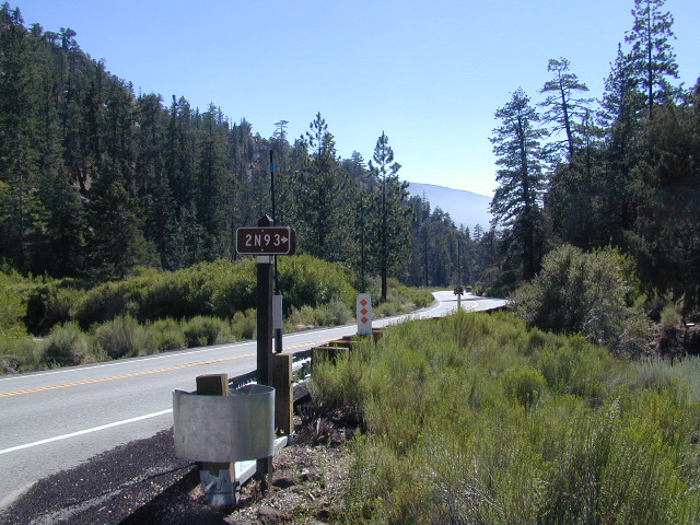
San Bernardino National Forest – has a few trail camps for 4×4 enthusiasts. John Bull Trail (near Holcomb Valley) has one real awesome camp spot with great views over the desert night lights. Holcomb Creek Trail also has a few spots near the creek. Overall this area is somewhat crowded for wheelin’ (especially on the weekends), as the population is so dense nearby.
Los Padres National Forest – the most 4×4 camping, readily accessible to Southern California. This is truly the best kept secret for Angelinos wanting an escape. The southern portion of the forests has Tecuya Ridge #9N22, with several camps only minutes from I-5. Cherry Creek 4×4 Camp, with a few other campsites tucked way back in there. Dome Springs Campground is located off Lockwood Valley Road, while Nettle Springs Campground is over near Highway 33.
Out west, Cerro Noroeste Road has the Blue Ridge w/ Marion and Caballo Camps. Red dirt high desert wash Quatal Canyon #9N09, is right next to the Chumash Wilderness.
2 OHV parks in the Los Padres Area: Hungry Valley & Ballinger both serve the off road crowds and have ample facilities, large camp spots to accommodate RVs and trailers.
The northern section of Los Padres (near Big Sur) has plenty of dirt roads & primitive camps, but none are truly 4×4 routes, as most can be accessed easily with a passenger car. See more on Big Sur Camping and Big Sur BackRoads.
Sequoia National Forest– Southern Sierra Nevada area has 4×4 camping right along the Kern River @ Keyesville, at the junction where Hwy 178 meets Hwy 155. Also, further up the river, Forest Rd#22S82 leads to primitive Camp 4, where there are several spots near granite pools, that can only be accessed by 4 wheel drive. The Big Meadows area also has some gorgeous forested back roads worth exploring. Kern Plateau has hundreds of miles of OHV trails near Troy Meadow.
High elevation Monache Meadows is a prime fishing & hiking destination on the south fork of the Kern River, accessed by an authentic “Jeep Road”.
Sierra National Forest– central Sierra forest has plenty of 4×4 routes that lead to granite rock gardens & mighty fine, secluded, forested camp sites. Gorgeous Red Lake & Coyote Lake are popular spots that require some technical skills & much patience to access. Both are frequented by fishermen & horses. Bald Mountain trailhead has awesome creekside camps on Rock Creek. Up near Wishon Reservoir is the dead end trail of Spanish Lake. Onion Springs Meadow is awesome back behind Edison Lake. Near the granite wonderland Courtright Reservoir is the infamous Dusy Trail signed #28E34 (aka #7S32, the Dusy Ershim), second only to the Rubicon Trail for high Sierra granite.
Stanislaus National Forest– camping in the Crandall & Niagara Creek OHV section of the forest, right off Hwy 108. Elevations range from 5000′-7000′. Higher up on the other side, Levitt Lake (access road near Levitt Falls) on the east end of the mountain range, east of the Sonora Pass sign.
El Dorado National Forest – has an area called Rock Creek for off roading in the Gold Country. Plus the ever popular Rubicon Trail starts hear (near Georgetown) & leads 20 miles across the High Sierra Nevada granite slabs to Lake Tahoe. Tons of camping back here in the National Forest.
Lakes Basin Recreation Area – Northern Gold County, just above the Yuba River. Gold Lake has many campable lakes. The area sees a lot of snowmobile traffic during winter snows, but warmer months are the time for fishing and camping. Most of the big lakes have small developed campgrounds, some are minimal, or primitive style camp sites on dirt roads without facilities. Maybe a picnic table at most.
Smith Lake is a place that fishermen and 4×4 enthusiasts love. It is small, secluded and kinda hard to find. You’ll need a good topo map of the region. Situated on the border of Tahoe and Plumas National Forest off the Gold Lake Hwy (aka Road #24). The PCT cuts thru this Lakes Basin area w/ Sierra Buttes There are dirt roads and off road trails leading deep into the backcountry from the Packer Lake and Gold Lake areas. Snag Lake is a free camp right on the main road.
Snake Lake Campground has numerous dirt roads and trails leading out to Butterfly Valley. Horse campers use this popular camp spot, so no loud vehicle activity inside the campground. No shooting up the bear locker either!
Milsap Bar is a long, narrow 9 mile dirt road which leads from Bald Rock Road in Berry Creek, down to the Middle fork of the Feather River. NFS Campground on the big river without fees!
China Gulch Road #60, a very long and winding dirt road, leads from Oro-Quincy Highway down to the Little North Fork. Although the NFS Campground is closed due to a landslide (1 mi before camp) there still is primitive camping at the second bridge. Be warned: the campsite at the first bridge is often over run with giant, juicy slugs at night.
Out there east of Quincy, somewhere off the historic, long and winding La Port Road, a few decent 4WD trails thru forest, access ridge lines or the big river below. Great fishing, amazing scenery & very secluded.
(north of La Porte Road)
– Feather River access
@ Cleghorn Bar Campground, 4 campsites (Road #23N24)
@ Stag Point Campground, 5 campsites (Road #22N80Y)
@ Hartman Bar NRT to Dan Beebe Camp (Road 94 to #22N42Y)
(south of La Porte Road)
– Poker Flat Camp near Sawmill Ridge & Table Rock (Road 800)
Sly Creek Reservoir is a super popular NFS Campground with trailheads and dirt roads leading deeper into the forests. The camp area is a favorite amongst the off roaders and dirt bikers that migrate up to the mountains for the weekend, to escape from the heat of the summer in the Sacramento Valley. LGVR is another body of water back in these parts and is more scenic and peaceful than the Sly Creek.
This coastal range is dirt road heaven, graded dirt roads, ridge routes, hiking trails, equestrian trails, big lakes, small lakes, creeks, meadows, forests, wilderness and 4×4 routes. Snow can be the most fun and challenging for the 4WD crews. Mud, snow, some road closures seasonally.
2019 WILDFIRE: Ranch Fire – wiped out most of this area. South of Snow Mountain Wilderness, plenty off road trails leading to peaks and ridge lines. Numerous small campgrounds to choose from, trailheads everywhere, acres and acres of wild mountainous areas, and a lake resort nearby. Lake Pillsbury is kinda the center of all the 4×4 action in Mendo.
Fouts Springs – Numerous NFS Campgrounds catering to the off-road types a portion of the year, but mostly quiet other times.
Heart Bar to Big Bear Lake, via the dirt road
San Bernardino National Forest
Big Bear Back Roads
Highway 38, East of Heart Bar @ Road #1N02
Southern California
alt big bear
This 8 mile long forested, dirt road begins right off Hwy 38, just east of Heart Bar Campground and is an easy turn to miss. One tiny, brown sign is all that is found (on the guard rail). Driving too fast, you are bound to miss it.
The unimproved route heads north through the National Forest, up and over and around SugarLoaf Mountain (elev 9952′), then down to the Big Bear Lake region.
Several primitive sites – yellow post camp sites – can be found way back in here, but you might NOT be able to have a campfire (depending on fire restrictions). Check w/ local rangers before you head out.
Forest roads are often closed (gated) during the winter, when snow and rain make a muddy mess of the terrain. Rock slides are also common in wetter months. Call the local rangers to inquire on road conditions or if this route is open.
The whole Big Bear Mountain area is a SoCal favorite forest destination, for weekenders and travelers alike. Mountain biking, hiking, backpacking, horseback riding, camping and 4-wheeling.
Plus the recreational lake is full of more water recreation w/ tourist shops and restaurants. Stay away from the crowds and take the back roads for adventure and recreation. Spend less money, stay outta town and camp for free.
Kelbaker Road is one of the well-traveled back roads in the Mojave Desert connecting two major Eastern California routes of Interstate system. The I-40 to the south and the I-15 to the north, spanning 50 miles from one to the other.
Kelbaker Rd continues south to T up w/ historic Route 66 near Amboy, CA. Gasoline is very iffy in Amboy, so remember gas up in Barstow.
This region is super scenic portion of Kelbaker Road, which cuts thru the western edge of Mojave National Preserve. The Kelbaker pavement reaches to an elevation of 4024′ at Granite Pass, about 6 miles north of the exit @ interstate 40. Boulder outcroppings, bare mountain peaks, secluded cove camp sites w/ dirt roads, and old mines all over. Joshua tree forest and pinyon pine forest encircle the Mid Hills region.
Some roads are suitable for passenger cars, but many are NOT. Dirt slides, erosion gullies, wash outs and rocks are common on these roads, so drive slow and pay attention. Have a spotter get out and take a look at the road conditions. Have a stroll, in the dark w/ the flashlights.
Or risk bottoming out, getting stuck in a deep rut. RVs should be very cautious. Daylight arrival is usually key for getting a perfect camp site, unless of course, you had it way-pointed on the GPS. Bingo! But the torrential thunderstorms, rearranged the valley since then, so use your brains.
There are private property ranches, active railroad tracks & BLM lands along the Kelbaker route. Some of the boundaries of NPS have been extended, so best to bring a decent topo map.
Free camping is abundant in this desert region, but it’s all primitive w/ no facilities and all are on dirt roads when your turn off Kelbaker. Some of the best camping areas are around 4000 feet (above sea level), so serious wind and even snow is quite possible in the winter months. Go prepared w/ plenty firewood.
Historic Mojave Trail (aka Mojave Road) is out this way. Dirt bikes, off roaders love this trail that connects the Colorado River @ Avi Casino to Afton Canyon near Barstow.
WILDFLOWERS – joshua tree, yucca, barrel cactus
Higher elevation deserts bloom in late Spring, generally March thru May. Perfect rainfall timing in the autumn, can determine wild blooms and flora months later. Providence Mountains SRA can be a good location for wildflower viewing.
Kelso, CA
Kelso Depot: historic spot, centered around the old train depot, which has been restored and has become the new visitors center and museum. Totally worth a 2 hour stop and HIKING/WALKING stretch break. The road heads north from Kelso and the name changes to: Kelbaker-Cima Road
Cima, CA
Cima Store, 20 miles to the north is one of the few businesses in this region. Post Office next door, maybe. Cima Road connects to I-15 in approximately 15 miles north. Kelbaker Road splits again and it heads up to I-15 @ Baker, CA
California meadow is a common term people search for when dreaming of their mountain retreat vacation or upcoming weekend camping trip.
Meadows are places in the forest where cool air collects and settles. Deer among other wildlife, can often be found here grazing around dawn and dusk. Alpine meadows are usually surrounded by trees with lush green grasses, located at higher altitudes above 6000′ – the ‘highcountry’ as most like to say.
Find meadows on National Forest lands from 3000-10,000′ elevation, and it is not uncommon to see cattle grazing in these same regions. California National Parks have some of the most protected meadows in the golden state!
MT SAGE – mountain sage meadows
High desert mountains have drier landscapes, with large sage brush meadows surrounded by sparse pinon pine and/or juniper forest. The Mojave desert’s sagebrush reaches out westward to the peaks of West Kern County. High deserts and mountain meadows can both have significant wildflower blooms. The deserts start to show color in March & April, while the highest elevations of the Sierra Nevada can bloom as late as July & August. All California Wildflowers depend on autumn seasonal rains & snow melt.
Kennedy Meadows from Bald Mountain Fire Lookout
Wilderness Meadows
The best places to find secluded wildflower meadows is on the high country trails of various mountains – Mount Pinos, Sierra Nevada, Shasta, Trinity & Lassen – all have marvelous meadows, some have easy access w/ parking nearby and others are hike-in only. Locate hiking trailheads for meadows and possibly find camp nearby.
Excellent near Meadows:
Stargazing, Wildflowers, Wildlife Viewing, Horse Camping
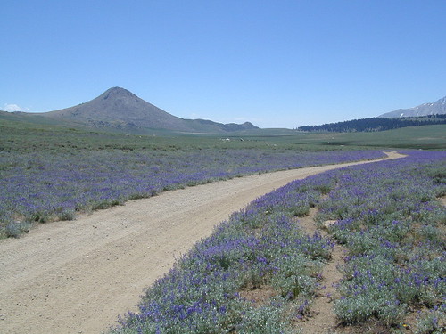
Explore dirt back roads of California to find your very own meadow. If you would like to explore at this level, a good topo map is highly advised. The Sierra Nevada mountains have the most beautiful meadows in the state (by far). Their scenery w/ granite outcroppings and wild flowers, surpasses all else. Although on rare occasions, even the Antelope Valley can look amazing — with poppies.
Mountain Meadows are sacred spaces: Do not disturb the lush, grassy landscape, as wildlife rely on these areas for survival.
No driving on meadows. No camping on meadows; No Campfires; Camp next to (or nearby), but not on top of the meadow. Picnicking should be kept on the sidelines.
Stay on designated dirt roads: No tires across the meadow; No mountain biking, No dirt bikes, No off roading. You’re not spreading the seeds, you’re destroying a fragile ecosystem.
Ranch FENCING w/ barbed-wire is quite common around meadows, to keep cattle out of certain problem areas. Fences also help keep the wandering public out of private lands or sensitive areas.
When hiking – stay out of the muddy spots and know that if you choose to hike directly across meadow, you may encounter water and deep, sinking mud. HINT: There is usually a shallow creek running through most meadows, during all times of the year.
Winter snow usually blankets these fragile areas in winter, and when deep enough – making this terrain prime destinations for snowmobilers.
Lassen Volcanic Park is surrounded by beautiful mountains and lakes, some inside the National Park boundary, but most outside. Lassen National Forest, Thousand Lakes Wilderness, Lake Almanor, Hat Creek and Burney Falls encompass this pristine water wonderland of NorCal. Outdoor recreation all over – rivers, fish, hunt, camp, mountain bike, off road.
Backpack camps, RV campground, fishing lakes, day hikes, off-road and lake side camp sites, we have it all listed on Total Escape.
Hiking, camping, fishing all over this region! Mountain bike, kayak, or relax all day in the hammock – in a shady spot with a view. Water flows freely and annual snow melt is abundant in this part of California. Some locales may not open until July 4th weekend. Always check with the Lassen NFS rangers to make sure.
(lakes on the trail)
Crumberg Lake
Twin Lakes
Jakey Lake
Snag Lake 6076′
Horseshoe Lake
Willow Creek
Long Lake
Lassen National Forest lakes:
Majority of these lakes require dirt road driving to reach them. Often forest roads close for snow, usually during winter months (DEC-MAY)
Wilson Lake 5267′ Crater Lake ^ 6800′
Echo Lake
Widow Lake
Star Lake 6362′
Rising River Lake
Baum Lake
Murken Lake
Haynes Reservoir
Heart Lake
Willow Lake
Shotoverin Lake
Killer Camp @ Echo Lake
Caribou Wilderness:
Campsites with hiking lakes and wilderness trailhead access, right next to Lassen Volcanic National Park.
Echo Lake ^
Caribou Lake ^
Silver Lake ^ – Silver @ Lassen
Triangle Lake
Find Lassen Maps, NFS Topo Atlas
Thousand Lake Wilderness:
North of Mount Lassen is the less-popular Wilderness Area w/ many miles of dirt roads to travel.
North Battle Creek Lake ^ 5571′
Logan Lake
Buckhorn Lake 4776′
Lake Eiler
Terry Lake
Tucked way back in the granite high elevations, near Donner Pass is a wilderness water flow called Canyon Creek. Connecting small lakes and big reservoir, this creek is part of the Nevada District water supply. The Sierra Nevada region is Tahoe National Forest and the terrain is abundant rock.
Campground is perched on the edge of rock overlooking the impressive whitewater; sounds of crashing water at certain campsites is deafening. Half of the campsites are located in a forest loop and the rest are out in the open, with much granite and fewer trees, perfect for star watchers.
Canyon Creek California
Lake Faucherie is a mile up the creek and Sawmill Lake is a mile down stream, so it’s a great fishing location, as well as hiking, kayaking and canoeing destination. The Pacific Crest Trail (PCT) is also routed close by. A hiking trailhead at the north end of Sawmill Lake leads to a loop hike of small lakes.
roughest roads in the region
Campground loop is paved, but the 12+ mile access road is NOT.
Twenty plus miles of paved & gravel backroads in boulder-hopping bliss, leads to granite lined lakes and forested campsites. Two different driving routes into this canyon:
One is the longer way Road 18 – paved access off of Gold Country Highway 20, which becomes an 8 mile long, rocky, rough, one-lane road around Bowman Lake.
The other is slightly shorter, county road #843 that comes in the back way from Jackson Meadow Reservoir (off Hwy 89, N of Truckee).
Both of these primitive roads join at Jackson Creek Campground, a favorite among off-roaders.
Canyon Creek Campground is another few miles up Road ##843-037, a rugged canyon route towards Lake Faucherie, where the road comes to a dead end.
Don’t let the old maps fool you: these National Forest Roads are labeled as gravel roads, but boulders and rock slides are quite common. 4×4 would be nice, but high clearance is recommended.
Minimal signs designate trails, roads and lake access; What signs that do exist are old, faded and broken. No warning signage reading ‘high clearance’ or ‘4WD recommended’ – so obviously Tahoe NF won’t be installing new signs anytime soon.
backpacking
camping
canoeing
fishing
hiking
kayaking
stargazing
Faucherie, Sawmill and Bowman Lakes are all along this waterway called Canyon Creek.
National Forest Campground Latitude: 39.436863 Longitude: -120.579564
Canyon Creek Campground
• Elevation: 6600′
• Number of Sites: 20
• Toilet: Vault
• Vehicle Access: High Clearance Vehicle, no trailers
• Campsites Reservation: No
• Camp Fee: No
• Length of Stay: 14 Days
• Season: June – October
• Trailheads: Faucherie & Sawmill Lakes
• Managing agency: Nevada Irrigation District
530-265-5302
Canyon Creek Campground is an excellent campground for staying away from the crowds, which seem to focus more around Bowman Lake & Jackson Meadows Reservoir.
All campsites at this campground have steel bear boxes – for proper food storage in black bear country.
Prefer camping outside of developed campgrounds? then the primitive camp sites that line Canyon Creek will be a welcomed surprise. Most are clearly marked with small signs and some may require 4×4 to access. When fire restrictions are tight, campfires are only allowed in the developed campgrounds.
Graded dirt road near Clarks Fork junction @ SR 108. Dirt road travels up into forest, hiking trails and meadows; South side of the volcanic Dardanelles @ Tuolumne Co. & Alpine Co. boundary
County Line Trailhead
Wheats Meadow Trailhead
Carson Iceberg Wilderness Area
The Dardanelles (9524′ elev)
winter road closure, annually check with local rangers on road access and conditions.
Rd# 6N06, climbs to mountain scenery at upper elevations, well of the main highway. Route is a 2-lane wide road at times, narrower and private towards the end of roads; several dirt roads, overgrown 2 tracks w/ many camp sites to choose from. Dispersed primitive camping requires a camp fire permit.
OHV off-roaders will only find dead ends on dirt route 6N06. NO motorized access in nearby wilderness. Wheelers should try south of Highway 108 @ Niagra Campgrounds; Niagra Off Road #5N01 for all the noise-makers, gear heads, dirt bikes, and toy boxes. Niagra Creek, Niagra OHV, Niagra 4×4.


 nearby destinations:
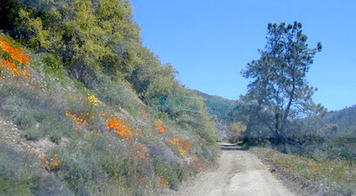

 The ever popular Pacific Crest Trail passes by this small NFS campground listed below. Backpackers, horse packers, dirt bikes and truck campers can all access this dirt road, but be warned it is WAY OUT THERE.


 On the north side of the lake is Grass Valley Bald Mountain (5906′ elev) in between Black Rock Creek and the northern shore.


 The best free camping in California for RVs & motorhomes is NOT the WalMart parking lot in some random town, but the gems that you find here on Total Escape.


 When & Where – Campfires in California


