Category Archives: Back Roads

California 4×4 Clubs

4x4 clubs CA

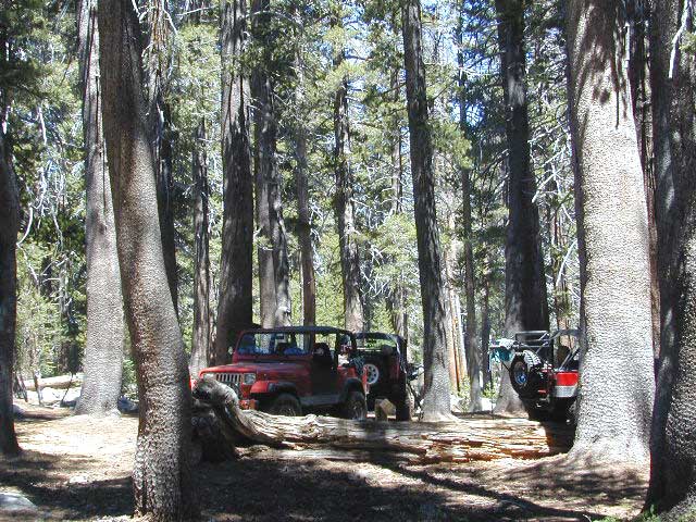
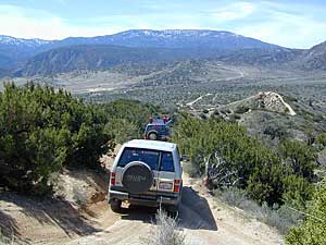
Heighten your sense of 4×4 adventure the safest way, with an experienced group. 4-wheel drive club or group. There are plenty off roading pals who enjoy the same kind of weirdness you do. Rocks & dirt! The more of it, the better. The longer & tougher the route, the more scenic views, the more enjoyment you seek. Typically there is a 4×4 event or trail run once per month & sometimes real meetings close to home. Total Escape has been listing these groups for years. If you need to add a new one, or make updates, do so here.

California 4wheel drive Clubs 4×4 –

Cal 4 wheel drive has been keeping these groups organized & on track for years.

4×4 Nut?

If you fall into the category, you know it. You eat, sleep and breathe a favorite brand of rig. Find other Toyota Tundra owners, seeking a SoCal Rover club, or a thousand Jeep enthusiast for a party in the desert, every Spring. Broncos, Sukis, Isuzus, Nissan Xterras, Pinzgauers & Unimogs – they all have organized groups, monthly trail runs, volunteer clean-ups and trail days.

find VEHICLE SPECIFIC CLUBS in California

11

DSCN0037

    Gorman dusty dana

    Map Roads

    mini mapsThese are desired roads that you would never find unless you had a good map. Well off the interstate, beyond the stop lights & stores; Well away. The longer route home. The smaller, narrow country roads, the secondary highways, county roads & scenic canyon roads. Bring a picnic!

    Total Escape has the maps
    to get you to the best scenic drives in all of California.

    See individual routes in California under BACK ROADS

    For SUV camping on such back roads, locate the forest first – then look under primitive camping.

    graded ridge

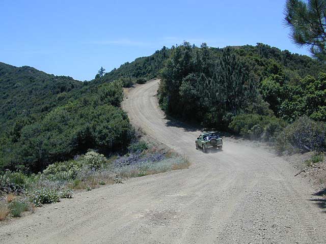
    Graded dirt road on the ridge overlooking the coastal stretches of Big Sur CA

    Los Angeles Back Roads

    Angeles Crest Back Roads – Angeles OHV Routes & Trails

    Mt. Gleason Road / Santa Clara Divide Rd.

    Angeles Crest Hwy.2 , North 9 mi. Left onto Angeles Forest Hwy.N3, drive 12 mi. to intersection of Santa Clara Divide Rd.

    • Turn left on paved road to Mt. Gleason. Many dirt roads will eventually branch off on the right side. A forest service map is advised for dirt road exploration.
    • LOOP -Turn right & go up the mountain past Mt. Pacifico & beyond (eventually hooks back up with Hwy.2 near Chilao area.(Check with ranger if your planning on doing this loop to make sure all gates are open)

    Angeles Forest provides over 300 miles of designated OHV roads/routes. When off-roading, all vehicles must meet DMV standards for mufflers & registration. Off-highway smaller vehicles must be equipped with approved spark arresters & have valid green stickers. State law requires that ALL ATV riders wear a helmet.

    • Rowher Flats OHV Area – Santa Clara/Mojave Ranger Dist
    • Littlerock OHV Area – Santa Clara/Mojave Ranger Dist
    • San Gabriel OHV Area – San Gabriel Ranger District

    California Trail Ettiquette –

    CLOSURES: Occasionally areas may be closed due to emergency situations, for resource protection, or during specific seasons when disturbances may drive animals from important habitat. These closures are usually temporary, and your patience and cooperation is appreciated.

    RESPECT THE LAND DUDE

    • Stream banks & lake shores are especially sensitive areas; VERY susceptible to damage. These waterway & creeks in California, are sources of food and shelter to wildlife.
    • Cross streams at a 90° angle at a slow speed and – DickHead, do not travel up & down stream channels. These are precious areas.

    LEAVE A GOOD IMPRESSION: Around developed sites, give other folks the space and quiet you would appreciate. Space out the RVs if possible. It’s not an RV park kinda deal. By law OHV traffic are permitted to exit & enter campgrounds, but not to PLAY within a campground. No one likes dusty salsa. If your muffler is not quiet (you’re an ass!), push your machine in the campground, with the engine shut off.

    STAY ON THE TRAIL: Cutting switchbacks, taking shortcuts or hillside climbing may be a big thrill & challenge, but once vehicle scars the earth, other vehicles follow. The mob mentality maybe, Macho shit. The deep muddy ruts do long-lasting damage to vegetation, plus it doe not help w/ erosion. Rains cause further damage by washing deep gullies in tire ruts. Vegetation & wildlife habitat is lost. Ugly, permanent, unsightly scars on the earth result. Staying on trails helps protect the land. And helps keep trails open!!

    Become a Adopt-a-Trail Volunteer – contact your local NFS
    Outdoor Volunteering in California!

    Angeles Forest – LA Back Roads

    nearby towns –

    Angeles Maps – hiking, OHV & mountain biking –

    Split Mountain Anza Borrego

    Anza Borrego Desert State Park

    Fish Creek Campground

    E of Borrego Springs CA.

    Well off Highway 78, past the busy OHV area, quads at Ocotillo Wells, past all the rural homes & the redneck bar, past the Elephant Trees hike – where the road goes from pavement to graded dirt to a wild desert wash, in a few short miles. If you don’t know where you are, then you’re almost there.

    This is a large wild desert wash with huge unstable walls, several areas for wind caves and a few historic markers. Lots of 4×4 trails beyonf Split Mountain, to the south. No real water in sight, except maybe the puddle you are standing in as it starts to poor. The soft sand can give way to a few heavy rain drops. May not be a great area to be during a serious storm or flash flood possibility, unless you want to get buried alive. Check the weather forecast in advance.

    A ratty, small developed campground of Fish Creek is on the left side, upon the ledge. Fish Creek Campground is picnic tables & a pit toilet – at most. Ya may as well camp out in the open, off road, like the pioneers did. You can do that out here in Anza Borrego. (Just keep it clean & carry a metal fire container.)

    split mountain

    Split Mountain, Anza Borrego Desert State Park

    This portion of the “mountain” is less than a mile from Fish Creek Campground. Fossils can be found in these walls. Shade is good in summer months, when day temps reach 100+. The rest of the year is ideal weather. This mountain split from water, erosion, mega force. High walls, wind caves, desert washes, great primitive camping & 4×4 routes.

    This desert scenic drive will require you to get that SUV dusty. 4 wheel drive not required. No RVs past the campground. All low lying passenger cars are warned, there are uneven areas, soft sand & boulders.

    Duh, do not attempt this one when desert flash floods are possible.

    ANZA BORREGO STATE PARK

    ANZA BORREGO MAP

    SAN DIEGO BACKCOUNTRY MAP

    nearby towns –

  • BORREGO SPRINGS CA
  • OCOTILLO WELLS CA
  • SALTON SEA CA

    splitmountain

    Great desert back road exploring out here. A zillions washes & canyons.

  • Mount Charleston Vegas

    Mt Charleston Las Vegas NV

    Mount Charleston Las Vegas NV

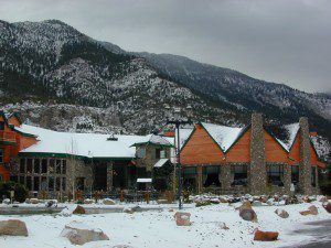
    Mount Charleston Resort
    Mount Charleston Resort

    Mt Charleston cabin rentals, vacation homes and 2 mountain lodges are located near the Spring Mountain Recreation Area, just outside of the Sin City limits. The tall alpine mountains behind RedRock SP, NW of Las Vegas, Nevada are virtually unknown by many non-locals. Great hiking, mountain biking, camping and waterfalls, plus a small seasonal ski and snowboard resort are some of the highlights. Imagine snowboarding Vegas!

    Mt Charleston Hikes
    Red Rock Canyon Map

    Las Vegas Forest Hikes

    Vegas means “the meadows”, but it sure seems more like desert these days. The forest is just up the hill, past the red rock and tract homes, well past the Joshua Trees. Conifer forests, snow and high elevation, less than an hours drive from the Vegas strip. Toiyabe – Humboldt NF is this public land managed by the US National Forest system. Toiyabe also covers Eastern Sierra slopes. Get California Toiyabe NF maps. Get the Nevada State Park map here!

    Camping Vegas

    Due to extreme dry conditions and wildfire danger no open camp fires are allowed from mid-April to mid-November in the Mount Charleston region. Several developed campgrounds, plus a primitive (dirt road) camp area off Lee Canyon. Cabin rentals are located at the Charleston Lodge.

    • Vegas trails
    • Hiking in Vegas
    • Mount Charleston skiing
    • Mt Charleston hikes

    9N09 – Los Padres NF

    Quatal Canyon

    Quattale

    Quatal Cyn: Forest Road #9N09 – Los Padres National Forest

    Toad Spring Campground is located at high elevations (5700′) of Quatal Canyon, on a dirt road, half mile off the pavement of Cerro Noroeste Rd. The Chumash Wilderness, the Cuyama River Valley, Apache Saddle, Mount Abel plus the Bittercreek National Wildlife Refuge all surround this region. Los Padres National Forest meets the vineyards, orchards & farmlands, near Ventucopa. This is the badlands – 18 mile scenic dirt road, well signed at Hwy 33 & mostly graded. Quatal Cyn connects Ojai’s Highway 33 to the pinyon pine forest above near Pine Mountain Club (@ nearly a straight line?) Motorcycle dirt bikes & off-roaders dig this place. Street bikes will prefer paved Cerro Noroeste which runs the rim above to the north.

    This major dirt road is not gated at either end, but winter sometimes closes the route due to snow depth. It never stays closed very long, as some beefy 4×4 will break thru the snow berm soon enough. Top elevation @ Cerro Noreste is approximately 5500′.

    Quatal Canyon (possible Chumash word for Snake) is a giant high desert wash, ripping down from Cerro Noroeste (aka Mt Abel). Serious erosion w/ San Andreas fault lines – make it a very interesting canyon to explore on foot, horseback, motorbike, or mountain bike. The lupine & wildflowers here are incredible in late Spring in this red dirt canyon. Both nearby mountain peaks of Mount Abel & Mount Pinos are the tallest in Kern County.

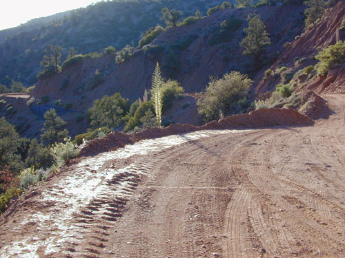
    This rugged primitive canyon gets torn up during a good storm in late summer or a big winter storm. Red dirt gets very slippery – especially on the edges of a cliff. Boulders in the road, flash floods – or no road, river of mud! 2WD passenger cars can take this route in dry months, but high clearance is usually preferred. 4×4 is needed during heavy rain or snow – which could be half the year (Nov-April). Flash flooding is possible all over Los Padres NF, so know the weather forecast in advance.

    Seen small RVs, trucks pulling trailers & even a U-haul moving truck down this way. MapQuest always amazes me where they route you. This is a graded dirt road, some of the time. MapQuest should post a ‘see Total Escape for this route’. Come on folks, if you’re traveling cross-country, while moving your residence, buy a real map to explore the National Forests of California. You may end up sleeping way out here – broken down in the moving van, in the boonies & no cell coverage, cuz you had a one page, wrinkled map in faded ink, wet & smeared. And MapQuest told you it was paved. It’s not paved 90% of the way.

    Primitive camping is also allowed in the canyon wash or on the side routes, in certain seasons. Use an existing camp site when possible. Clean out the rock fire ring of litter & bottles, pull back all dry brush at camps & leave these places better than you found ’em. There are hundreds of dispersed campsites out here. The open wash is especially nice on a full moon hike, just bring friends – cuz it is considered “big cat country”. Camp fire restrictions are in tight control on this SoCal region. You will need a camp fire permit, a big shovel & lotsa water. Check with the Los Padres rangers to make sure. Recently Zaca Fire (2007) & the month long Day Fire (2006) both came very close to this precious sanctuary.

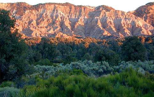
    The high desert terrain is pinyon forest, with yucca & manzanita. The eroded cliffs of red rock, white & orange hues, glow best during the clearest sunsets. You will almost think your in Utah, until you get up on a ridge & see the smog in the Central Valley of California.

    Mahu Tasen, a Native American camp and sweat lodge, has ceremonial grounds in a canyon off of Quatal. There is also a large rock quarry mining operation, as well as numerous wineries and ranches along this route. Several private residences too.

    Ballinger Canyon OHV Park is close by, 5 miles N on Hwy 33

    Carrizo Plain National Monument is also pretty close, N off Hwy 166

    towns nearby –

    PINE MOUNTAIN CA

    MARICOPA CA

    VENTUCOPA CA

    helpful maps of the region –
    Quatal Chumash Lands

    Mount Able

    Camp-O-Alto

    MOUNT ABEL, California

    So many misspell Abel like Able, its a wonder anyone can find this place.

    But what a nice find it is! Camp O Alto Campground, among the giant trees. RV friendly

    Cerro Noroeste / Mt Abel / Noroeste Peak
    Los Padres mountains, camping on the back roads, mountain biking, hiking, exploring. This gorgeous 8286′ mountain peak sits just to the west of Mount Pinos @ 8831′ (the tallest peak in Kern County). Home of the Jesus Tree, the best sunset spot for miles and the infamous motorcycle road out west, this mountain is one of the lesser known in Southern California. Oddly shaped, Jefferey and Ponderosa pines towering above have their tops stunted and enormous branches hanging down. Maybe from lightning strikes, or maybe from a historic Tejon earthquake that snapped them?

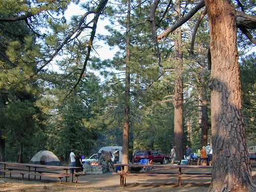
    Camp-O-Alto is the official name of this primitive open, FREE campground. First come basis. This place is a perfect option B, instead of the busier Mt Pinos Recreation Area that is located to the east. RV campers love this camp, as there is plenty of room to spread out in between the sites. There is also a large group site at the west end of the campground – available to whomever can grab it first, but you must have a large group to utilize this spot.

    Just south of Apache Saddle, there is a faded, large sign that reads Westside Park, but this is the only reference we can find and no one locally calls this mountain by this name. The Cerro Noreste Road gate (near Camp Condor), closes seasonally for winter snow and rock slides.

    Once you are past this gate & start climbing from the saddle, there is a great viewpoint a few miles up on the right side, overlooking red dirt beauty of Quatal Canyon. You can see the mountains out near the coast, as well as the high desert, natural wash on the left side and the faint graded dirt road paralleling it to the right side, all mixed up amongst the pinyons & junipers. The Chumash Wilderness is on the left side.

    DIRECTIONS TO MOUNT ABEL:

    To get here from Interstate 5, exit Frazier & head west, thru Frazier Park, thru Cuddy Valley, turn right on Mil Potrero Hwy (forest road #9N05) & past the golfing community of Pine Mountain Club; continue west to Apache Saddle. At this intersection, turn left on to Cerro Noroeste (#9N25) & drive 10 miles to the top of the mountain.

    To get here from Hwy 166, take the Cerro Noroeste Road turn off just east of Hwy 33. Continue 20-something miles up to Apache Saddle ranger station. At this intersection, turn right on to Cerro Noroeste (#9N25) & drive 10 miles to the top of the mountain.

    Los Padres Trail # 21W03 / Chumash Wilderness

    Hiking Trails / Mountain Bike SoCal

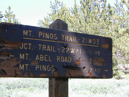
    This area is very popular among mountain bikers and sunset seeking couples. The “Peak to Peak” hike is an all day adventure of 6.5 miles, that should be planned well in advance – with another shuttle car at the Pinos parking lot. This is a moderately, strenuous hike that can take up most of the day – with awesome views over the San Joaquin Valley, Lockwood Valley, Pine Mountain Village and San Emigdio range. The area located in between Pinos & Abel is called the Chumash Wilderness.

    Trail 21W03 Mt Pinos

    Canyon Roads in California

    California Scenic Drives – Canyon Roads CA

    Canyon roads are plentiful in California. From the lush coastal hillsides w/ mansions to the lunar like box canyons & slot canyons of the desert. We dig the back roads as much as you do, so get ready to explore this weekend. (GPS data is later dude!)

    SoCal Backroads

    What is the difference between a canyon & a valley?

    I can recall that canyons are tighter, smaller cracks in the terrain, most likely in lower elevations & rugged hillsides. Steeper walls, lots of rocks, some vegetation. A major desert wash, a creek or seasonal stream usually runs parallel to the paved road.

    Many canyon roads in California have been paved for urban development or for a major through-route access. These provide great quick “day trips” from the city.

    Valleys are larger open areas surrounded by mountains. Since the majority of Southern Cal is desert climate, you won’t be seeing many fern canyons or big open alpine meadows. Manzanita & sage brush meadows are the norm, for elevated valleys & mountains, such as the National Forest.

    Los Angeles County is a popular place to explore canyons for a “mind-unwind drive” or the half day picnic trip, away from work.

    California Scenic Drives listed below….

    PAVED Canyon Roads –

    • Big Tujunga Canyon (LA)
    • Bouquet Canyon, Palmdale
    • Brainard Canyon, Palmdale
    • Carbon Canyon (142) Chino CA
    • Death Valley National Park
    • Highway 33 N of Ojai CA
    • Hwy 39 – San Gabriel Canyon
    • Highway 76 (Ortega)
    • Lockwood Valley Rd, Frazier Park CA
    • Lone Pine Canyon Rd, Wrightwood CA
    • Malibu Canyon Rd, Malibu CA
    • San Antonio Canyon, Mt Baldy CA
    • Santa Anita Canyon (LA)
    • Santiago Canyon (S18), Orange CA
    • Soledad Canyon, Palmdale
    • Topanga Canyon Rd, Malibu CA
    • Wildcat Canyon, El Cajon CA

    UNPAVED Canyon Roads –

    desert canyons

    Goler Wash (aka Goler Canyon) in Panamint Valley. Barker Ranch is up that way.

    Trona Road

    Trona RoadThe North Mojave Desert is a sightseeing wonderland. These odd formations are inside the Trona Pinnacles, off of Hwy East of Ridgecrest CA.
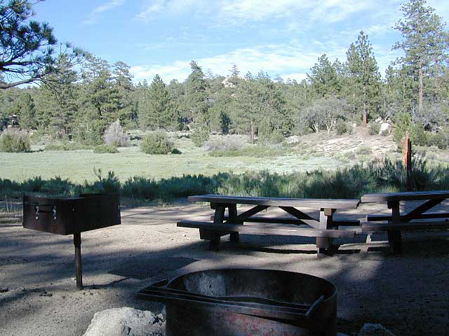
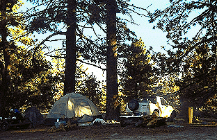
    Trona Road is a red paved route that runs from Red Mountain @ Highway 395 east to the town of Trona, California, then thru Panamint Valley & on to the western borders of Death Valley National Park.

    Spangler Hills OHV Area is a popular off -roaders camp & a huge network of dirt roads can be found to the west of Trona Pinnacles. The access road to the bizarre dry lake is # miles long & graded dirt w/rocks. Passenger cars can handle it, but not recommended in rainy weather.

    Allegator painted rocks, old mining claims, dirt trails everywhere & a chemical plant in Trona. Keep driving north to connect with Death Valley  National Park. Wildrose Canyon, Panamint Valley & Ballarat ghost town are worth it.

    Southern California Backroads

    SoCal Backroads

    If you are seeking dirt roads in California, then congratulations. You have made it to the web site of your dreams, Total Escape. We love the back roads as much as you do, maybe even more. Honest!

    This entire 3000 page web site is a decade long dedication to the rural places in California, the trails, the canyons, the caves, the wildflowers, the scenery & even the old abandon mines. We have OHV maps, forest road maps, most regions, every trail map you might want. DanaMite has been researching these routes & documenting for years. And the GPS data is still to come!

    Since SoCal is majority desert, you won’t be finding many lush fern meadows, dense forests or huge waterfalls. There are a few Southern California National Forest that may have pine & oak trees, a creek half the year & great camping. SoCal has the desert back roads & there are literally thousands of them. Grab a map, get your rig tuned up & start exploring. Right here right now.

    SoCal regions for exploring Back Roads –

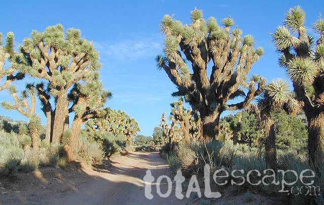
    joshua trees

    This joshua tree drive is located in Round Valley
    On forest road# 2N02 in San Berdu NF; W of Big Bear City.

    Check out CALIFORNIA CANYON ROADS

    6S13 – San Berdu NF

    Thomas MountainThomas Mountain: Forest Road #6S13 – San Bernardino National Forest
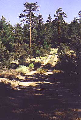
    Camping 6 miles south of Idyllwild CA. Off of Highway 74 (the Palms to Pines Hwy) Thomas Mountain has a dirt road that follows a 5000′ pine ridge line, overlooking the pond of Lake Hemet. This route has several secluded, yellow post camp spots. High clearance or even 4×4 may be needed much of the year, due to rain & snow.

    2 Camp areas –

    • Thomas Mountain
    • Tool Box Springs

    4S01 – San Berdu NF

    Boulder Basin Rd: Forest Road #4S01 – San Bernardino National Forest

    9 miles N of Idyllwild on Hwy.243, right turn onto Forest Service Rd. #4S01. It’s Idyllwild camping on the back roads. Boulder Basin is compact dirt route around 6500′ elevation, perfect for the SUV, truck or Jeep who wants to stay outta the Campgrounds. Fire restrictions are sometimes tough, so check with the rangers on backcountry campfires. Boulder Basin has pinyon pines, boulders, & a few camp sites. Out in the Banning / Idyllwild portion of San Bernardino NF. 909-866-3437

    Good mountain biking, bouldering & back road exploration. Some secluded spots.

    3N14 – San Berdu NF

    Fawnskin CampingFawnskin Camping; Forest Road #3N14 – San Bernardino National Forest
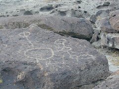
    The best Big Bear camping is the back roads with the Yellow Post Sites. From the center of town in Fawnskin, head up the big hill, the graded wide dirt road, right behind the fire station; Forest Service Rd# 3N14 leads straight up to tall pines, pinyon forest & manzanita. You can find plenty primitive spots to camp in. Look for the yellow post sites.

    Along this route is also 2 popular Big Bear Campgrounds

    • Hanna Flat Campground w/ 88 camp spots
    • Big Pine Flat Campground w/ 17 camp spots

    Another dirt road #3N16 crosses this road & runs the length of the ridge. Great region for SUV forest exploring – for the first timer. Big OHV area, so be prepared for an occasional motorcycle or quad screaming by. You can find the best seclusion, on dead end routes, near old mines.

    This North Big Bear Lake forest area was affected by wild fires in 1999.

    25S15 – Sequoia NF

    Shirley Meadows: Forest Road# 25S15 – Sequoia National Forest

    This route is paved from the small cabin community of Alta Sierra to the Shirley Meaows Ski Resort. Cross country skiing is popular out here. The road turns to dirt & continues on to become Rancheria Road, heading south thru the Greenhorn Mountains, towards the Kern River.

    [ photos to come ]

    Alder Creek & Alder Creek Campground with 13 camp sites @ 3900′, can be accessed via side route# 25S04. The 6000′ mountain range is lined with smaller spur dirt roads, some leading to old lumber mills. Evans Flat Campground @ 6100′ elevation has 20 camp spots, is approx. 5 miles from Shirley Mdws. Road#25S15 is marked as Kern County Rd# 465 as is decends into the agricultural valley east of Bakersfield.

    ALTA SIERRA CA

    WOFFORD HEIGHTS CA

    21S03 – Sequoia NF

    Black Rock: Forest Service Rd# 21S03 – Sequoia National Forest

    N of Troy Meadows; Paved road leads deep into forests & meadows to Black Road Campground, at the very edge of Golden Trout Wilderness. Big equestrian area with pack stations & corral areas. Plenty smaller dirt roads on both sides of main paved road.

    Osa Meadows, Lion Meadows, Little Horse Meadows & Beach Meadows are all quiet areas to the west side. OHV area to the south of this near Black Rock Ranger Station.

    Monache Meadows is NE of this area.

    21S36 – Sequoia NF

    Powell Meadow: Forest Service Road# 21S36 – Sequoia National Forest

    This paved route peels off of Road# 21S03, N of Troy Meadow. Smith Meadows is on the east side of the road & Powell Meadow is just N of that. The road becomes dirt within a few miles near 9000′ Granite Knob.

    There is plenty primitive camping back in these woods, so come prepared to rough it. Creekside camp sites are common. This is a great meadow area for equestrian campers with horses.

    The trailhead for Monache Meadows takes off to the north &  is signed “Jeep Road”; High clearance vehicle is required, but 4 wheel drive may be needed on one steep section past Bull Meadow. Read more on Monache Meadow.

    https://totalescape.com/active/campstuff/CAMPGR/INYONF/monache.html

    19S09 – Sequoia NF

    Dillonwood Grove: Forest Service Road# 19S09 – Tule River, Sequoia National Forest

    Jack Flat primitive camp area; Pine Creek, Jenny Creek  & Backbone Creek; Dirt road access to creekside camps, via Balch Park Dr, off of Rd# 276, after passing County Rd# J37. Next to Blue Ridge & Mountain Home State Forest. NFS or topo map is highly recommended. High clearance vehicles.

    Dillionwood Sequoia Grove is located at the end of this route, on private land, but can accessed by hiking trail. NO camping on private land.

    https://totalescape.com/active/campstuff/NF/seqnf.html
    https://totalescape.com/active/campstuff/SF/mtnhome.html

    Fish Slough

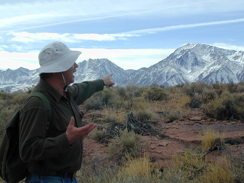
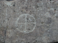
    On the north end of Bishop CA, running parallel to & on the west side of Hwy 6, is a long dirt road called Fish Slough Rd. Indian petroglyphs can be found out here & also on the ridges along Chalk Bluff Rd (to the south). The entire region is called a volcanic tableland & hot springs are very common in this region. The Owens River Gorge & Lake Crowley are to the west. High clearance vehicles are recommended for traveling these back roads, but 4×4 is rarely needed.

    Read & see more on Fish Slough Petroglyphs

    BISHOP CA

    LAKE CROWLEY

    BENTON HOT SPRINGS

    Visit Hwy 395 Hot Springs

    Indian Art Eastern Sierra

    Fish Slough

    Dave Explains