Category Archives: Camping

California Camping Advice

Find a Creek

Finding a Creek in California

Creek Bound Campers

California Stream Fishing
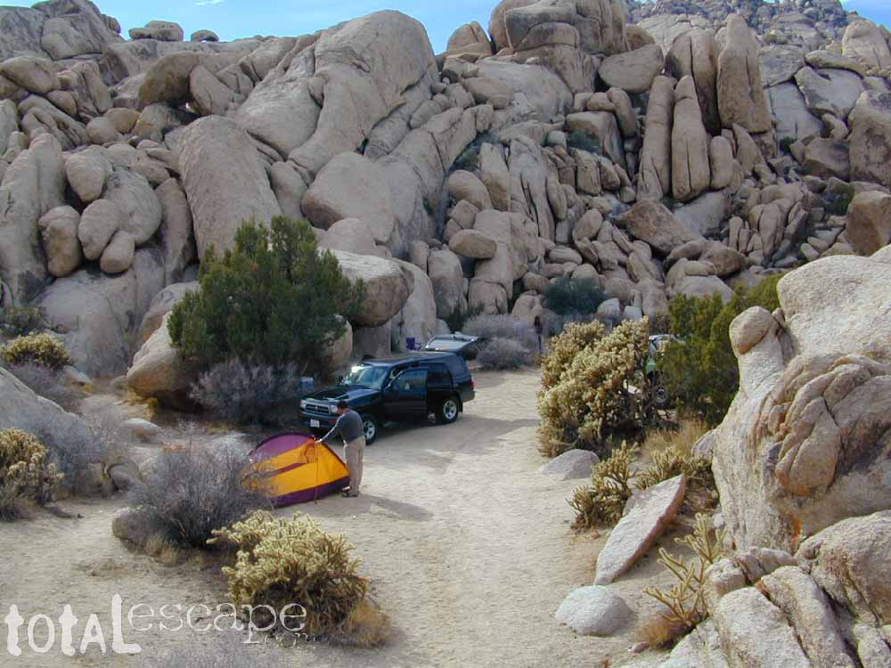
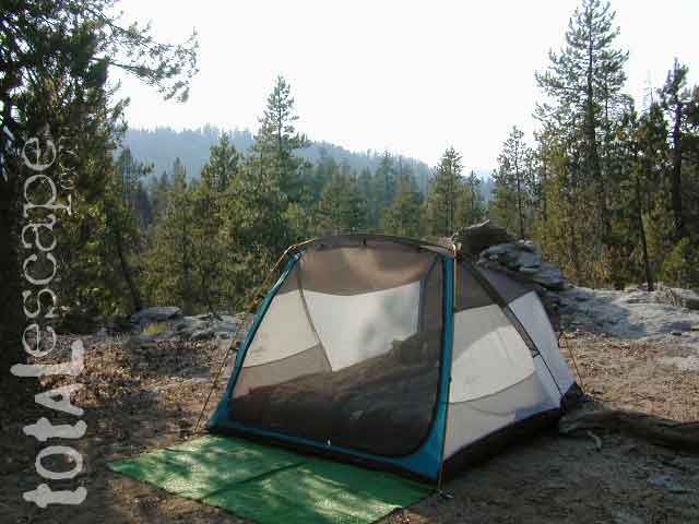
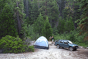
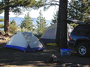
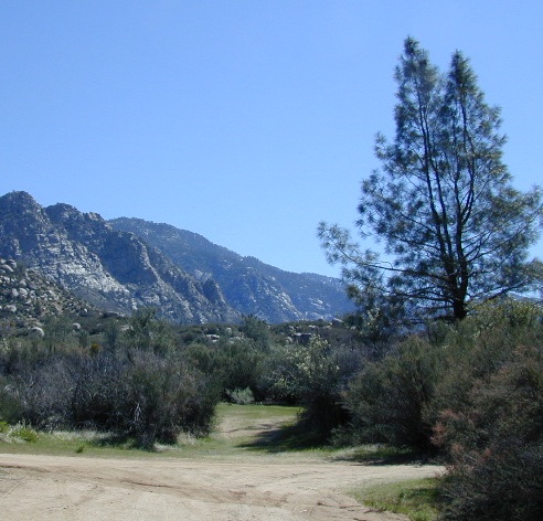
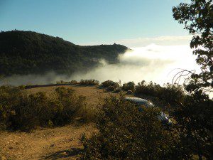
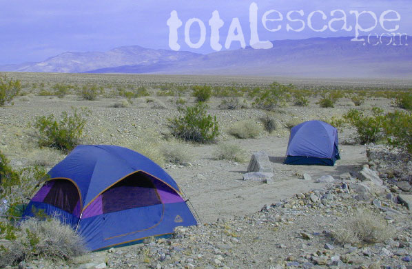
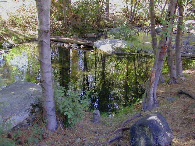
California Creek Camping

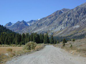
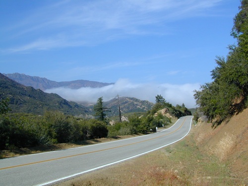
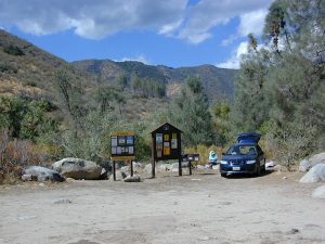
Since SoCal is more of a desert terrain, big water in California can be found elsewhere throughout the state. Natural waterways flow primarily from NorCal and from the backbone of the west coast, the Sierra Nevada mountain range. Determining the region to explore is a first step, then narrowing it down to several possible camp spots after you’ve found a good printed map (a hard copy, non digital, non electricity, the old fashioned kind).

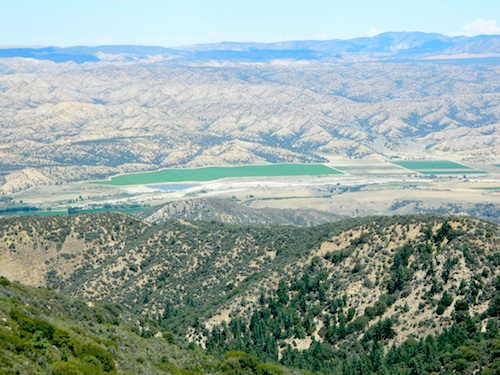
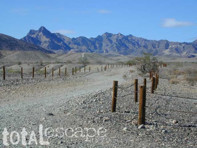
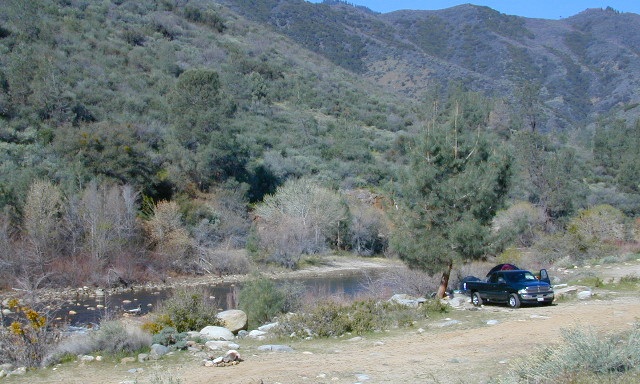
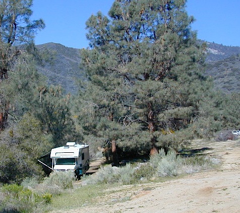
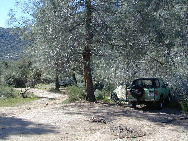
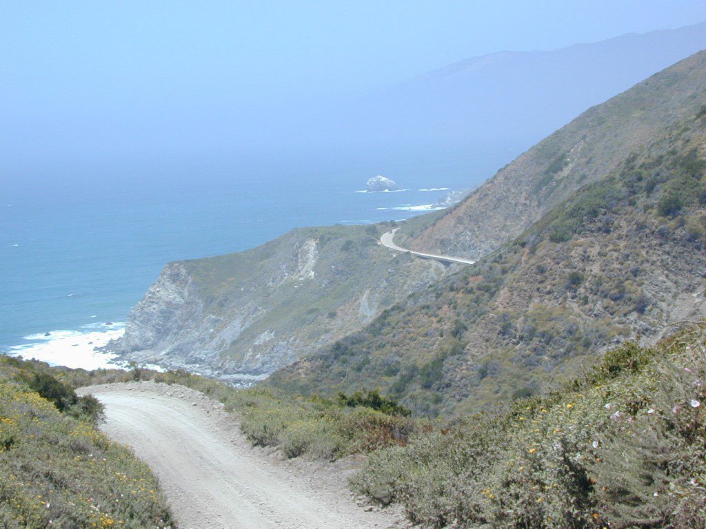
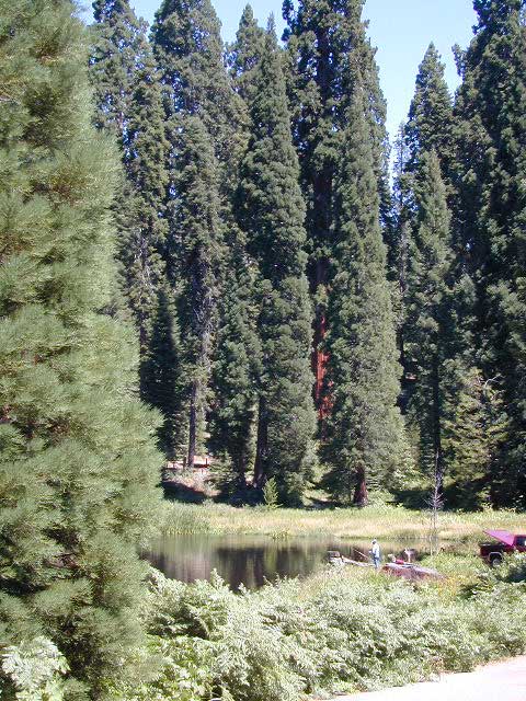
California Rivers are popular destinations for the outdoor vacationer. The most desirable streams or creeks in California flow into a reservoir, not out of. The wilder scenery above the lake, deeper up the canyons are the secluded places we seek. Some accessed only by dirt back roads. 4×4 camps are commonly positioned near creeks.  Wilderness trail heads can lead to even more privacy if you are willing to huff it.
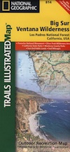
SELECTING A MAP

Full color, waterproof maps show every creek, stream, river, paved road, dirt road

Topographic maps show more detail on terrain, elevation, trails, roads; Less colorful.

READING THE MAP

look for the tiny blue lines, the bolder the better

– is your choice a main blue line?
– does this one creek feed into another larger stream?
– is it a creek that will be flowing strong?
– how far from a paved road is it?

How to find a streamside camp

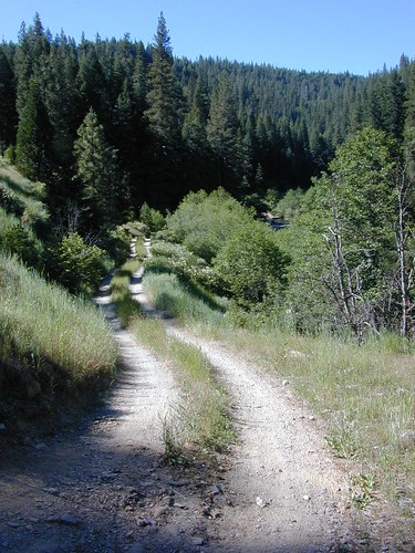
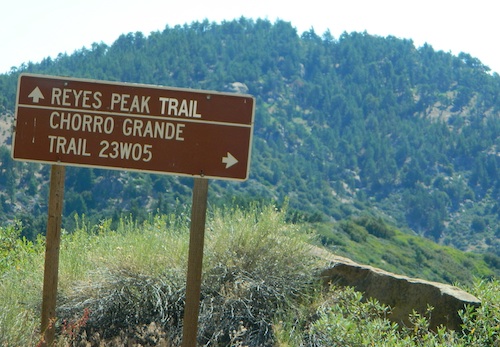
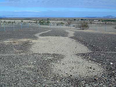
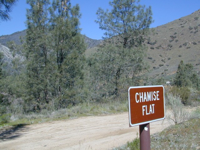
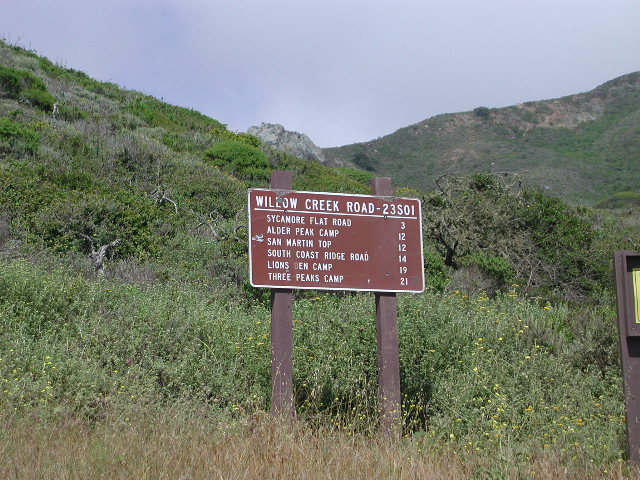
Forest Service Back Roads are usually one lane dirt roads and have strange long numbers attached to them. Maybe signed, but don’t count on it. In the illustration: Look Road #22S59 is right along a creek, and maybe 22S08 has some water sources, but has a developed campground w/ possible fee. 22S59 is very likely to have some dispersed sites along it. You always have options open when you have a good map; make your back up choices when planning your destination. Have a few plan B roads chosen, just in case your first choice is too steep of a slope, or packed with RV families, or totally muddy and impassable with your vehicle.


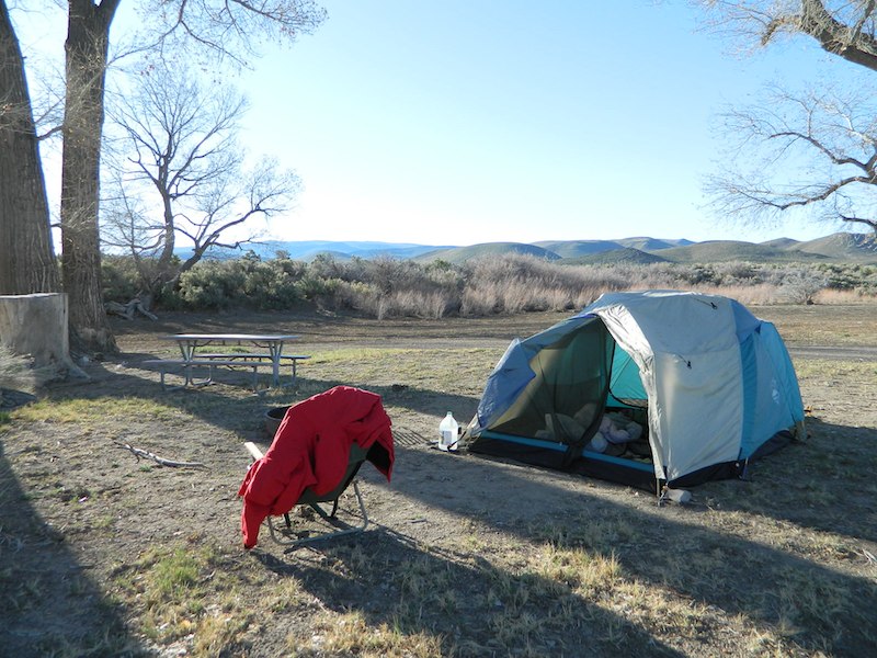
Creekside Camping in California

MIneral KIng Walkin Camps

4WD needed?

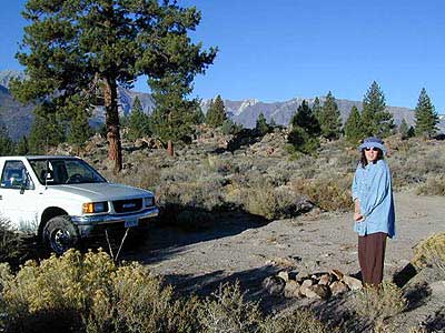
Spring snow melt is when the dirt roads are still closed (gated) and often quiet muddy. Some primitive camp sites may be best access with a 4-wheel drive, but each river or creek side camp spot is unique at different times of the year, due to the snow depth and land erosion process. For easy-going exploring purposes, small all-wheel-drive vehicles work well too, but clearance can be a limiting factor. You wouldn’t believe what passenger cars we see on the back roads of Baja. Almost anything goes anywhere, slowly, as long as it runs and rolls.

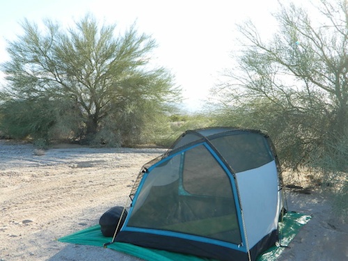
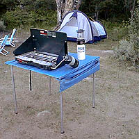
last tip – mosquito, where?

Screen room tents may appear unsightly, but those hungry, annoying mosquitoes don’t really care what flavor you are. Them lil suckers are abundant in areas with water, standing or still water, meadows, creek beds, especially active in the warmer summer months. Beat ’em before they hatch – camp in the springtime. By autumn their numbers seem to dwindle with the night time chilly temps, but make sure to come prepared for those colder nights.

Perfect Tent Spot

Boulder Cove Camping

Choosing your Perfect Tent Spot

Before you can choose the ultimate place for your tent, you must decide where it is you wanna sleep OUTDOORS. What ultimate location? Your destination can play a huge factor in you getting a peaceful nights rest. And do you really need a campground? Or, are you ready to try to rough it, without the amenities? Best camping is off-the-beaten-path, and usually on the back roads. Trailhead camps, 4×4 camps, best view camps, creek camps; Dispersed camping, often called primitive camping. Focusing here on car camping, tent camping and backpacking routes.

Sierra Granite ViewsJust choosing a flat tent spot isn’t good enough anymore. You crave the best camping experience and seek real nature, with minimal crowds. No annoying neighbors, no parking hassles, no traffic or cars passing by. We at Total Escape are here to help you get to your wilderness goals and experience nature like never before. Right here, right now and it doesn’t hafta cost you a dime.

California Camping Destination:

Let’s start with a terrain overview. California has it all ­ – mountains, deserts, coastal, rolling oaks with rivers in the countryside, plus the infamous wine country and developed campgrounds within city limits. Desert camping in summer months should only be attempted by the experienced camper who loves 90+ temperatures. Mountain camping in winter can be freezing, so make sure you have the proper gear. Good maps are a must have and the readily available National Forest maps are your best avenue for getting and staying away from the masses. Visit our Destinations page to decide what kinda place you wanna ‘call home for the weekend’.

topo mapsIf you are the “I don’t care where I sleep kinda guy, as long as I can do/see this many things” all crammed into a 3-day holiday weekend, then you best do your research ahead of time. Get a good map, measure the mileage, plan picnic stops and sightseeing. Plan to set camp in a central location close to the main highway to call home-base, so you can be off exploring as much as possible.

Schedule in some “down time” or a full day for relaxing. Calculate driving distances and pad it w/ an extra hour. Maybe make a campground reservation if you are visiting a National Park or busy State Park. If you plan to wing it without reservation, always have plan B or plan C  options already picked out. With millions of residents and tourists on the west coast, chances are you won’t be the only person wanting to do Big Sur, Yosemite or Point Reyes that particular weekend.

camp

Helpful Hints
for a Good Nights Sleep @ the Camp Site

  • Bring a decent Sleeping Pad. Air Mattress with the inflator pumps will be the most luxury, without sleeping directly on the hard ground. Therm A Rest sleeping pads are another fine option, for those who like to travel light and still have air underneath them. Extra blankets, always.
  • Flat & Soft ground is the goal in choosing the best tent spot. Park your vehicles over the rocky slanted ground and keep the best flat areas for your camp site.
  • Do not pitch a tent in a meadow, no matter how inviting it looks. Wetlands and meadows are fragile ecosystems, an area that should be protected.
  • Look at the big trees above your sleeping spot and examine them. Do not place your tent near or underneath a dead tree or a dead limb. Trees do break and fall, especially if winds pick up. This could be a life or death choice, so remember to look up.
  • Bring abundant good tent stakes and USE them. Yellow plastic stakes are for soft cedar and sand. Thin aluminum stakes are for backpackers. Large steel nail stakes (some w/ plastic tips) are best stakes for all-around terrain.
  • Bring a mallet to pound stakes or use big rocks to hammer them. Gloves are also a good idea!
  • Never underestimate the use of a big tarp and some rope.
  • Guy lines help hold a tent in place when windy weather turns to big storm. If wind is in the forecast, then do this task before you head out on your day hike away from camp.
  • Make sure selected tent site is flat. Lay on the ground to check it out.
  • Place head of bedding up hill (if any slant can be noticed)
  • Tents should be at least 10 feet away from your campfire. At least 100 feet away from a creek or lakeshore.
  • Beach camping at the ocean edge; Know the high tide mark; place tent accordingly.
  • Slot canyons are awesome, sandy, narrow washes, many with cliffs and caves. In the desert badlands these can become raging rivers w/ flash floods. When rain is heavy in the mountains many miles away, you could get flooded in the low lands. If you hear any thunder – RUN to high ground. Better off picking another camp site, than to die by a wall of water!
  • Shade in the Desert sounds like an oxymoron, unless you find a place with high cliffs, or slot canyons. Tamarisk trees and palm canyon locations are usually an oasis of RV tourists & travelers. Hot Springs are also busy spots. Pinyon pines, juniper and over-sized manzanita can be found in higher elevation deserts above 1000′. The prime desert camping season is generally October thru March, as April can easily soar close to 90 degrees high.
camp

Campgrounds listed individually on
California town pages A to Z

campfires

morning sunshine

Late Nighters & Sunrise:
Determining East & the North Star

reading the stars

Sequoia NF - The Den

Campground vs. Dispersed Camping:

Follow Dirt Roads
Some people swear by the open spaces and back road camping options, as they have more seclusion, plenty privacy and best off all, no campground fees. You might need a GPS and a high clearance SUV to reach some of these camp spots, but you will be blessed with a unique secret spot to call your own.

Campgrounds come in all styles these days: From small primitive camps on a creek to the luxurious RV resorts with laundry room and showers. And then there is everything in between. This web site Total Escape specializes in FREE camping on the back roads and the smallest of campgrounds.

Reservations are usually accepted at the most popular camp locations, many are wide open on weekdays and the majority of campsites overall are available on a first come, first serve basis.

Camp Clean

Minimal Impact Camping

Camping Tread Lightly

Leave No Trace Camping

Camp Cleaning

  • No Soap in Streams, Creeks or Lakes: Even Biodegradable Soap is not good for the poor fish downstream.
  • Bring a bucket or wash tub – Wash dishes, clothes & yourself 100′ from streams & lakes
  • Food put away & dishes washed up before bed time. Keeping a clean camp will lessen the chances of wildlife or a bear visit
  • Use existing campsite or rock campfire ring to prevent impacting new areas
  • Pitch tent in cleared camp spots only (when primitive camping). No need to trample new spots.
  • Do not set a tent up in a meadow, next to a creek or on a lake shore. It’s too fragile an environment.
  • Bring extra trash bags (heavy duty lawn type is best) for cleaning any litter you might find at your selected camp site.
  • Sometimes you’ll need to shovel out the whole fire pit (full of glass and trash)  to start a fresh new campfire. Building your fire on top of somebody else’s mess means you’ll be inhaling all their left-over garbage.
Always leave a clean camp
always leave a clean camp

leave no trace

Camp Kitchen Outdoors

Try to keep all food, drinks and cooking to one area of the camp. If you plan to cook over the campfire, this choice will make much more sense. Setting up kitchen area in between the tent and the campfire is usually an excellent spot. Having the vehicle close by for proper food storage is also advised, or use bear boxes if available. If you choose to hang your food in the tree, bring adequate ropes and bags.

The last person still up around the campfire at night should double check the cleanlness camp before retiring for bed. Chances are there is a half-eaten snack or left over beverage that could attract the animals. Oh no, the GARBAGE!! Don’t forgot to put your garbage bag away at night, or dispose of it in a proper trash container. Double bag your garbage if you are concerned with it leaking or smelling up the vehicle.

Food Preparation

Potty Breaks in the Outdoors

shovel

  • Bathroom break in the bushes? Don’t leave your toilet paper trash. Dispose of in your vehicle with a plastic bag or back at camp.
  • For human waste – Bring a shovel, dig holes 8″ deep & pack out all toilet paper. Do not bury paper as animals will just dig it up.
  • Certain areas are so sensitive or overused that all solid waste must be packed out, check for the local regulations.

Camp Hygiene in the Outdoors

Mono Lake California

The Great Basin meets California, at the Eastern Sierra Nevada Mountains

Navy Beach, Mono Lake

Mono Lake


elevation: 6383′
Eastern California
US Hwy 395 @ CA SR 120

East of Yosemite NP
Lee Vining, CA

Mono Lake

Rumor has it this lake basin could be the ancient super volcano of the region. MonoLake is located on the north end of the Long Valley Caldera, a volcanic ridge which stretches down to Bishop and parallels Mammoth Mountain & US 395.

Huge shallow lake with a very turbulent history. Signs and plaques throughout the lake shore give info on ancient history of the lake, the wildlife, and regional detail. Majestic views of the Sierra Mountains, with sparse vegetation, lunar type landscape. Eerie with storm clouds; Beware of bad weather. Kayakers love this lake too!

Sierra Nevada backdrop

Canoeing
Hiking
Hot Springs
Kayaking
Picnic
Primitive Hot Springs
Stargazing
Volcanic Landscape

Mono Lake Camping

Camping is closeby, but not located on the fragile lakeshore.
open camping
Dispersed camping (FREE) is allowed in Mono Basin National Forest Scenic Area, the region that surrounds the Tufa State Natural Reserve. Campfire permits are required. Contact the park listed below for all the details on the camping policy.

campgrounds
Camps include National Forest Campgrounds in Lee Vining Canyon (8 miles), June Lake Loop (15 mi), Lundy Lake (12 mi). Private RV parks can be found in nearby Lee Vining and further south, at Lake Crowley.

[PDF download]
Camping In The Mono Basin
by LeeVining.com

Inyo National Forest USDA
Camping Mono Lake Ranger District

local links:

Mono Lake Tufa State Natural Reserve
California State Park
760-647-6331

Mono County Tourism
MonoCounty.org

760-924-3699

Mono Lake Committee
MonoLake.org

Bookstore @ 3rd, Lee Vining
760-647-6595

Tufa Towers

nearby interests:

Yosemite National Park
Inyo National Forest
Toiyabe National Forest
Benton Hot Springs
Bodie Ghost Town
Convict Lake
Mono Craters – Panum Crater & Crater Mountain
Long Valley Caldera
Lundy Lake
California Aspen Groves
Autumn Colors Camping

Long Valley Craters Mono Lake
Long Valley Caldera Craters near Mono Lake

regional maps:

Tom Harrison Mono Lake Map

NatGeo Mammoth Lakes & Mono Map

Inyo National Forest USDA Map

Ansel Adams Wilderness Maps

nearby towns w/ lodging:

Benton Hot Springs
Bridgeport, CA
Lee Vining, CA
June Lake, CA
Mammoth Lakes, CA


View Larger Map

Reyes Peak

CA 33 N
Ojai Camping
North of Ojai, CA

Camp out among tall pines, well above the coastal fog.
Los Padres National Forest Road #6N06

Ojai, CA – NORTH on HWY 33
a very scenic drive, in North Los Angeles County

Coastal Foothills

Near the Pine Mountain Summit (elev 5080′) on California Highway 33, the small sign only reads PINE MTN and points east, to a rugged side road. By far one of the worst paved roads around.

This Reyes Pine Mountain, should not to be mistaken for the golf course community of Pine Mountain Club, many miles north of here, around the other side of Mount Abel.

This is Reyes Peak, also known as Pine Mountain Ridge “north of Ojai”, on the sorta paved Pine Mountain Road. (Los Padres National Forest Rd # 6N06)

overozena
The view above is from one huge dirt pull out, on the left – over looking Ozena Valley, on the west end of Lockwood Valley Rd. Motorhomes, trailers, off-roaders and hunters like this as a last minute camp site, very close to the highway.

If your vehicle can endure 9 long miles of poor pavement, pot-holed roads, then maybe you can find seclusion back in the woods around here.

Six or more primitive campsites, spread out along a forested ridge line (around 5000′ elevation). Tables and fire rings only. No fees, no toilets. Bring a shovel and plenty water. No pipes, no running water up here.

The scattered camp sites are located far enough away from each other, that the location provides some privacy and still relatively close to town. Some sites are in forested settings, while others have big boulders, but are exposed to wind and sun. Although these few sky view camps are perfect for the stargazers.

Dark night skies can be okay, if the coastal fog stays low. Neighboring Mount Pinos is all paved – usually best choice for RV campers w/ telescopes, who need large areas of flat level ground.

reyespeakcamp

One particular camp site is located at a very decent view spot. Boulders, pine trees and mountain views to the south. Click the image above to expand.

PRIMITIVE CAMPGROUNDS
Campfire permits are required.

Launch Spot

The end of the road is a top destination LAUNCH spot for hang gliders & para-sailers. Watch them jump on YouTube compliments of DanaMite.

Youtube


The hiking Trailhead for Reyes Peak and the Chorro Grande Trail #23W05 are also at the end of this dead end road #6N06. Reyes Peak Trail leads east, out to 7510′ elevation, overlooking the whole lower Los Padres region – Lockwood Valley, Ozena, Piedra Blanca, Sespe Gorge, Potrero Seco.

reyespeaktrail

Get outside this weekend. There are no more excuses!

MAPS: Los Padres National Forest Maps

NEAREST TOWNS:

Bureau of Land Management

free desert washes

California BLM

desert figure blythe
Giant figures INTAGLIOS, on desert floor, near Blythe, CA

Camping while traveling. The east-west corridors across the California deserts are well traveled routes. If you plan to camp, get to know areas managed by the California Bureau of Land Management.

All BLM Offices in California BLM CA

  • 4×4
  • Back Roads
  • Car Camping
  • Canyons
  • Deserts
  • Dirt Bike Trails
  • Dunes
  • Hiking
  • Historic Sites
  • Hot Springs
  • Intagios
  • Mountain Bike
  • Off Road
  • Palm Canyons
  • Petroglyhs
  • River Camps
  • RV Camping
  • Slot Canyons
  • Tent Camping
  • Wildflowers

ocotilloBLM

BLM lands in California are often known as the ‘free camping’ option. freeway close campingNo charge camp sites, convenient, in-route locations, many areas along major highways or interstates. Campfire permits are always required for any open fires, BBQs and campfires.

BLM Field Offices in California located in neighboring towns can provide maps, information and campfire permits. 

giantcholla

DESERT WILDFLOWERS can be found annually, February – April in most of these areas. Springtime blooms draw the crowds, but few visitors actually camp out overnight.

When searching out premium camp sites – drive slower than 50 mph & look for the brown recreation signs. Since people like to drive fast in the desert, make sure to put your hazard lights or blinkers on, so traffic knows you are slow poking. Typically dirt roads are only marked with small, thin reflectors, maybe numbers or letters, if you’re lucky.

Traffic noise will be minimal if you camp away from the main drag at least ONE mile or more. Motorhomes may not have the luxury to travel that distance; they often prefer to stay in large, level, flat pull outs, right near the pavement.

If daring to venture more than 2 miles from the pavement, be prepared for rough conditions. 4WD drive may be needed in certain spots, or in the wettest of weather. Wind is always a factor in desert regions, so keep that in mind. Deep sandy washes, tow strap anyone? No facilities, no services, no toilet. Spotty cell phone coverage. Basically – the boonies!

BOONDOCKING
is the latest phrase for “open, free camping”

Palo Verde Washes


SEEKING QUIET CANYONS? stay away from the off-roaders. They usually congregate in dunes and specified OHV areas. Trails and dirt roads are for multi-purpose use, so a variety of recreation can be had. Many people use these public lands, so leave them clean and better than you found it. Boulder coves, palm gardens, primitive hot springs. There are plenty of hidden camp spots within the vast desert region of SoCal.

Several BLM lands are near Wilderness Areas. Camping is allowed close by, mountain biking & hiking are usually abundant. Off roading prohibited within Wilderness boundaries.

hikes tent camping 4x4

URLs within the official BLM site keep changing, which is why we are rebuilding our BLM pages. So you can find what you need, easily.

ca.blm.gov
blm.gov/ca

www.blm.gov/ca
https://www.blm.gov/california

road BLM

Kern Flats Camping Free

chamise flat

Dispersed Camping Kern River

boondocking
primitive camping
undeveloped sites

KERNVILLE, CA

Located north of the small community of Riverkern and south of the Johnsondale Bridge, numerous flat camp spots adjacent to the rivers edge can be found.

johnsondale bridge @ KERNAnt Canyon Dispersed Area
Brush Creek Campground
Calkins Flat Dispersed Area
Chamise Flat Dispersed Area
Chico Flat Campground
Corral Creek Campground
Springhill Dispersed Area


Kern River Road
Sierra Way in Kernville travels north along the Upper Kern River & becomes Mountain Hwy 99 – which eventually connects with the Western Divide Highway in Giant Sequoia National Monument.

California NFS Kern RVing kern campgrounds open camping

truckcamping

Dispersed Camping Areas along the Kern River

Open Year Round! These FREE camp areas are called dispersed camping sites. No pavement, no picnic tables, no bathrooms, no piped water. Portable toilets & trash bins may be available in the busier summer months. Campfire permits are required for all campfires, BBQs, and camp stoves. Fire restrictions are common in extreme dry conditions. 14 day limit on camping.

Mountain Biking Kernville kern hiking fishing Kern snow Kern

camping, fishing, kayaking, mountain biking, rafting

Many flats are signed w/ small brown signs, while others are not. Some are actually flat and easy to access, while others are steep, eroded dirt trails unsuitable for RV travel.

Kelly’s Hole, overgrown, unknown, well-known or burnt beyond recognition? Roads End is no more.

Camp sites listed on this page are dispersed camping areas around the Kern River Area. Not all camp spots are listed, cuz many are unnamed. Bring your GPS to mark your favorite camp sites and you can arrive in the dark, late at night, anytime, (avoiding city traffic after work).

chamise pre-wildfire

Several spots known as “dirt flats” are easy accessible right off the pavement of Sierra Way. Primitive river camping, fishing spots and raft launch areas north of town. Vault toilets might be available during busy summer months, but you’re on your own the remainder of the year. Bring a shovel and take a hike, away from the water flow. And if that sounds like too much work for a potty break, maybe you are not cut out for the primitive kinda camping style. No garbage service either: pack it in, pack it out.

Wildflowers are abundant in the Kern Canyon nearly every Spring season (April & May), which is a popular time to enjoy this region. Autumn brings minimal fall colors to this dry, desert mountainous landscape, but the fishing is decent at that time of year.

campfiresCAMPING OUTSIDE OF CAMPGROUND means you must obtain a free fire permit from the local rangers. Sometimes these dispersed spots are fire-safe areas, and you are allowed to have camp fires. Other times campfire restrictions are in place w/ wildfire dangers too extreme and no fires are allowed, anywhere. (Not even inside a developed campground!)

Kern RV spot

river Kern 
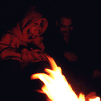
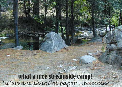
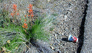
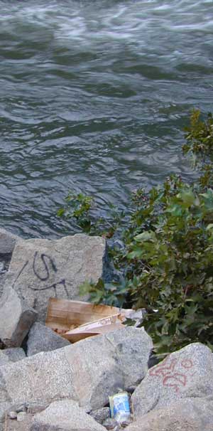
WILDERNESS NOTE: The USDA National Forests web site states that “Camping and campfires within 25 feet of the water’s edge is prohibited due to the Wild and Scenic Designation”, but that doesn’t seem to stop some from setting up right on the fragile rivers edge. Doubtful that this rule is being enforced by the rangers, but consider yourself warned unless they start to get serious about this restriction. Many believe that the free camping along the Kern river is destroying it, so don’t be surprised if these areas get closed or barriers placed at the flats.

Caulkins FLAT has some new boulder barriers put in place which prevent cars from reaching certain ideal camp spots (right at the waters edge). Tough luck. Now we have to hike more.

California rivers

kern flat camping

Upper Kern River
North of Kernville, CA

all camps below listed from south to north

ALL CAPS = developed campgrounds managed by US Forest Service, w/ links to Kern River Campgrounds. California NFS

HEADQUARTERS CAMPGROUND (NFS)

Both Halfway & Thunderbird used to be dispersed camps, but they were converted to reservation-only Group Campgrounds by the National Forest in 2014

Chico Flat
2500′ elev
Just south of Hospital Flat Campground.
This camp area is known as “Chico Flat Campground” on GoogleMaps.

HOSPITAL FLAT CAMPGROUND (NFS)

Corral Creek
3200′ elev
Hike to Corral Creek Beach & Picnic Area.
This camp area is known as “Corral Creek Campground” on GoogleMaps.

Spring Hill
This camping area is marked as “Upper Springhill Campground & “Lower Springhill Campground” on GoogleMaps.

GOLD LEDGE CAMPGROUND (NFS)

Ant Canyon
Just north of Goldledge Campground, along the Upper Kern River.
South of Salmon Creek; Hike to Salmon Creek Falls.

Chamise Flatchamisespot
12 miles north of Kernville, CA
This camping bluff could be the most forested of all the ‘kern flat’ camping areas, but river is a short hike down a very steep cliff. Fishing is excellent in this stretch.

Calkins Flat
15 miles north of Kernville, along the Upper Kern River. Just south of Fairview (McNalley’s). Sign at the location reads a different spelling of “Caulkins Flat”. Kayak and rafting put-in spot. One of the best sites for large groups. Area is also known as simply “Lower Campground” on GoogleMap.

free kern river camp

FAIRVIEW CAMPGROUND (NFS)

LIMESTONE CAMPGROUND (NFS)

Brush Creek
3600′ elev
Just south of Sherman’s Pass Road turnoff. This place also serves as a Day Use Area, where Brush Creek meets the Kern. Kayaking put in spot. Popular fishing area. Large open dirt parking lot with a vault toilet.


California rivers

Lower Kern River
Southwest of Kernville, CA

Lake Isabella has some shoreline camping with wide open access to the lake. Paradise Cove perhaps?

Historic Keyesville – “off-roaders camping paradise” along the river, but no swimming is allowed due to the extremely dangerous section of river. OHV trails lead (west) down river for many miles. Dirt bikes love the rugged boulder-scapes and steep hills. FREE camping; BLM Kern.

SANDY FLAT CAMPGROUND (NFS) – Open all year long! Terraced & paved hillside with numerous camp sites and plenty of room to spread out. RV campers like this location, due to the proximity to Hwy 178. elev 2300

HOBO CAMPGROUND (NFS)

Remington

Remington Hot Springs can be a zoo at times w/ the amount of people who love to stop here. A busy dirt parking lot, right across from the Remington trailhead sign. Many vehicles park here daily for day hikes, hot springs, fishing – and people also like to camp out, although camp sites are on slopes (not ideal), only a few and they fill up fast (before sunset).

Total Escape TIP: The very best camps at Remington are actually the ones you hafta hike down to. Less than a half mile down to the rivers edge to find a private mini beach. Pack light and arrive prepared to walk several miles (back & forth, several times).

Old Kern Canyon Road parallels Sierra Highway 178 and sits well above the river, so any flat spots you find will have great views w/ minimal river access.

Lower Kern River
Lower Kern River has very limited camping options.

Lake Mohave

viewpoint mohave

Lake Mohave NRA

Lake Mohave National Recreation Area

Mojave Reservoir @ Colorado River: AZ / NV / CA
@ the V, bottom of Nevada state = Arizona – Nevada – California, all merge together

National Park Service

The Colorado River travels through the southwest desert, splitting the Grand Canyon and further south, separating California from Arizona at the southern tip of Nevada. Agriculture lines the big river down to Baja, Sea of Cortez, Mexico.

Up near Las Vegas and down to Searchlight, NV

Above Hoover Dam is Lake Mead, sediment from Utah National Parks. Red dirt and silt shorelines. South of Hoover dam is a super deep rock gorge w/ hike-in hot springs. Beyond that, this beauty called Lake Mohave – with the super clear water, secluded coves and abundant fishingfish

Lake Mohave: elevation 647′

Desert peaks in this region are around 2000-3000′ elevation. Mohave Lake is actually a wide section of the Colorado River, spanning the region from massive Black Canyon south to busy Laughlin w/ river casinos. This lake is long and skinny in spots with lots of shoreline cliffs, canyons and coves. Minimal vegetation, so please bring your own firewood and don’t chop down the few trees trying to survive. Summer temps exceed 100 degrees, so plan your visit for the winter time.

boatramp
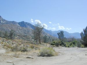
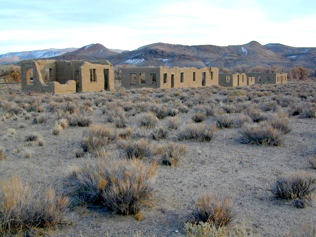
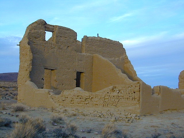
Lake Mohave Ranger Stations
Cottonwood Cove
Katherine Landing

boating, camping, fishing, hiking, hot springs, kayaking, off-road, picnics, viewpoints

camping areas below listed from north to south

Willow Beach RV Park & Campground
Arizona side, off Hwy 93
928-767-4747

car camp mohave

El DORADO CANYON

El Dorado Canyon Road, main paved route can be accessed near California’s state border. North of Searchlight, Nevada – off main highway 95, on side route 165 to Nelson, NV

Secluded dirt roads up and down canyons near El Dorado Canyon Rd. Minimal vegetation, maximum open scenery and dark skies. Kayak rentals @ El Dorado Canyon.

desert badlands erosion

deep washes
Ireteba Peaks Wilderness

4×4 camping routes: 15 day camping limit

Find your own route with many to choose from, drive the soft sandy washes (with a few boulders to dodge) and camp for free, right at the waters edge. Adventurers: Only for the self-contained campers. Some routes marked 4WD only, so pay attention to signs. AWD (all wheel drive) vehicles should fare well on the sandy roads; but standard passenger cars and vans will need to keep their speed up in the soft sand areas.

No garbage collection. Pack it in, pack it out.
No facilities, no fees. No buildings. No campfire rings, no picnic tables, very few vault toilets. Bring your shovel!

Driving off the roads is strictly prohibited. Primitive camp sites can be found both at numerous coves and also inland inside the canyons. The ridges get windy in the deserts, but are favorable for night sky views and self contained camper vans.

Always know the weather forecast, cuz flash floods are possible and these dirt roads will be impassible during big rain. This is the main drainage to the big river!

Dogs Allowed

DRIVING TIPS

Most desert washes here are signed routes 4×4, but mini vans, AWD sport-wagons, trucks, SUVs, small RVs can all be found camping near Lake Mohave. That is – if you know how to ‘drive off road’, which is not fast, but not too slow either.

Avoid getting stuck in the deep sand: keep speed up, do not turn sharply and do not brake hard. Carry tow strap in case you need an emergency pull. Be nice to strangers and you may find help.

Campfires are allowed, but you need to bring firewood. Dogs are allowed. Party animals tend to trash these desert coves, so be warned that there is a fair amount of litter. Bring a black trash bag and take some out! This trash problem could get the area closed off to vehicles so keep that in mind.

The canyons here have giant power lines that cross @ Aztec Wash; they can easily be avoided.

montana wash

primitive camping 4x4 camping boat camping

4×4 recommended @ MOHAVE:

Eagle Wash Road #46 – popular spot
Montana Wash #45 – camping ok
Placer Wash #47 – no camping

The rangers don’t wanna be pulling your ass out of the sand, which is why they post the 4×4 signs. Don’t expect to find help without walking a few miles first, or waiting several hours.


desert wilderness

Several wilderness areas are located along the west side of this lake & river. Often dirt roads will parallel a portion of the wilderness boundary, providing excellent access to secluded coves and beaches. Emergency CALL boxes are placed in remote parts of these shores.

  • Ireteba Peaks Wilderness (northwest, next to El Dorado Canyon)
  • Nellis Wash Wilderness (western side)
  • Spirit Mountain Wilderness (southwest)
  • Bridge Canyon Wilderness (southwest, near Laughlin)

mohave2011

RV camp campground marina

COTTONWOOD COVE
developed campground, boat launch, marina, lodging, hiking, picnic areas

Cottonwood Cove Resort
near Searchlight, NV
702-297-1464

primitive camping boat camping RV camp campground marina

LAUGHLIN, NV
Nevada, California and Arizona states join down in this part of the world. Katherine Landing, full service marina, slip rentals, lodging, city services and casinos.

Lake Mohave Resort
928-754-3245

katherine landing camping
Katherine Landing offers back roads camping, via rough dirt roads.
Laughlin Marina
Laughlin Marina @ Katherine

Lake Mohave NRA
NPS Headquartersnevada_atlas
601 Nevada Way
Boulder City, NV 89005
Visitor Center open daily
702-293-8990

maps of the region:

covecamps

Mojave Desert – This river-created lake is located on the Colorado River, in between Las Vegas, Nevada and Needles, California. The river water here is crystal clear, very swimmable and the fishing is decent.  No paved boat rampsclearest water

nearby towns: (with elevation)

Avi Casino
Bullhead City, AZ (540′)
Laughlin, NV (535′)
Kingman, AZ (3340′)
Needles, CA
Nelson, NV (2954′)
Nipton, CA (3042′)
Oatman, AZ
Searchlight, NV (3470′)


Horse Canyon

Horse Canyon Mojave

Horse Canyon California

Southern Sierra / Mojave Road SC 65

Mojave Desert meets the Sierra Nevada Mountains
North Highway 14

North of Mojave, CA
North of Red Rock State Park
North of Jawbone Canyon

South of south of US Hwy 395, south of jct Hwy 178

backroads BLM camping desert roads hiking PCT mountain bike jeep roads primitive camp

elevation: 3000′-7000′

Horse Canyon is a dirt road up a high desert canyon, with joshua trees and wash outs. 7000′ elevation pinyon pine ridges above w/ PCT.

Most would say the see a whole-lotta-nothingness out here in these deserts…. when they zoom by at 70 mph on the blacktop highway.

at Total Escape, we beg to differ.

Solo Driver SUV

Intersection on Hwy 14 @ SC 65, dirt route will travel west into the mountains. Initial desert road follows Little Dixie Wash, but veers north up to Horse Canyon and the higher forested ridges.

Horse Cyn is a scenic, desert, dirt road that becomes a rugged 4×4 trail the higher it climbs in the canyon. The route traverses a ridge line and dead ends at the old cabin; No through route, no loop. The PCT continues on to the Walker Pass @ the 178.

The lower Horse Canyon is area quite accessible by standard truck or SUV. High clearance is recommended out on these kinda roads. Vegetation is quite sparse at first, but improves with the miles traveled. Wildflowers can be awesome, usually April-June. Picnic spots everywhere; primitive camping sites can be found out here, off the main dirt road. Please reuse existing camp sites when possible.

wheelin pals

Passenger cars may attempt this, but should watch for unexpected deep dips and rocks, washed out in the road. (No tow service in the middle of nowhere). Road conditions do change with the seasons out in the boonies. Cell phone reception could be spotty back in the deepest of canyons.

PCT
PCT trail access: Pacific Crest Trail follows this ridge road for miles. They call this range the SCODIE Mountains; Old cabin at the end of the road.

cabin mcivers

Sage Canyon and Cow Heaven Canyon are both to the north, along with Freeman Canyon (CA SR 178). Bird Spring and Dove Spring Canyons are both to the south, along with the most popular regions of Red Rock State Park and the Jawbone OHV area.

nearby towns:

INYOKERN, CA
LAKE ISABELLA, CA
MOJAVE, CA
RANDSBURG, CA
RIDGECREST, CA

joshuacanyons

Fort Churchill Camping

Desert camping south of Reno? Well there ain’t much to choose from out here. Walker Lake near Hamilton, NV looked dismal, so keep driving northbound and hope for the best.

Maybe one of the canyons near the reservation has a level pull out along the highway. Just far enough off the main road to hear the midnight traffic, just barely.

Fort Churchill, Nevada

churchill terrain

Fort Churchill was one of the original US Army forts built to help with the flood of overland pioneers making their way to California. Adobe structures in ruin, plus the sagebrush wetlands and cottonwoods along the river make for ideal scenery. A Pony Express route too!

Shall we call it the first of the California Welcome Centers?
Or an invasion of the “wildness” of the Sierra Nevada, and the West Coast.

From the year 1800 on – trappers, hunters, miners, ranchers, prospectors, surveyors, homesteaders – and basically everyone was headed westward, across the continent. The secrets of the golden state were unfolding worldwide. After gold & silver were discovered in the hills, the real rush to Alta California began.

California [population boom] history

Nevada California border

US Highway 95A

ALT95 – The Yerrington Cutoff

Ideal “in route camping” if traveling near Reno, south of Interstate 80. You gotta be off on the side route through Yerrington, Nevada to reach this convenient road side campground. Big trucks stick to the main highway, but this rural 2-laner cuts thru residential, reservations, and ranch lands. Rural backroads are abundant and most are private property.

Fort Churchill State Historic Park
Ranger Office
10000 Highway 95A
Silver Springs, NV 89429
775-577-2345

Nevada Desert Camping

OPEN ALL YEAR LONG

Driving on rural Nevada Highway 95A you can find the park headquarters and fort on the west side of the road. The camping is on the opposite (east) side of the highway, down an embankment, near the Carson River. A very small brown sign with the word CAMPING (reflects at night) and you may see it – if you aren’t driving 70 mph.

DESERT CAR CAMPING – VEGAS TO RENO

In Route Camp

Perfect refuge for weary travelers, along the long, lonely, desert highways of Nevada. RV campers will like the wide dirt road w/ some level spots, accommodating the largest of motorhomes w/ dump station nearby. Trucks w/ trailers are often seen sleeping along the roadside at this location. Equestrian river access w/ horse trailers too.

Cottonwoods in some of the lower spots, but mostly sage brush, rabbits and open skies. This is the Carson River Basin, so dirt roads w/ mud and potholes are common. No street light near here. In the dark, the primitive roads are manageable, but the signs are minimal.

elevation 4250′
SNOW is minimal in WINTER months (DEC-MARCH)

Desperate tent campers (willing to drive dirt for a bit) can find the “scout camp”. Most nights are filled with the cries of the coyotes in the distance. Park rangers patrol in the morning to collect camp fees. Or you can find the park headquarters, across the highway.

fortchurchill

NO CAMP RESERVATIONS
Primitive campground has 20 sites suitable for travel trailers, motor homes or tents. Campsites include a table and fire ring, w/ camping limit of 14 days. Group camping is also available.

churchillruins

Sawmill Lake Sierra

primitive camp spots

Sawmill Lake, California


N of Donner Pass, Sierra Nevada

elevation 5800′Canyon Creek connects Lake Faucherie, Sawmill Lake and Bowman Reservoir in the Sierra, Tahoe National Forest. 20+ miles of backroad travel, off I-80.

While many consider Faucherie to be the most beautiful scenic lake, Sawmill Lake just downstream a couple of miles is still quite attractive – with dense forests and a granite mountain backdrop. Sawmill is especially nice for those who like to primitive camp, ouside of developed campgrounds. Way off the interstate @ Hwy 20, tucked in way back behind Bowman Lake a few miles, you can find Sawmill Lake.

Sawmill Lake California

Fishing and camping, kayaking and canoeing are all popular recreation around this lake. A trailhead on the northend of the lake leads out to even more alpine lakes (a day hike “lake loop” or backpacking option). The Pacific Crest Trail is also routed nearby.

No motorized boats or watercraft allowed. No boat ramps, no pavement, no picnic tables, no bathrooms, no fees.

4×4 Lake
Fishing Lake
Free Camping Lake

The north shoreline is abundant with dispersed campsites: metal fire rings and a clearing only; no picnic tables, no toilets. Self sufficient campers only. Campfire permits, a water bucket and a shovel are required. During extreme fire restrictions campfires may not be allowed. Check with local rangers for up to date info.

Tahoe National Forest
Truckee Ranger Station
530-587-3558

National Forest Lake & Forest Lake Fishing Kayak lake hiking lake

Most campsites are drive up and park, while others closer to the shoreline have only walk-in access. Hauling your gear down hill won’t seem unthinkable once you’ve seen the lakeside views. There is even a camp below the dam, next to the waterfall.

waterfallfromdam

The main access Road #843-037 is very rocky and 4x4s love to frequent the area. The backroads here are best suite for truck travel, high clearance vehicles, off-roaders and SUVs. No small RVs or trailers. Passenger cars are not recommended. The access roads around the lake and up to the lake are dusty and rugged. The road below the dam is quite rough w/ rocks.

For more driving details, please see entry on Canyon Creek Campground.

road at dam
The water at Sawmill Lake is crystal clear snowmelt. The lakes around here are managed by Nevada Irrigation District, so this is why there are no engines allowed on the lake. This canyon area closes to public entry during winter months (NOV-APRIL), due to deep snow.

clear water

Trinity Alps Camping

Trinity Alps Wilderness Campgrounds

Northern California Camping
Shasta Trinity National Forest

Trinity Alps Wilderness

camp


  • backpacking
  • camping
  • fishing spots
  • floating
  • hiking
  • hunting
  • kayaking
  • mountain biking
  • off-roading
  • soaking
  • swimming holes
  • tubing
  • stargazing

trinitydetail

campgrounds near Trinity trailheads –

camping Highway 3
(California State Route 3):

  • Horse Flat Campground, near Eagle Creek trailhead
  • Eagle Creek Campground @ Hwy, near Stoddard Lake & Eagle Creek trailhead
  • Goldfield Campground, near Boulder Creek trailhead
  • Big Flat Campground (via Coffee Creek Road #104)
  • Preacher Meadow Campground @ Hwy, near Swift Creek trailhead

camping Highway 299
(California State Route 299):

  • Ripstein Campground, near Canyon Creek trailhead
  • Hobo Gulch Campground, on Road #34N07
  • Hayden Flat Campground, near Big French Creek & Green Mountain
  • Denny Campground, near Jim Jam Ridge, East Fork & New River; Way out west
  • Groves Prairie Campground, near Grizzly Camp trailheadtrinityalps_lg
  • Happy Camp Campground, near Grizzly Camp trailhead

camping Highway 96
(California State Route 96):

  • Tish Tang Campground, near Tish Tang trailhead
  • Box Campground, near Red Cap Lake, Bear Hole & Mill Creek Lake
  • Klamath Riverside Campground @ Hwy, near Salmon Summit

camping Salmon River (Cecilville Road #1C02):

trinitysign
Trinity Scenic Byway (CA SR 3)

NorCal Topographic Maps – Trinity Map

Shasta Trinity National Forest Map

Pacific Crest Trail Map #6 (Shasta Cascades)

Trinity Alps Wilderness Map

outdoor destinations also nearby –


View Larger Map

Saline Valley Hot Springs

Saline Valley Hot Springs
Saline Valley Warm Springs

NORTH Death Valley National Park, in a super remote desert valley located in the vast mountains in between Big Pine CA Route 168 & Death Valley (west) Highway 190.

Inyo National Forest: Inyo mountains are a towering range of high elevation desert peaks running in between Owens Valley and Saline Valley.

desert wilderness access: 4 dirt road routes lead into Saline Valley – 2 backcountry 4×4 trails from the upper reaches of the park and 2 main dirt roads. All routes require a high elevation pass, so snow is likely in winter months (Nov-May).

Wilderness routes road conditions can change often, seasonally with winter snows, mud and summer thunderstorms. The most popular access are the main routes (both long dirt roads, subject to snow and closure at any time) – the North Pass (Big Pine) and the South Pass (Panamint). Detailed directions on those further below. Both backcountry roads Steele Pass and Lippincott Road, originate from the northern, desolate areas of the National Park and both require 4 wheel drive, with a recommended locking differential.

No developed campground facilities. Clothing optional my ass — nudity is the norm here.

Since the challenging drive in to this remote desert valley is so grueling and time consuming, plan to spend a minimum of 4 nights. Anything less is way too rushed to totally enjoy the experience.  Best way to enjoy this place is a full week off of work, and as much firewood, food and ice as you can haul. Some folks spend weeks camping here. The NPS limits your camping stay to 30 days! If you plan on driving out to Lone Pine for camping supplies and returning the same day, you best leave at dawn – cuz the entire round trip ‘beer run’ will take 6 hours or more.

High clearance vehicle a must & 4 wheel drive is highly recommended in all this region. All wheel drive wagons and passenger cars have been known to bottom out, break down and pop tires out here in the harsh conditions, so a first challenge may be to obtain a dependable and capable off-road vehicle.

Topographic GPS & decent back road maps are highly advised. One way drive is easily 4 hours, from any paved highway. Pack like you’re gonna live out here, if need be. Warning: this is a very long off-road journey for any average camping trip. This isn’t a weekend kinda place. First timers beware – it’s a full day journey to travel here!

Air Strip? The fly in option is a dirt landing strip called ‘Chicken Strip’, but National Park Service has yet to closed it.

NORTH PASS to Saline Valley Road:

from Big Pine, take Hwy 168 N from Hwy 395, turn right onto Death Valley Road (some maps may have this one listed as Waucoba Springs Road or just Waucoba Road). Proceed on the main route to the hard to read entrance sign marking the Saline Valley Road, past a few old structures and down to the main valley. Winter snow can be deep, so carry chains. 4×4 is best to access this remote valley, AWD high clearance might make it and normal passenger cars, 2WD SUVs should be warned about weather and access to the real world. Many times all mountain passes are snowed in – people do get trapped at Saline and cannot get out for weeks. So take that into account when requesting days off of work for this epic journey.

SOUTH PASS to Saline Valley Road:

from Olancha, take Highway 190 E, turn N off Hwy. 190 to Saline Valley Rd. Rugged 50+ mi. of hard core dirt roads. 4×4 and high clearance a must. Winter months expect snow, springtime rock slides and summers torrential downpours cause overflowing creeks w/ impassable washouts. Grapevine Canyon can be a challenging drive, but with patience and skill you can be down on the main valley floor in about an hour and a half (if you’re lucky). Did I mention the dozen or more miles of heavy washboard road conditions, at the base of the alluvial fan of mountain rock? Newbies and first timers should attempt the North Pass.

———————-

Near the marsh, when you finally reach the sand dunes area, you know the turn off is close-by, so slow down and stop to read the landscape. Know that the hot springs are located above the sand dunes to the east slope of the red volcanic mountains. When you see the metal bat sign and the mass of palm trees in the lower grove, you know you’ve arrived.

You’ve only truly arrived, when your whole body is immersed in hot water looking up at the stars and you learn to relax again. Breathe the deepest you have all year.

CAUTION: Stopping for those vehicles distressed on the side of the road is also a common practice. Many people break down on this route, Jeeps slide off cliffs. Harsh landscapes, plus weather are unforgiving and people die, so realize that this camping trip is no walk in the park.

Saline Valley Road Conditions & discussions can be found on
Saline Valley Talk, the Saline Valley Message Board
forum.salinepreservation.org

Saline Preservation Association
salinepreservation.org

Trip Review from Student Reader
studentreader.com/saline-valley

natural hot springs

nearby desert destinations –


View Death Valley National Park in a larger map

Camping Inyo

Primitive Camping Inyo National Forest – Eastern Sierra Car Camping

395 Sign

The mighty US Highway 395 runs from the Mojave Desert north through the eastern side of California, where the state line of Nevada meets. Mount Whitney and the tallest peaks run on the western range @ 14,000’+ the highest in elevation.

The Inyo Mountain range sits @ 11,000′ to the east side of the Sierra Nevada. Major elevations but little vegetation, when compared to it’s neighboring Sierra range. The Inyos lay in the rain shadow of the taller western mountains – but still get snow. Plenty of primitive SUV camping on the dirt roads throughout this desert area north of Death Valley.

camp sitesA more forested part of the Inyo National Forest is the Eastern Sierra region. Encompassing Mount Whitney & Mammoth Mountain area, plus the entire Hwy 395 corridor. This side of the Inyo National Forest is quite different that the desert range of Inyo.

Eastern Sierra back roads lead all over the place & may require 4WD. A high clearance 2WD can still get you to some awesome viewpoints & scenery. No picnic tables or toilets are available out in the boonies, but plenty of seclusion & vast open space wilderness. INYO Forest Service Map is highly advised for this area. There are many dirt roads for dispersed primitive camping w/ no fees. See the Camping Checklist to make sure you’ll have what you need.

Open (free) Camping along Hwy 395

Monache Meadows – This high elevation (8000′) south Sierra Meadow is accessible by 4WD truck or SUV. Near Kennedy Meadows CA

Walker Creek Rd – quick camp in the lowlands; an easy in route camping near oaks & creek. Southside of Olancha CA, look for turn off & follow dirt road up into the tight canyon. No RVs whatsoever.

Fish Slough Road – open desert camping w/ popular bouldering & rock climbing areas; near Indian Petroglyphs. N of Bishop, CA

Road# 6S16 – Pine Creek Road – Camp on creek, no facilities. NW of Bishop behind Rovana.

Lower Rock Creek Road – signed turn off US Hwy 395. Only a couple good camp spots tucked away in the trees. Small creek, very overgrown, traffic noise minimal. Nearby Round Valley @ Sherwin Pass had a big wildfire in wintertime (dry) FEB 2015!

crowley camps

Road# 4S02 – Owens Gorge Road – N of Bishop behind Lake Crowley. Free RV camping w/ boulders & pines

Road# 4S86 – Laurel Lakes Road – Camp in aspens @ small lakes, high elevation; no facilities. SE of Mammoth

Road# 2S05 – Deadman Creek – Camp in pine forest on creek; no facilities. N of Mammoth

Road# 2S07 – Owens River Road – Camp in pine forest, near hot springs; no facilities. N of Mammoth

Parker Lake Road – Camp along aspen creeks or in pine forest, near lakes; no facilities. E of Grant Lake on June Lake Loop (Hwy 158)

Coyote Flat 4×4 Bishop – just west of Bishop CA is a 4 wheel drive paradise, Coyote Creek – This steep dirt road is quite a climb. A true off-roaders dream of open space, great views, large meadows, & alpine lakes. Great primitive camping along creeks, in pine or aspen forest or near small secluded lakes. Real remote Sierra high country, usually only reached by backpackers, is accessible to those who dare to venture off the beaten path of Highway 395.

At the golf course keep your eyes peeled — from the highway take Schober Ln. / Underwood Ln. due west through a residential neighborhood to the backside of the town. Find the electrical power station to the left at the base of the hills. Veer onto the slightly paved /dirt road to the right of the station & continue straight up the sandy wash. 4×4 is recommended, since the lowest gears are needed for the careful climb. The road will begin to get steep & gain in elevation fast. The area up here changes with the mileage: passing pinyon pines on cliffs, topping off to high meadows & aspen lined creeks, finally reaching large towering pines & small alpine lakes with snow melt still visible. Basically TREE LINE. This region is most likely open only half the year, due to its high elevation of 8000’+ and winter snow.

  • BISHOP PASS TRAIL MAP
  • INYO Forest Service Map
  • PALISADES TRAIL MAP
  • WHITNEY MAPS
  • 23S01 – Los Padres NF

    Big Sur Dirt Roads

    Los Padres National Forest Road #23S01

    Willow Creek Road
    Los Burros Road

    South Big Sur Coast Dirt Roads & super scenic US HWY 1 – North of San Simeon and Hearst Castle, north of Ragged Point and just past Gorda, CA a dirt shoulder, widens, a break in the bushes on the right side of the highway, a small wooden sign for the Yurt Resort called Treebones and the turn off to the back-country of Los Padres National Forest Road #23S01

    Willow Creek is a steep coastal canyon w/ Willow Creek Trail #5E08 in the creek below and the dirt road 1000′ above. Willow Creek Day Use Area, the Willow Creek bridge and Willow Creek beach w/ restrooms, picnic tables, and paved parking lot near the highway.

    DIRT ROAD, high clearance is recommended, but not required. 4×4 may be needed in wet weather. Motorhomes, trucks w/ trailers and RV campers are not gonna like this rugged, narrow, steep, dirt road and are advised to stick to the pavement. Camper vans and SUVs are be better suited for this terrain.

    • Both Thomas Bros. Maps & Benchmark Map’s California Atlas has this route listed as Los Burros Road
    • Google Maps has this route named Will Creek Road
    • Yahoo Maps has this route as Willow Creek – Los Burros Road
    • Mapquest has this one listed as Los Burros Rd – Fort Hunter Liggett (which is a military base,  on the opposite side of the mountain range near US Hwy 101)


    View Larger Map


    Free Camping in Big Sur

    Willow Creek Rd

    Several primitive camp sites can be found along this rugged dirt road, which climbs steeply and switchbacks thru redwoods, madrones, cedars, grass lands and oak hills. Sites within the first 3 miles  of this road offer the serene sounds of the ocean – waves, seals, sea lions as well as traffic on the busy highway. There are a few private properties back here in the boonies too, so read signs and don’t go exploring this region in the dark.

    About 8 miles back on Willow Creek Rd is Alder Creek Campground – a small developed camp w/ only 2 camp sites and no piped water and no fees.

    Prewitt Ridge  also has numerous ideal top-of-the-world, free camp sites, which do require a lot more dirt road driving and a very good backcountry map.

    • Sycamore Flat Road intersects @ 3 miles up
    • Alder Peak Camp is San Martin Top @ 12 miles up
    • South Coast Ridge Road is at the very top @ 14 miles
    • Lions Den Camp is 19 miles of dirt road driving
    • Three Peaks Camp is 21 miles way back there
    Los Padres Monterey District Big Sur Map NatGeo

    Cleaning Up Litter

    Litter ay Camp

    Garbage on the Back Roads
    Wilderness Ethics

    Litter seems to be nearly everywhere. Although there are trash cans at most campgrounds & developed picnic areas, some lazy folks still seems oblivious to the fact that their ignorance is causing an eye sore for the rest of us. Does that bunny rabbit really need to look at your abandon water bottle in the bushes, for the next 7 years?

    littercup

    Remove Trash while Camping & Picnicking

    • Pack it In; Pack it Out, means if you bring it out there, please take it back home (or to a proper garbage disposal site).
    • Bring work gloves when camping; do messy job faster and have clean hands
    • Bring trash bags or cardboard boxes for storing trash for transport
    • Take out some litter; Leave the camp or picnic site cleaner than you found it
    • Use existing campsites & fire rings to prevent impacting new areas
    • Pitch tents in cleared camp spots only (when primitive camping)
    • Do not set a tent up in a meadow. It’s a fragile environment

    graf_kern_i

    tread lighty
    leave no trace
    and always leave the site nicer than you found it

    desert camping

    Where to Camp

    Where to set Camp in California?
    Camping Spots
    Small campgrounds have fewer facilities than the larger developed campgrounds, but less sites means more nature and less people. Roughing it on the back roads with dispersed camping is by far the best experience for seclusion and privacy

    real peace and quiet.

    Primitive, free camping requires more thought and planning than just pitching a tent in a flat spot at a developed campground.

    First off, you will need a decent topo map to find the dirt back roads, the trailheads and the creeks with the best camp sites; a dependable and capable rig to get you out there, plus your camping gear.

    Campfire permits are usually required for camp stoves, BBQs and any open fires. (bucket & shovel needed).

    And most importantly, since California is known for its super dry climate and seasonal wildfires, make sure to check with local rangers to find out about any current campfire restrictions.

    Streamside Camping
    some tips for a good camping experience – without scoldings or citations from Mr. Ranger:

    • Choose existing campsite in a used area – rather than creating another rock ring & trampling a fresh spot.
    • Always know fire conditions; get a fire permit if you have a campfire outside of a developed campground.
    • Set up camp away from other people. The majority of people go to the wilderness to experience quiet, peace, & solitude. There is plenty space for everyone, so spread out.

    mountains

    • Never set camp in a meadow. It is a very fragile ecosystem.
    • Use an existing camp site when possible. Rebuilding and cleaning campfire pits is part of the job!
    • Camping right on the a creek bed or lake shore is damaging to the vegetation and wildlife areas. Place tent at least 20+ feet away from waters edge. Many camp site already exist in prime areas on creek front, so seek out those first. The deeper you go into the wood, the more you will find. Seclusion is possible, if you want to drive beyond the pavement.
    • Do not camp beneath large dead trees. Check tent spots for old overhanging branches too.
    • Do not camp near a mine shaft; Toxic heavy metals or radioactive debris could be present in the dirt.
    • Camping next to a lake, wetlands or a meadow can often result in abundant mosquitoes & insects overall.
    • Snow is possible anytime from October to May above 5000′ elevation. Chilly nights are common in summer.

    deserts

    • Avoid camping inside desert canyons when the threat of rain is approaching: possible flash floods.
    • Consider the benefits of potential windbreaks in desert terrain. Large rocks, bushes, trees, your vehicle & even a hillside.
    • Picking a camp spot on a ridge line means sun exposure and windy conditions. Breezes will keep the bugs away and you can’t beat the better view, but wind can pick up at any time especially in desert regions.
    • Low elevation in late spring and fall means very warm temps; summer is triple digit heat most days.
    • Do not camp near a mine shaft; Toxic heavy metals or radioactive debris could be present in the dirt.

    coastal

    • Avoid camping on fragile coastal cliffs; unstable, which can give way, caving in, resulting in danger to you.
    • Camping on the beach means watching the tides. Know where high water mark is before you set camp up.
    • Beach camping in early summer means low clouds and fog are likely. June Gloom can last months.

    countryside

    • Avoid building campfires up against a large boulders or against a rock face.
    • Rivers controlled by hydroelectric dam systems mean that the water levels can change at any time without warning.
    • Never set camp in a wildflower meadow. It’s too fragile of an ecosystem.
    • Lower elevations in summer time means potential triple digit heat during mid-day.
    • Do not camp near a mine shaft; Toxic heavy metals or radioactive debris could be present in the dirt.
    National Parks National Forests State Parks California BLM OHV routes California Wilderness
    Beach Camping
    California Forests
    Wineries
    Desert Parks
    California Back Roads California Lakes

    Eeeew Bugs

    LadyBugs

    Spiders and Bugs

    terrachula 
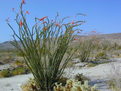
If insects are your biggest concern when camping, then consider yourself totally “spoiled rotten”. Grasshoppers, ladybugs, beetles, butterflies, dragon flies, damsel flies, bumble bees and honeybees are usually not feared, but other bugs are more frightening looking or just extremely annoying.

    Some of the most common pests you will experience in California –

    • mosquitoes (warm weather & near water sources)
    • yellow jackets (they want meat or sugar)Alabama Hills Lone Pine
    • horse flies (near coast & in the mountains)
    • small black flies (near oak groves and pinyon forests)
    • no-see-ums (tiny gnats, zip the tent up)
    • moths (@ night, attracted to lights)
    • scorpions (up to 6000′ elevation)
    • terantulas (painful bite, but harmless to humans)

    Follow these tips:

    • Do not camp near any still or stagnant water
    • Do not camp next to meadows
    • Do not wear perfumed products; the less scent the better
    • Build a small fire, smoke will keep most bugs away
    • Zip up tent door (always). Even if you’re just inside for a minute
    • Turn off flashlight before entering the tent. Moths may follow the light in with you
    • Camp in the cooler months, Spring & Fall

    HELPFUL ITEMS to PACK:Coleman Tents

    • Scented Options

      • Candles w/ citronella scent
      • Citronella incense sticks
      • Tiki torches with citronella fuel
      • Green Mosquito Coils (toxic to water sources)
    • Insect Repellent Spray

      • All Terrain Bug Repellent (non-toxic)
      • Deet is simply Poison
      • Citrus scents are effective
      • Combo sunscreen insect repellents are new
      • Avon’s Skin So Soft Lotion is well known for keeping bugs away

      Screen Room – large tent with open walls. Staking this structure down properly is key. Then park your picnic table and chair inside to enjoy a meal in peace.

      Ponds and Meadows
      Ponds and Meadows are areas in the forest where water collects, and mosquitoes are common. When the low temps dip into the 30’s at night, they usually die off.