Category Archives: California Deserts

Old Kane Spring Road

Kane Spring California

Quartz Wash Anza

Old Kane Spring Road parallels California SR Highway 78 a few miles from Ocotillo Wells, in east Anza Borrego Desert. A graded dirt road that can often gets sandy and you might need to keep you speed up certain soft spots. A few dead end canyons lead southward; hidden camp sites can be found out this way if you have the time to look. Harper Canyon, perhaps. See below for more on camp sites.

San Diego Desert Map

Anza Borrego Desert State Park Map

San Diego Backcountry Map

Spring Wildflowers can be quite spectacular out along this desert trail. Towering red-tipped ocotillo in some canyons serve as great backdrops to a perfect picnic lunch.

Ocotillo California

The Kane dirt route peels off the highway about a mile east of an area known as The Narrows. Marked on the highway as a small hiking trail, the highway curves at a narrow section of the canyon, as San Felipe Creek wash carves its way through the harsh landscape.

primitive campThe best primitive camping in this area is actually west of The Narrows. You might need a high clearance vehicle to reach some spots and a good map with the creek/wash names. Make sure to look for these – Free Camping

  • Nolina Wash
  • Pinyon Wash
  • Quartz Vein Wash

pinyonoco vcampoutpinyonwsh

On the opposite the highway is Ocotillo Wells SVRA, where off road enthusiasts can get their kicks. Wind caves can be found in Butte Canyon, where the 4×4 trails abound. Kane Springs intersects Split Mountain Road. The Elephant Trees, Split Mountain and more wind caves are south of the railroad tracks.

Anza Borrego Desert Map


View Larger Map

Agua Caliente Hot Springs

Agua Caliente Springs

Agua Caliente County Park
Agua Caliente Anza Borrego Desert
Agua Caliente Hot Springs

East San Diego County
N of Ocotillo, CA

Anza Borrego Desert MapAgua Caliente Hot Springs County Park is a remote 910-acre San Diego County Park next to the Anza Borrego Desert. A developed hot springs, picnic area & a large campground. This desert destination is perfect for California winter recreation, offering a small air strip for small plane pilots.

Located North of Interstate 8 on San Diego Road S-2 on the south end of Anza-Borrego Desert State Park. Local mountain’s seismic forces created the fault that runs beneath this region & forces water up to tRV campground Anzahe desert surface. A decent water supply also supports plant life & wildlife.

For minimal crowds AVOID THIS PLACE on holiday weekends or peak winter months. Spring & Autumn are excellent times to visit here, but watch the weather forecast for any heat waves. Who wants to soak when it’s 100 degrees outside?

2 natural hot mineral pools:

  • large outdoor pool is kept at natural 96 degrees
  • glass walled indoor pool is heated & has bubbling jets
  • spring-fed, warm showers are available
  • hiking trails, horseshoe & shuffleboard

Indoor Pool

Agua Caliente Campground

140 campsites – tent sites & RV hookups w/ dump station. Shady trees only at some camp sites. Indoor pool, outdoor pools, maybe a hike-in primitive tub too. Individual campsites may be reserved up to 12 weeks in advance 858-565-3600

  • Anza Borrego Desert Map
  • San Diego Backcountry Map

  • View Larger Map

    Anza Borrego Hot Springs
    Several nice camp spots line this canyon on the north side.

    West Kern

    festivals kern

    CA Kern / western Kern county

    Kern County is known for its oil, its agriculture, and outdoor recreation. The Kern River is the highlight of the region with lush, green and grey granite canyons, a big reservoir & the Sequoia trees just up the road. On the western side of Kern County are small towns like Frazier Park, the golfing cabin community of Pine Mountain Club, plus the oil meccas of Maricopa and Taft. Expansive Lockwood Valley enters into Ventura County. Cuyama River borders Santa Barbara & SLO counties.

    Much of the western Kern area is rural ranch land, desert or forest. Los Padres National Forest, Chumash Wilderness, Bittercreek Wildlife Refuge, Wind Wolves Preserve, Buena Vista Reservoir, Ballinger Canyon, Hungry Valley and Fort Tejon State Park all call this region home, right on the mighty tangent of the San Andreas fault line. The San Emigdio range and the surrounding mountains of Mt Pinos and Mount Able design a perpendicular range to the Central Cali coastline, connecting the huge Mojave desert to the ocean. Cerro Noroeste is a very scenic drive.

    The 17 mile long Quatal Canyon, where the indian camp of Mahu Tasen hosts a Bear Dance every summer is also a wild place of bird watching, camping and hunting. The indian word for Mount Pinos is “Iwihinmu” – a sacred spot for Chumash Indians, as well as others; Chumash call it the ‘center of the world’. Locals respond regularly with music, hikes, star gazing, drum circles (seasonally) and local festivals (annually) .

    PHOTOS: Los Padres Photos | Miller Jeep Trail Off Roading Photos

    Drum Camp Pinos | Drumming Cerro Noroeste

    Tecuya Ridge

    Tecuya Ridge, Cuddy Valley 4×4 trails can keep you busy for a whole weekend of back road exploring.

    boating, camping, dirt biking, fishing, hiking, horseback, hunting, mountain biking, off roading, skydiving, xc skiing

    DSCN0029

    Quatal Canyon

    Chumash Wilderness

    Chumash Wilderness
    Los Padres National Forest

    38,150 acres
    Mount Pinos – 8831′ elevation
    Cerro Noroeste – 8286′ elevation
    Los Padres National Forest

    Terrain consists of high mountain peaks, badlands of Quatal Canyon Wash & Lockwood Valley; Steep slopes of forests, rock outcroppings, sparse forest areas, on border of Kern County & Ventura County. This area is sacred to the native California Chumash tribe.

    Quatal Canyon Rd #9N09

    DSCN0042Mount Pinos, Mount Abel, Cerro Noroeste, Westside Park, Hudson Ranch Road, Mil Potrero Highway, Lockwood Valley Road, East Dry Canyon, Apache Canyon, Cuyama River

    campgrounds nearby –

    The Peak to Peak Hike is a 7 mile, high elevation, ridge line day hike that traversed 2 of the tallest peaks in Kern County – Mt Pinos (elevation 8831′) and Mt Abel (8286′). Day hikes, equestrian trails, backpacking, mountain biking areas nearby. Steep, granite, chaparral, lightly forested w/ ponderosa and Jeffrey pines. From this ridge trail you have a 360 degree view over the entire region. The cabin community of Pine Mountain Club is to the north side (and IF the skies are really clear, you can see the Sierra Nevada mountain range too); Lockwood Valley & Ozena Valley are located to the south; Cuyama Valley to the west and the Tejon Pass w/ Frazier Park to the east.

    Off road use 4×4, dirt bikes, ATVs, and quads are common in Quatal Canyon, Apache Canyon, East Dry Canyon leading up to the wilderness edge. Rangers will ticket if they find you on the Chumash side of Quatal wash. The secluded yet inviting, wide, white sandy washes are just too tempting for some bad boys.

    Chumash trailheads are located

    • about a mile before Camp-O-Alto Campground (Mount Abel)
    • along lower end of Quatal Canyon Wash (OHV areas parallel)

    nearby towns –


    DSCN0060


    View Chumash Wilderness Area in a larger map

    Split Mountain Anza Borrego Desert

    Split Mountain Road

    Fish Creek Wash
    Anza Borrego Desert State Park
    Ocotillo Wells, CA

    Fish Creek Wash @ Split Mountain

    Explore Anza Borrego State Park desert deeper for the secluded hidden treasures. Find yourself traveling the east San Diego county desert, on Highway 78 eastbound on the way to the Salton Sea. Passing the turn offs for Borrego Springs, slow down and look for the intersection of off-roaders & ATVs @ Ocotillo Wells, California. Ocotillo Wells State Vehicluar Recreation Area is on the north (left) side of the highway and Split Mountain is on the right.

    From highway turn south (right) on to Split Mountain Road, which leads to numerous back road destinations. Ranch homes and private property line the first mile of the road, neighborhood general store and a tiny saloon, RV park and an ATV rental shop.

    Old Kane Springs Road is a main dirt road that parallels the highway from the narrows at San Felipe Wash to the Salton Sea. Old Kane Springs Rd intersect the Split Mountain route about 1 mile south of highway.


    View Larger Map

    Split Mountain ranger station is before the Elephant Trees nature trail. Near the railroad track, the paved road turns into Fish Creek Wash near Fish Creek Campground. If you have a low rider passenger car, you might wanna park it here and walk in to the canyon. Within the first few miles there is a lot to explore – fossils in walls, huge cliffs, wind caves, narrow canyons.

    The actual “split in the mountain” section is located just beyond the campground on a sandy desert road.

    Anza Borrego’s Split Mountain

    Fish Creek Wash continues south, deep into the Carrizo badlands where 4×4 is definitely needed. The trail system eventually loops back over to paved S2 @ Canebrake, via Pinyon Mountain w/ the Squeeze, or Canon Sin Nombre. Unlimited primitive camp sites, found inside every other nook and cranny. Numerous hidden slot canyons, sandstone cliffs and wide sandy washes becomes a literal maze of off-road trails so you better carry a good back roads topographic map.

    Old West Days in Randsburg CA

    bands

    Old West Days in Randsburg

    Many old west towns are still in existence in California, but few are as unique as the Randsburg Mining Camp in the Northern Mojave desert, where Hwy 395 meets the 14. The sleepy desert town is a hub of activity ( on weekends) for car clubs, dirt bikers, of-roaders & travelers passing through. Mid week you’ll see the locals and fewer tourists.Green Shack


    This high desert annual event is on the third Saturday in September every year, music street fair is the biggest day of the year for local residents & tourists alike. Historic sights, donkeys, horses, cowboys, live music, food & all the fun you can imagine in the middle of nowhere. One day only!

    Sponsored by the Rand Desert Museum

    Annual event: September
    760-793-3147

    Randsburg, CA

    JLRansb14


    Post Office Cat


    Night Time Entertaining Ourselves

    Nettle Springs Campground

    Nettle Springs

    Apache Canyon Campsites

    Cuyama Camping near Highway 33

    Los Padres National Forest 

    Way back off there beyond the boonies, 10 miles on a bumpy dirt road #8N06, and far from the pavement. Seclusion, peace and quiet, plus privacy is what this canyon can offer. This small campground is rarely busy, unless a huge family or hunting group has taken over camp. Most of the time it’s so quiet you can hear the wind in the trees, birds chirping and bugs buzzing.

    N of Ojai (about an hour), scenic drive Highway 33 N of Ozena @ Lockwood is a little-known signed route called Apache Canyon. Los Padres Road #8N06 leads from the south end of Cuyama River Valley east to the dead end badlands canyon w/ Nettle Springs Camp. OHV trails and Chumash Wilderness access.

    Elevation: 4,400′
    Number of Sites: 8
    Camping Reservations: No
    Sites Available: First come, First serve
    Vehicle Accessibility: small RV ok
    Length of Stay: 14 Days
    Water: No Piped; seasonal creek iffy
    Toilet: Vault
    Season: Open all year
    Fee: No
    Operated By: National Forest Service
    Closest Towns: Frazier Park, CA & Ojai, CA

    Los Padres National Forest
    Lockwood Ranger Station
    661-245-3731

    Secluded Campground and Spacious Camp Sites


    Dome Springs Campground

    Domesprings

    Los Padres NF – Frazier Park Camping

    Dome Springs Campground

    Los Padres Forest Rd #8N40

    North of Lockwood Valley Rd. 20 miles W of Frazier Park, CA

    Free, small campgrounds are abundant inside the Los Padres. Pinyon pine forest & a wide high desert wash, steep canyons and mountain wilderness. Kern County’s highest peak sits nearby @ Mount Pinos 8831′, with neighboring Mount Able 8286′ directly west of Pinos. Peak to Peak hike is a popular attraction for day hikers and backpackers alike.

    Saabaru Off-Roader

    Lockwood Valley Camping

    free campground  / badlands terrain

    When mountain winter temps set in (around the holiday season), camping overnight in the low lands might be more appealing. Domesprings is a perfect camp spot for car campers, off roaders, hunters or even mountain bikers. OHV trails, target shooting areas are abundant, as well as hiking and stargazing opportunities. The main wash is called Dry Canyon, which is nice when there has been some mild rain for minimal dust. No motor bike, vehicles or bicycles in the neighboring Chumash Wilderness, which borders this region on the north next to Mt Pinos.

    Dome Springs – Dry Canyon main access road #8N40 can be sandy at times and 4×4 might be needed to reach camp during drier months. Snow or wet weather might also pose a problem with this road, so always check weather and call the rangers ahead of time to find out current road conditions. Most of the time you can get back here with a low rider passenger car.

    Elevation: 4,585′
    Number of Sites: 4
    Camping Reservations: No
    Sites Available: First come, First serve
    Vehicle Accessibility: small RVs
    Length of Stay: 14 Days
    Water: No Piped; seasonal creek iffy
    Toilet: Vault
    Season: Open all year
    Fee: No
    Operated By: National Forest Service
    Closest Town: Frazier Park, CA

    Los Padres National Forest
    Lockwood Ranger Station
    661-245-3731

    camp

    2 other big washes off this mountain ridge are –

    Apache Canyon Road #8N06Nettle Spring Campground, running to the west.

    Quatal Canyon Road #9N09Toad Spring Campground, running to the west.


    litterlogs_med

    Guadalupe Canyon Hot Springs

    Guadalupe Canyon Baja Hot Springs

    Canon de Guadalupe

    Baja Hot Springs Camping Resort


    Baja California Hot Tub

    40 miles SW of Mexicali – Laguna Salada off Mexican Highway 2

    Guadalupe Canyon Oasis
    Palm Canyon Hot Spring Camping Resort
    619-639-7597


    Off road destination, palm canyon in Baja California Norte
    East of San Diego
    SW of El Centro / Mexicali

    Imagine a palm oasis canyon in a remote area of the Baja desert; Cool springs that feed the lush landscape with huge boulders & cliff diving waterfalls. With each campsite featuring it’s very own custom hot springs tub. This place was a paradise 20 years ago, but is now over-developed w/ large groups, parties and camping families. If you can handle the 30+ miles of unimproved dirt roads, this spot is worth a visit mid-week. Winter months are prime time to visit the desert. Temperatures are moderate, days are pleasant & midweek has minimal tourists. Avoid holiday weekends as crowds a can get rowdy and disrupt the peaceful setting. Summer is triple digit heat for months. This canyon is hard to reach and inside a third world country, but well worth the distant journey.

    Baja MapsPlenty of great hiking and petroglyph canyons, cool pools and waterfalls, granite boulders, soothing warm waters & gorgeous desert scenery. Summers are usually roasting out here, so plan your vacation accordingly. Palalpas (built for shade) add to the charm & unique look. Each campsite is unique & has a different lay out. Reservations are recommended.

    A family run set of campgrounds within a steep palm canyon. Hot Springs are piped to individual pools at each campsite for a maximum of privacy. A cold creek runs through the canyon as well, feeding the palm grove below & waterfalls way up canyon. A desert oasis set upon the slopes of the Sierra Juarez Mountains in Baja.

    getting there is a journey –

    Recommended high clearance vehicle, sport utility vehicle, or truck. The last 35 miles of the trip is through rough & rugged sandy roads.

    nearest towns –

    Guided tours to Guadalupe Canyon can be booked thru Baja Trek. We are no longer offering Baja California trips with Total Escape Adventures

    Baja hot spring photos from Total Escape Adventures trips –
    FEB 2000
    NOV 2000
    APR 2001
    NOV 2001
    NOV 2002

    Lazy Afternoon in Baja

    Pool Reflections 5

    Split Mountain Anza Borrego

    Anza Borrego Desert State Park

    Fish Creek Campground

    E of Borrego Springs CA.

    Well off Highway 78, past the busy OHV area, quads at Ocotillo Wells, past all the rural homes & the redneck bar, past the Elephant Trees hike – where the road goes from pavement to graded dirt to a wild desert wash, in a few short miles. If you don’t know where you are, then you’re almost there.

    This is a large wild desert wash with huge unstable walls, several areas for wind caves and a few historic markers. Lots of 4×4 trails beyonf Split Mountain, to the south. No real water in sight, except maybe the puddle you are standing in as it starts to poor. The soft sand can give way to a few heavy rain drops. May not be a great area to be during a serious storm or flash flood possibility, unless you want to get buried alive. Check the weather forecast in advance.

    A ratty, small developed campground of Fish Creek is on the left side, upon the ledge. Fish Creek Campground is picnic tables & a pit toilet – at most. Ya may as well camp out in the open, off road, like the pioneers did. You can do that out here in Anza Borrego. (Just keep it clean & carry a metal fire container.)

    split mountain

    Split Mountain, Anza Borrego Desert State Park

    This portion of the “mountain” is less than a mile from Fish Creek Campground. Fossils can be found in these walls. Shade is good in summer months, when day temps reach 100+. The rest of the year is ideal weather. This mountain split from water, erosion, mega force. High walls, wind caves, desert washes, great primitive camping & 4×4 routes.

    This desert scenic drive will require you to get that SUV dusty. 4 wheel drive not required. No RVs past the campground. All low lying passenger cars are warned, there are uneven areas, soft sand & boulders.

    Duh, do not attempt this one when desert flash floods are possible.

    ANZA BORREGO STATE PARK

    ANZA BORREGO MAP

    SAN DIEGO BACKCOUNTRY MAP

    nearby towns –

  • BORREGO SPRINGS CA
  • OCOTILLO WELLS CA
  • SALTON SEA CA

    splitmountain

    Great desert back road exploring out here. A zillions washes & canyons.

  • Colorado River Jet Ski

    mohavelake01Mojave Lake

    Colorado River: Tri-State area includes Arizona, California, Nevada. From the northern Lake Mead @ Las Vegas to the lower Colorado River marshes of Yuma, a span of fresh water that travels the western deserts. From the snow melt of the Rocky Mountains, through the red rock of Utah’s canyonlands, Grand Canyon and all it’s glory, way down to the farms near Mexicali, this is the biggest river in the west.

    outdoor recreation includes –
    fishing, camping, kayaking, canoeing, boating, houseboats, water ski, watercraft rentals

    Below are personal water craft rentals and shops around the region.

    LAKE MEAD PWC RENTALS

    Callville Bay Marina
    800-255-5561

    Lake Mead Resort Marina
    877-765-3745
    702-293-1191

    Skiwi Rentals
    702-568-8999

    Temple Bar Marina
    800-255-5561

    World Wide Jet Ski
    702-558-7547

    LAKE MOHAVE PWC RENTALS

    Cottonwood Cove Marina
    800-255-5561

    Willow Beach Marina
    928-754-2443

    BULLHEAD CITY, AZ

    AC Watercraft Rental
    928-767-4747

    River Rats Water Sports
    928-754-4782

    LAUGHLIN, NV

    Avi Resort
    800-430-0721
    702-535-5526

    Best Jetz
    702-298-0757

    Xtreme Watercraft Rentals
    702-298-7541

    LAKE HAVASU CITY

    All Seasons Water Sports
    928-706-2512

    Champion Rentalsdocpicacho
    928-855-8088

    Dana’s Rental
    928-854-1124

    Desert Sun Watersports
    928-706-3958

    London Bridge Watercraft Tours & Rentals
    928-453-8883

    Walt’s Motorsports Marine
    928-855-5019

    Wet Monkey Powersport Rentals
    877-938-6659

    Windsor Beach Rentals
    888-428-2792
    928-453-4792

    YUMA, AZ

    Jet Rent
    928-314-4345

    Jet Ski is a registered trademark under Kawasaki
    Watercraft manufacturers also include: Sea-Doo & Yamaha

    9N09 – Los Padres NF

    Quatal Canyon

    Quattale

    Quatal Cyn: Forest Road #9N09 – Los Padres National Forest

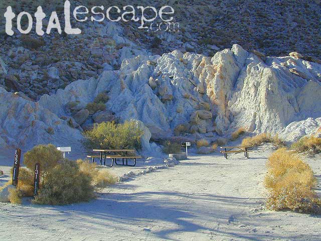
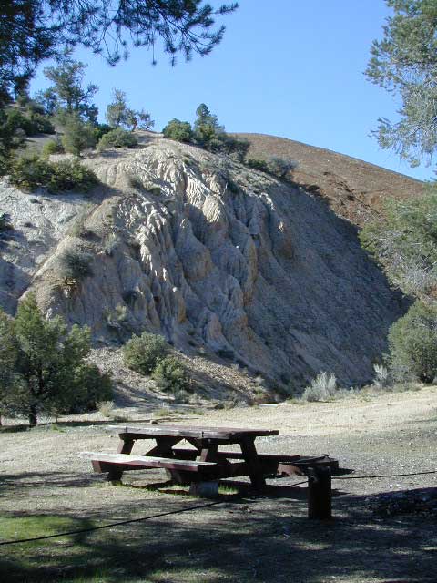
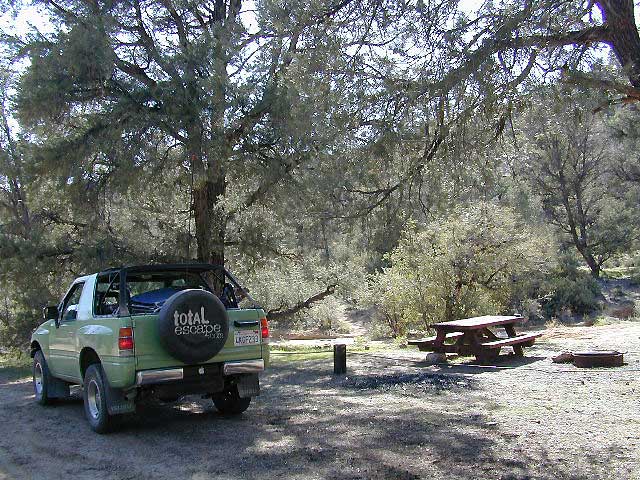
    Toad Spring Campground is located at high elevations (5700′) of Quatal Canyon, on a dirt road, half mile off the pavement of Cerro Noroeste Rd. The Chumash Wilderness, the Cuyama River Valley, Apache Saddle, Mount Abel plus the Bittercreek National Wildlife Refuge all surround this region. Los Padres National Forest meets the vineyards, orchards & farmlands, near Ventucopa. This is the badlands – 18 mile scenic dirt road, well signed at Hwy 33 & mostly graded. Quatal Cyn connects Ojai’s Highway 33 to the pinyon pine forest above near Pine Mountain Club (@ nearly a straight line?) Motorcycle dirt bikes & off-roaders dig this place. Street bikes will prefer paved Cerro Noroeste which runs the rim above to the north.

    This major dirt road is not gated at either end, but winter sometimes closes the route due to snow depth. It never stays closed very long, as some beefy 4×4 will break thru the snow berm soon enough. Top elevation @ Cerro Noreste is approximately 5500′.

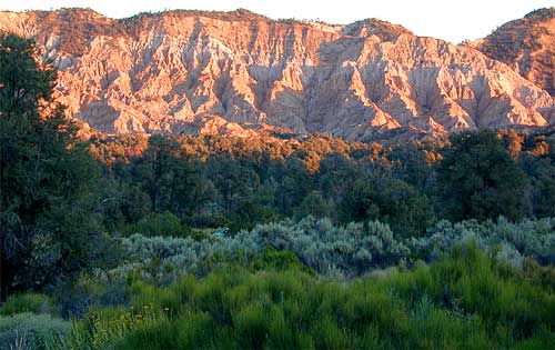
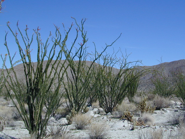
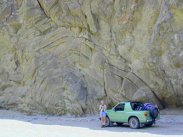
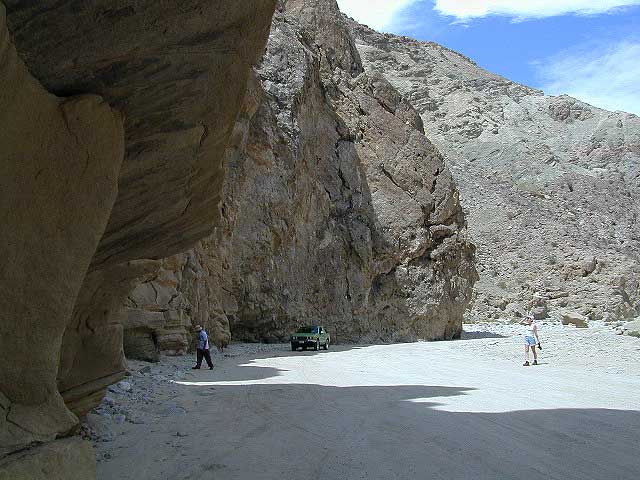
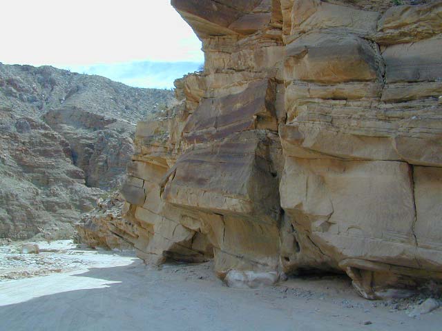
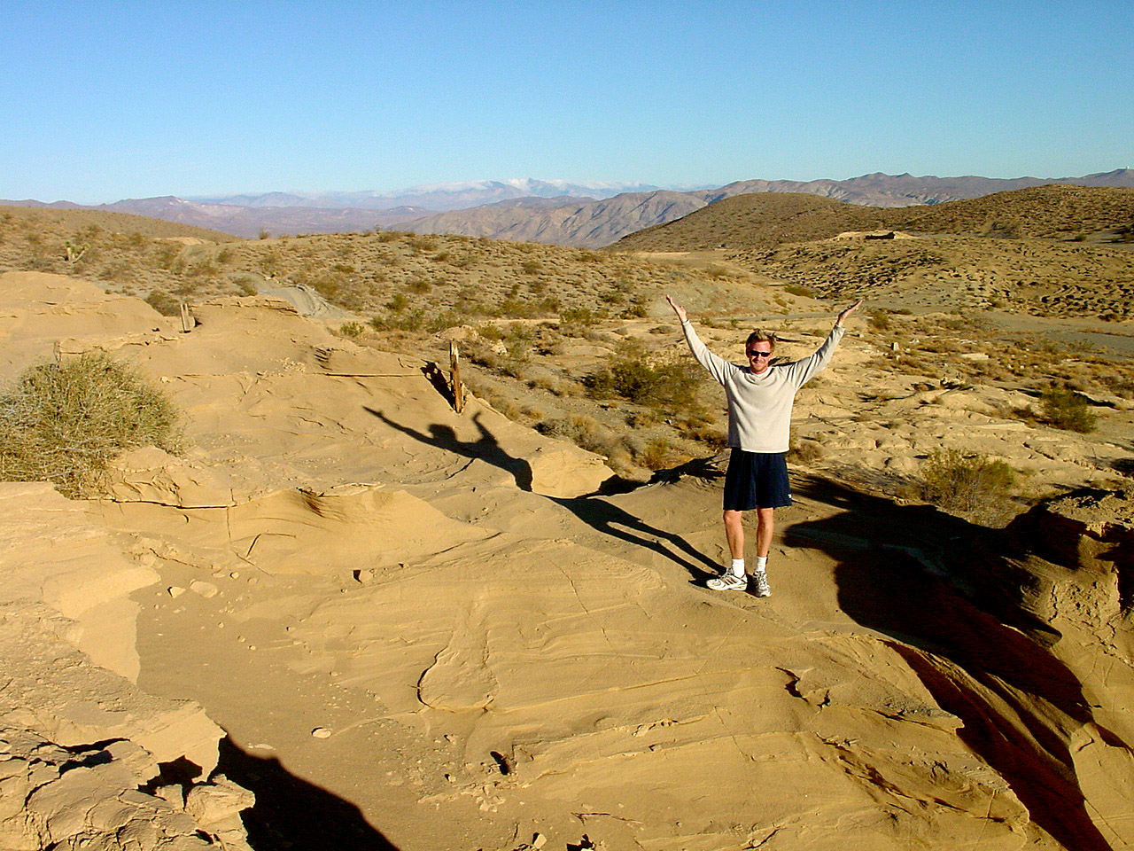
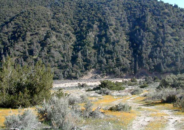
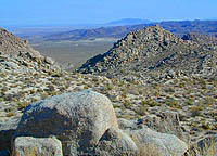
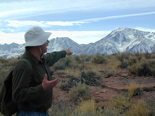
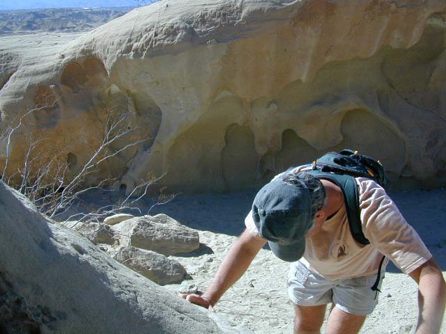
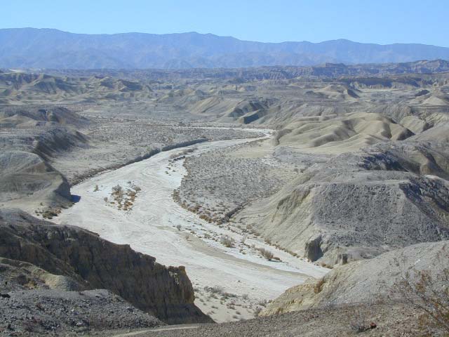
    Quatal Canyon (possible Chumash word for Snake) is a giant high desert wash, ripping down from Cerro Noroeste (aka Mt Abel). Serious erosion w/ San Andreas fault lines – make it a very interesting canyon to explore on foot, horseback, motorbike, or mountain bike. The lupine & wildflowers here are incredible in late Spring in this red dirt canyon. Both nearby mountain peaks of Mount Abel & Mount Pinos are the tallest in Kern County.

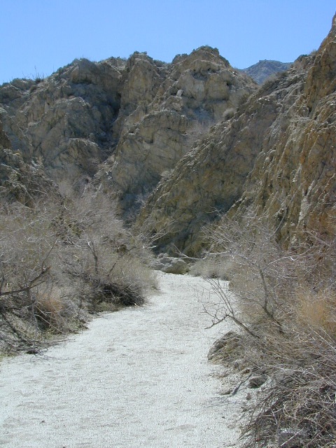
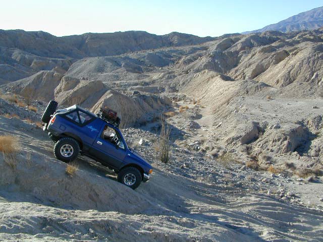
    This rugged primitive canyon gets torn up during a good storm in late summer or a big winter storm. Red dirt gets very slippery – especially on the edges of a cliff. Boulders in the road, flash floods – or no road, river of mud! 2WD passenger cars can take this route in dry months, but high clearance is usually preferred. 4×4 is needed during heavy rain or snow – which could be half the year (Nov-April). Flash flooding is possible all over Los Padres NF, so know the weather forecast in advance.

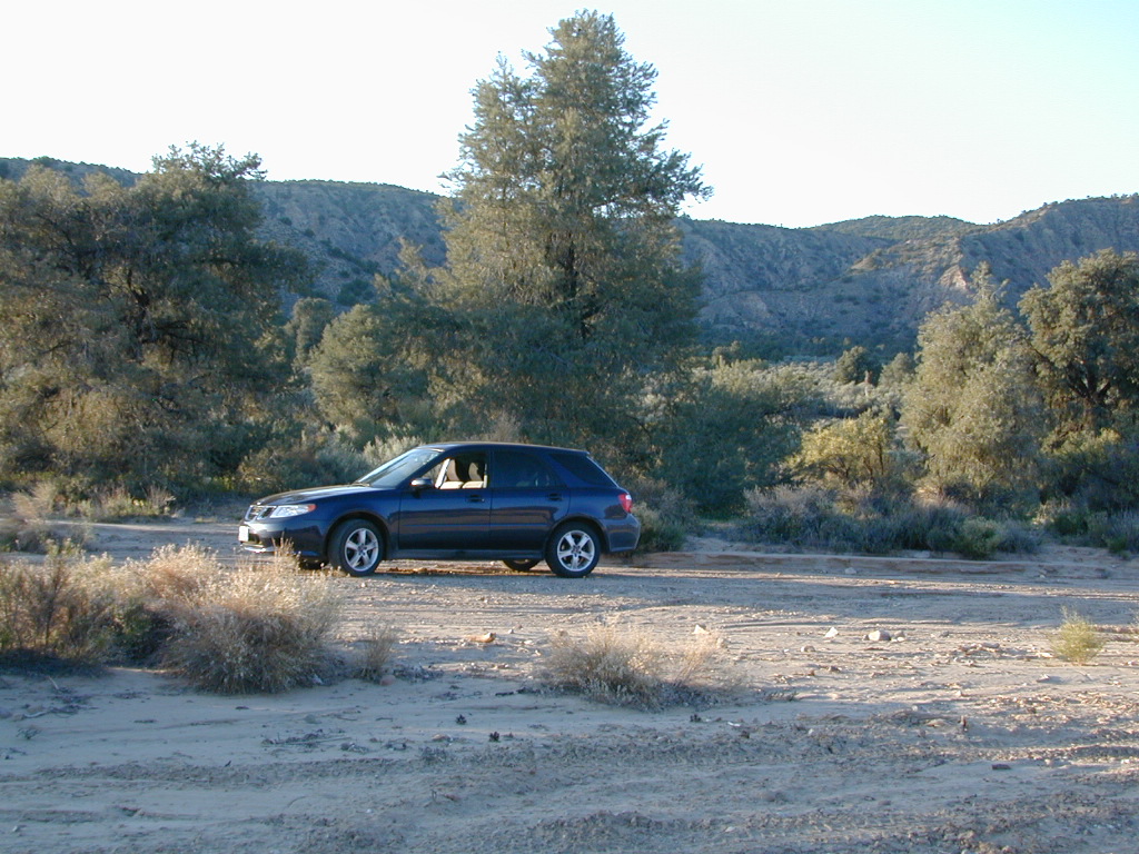
    Seen small RVs, trucks pulling trailers & even a U-haul moving truck down this way. MapQuest always amazes me where they route you. This is a graded dirt road, some of the time. MapQuest should post a ‘see Total Escape for this route’. Come on folks, if you’re traveling cross-country, while moving your residence, buy a real map to explore the National Forests of California. You may end up sleeping way out here – broken down in the moving van, in the boonies & no cell coverage, cuz you had a one page, wrinkled map in faded ink, wet & smeared. And MapQuest told you it was paved. It’s not paved 90% of the way.

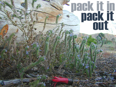
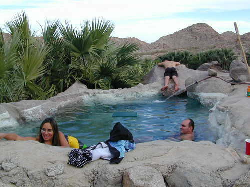
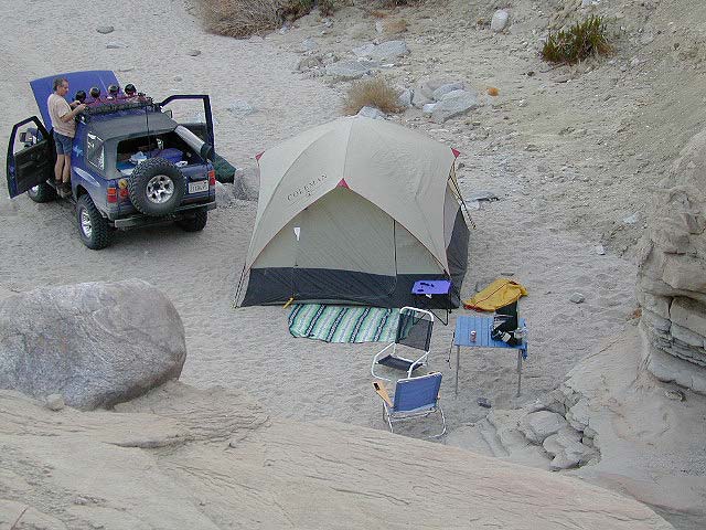
    Primitive camping is also allowed in the canyon wash or on the side routes, in certain seasons. Use an existing camp site when possible. Clean out the rock fire ring of litter & bottles, pull back all dry brush at camps & leave these places better than you found ’em. There are hundreds of dispersed campsites out here. The open wash is especially nice on a full moon hike, just bring friends – cuz it is considered “big cat country”. Camp fire restrictions are in tight control on this SoCal region. You will need a camp fire permit, a big shovel & lotsa water. Check with the Los Padres rangers to make sure. Recently Zaca Fire (2007) & the month long Day Fire (2006) both came very close to this precious sanctuary.

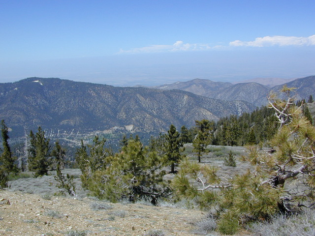
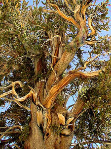
    The high desert terrain is pinyon forest, with yucca & manzanita. The eroded cliffs of red rock, white & orange hues, glow best during the clearest sunsets. You will almost think your in Utah, until you get up on a ridge & see the smog in the Central Valley of California.

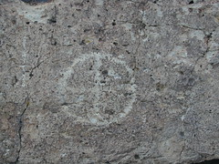
    Mahu Tasen, a Native American camp and sweat lodge, has ceremonial grounds in a canyon off of Quatal. There is also a large rock quarry mining operation, as well as numerous wineries and ranches along this route. Several private residences too.

    Ballinger Canyon OHV Park is close by, 5 miles N on Hwy 33

    Carrizo Plain National Monument is also pretty close, N off Hwy 166

    towns nearby –

    PINE MOUNTAIN CA

    MARICOPA CA

    VENTUCOPA CA

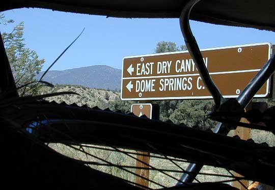
    helpful maps of the region –

    Quatal Chumash Lands

    CA Nevada

    California – Nevada
    Ancient Bristlecone Pine

    The name Nevada originates from a Spanish word meaning “snow-covered”.
    Nevada is located in the desert just east of California.

    California state has many places with Nevada in the name:

    Sierra Nevada Mountains – the backbone of the state, alpine mountains running vertically through CA

    Nevada City, CA

    Nevada County inside California

    Death Valley National Park borders the state of Nevada

    The Mojave desert occupies a significant portion of southeastern California and smaller parts of central California, southern Nevada, southwestern Utah and northwestern Arizona.
    http://en.wikipedia.org/wiki/Mojave_Desert

    Mojave National Preserve between Interstate 40 & Interstate 15 is on the way to Nevada.

    The Eastern Sierra mountain range faces the east toward Nevada.
    Inyo National Forest are the maps you will need to explore this area.

    Lake Tahoe sits right on the border of California & Nevada
    Topaz Lake, along Hwy 395, also is halfway inside of NV

    Ancient Bristlecone Pine Forest, the oldest trees in the whole wide world, are adjacent to Nevada & part of the circle that encompasses the Great Basin

    Toiyabe National Forest is located both in CA & NV

    The ghost town Bodie has back roads that lead over to Nevada

    Recent Earthquakes in California and Nevada

    Lyrid Meteor Shower

    Anza Borrego DesertsThis annual meteor shower peaks in late April, one of the few shooting star shows in the Springtime. Look in the east part of the nights sky for the grazers or shootings stars, up to 12 per hour. Pre-dawn viewing is always best for meteor showers. Most deserts are prime star gazing spots. Spring blooms
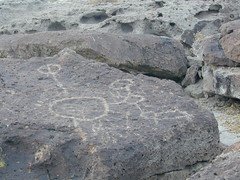
 wildflowers in the California deserts at this time of year.

    This photos is taken at the heights of Mortero Canyon Wash in the southern portion of Anza Borrego Desert State Park. County Road S2 leads out to some great back road camping options. Morterro Wash has big boulder campsites – back behind the abandon rail road tracks. These desert dirt roads are not recommended for RV or motorhome travel. Deep sand is common. Passenger cars can make it – if they do not slow or stop in the soft sandy spots.

    Annual event; April

    How to best view a Meteor Shower

    California Desert Destinations
    California Desert Camping
    California Hot Springs Resorts

    CURRENT MOON

    Fish Slough

    On the north end of Bishop CA, running parallel to & on the west side of Hwy 6, is a long dirt road called Fish Slough Rd. Indian petroglyphs can be found out here & also on the ridges along Chalk Bluff Rd (to the south). The entire region is called a volcanic tableland & hot springs are very common in this region. The Owens River Gorge & Lake Crowley are to the west. High clearance vehicles are recommended for traveling these back roads, but 4×4 is rarely needed.

    Read & see more on Fish Slough Petroglyphs

    BISHOP CA

    LAKE CROWLEY

    BENTON HOT SPRINGS

    Visit Hwy 395 Hot Springs

    Indian Art Eastern Sierra

    Fish Slough

    Dave Explains