Category Archives: Backpacking

Horse Canyon

Horse Canyon Mojave

Horse Canyon California

Southern Sierra / Mojave Road SC 65

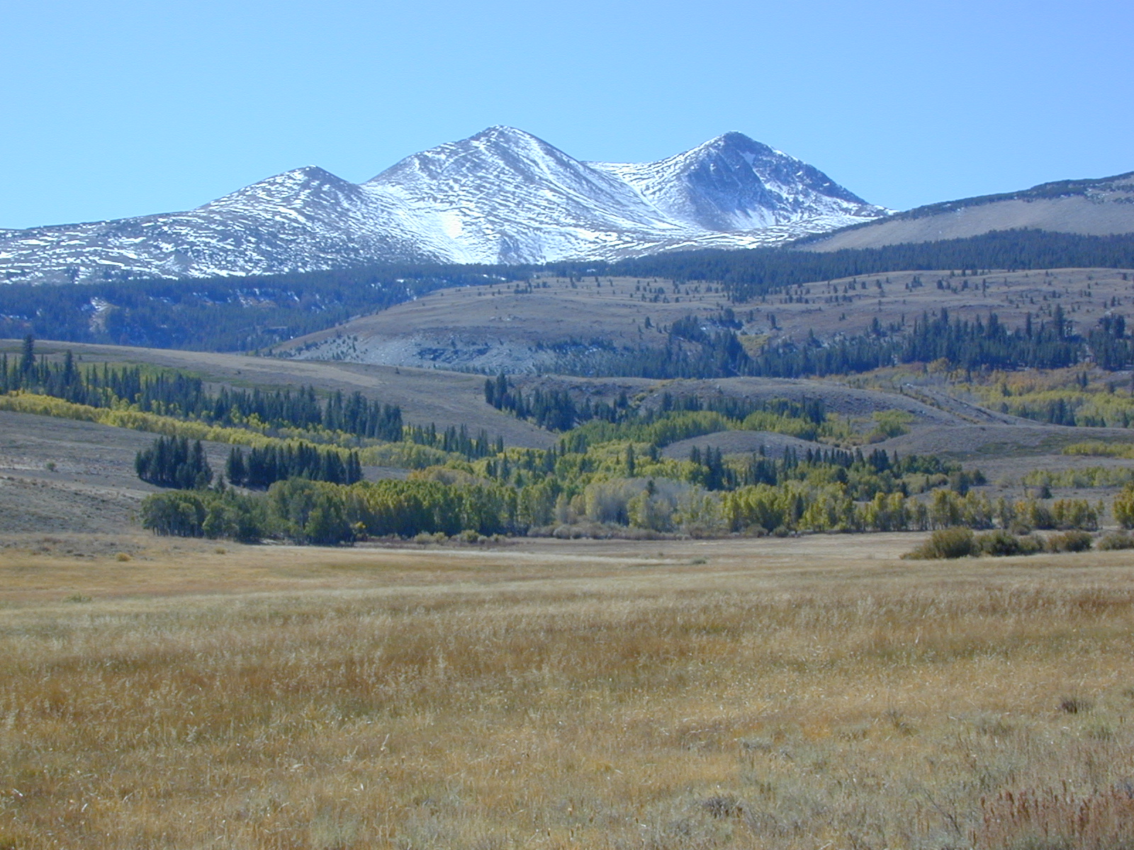
Mojave Desert meets the Sierra Nevada Mountains
North Highway 14

North of Mojave, CA
North of Red Rock State Park
North of Jawbone Canyon

South of south of US Hwy 395, south of jct Hwy 178

backroads BLM camping desert roads hiking PCT mountain bike jeep roads primitive camp

elevation: 3000′-7000′

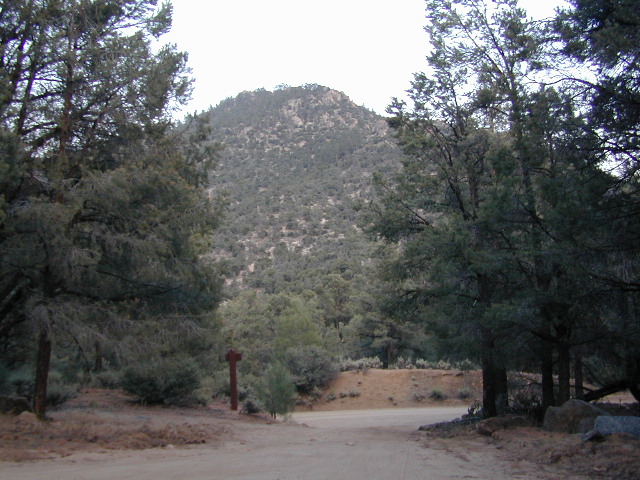
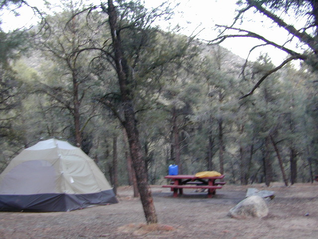
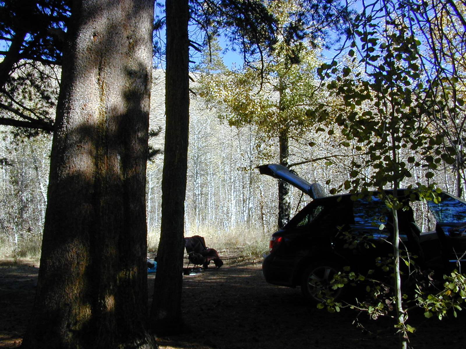
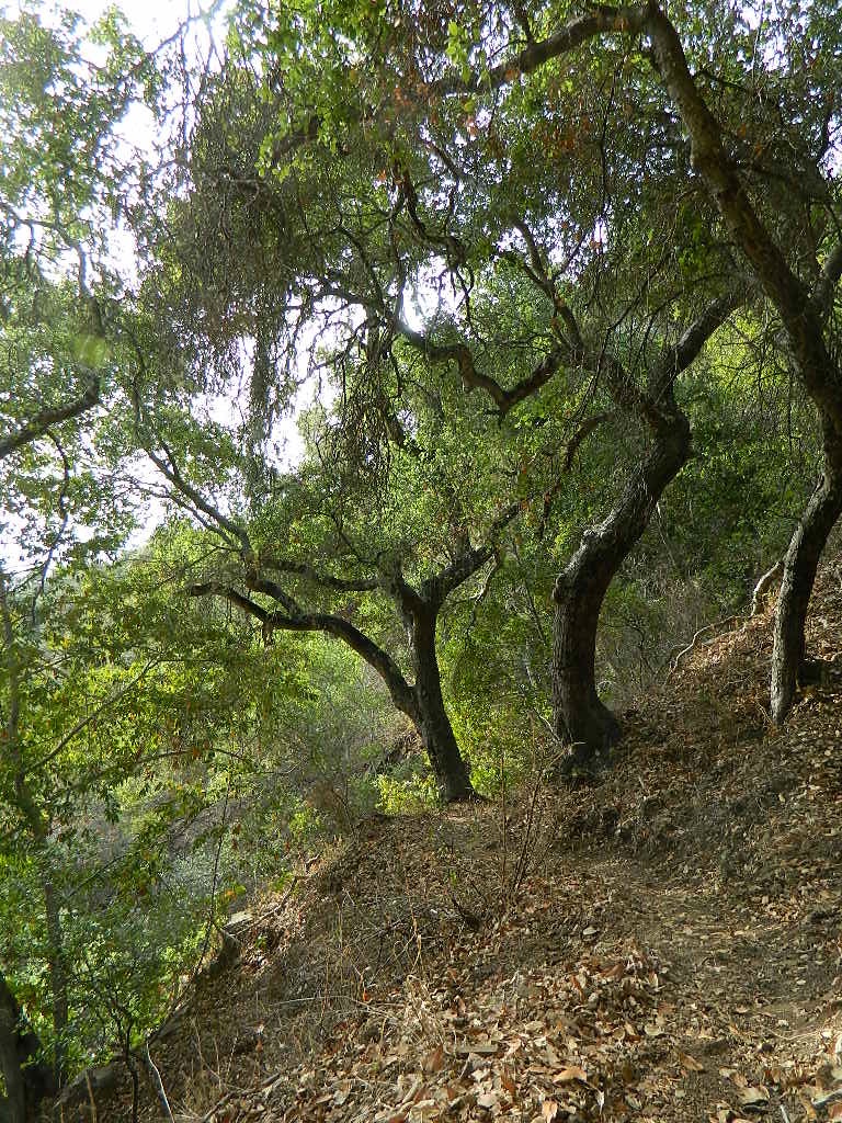
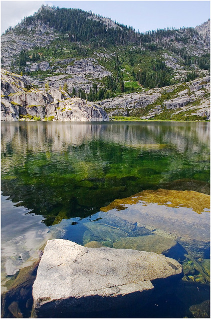
Horse Canyon is a dirt road up a high desert canyon, with joshua trees and wash outs. 7000′ elevation pinyon pine ridges above w/ PCT.

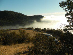
Most would say the see a whole-lotta-nothingness out here in these deserts…. when they zoom by at 70 mph on the blacktop highway.

at Total Escape, we beg to differ.

Solo Driver SUV

Intersection on Hwy 14 @ SC 65, dirt route will travel west into the mountains. Initial desert road follows Little Dixie Wash, but veers north up to Horse Canyon and the higher forested ridges.

Horse Cyn is a scenic, desert, dirt road that becomes a rugged 4×4 trail the higher it climbs in the canyon. The route traverses a ridge line and dead ends at the old cabin; No through route, no loop. The PCT continues on to the Walker Pass @ the 178.

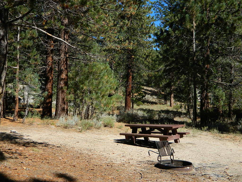
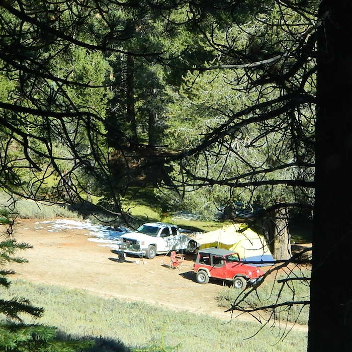
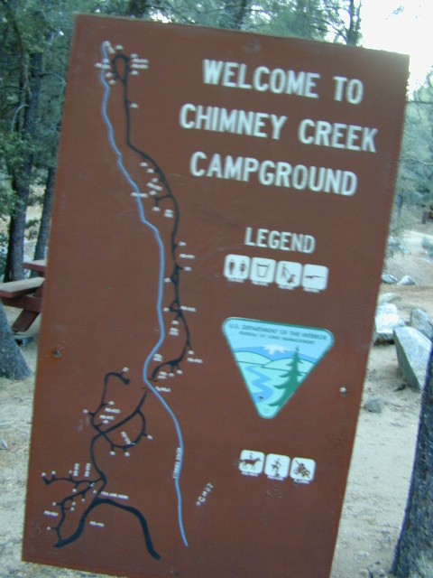
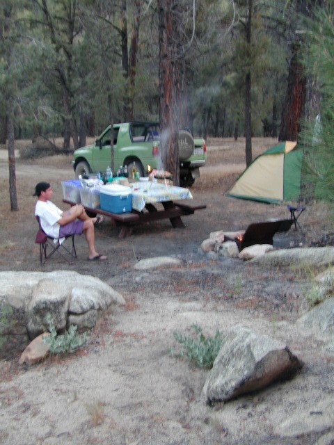
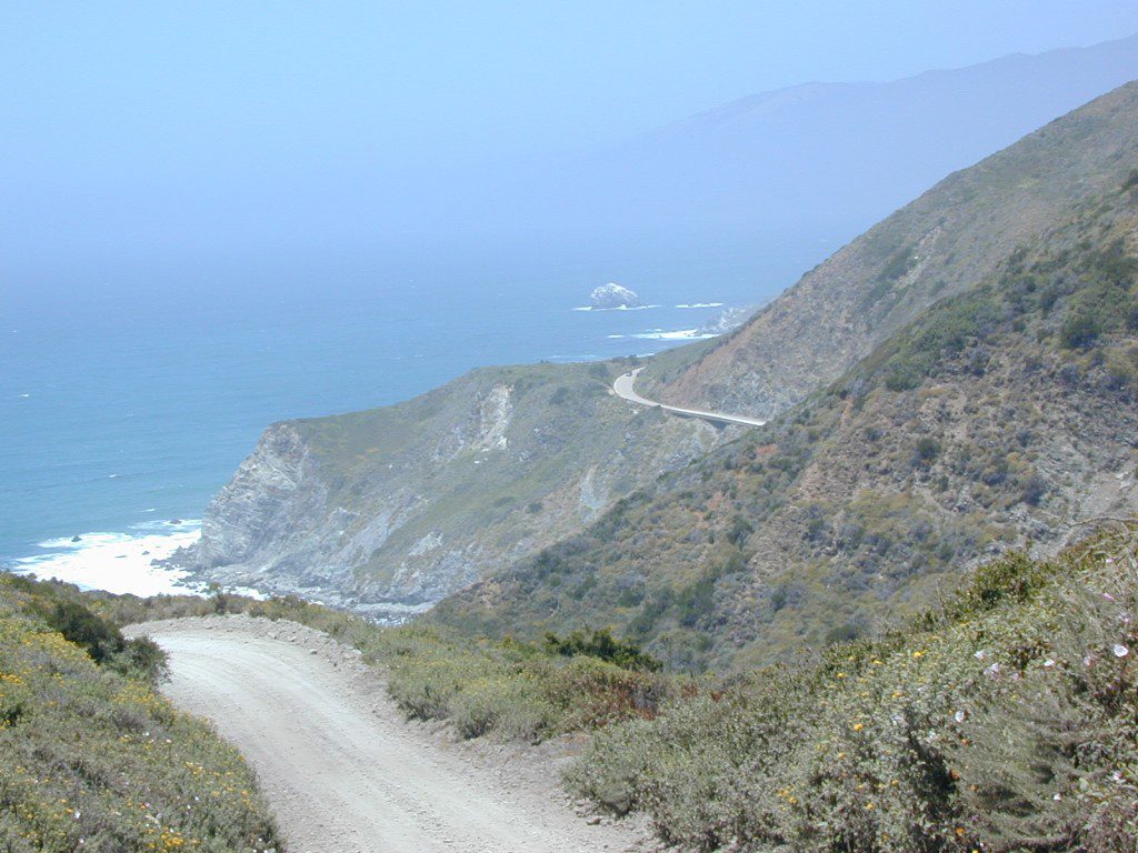
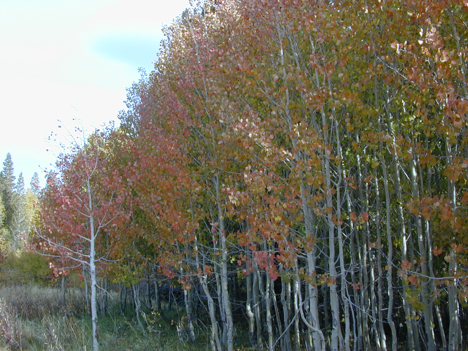
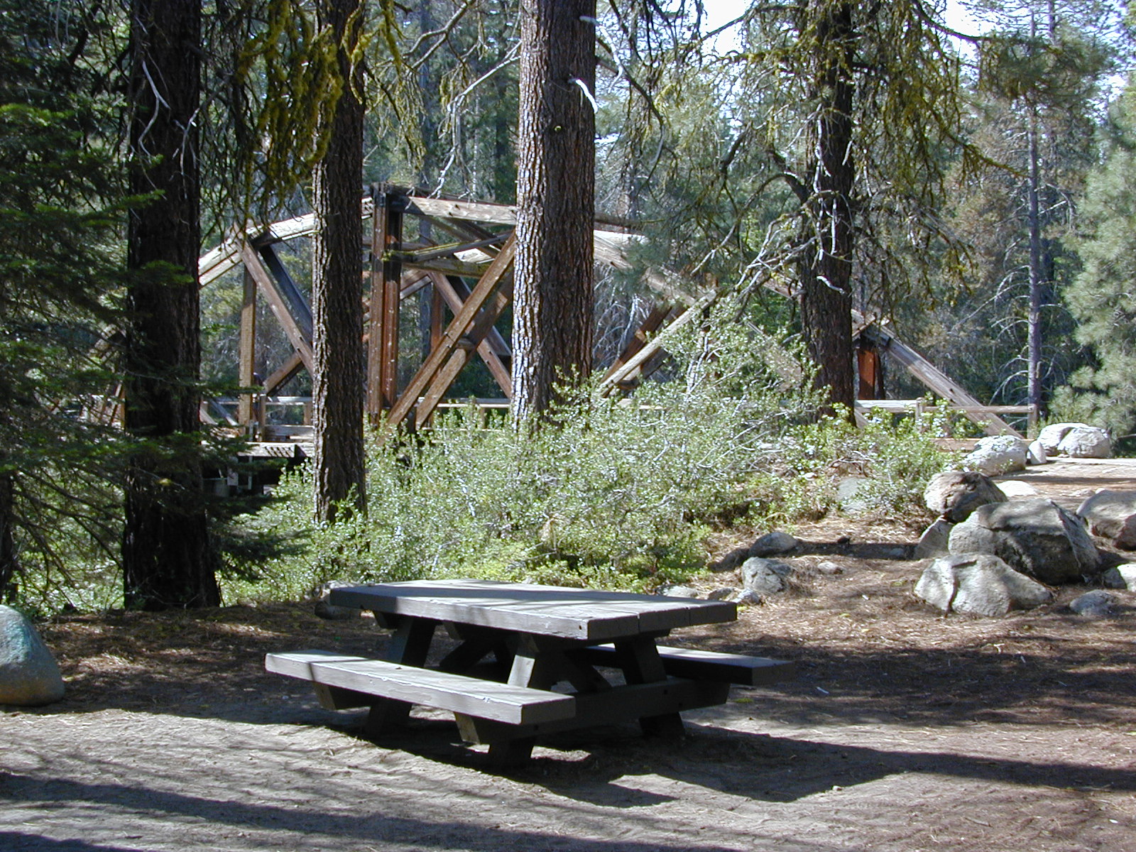
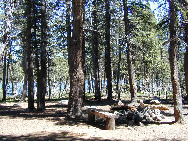
The lower Horse Canyon is area quite accessible by standard truck or SUV. High clearance is recommended out on these kinda roads. Vegetation is quite sparse at first, but improves with the miles traveled. Wildflowers can be awesome, usually April-June. Picnic spots everywhere; primitive camping sites can be found out here, off the main dirt road. Please reuse existing camp sites when possible.

wheelin pals

Passenger cars may attempt this, but should watch for unexpected deep dips and rocks, washed out in the road. (No tow service in the middle of nowhere). Road conditions do change with the seasons out in the boonies. Cell phone reception could be spotty back in the deepest of canyons.

PCT
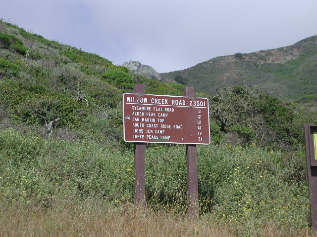
PCT trail access: Pacific Crest Trail follows this ridge road for miles. They call this range the SCODIE Mountains; Old cabin at the end of the road.

cabin mcivers

Sage Canyon and Cow Heaven Canyon are both to the north, along with Freeman Canyon (CA SR 178). Bird Spring and Dove Spring Canyons are both to the south, along with the most popular regions of Red Rock State Park and the Jawbone OHV area.

nearby towns:

INYOKERN, CA
LAKE ISABELLA, CA
MOJAVE, CA
RANDSBURG, CA
RIDGECREST, CA

joshuacanyons

Horse Meadow Campground

Kern Meadows Camping

Horse Meadow Campground

Salmon Creek, Kern Plateau –
Sequoia National Forest

horse camping National Forest Camps Mountain Biking Kern Hikes fish Trailer access camping
Looking to stay away from the masses camping at the Kern River?

Horse Meadow Campground can be found on the east side of the Kern River, up on the Kern Plateau. Up the infamous, steep and rugged Shermans Pass Road. How exciting!

Steep Grades

Climb the hill slowly and cautiously, no guardrails. Up the grade, Shermans eastbound – out of the dryness of the Kern canyon. Find Cherry Hill Road, that is also the Big Meadow turn off: Forest Road# 22S12, a long, narrow dirt road leads from paved Shermans Pass Road, 10 miles out to this ideal campground. Far enough off the main road, so you won’t see much of a crowd out here.

22s05 sherman pass

Hunters, horse campers and hikers really like this spot. Mountain bikers are known to frequent the region as well. Forest, meadows, trails, creeks, nature, all around. Dome Land Wilderness is close by; Waterfalls hikes, swimming holes, viewpoints. Fishing, hunting, horseback trails. Dirt roads and single track trails all over – all within the vicinity of Big Meadow.

Kern Meadows Camping

From the main Rd #22S12, the camp access road #23S08 will lead out to the NFS Campground – HORSE MEADOW. Located at higher elevation forests – 3000′ feet higher than the Kern River!

Nice forested, high country camp spots in a developed campground. The long, access road is worth it for all the scenery and seclusion. Vault toilets, piped water, maybe a small fee. Open summer into autumn, closes for winter months.

Horse Meadow Campground

• Elevation: 7600′
• Number of Sites: 41
• Vehicle Access: RV 23′ max
• Campsites Reservation: No
• Camp Fee: Yes
• Length of Stay: 14 Days
• Season: June – November
• Trailheads: Salmon Creek

33e36trailhead
Developed Campground @ Salmon Creek Trail #33E36. Hiking trailheads lead off to various destinations like, Salmon Creek Falls, Big Meadow, Cannel Meadows and Dome Lands.

Sequoia Kern Map

Sunny Campsite

SUMMERTIME: If you are coming in from Kennedy Meadows on the EAST (or the Mojave desert US 395) – first verify that the Sherman Pass is OPEN for through traffic. Ask road conditions with local rangers ahead of time. ANY amount of snow will close this whole paved route for the winter season, up until June sometimes.

Over 30 miles (one way) to the nearest general store for supplies. Pack ‘block ice’ in the cooler, instead of cubes.

nearby towns:
Fairview
Kennedy Meadows
Kernville
Lake Isabella
Mojave

Big Meadow is closeby. Check it out!

Big Meadow Kern

22S12 – Sequoia NF

open camping

Big Meadow: Forest Road# 22S12 – Sequoia National Forest

Take Sierra Hwy. N of Kernville, past Fairview & over the Johnsondale bridge; Right turn on Sherman’s Pass Road & drive up to a signed intersection (near a snow gate). NOTE: This area may not be accessible during winter months.

Turn right on Big Meadow Road, aka Forest Service Rd# 22S12. This is a very long road which is paved for the first few miles. 22S12 becomes a graded dirt road, suitable for horse trailers; it forks off to other smaller dirt roads, as it progresses through the forests & dead ends back by Cannell Meadow. The main routes are passenger car accessible, but some of the smaller dirt roads can get quite bumpy. A truck or SUV would be advisable to explore these secondary routes. Certain areas have suffered from wildfires 2000-2002.

Big Meadow Sequoia

Horses & equestrian camping are very popular in this region. There is also a fair amount of backpackers heading into the Domeland Wilderness and mountain bikers looking for premium backcountry rides, away from the crowds at the Kern River.

NFS developed Horse Meadow Campground can be found on the right via road# 23S08. Located at 7400′ elevation w/ 41 spots, in the forest. Trailhead to Salmon Creek leads directly from camp.

SPUR – side routes include:

  • #23S14 Cherry Hill – a few camp spots near creek & a meadow with views at the very end
  • #23S41 Poison Meadow
  • #23S13 Salmon Creek
  • #22S07 Big Meadow – loop road around the “Big Meadow”. Plenty of primitive camp sites around Big Meadow, but they are the first ones to fill up during a popular summer weekend. The region is perfect for backpackers or day hikers wanting to access Manter Mdw. & the Domelands Wilderness.
  • #24S13 feeds the last stretch of road to Rattlesnake Meadow. Taylor Creek near 24S43, features numerous waterfalls leading to the South Fork of the Kern River
  • #24S12 Cannell Meadow & Pine Flat. The Cannell Meadow National Recreation Trail runs thru here, from Big Meadow down to Kernville, CA.

North Meadow

Sequoia National Forest

Sequoia National Forest MAP

DOME LAND Wilderness MAP

Nearby towns include:

Long Valley Campground

Secluded Camp Sites

Long Valley Campground BLM

Southern Sierra Nevada
secluded camp, fishing & hiking trails
(free campground, open all year long)

South Fork of Kern River & DomeLand Wilderness

20+ miles from the nearest paved road; a remote camp on Long Valley Loop Road, off Canebrake Road. Both are dirt roads: high clearance vehicle recommended!

High Desert meets the Sierra Mountains

Back in the dry pinyon hills east of Kernville, beyond Sherman’s Pass; high above the Mojave desert and north of Canebrake & Highway 178. Long dirt roads, remote campground w/ fishing & hiking trails. Wilderness access.

hiking fishing trails horse trails back roads back roads sierra mountains

Chimney Peak Back Country Byway
Canebrake, California

These dirt back roads listed above skirt the edge of Dome Land Wilderness & Sequoia National Forest winding through BLM Land bordering the Mojave. The byway networks recreation areas between Kennedy Meadows and Canebrake, east of Lake Isabella. Eastern Kern County, California.

backpacking
camping
fishing
hiking
horseback trails
mountain biking
rock climbing
stargazing
wildflowers

Trailheads Domeland

People come way out here for the seclusion – the peace & the quiet. Mid-week you can have the whole place to yourself. Abundant hiking trails & fishing access. Into the Dome Land Wilderness you will find incredible scenery and diverse terrain – giant granite domes, waterfall canyons, and the South Fork of the Kern River (3 mi hike to river). PCTThe infamous Pacific Crest Trail passes close to Long Valley Campground, but Chimney Creek Campground is much closer to the PCT.

BLM Camping

Long Valley Campground

• Elevation: 5200′
• Number of Sites: 13
• Vehicle Accessibility: High Clearance Vehicle
• Facilities: picnic tables, fire rings, vault toilet
• Campsites Reservation: No
• Camp Fee: None
• Length of Stay: 14 Days
• Season: Open all year
• Operated by: BLM
• Trailheads: S. Fork Kern River & Domeland Wilderness

Bureau of Land Management
BLM Bakersfield Field Office
661-391-6000
Find a BLM page w/ map & info

Recent Domeland Wild Fires:
Manter Fire (2000)
McNally Fire (2002)

Long Valley Loop
Long Valley Loop Road (2001)

2016 NOTE: The part of the LOOP of Long Valley Loop Road that connects this campground to Kennedy Meadows (to the north) is CLOSED due to a huge washout. The Long Valley campground is accessible from the south side, from Hwy 178 @ Canebrake – and requires many miles of dirt road driving. High clearance vehicles are recommended; 4×4 needed in wet weather or snow.

towns nearby:

CANEBRAKE
KENNEDY MEADOWS
KERNVILLE
LAKE ISABELLA
MOJAVE

High Desert Sagebrush
High Desert Sagebrush & Dirt Roads
Wildfire Burn
Manter Wildfire Burn Area (2001)

Chimney Creek Campground

campmap

Chimney Creek Campground
BLM Kern / Mojave

High mountain desert camp is mislabeled on some maps as “Chimney Peak Campground” or “Chimney Rock Campground”. Pinyon pine forest on Chimney Creek, near hiking trailheads, wildflowers and Chimney Peak Wilderness. Southern Sierra ridge near Mojave Desert and California SR 178.

peakpinyons

Canebrake Road is a graded dirt road that makes up part of Chimney Peak Back Country Byway. This rural route is a major graded dirt road located north of Highway 178 – which connects Canebrake to Long Valley up near Kennedy Meadows. Pacific Crest Trail passes next to this campground in the Southern Sierra mountains. The campground turn off is way east of Lake Isabella Hwy 178 is (near Walker Pass & PCT) and follow dirt road north to Kennedy Meadows in the far eastern reaches of Sequoia National Forest

Chimney Peak BLM
• Elevation: 5,700′
• Number of Sites: 32
• Camping Reservations: No
• Sites Available: First come, First serve
• Vehicle Accessibility: RV limit 28′ max
• Length of Stay: 14 Days
• Water: Piped (April – Sept)
• Toilet: Vault
• Season: Open all year
• Fee: No
• Operated By: BLM
• Closest Town: Lake Isabella, CA

Bureau of Land Management
BLM Bakersfield Ranger Station
661-391-6000

Lamont Peak
Lamont Peak – elev 7510′

nearby destinations –
Camp Kern Backroads

Chimney Peak Wilderness
Lamont Peak
Long Valley Campground
Dome Land Wilderness
Owens Peak Wilderness
Jawbone Canyon
Sequoia National Forest
Sacatar Trail Wilderness
Kiavah Wilderness
Kennedy Meadows
Lake Isabella
Kern River
Monache Meadows


View Chimney Creek Campground in a larger map

Sawmill Lake Sierra

primitive camp spots

Sawmill Lake, California


N of Donner Pass, Sierra Nevada

elevation 5800′Canyon Creek connects Lake Faucherie, Sawmill Lake and Bowman Reservoir in the Sierra, Tahoe National Forest. 20+ miles of backroad travel, off I-80.

While many consider Faucherie to be the most beautiful scenic lake, Sawmill Lake just downstream a couple of miles is still quite attractive – with dense forests and a granite mountain backdrop. Sawmill is especially nice for those who like to primitive camp, ouside of developed campgrounds. Way off the interstate @ Hwy 20, tucked in way back behind Bowman Lake a few miles, you can find Sawmill Lake.

Sawmill Lake California

Fishing and camping, kayaking and canoeing are all popular recreation around this lake. A trailhead on the northend of the lake leads out to even more alpine lakes (a day hike “lake loop” or backpacking option). The Pacific Crest Trail is also routed nearby.

No motorized boats or watercraft allowed. No boat ramps, no pavement, no picnic tables, no bathrooms, no fees.

4×4 Lake
Fishing Lake
Free Camping Lake

The north shoreline is abundant with dispersed campsites: metal fire rings and a clearing only; no picnic tables, no toilets. Self sufficient campers only. Campfire permits, a water bucket and a shovel are required. During extreme fire restrictions campfires may not be allowed. Check with local rangers for up to date info.

Tahoe National Forest
Truckee Ranger Station
530-587-3558

National Forest Lake & Forest Lake Fishing Kayak lake hiking lake

Most campsites are drive up and park, while others closer to the shoreline have only walk-in access. Hauling your gear down hill won’t seem unthinkable once you’ve seen the lakeside views. There is even a camp below the dam, next to the waterfall.

waterfallfromdam

The main access Road #843-037 is very rocky and 4x4s love to frequent the area. The backroads here are best suite for truck travel, high clearance vehicles, off-roaders and SUVs. No small RVs or trailers. Passenger cars are not recommended. The access roads around the lake and up to the lake are dusty and rugged. The road below the dam is quite rough w/ rocks.

For more driving details, please see entry on Canyon Creek Campground.

road at dam
The water at Sawmill Lake is crystal clear snowmelt. The lakes around here are managed by Nevada Irrigation District, so this is why there are no engines allowed on the lake. This canyon area closes to public entry during winter months (NOV-APRIL), due to deep snow.

clear water

Faucherie Lake

Faucherie Kayak Camp

Faucherie Lake California

Lake Faucherie is set in spectacular scenery of granite mountains, with peaks and waterfalls all around. Many believe that you could only reach this kinda high elevation beauty by foot, with a backpack, but here it is – accessible by a very long, rough & rocky backroad.

No motorhomes, no camper trailers, no motorboats, no engine noises on the lake, no big families. Just well-deserved solitude, finally. Peace and quiet!

Perfect alpine lake for car-top boaters – those who carry their boats on top of a vehicle. But be warned very few ‘passenger cars’ make it back this far, due to the challenging roads.

BACKPACKING, CAMPING, CANOEING, FISHING, FLOATING, HIKING, KAYAKING, OFF-ROADING, SOAKING, STARGAZING, SWIMMING

No motorized boats or watercraft allowed. One public boat ramp; gravel parking area, vault toilets, gated entry for group campground. No more driving across dam (it is now gated).

NFS NFS NFS kayak camp hiking mountains NFS backroads snowmelt stars

Faucherie Lake Road – a spur road, off of the ‘843 Road’ leads up to both Sawmill & Faucherie Lakes, as well as the Canyon Creek Campground.

This primitive road forks off at Jackson Creek Campground, Tahoe NF, way, way back behind Bowman Lake. The rugged route is also known as Nevada County Rd #843-037. Conflicting numbers appear on USDA web site for this route, so don’t get confused.

The brown Forest Service signage is decent at Jackson Creek Campground – so if you get that far, you’re almost there. Sorta. Did I mention how crazy the road is? Any wet weather or snow will make this route “4×4 required”. This place is closed off about half the year, due to deep snow (NOV-MAY). Although on summer weekends, this area is busy for a remote high Sierra lakes region.

To reach this rugged Canyon Creek takes hours of driving with a good backcountry map and a reliable, high clearance rig. AWD Subies and mini SUVs beware, you’ll need a spotter on the bad sections of this road (or risk serious oil pan damage). Or perhaps maybe, we “shouldn’t be back on these kinda roads in that ‘lil sportwagon’ missy.”

See more details on driving directions for Canyon Creek Campground.

Crystal Clear Faucherie

Faucherie Lake Group Campground
(25 people maximum per site)

• Elevation: 6135′
• Number of Sites: 2
• Vehicle Access: High Clearance Vehicle, no trailers
• Campsites Reservation: Yes
• Camp Fee: Yes
• Season: June – October
• Trailheads: Faucherie Lake Falls, Five Lakes Basin, French Lake, Haystack Mountain

camp
Faucherie Group Camping

Campground Reservations:
Nevada Irrigation District
530-265-5302

incoming flow

Faucherie Falls – Six waterfalls above lake:
Upper Faucherie Lake Falls #1: 39.4257 N, 120.5616 W
Upper Faucherie Lake Falls #2: 39.4257 N, 120.5606 W
Upper Faucherie Lake Falls #3: 39.4262 N, 120.5568 W
Upper Faucherie Lake Falls #4: 39.4268 N, 120.5550 W
Upper Faucherie Lake Falls #5: 39.4270 N, 120.5544 W
Upper Faucherie Lake Falls #6: 39.4272 N, 120.5538 W
USGS Topo: English Mountain

Granite Faucherie

Bucks Lake Wilderness

DSCN0237

Bucks Lake Wilderness Area

Bucks Lake, California
Plumas National Forest

topo mapIn the hills and canyons above Chico many wonders can be found. North Sierra Nevada mountains, medium sized recreation lake surrounded by lush forest; N of Lake Oroville and S of Lake Almanor. North Fork Feather River canyon forms the northern boundary to this designated Wilderness Area. The area is popular with backpackers and PCT hikers, as well as equestrian and the region has over a dozen campgrounds. Backcountry terrain includes an impressive 6 mile long canyon wall.

camp Bucks Lake Campgrounds

hotels Bucks Lake Lodging

The popular boating destination, Bucks Lake reservoir, is just outside the wilderness boundary, which makes for an excellent destination for day hikes. Boating, fishing, backpacking, hiking, camping, canoeing, kayaking, rock climbing, snowmobiling and mountain biking are just some of the outdoor recreation in the area. This Wilderness region features a Silver Lake and Gold Lake, as well as numerous other small, unheard-of lakes. A few can be accessed by vehicle, but more than half are hike-in only lakes.

  • backpacking
  • boating
  • cabin rentals
  • camping
  • canoeing
  • fishing
  • floating
  • hiking
  • kayaking
  • sailing
  • swimming
  • Bucks Lake Wilderness
    23,958 acres
    5200′ elevation at Bucks Lake

    Alpine wilderness, mountain peaks, hiking trails, PCT trailheads, numerous small lakes, plus large recreational fishing lake

    Bald Eagle Mountain – 7183′
    Bucks Mountain Peak – 6819′
    Mount Pleasant – 7067′

    Small lakes around the Bucks Lake Wilderness Area

    Bald Eagle Lake
    Blue Lake
    Cape Lake
    Gold Lake
    Grassy Lakes
    Jacks Meadow Pond
    Kellogg Lake
    Lost Lake
    Mud Lake
    Rock Lake
    Silver Lake
    Snake Lake
    Smith Lake
    Thompson Lake
    Three Lakes
    Upper Mud Lake

    regional maps –

    nearby towns –
    Berry Creek, CA
    Meadow Valley, CA
    Quincy, CA
    Chico, CA
    Oroville, CA

    lodge and cabins
    historic lodge burnt down, but they rebuilt and are re-opened again

    DSCN0242

    more info –

    Bucks Lake Trailheads (PDF)
    BucksLake.net
    Bucks Lake Fire Dept
    Bucks Lake Wilderness Wiki


    View Larger Map

    Maxson Trailhead

    If you are a backpacker wanting to easily access the John Muir Wilderness, the paved parking area of Maxson is the trail head for you. The Courtright Reservoir is located at over 8000′ elevation, w/ granite domes & alpine scenery all around. This place is way back behind Dinkey Creek, past the McKinley Sequoia Grove inside a deep granite gorge. The Sierra National Forest is the region, which is south of Yosemite National Park. The paved route is a long one from Shaver Lake, via Dinkey Creek Road, but the rewards are great. An all day adventure and a side trip not to be rushed.

    Warning: You could spend a whole day just driving & sightseeing in this area! Meadows, wildflowers, dirt roads, trails, Big Creek, McKinley Grove of Sequoias, Wishon Reservoir, the list goes on. All the way out to the Wilderness boundary, Courtright Lake is not a quick or easy drive.

    The hikers trailhead is located at the end of Courtright Rd. Cross over the big dam to the right & drive approx one mile; look for signs on the right side of the road. There are minimal areas to set camp at this granite , windswept face. Good luck getting a tent stake in the ground. Rock rules here. There are a few developed Campgrounds on the opposite side of the lake which may be a better choice for car camping. This Maxson parking lot is primarily for backpackers.john muir maps

    nearby locales –

    maps of this Sierra region –


    View Larger Map

    Dusy Ershim 4×4 route start right here too – on the opposite side of the road. It’s second only to the Rubicon Trail, as far as High Sierra rocks & terrain.

    Rock Climbers also love this spot for the granite domes & walls. Hiking all the way around this lake is a full day trip, with lunch and sightseeing stops. A pleasure not to be rushed.

    dusy ershim

    Trinity Alps Camping

    Trinity Alps Wilderness Campgrounds

    Northern California Camping
    Shasta Trinity National Forest

    Trinity Alps Wilderness

    camp


    • backpacking
    • camping
    • fishing spots
    • floating
    • hiking
    • hunting
    • kayaking
    • mountain biking
    • off-roading
    • soaking
    • swimming holes
    • tubing
    • stargazing

    trinitydetail

    campgrounds near Trinity trailheads –

    camping Highway 3
    (California State Route 3):

    • Horse Flat Campground, near Eagle Creek trailhead
    • Eagle Creek Campground @ Hwy, near Stoddard Lake & Eagle Creek trailhead
    • Goldfield Campground, near Boulder Creek trailhead
    • Big Flat Campground (via Coffee Creek Road #104)
    • Preacher Meadow Campground @ Hwy, near Swift Creek trailhead

    camping Highway 299
    (California State Route 299):

    • Ripstein Campground, near Canyon Creek trailhead
    • Hobo Gulch Campground, on Road #34N07
    • Hayden Flat Campground, near Big French Creek & Green Mountain
    • Denny Campground, near Jim Jam Ridge, East Fork & New River; Way out west
    • Groves Prairie Campground, near Grizzly Camp trailheadtrinityalps_lg
    • Happy Camp Campground, near Grizzly Camp trailhead

    camping Highway 96
    (California State Route 96):

    • Tish Tang Campground, near Tish Tang trailhead
    • Box Campground, near Red Cap Lake, Bear Hole & Mill Creek Lake
    • Klamath Riverside Campground @ Hwy, near Salmon Summit

    camping Salmon River (Cecilville Road #1C02):

    trinitysign
    Trinity Scenic Byway (CA SR 3)

    NorCal Topographic Maps – Trinity Map

    Shasta Trinity National Forest Map

    Pacific Crest Trail Map #6 (Shasta Cascades)

    Trinity Alps Wilderness Map

    outdoor destinations also nearby –


    View Larger Map

    Hiking Mount Whitney

    Mt Whitney Trail / Mount Whitney Map

    mt whitney map
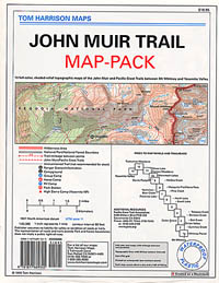
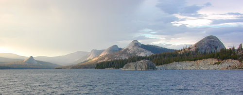
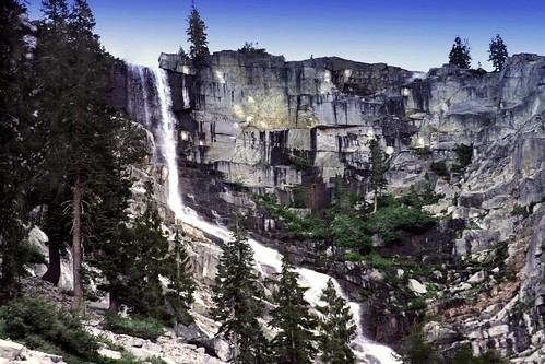
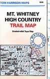
When the snow melts in the High Sierra, the rush is on! This is one of the most popular backpacking trips in the Eastern Sierra, as Mt Whitney is the highest peak (14505′ elevation) in the contiguous United States of America.
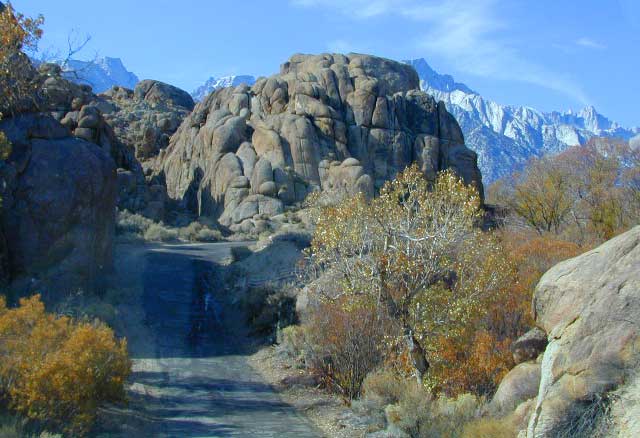
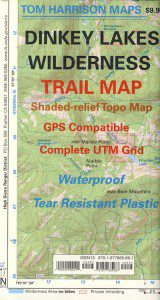
    Day hikes to the summit should only be attempted if you are in excellent physical shape & used to high altitude hiking. There are so many folks trying to hike this sought-after peak in the warmer summer months (MAY-OCT) that the National Forest has put tight restrictions on these Mount Whitney trails. You must obtain a Wilderness hiking permit for this hike & that requires waiting in a long line of outdoor enthusiasts that also seek this prime destination.

    The Lone Pine Ranger station holds an annual Whitney trail LOTTERY, where you must apply a year in advance & be granted a permit before you can set foot on this popular hiking route.

    An alternate backpacking route to Mt Whitney is the southern ridge line from the Cottonwood Lakes trailhead, but you still must verify with local authorities for permits & Wilderness passes.

    The Alabama Hills, between US Hwy 395 @ Lone Pine CA and the Whitney Portal offers camping and mountain biking trails with excellent views of Mount Whitney from below. A short drive up to the portal & you can stand in the waterfall mist & then do a day hike up to Lone Pine Lake.

    Now that we have you salivating for this epic adventure, you can start your dreaming & real planning by ordering hiking topo maps of the region. Then after you have thoroughly reviewed the maps, the terrain (as well as your own physical condition), you can contact the Inyo National Forest / Lone Pine ranger office for more specifics on dates & details. This may take years of planning to make it happen.

    lone pine roads

    The Alabama Hills sit at the base of Mt Whitney, California

    23S01 – Los Padres NF

    Big Sur Dirt Roads

    Los Padres National Forest Road #23S01

    Willow Creek Road
    Los Burros Road

    South Big Sur Coast Dirt Roads & super scenic US HWY 1 – North of San Simeon and Hearst Castle, north of Ragged Point and just past Gorda, CA a dirt shoulder, widens, a break in the bushes on the right side of the highway, a small wooden sign for the Yurt Resort called Treebones and the turn off to the back-country of Los Padres National Forest Road #23S01

    Willow Creek is a steep coastal canyon w/ Willow Creek Trail #5E08 in the creek below and the dirt road 1000′ above. Willow Creek Day Use Area, the Willow Creek bridge and Willow Creek beach w/ restrooms, picnic tables, and paved parking lot near the highway.

    DIRT ROAD, high clearance is recommended, but not required. 4×4 may be needed in wet weather. Motorhomes, trucks w/ trailers and RV campers are not gonna like this rugged, narrow, steep, dirt road and are advised to stick to the pavement. Camper vans and SUVs are be better suited for this terrain.

    • Both Thomas Bros. Maps & Benchmark Map’s California Atlas has this route listed as Los Burros Road
    • Google Maps has this route named Will Creek Road
    • Yahoo Maps has this route as Willow Creek – Los Burros Road
    • Mapquest has this one listed as Los Burros Rd – Fort Hunter Liggett (which is a military base,  on the opposite side of the mountain range near US Hwy 101)


    View Larger Map


    Free Camping in Big Sur

    Willow Creek Rd

    Several primitive camp sites can be found along this rugged dirt road, which climbs steeply and switchbacks thru redwoods, madrones, cedars, grass lands and oak hills. Sites within the first 3 miles  of this road offer the serene sounds of the ocean – waves, seals, sea lions as well as traffic on the busy highway. There are a few private properties back here in the boonies too, so read signs and don’t go exploring this region in the dark.

    About 8 miles back on Willow Creek Rd is Alder Creek Campground – a small developed camp w/ only 2 camp sites and no piped water and no fees.

    Prewitt Ridge  also has numerous ideal top-of-the-world, free camp sites, which do require a lot more dirt road driving and a very good backcountry map.

    • Sycamore Flat Road intersects @ 3 miles up
    • Alder Peak Camp is San Martin Top @ 12 miles up
    • South Coast Ridge Road is at the very top @ 14 miles
    • Lions Den Camp is 19 miles of dirt road driving
    • Three Peaks Camp is 21 miles way back there
    Los Padres Monterey District Big Sur Map NatGeo

    Castle Crags Wilderness

    NorCal Hiking
    Castle Crags State Park
    CastleCrags Wilderness

    12,232 acres
    Northern California Mountains
    South of Dunsmuir, CA
    Interstate 5
    exit #724 – Castella

    backpacking, camping, creek fishing, hiking, mountaineering, lakes, rock climbing, snowshoeing, swimming, waterfalls

    About an hour north of Redding, you can see those impressive peaks off to the left above the lush forest. Way up off the west side of I-5, lies a hiking paradise of scenic lakes, waterfalls and wildflowers. Opposite the freeway from Mount Shasta; Just south of Lake Siskiyou.castle crags

    Castle Crags Wilderness neighbors the Castle Crags State Park, which is surrounded by Shasta-Trinity National Forest. This area is named for 6,000′ tall glacier-polished peaks and pointed crags. Due to their relatively low elevation, year-round recreation, hiking, backpacking, and rock climbing are popular spring through fall. Snowshoeing near Castle Lake is excellent.

    Castle Crags State Park
    530-235-2684

    Castle Crags State Park Campground
    76 developed campsites
    6 environmental campsites

    Max Camper Length: 27′
    Max Trailer Length: 21′

    28 miles of hiking trails (2.7 mi access trail to Castle Crags Wilderness)
    The Pacific Crest Trail also passes through the park.
    Dogs not allowed on park trails.

    Shasta-Trinity National Forest
    Mount Shasta Ranger District
    204 West Alma
    Mt. Shasta, CA 96067
    530-926-4511

    Climbing at the Crags:
    the Cosmic Wall & beyond

    regional history: The northwest area contains the largest glacial cirque, Castle Lake, which is near where the Modoc War’s 1855 Battle of Castle Crags took place. Now a historical landmark, the battle was fought on a ridge saddle between the lake and what is known as Battle Rock. The Wintu tribe inhabited the area, they called the crags the Abode of the Devil and the Spanish explorers called it Castle del Diablo (Castle of the Devil.) read more on wiki

    nearby towns –


    View Larger Map

    Hoover Wilderness

    Dunderberg Meadow

     Dunderberg Peak capped with snow about half the year @ 12,374′ elevation. Dunderberg Meadow is a side route off Green Creek Rd. Upper Summer Meadow Rd is another side route off Green Creek Rd.

    Eastern Sierra Hoover Wilderness

    East Yosemite National Park

    48,601 acres
    10 miles South of Bridgeport, CA
    Toiyabe National Forest Autumn Eastern Sierrasand Inyo National Forest

    Hoover Wilderness spans  the mountain ranges from Sonora Pass to Tioga Pass, with high elevation peaks ranging from 10,000 to over 12,000′ elevation. Emigrant Wilderness lies to the west of Hoover, with Yosemite National Park & Inyo National Forest to the south.

    • Twenty Lakes Basin
    • Virginia Pass
    • Virginia Lakes Basin
    • Lundy Pass
    • Bond Pass
    • Hoover Lakes
    • Return Creek
    • Little Walker River
    • West Walker River
    • Matterhorn Peak – 12,264′ elev

    towns nearby –

    Aspen groves in the Eastern Sierra are some of the best autumn colors in the whole state. Fall car camping includes nighttime temps in the teens w/ fishing and hunting nearby.

    PCT trails, Eastern SierraPacific Crest Trail passes partially through Hoover Wilderness inside  Yosemite National Park.

    Hoover trails are not all dirt road access, but most are. There are 2 major trail heads along Highway 120 inside Yosemite NP, which lead north to Hoover.

    Hoover trailheads –

    California SR Highway 120 (Yosemite NP):

    off US Highway 395:Hoover Trail Map

    Twin Lakes area:

    • Robinson Creek
    • Horse Creek
    • Cattle Creek
    • Tamarack Lake
    • Buckeye

    Little Walker River area:

    • Bort Canyon
    • Emma Lake
    • Molybdenite Creek

    California SR Highway 108 (Sonora Pass):

    hoover wilderness map

    Green Creek Road is a signed dirt road on US Highway 395, near Virginia Creek Settlement and across from the Bodie ghost town turn off. Green Creek Campground  (a developed NFS campground) also has trailhead parking for Hoover hiking trails. Primitive free camp site can be found all along this major graded dirt road.

    Many developed campgrounds in the surrounding areas – Saddlebag, Lundy, Virginia, Green Creek, Twin Lakes, Buckeye, Obsidian. Off Sonora Pass, Levitt Lake usually gets the most snow depth around and is only acessible in summer months. Super remote primitive camping for those with a high clearance vehicle.

    FRee Camping Green Creek


    Silver Peak Wilderness

    Hiking the Southern Big Sur Coastline

    faded public lands
    Sun-bleached, wooden Los Padres sign – near Salmon Creek trailhead.

    Silver Peak Wilderness, Big Sur Coast

    Central California Coast

    31,555 acres

    8 miles South of Gorda, CA
    along Pacific Coast Hwy 1
    near Big Sur, CA
    Los Padres National ForestBig Sur Wilderness Map

    Backpacking and hiking trails on the Pacific Coast, steep terrain next to ocean. Coastal redwood canyons, oaks hills, great views. The neighboring Ventana Wilderness is located just north of Silver Peak hiking trails.

    Southern Redwood Botanical Area

    Silver Peak –3,590′ elevation
    Alder Peak –3,744′

    trailheads

    • Salmon Creek Trail #5E09
    • Hwy 1 @ connection Trail #5E10
    • Alder Creek Trail #5E09

    mm

    mile markers along Pacific Coast Highway 1
    (Monterey County)

    • Cruickshank Trailhead – 6.5 mm
    • Soda Springs Trailhead – 3.8 mm
    • Buckeye Trailhead – 2.4 mm
    • Salmon Creek Trailhead – 2.2 mm

    developed campgrounds nearby –

    nearby towns –

    Ocean View Hikes Big Sur


    View Larger Map

    Oak Foothills

    Dinkey Lakes Wilderness

    Central Sierra Nevada

    Wilderness lakes
    Courtright Reservoir w/ CLIFF LAKE trailhead

    Dinkey Lakes California

    Dinkey Creek Road
    Tom Harrison Dinkey Map East of Shaver Lake, Hwy 168

    30,000 acres

    Sierra National Forest

    Located in the high elevations between Shaver Lake and Courtright Reservoir is the Dinkey Lakes region. Granite domes and alpine lakes are the key feature of this mid-Sierra forest. John Muir Wilderness is located on the east (right) side of Courtright, while Dinkey Lakes Wilderness is on the opposite west (left) side.

    • alpine lakes
    • backpacking
    • camping
    • creeks & streams
    • cross country ski
    • fishing
    • granite domes
    • horseback trails
    • hiking trails
    • off-roading
    • rock climbing
    • snowmobiling
    • snowshoe
    • stargazing
    • wildflowers
    • wildlife viewing

    4 wheel drive trails serve some of the Wilderness boundaries. Dusy Ershim OHV Trail (pronounced ‘doosey’) crosses the boulder strewn terrain for 30 rugged miles, from Courtright to Kaiser Pass. Road #8S10 is known as ‘Red Lake Road’ and pretty popular among 4x4s and fishermen. This high clearance 4×4 trail accesses both scenic lakes – Red Lake and Coyote Lake, as well as Dinkey Wilderness trailheads.

    Trailhead Access:

    Access the trailheads on the north side of Dinkey Creek Road, a paved route which connects Shaver Lake to the Sequoia McKinley Grove and then on to Wishon and Courtright. Rock Creek Road #9S10 becomes dirt and leads up to the Dinkey Lakes hiking trails.

    Paved Dinkey Creek Road leads out to the Trails End trailhead. Dinkey Creek and main Campground is located at 5840' elevation and tucked deep in the forest, about 10 miles east of Shaver Lake. Beyond the Sequoia grove is Wishon & Courtright Reservoirs w/ Cliff Lake trailhead. All the other trailheads located at these large lakes lead over to John Muir Wilderness.

    Paved Dinkey Creek Road leads out to the Trails End trailhead. Dinkey Creek and main Campground is located at 5840′ elevation and tucked deep in the forest, about 10 miles east of Shaver Lake. Beyond the Sequoia grove is Wishon & Courtright Reservoirs w/ Cliff Lake trailhead. All the other trailheads located at these large lakes lead over to John Muir Wilderness.

    The Dinky Creek locale (on most maps) is located at the main Dinky Creek Campground, along Dinky Creek near the historic Dinky bridge on a small, paved, side route north of the main road. Although this summer vacation area is well signed, people can often miss this turn, especially at night.

    DSCN0005

    USDA map Two main hiking trail systems can be accessed from the west, via Tamarack Ridge (parking at Hwy 168). Both dirt routes from highway, Road #9S09 and Road #8S10 lead out to Dinkey trails, although one is rugged 4×4 trail, Red Mountain OHV, and the other is a long, graded dirt road.

    Kaiser Pass Road to the north side has even more trails leading into Dinkey. Badger Flat and White Bark trailheads are closest points to Huntington Lake, CA. Bolsillo trailhead is way back near Florence Lake, which also has a major trailhead and paved parking.

    NFS


    local rangers:

    Sierra National Forest
    High Sierra Ranger District
    29688 Auberry Rd
    Prather, CA 93651
    559-855-5355

    Secluded Camping
    4×4 Camping at Coyote Lake


    Ishi Wilderness

    Bridge and Chute from top of Black Rock

    NorCal Ishi Wilderness

    41,840 acres
    20 miles N of Chico, CA
    Lassen National Forest

    • Barkley Mountain (elev. 4488′)
    • Black Rock Campground
    • Deer Creek
    • Flat Iron Mountain (elev. 4400′)
    • Iron Mountain (elev. 3274′)
    • Indian Ridge Campground
    • Mill Creek
    • Peligreen Place
    • Pine Creek
    • Pinnacle Peak (elev. 3293′)
    • South Antelope Campground
    • Twentymile Hollow

    Up in the mountains behind Chico sits a rugged landscape of deep canyons lined with bizarre rock formations and roaring mountain creeks. Wilderness encompasses lower elevations – ranging from 1500′ – 3500′  – making this outdoor destination a winter haven, when the rest of the backcountry is covered in several feet of snow. One of the most historic wilderness areas in the state, as the aboriginal existence of the Native Americans came to an end in this area.

    COHASSET ROAD climbs up the volcanic fin of Cohasset Ridge into the pine forests high above the valley floor. The paved road becomes dirt and the road name changes to Ponderosa Way (Lassen Road# 28N29). The Ishi Wilderness can also be accessed from the north side via Highway 32, near the Tehama State Game Refuge.


    View Larger Map

    • backpacking trails
    • hiking trails
    • fishing creeks
    • horseback trails
    • wildlife viewing


    Ishi Wilderness mapIshi Wilderness Map

    Ishi Wilderness


    Trinity Alps Trailheads

    Trinity Alps Wilderness Trailheads
    NorCal Hiking Vacations

    Meadow on Trinity Alps Long Canyon Trail

    Northern California, Trinity Lakes
    Shasta Trinity National Forest

    • backpacking
    • camping
    • fishing lakes
    • hiking trails
    • horseback trails
    • waterfalls

    Trinity Alps Wilderness

    hike


    Trinity Wilderness trailhead locations –

    trailheads from Highway 3:

    • Scott Mountain (PCT access)
    • Bear Creek
    • Eagle Creek
    • Stoddard Lake
    • Boulder Creek
    • Big Flat
    • Swift Creektrinityalps_lg

    trailheads from Highway 299:

    • Canyon Creek
    • Hobo Gulch
    • French Creek
    • Green Mountain
    • Jim Jam Ridge
    • East Fork
    • New River
    • Grizzly Camp

    trailheads from Highway 96:

    • Tish Tang
    • Red Cap Lake
    • Bear Hole
    • Mill Creek Lake
    • Salmon Summit

    trailheads from north @ Salmon River, Cecilville Rd #1C02:

    • Hidden Horse
    • Trail Creek
    • Carter Meadows Summit (PCT access)
    • Middle Boulder

    Trinity Alps Wilderness Trail
    Overview @ SummitPost

    Trinity Alps Lakes & Waterfalls

    Trinity Wilderness Lakes & Waterfalls

    Grizzly Falls -- Trinity Alps Wilderness

    Northern California Lakes
    Shasta Trinity National Forest

    NFS


    Trinity Alps Wilderness

    lake


    Lakes & Waterfalls in the Trinity Alps region –

    Canyon Creek Fallstrinityalps_lg
    Trinity Lake
    Josephine Lake
    Hidden Lake
    Caribou Lake
    Lost Lake
    Grizzly Lake
    Sapphire Lake
    Papoose Lake
    Emerald Lake
    Conway Lake
    Barker Lake
    Foster Lake
    Boulder Lake
    Cecil Lake
    Lion Lake
    Ward Lake
    Mirror Lake
    Long Gulch Lake
    Trail Gulch Lake
    Fox Creek Lake
    Red Cap Lake
    East Boulder Lake
    Middle Boulder Lake
    Big Boulder Lake
    Big Bear Lake
    Big East Fork Lake
    Little Bear Lake
    Canyon Creek Lakes


    Trinity Alps Lake

    West Kern

    festivals kern

    CA Kern / western Kern county

    Kern County is known for its oil, its agriculture, and outdoor recreation. The Kern River is the highlight of the region with lush, green and grey granite canyons, a big reservoir & the Sequoia trees just up the road. On the western side of Kern County are small towns like Frazier Park, the golfing cabin community of Pine Mountain Club, plus the oil meccas of Maricopa and Taft. Expansive Lockwood Valley enters into Ventura County. Cuyama River borders Santa Barbara & SLO counties.

    Much of the western Kern area is rural ranch land, desert or forest. Los Padres National Forest, Chumash Wilderness, Bittercreek Wildlife Refuge, Wind Wolves Preserve, Buena Vista Reservoir, Ballinger Canyon, Hungry Valley and Fort Tejon State Park all call this region home, right on the mighty tangent of the San Andreas fault line. The San Emigdio range and the surrounding mountains of Mt Pinos and Mount Able design a perpendicular range to the Central Cali coastline, connecting the huge Mojave desert to the ocean. Cerro Noroeste is a very scenic drive.

    The 17 mile long Quatal Canyon, where the indian camp of Mahu Tasen hosts a Bear Dance every summer is also a wild place of bird watching, camping and hunting. The indian word for Mount Pinos is “Iwihinmu” – a sacred spot for Chumash Indians, as well as others; Chumash call it the ‘center of the world’. Locals respond regularly with music, hikes, star gazing, drum circles (seasonally) and local festivals (annually) .

    PHOTOS: Los Padres Photos | Miller Jeep Trail Off Roading Photos

    Drum Camp Pinos | Drumming Cerro Noroeste

    Tecuya Ridge

    Tecuya Ridge, Cuddy Valley 4×4 trails can keep you busy for a whole weekend of back road exploring.

    boating, camping, dirt biking, fishing, hiking, horseback, hunting, mountain biking, off roading, skydiving, xc skiing

    DSCN0029

    Quatal Canyon