Category Archives: Equestrian

West Kern

festivals kern

CA Kern / western Kern county

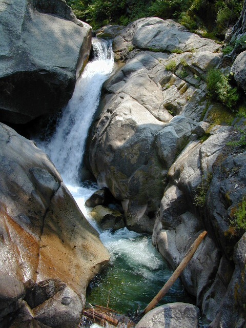
Kern County is known for its oil, its agriculture, and outdoor recreation. The Kern River is the highlight of the region with lush, green and grey granite canyons, a big reservoir & the Sequoia trees just up the road. On the western side of Kern County are small towns like Frazier Park, the golfing cabin community of Pine Mountain Club, plus the oil meccas of Maricopa and Taft. Expansive Lockwood Valley enters into Ventura County. Cuyama River borders Santa Barbara & SLO counties.

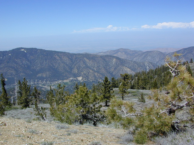
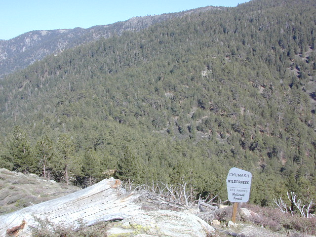
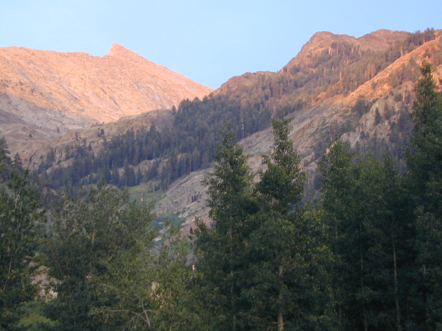
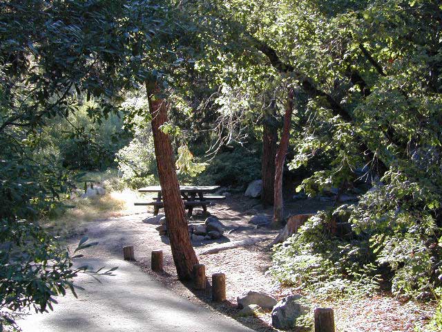
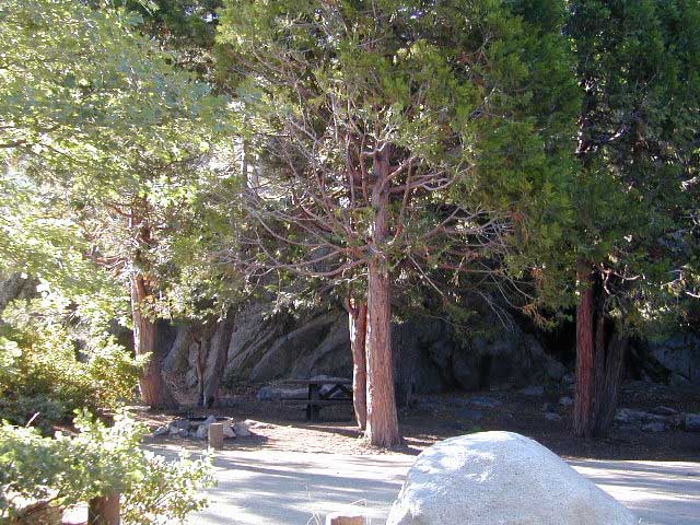
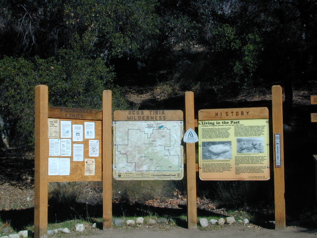
Much of the western Kern area is rural ranch land, desert or forest. Los Padres National Forest, Chumash Wilderness, Bittercreek Wildlife Refuge, Wind Wolves Preserve, Buena Vista Reservoir, Ballinger Canyon, Hungry Valley and Fort Tejon State Park all call this region home, right on the mighty tangent of the San Andreas fault line. The San Emigdio range and the surrounding mountains of Mt Pinos and Mount Able design a perpendicular range to the Central Cali coastline, connecting the huge Mojave desert to the ocean. Cerro Noroeste is a very scenic drive.

The 17 mile long Quatal Canyon, where the indian camp of Mahu Tasen hosts a Bear Dance every summer is also a wild place of bird watching, camping and hunting. The indian word for Mount Pinos is “Iwihinmu” – a sacred spot for Chumash Indians, as well as others; Chumash call it the ‘center of the world’. Locals respond regularly with music, hikes, star gazing, drum circles (seasonally) and local festivals (annually) .

PHOTOS: Los Padres Photos | Miller Jeep Trail Off Roading Photos

Drum Camp Pinos | Drumming Cerro Noroeste

Tecuya Ridge

Tecuya Ridge, Cuddy Valley 4×4 trails can keep you busy for a whole weekend of back road exploring.

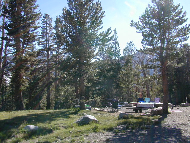
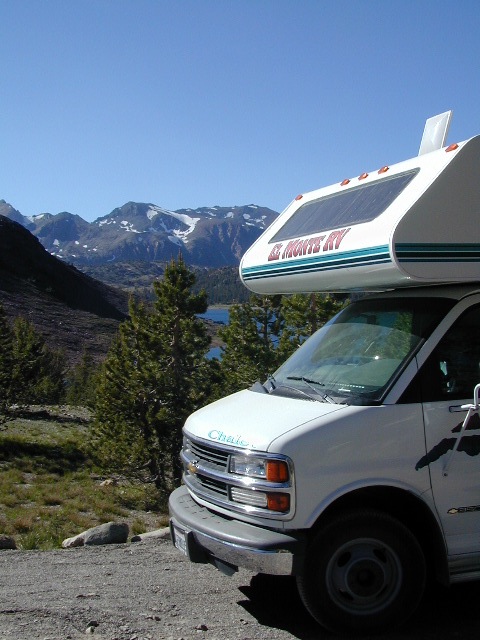
boating, camping, dirt biking, fishing, hiking, horseback, hunting, mountain biking, off roading, skydiving, xc skiing

DSCN0029

Quatal Canyon

Chumash Wilderness

Chumash Wilderness
Los Padres National Forest

38,150 acres
Mount Pinos – 8831′ elevation
Cerro Noroeste – 8286′ elevation
Los Padres National Forest

Terrain consists of high mountain peaks, badlands of Quatal Canyon Wash & Lockwood Valley; Steep slopes of forests, rock outcroppings, sparse forest areas, on border of Kern County & Ventura County. This area is sacred to the native California Chumash tribe.

Quatal Canyon Rd #9N09

DSCN0042Mount Pinos, Mount Abel, Cerro Noroeste, Westside Park, Hudson Ranch Road, Mil Potrero Highway, Lockwood Valley Road, East Dry Canyon, Apache Canyon, Cuyama River

campgrounds nearby –

The Peak to Peak Hike is a 7 mile, high elevation, ridge line day hike that traversed 2 of the tallest peaks in Kern County – Mt Pinos (elevation 8831′) and Mt Abel (8286′). Day hikes, equestrian trails, backpacking, mountain biking areas nearby. Steep, granite, chaparral, lightly forested w/ ponderosa and Jeffrey pines. From this ridge trail you have a 360 degree view over the entire region. The cabin community of Pine Mountain Club is to the north side (and IF the skies are really clear, you can see the Sierra Nevada mountain range too); Lockwood Valley & Ozena Valley are located to the south; Cuyama Valley to the west and the Tejon Pass w/ Frazier Park to the east.

Off road use 4×4, dirt bikes, ATVs, and quads are common in Quatal Canyon, Apache Canyon, East Dry Canyon leading up to the wilderness edge. Rangers will ticket if they find you on the Chumash side of Quatal wash. The secluded yet inviting, wide, white sandy washes are just too tempting for some bad boys.

Chumash trailheads are located

  • about a mile before Camp-O-Alto Campground (Mount Abel)
  • along lower end of Quatal Canyon Wash (OHV areas parallel)

nearby towns –


DSCN0060


View Chumash Wilderness Area in a larger map

Garcia Wilderness

Garcia Wilderness, Los Padres NF

14,100 acres
Garcia Peak – 3146′ elevation
Los Padres National Forest
Huasna River
Pozo Creek

himtncampgroundcampgrounds nearby –

American Canyon Campground
Hi Mountain Campground
La Panza Campground
Lake Lopez Campground
Navajo Campground

trailheads for Garcia Wilderness

  • Hi Mtn
  • Santa Lucia
  • Garcia OHV

POZO ROAD is also known as

  • Pozo La Panza Rd
  • Hi Mountain Rd
  • Pozo Arroyo Grande Rd

San Luis Obispo’s Los Padres Pozo Rd is a 4×4 route that accesses the Garcia Wilderness; the dirt route connects Lake Lopez to Pozo Saloon, out near Santa Margarita. Los Padres National Forest 

Located inland from the Pismo Coast in south San Luis Obispo county.
Garcia Peak OHV Route, off Pozo Road behind Lake Lopez, Arroyo Grande, CA

  • backpackingLupine on Pozo Rd
  • camping
  • hiking
  • mountain biking
  • off roading
  • waterfalls
  • wildflowers

Steep lush coastal mountains, rugged, remote landscapes close to Central Coast San Luis Obispo.

Garcia Ridge Road #30S18

Garcia Ridge Trail #15E11

Hi Mountain Road #30S11


DSCN5297

also nearby – Machesna Mountains Wilderness and Santa Lucia Wilderness

Mineral King Camping

DSCN0019

Mineral King is a magnificent canyon in the southern portion of Sequoia National Park, east of  Visalia, CA. So magical indeed that Disney tried to purchase the rugged scenic lands for a wilderness ski theme park in 1960. Thankfully that project never happened, due to strong opposition from preservationists. Mineral King became part of Sequoia National Park in 1978.

Mineral King is the Great Western Divide, where high peaks separate the foothills from the taller Eastern Sierra range. Upper Kern River Canyon lies beneath as the main south drainage from the very tallest peak, Mount Whitney @ 14,494′

sierra topo maps

Mineral King Road is a paved off shoot from Highway 198, just to the east of the town of  Three Rivers, CA. The road is steep and curvy and 25 miles long. No gasoline at all. No RV motorhomes or trailers are permitted to travel this scenic and amazing back road. Certain portions of the road are dirt and usually graded, but most of the route is paved.  Snow closes the road in winter months – NOV-MAY.

We usually get less than a half year to enjoy this special place, so make plans in advance to fit this destination into your schedule JUNE-JULY-AUG-SEPT.

And do not even think of trying to cram spectacular Mineral King into an already packed Sequoia Park weekend trip. The Giant tree Sequoia groves, Hume Lake and Kings Canyon are over an hour north (hwy 198), to other side of the park.

If you have a full week to hang out in the Sequoia National Park area, then obviously Crystal Cave and Mineral King should be on the list, but keep in mind taht each destination will take a full day to drive to and explore.

Driving the distance on Mineral King Road, the wonders abound on every curve. Wildlife, waterfalls, water flowing and the dense forests.

Atwell Mill Campground is located at an old wood mill site and has a good hike to a footbridge at Kaweah River. There is a small cabin community called Silver City which caters to summer crowds and family campers. Only open during the warm season.

At the very end of Mineral King Road is the gravel parking. Step out into high elevation (7830′ above sea level), breathe deep and enjoy the granite bowl of alpine bliss with creeks, meadows, wildflowers, picnic spots, hiking trails and scenery everywhere. Mid day sunshine can be bright. Black bears and marmots are very common.

Cold Springs Campground is the last developed campground, located next to a raging creek. The hike-in sites are the best choice for seclusion at this camp.

South Fork Campground is the smallest of the campgrounds in this area; located in the foothills at 3600′ elevation, open all year. From Highway 198 (W of the town of Three Rivers), take South Fork Drive 13 paved miles to camp.

KaweahFalls

mineral king backpacking

Mineral King is a favorite destination among backpackers as it gives instant access to many high country trailheads with mostly paved road driving. Located deep in the forest at end of a long road, near the center of the Sierra Nevada range gives ample hiking in every direction. The hikes are steep and challenging, but the rewards are solitude, true wildness and grandeur scenery. Although inviting, these steep passes might not be adequate for beginner backpackers, so please keep that in mind when planning. Fishing lakes, day hikes, horseback trails, waterfalls, creeks, and jagged mountain peaks.

From Mineral King you can access the these popular spots – PCT, the Great Western Divide, the Golden Trout Wilderness, Sequoia National Park, Kings Canyon High Country, Keasarge Pass, John Muir Wilderness.

top maps for the region –

Saddlebag Lake Campground

Saddlebag Lake, Yosemite East Side

Inyo National Forest @ Tioga Pass, Hwy 120

Yosemite High Elevation Campground

Yosemite Lake View Camp Sites

Tioga Pass camping on the eastern side of Yosemite National Park, just outside park boundaries is Inyo National Forest lands. Snow is usually epic up here and some of the deepest on the range of light.

Several prime campgrounds line this popular Sierra pass, highway 120. Most camps are located along the busy highway just outside the National Park gate. Behold, this prime choice destination is a few miles back off the highway, at the end of a graded dirt road. Smaller RVs okay.

Saddle Bag Lake

High altitude, tree line, thin air, snow melt everywhere, spectacular elevations and dark skies make this an awesome stargazing spot. Summer is busy with trailers, boat rentals, horses and day hikers. Locals and fishermen use this small campground often, so tourists should feel lucky to find such a rare camp here. First come, First serve, when it is open (only half the year).

Elevation: 10,000′
Number of Sites: 19
Camping Reservations: No
Sites Available: First come, First serve
Vehicle Accessibility: Vehicle limit 22 ft. max.
Length of Stay: 14 Days
Water: Piped; lake, creek nearby
Toilet: Vault
Season: Closed during winter & spring
Fee: Yes
Operated By: National Forest Service
Closest Town: Lee Vining, CA

Inyo National Forest
Bishop Ranger Station
760-873-2400

RV Camper Lake

Lily Pad Campground

Lilypad Campground @ Lake Wishon Reservoir
Sierra National Forest, California

The long journey up the mountain into the Sierra National Forest is only for the true adventure seekers. First off, get a good forest map. Second, plan several days if not a full week off of work to explore this region in depth. It is a long drive from most anywhere in California, and this spot is way, way tucked back in there right up against the High Sierra peaks and wildness.

East of in Fresno, historic village of Clovis is a good lunch stop in route. Drive up mountain on Hwy. 168, turn right at Shaver Lake on to Dinkey Creek Rd. Now you will clock the mileage 28.7 miles to the camp. Drive past McKinley Grove and past Dinkey Creek. Follow signs to Wishon Reservoir. This campground is located adjacent to the road before you reach the dam.

All this travel time will have you asking ‘is it worth it’? The answer is ‘yes’….. if you want an uncrowded lake with plenty of wilderness surrounding you. Granite rock and forest all around. Lake Wishon is a hydroelectric reservoir operated by PG&E

Lily Pad Campground

Central Sierra Camping – Wishon Lake

High Sierra Rangers Office: 559-855-5355

• Elevation: 6,500′
• Number of Sites: 15
• Camping Reservations: No
• Sites Available: First come, First serve
• Vehicle Accessibility: 35′ limit on RVs & trailers
• Length of Stay: 14 Days
• Toilet: Vault
• Water: Piped
• Season: Closed in Winter Snow
• Fee: Yes

camp sites at lake

Large granite boulder coves provide cubby-hole privacy w/ shady trees and well spaced camp sites. Very unique design with paved driveways, adequate for handicapped camping with some sites with better access than others. 4 camp sites are considered walk-in sites.

Lake views from camps are only a mere climb up to the top of the nearest granite, which will show you just how close you are sleeping to the big water.

As with any Sierra location, holiday and summer weekends are the most busy. Tourists, family campers and RVers are all out enjoying the sunshine. Mid-week camping is good for fishing, relaxing w/ peace and quiet. Off season is best for having the place to yourself.

Outdoor recreation in the area include – hiking, camping, backpacking, rock climbing, mountaineering, sightseeing, kayaking, canoeing, mountain biking, off-roading, creek fishing, lake fishing.


Neighboring Wishon Village has a small general store, RV park w/ wifi & boat rentals.


Thousand Lakes Wilderness

NorCal hiking & backpacking

Thousand Lakes California

Although the name suggests more, the number of lakes in this region is approximately seven: Eiler Lake and Box Lake are the 2 largest lakes within the Wilderness boundary. Logan Lake and North Battle Creek Reservoir are on the outskirts. Trout fishing is a popular recreation sport all around Lassen. Thousand Lakes Wilderness is part of the Cascade Range in northern California. 16,335 acres and 21 miles of trails, all managed by Lassen National Forest. The area lies midway between the mountain town of Burney and Lassen Volcanic National Park.

Volcanic activity and glaciers have combined to create the Lassen topography. Dominated by Crater Peak 8677′, which is the highest point in Lassen National Forest, this area is a reminder of the glacial action that eroded the original, much larger Thousand Lakes Volcano and created the many small lakes and ponds scattered throughout the region. Wildlife includes black-tailed deer, black bear, pika, pine marten, northern goshawk, spotted owl, pileated woodpecker, and Clark’s nutcracker. Even elk have been known to visit occasionally.

Lassen National Forest
Lassen Volcanic National Park


View Larger Map

Thousand Lakes Wilderness

Roads and trailheads surrounding Thousand Lakes Wilderness and the Wild Woods

Lassen Forest Road #16 – Ashpan Winter Recreation Area @ Hwy 44, leads to hikes on the west side of the Wilderness. Bunchgrass trailhead and Magee trailhead. LaTour State Forest, Ashpan Butte, Huckleberry Mountain, Fredonyer Peak, Crater Peak, and Whittington Butte. Lassen Route 16 is a graded dirt road that connects to Tamarack Road #4M001 at Burney Creek, near the north side of the Wilderness.

Road #32N17 – access to North Battle Creek Reservoir
Road #32N16
Road #32N24

Thousand Lakes Wilderness Map
Road #32N31 – access to North Battle Creek Reservoir

Road #32N18 leads to PG&E North Battle Creek Reservoir
North Battle Creek Campground: elevation 5600? / 15 camp sites / open Apr-Oct

Road #26 on the north side of the Wilderness, connects Hwy 89 @ Hat Creek, west to Road #32N22. Cypress trailhead is located on a side route nearby.

Road #32N23 is up on Burney Mountain elev. 7863′, another hang glider launch site.

Road #33N25 leads to the Tamarack trailhead
Road #34N78 off Hwy 44, near Logan Lake and route leads to McElroy Flat

Road #32N35 behind Burney connects to Hat Creek (the back way).


LASSEN AREA MAPS –

Lassen National Forest Map
Thousand Lakes Wilderness Map


List of Thousand Lakes Wilderness trailheads:

Bunchgrass Trailhead
Magee Trailhead
Cypress Trailhead
Tamarack Trailhead


List of nearby towns:

Agua Tibia Wilderness

Agua Tibia Wilderness Area

  • 15,900 acres
  • chaparral & oak at lower elevations
  • pine & fir forest at high elevations
  • elevations range 1,700′ – ­5,000′
  • 25 miles of trail
  • summer temperatures exceed 100°F
  • occasional snow in winter
  • best in winter through spring
  • wood fires prohibited
  • portable stoves permitted
  • water scarce
  • no overnight use of pack or saddle stock
  • groups limit – 15 people
  • visitor permits required
Agua Tibia lies right on the RIVERSIDE
& SAN DIEGO COUNTY border

Cleveland National Forest
Palomar Ranger District
1634 Black Canyon Road
Ramona, CA 92065
760-788-0250

Agua Tibia Map

Agua Tibia Trailhead

This is the trailhead for Agua Tibia Wilderness located at Dripping Springs Campground on Highway 79, near Temecula CA.

See more: Agua Tibia Mountain hike details

hiking SoCal

Atwell Mill Campground

Atwell Mill Campground
Mineral King Camping, Sequoia National Park

Atwell Mill is near the East Fork of the Kaweah River, situated in an old logged sequoia grove with the southern Sequoia National Parks impressive Mineral King Canyon. Located 19 mi from Highway 198 near Three Rivers, CA. About 1 mi West of Silver City and 6 miles before the end of road at Mineral King.

mill_i
Meadows with pines at this campground

• Elevation: 6,650′
• Number of Sites: 21
• Camping Reservations: No
• Sites Available: First come, First serve
• Vehicle Accessibility: No RVs; tents only
• Length of Stay: 14 Days
• Toilet: Pit
• Water: Piped
• Season: Closed in Winter Snow
• Fee: Yes

site4

Bear Box in Mineral King Campground

Bear lockers for food storage are required in this region. Nice shady camp spots spaced out well at this small developed campground. Hikers parking lot is located at one end of the campground. Big bonus for hiking trails nearby.

FOOTBRIDGE HIKE: Great half day hike down to the Kaweah River. Small wooden bridge down at the river crossing and numerous trails lead off into plenty backpacking destinations around Mineral King.


View Larger Map

Mount Charleston Vegas

Mt Charleston Las Vegas NV

Mount Charleston Las Vegas NV

Mount Charleston Resort

Mt Charleston cabin rentals, vacation homes and 2 mountain lodges are located near the Spring Mountain Recreation Area, just outside of the Sin City limits. The tall alpine mountains behind RedRock SP, NW of Las Vegas, Nevada are virtually unknown by many non-locals. Great hiking, mountain biking, camping and waterfalls, plus a small seasonal ski and snowboard resort are some of the highlights. Imagine snowboarding Vegas!

Mt Charleston Hikes
Red Rock Canyon Map

Las Vegas Forest Hikes

Vegas means “the meadows”, but it sure seems more like desert these days. The forest is just up the hill, past the red rock and tract homes, well past the Joshua Trees. Conifer forests, snow and high elevation, less than an hours drive from the Vegas strip. Toiyabe – Humboldt NF is this public land managed by the US National Forest system. Toiyabe also covers Eastern Sierra slopes. Get California Toiyabe NF maps. Get the Nevada State Park map here!

Camping Vegas

Due to extreme dry conditions and wildfire danger no open camp fires are allowed from mid-April to mid-November in the Mount Charleston region. Several developed campgrounds, plus a primitive (dirt road) camp area off Lee Canyon. Cabin rentals are located at the Charleston Lodge.

  • Vegas trails
  • Hiking in Vegas
  • Mount Charleston skiing
  • Mt Charleston hikes

Mountain Horse Riding

horse rides to camp, to fishing the lakes, to sight see alpine country

There are so many gorgeous mountains and high deserts in California, that just choosing a perfect horseback ride destination can actually be fun. Browse this extensive list of all local providers. City folks need to consider the colder weather at the higher elevations: bring jackets, hats and warmer clothing.

SoCal areas for horseback are Big Bear, Idyllwild, and San Diego. Horse riding Central Coast regions could consider these places Big Sur, Carmel and Paso Robles. NorCal Coast has the Sea Ranch, Mendocino; but the Sierra Nevada and Gold Country are prime destinations with wildflower creek beds and oak foothills all they way up to the high country alpine granite splendor. Horseback rides in CA

Overnight horseback riding

Also called pack trips, or pack trains, these are trained animals (horsea, donkeys, mules, or llamas) that carry your heavy load up the mountain, while you hike solo nearby. Or you can ride the horse, and have another horse carry the gear. Many high elevation back-country can be reached this way – in the warmer months, after the snow has melted. Sierra lake fishing trips by horseback are very popular tours. Find outfitters in Cali for horses, or check out the Llama Trips.

see also – Horse Drawn Carriage Rental

Here is a list of some of California’s most horse friendly towns, some of which have limited winter access:

  • BIG BEAR CITY
  • BISHOP
  • DARDANELLE
  • GOLD LAKE
  • IDYLLWILD
  • JULIAN
  • JUNE LAKE
  • KENNEDY MEADOWS
  • KERNVILLE
  • KINGS CANYON
  • LAKE TAHOE
  • PINE MOUNTAIN
  • PIONEERTOWN
  • RAMONA
  • RANDSBURG
  • SEQUOIA
  • SIERRA CITY
  • TRUCKEE
  • YOSEMITE