Category Archives: Trailheads

Mountain Horse Riding

horse rides to camp, to fishing the lakes, to sight see alpine country

There are so many gorgeous mountains and high deserts in California, that just choosing a perfect horseback ride destination can actually be fun. Browse this extensive list of all local providers. City folks need to consider the colder weather at the higher elevations: bring jackets, hats and warmer clothing.
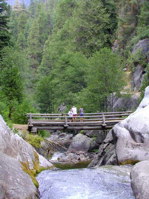
SoCal areas for horseback are Big Bear, Idyllwild, and San Diego. Horse riding Central Coast regions could consider these places Big Sur, Carmel and Paso Robles. NorCal Coast has the Sea Ranch, Mendocino; but the Sierra Nevada and Gold Country are prime destinations with wildflower creek beds and oak foothills all they way up to the high country alpine granite splendor. Horseback rides in CA

Overnight horseback riding

Also called pack trips, or pack trains, these are trained animals (horsea, donkeys, mules, or llamas) that carry your heavy load up the mountain, while you hike solo nearby. Or you can ride the horse, and have another horse carry the gear. Many high elevation back-country can be reached this way – in the warmer months, after the snow has melted. Sierra lake fishing trips by horseback are very popular tours. Find outfitters in Cali for horses, or check out the Llama Trips.

see also – Horse Drawn Carriage Rental

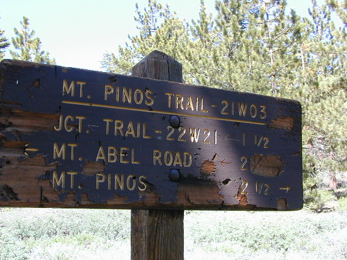
Here is a list of some of California’s most horse friendly towns, some of which have limited winter access:

  • BIG BEAR CITY
  • BISHOP
  • DARDANELLE
  • GOLD LAKE
  • IDYLLWILD
  • JULIAN
  • JUNE LAKE
  • KENNEDY MEADOWS
  • KERNVILLE
  • KINGS CANYON
  • LAKE TAHOE
  • PINE MOUNTAIN
  • PIONEERTOWN
  • RAMONA
  • RANDSBURG
  • SEQUOIA
  • SIERRA CITY
  • TRUCKEE
  • YOSEMITE

Mount Able

Camp-O-Alto

MOUNT ABEL, California

So many misspell Abel like Able, its a wonder anyone can find this place.

But what a nice find it is! Camp O Alto Campground, among the giant trees. RV friendly

Cerro Noroeste / Mt Abel / Noroeste Peak
Los Padres mountains, camping on the back roads, mountain biking, hiking, exploring. This gorgeous 8286′ mountain peak sits just to the west of Mount Pinos @ 8831′ (the tallest peak in Kern County). Home of the Jesus Tree, the best sunset spot for miles and the infamous motorcycle road out west, this mountain is one of the lesser known in Southern California. Oddly shaped, Jefferey and Ponderosa pines towering above have their tops stunted and enormous branches hanging down. Maybe from lightning strikes, or maybe from a historic Tejon earthquake that snapped them?

Camp-O-Alto is the official name of this primitive open, FREE campground. First come basis. This place is a perfect option B, instead of the busier Mt Pinos Recreation Area that is located to the east. RV campers love this camp, as there is plenty of room to spread out in between the sites. There is also a large group site at the west end of the campground – available to whomever can grab it first, but you must have a large group to utilize this spot.

Just south of Apache Saddle, there is a faded, large sign that reads Westside Park, but this is the only reference we can find and no one locally calls this mountain by this name. The Cerro Noreste Road gate (near Camp Condor), closes seasonally for winter snow and rock slides.

Once you are past this gate & start climbing from the saddle, there is a great viewpoint a few miles up on the right side, overlooking red dirt beauty of Quatal Canyon. You can see the mountains out near the coast, as well as the high desert, natural wash on the left side and the faint graded dirt road paralleling it to the right side, all mixed up amongst the pinyons & junipers. The Chumash Wilderness is on the left side.

DIRECTIONS TO MOUNT ABEL:

To get here from Interstate 5, exit Frazier & head west, thru Frazier Park, thru Cuddy Valley, turn right on Mil Potrero Hwy (forest road #9N05) & past the golfing community of Pine Mountain Club; continue west to Apache Saddle. At this intersection, turn left on to Cerro Noroeste (#9N25) & drive 10 miles to the top of the mountain.

To get here from Hwy 166, take the Cerro Noroeste Road turn off just east of Hwy 33. Continue 20-something miles up to Apache Saddle ranger station. At this intersection, turn right on to Cerro Noroeste (#9N25) & drive 10 miles to the top of the mountain.

Los Padres Trail # 21W03 / Chumash Wilderness

Hiking Trails / Mountain Bike SoCal

This area is very popular among mountain bikers and sunset seeking couples. The “Peak to Peak” hike is an all day adventure of 6.5 miles, that should be planned well in advance – with another shuttle car at the Pinos parking lot. This is a moderately, strenuous hike that can take up most of the day – with awesome views over the San Joaquin Valley, Lockwood Valley, Pine Mountain Village and San Emigdio range. The area located in between Pinos & Abel is called the Chumash Wilderness.

Trail 21W03 Mt Pinos

Utah Red Dirt Roads

Zion waterfalla

Zion National Park after a huge thunderstorm afternoon (late summer)


Hiking trails? That’s pretty much all we did in Zion & Grand Cyn.(N. Rim) Angels Landing…great 5-6 hour hike in Zion! Major elevation gain, but well worth it. Did a small Canyon overlook trail with spectacular views espcially at sunset. Hiked into the Grand Cyn. on the North Kaibab trail, but it was covered in mule poop & was a pretty stinky trip. Wish I could have spent the day differently. Next time I hike into the canyon, I’ll remember to pick a trail that is NOT used by animals.
 
Explored the Narrows a bit, before the afternoon thunderstorm. It was flash flood season & we didn’t want to be caught in a slot canyon. 2 California men (bodies) were pulled out earlier last month. Rangers are serious when they warn about the dangers of hiking in the afternoon or even the wrong season. It was weird weather. Sunny one minute, stormy the next. Couple of thunder storms dumped on us at night. EEEkkk. My tent held up fine. Good big ole Coleman condo style..I love it! Didn’t get wet, no leaking.
 
My favorite campground (just E of Zion , N.Fork Virgin River – Ponderosa-Zion primtive camp) was inaccessible due to slick, muddy dirt roads. We tried, believe me… we really tried, but the “dirt roads are impassable when wet” notes all over the maps aren’t kidding. I just wanted to find out for myself. Ended up at a convenient (but expensive) campground just outside Zions East entrance station.
 
That Utah red clay dirt is very slippery. I got about 2-3 mi. up the road, before I loss control. Fish tailin’ all over & stopping on the edge of a cliff. Those small oak trees wouldn’t have braced my Amigo if I did go over. Scarey! My BFGoodrich Mud Terrain tires were packed solid. No tread at all & you know me, NO 4 wheel drive either. Luckily, I had 2 very strong guys & a lot of patience. Using sticks to scrape some mud out, my friends pushing my vehicle & a tedious 11-point U-turn, we got outta that bad sitch. Headed down hill, slowly, cautiously & praying for gravel & pavement to start soon. A little dirty & a few minutes on cam-corder. It should be a fun experience to re-live through video later. Hey, whats that saying??….”that which does not kill us, makes us stonger”. I think I live by that motto.

Kern Rock Climbing

needles climb Sequoia

The Needles as seen from Dome Rock, on the Western Divide Highway.
Eastern Sierra’s Mount Whitney can be seen in the far distance on the right.

Sierra Nevada Rock Climbing – Sequoia National Forest

Good granite without the crowds! This Sequoia park is often passed by for the masses heading to the big walls of Yosemite or the bouldering of the Eastern Sierra Nevada.

Check out these Sequoia spots for some climbing options:

  • Dome Rock on the Western Divide (if half dome didn’t split & was smaller)
  • Kern River Gorge (deep in the heart of Kern River & the Rincon)
  • The Needles (granite spires at 8000′ elevation overlooking Kern River Valley)

Torrey Pines Coastal Hiking

torrey pines hiking
Torrey Pines State Reserve is in San Diego County – just south of Del Mar CA. Easy access from I-5 & perfect for hikers seeking exercise – instead of sitting in traffic on the freeway. The point you see in the distance is La Jolla.

Ocean, cliffs, pines, beaches & sunny San Diego weather.
What could be better for an after work stroll?

There are numerous pine forest groves, with hiking trails leading down the cliffs to tide pools & beautiful beaches. You could easily spend a whole day exploring this coastal park. There is a Visitor Center, guided nature walks & paved parking lots. The lagoon region has a train track running through the valley east of it – and the tracks meet the coast nearby. The rocky beach to the north is very popular with surfers & there is even surfing contest held here annually. Plenty parking along this stretch too. If you wanna avoid the park fees, you can park along PCH (Pacific Coast Highway) & walk the beach to the south. The cliffs make for seclusion & many sunbathers love this area.

On occasion, if the conditions are right, the San Diego RED TIDE will appear, which can only be seen at night. The kelp beds glow with sparkles of green & blue light (not red) w/ the phytoplankton …..as the waves come crashing toward the shoreline. More info on red tides on Wikipedia

Del Mar CA

TORREY PINES TRAILS

Footbridge Hike to Kaweah River

Mineral King Footbridge – Atwell Mill

The Kaweah River skirts about a mile south of Atwell Mill campground on the Mineral King Road inside Sequoia National Park. From the Atwell Mill campground, this well traveled trail leads down to a footbridge for a nice half day hike destination. There are a few waterfalls & creek crossings along the way. A few pools & waterfalls await you at the river. Pack a picnic & spent the day here.

This area is popular for backpackers also. A few Sierra Nevada back country destinations lead from this point into Tar Gap & East Fork Grove. Prescribed fires or ‘controlled burns’ by Forest & Park Services help keep the underlying brush fuel down to a minimum; which helps the forest with carbon in the soil and for decreasing future wild fires.

Western Sierra Nevada river hiking near
SILVER CITY CA

MINERAL KING California

Sierra Nevada Hikes

Heaps Arboretum

Big Bear Sequoias

Sequoia Trees in Big Bear? You find it hard to imagine that these famed trees exist in Southern California , but here they are tucked right on Hwy.18 in between Running Springs & Lake Arrowhead. This small redwood grove will be your treat after a short clockwise hike around Heaps Arboretum trail. It is located just inside the San Bernardino National Forest area.

A variety of pines trees grow in this park & there are plenty of small signs to inform you of each species. Benches are places along the path for a leisurely stroll. Great family hike on the way to Big Bear or Arrowhead. It is an easy hike for grandma too.

Wildflowers only last a short season, so get up there before the heat of summer kicks in. Early summer still has greenery, even though all the flowering plants have ceased.

Big Bear Hiking
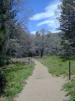
A few miles east Lake Arrowhead on Hwy. 18 is a parking area for Heaps Peak Trailhead & the Arboretum. This small hike takes less than an hour & is the easiest nature trail around. Educational brochures are available & a small donation is requested.

Fish Slough

On the north end of Bishop CA, running parallel to & on the west side of Hwy 6, is a long dirt road called Fish Slough Rd. Indian petroglyphs can be found out here & also on the ridges along Chalk Bluff Rd (to the south). The entire region is called a volcanic tableland & hot springs are very common in this region. The Owens River Gorge & Lake Crowley are to the west. High clearance vehicles are recommended for traveling these back roads, but 4×4 is rarely needed.

Read & see more on Fish Slough Petroglyphs

BISHOP CA

LAKE CROWLEY

BENTON HOT SPRINGS

Visit Hwy 395 Hot Springs

Indian Art Eastern Sierra

Fish Slough

Dave Explains