Category Archives: California Rivers

Partington Cove Hike in Big Sur

Big Sur – Partington Cove

DSCN3026
Go west to & visit the oceans edge or head east to explore a deep redwood canyon.big

Approx. 5 miles South of Big Sur State Park and just north of Julia Pfeiffer Burn State Park, this unmarked dirt turnout area on Highway 1 is a rare find. Rocky shorelines at the historic point, plus the scenic tree lined waterfall & cross the highway & head east for a shady Redwood canyon forest with plenty of backpacking options into the Big Sur back country of Los Padres National Forest. From bright sunny ocean view hillsides to dark shady forests.

This portion of the highway cuts into a deep bend along the coast & has no markings to the paradise that lies within. A steep dirt fire road (down to the cove) with metal gate is your only clue. Dirt parking area on both sides of the road indicate that people have parked here before.

This un-signed secluded hide-away has a variety of landscape & sites to see. You could easily kill 6-8 hours just in this canyon alone!! Definitely not a hurry through kind of place. Take your time, enjoy the view, tide pools, bring your swim suits & refresh in the creek. Carry a picnic eastbound into a shady creek-bed canyon & watch the sun dance through the towering pines above.

Driving northbound on Highway 1, look for large hair-pin turn out in canyon area – approx. 3-5 mi. North of Julia Pfeiffer State Park in wide dirt areas along roadside. Located in between Julia State Park & Pfeiffer Big Sur State Park.
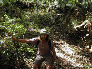
Hike down the dusty wide gated fire road in dry brush chaparral. The view of Redwood trees, the royal blue ocean in front of you, the sounds of a water falling creek. The trail forks off in 3 directions:

Right / Rock Beach – this a boulder lined cove where the clear fresh water stream meets the ocean. Small pools & waterfalls can be found just upstream .

Bridge Crossing / Point – through a wooden tunnel to a cliff area with tide pools & wooden structure (an old boat launch?)

Left / Up Stream – a forested canyon w/ a variety of trees; dead ends a few hundred yards up into the canyon
DSCN3021Another option to this canyon is the East side:

Hike up inland (away from ocean) into a densely forested creek area. Redwoods, waterfalls & boulders. Deer sightings are quite common in this area. Shady & dark this trail climbs gradually in elevation. One fork of the trail leads to an old Redwood Grove. A portion of the trail is closed 2.5 mi. up due to a landslide. But overall the is a perfect option for backpackers wanting a short hike.

  • Los Padres Maps (USDA)
  • Big Sur Map (NatGeo)
  • Ventana Wilderness Map w/ Silver Peak
  • Split Mountain Anza Borrego

    Anza Borrego Desert State Park

    Fish Creek Campground

    E of Borrego Springs CA.

    Well off Highway 78, past the busy OHV area, quads at Ocotillo Wells, past all the rural homes & the redneck bar, past the Elephant Trees hike – where the road goes from pavement to graded dirt to a wild desert wash, in a few short miles. If you don’t know where you are, then you’re almost there.

    This is a large wild desert wash with huge unstable walls, several areas for wind caves and a few historic markers. Lots of 4×4 trails beyonf Split Mountain, to the south. No real water in sight, except maybe the puddle you are standing in as it starts to poor. The soft sand can give way to a few heavy rain drops. May not be a great area to be during a serious storm or flash flood possibility, unless you want to get buried alive. Check the weather forecast in advance.

    A ratty, small developed campground of Fish Creek is on the left side, upon the ledge. Fish Creek Campground is picnic tables & a pit toilet – at most. Ya may as well camp out in the open, off road, like the pioneers did. You can do that out here in Anza Borrego. (Just keep it clean & carry a metal fire container.)

    split mountain

    Split Mountain, Anza Borrego Desert State Park

    This portion of the “mountain” is less than a mile from Fish Creek Campground. Fossils can be found in these walls. Shade is good in summer months, when day temps reach 100+. The rest of the year is ideal weather. This mountain split from water, erosion, mega force. High walls, wind caves, desert washes, great primitive camping & 4×4 routes.

    This desert scenic drive will require you to get that SUV dusty. 4 wheel drive not required. No RVs past the campground. All low lying passenger cars are warned, there are uneven areas, soft sand & boulders.

    Duh, do not attempt this one when desert flash floods are possible.

    ANZA BORREGO STATE PARK

    ANZA BORREGO MAP

    SAN DIEGO BACKCOUNTRY MAP

    nearby towns –

  • BORREGO SPRINGS CA
  • OCOTILLO WELLS CA
  • SALTON SEA CA

    splitmountain

    Great desert back road exploring out here. A zillions washes & canyons.

  • Colorado River Jet Ski

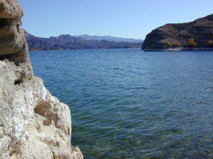
    mohavelake01Mojave Lake

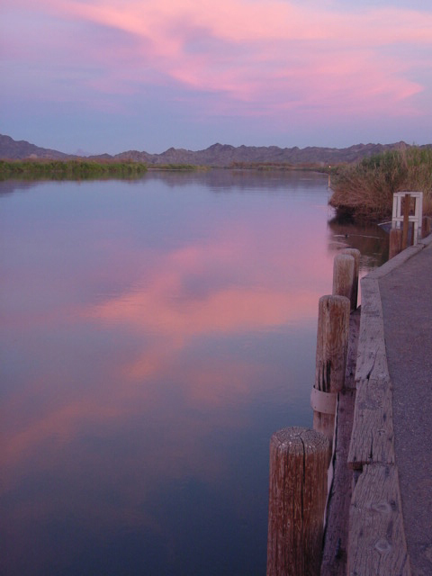
    Colorado River: Tri-State area includes Arizona, California, Nevada. From the northern Lake Mead @ Las Vegas to the lower Colorado River marshes of Yuma, a span of fresh water that travels the western deserts. From the snow melt of the Rocky Mountains, through the red rock of Utah’s canyonlands, Grand Canyon and all it’s glory, way down to the farms near Mexicali, this is the biggest river in the west.

    outdoor recreation includes –
    fishing, camping, kayaking, canoeing, boating, houseboats, water ski, watercraft rentals

    Below are personal water craft rentals and shops around the region.

    LAKE MEAD PWC RENTALS

    Callville Bay Marina
    800-255-5561

    Lake Mead Resort Marina
    877-765-3745
    702-293-1191

    Skiwi Rentals
    702-568-8999

    Temple Bar Marina
    800-255-5561

    World Wide Jet Ski
    702-558-7547

    LAKE MOHAVE PWC RENTALS

    Cottonwood Cove Marina
    800-255-5561

    Willow Beach Marina
    928-754-2443

    BULLHEAD CITY, AZ

    AC Watercraft Rental
    928-767-4747

    River Rats Water Sports
    928-754-4782

    LAUGHLIN, NV

    Avi Resort
    800-430-0721
    702-535-5526

    Best Jetz
    702-298-0757

    Xtreme Watercraft Rentals
    702-298-7541

    LAKE HAVASU CITY

    All Seasons Water Sports
    928-706-2512

    Champion Rentalsdocpicacho
    928-855-8088

    Dana’s Rental
    928-854-1124

    Desert Sun Watersports
    928-706-3958

    London Bridge Watercraft Tours & Rentals
    928-453-8883

    Walt’s Motorsports Marine
    928-855-5019

    Wet Monkey Powersport Rentals
    877-938-6659

    Windsor Beach Rentals
    888-428-2792
    928-453-4792

    YUMA, AZ

    Jet Rent
    928-314-4345

    Jet Ski is a registered trademark under Kawasaki
    Watercraft manufacturers also include: Sea-Doo & Yamaha

    California Big Foot

    Camping near Sasquatch, Yeti, California Bigfoot

    bigfoot California

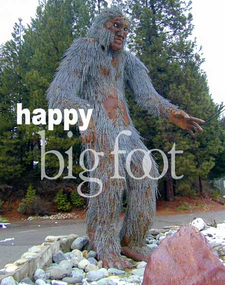
    This bad boy stands at a corner in Happy Camp, on the Klamath River in Northern California. Does he look happy to you? Their populations may not be thriving, as previously thought.

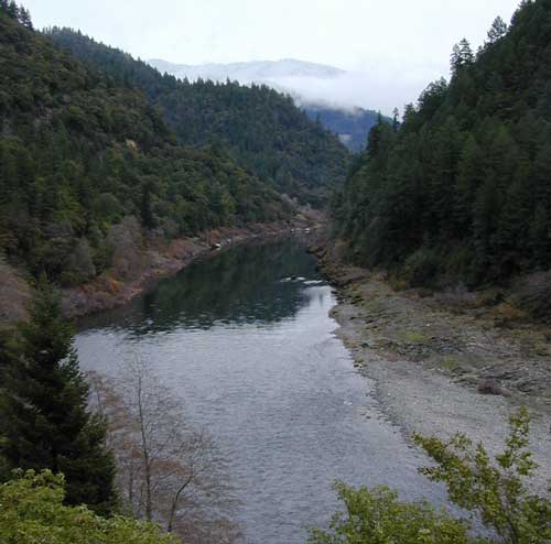
    Highway 299 Westbound, in winter means wet, mud, and rock slides. A dark river canyon with big trees and tall cliffs. Wildfire burnt areas near Weaverville CA; Snow at 3000′. As an avid camper in California, I get questions. Plenty. Most about local destinations, some about secret spots, a few about camping gear. Tourists will ask about the California big foot – every so often. The majority of Total Escape tent camping has been in Baja & SoCal, the Central Coast & the Western US deserts. Minimal in Northern California – where the mythical beast is know to live.

    Bigfoot Country is considered anything north of Trinity County (up into Oregon & Washing state). The story begins with Native Americans about multiple “sasquatch” creatures that live around Bluff Creek near the remote Klamath River. Is he a urban legend, a great hoax or for real? Upon our 2008 Xmas road trip we interviewed plenty locals about the possibility; the only guy who had a sorta believable story about ‘hearing one, but never see it’ — was a 21 yr old slacker kid from Willow Creek, so the credibility is questionable.

    Stay overnight at the Big Foot Lodge down in Willow Creek & you’ll spend much more than necessary for a simple hotel room. If it’s raining hard & you need a place, it may be your only option. Best to call ahead for other lodges & cabins. The Bigfoot Museum is located in these parts and the Bigfoot Festival is held every Labor Day weekend in downtown Willow Creek. Anyone up for Big Foot river rafting?

    Small town of Happy Camp is serious “back woods” California – at it best or worst, you decide. The chamber of commerce is trying to make this more of a tourist destination, we’ll see how that pans out. But if you wanna see a big foot, these areas of Klamath & Six River National Forests are both prime places to do it. Explore way, way back there. Be prepared, with camera & a weapon.

    Klamath River has tons of outdoor recreation, camping, fishing, rafting, kayaking, mountain biking, hiking, backpacking, mountaineering, equestrian trails. The lodging was minimal in HappyCamp. Primitive tent camping on the river rock/sand bars at Independence Creek on Klamath Hwy 96 – looked more inviting. Crazy kayakers!

    As far as any yeti encounters with Total Escape – nope, none, nada.
    Not one…. yet.

    saquatch

    If you are a local from NorCal with a great big foot story, we would love to hear about it


    Sierra Nevada Trips

    Total Escape specializes in California locations & the beautiful Sierra Nevada mountains are the backbone to the gorgeous golden state. From the Tehachapi Mountains to the Lassen Volcano, we cover the best back roads for camping, fishing, biking, hiking, kayaking, backpacking, off-roading & hot springing.

    Summer is the time to explore the High Sierra. During the fall, winter, and spring, precipitation in the Sierra ranges from 20-80 inches, mostly as snow above 6000′ elevation.

    Giant Sequoias are the most massive trees in the world. Sequoia trees can be found in several locations within the Sierras, from the Western Divide Hwy to northern areas of Yosemite Park on Hwy 120. Within Total Escape you can find the hidden groves too.

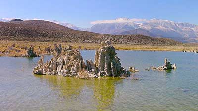
    Eastern Sierra along Hwy 395, is all about the drastic elevations & volcano valleys. The Mono Craters are the youngest mountain range in North America. Located near Mono Lake & Lee Vining CA.

    mono lake views

    National Forests & Wilderness areas within the Sierra Nevada range:

    Sequoia National Forest

    • Dome Land Wilderness
    • Golden Trout Wilderness

    Sierra National Forest

    • Ansel Adams Wilderness
    • Kaiser Wilderness

    Inyo National Forest

    • John Muir Wilderness
    • Golden Trout Wilderness

    Stanislaus National Forest

    • Carson Iceberg Wilderness
    • Emigrant Wilderness

    El Dorado National Forest

    • Mokelumne Wilderness

    Toiyabe National Forest

    • Hoover Wilderness

    Tahoe National Forest

    • Desolation Wilderness
    • Granite Chief Wilderness

    Plumas National Forest

    Lassen National Forest

    Sierra Nevada destinations

    The most popular Sierra destinations:

    MAMMOTH LAKES

    GOLD COUNTRY California

    LAKE TAHOE California

    MOUNT WHITNEY

    JUNE LAKE Loop

    YOSEMITE VALLEY

    SEQUOIA Park

    Some unheard of spots in the Sierra Nevada:

    DARDANELLE CA

    COURTRIGHT

    PONDEROSA CA

    GOLD LAKE

    LONG BARN

    ALTA SIERRA

    PINE CREST

    Mountain Home State Forest

    McKINLEY GROVE

    Monache Meadows

    county line

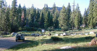
    County Line trailhead in Stanislaus National Forest, Sonora Pass

    Footbridge Hike to Kaweah River

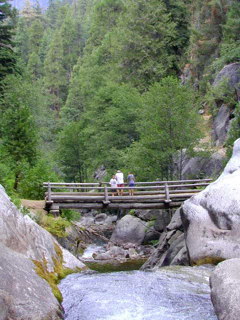
    Mineral King Footbridge – Atwell Mill

    The Kaweah River skirts about a mile south of Atwell Mill campground on the Mineral King Road inside Sequoia National Park. From the Atwell Mill campground, this well traveled trail leads down to a footbridge for a nice half day hike destination. There are a few waterfalls & creek crossings along the way. A few pools & waterfalls await you at the river. Pack a picnic & spent the day here.

    This area is popular for backpackers also. A few Sierra Nevada back country destinations lead from this point into Tar Gap & East Fork Grove. Prescribed fires or ‘controlled burns’ by Forest & Park Services help keep the underlying brush fuel down to a minimum; which helps the forest with carbon in the soil and for decreasing future wild fires.

    Western Sierra Nevada river hiking near
    SILVER CITY CA

    MINERAL KING California

    Sierra Nevada Hikes

    Tuttle Creek Campground

    Tuttle Way

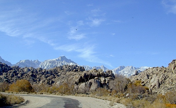
    There she sits, above Lone Pine California, right next to the High Sierra. Above the Alabama Hills….. at the base of Whitney, on an alluvial fan overlooking the Owens Valley & US Hwy 395.

    Tuttle Creek Campground is perfect stop for RVers traveling the Eastern Sierra, beginner mountain bikers needing to explore & test their skills, or the avid backpackers waiting to acclimate & get a good nights rest in reasonable temperatures, before attempting the tallest Mount Whitney.

    Tuttle Creek is a BLM Campground w/ picnic tables, fire rings or BBQs. Awesome creek camping at the base of Mount Whitney. Hear the water rushing over the boulders; soothing for bedtime or stargazing. The fishing is decent. Wildflowers like indian paintbrush & lupine can be found here in spring and summer, in the high desert sage lands of the Eastern Sierra.

    • Elevation: 5120′
    • Number of Sites: 85
    • Vehicle Accessibility: RVs okay
    • Camp Fee: No
    • Campsites Reservation: No
    • Length of Stay: 14 Days
    • Season: March – October
    • Trailheads: John Muir Wilderness

    From Lone Pine CA, head West 3 miles on Whitney Portal Rd, turn LEFT on Horseshoe Meadow Road, within 2 miles, turn right on a dirt road that leads to the campground.

    Tuttle Creek flows past campground; No drinking water.
    Pit toilets; Some shade.

    BLM Lone Pine
    760-872-4881

    LONE PINE CA

    HINT: On the dirt back roads, on the slopes of the Eastern Sierra, between Lone Pine & Bishop, you can find & fishing holes & primitive camps (free camping) on any numerous of creeks; some you can park so close that you don’t have to leave your vehicle to fish. You may need a high clearance vehicle to reach some.

    Fish Slough

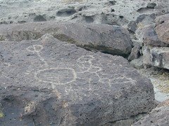
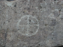
    On the north end of Bishop CA, running parallel to & on the west side of Hwy 6, is a long dirt road called Fish Slough Rd. Indian petroglyphs can be found out here & also on the ridges along Chalk Bluff Rd (to the south). The entire region is called a volcanic tableland & hot springs are very common in this region. The Owens River Gorge & Lake Crowley are to the west. High clearance vehicles are recommended for traveling these back roads, but 4×4 is rarely needed.

    Read & see more on Fish Slough Petroglyphs

    BISHOP CA

    LAKE CROWLEY

    BENTON HOT SPRINGS

    Visit Hwy 395 Hot Springs

    Indian Art Eastern Sierra

    Fish Slough

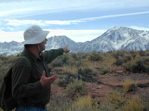
    Dave Explains