

Sierra Madre Mountains
Cachuma Lake to Cuyama Valley

197,380 acres
Central Coast Foothills
Los Padres National Forest
 North of Santa Barbara, CA
East of Santa Maria, CA
South of New Cuyama, CA
West of Ventucopa, CA
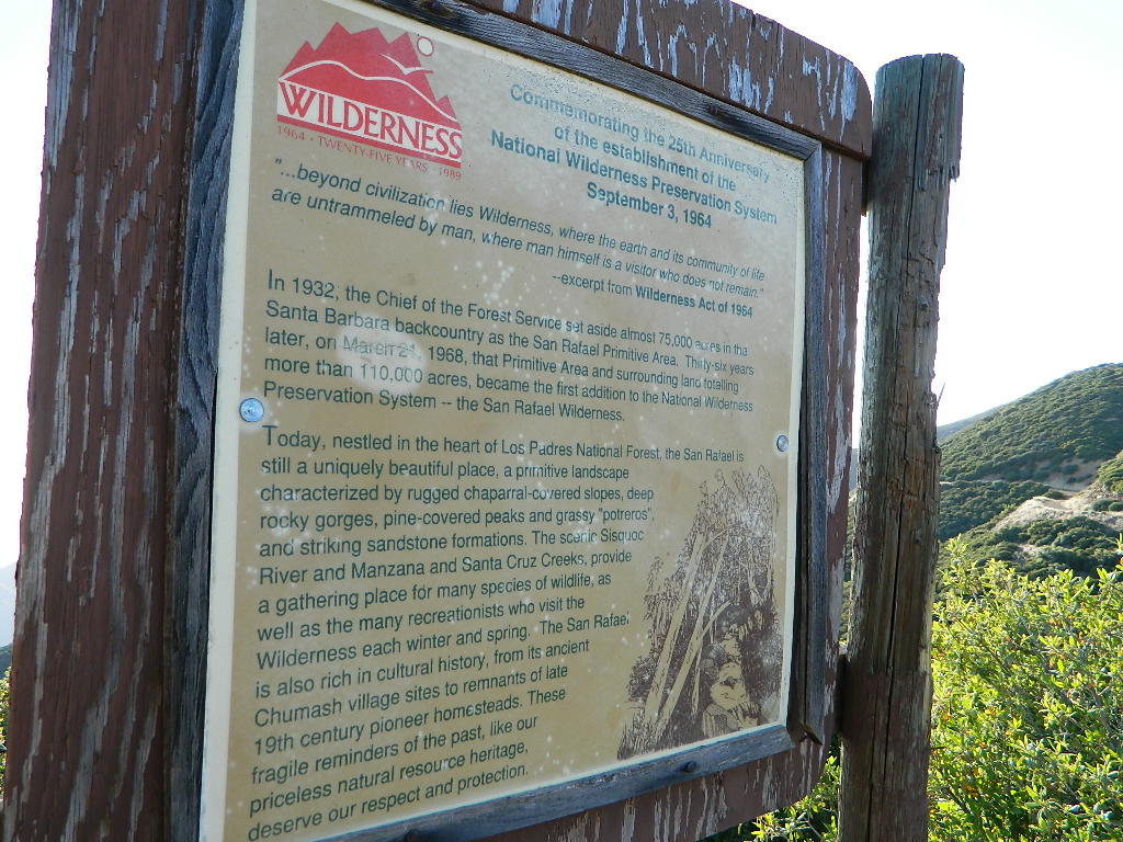
San Rafael Wilderness is otherwise known as the Santa Barbara backcountry. The Sierra Madre mountains and San Rafael mountains make up the this chunk of wilderness, a vast open space near the coast – which extends from Lake Cachuma to the Cuyama River Valley. This is the southern ridge line along Highway 166, with few pine trees, mostly oaks, leading west to Santa Maria River.
 Figueroa Mountain and Lake Cachuma are to the south near Santa Barbara. Vineyards and wineries skirt the western hills of Santa Maria, cattle grazing, oil fields and agriculture line the northern borders near Cuyama Valley. Dick Smith Wilderness is just to the east a little bit, spanning over toward Hwy 33.
OHV: better known as off-roading and dirt biking is common in the foothills behind Santa Barbara, as well as on the west side of the San Rafael Wilderness, near Miranda Pine and Tepusquet Road. Numerous small campgrounds on dirt roads are positioned around the perimeter, but no OHV trails lead into the wilderness areas.
McPherson Peak – 5749′ elevation
Peak Mountain – 5843′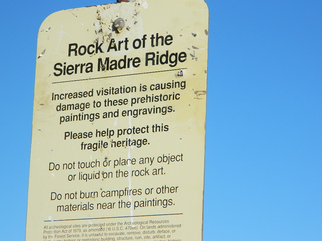
Timber Peak – 4764′
Miranda Pine Mountain – 4120′
Wheat Peak – 2436′
trailheads –
- via Figueroa Road #8N09
- Cachuma Saddle
- Davy Brown
- McPherson Peak, on Sierra Madre Ridge
- Painted Rock, on Sierra Madre Ridge
- Santa Barbara Canyon, off Hwy 166
developed campgrounds surrounding the wilderness
- Davy Brown Campground
- Nira Campground
- Cachuma Campground
- Figueroa Campground
- Manzana Schoolhouse
- Colson Canyon (OHV) #11N04
- Brookshire Springs
- Miranda Pine #11N03
- Horseshoe Springs
- Lazy Campground
- Wagon Flat Campground
- Barrel Springs #10N06
- Alesandro Campground
back road access –
- Figueroa Mountain Road #8N09
- Tepusquet Road, off Hwy 166
- Miranda Pine Road #11N03
- Sierra Madre Ridge Road #32S13
- Cottonwood Canyon Rd @ Hwy 166
- Santa Barbara Canyon Rd, off Hwy 166
indian rock art
Native American petroglyphs can be found in this remote region of Central California, but may require topographic skills, detective work, trekking and at least a full day of physical action.
Access to ”Painted Rock” on Sierra Madre ridge is hike/bike in only. The dirt road that access these trailheads are rough road and not maintained. High clearance may be needed. This day trip is an all-day adventure and you might want to consider bringing the mountain bike. Just stay on the road, as rangers will ticket for riding in the designated Wilderness Areas.

from the west – If you plan to visit the rock art from the west side, take Cottonwood Canyon (small sign) turn off of Hwy 166. Pay attention to private property signs, cuz the locals are serious about their lands. Keep on driving up the mountain. Above Bates Canyon Campground up on the ridge, turn left, east on dirt road #32S13 – proceed several miles to the dirt parking area at the pig pen w/ locked gated and signed trailhead.
from the east – dirt road hike is about 10 miles (one way) and it starts at the Santa Barbara Canyon trailhead @ locked gated. Rural back road access requires a good topo map. Find Cuyama River @ Hwy 166, take the route on west side of bridge. East of New Cuyama, CA

nearby towns –
