

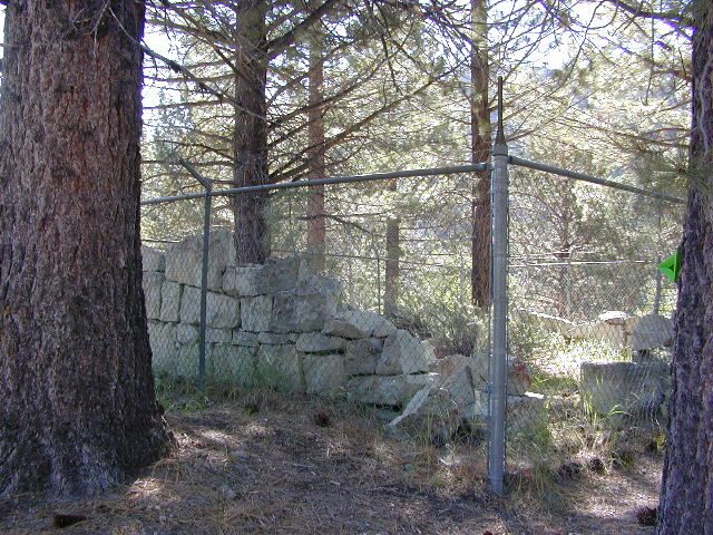
Historic Town Site: Kongsberg, Eastern Sierra, California
Silver Mountain City
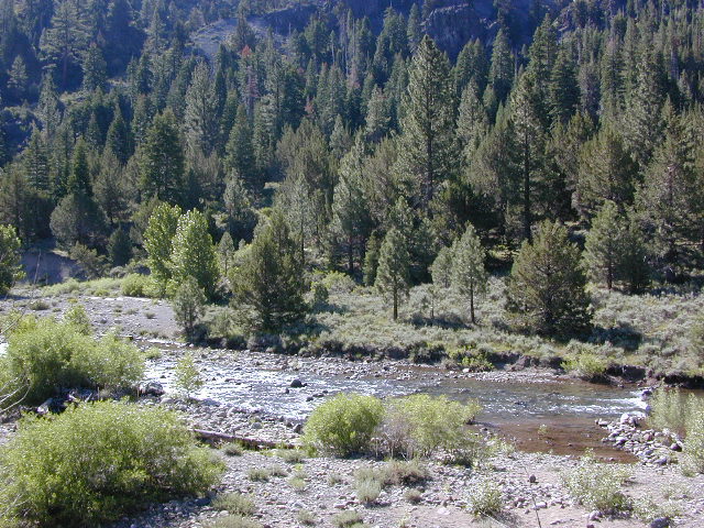
Located on the lightly forested slopes of the Carson River. About 7 miles east of Ebbett’s Pass, Highway 4 (CA SR 4)
Silver Boom Town in 1866
population 3000
Founded as Kongsberg in the late 1850’s by Scandinavian mining prospectors, the town name was later changed to Silver Mountain City. This wild, remote locale was the county seat for Alpine County from 1864 to 1875. The mining camp town was abandoned by 1886.
Nearby Towns:
Markleeville, CA

This canyon stretch of SR 4 highway has limited primitive camping options along the water. Flat dirt clearings and maybe a rock fire ring. No facilities, no bathrooms.
Silver Creek runs parallel to the highway and meets East fork of Carson River. Google Maps has this named Alpine State Hwy (which is closed in winter)
Drive less than 55 mph to take in all the scenery, slower if you want to find a decent place to stop. Look for easy pull-offs on dirt, a few trails, parking spots, picnic trees, some favorite fishing spots. Campfire permits are needed for dispersed camping.
Humboldt-Toiyabe National Forest
NFS Campgrounds nearby :
- Silver Creek Campground @ 6800′ elev.
NFS developed camp w/ fee (open June-Sept) - Centerville Flat Campground @ 5900′ elev.
undeveloped sites. Silver Creek meets East fork of Carson River
 Pacific Crest Trail access –
PCT trail crosses highway near Ebbetts Pass
