Central Coast Mountains / Central Coast Cali
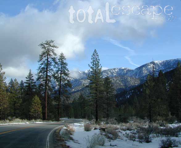
Within 40 miles from the Santa Barbara coast are mountains that reach near 9000′ elevation, the tallest in Kern County. Mount Pinos & Mt Able, as well as the Sespe, Dick Smith, San Rafael, Matilija & Chumash Wilderness Areas, make up this southern portion of Los Padres National Forest. There are plenty of tiny, primitive campgrounds that offer seclusion for RVs & car campers. 4×4 camps, OHV routes & parks, plus numerous Wilderness areas that will suit everyone’s need for the outdoors. A great drive for accessing this area is Hwy 33 North from Ojai.
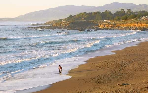
 Further up the coast is the northern section of Los Padres National Forest – which is the mountainous back drop to the magnificent Big Sur coastline. If you are seeking to camp near Big Sur without the fees of a developed Campground, these dirt road ridge lines may be your saving grace… if you don’t mind roughing it. Views over the ocean & coastline are even more spectacular than from Hwy 1, but campfire restriction can be tight in summer & fall months. There are plenty lodging opportunities, historic lodges, cabins or luxury RV parks, located in the small towns along the coast.
Both Los Padres forest north & south are open all year long for recreation & camping. Only one town in this region, Pine Mountain Club, gets considerable amounts of snow (roads may be impassable without chains, AWD or 4×4). Central Coast icon Big Sur with Hwy 1 is prone to mud & rock slides during heavy rains, so plan for alternate routes & check road conditions w/ CalTrans when traveling during inclement weather.
Central Coast forest & parks –
Los Padres National Forest
Andrew Molera State Park
Julia Pfieffer Burns State Park
Limekiln State Park
Pfieffer Big Sur State Park
San Simeon State Park
Central Coast maps & trails –
- Los Padres National Forest Maps
- Dick Smith Wilderness Map
- Sespe Wilderness Map
- Ventana Wilderness Map
Central Coast towns nearby –
Big Sur, Cambria, Frazier Park, Gorda, Gorman, Ojai, New Cuyama, Pine Mountain, San Simeon, Ventucopa