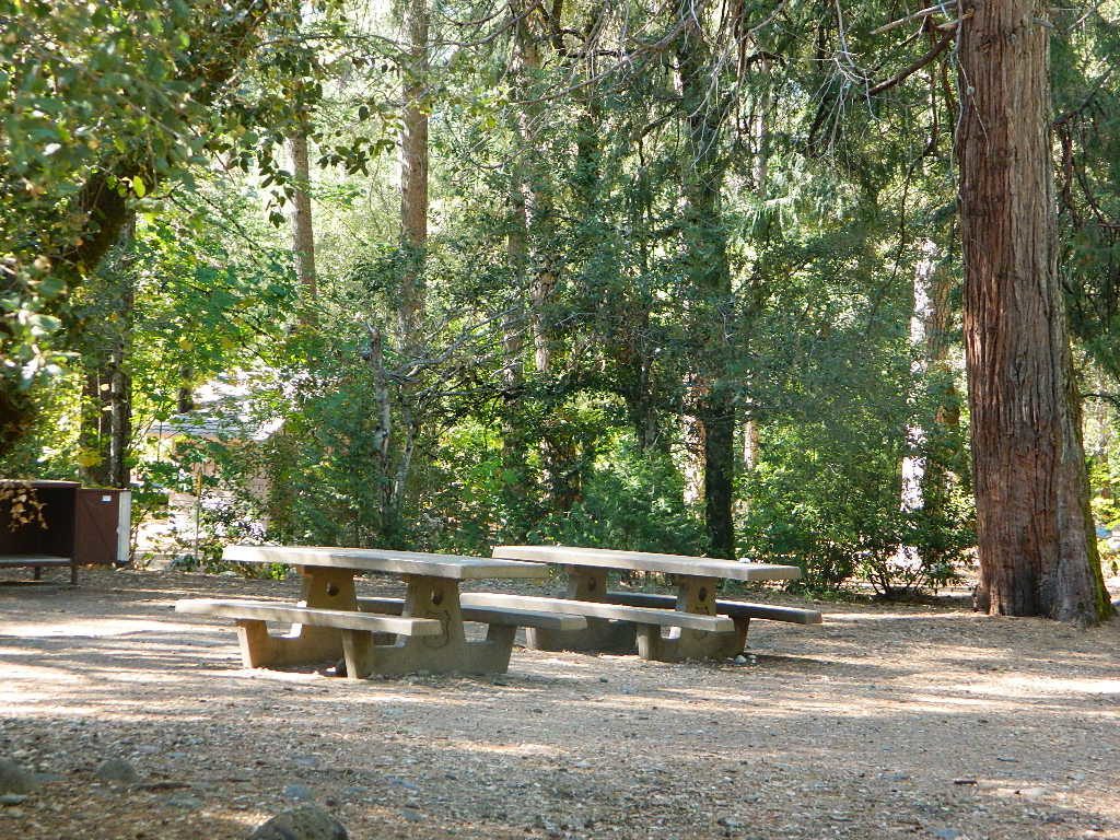
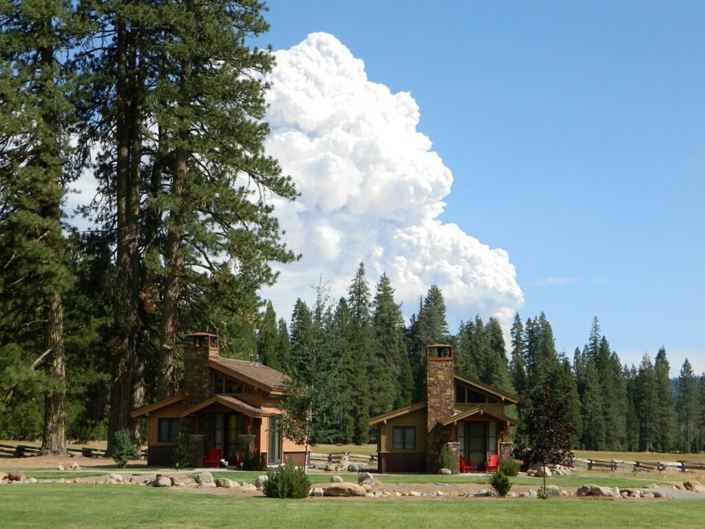
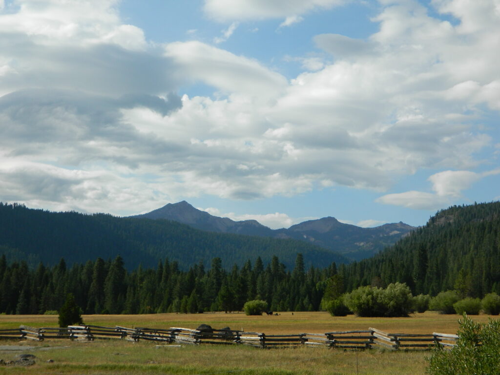
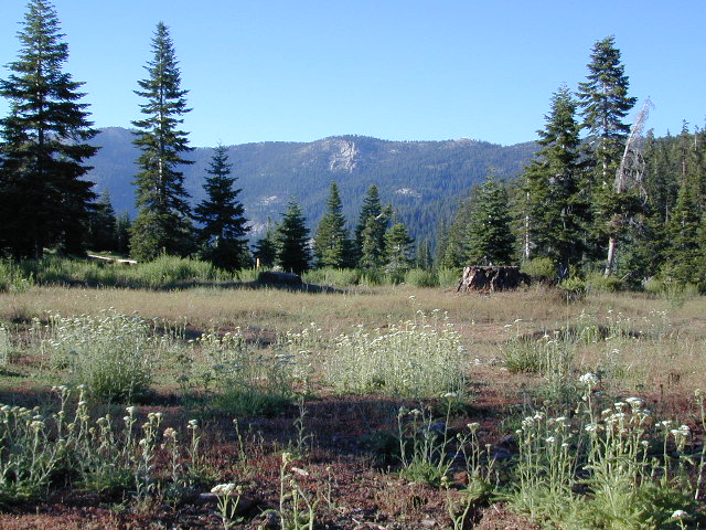
Highlands Ranch Resort cottages on Child MeadowChilds Meadows @ Lassen
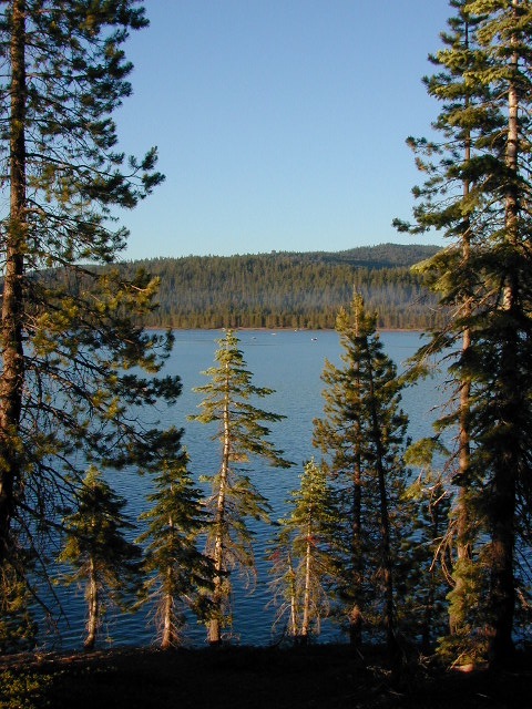
Big Meadows, California
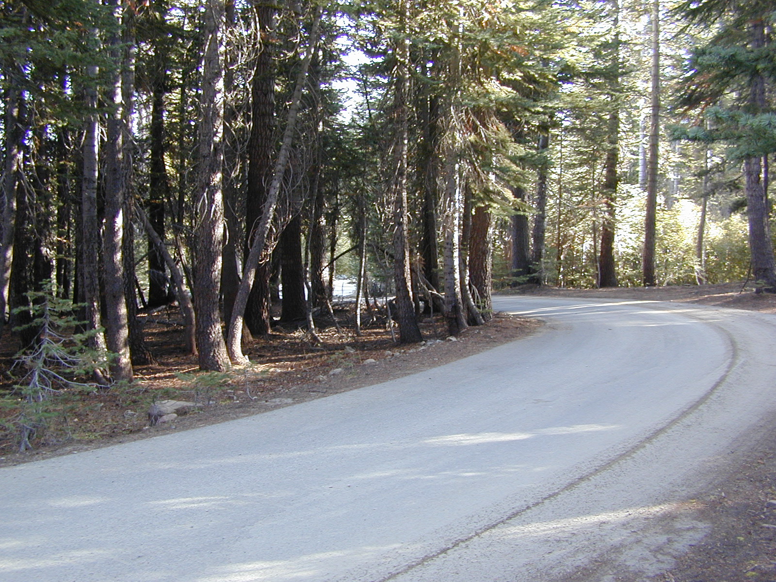
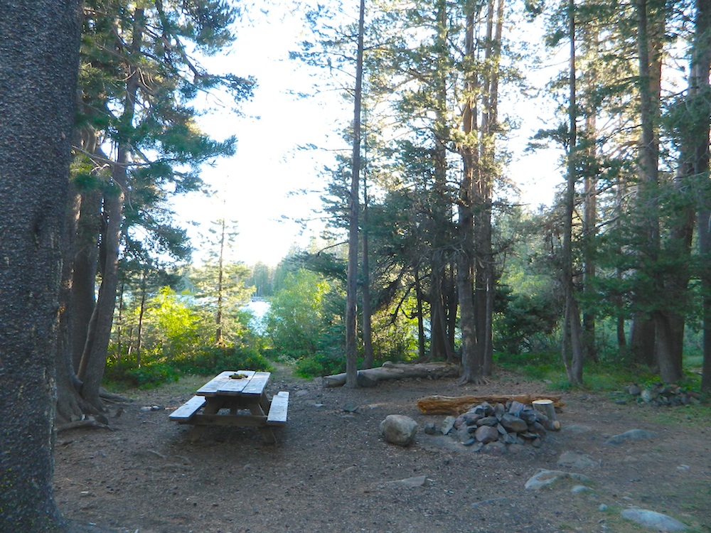
In the mountains numerous places called ‘big meadows’ exist in California. Large meadows, huge meadows, high elevations and low. We are truly blessed by such a natural beauty in our local region. Remember those who have protected the land for future generations.
camping near
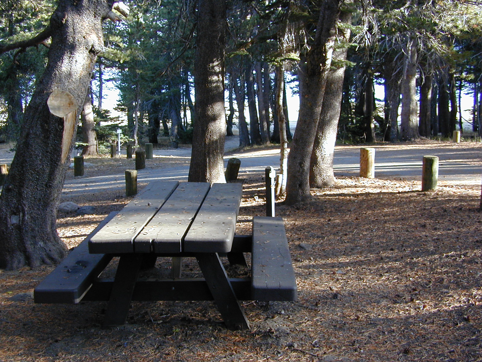
picnic
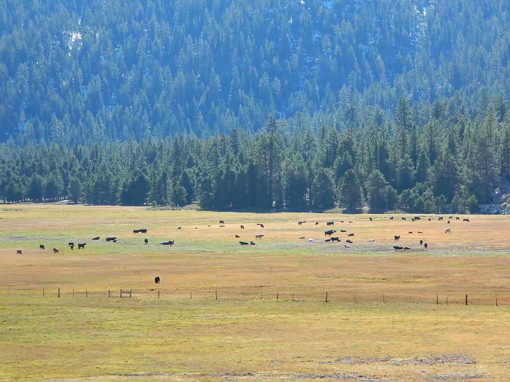
cattle grazing
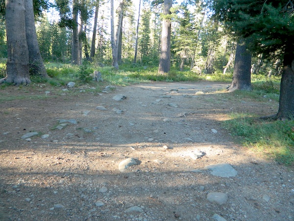
hike thru
bike around
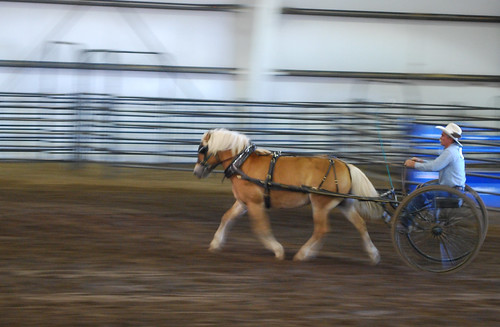
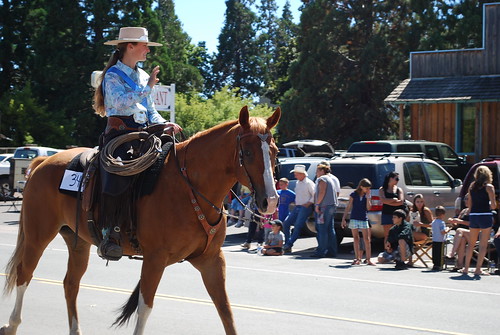
horseback riding
cross country ski
snowmobiling
stargazing
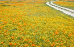
wildflowers
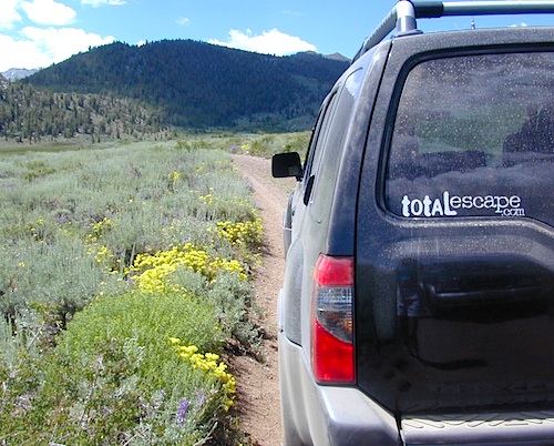
Inyo National Forest – highcountry backroads
For Southern California meadows – Mount Pinos has a large meadow next to the walk-in campground, Chula Vista. San Diego’s Laguna Mountain has some meadows and Big Bear Lake offers sage meadows, on the Fawnskin side.
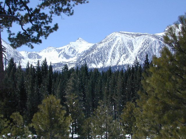
Wild Meadows range from 3000′ elevation in the foothills, to about 11,000′ elevation in the highcountry. Vacant of trees, these wide open areas are generally colder spots, with moisture and with fragile ecosystems.
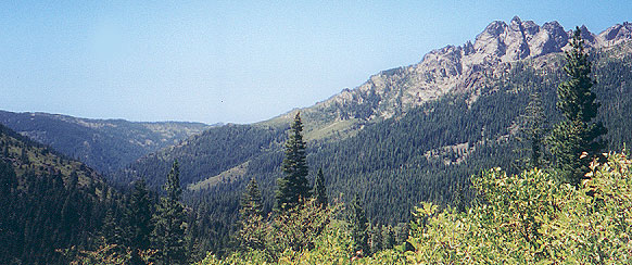
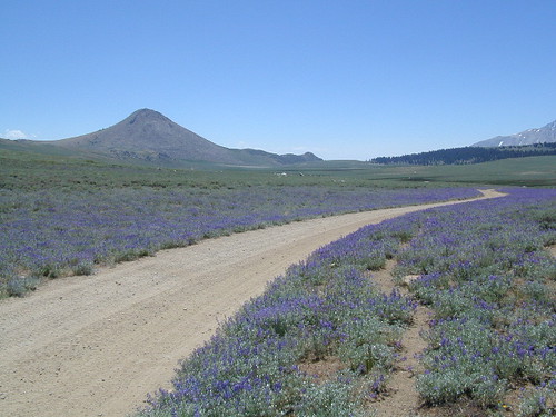
Eastern Sierra’s Inyo has gorgeous meadows of lupine wildflower (see above). Cattle grazing and 4×4 roads all over, up to 12,000′. High country mountain peaks surround. That area is called Coyote Flat w/ Coyote Lake. 4WD needed! Winter, snowy and almost inaccessible.
SNOW – Since meadows are generally located in the mountain regions, deep winter snow can make these special places impossible to reach (for about half the year). Summer is the prime time to explore the higher elevations, so plan accordingly.
WILDFLOWERS – Remember that the higher the elevation, the later the wildflowers will bloom. High Sierra meadows often bloom well into July & August.
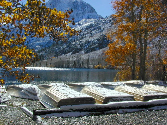
AUTUMN COLORS – Aspen groves are often located next to meadows. Fall colors can be quite decent around October, before the first snow fall of the season.
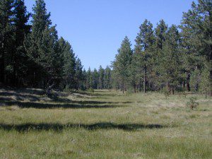
Big Meadow, Kern Plateau in Sequoia NF
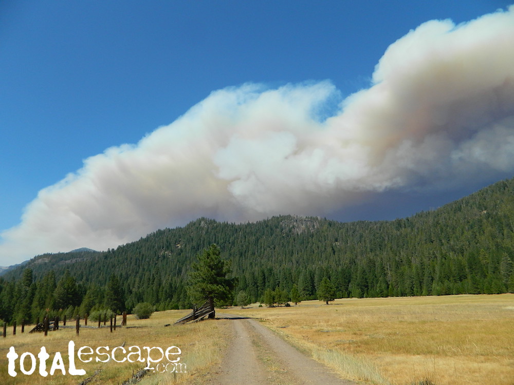
MENDO glade – In the Mendocino National Forest the meadows are called “glades” – and the area has been heavily impacted by wildfire. Snow Mountains Wilderness was totally burnt in the Ranch Fire 2018, the largest wildfire in California history.
NORCAL history – Some Mountain Maidu tribes are known as the “Big Meadow Indians” – they made the Big Meadows of the Upper Feather River their home. Damming the Feather River created Lake Almanor in 1914, which flooded the meadows and forced native people to relocate.
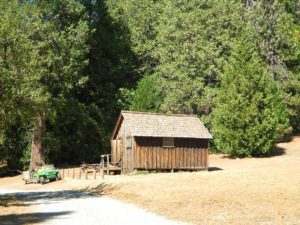
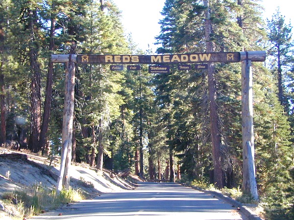
Horse pack station Red’s Meadow, behind Mammoth Mtn. Eastern Sierra
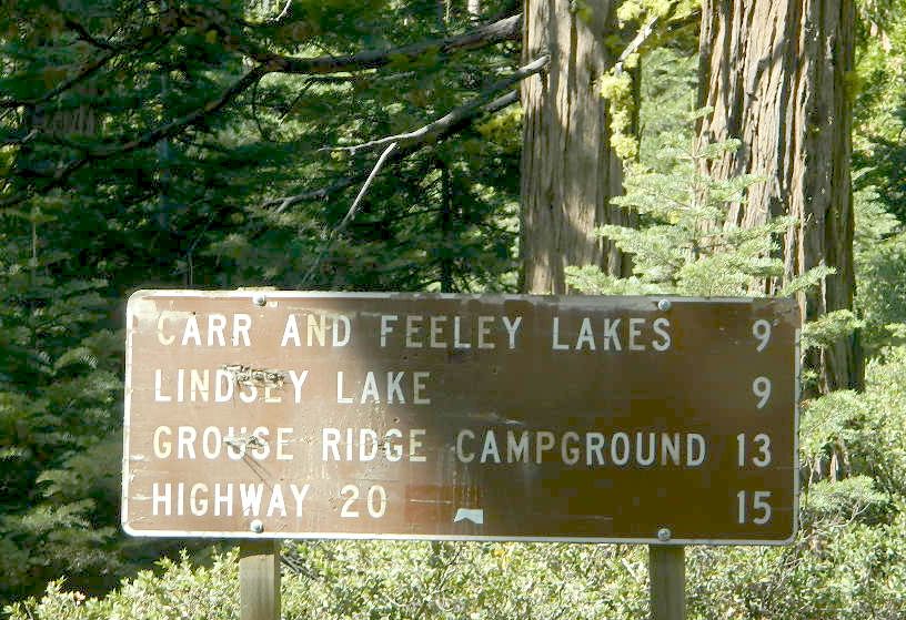
The Big Meadows below are listed from south to north.
Enjoy!
MOUNTAIN MEADOWS are the perfect place to watch meteor showers! Bring your tarps, blankets, pillows and lounge chairs, plus plenty of snacks & drinks for the overnight adventure.
Camping Lakes – Campground Lakes
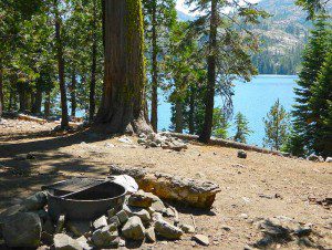
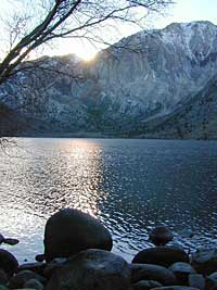
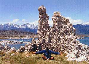
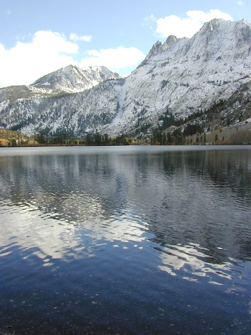
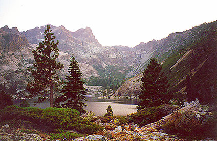
Lake Eastern Sierra California
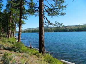
There is not enough room on this web site to list every single alpine lake in the majestic Eastern Sierra range, since there are hundreds, but we highlight a few of the hike-in accessible ones & the more popular camping lakes below.
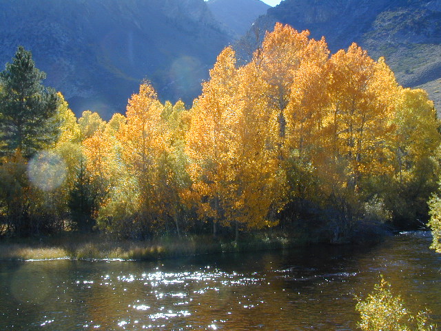
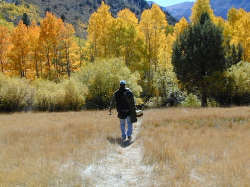
June Lake Loop is a paved, scenic drive highway that has multiple lakes with cabin rentals, camping, fishing, boat rentals. One of the best places to spend autumn looking for fall colors among the aspens.
DanaMite also knows a picture is worth 1000 words, so just click links for photos & enjoy!!!
Trinity is NorCal’s jewel of alpine lakes and granite peaks – many above 8000′ elevation, about 40 miles inland from the ocean. Trinity is located in between the infamous redwood coast and the I-5 corridor. Rivers, creeks, lakes, and trails into the high elevations regions, bqckpackers and equestrian campers alike.
Hiking trailheads are accessed from all sides -On the east side you have Trinity Lake & Trinity River w/ Highway 3 running lengthwise in a north-south direction. Hwy 299 runs east-west along the south side of the wilderness. Klamath River Hwy 96 lies on the west side of the wilderness. Salmon River, Scott Mountains and Cecilville are north of the alps.
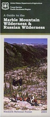
Both the small Russian Wilderness & the larger Marble Mountain Wilderness are located to the north of Trinity Alps, along with rural towns near the Scott Mountains and the Salmon River. Castle Crags Wilderness is to the eastern side, near Interstate 5.
The mountainous area is quite unique, as exposed granite mountain peaks and alpine lakes are pretty rare in the coastal Cascade ranges. The only other spot in California that has an 8000′ peak nearing the coast is just north of Los Angeles – Los Padres’s Mount Abel & Mount Pinos peaks, both over 8000′ in elevation.
TRINITY ALPS TOPO MAP
The USDA map for Trinity Alps Wilderness was outta print for nearly 2 years and it has recently been updated and reprinted. New edition released in 2013 and now available at the Total Escape map store. Printed on waterproof map paper and updated in 2012.
Numerous Silver Lakes, Creeks and other “silver” terrain can be found inside California. After the Gold Rush of 1849 in the western Sierra, Silver was discovered in Nevada shortly after (east of Sierra Nevada mountains). This page is an overview on all places with SILVER in the name, or places that have had a history of silver mining. California Counties are listed in parenthesis. Links below will lead to more detailed pages or campground reservations.
Silver Fork of the American River. Silver Fork Road connects US Highway 50 & Carson Pass Hwy 88. Silver Fork Campground & China Flat Campground (NFS) are both located on this remote, backcountry route, about 8 miles from US Hwy 50
Autumn aspen groves ignite with color in October. Often, some of the best fall colors in the Eastern Sierra. Day trips w/ fishing. Hiking everywhere. Overnighters or backpackers could be greeted with snow at anytime in October or later. The June Lake Loop (SR 158) closes for snow annually!
below are silver mining camps and other silver related destinations, plus some campgrounds
Bodie SHP (State Park)
(Mono Co)
8375′ elev. US Hwy 395 near Bridgeport, CA. Infamous, high desert ghost town, now a California Historic State Park. Large gold mining camp w/ well-preserved, wooden, old town structures. Silver was discovered in nearby Aurora Canyon. All dirt road access. No developed campground @ Bodie, so try nearby Green Creek Road instead. Or high desert, back road camping on Aurora Canyon Road over to Bridgeport Reservoir.
Cerro Gordo
(Inyo Co)
8500′ elev. Inyo mountains, West of Death Valley, east of US Hwy 395 @ Junction 136. Old mining camp rich in silver history. Someone might even live up there. Extreme remote location in rugged, high desert mountains. 4×4 is always required!
Silver City Sequoia
(Tulare Co)
6935′ elev. cabin resort on Mineral King Road, in the South Sequoia National Park
Silver Valley Campground & Silver Tip Campground (Alpine Co)are both located near Lake Alpine on Highway 4 Ebbetts Pass , Central Sierra
Silvertip is also a Group Camp at Jackson Meadow Reservoir (Sierra Co) off Hwy 89, North of Truckee, CA. Silvertip Group Campground, as with all group camping facilities, is by reservation only.
Silver Lake @ LA (Los Angeles Co) a hip and popular, tree-lined neighborhood in Los Angeles, near Griffith Park.
Silver Lake
(San Bernardino Co)
Silver Dry Lake, a dry lakebed in the Mojave desert, near the Hollow Hills Wilderness, north of Baker, CA off I-15
Silver Lakes
(San Bernardino Co)
2430′ elev. a desert community southwest of Barstow, near Helendale, CA. Located on the Mojave River (which flows underground) in between Historic Route 66 & US Hwy 395. Attraction nearby – Exotic World, the Burlesque Hall of Fame.
A multi-day festival that screens independent features and shorts in the spectacular setting of Mammoth Lakes and the ruggedly beautiful Eastern Sierra. Traditionally held on Memorial Day weekend. There used to be a “Mammoth Mountain Film Festival”, but I guess this event replaces it.
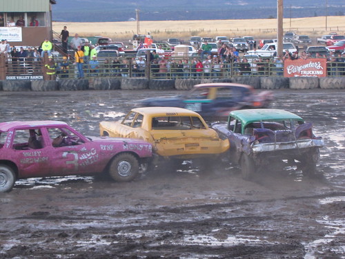
90 years running. Intermountain Fair is held annually at McArthur Fairgrounds, east of Fall River Mills, CA. Small town parade, exhibits, livestock, motocross, demolition derby, carnival rides and games. If you are looking for a small hometown fair inside California, this one is choice pickins.
The Inter-Mountain Fairgrounds is located in the northeastern tip of Shasta County on Highway 299E in the town of McArthur, CA. McArthur is located in the Fall River Valley – along with neighboring communities of Fall River Mills, Glenburn, Pittville, and Dana. All are farming communities with a total population of about 2,000 people @ 3400′ elevation.
ADA Camping (Americans with Disabilities) Handicap accessible camp sites at Blue Lakes, near Hope Valley, CA
Blue Lake Campgrounds
highest lake campgrounds in the vicinity
Eldorado National Forest in Amador Ranger District; a forest south of Lake Tahoe in the central portion of the Sierra Nevada mountain range. This set of scenic, alpine lakes sits in between both Eldorado, Toiyabe National Forests and the Mokelumne Wilderness. But please take note that the Blue Lake facilities are owned and operated by utility company PG&E
No Reservations. most camp sites are available first-come, first-serve
RV limitations: 30 feet
69 miles east of Jackson, CA on Highway 88 and then another 12 miles south on Blue Lakes Road. This area is close to Hope Valley, south of Lake Tahoe, CA
Blue Lakes consist of several developed campgrounds. Blue Lakes Rd# 13 is a well signed, paved road off Hwy 88, just east of Carson Pass (8560′ elev). The route is closed during winter snow, while it serves as a winter recreation area. The main paved road becomes dirt near the campgrounds. A dirt road continues past the lakes and south to Deer Creek and meets w/ Hwy 4 near Ebbett’s Pass.
RV campers, fishing folks, hikers, kayakers and disabled travelers like this lake camp area due to the easy access, paved parking and campground amenities. Handicapped camp sites are also prime lake front locations.
Group Campgrounds are reservable. Picnic Areas, Group Sites and campfire rings. Piped water, bear boxes and vault toilets. No RV hookups, no dump station, no showers. Unimproved boat ramps are available at Upper and Lower Blue Lakes.
Upper Blue Lake Campground elev. 8136′
camp sites: 32
Overflow Camp camp sites: 34
Backpackers and day hikers: Sierra trailheads out here lead south into the Mokelumne Wilderness Area. The infamous Pacific Crest Trail also passes thru this high elevation region: PCT access @ Carson Pass, Upper Lake & Tamarack Lake
BLUE LAKE CAMPGROUND
NorCal region of the South Warner Wilderness in Modoc National Forest. That’s way out near Alturas. Likely, CA is the turn off US 395. Northeast California, real seclusion.
EASTBOUND Paved Road #64 is Jess Valley, which leads along the Pit River, cool volcanic cliffs, and up to forested Blue Lake Campground, elevation 6051′
Wildlife viewing @ Blue Lake Modoc
Donner Blue Lake
DONNER PASS – Sierra Nevada
Interstate 80 BLUE LAKE CAMPGROUND
i80 Donner Pass, near Truckee, CA; a PGE Campground w/ 4×4 access and hike-in only. First come, first serve. No tables or restrooms, elevation 5900′
Lake side resort w/ boat rentals and fishing, near Upper Lake, CA
elevation 1357′
A small resort w/ hotel suites and a lakeside setting w/ abundant nature. Two small lakes, kinda close to the highway. Non motorized boats only, kayaks, paddle boards, canoe, swimming, birdwatching, bike paths and fishing. Wedding venue next to lake. Wineries, restaurants, and a casino nearby.
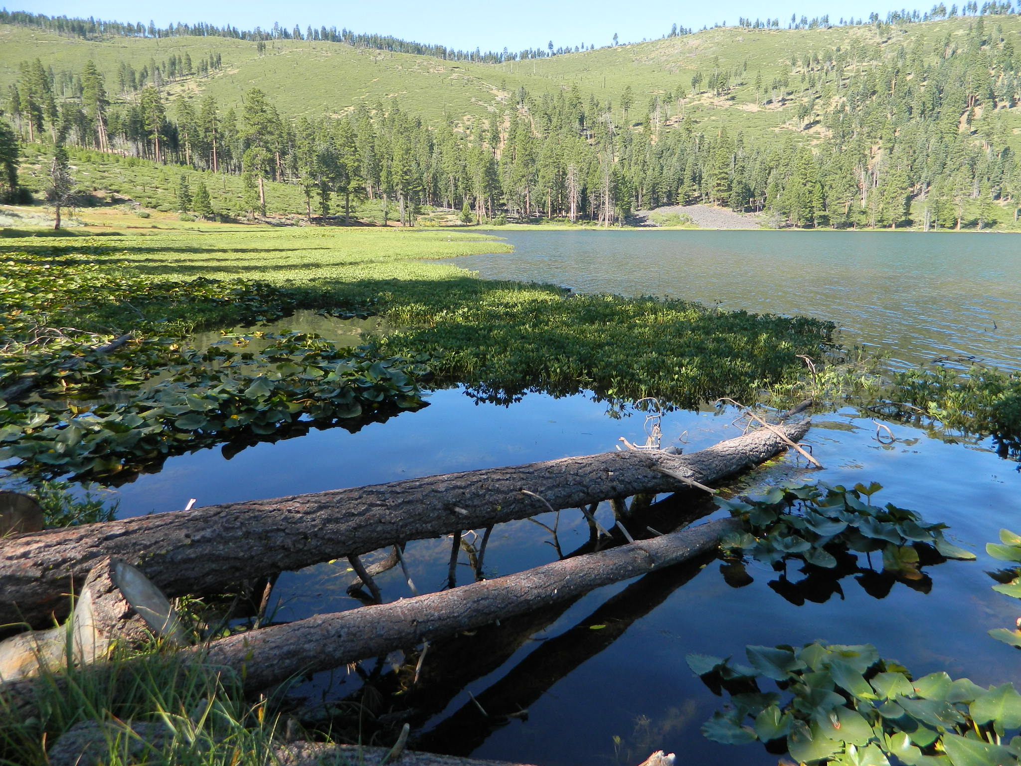
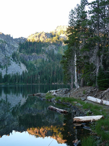
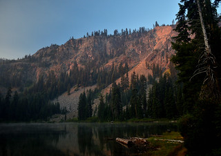
Craggy granite peaks, abundant meadows, big streams, w/ 89 lakes are the main highlights of this wild land area in Northern California.
Marble Mountain itself, a stark, red-and-gray marbled peak. Most of the peaks exceed 6,000 feet in height, with Boulder Peak being the highest at 8299 feet. Long recognized for its wild value, this region became a Primitive area in 1931, a Wilderness in 1953, and a part of the NWPS in 1964. Numerous trails provide excellent and extensive access to the Wilderness, and human use is rated as moderate.
Majority of the lakes are tranquil gems set in rocky settings. At least one-third of the wilderness is cloaked in a great variety of trees, dominated by Tanbark oak, madrone, and Douglas fir populate lower elevations, with whitebark pine, foxtail pine, and mountain hemlock higher up in altitude.
Alpine meadows and bare rock in the highest elevations. Bear, deer, and many other species of wildlife are plentiful. The Pacific Crest Trail crosses the entire Wilderness for 32 miles north-south, and accesses many other trails. Most of the trails offer relatively easy travel for people and horses, and excellent campsites are to be had along the way. Nearby guest ranches offer pack trips and accommodations during summer season.
NorCal weather = Rain and snow is common for more than half the year, so winter access could be muddy, snowy, rainy, windy and cold. Kayakers, anglers and hunters may not mind the inclement weather, but most of the hikers, backpackers and horse like the warmer months.
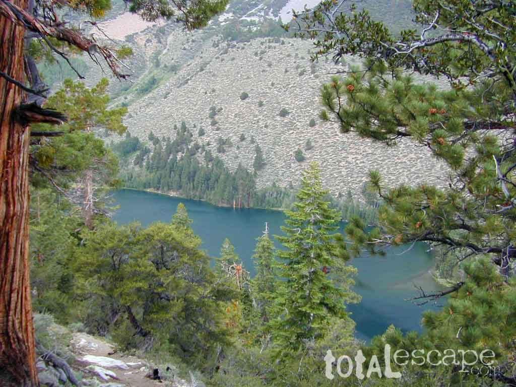
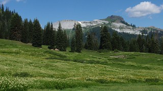
California meadow is a common term people search for when dreaming of their mountain retreat vacation or upcoming weekend camping trip.
Meadows are places in the forest where cool air collects and settles. Deer among other wildlife, can often be found here grazing around dawn and dusk. Alpine meadows are usually surrounded by trees with lush green grasses, located at higher altitudes above 6000′ – the ‘highcountry’ as most like to say.
Find meadows on National Forest lands from 3000-10,000′ elevation, and it is not uncommon to see cattle grazing in these same regions. California National Parks have some of the most protected meadows in the golden state!
MT SAGE – mountain sage meadows
High desert mountains have drier landscapes, with large sage brush meadows surrounded by sparse pinon pine and/or juniper forest. The Mojave desert’s sagebrush reaches out westward to the peaks of West Kern County. High deserts and mountain meadows can both have significant wildflower blooms. The deserts start to show color in March & April, while the highest elevations of the Sierra Nevada can bloom as late as July & August. All California Wildflowers depend on autumn seasonal rains & snow melt.
Kennedy Meadows from Bald Mountain Fire Lookout
Wilderness Meadows
The best places to find secluded wildflower meadows is on the high country trails of various mountains – Mount Pinos, Sierra Nevada, Shasta, Trinity & Lassen – all have marvelous meadows, some have easy access w/ parking nearby and others are hike-in only. Locate hiking trailheads for meadows and possibly find camp nearby.
Excellent near Meadows:
Stargazing, Wildflowers, Wildlife Viewing, Horse Camping
Explore dirt back roads of California to find your very own meadow. If you would like to explore at this level, a good topo map is highly advised. The Sierra Nevada mountains have the most beautiful meadows in the state (by far). Their scenery w/ granite outcroppings and wild flowers, surpasses all else. Although on rare occasions, even the Antelope Valley can look amazing — with poppies.
Mountain Meadows are sacred spaces: Do not disturb the lush, grassy landscape, as wildlife rely on these areas for survival.
No driving on meadows. No camping on meadows; No Campfires; Camp next to (or nearby), but not on top of the meadow. Picnicking should be kept on the sidelines.
Stay on designated dirt roads: No tires across the meadow; No mountain biking, No dirt bikes, No off roading. You’re not spreading the seeds, you’re destroying a fragile ecosystem.
Ranch FENCING w/ barbed-wire is quite common around meadows, to keep cattle out of certain problem areas. Fences also help keep the wandering public out of private lands or sensitive areas.
When hiking – stay out of the muddy spots and know that if you choose to hike directly across meadow, you may encounter water and deep, sinking mud. HINT: There is usually a shallow creek running through most meadows, during all times of the year.
Winter snow usually blankets these fragile areas in winter, and when deep enough – making this terrain prime destinations for snowmobilers.
This is one of many small lakes situated within the Lakes Basin Recreation Area , in the Northern Sierra Nevada mountains. Just north of Downieville & Historic Gold Country. Snag Lake is nothing special compared to the rest of the scenic lakes close by, but it is worth a mention due to a few fun facts.
One thing this small lake campground does have is convenience, located right on the Gold Lake Highway – next to Goose Lake, plus hiking distance to the largest of the lakes, Gold Lake. The second feature is the campground is small, 16 primitive sites, picnic tables & one vault toilet. The third thing is that this is a FREE campground; no charge.
Snag Lake Campground
• Elevation: 6600′
• Number of Sites: 16
• Vehicle Accessibility: Small RVs
• Campsites Reservation: No
• Camp Fee: No
• Length of Stay: 14 Days
• Season: June – October
• Trailheads: Gold Lake
dirt drive (no pavement)
No motorized boats allowed. No paved boat ramps. Kayaks & canoes can hand launch from several spots. The dirt driveway is easily missed, especially at night. The old wooden, forest service sign is not reflective. The vault toilet is close to the highway and the camp sites are along the lake edge. No pavement anywhere!
Upon arrival, camper trailers will want to get out and select the best route to a camp site. The small boulders, dead trees, root and rock obstacles are abundant on the dirt road entry, all around the campground, and at each camp site. High clearance vehicles would fair best at this camp, but some passenger cars may be able to manage the rocky entrance. Get out and look at the road, before scraping across the biggest rock. Slowly, carefully, maybe… and preferably an arrival before dark.
LOCALS TIP: The wind tends to pick up at night around these lakes, so brace your tent well and position your vehicle appropriately.
fishing lake?
Obviously with a name like SNAG, you can imagine that the fishing here is not the best, since roots and old tree stumps make up a good portion of the shoreline. Luckily there are a dozen alpine lakes within a 20 mile radius to choose from for another fishing spot. Some lakes are hike-in only, some require 4×4 to reach and others have cabin resorts.
Gold Lake Hwy (or Gold Lake Road) closes in the winter months (NOV-APRIL) due to snow and the region is used as a winter recreation area. Cross-country skiing and snow-mobiling are both popular activities.
Lassen – Snag Lake
ANOTHER SNAG LAKE in NorCal, can be found by foot, hiking into the Lassen Volcanic Wilderness. Backpacking the lake loop is approx 17 miles RT and includes 3 lakes – Snag Lake, Widow Lake, and Jakey Lake. Trailhead is located at Juniper Lake, at the north shore.
7700′ elev. Hwy 158, Backside of June Lake Loop, north of Mammoth.
Prime hiking and fishing destination of the Eastern Sierra, California. With impressive Carson Peak (10,909′) towering as a granite backdrop for the lake, every day out here is super scenic. Unless, of course, blizzard white-out conditions occur – which is possible during winter.
October-November, Autumn colors – at this particular location – tend to be fantastic, with aspen groves encompassing the lake, nearby streams and steep canyons.
fish: Reverse Creek, Rush Creek, Silver Lake, Grant Lake, Gem Lake, Gull Lake, June Lake
Winter weather & deep snow can close the paved highway loop, so know road conditions and weather forecast before you go. This beautiful Silver Lake is within walking distance of two lodges – Whispering Pines & Double Eagle Resort, so if rain or snow is predicted make your reservations.
This gorgeous, 80 acre alpine lake is a popular campground for fishing, picnicking, hiking, summer and autumn camping. Accommodates tent camping and RVs. Boat ramp, grocery store, coin-op laundry – all nearby. Camp closes for snow annually.
Silver Lake Campground NFS
• Elevation: 7600′
• Number of Sites: 28
• Vehicle Accessibility: RV 20′
• Campsites Reservation: Yes
• Camp Fee: Yes
• Toilets: Flush
• Water: Piped/Potable
• Length of Stay: 14 Days
• Season: April – October
Inyo National Forest
Mono Lake Ranger Station
North US Hwy 395
Lee Vining, CA 93541
760-647-3044
The granite spires of the Sierra Buttes (8591′) tower above both Upper & Lower Sardine, making for a glorious backdrop to these two lakes. This is a popular fishing lake with no swimming allowed. The water is so clear that at noon you can see to the bottom!
There are numerous, super-scenic, small lakes in this region and one trip here is not nearly enough. Total Escape rates this collection of small lakes up there w/ the ‘best hiking lakes’ in California. The Pacific Crest Trail runs through this awesome lakes area, which is located north of Truckee, east of Downieville.
backpacking
boating
camping
canoeing
fine dining
fishing
hiking
granite peaks
kayaking
mountain biking
off-roading
stargazing
waterfalls
wildflowers
high elevation means snow
Plumas Co Road #24 is the Gold Lake Road, also referred to as the Gold Lake Highway – which skirts the lakes, the buttes and connects Historic Gold Country Hwy 49 to Graeagle Golfing @ Hwy 89. SNOW CLOSES THIS ROAD, but the area remains open for winter recreation.
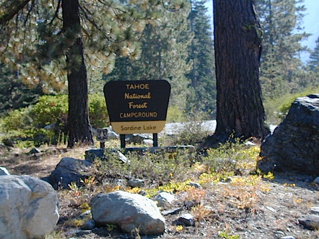
SARDINE LAKE ROAD, a paved turn off the main road. NFS Campground is located one mile from the shore at Lower Sardine. Sardine Lake Resort rents cabins and the restaurant serves dinners w/ lake view!
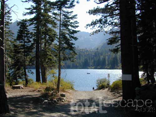
Sardine Lake Campground
• Elevation: 5800′
• Number of Sites: 29
• Vehicle Accessibility: RV 22′
• Campsites Reservation: Yes
• Camp Fee: Yes
• Facilities: piped water, vault toilet
• Length of Stay: 14 Days
• Season: June – October
• Trailheads: Sierra Buttes & PCT
Sardine Peak Lookout
SARDINE PEAK FIRE TOWER LOOKOUT (NFS)
Built in 1935, a three story enclosed tower with external stairs. 2019 – No longer available as an overnight rental. (elevation 8138′)
Upper Sardine Lake: Takes only a short hike to get to. This is a pure glacial bowl; the rock plunges straight into the water, no beach at all. Great fishing; ice-cold swimming.
Little Grass Valley Recreation Area
Plumas National Forest
Tucked way up in the Northern Sierra Nevada mountains, at the top edge of the California Gold Country, is this popular recreational lake in the forest above the busy Sacramento Valley.
Up on the mountain at 5000 feet above sea level, via La Porte Road (Plumas #120), a Sierra Nevada THRU-ROAD – one which closes for winter snow. The lake destination may be open, but the campgrounds are closed up seasonally. (NOV-APRIL)
Little Grass Valley Reservoir
Lake Statistics:
Elevation 5,100′ Surface Area 1,433 acres Shoreline 16 miles Capacity 93,101 acre-feet
With over 300+ camp sites available in 10 different campgrounds, Little Grass Valley has room for everyone. Reservations are recommended in summer months, although some camps are on a first-come basis.
Camper Trailers up to 40 feet can be accommodated in some of the camping units. 2 RV dump stations are available, near Tooms Boat Launch & Red Feather. Campgrounds have piped water, but no RV hookups.
Swim beaches provide excellent swimming and picnicking opportunities. The Lakeshore Trail (13 miles) winds around the entire lake, for hiking, horseback riding, and mountain biking.
Horse Camp
Little Beaver Campground
Red Feather Campground
Sly Creek Campground
Strawberry Campground
Wyandotte Campground
LaPorte, California – up the mountain
TRAVEL NOTE: The nearest town isn’t much of a “town” at all – so driving to get “anywhere w/ tourist services” from here is quite a chore. Gasoline is minimal on this mountain, if any. Plan to bring everything you will need for your outdoor vacation stay, cuz driving to Quincy, or down the hill to O-ville will take more than an hour (one way). Go prepared.
The biggest Gold Lake, California is the well-known one, along the Gold Lake Highway in the Lakes Basin Recreation Area. Plumas meets Tahoe National Forest. North of Gold Country Hwy 49, Downieville & the Yuba River. Right where the Sierra Nevada granite meets the volcanic lava rock of NorCal.
Impressive jagged spires known as The Sierra Buttes (8591′) tower above the stunning lake scenery. This big Gold Lake is surrounded by a dozen smaller alpine lakes which make up the popular region called Lakes Basin. Easy access paved highway, which closes in winter for deep snow and winter recreation. The Gold Lake Highway is also referred to as Plumas County Road #S620
the sierra buttes
Sardine Peak Fire Lookout NFS fire tower – no more overnight rentals! overlooking the Sierra Buttes and the serene Lakes Basin, Yuba River, Northern Gold Country California
LAKES BASIN RECREATION AREA Cabins, camping, lake fishing, backpacking, hiking, horseback riding, mountain biking, off-roading, snow-mobiling.
Mini Gold Lake
(Plumas Co)
6000′ elev.
Another smaller Gold Lake exist on the granite slopes in Bucks Lake Wilderness – E of Oroville & W of Quincy, CA.
This hidden gem is a hike-in only lake – and well worth the effort. A somewhat short hike, great ridge line views to the east, although the last half mile of this route is a doozie (moderately strenuous).
The main trailhead departs from Silver Lake and climbs a ridge line that heads over to the PCT (Pacific Crest Trail). An off-shoot trail goes another mile to the miniature Gold Lake, a granite bowl of sheer beauty. A great day hike for those wishing to see the backcountry. Pack your picnic lunch, camera, and make a whole darn day of it!
Swimming & skinning dipping seem quite natural at this alpine lake, since it is a pretty remote location (without a lot of visitors) and there is absolutely no swimming allowed at neighboring Silver Lake.
The steep, overgrown, rocky shoreline leads one to bush whack through old trails, only to be met by a rock slide. Many dead ends and obstacles to climb around, or over. Some way… maybe, or maybe not!
Boulder and rock scrambling is the key phrase to remember, once you reach this lake. Knees may be sore from climbing, up and over the boulder ledge surrounding the lake bowl.
A few primitive camp sites are scattered about on the edge of the lake for those backpacking in, but be warned – they can be very difficult to reach. Much more suitable campsites can be found scattered throughout the area.
Warning: there are no flat, lush meadows to lounge in up at the lake, so pick yourself a side route (on the walk in) to find real seclusion and privacy.
This mile-long-ridge hiking trail to mini Gold Lake has some amazing views down to the east side – Jacks Meadow right below; then Meadow Valley & Quincy off in the distant hills. RURAL CALIFORNIA – Plumas County from above.
jacks meadow, way below
High Sierra Gold Lakes in California
hike-in only lakes
Golden Bear Lake
(Tulare Co)
12,000′ elev
High Sierra – Kings Canyon National Park
Center Basin / Center Peak 12,760′
PCT – Pacific Crest Trail
North of Mount Whitney
Eastern Sierra, Independence, CA
Golden gems of California, a collection of alpine lakes on the north end of Historic Gold Country, North Yuba River, Northern Sierra Nevada
EAST of Downieville, CA
California’s Gold Lake and surrounding lakes; the granite spires of the Sierra Buttes and the creeks, waterfalls, headwaters of the Yuba River — total wild beauty. Steep, granite, river canyon from Downieville drive east on Highway 49 from Sierra City to Bassetts, a gasoline and market stop; they have a small hotel there too.
Take the left turn, north on to the Gold Lake Highway. The alpine and extremely scenic Lakes Basin Area consist of all small lakes in between Hwy 49 to Hwy 89, along GOLD LAKE HWY [Road S620] some maps read Road #24 or call this Gold Lake “Road” instead of highway. Snow closes in this route during winter months.
Frazier Falls Trail
Length: 1 mile RT / Directions: Trail head is located on Old Gold Lake Road, about 5 miles from the Highway 89/Gold Lake Road intersection. Take the signed, narrow paved access road 4 miles to the trail head.
Lake Genevieve, hike-in only access. Way up behind Convict Lake @ Mammoth Lakes, CA
calif lakes / secluded lakes / loop hike around lake / best lake in california / lake elevation / geology lakes / alpine lakes
hike-in lakes
Wilderness lakes are as pure as it gets. No cattle, no roads nearby. Snow melt, cool days, good fishing, great mountain scenery, granite, fresh air & clean water. You have to really wanna reach them. You must physically WORK to get to these remote alpine wonderlands – hike, bike, or horseback.
Heart Lake, near Onion Valley & Kearsarge Pass
Some lakes are accessible via a day hike, with miles of forest trails or granite switchbacks in between. Waterfalls, wildflowers and wildlife will keep you entertained, as you enjoy your trek. No rush, no pressure; Go slow and take it all in. Remember, it’s not a race!
Most people prefer to backpack in to these locations and stay a while. Why not? These puppies are ACCESSIBLE only a few months outta the whole year. May as well enjoy them while you can. The rest of the time they are frozen solid or buried with serious snow. Wilderness areas do not allow dogs nor mountain bikes on trails, so plan accordingly.
camp, fish, hike, horseback, swim
California is lucky to have hundreds of lakes within protected wilderness areas. Almost all are gorgeous and have very limited access. While we haven’t yet been able to hike every Wilderness in Cali, we will leave you with the visuals and links, plus a way to buy the specific topo maps.
HIGH ALTITUDE LAKES: 4000′ elevation to 14,000′ elevation
SEASONAL deep SNOW makes many of these beautiful lakes inaccessible for more than half the year. Call ahead to local rangers to make sure your desired destination is indeed open for traffic. Certain locations may require snow shoes, snowmobile or a 4WD to access.
Forget the hike!
If you are seeking a remote mountain lake that you can drive to, you will need to search for one that has the fewest people. A high clearance vehicle will help you exit the tourist traps, via plenty of the back roads. Some dirt roads are acessible with just a passenger car or AWD wagon. Talk to the ‘field ranger’ for up-todate road conditions and closures.Make sure to get a campfire permit, before you camp outside of developed campgrounds. Always steer clear of crowded, holiday weekends.
The lake list above samples most of the lakes in California. For secluded locations and rare finds (accessible by vehicle), see the list below and follow links for more info.
Fern Lake – hike in access, June Lake Loop Hwy 158
More California regions with pristine lakes, but not dubbed Wilderness:
alphabetically listed; cross reference by lake or campground name. reservations may be accepted for certain locations; follow links.
Developed Lake Campgrounds
inside California
Most of the lake campgrounds listed below are traditional style campgrounds with easy access: paved driveways, toilets, tables, maybe piped water. Various agencies manage these park campsites and additional links are provided.
Some of the campgrounds may be more primitive than others, with long dirt road access, gravel driveways, and minimal facilities. This list includes a wide range of lakes, from reservable group camps, to private RV resorts to back road beauties. Even a few campgrounds without fees!
Higher elevation locations close-up for the seasonal winter snow, which can last from NOV-MAY (or later, depending on snowmelt).
no motor boats?
no RVs?
wilderness lake fishing?
trailhead access?
Each lake camp is different, so know what is available at the location before you get out there. Many spots do not have a boat ramp. Some lakes do not allow swimming. Some might be 4×4 access only, w/ hairy granite rock road, 12 miles long. If you require a general store within walking distance, then get the maps out, follow links and make sure.
Listed below are developed camp grounds and RV camps around Lake Tahoe, run by various agencies. Most require reservations and are only open half the year (or less).
Lake Tahoe campgrounds: blue links lead to camp info.
All Tahoe Campgrounds will charge a fee for day use or overnight stays; Many require advanced reservations. Nightly rates vary per park, but tend to be expensive in this region. Most campgrounds are closed during the winter due to the big snow. Check with the ranger districts listed here.
Sawmill Lake 4×4 Camp
Tahoe National Forest encompasses a large region of the Sierra Nevada mountains surrounding the north portion of Lake Tahoe. areas included – Donner Pass, American River, Yuba River, Northern Gold Country; Lakes Basin Recreation Area; Small lakes and reservoirs with excellent fishing, all surrounded by lush forests.
Campgrounds with mid (5000′) to high-elevation (8000′) locations close annually for winter snow. Many are open for a few short summer months.
Listed below are Tahoe Campgrounds located away from the Lake Tahoe Basin; Inside Tahoe National Forest Smaller camps are on a first come, first serve basis. blue links lead to camp info.
Steep, rocky, gravel road, way up above (and behind) Convict Lake. 4WD may be needed during wet or snowy weather. High clearance is always advised. Locked GATE at the bottom means the NFS rangers have closed the route (seasonally) for deep snow, rock slides, avalanches, or other erosion hazards.
Laurel Canyon, US Hwy 395
Laurel Creek
Laurel Lakes
Oldest, exposed rock in the Sierra Nevada mountains range. Buckling granite w/ volcanic rocks. Evidence of glacial activity including, terminal, lateral, and recessional moraines, glacial striations and polish, erratic boulders, and of course the numerous lakes. see more
Ancient volcanic peaks mix with Sierra Nevada granite rock, pine forests and fresh, clear, clean mountain water! California, of course.
Stanislaus Forest Road #7N01 leads down from Highway 4 to this popular series of alpine lakes and reservoirs. Camping, fishing, hiking and mountain biking. Sailing, canoeing, kayaking, swimming, floating and fishing are also popular water activities.
Rules of the Reservoir:
10 mph speed limit on Western Arm.
No motorized boating in Eastern Arm.
Camp only in developed Campgrounds.
2 NFS Campgrounds at west end of lake:
Spicer Campground (60 sites)
Spicer Group Camp (75 people max)
Campgrounds only open June-September. Some campsites at the campground are wheelchair accessible.
Additionally, Stanislaus River Campground w/ only 8 sites, is located just off the main access road #7N01, right near the river.
Numerous smaller lakes in the region make this a hot spot for summer vacations. Union and Utica Reservoirs (both with dirt road access) are good for kayaking and canoes, while power or sail boats prefer the larger Spicer Lake. Summit Lake and Elephant Rock Lake are perfect for quite picnics and day hikes. Trails (many unmarked) connect the lakes to each other. Area gets buried with snow in winter, so these roads are generally only open half the year.


 Salmon & Scott Rivers Ranger District

 Stay on designated dirt roads: No tires across the meadow; No mountain biking, No dirt bikes, No off roading. You’re not spreading the seeds, you’re destroying a fragile ecosystem.


 This hidden gem is a hike-in only lake – and well worth the effort. A somewhat short hike, great ridge line views to the east, although the last half mile of this route is a doozie (moderately strenuous).