Tag Archives: Big Bear Lake

2N93 – San Berdu NF

Big Bear Dirt Roads

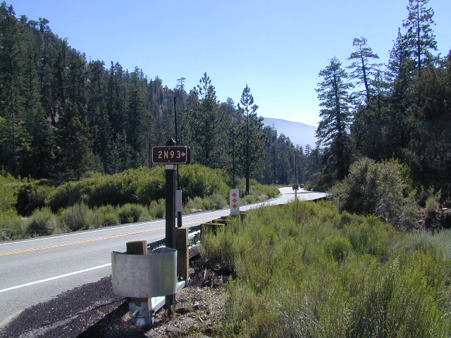
2N93 – Wildhorse Meadows

Heart Bar to Big Bear Lake, via the dirt road
San Bernardino National Forest

Big Bear Back Roads
Highway 38, East of Heart Bar @ Road #1N02
Southern California

alt big bear

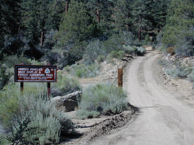
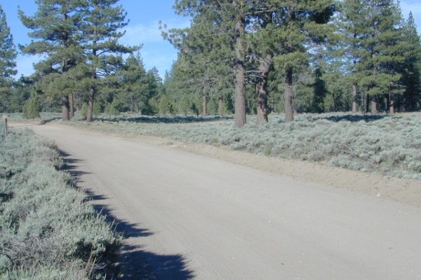
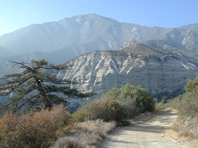
This 8 mile long forested, dirt road begins right off Hwy 38, just east of Heart Bar Campground and is an easy turn to miss. One tiny, brown sign is all that is found (on the guard rail). Driving too fast, you are bound to miss it.

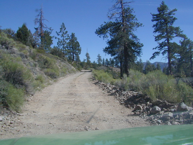
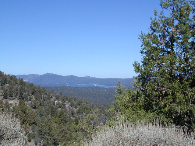
The unimproved route heads north through the National Forest, up and over and around SugarLoaf Mountain (elev 9952′), then down to the Big Bear Lake region.

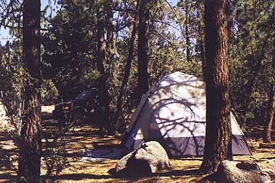
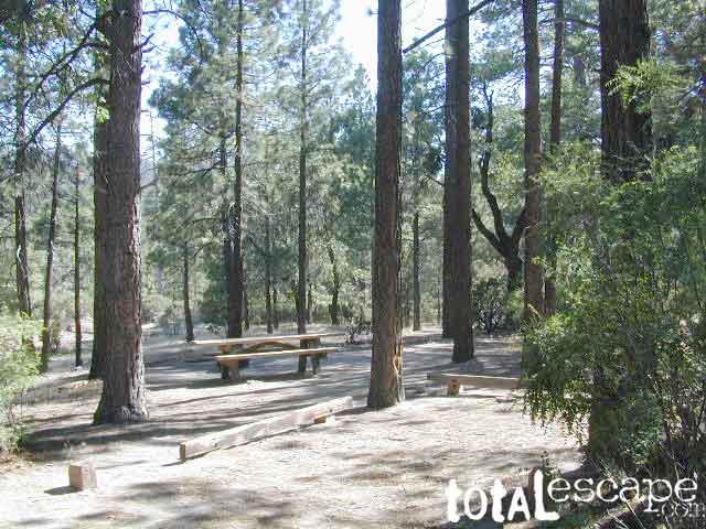
Several primitive sites – yellow post camp sites – can be found way back in here, but you might NOT be able to have a campfire (depending on fire restrictions). Check w/ local rangers before you head out.

snow Forest roads are often closed (gated) during the winter, when snow and rain make a muddy mess of the terrain. Rock slides are also common in wetter months. Call the local rangers to inquire on road conditions or if this route is open.

Road 2N93

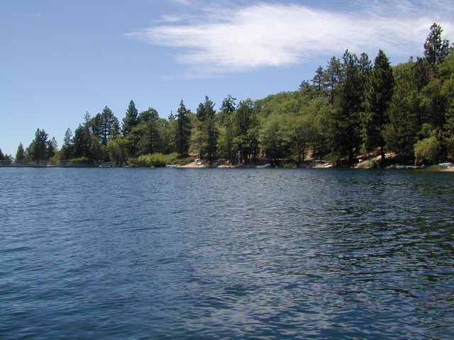
The whole Big Bear Mountain area is a SoCal favorite forest destination, for weekenders and travelers alike. Mountain biking, hiking, backpacking, horseback riding, camping and 4-wheeling.

Plus the recreational lake is full of more water recreation w/ tourist shops and restaurants. Stay away from the crowds and take the back roads for adventure and recreation. Spend less money, stay outta town and camp for free.

camp

On the south side –

Big Bear Highway 38
Heart Bar Campground
Heart Bar Equestrian Camp
San Gorgonio Wilderness

On the north side –

Green Spot Equestrian Campground
Green Canyon Group Campground

SugarLoaf Mountain has a National Recreation Trail, overlooking much of the Moonridge golf & ski area.

San Bernardino National Forest

ranger

Big Bear Rangers:

San Gorgonio District
Mentone CA
909-382-2881

Barton Flats District
Barton Flats CA
909-794-4861

Big Bear Discovery Center
909-382-2790

Big Bear Maps
San Bernardino National Forest Map

nearby towns:
Angeles Oaks
Big Bear City
Big Bear Lake
Forest Falls
Mentone, CA

Big Bear OffRoad Areas

Views to Big Bear Lake

Holcomb Valley

holcomb valley

On the eastern mountain slopes of Big Bear Lake, Holcomb Creek creates a forested sage valley – called Holcomb Valley, located only a few miles away from the big lake. A graded dirt road leads out to this pine forest & a prime campground area. Perfect location for picnics and sightseeing.

Holcomb Valley Campground
@ Big Bear Lake

campground  elev.
spots
 veg toilet water comment
Holcomb
Valley
7400′ 19 pines vault no Road 3N16,
open year round

National Forest Campground in San Bernardino NF, located at higher elevations.

Although the developed campground is open all year long, please take into consideration that SNOW and mud is the norm for winter months.

Nice shady sites to beat the summer heat. Camp spots spaced out fairly well. Hikers parking lot is located at one end of the campground. Bears are well known in the region, so please lock all food in the provided metal bear lockers.

  • backpacking
  • bouldering (rock climbing)
  • camping
  • cross country snow skiing
  • hiking
  • mountain biking
  • off roading
  • stargazing
  • water recreation @ lake
holcombcamp
CLICK TO ENLARGE

The epic Pacific Crest Trail runs right through the Holcomb Valley. Doble Trail Camp is out this way for PCT parking, next to Holcomb Valley Road #3N16 which encircles this whole forested area inside San Bernardino National Forest.pct

cabin holcomb
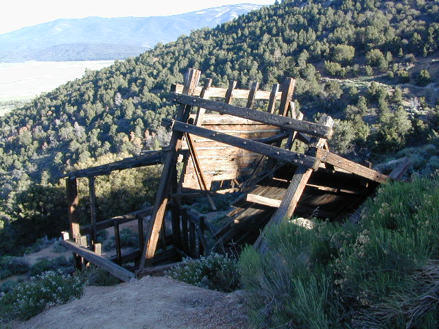
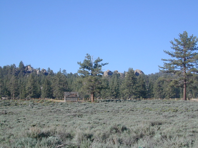
Holcomb Valley has a historic cabin to see. Numerous old mines exist around this area. Nearby Gold Mountain is a popular 4WD route.
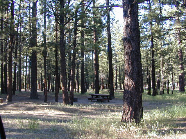
The dirt back road leads east down to the high desert @ Highway 162. Down to Pioneertown and Yucca Valley, and eventually Joshua Tree National Park.

holcomb campsites

towns nearby

mine shaft
Old mine shaft back behind Holcomb Valley

Campground San Bernardino

whitecliffs

Big Bear – San Bernardino National Forest Camping & Campgrounds

areas include:
Big Bear Lake, Fawnskin, San Gorgonio, Lake Arrowhead, Forest Falls, Green Valley Lake & Idyllwild

Listed below are all the San Bernardino National Forest campgrounds, public lands for outdoor recreation. SoCal campground reservations can be booked online with the linked campsites below.

Big Bear Campgrounds near Big Bear Lake & Fawnskin area

campground elev spots veg toilet water notes
Applewhite Campground 6800′ 42 pines vault piped disabled access, RV 30′
Barton Flats Campground 6300′ 52 pines vault shwrs disabled access, RV 45′
Big Pine Flats Horse Camp 6800′ 17 pines vault piped Way back 3N14, year round
Cold Brook Campground 7000′ 36 pines vault piped RV max 25′
Crab Flats Campground 6200′ 29 pines vault piped 3N16, Green Valley Lk
Dogwood Campground 7000′ 90 pines vault piped disabled access, RV 22′
Green Valley Campground 7000′ 37 pines vault piped Green Valley Lake
Hanna Flat Campground 7000′ 88 pines vault RV max 25′
Heart Bar Campground 6900′ 94 pines vault seasonal Hwy 38, equestrian
Holcomb Valley Campgr 7400′ 19 pines vault no Rd 3N16, year round
Horse Springs Campgr 5800′ 17 pines vault no Rd 3N17, year round
North Shore Arrowhead 5100′ 27 vault piped disabled access
Pineknot Campground 6400′ 48 vault piped disabled access, RV 45′
San Gorgonio Campground 7000′ 54 pines vault shwrs Hwy 38, disabled, RV 43′
South Fork Campground 6400′ 24 pines vault piped Hwy 38, RV max 30′

site12

San Jacinto Campgrounds near Idyllwild area

campground elev spots veg toilet water notes
Black Mountain Group 6000′ 16 pines pit piped group site
Boulder Basin Campground 7300′ 34 pines pit piped CLOSED
Dark Canyon 5800′ 22 pines pit piped CLOSED
Fern Basin Campground 6000′ 22 pines vault piped Rd# 4S02
Marion Mountain Campground 6400′ 24 pines vault piped Rd# 4S02
Pinyon Flat Campground 4000′ 18 pinyon vault piped bighorn sheep, year round
Santa Rosa Springs Camp 7000′ 3 pines pit no no RVs, Toro Peak
Thomas Mountain Camp 6800′ 6 mixed vault no no RVs, Rd 6S13; Lk Hemet
Tool Box Spring Campground 6500′ 6 mixed vault piped no RVs, above Lake Hemet
Toro Campground 7800′ 5 pines pit no Santa Rosa Wilderness

Southern California Camping see also –

Topo maps, wilderness hiking maps, Equestrian trails, OHV maps –

SoCal mountain communities include:

Big Bear Campsites

Thanksgiving Day Turkey Trot

Turkey Trot

Many California cities and towns host holiday runs or races called the Turkey Trot, or the Gobble Wobble (or any other equally silly name).

Traditionally held on Thanksgiving Day (in the morning hours), this event can be family friendly, with costumes or to some folks, a more serious race with thousands of runners. Each city has it’s own unique history of this annual favorite.

also known as –

Turkey Run, Thanksgiving Race, Thanksgiving Day 5K Run

driftwood

Anaheim Turkey Trot

Apple Valley Turkey Run

Arroyo Grande Turkey Trot

Belmont Shore Turkey Trot

Big Bear Turkey Trot

Burbank Turkey Trot

Concord Turkey Trot

Coronado 5K Turkey Trot

driftwood

Dana Point Turkey Trot

Orange County is the place & Dana Point holds the annual Turkey Trot every Thanksgiving Day. Over 10,000 runners participate in the coastal marathon event.

harbor dana point

driftwood

Davis Turkey Trot

Elk Grove Gobble Wobble

Encinitas Turkey Trot 5k & 10K

Fallbrook Turkey Trot

Folsom Turkey Trot

FTR047 Folsom Turkey Trot

Huntington Beach Turkey Wobble

La Cañada Thanksgiving Day 5K Run

Lake Almanor  5K Turkey Trot

Lompoc Turkey Trot @ River Park

Los Angeles Turkey Trot 5K & 10K

Marin Turkey Trot in Novato

Napa Valley Turkey Chase

Oakland Turkey Trot

Oceanside O’Side Turkey Trot

Orange County Turkey Trot 5K

Pacific Palisades Turkey Trot

Palm Desert Thanksgiving Day 5K Run

Pasadena Rose Bowl 5K Turkey Trot

Petaluma Turkey Trot

Piedmont Turkey Trot

Roseville Turkey Trot

San Bernardino Turkey Trot

San Francisco Turkey Trot

San Jose Silicon Valley Turkey Trot

20071122 016.JPG

San Luis Obispo Gobble Wobble 5K

San Mateo Gobble Wobble

Santa Barbara UCSB Turkey Trot

Santa Cruz Turkey Trot

Santa Maria Turkey Trot

Santa Monica Turkey Trot

Solano Turkey Trot

Solvang Turkey Trot

Turlock Turkey Trot

Crab Flats Campground

Crabflats

San Berdu National Forest: Crab Flats Campground National Forest Service

SOUTHERN CALIFORNIA MTS:
Big Bear Area Camping; Crabflats is on dirt road – Road# 3N16
elevation
North of Green Valley Lake, off Hwy 18. Between Big Bear Lake & Lake Arrowhead, California.

OHV trails abundant in this region, so expect some 4x4s, dirt bikes and engine noise. Looking for peaceful camp, try Heart Bar Camp.

Crab Flats Campground

• Elevation: 6,200′
• Number of Sites: 28
• Camping Reservations: Yes
• Sites Available: 3 first come
• Vehicle Accessibility: RV 15′ max
• Length of Stay: 14 Days
• Water: No Piped; seasonal creek iffy
• Toilet: Vault
• Season: Open APR-NOV
• Fee: YesNFSlogo
• Operated By: National Forest Service
• Closest Town: Lake Arrowhead, CA

San Bernardino National Forest
Big Bear Discovery Center
Big Bear Lake, CA
909-382-2790

Topo maps, wilderness hiking maps, Equestrian trails, OHV maps –

nearby mountain communities:

Green Valley Lake