2018 (Mendo Complex Wildfire) Ranch Fire
burnt most of this area
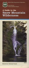
Located in the coastal mountain range north of Clear Lake and west of Stonyford, California; in between I-5 and US 101
On the southern half of the Mendocino National Forest.
60,076 acres
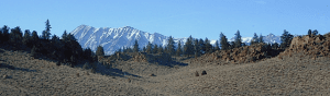
East Snow Mountain Peak – 7056′ elevation
West Snow Mountain Peak – 7038′ elevation
Lake Pillsbury – 1818′ elevation Mendocino National Forest
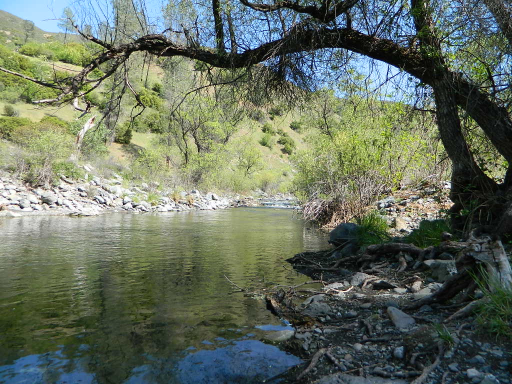
Eel River
Elk Creek
Cold Creek
Anderson Creek
Corbin Creek
Sheet Iron State Game Refuge
backpacking
camping
hang gliding
horseback trails
off roading
paragliding
snowboarding
snow shoeing
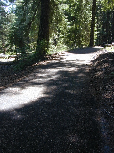
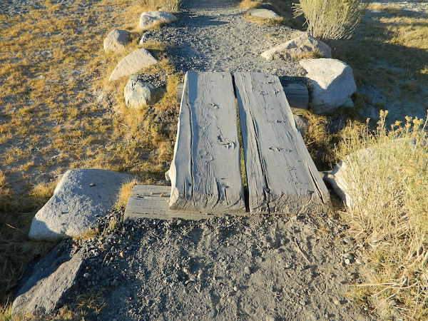
Wilderness permits and campfire permits are required. Check local rangers for up to date weather conditions, road closures, parking and trail conditions.
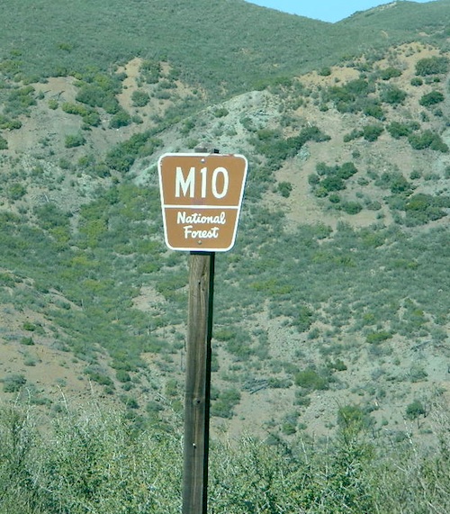
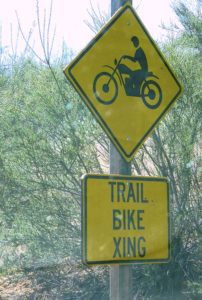
Dirt Roads M10 and M3 are the major routes around this mountain area. Route M10 is also known as 43A on some older maps. Several 4×4 trails skirt the wilderness boundary near the tallest peaks, so you may see some OHV use in this region when hiking.
ranger stations
EAST SIDE
National Forest Office
Grindstone Ranger District
Willows, CA
530-934-3316
Feather River Camping, Lake Almanor Campgrounds, Hat Creek, River Fishing NorCal, Topo Maps, California Campground Reservations, Lassen National Forest camp sites and all the outdoor recreation you can imagine.
Volcanic lands of Lassen National Park are surrounded by Lassen National Forest, which means if you cannot find camping inside the National Park – you can surely find it in the outlying regions – with rivers . The National Park Lassen Hwy 89 is often closed during winter months due to snow, as Diamond Peak & Reading Peak are around 8000′ elevation. In 2011 the south entrance did not open until late summer due to heavy snows.
A few Lassen campground sites may be reservable, more info with links below; the rest of the campgrounds in the green lists are on a first come, first serve basis.
A few PG&E Campgrounds can be found near Lake Alamanor, which are managed by the utility company and not listed on National Forest or National Park web sites.
MOST ALL CAMPGROUNDS CLOSED, due to Dixie Fire damages
LAKE ALMANOR – PG&E Campgrounds
Southshore @ Canyondam, CA
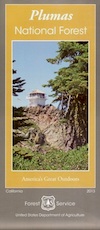
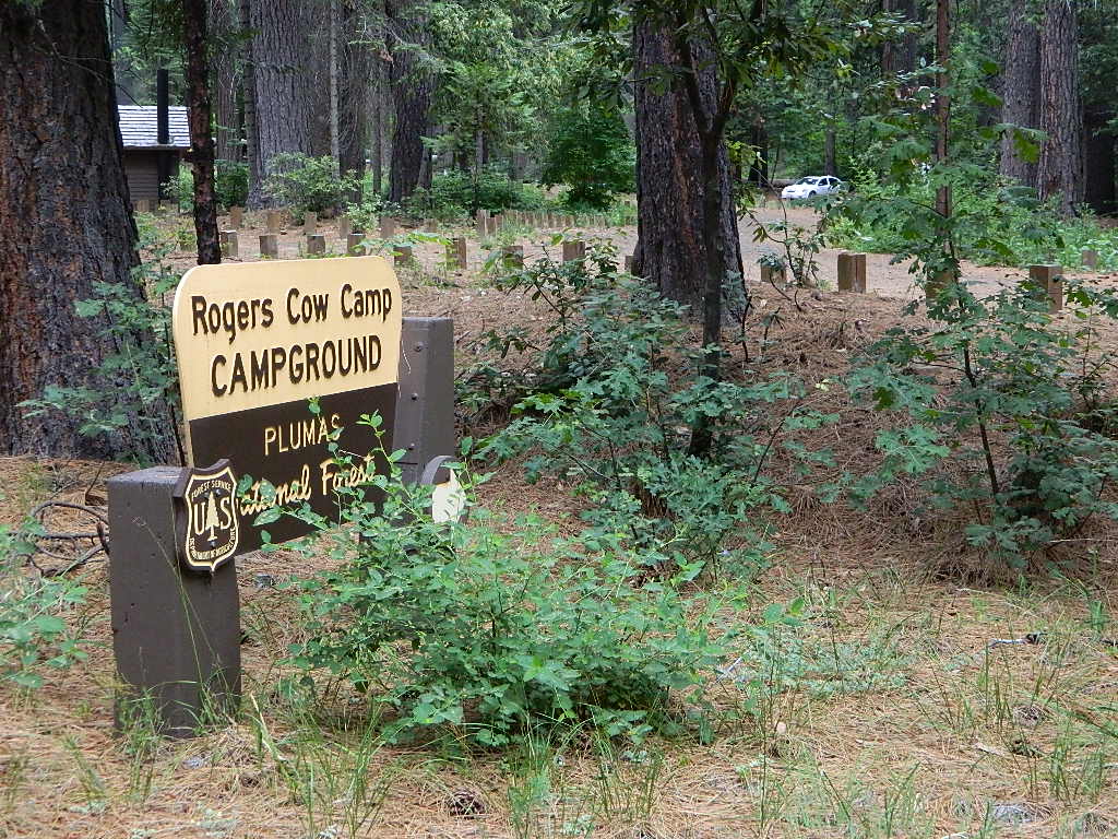
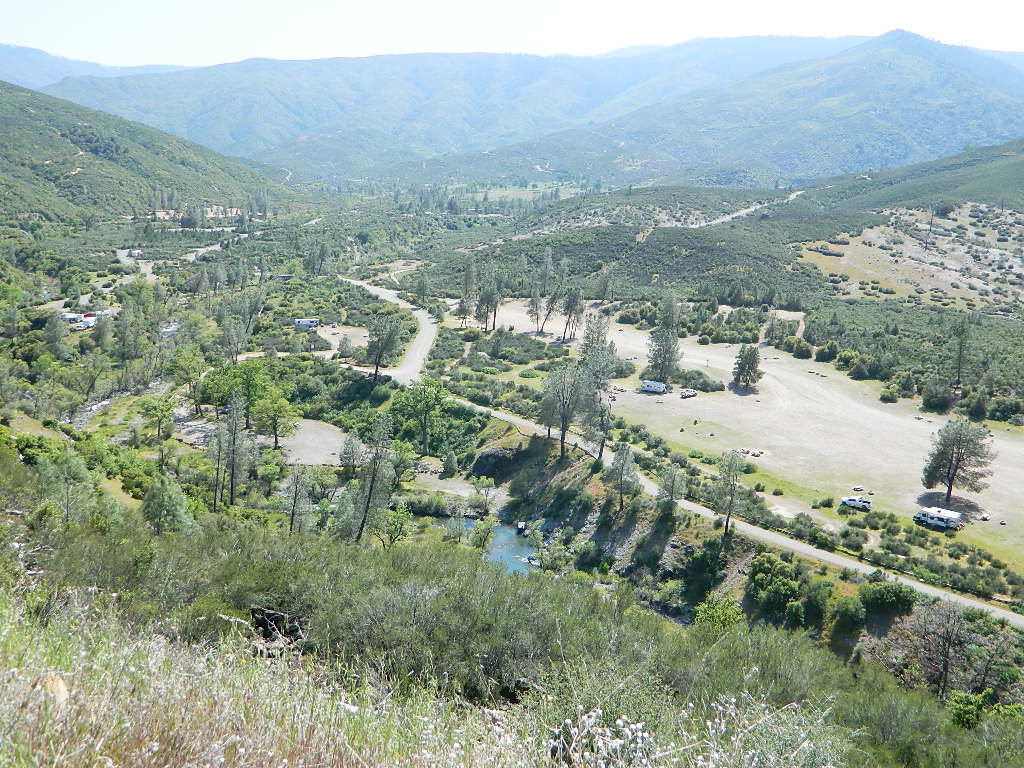
Plumas National Foresthas excellent outdoor recreation and developed campgrounds, as well as secluded, primitive back roads camping sites. If you prefer a camp with table, toilet and a campfire ring, then expect to pay a fee. There are several small, remote campgrounds listed below, but most are located on paved roads. Venture down dirt roads to find a premium camp sites for free. Scroll the map links below to explore the back roads of Plumas, and discover hidden fishing holes.
SOME CAMPGROUNDS are closed due to wildfire damage in the Plumas region.
Butte County Bicycle Ride Chico Wildflower Century Ride
Bike riders can enjoy the hilly Wildcat 100 & 125, the traditional Wildflower 100 & 65, the Flatflower 60 & 30, and the Childflower 12. Wildfest pre-ride party.
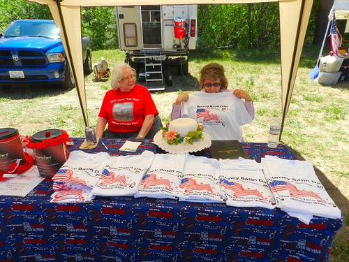
Held in the hills above Redding in the mountain town of Burney. The impressive volcanic Lassen forests, with small town events like Burney Basin Days draws tourists from near & far.
Parade, fireworks, craft fair, breakfast and lunch, car show, bed races, horseshoe throwing competition and a cornhole tournament. Plenty of great camping all around this location. The few local motels fill up fast during summer months.
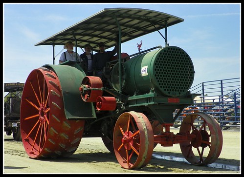
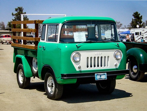
Visit agriculture’s past by learning about tractors, engines, equipment, and more. Antique Equipment Auction will be held south of Farm Credit Dairy Center. Tractor & truck parade. Kids Tractor Pull, Pony rides, Tractor rides.
International Agri-Center
4500 S. Laspina Street
Tulare, California 93274
(located right off Highway 99)
Pacific Islanders of the San Francisco Bay Area offer talents in music & dance during this 2-day festival of arts. Entertainment highlights include Pacific Islander music as well as Polynesian dance. The festival will also feature arts & crafts vendors, island cuisine, educational exhibits and workshops, and games for the kids! Located at the San Mateo County Event Center.
One of the largest FREE music street fairs in California. Over 90 live music acts on 7 stages, 4 beer gardens, Giant Carnival rides and 300 craft & food vendors.
Two day Music Festival covers many blocks of Adams Avenue, only a few miles from downtown San Diego. Held in late summer near 35th Street to 32nd Street. Adams Ave Street Fair is Southern California local fun.
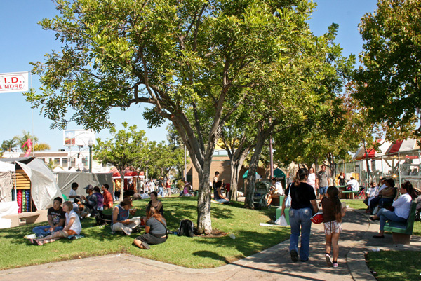
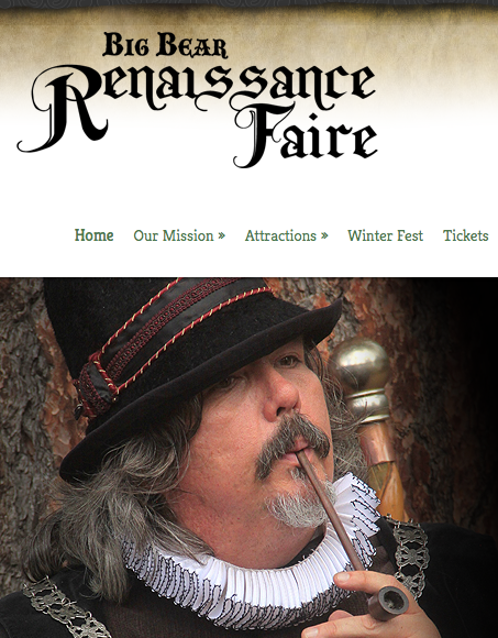
Three weekends of fun, music and merriment. An authentic re-creation of an English Summer Faire. Visit an exciting, vibrant village where you can experience a joust, strolling entertainers, stage performances, beautiful handcrafts, delicious food and drink, children’s area and the spirit of the days of William Shakespeare and the Renaissance.
Meadow Park
41276 Park Ave.
Big Bear Lake, CA 92315
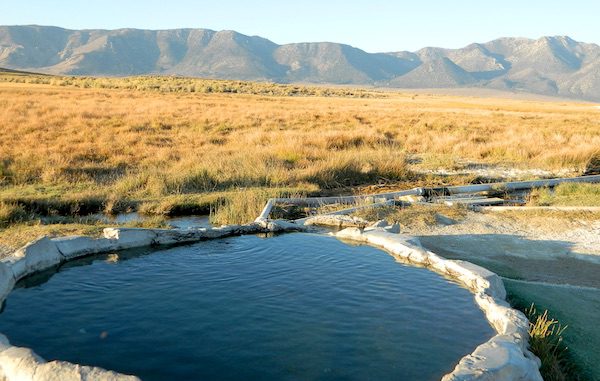
The Eastern Sierra Nevada mountains run the length of US Highway 395, through most of the eastern side of California. Mammoth mountain is a volcano, so naturally hot springs come with the package. These hot tub destinations listed here are mostly part of the Long Valley Caldera, an ancient volcanic table land. North of Bishop and near the snow ski destination towns of June Lake and Mammoth, California in Mono County, California.
(This region is not to be confused with Mammoth Hot Springs in Yellowstone National Park, nor the Mammoth Site in Hot Springs, South Dakota.)
Backroads Camping is allowed throughout Inyo National Forest, but there is private ranch lands mixed in w/ public lands. Respect property boundaries, and speed limits around gates and intersections.
Camp sites are not located next to the soaking tubs. A few may be within walking distance. Parking is often limited at these remote, public use hot pools. Total Escape TIP: Behind Lake Crowley: abundant, free camping – wide graded dirt roads (RV and passenger car suitable). Inyo National Forest Map is recommended.
Eastside of Highway 395
Casa Diablo Hot Springs near the Mammoth exit, is a location noted on most maps, but this seems to be the geothermal power plant for the region. If you are looking for hot springs tubs to soak in, you’ll need to get off the main drag for those beauties, way off the highway.
On to dirt roads
Hot Creek
Inyo Forest Road #3S45
Hot Creek Hatchery Road
(near Mammoth Airport)
Minimal dirt road driving. A very popular spot where hot springs are located within the big creek, so you can feel cold and hot water flowing by you. Scalding can occur near vents underwater, so use caution when wading. Large parking lot overlooks the soaking area and creek canyon. Swimsuits required.
Benton Crossing Road
leads east, around Lake Crowley, to the small town and camping resort and inn of Benton Hot Springs
Inyo Forest Road #2S84
Benton Crossing Road
This rural intersection at US Hwy 395 is known for the little green church on the corner. Turn east off the highway on to this road > BENTON CROSSING.
Pull over, get out and stretch. Look at your maps, get the GPS out and then start your exploring. First timers might be able to find a soaking tub within half an hour, if you don’t get lost. Or get stuck in a muddy spot, which is easy to do at night.
Hill Top Hot Springs
Latitude: 37.6642
Longitude: 118.7883
Elevation: 6873′
also known as – “Hilltop, Pulky’s Pool”
Willy’s Hot Spring
Latitude: 37.6591
Longitude: 118.8425
also known as – “Wild Willie’s, Crowley Springs”
Inyo Forest Road #2S07
Whitmore Tubs Road
a major graded dirt road that leads north off of the paved road, becomes Owens River Road and connects back to US 395 many miles to the north.
Several primitive hot tubs can be found on dirt roads in this region, which lead off the main paved road. At night these remote pools can be hard to find – with no signage, no street lights and pitch black darkness. Plus the mud bogs and grassy fields all around make the landscape difficult to navigate. If you plan a nighttime arrival, then plan to drive in slowly around the pools, have your GPS handy and look for steam in the air. Cut your headlights if you see other cars or people, and proceed slowly.
Be considerate of others and friendly. Do not litter. Do not crank up music. Wait for others to finish soaking and do not rush anybody. Give others space and privacy to get dressed.
Crab Cooker Hot Springs
Latitude: 37.6633
Longitude: -118.7995
Elevation: 6857′
also known as – “Fleur de Lys”
Shepard Hot Springs
Latitude: 37.6668
Longitude: -118.8025
Elevation: 6940′
also known as – “Shepard Springs”
Rock Tub Hot Springs
Latitude: 37.6474
Longitude: -118.8080
Elevation: 6990′
also known as – “The Rock Circle”
Little Hot Creek
Latitude: 37.6902
Longitude: -118.8424
Elevation: 7000′
Inyo Forest Road #3S138 high clearance vehicle required
Whitmore Hot Springs
904 Benton Crossing Road Mono County Park w/ public swimming pool & day use fee
Phone: 760-935-4222
also known as – “Whitmore Tubs, Whitmore Springs”
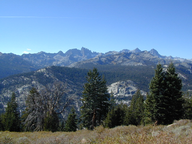
Minarets at Mammoth
The Backside
Inyo Forest Road #3S11
Minaret Summit Rd
This wilderness region is located the on the west side of Mammoth Mountain, accessible by the paved Minaret Summit Road, which closes due to deep snow and is generally only open during summer months.
Red’s Meadow Hot Springs
developed campground w/ wooden sheds for baths: showers & tubs.
near Devil’s Postpile National Monument
Latitude: 37.618
Longitude: 119.074
Elevation: 7000′
also known as – “Red’s Meadow Hot Showers”
Iva Bell Hot Springs
remote, wilderness; hike-in hot springs.
south of Mammoth & Rainbow Falls, via trail #2622
Latitude: 37.532
Longitude: 119.025
Elevation: 7400′
also known as – “Fish Creek Hot Springs”
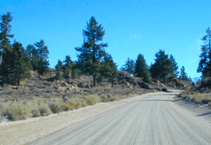
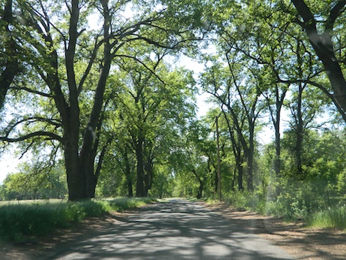
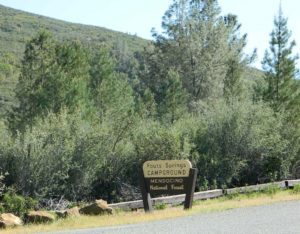
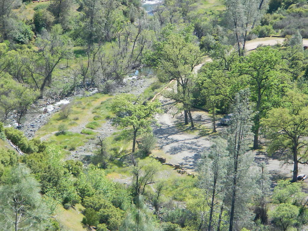
Fouts Springs is multi-use recreation area on the east side of Mendocino National Forest. Located near the Snow Mountain Wilderness trailhead, this region is popular with the off-roaders and dirt bikers. Expect some noise if camping overnight on a weekend.
Excellent picnic spots along creek in springtime. Wildflowers bloom March-May. Campfire restrictions may begin as early as July, so know current fire conditions.
Fouts campgrounds are located on the EAST SIDE of Mendo NF on paved road M10. Situated below 2000′ elevation and open year round.
Road M10 Mendocino
TRAVELERS NOTE: Tent campers, RV and truck campers can easily access this area, all paved roads. Exit Williams or Willows on I-5 and head west. A decent back country map or Mendocino National Forest Map is advised; Numerous canyons, forested creeks and campgrounds. Always check with Mendocino National Forest for road closures and conditions.
OFF-ROADERS NOTE:Use caution on paved access road M10, especially when driving with trailers or large RVs. Narrow road, long and winding with blind curves and no guard rails. Always check with Mendocino National Forest for road closures and trail conditions.
Mendocino Ranger Stations can be found on link below
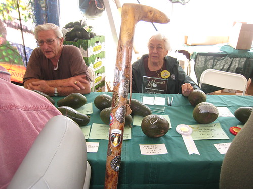
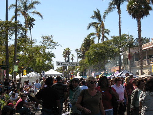
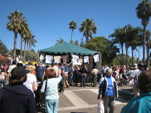
Take a scenic drive and see the back roads near Lake Casitas, where numerous avocado orchards grace the hillsides. This coastal Avocado Festival has evolved into one of the largest festivals within California; Three full days of fabulous food, terrific music, & family fun. Held in Carpinteria, just south of Santa Barbara, CA
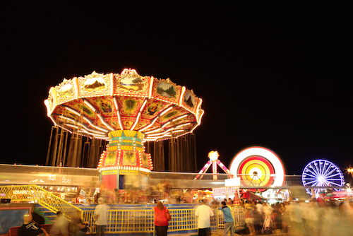
For over 165 years, the California State Fair has showcased the progress and advancements of agricultural industry. 17-day event with carnival rides & games, numerous exhibits, livestock, plus local wines, cheeses, craft beers, cannabis, olive oils, and fine arts.
1600 Exposition Blvd
Sacramento, CA 95815-5199
916-263-3000
In 1854 the first California State Fair was held in San Francisco.
Travel was a hardship for many in those days so organizers arranged for the Fair to move locations each year. Sacramento, San Jose, Stockton, and Marysville hosted the Fair for the subsequent four years. Pioneer residents quickly recognized tremendous riches in the fertile soil and so California’s number one industry, agriculture, was born. The Fair was the yearly source of entertainment and education for early settlers, drawing huge crowds of as many as 15,000 on a single day.
When the Fair returned to Sacramento in 1859, a decision was made to find a permanent home. Sacramento was a bustling city with more than 2,500 buildings and a newly installed water system using two and a half miles of pipe. Six square blocks between E and H Streets from 20th to 22nd Streets were bought with monies raised through a special election and contributions from local citizens. This site was called Capitol Park. One aspect of those early Fairs that deserves special mention is the significance of the horse.
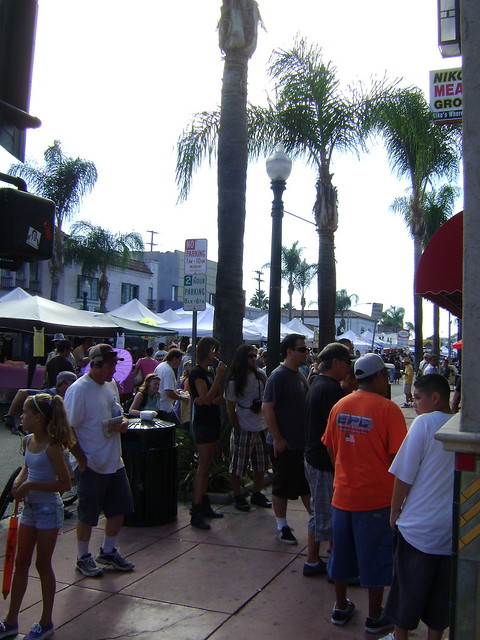
Fallbrook Avocado Festival, a one day celebration; Fantastic street fair featuring three hundred vendors, three areas with music, farmers market, art village, children’s events, and lots of guacamole!
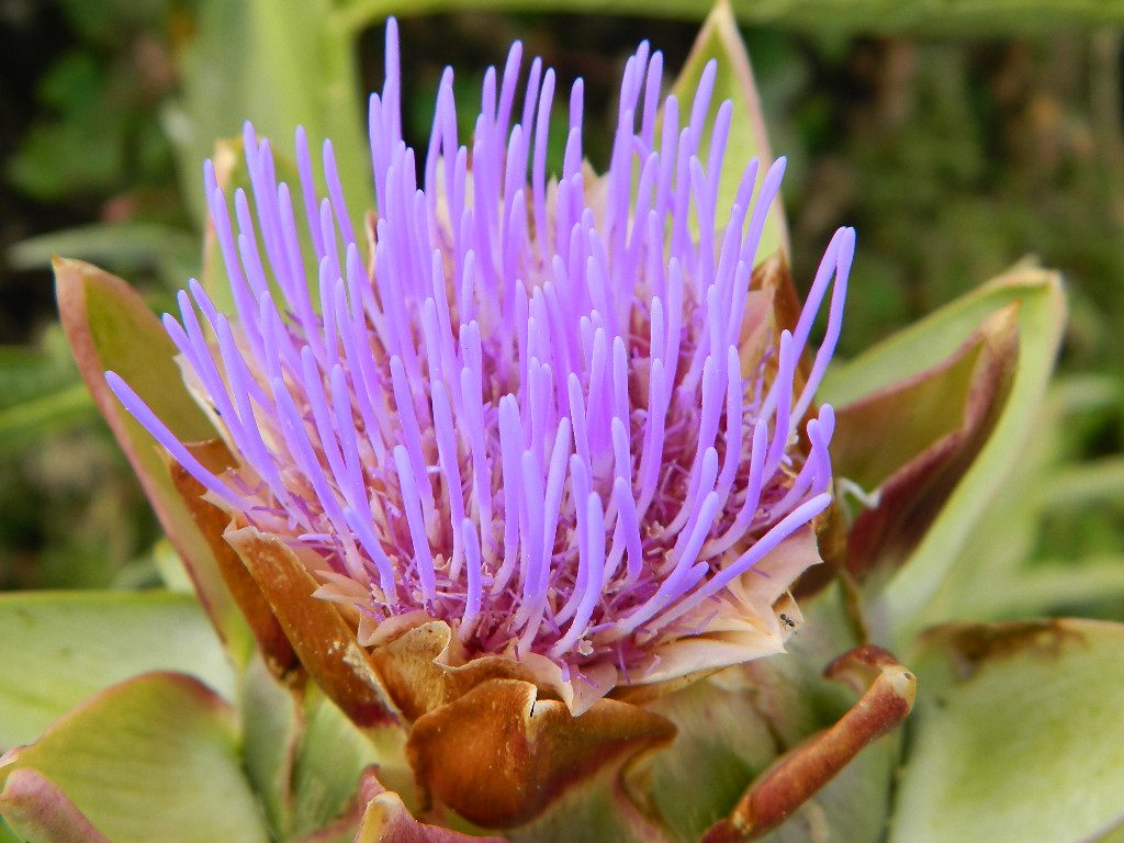
Artichoke cooking demonstrations by local celebrity chefs, A bountiful farmer’s market with freshly harvested produce from Monterey County and beyond, An agricultural education exhibit, Live entertainment on two stages, Plenty of family-friendly fun activities
Artichokes prepared in some of your favorite ways, including the fan-favorite — fried baby artichokes! Plus, steamed, grilled, and in unique forms such as lumpia, burritos, sausage, cupcakes and even ice cream.
Artichoke eating and harvest contests, arts and crafts vendors, a family fun run on Sunday, and our ever popular wine tasting event, featuring the wines of small production, boutique wineries from around California.
Monterey County Fair & Event Center
2004 Fairground Rd.
Monterey, CA 93940


 Wilderness permits and campfire permits are required. Check local rangers for up to date weather conditions, road closures, parking and trail conditions.


 Plumas National Forest


![Avocado Festival @ Fallbrook [Apr 2016]-0093](https://live.staticflickr.com/1591/26496966525_08e9457f67.jpg)