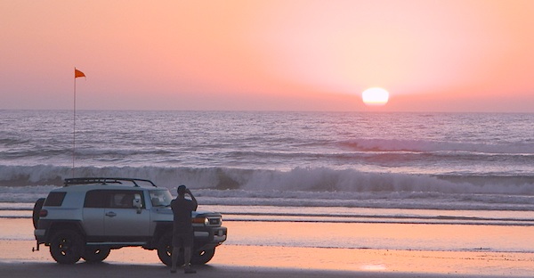
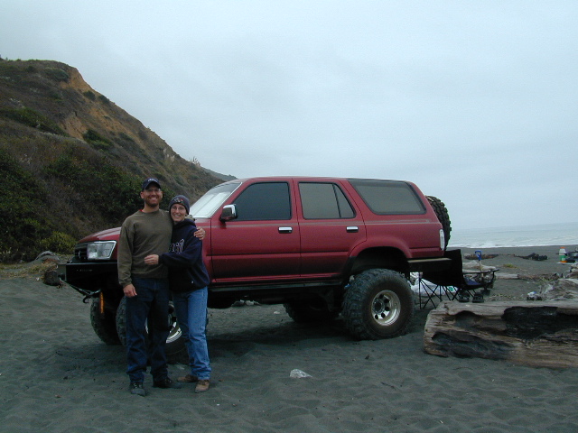
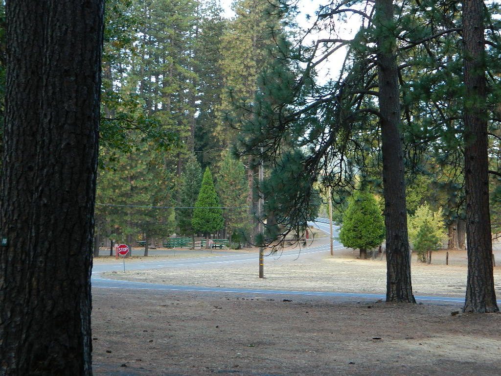
Gone are the days of ‘beach blanket bingo’ where film crews glamorized California – the beautiful people, the nice vehicles, the sport of surfing and the glorious beaches. There are very few places left on the California coast that you can actually drive a vehicle on the sand, right next to the ocean. The military bases, oil corporations and the utility companies have the front row seats to the Pacific genocide, and the rest of the population is restricted with extreme limited access.
Baja California has minimal regulations on coastal access with a car. No pavement, no signs, no cell phone signal, and no help for miles – something to consider if you get stuck south of the border in Mexico. Baja has numerous places to explore below Ensenada, but asking locals is always a favored approach. Pay attention to private property signs and always close the cattle gate (if you found it closed).
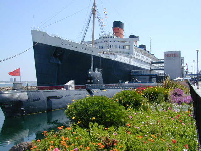
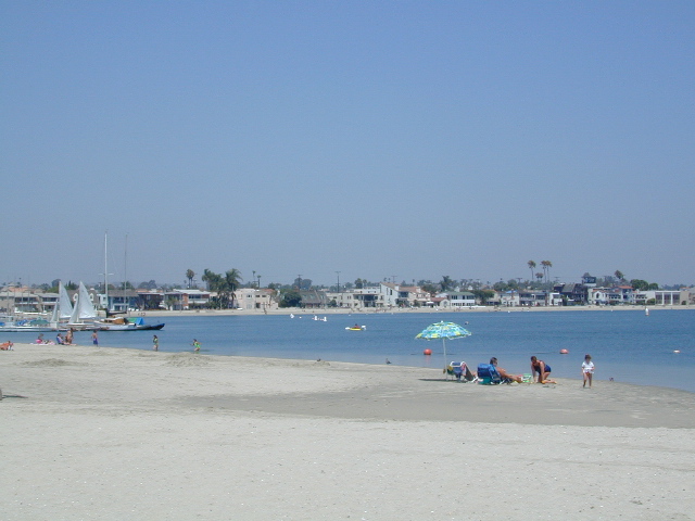
Southern California, no beaches allow vehicle traffic. San Diego offers a sliver of sand @ Silver Strand SB, which is a developed campground for motorhomes and car campers, located right on the beach south of Coronado, CA. Fiesta Island in Mission Bay, San Diego allows driving on sand and a favorite among active dogs, but not camping is allowed. In Los Angeles you can park a motorhome at a sandy, paved campground for a hefty overnight fee. Dockweiler Beach, right near the Chevron plant and LA sewage treatment facility. Sounds delightful, not.
Ventura & Santa Barbara Coastal Regions have many awesome State Beaches, but none allow vehicles on the sand.
Central Coast California:
Oceano SVRA – off road sand dunes and open camping on the beach. Day use or overnight camp fee required; near Pismo Beach, CA
Red, White and Blue Beach – nude beach w/ campground (now closed); north of Santa Cruz, CA
Northern California:
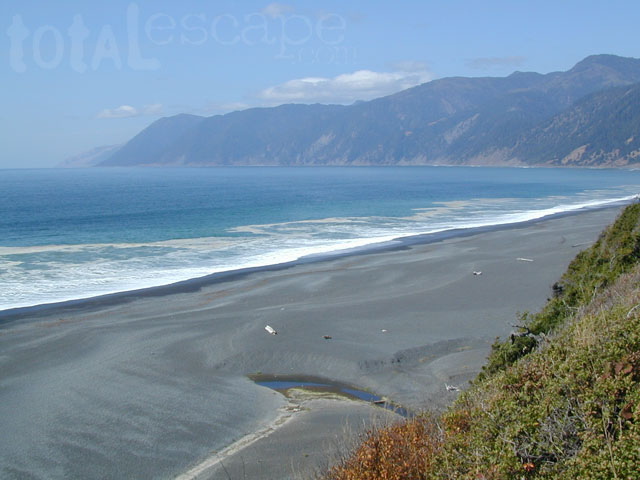
Lost Coast
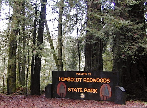
Usal Beach Campground – redwood creeks and forests meets coast and cliffs. Camp fee for overnight use. Long dirt road access. No RVs!
Black Sands Beach (OHV 4×4 trail, now closed to all vehicles) near Shelter Cove, CA
after-the-fun maintenance tip:
Salt water and sand is very corrosive to metal – which will rust your truck or car badly. Now that you’ve had fun on the beach, we remind you to clean the underneath of your vehicle ASAP. Spraying powerful hose in your wheel wells and all underneath the vehicle. You might need to lay on the ground and get wet to do this job properly. Some car wash places might be able to do this service for you, but it will cost ya.
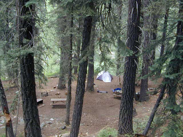
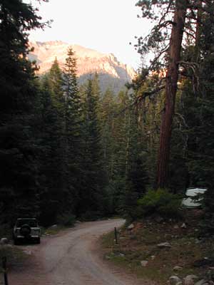
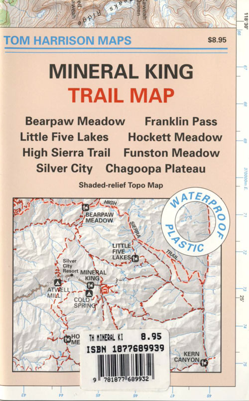
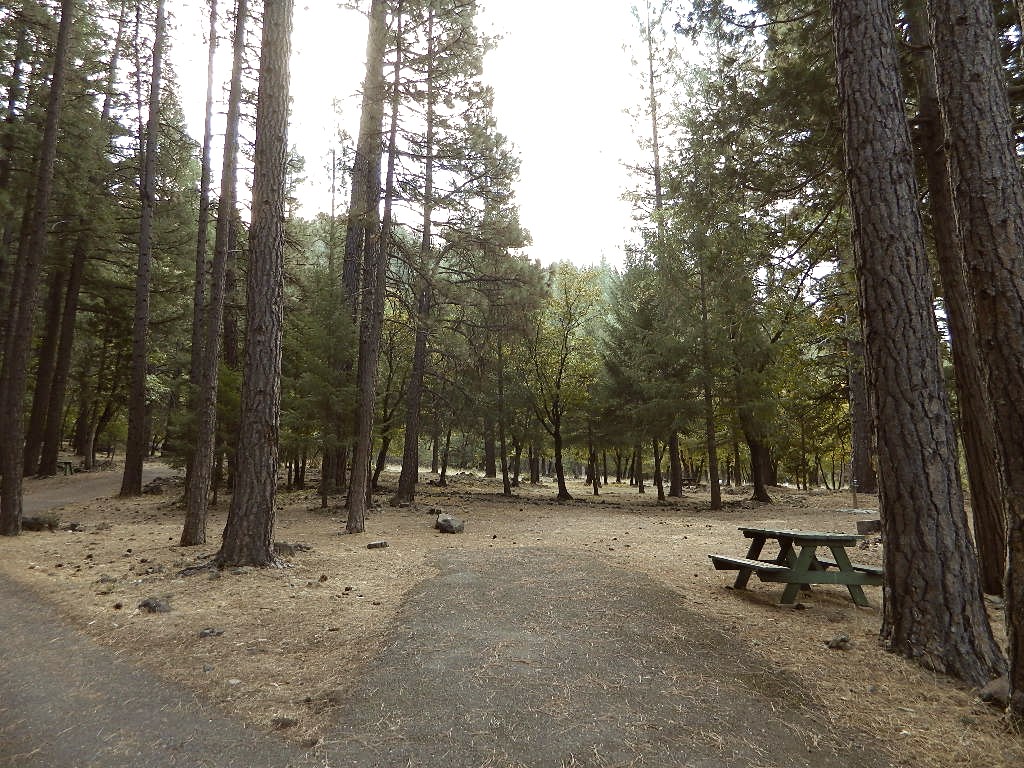
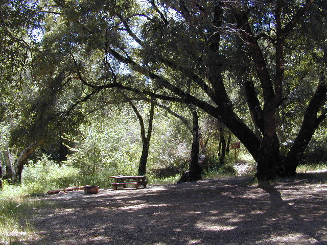
Sequoia National Park: Cold Springs Campground in Mineral King Area
A large developed camp ground with bear lockers, a raging creek, some walk in sites, & access to the Sierra Nevada high country trails. This is the last real campground in the main valley, everything beyond this spot is pure alpine highcountry.
9000′-13,000′ peaks – in the Southern Sierra Nevada mountains. Car camp, tent camping or bring a backpack and climb to pristine lakes and into the real Wilderness.
Cold Springs Campground, California
on the East Fork of the Kaweah River, closest campground to the hiker trailheads @ Mineral King Valley. Mineral King Road open May-October (depending on snow)
Atop the mighty canyon sits mountain passes, peaks and lakes above 10,000′ elevation. A rocky alpine valley of wonder and water, granite, dark skies and a good night sleep. Black bears and hikers are everywhere, anytime.
This sweet spot river campground has more than 25 camp sites, but there is not a lot to choose from way back here on the dead end back road known as Mineral King in California. Just up the road a piece from Silver City. Nearest real town is Three Rivers near Sequoia NP south gate, California State Route 198.
Western Sierra /
Sequoia South Camping –
37 camp sites in Mineral King @ 7500′ elevation
vault toilets, river and piped water, bear boxes first come, first served camping
Max Camper Length: 0
(RV, motorhomes, camper trailers are not allowed)
Rangers Office: 559-565-3768
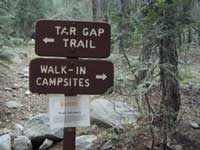
Cold Springs Campground has several campsites right on a river with other sites set up a steep forested hills. There are good number of walk-in camp sites at the end of this campground, ideal for backpackers arriving late at night. The actual walk is more like a hike, so be prepared to carry your stuff a mile down a steep forested trail. You will be rewarded with a great camp spot, near the river, away from the parking lot and noise of the car campers above. Tar Gap hiking trail leads out of Coldsprings campground and straight into the back country.
Coldsprings Camp & Atwell Mill are the only options for local tent camping.
Strapping on a backpack and heading for the high country is what most visitors do, as this is an ideal high country trailhead accessible from the western reaches of the Sierra Nevada range.
East of Three Rivers, CA on Highway 198 – Mineral King Road peels off to the right, south east to a vast 30 mile long canyon. This mostly paved route closes for winter months when snow is present and rock slides are common. There is a few miles of unpaved, graded 2 lane road, but the majority is paved. Late spring (May) is typically the opening season for this road. RVs, buses, and trailers are not allowed on this narrow, winding road!
BIG TREES NOTE: Although this gorgeous, secluded canyon is located within Sequoia National Park, there are no Sequoia redwood trees in this particular canyon. And you might need to drive an hour up the other mountain to reach them. Just a consideration. If you have your heart set on the seeing the big trees, go do that on another trip. Mineral King is a journey and after your drive that road you will understand a few times.
HIKER PARKING: The NPS rangers station is walking distance from Cold Springs Campground. A beautiful meadow walk to the east of the campground. Bears are known to frequent the area, so locking all food in the provided metal bear lockers is a must.
Badgers are a problem too. Them critters eat radiator hoses – no joke! A good roll of chicken wire could be needed if you plan to leave your car unattended for any length of time.
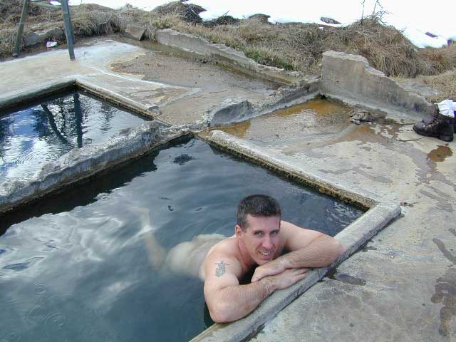
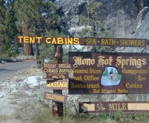
Best of both worlds, way back in the boonies – two primitive tubs soaking perched on a soggy hill next to a big river, developed campground below, and a small resort w/ cabins, camping, restaurant and private soaking areas on the other side of the river.
15 mi. NE of Huntington Lake off Kaiser Pass Rd. Huntington Lake & Hwy. 168
Two squared cement tubs overlooking the San Joaquin River, deep in the Sierra Nevada Mountains.
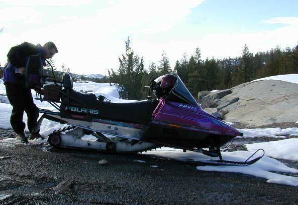
The coolest thing about this primitive hot springs is that it is a great destination for a one day snowmobile adventure. Rentals are in the nearby community of Lakeshore & the plowed paths are fairly easy to follow. If you plan on visiting the springs, you must not play around in the meadow much, there is plenty great Sierra scenery to be had. The snomo trip is a good 5 hours round trip with a lunch break & dip at mineral spring tubs.
backpacking
boating
camping
cross country skiing
fishing
hiking
horseback
kayaking
mountain biking
mountaineering
snow mobiling
stargazing
swimming
Sierra Snow-Mobilin’
Winter: road is closed half the year due to heavy snow. Summer: snow is gone and the road is open.
KAISER PASS ROAD Large motorhomes, RVs are not allowed on this long, steep, narrow paved route.
Max vehicle length: 25 feet
Take Hwy.168, turn right on Kaiser Pass Rd, just past the big ski resort. Pass the large meadow & follow signs to Mono Springs & Lake Edison. Make sure not to miss the left turn or you may end up at Florence Lake.
Parking near the green bridge over the San Joaquin River & hike over to the tubs on the hillsides. If there are other vehicles parked here, expect to see naked people nearby; Soaking should never be rushed. Clothing is optional – in California.
Mono Hot Springs Campground NFS
• Elevation: 6700′
• Number of Sites: 30
• Vehicle Accessibility: RV 25′
• Camp Fee: Yes
• Campsite Reservation: Yes
• Toilet: Vault
• Length of Stay: 14 Days
• Season: June – September
• Trailheads: Ansel Adams & John Muir Wilderness
NOTE: This USFS Campground, should not to be confused with the neighboring business, a privately run camp called –
The Mt Pinos Recreation Area is located on the border of Southern and Central California, inside Los Padres National Forest. After passing Frazier Park, the winding, paved, mountain road starts atop Cuddy Valley and is approximately 12 miles from Interstate 5 @ Tejon Pass. The 8831′ peak is the tallest in Kern County and is a popular spot for both summer and winter recreation: cross country skiing, snow shoeing, backpacking, hiking, mountain biking. The snow gates often close during heavy snow.
Mount Pinos Road starts atop Cuddy Valley Rd, at the “Y” – where it intersects with Mil Potrero Highway, which heads out to Pine Mountain Club, California.
One mile up the Mount Pinos route, you will find McGill trailhead on the right side (it is popular w/ mountain bikers) and then the first snow gate at Burbank Rd. Another 4 miles up hill, you come to the only set of dirt roads accessible on this range. A left turn will take you winding thru pine forest to the valley below. 4×4 is not required, but a National Forest map could be very handy. Unfortunately all the private properties at the bottom have locked gates & no thru access to Cuddy Valley is allowed. Although it is an awesome drive to just go exploring in the woods, there is no way out (once you get down the hill), so you must return the same way you came.
Back on the main route, shortly after the dirt roads is McGill Campground on the right side & another snow gate. In another mile and a half you will reach Mt Pinos Campground on the left side; the entrance is easy to miss. From here you are less than 2 miles from the end of the main road.
Mountain Bike, Hike, Backpack, Camp, XC Ski, Snow Sled
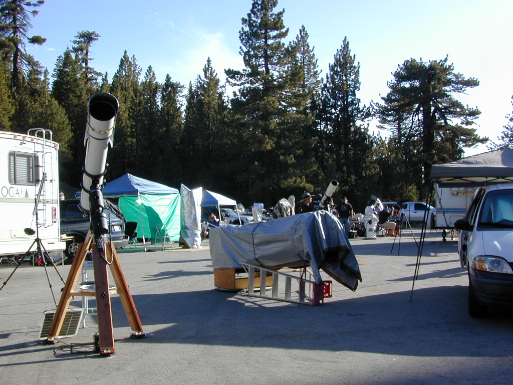
Darkest Skies for Stargazing in Southern California
The huge paved parking lot is the dead end (2 miles from the peak of Pinos) – very popular with astronomers, mountain bikers, plus the families and snow sledders in winter (if the gates are open). A National Ski Patrol’s Nordic Base, the only building you will see up this way. At 8300′ elevation, the large parking area is perfect overnight spot for amateur astronomers, so be considerate when visiting night. New moon (no moon) weekends APR-OCT are optimal viewing months. In busy summer months you can often find motorhome campers all set up with expensive equipment tracking the heavens all night long. Please be respectful of their hobby & eyes; Turn off headlights when you approach the parking area at night.
ROAD CONDITIONS to Mount Pinos, call the rangers 661-245-3731
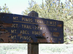
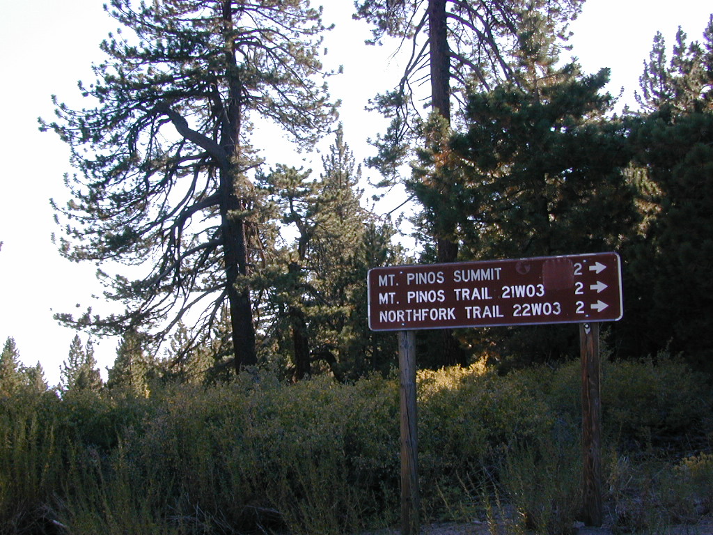
Pinos – Peak to Peak Hike
The trailhead for Pinos Summit starts at this parking lot. It is a 2 mile moderate, but steep hike on an old fire road. The neighboring peak to the west is called Mount Abel @ 8286′ elevation (aka Cerro Noroeste). The infamous peak to peak hike along the ridge line from Mt Pinos to Mt Abel is 6.5 miles one way – and very popular in summer months. This hike requires 4-6 hours & a car shuttle should be arranged in advance. The Chumash Wilderness sits between Mount Pinos and the tiny community of Pine Mountain, which can be seen below on many places along the hike.
There are 3 developed campgrounds in the Mount Pinos Recreation Area:
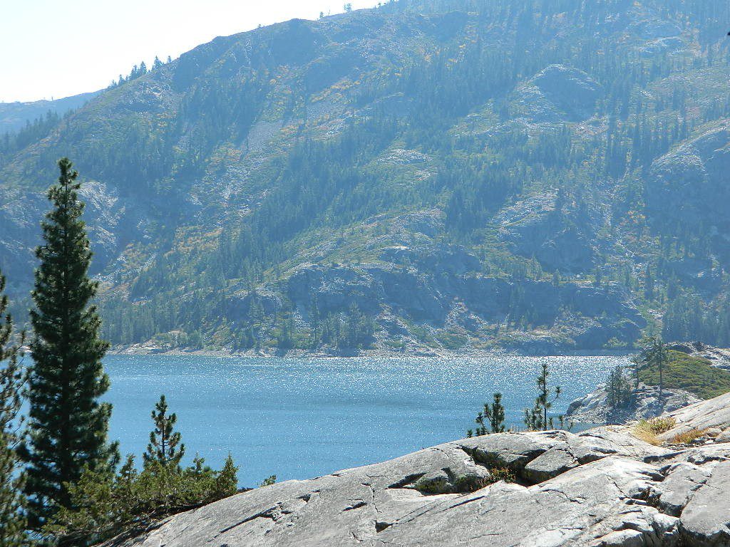
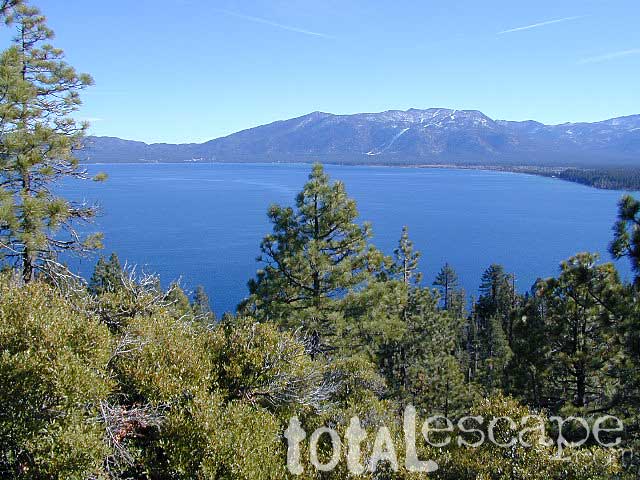
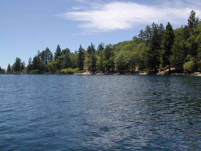
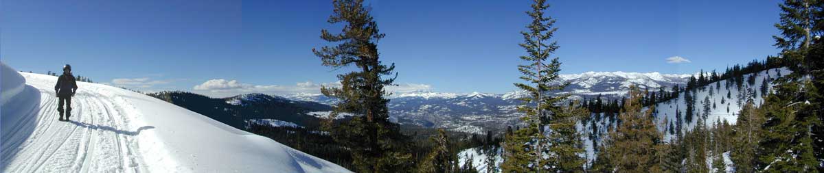
Lake Tahoe California One of the most popular Sierra destinations – be it summer or winter, Tahoe sure is crowded these days.
Below are all the developed campgrounds surrounding beautiful Lake Tahoe, CA. Most of these are located near the lake or, on the Truckee River. Most accept campground reservations in advance. blue links lead to camp info
All Tahoe Campgrounds charge a fee; Many require advanced reservations. Nightly rates vary per park. Most campgrounds are closed during the winter due to snow. Check with the ranger districts listed here.
Bowman Lake
Tahoe Forest
Tahoe National Forest encompasses a larger region of the Sierra Nevada mountains surrounding the north portion of Lake Tahoe. American River, Yuba River, Northern Gold Country; Plus many small lakes with excellent forests, including Lakes Basin Recreation Area.
Blue Lakes has several campgrounds, south of South Lake Tahoe.
Below are Tahoe Campgrounds located away from the Lake Tahoe Basin; Most small camps are on a first come, first serve basis. blue links lead to camp info.
at Indian Valley, Northern Sierra Nevada mountains
also known as – Taylorsville County Campground Taylorsville Community Campground Taylorsville Park Campground
Beautiful North Sierra Nevada. The rural country life is out here… in the mountains of NorthernCal. Cattle ranches, a few sheep, grazing deer, big old barns, bike races and much residential. Taylorsville is a very small town, on the edge of the Indian Valley. Right across the valley from Greenville and Round Valley Reservoir.
elevation: 3200′ camp sites: 32 piped water near camp: yes toilets: flush showers: yes fee: yes season: May-October
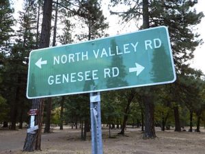
Easy Walk to Town – Taylorsville, CA
The wooded campground is located at the intersection of North Valley Road, Genesee Rd and Arlington Rd – a few miles off the main highway 89.
Looking for a quiet place to tent camp in between Quincy & Greenville? then this is it. The best developed campground option in the whole region. Closed for winter months – cuz it does snow pretty good up here.
This shaded tent campground loop is on a hillside; across the street from the small rodeo grounds, the community park w/ picnic areas, tennis courts and a small RV park. Campground host located behind the bathrooms.
Nearest local laundromat in nearby Greenville, behind the main grocery market.
bathing… would be nice
Flush toilets and showers, affordable overnight prices, plus ideal walking-hiking-biking location make this a special campground worth mentioning!
Lake Davis Loop is a 20 mile circle around the lake. Drive or mountain bike route. Scenic drive on dirt roads, or an easy bike ride. Average ride time 2 hours for biking.
A flat, easy loop around Lake Davis is best in summer months, as snow usually closes this area in winter. The whole route is a mix of paved, dirt and gravel road. There are picnic areas along the way, lake views, bird and wildlife viewing, wildflowers.
Numerous primitive camp sites and secondary dirt roads fork in various directions, off of this main loop. Volcanic ridges line the west side of the lake, dense forest and seclusion can be found all around. Bald eagles fly overhead and wild life is abundant.
boat
camp
fish
hike
mountain bike
stargaze
wildlife
CROCKER GUARD STATION
Crocker Station is for rent and reservations are required. This wooden 2-story home was built in 1912 for Forest Service personnel, and later staffed as a fire station until the 1980s.
Situated at 5700′ elevation, its alpine beauty and cooler temps make it a much sought after, especially in summertime. Located a few miles from the lake and 10 miles northeast of Portola, California. There is a small campground next door called Crocker Campground. A dirt road access to Crocker Meadow is quickest from lake, but the paved route around is longer.
DIRECTIONS:
From California SR 70 (Highway 70) in Portola take West Street approximately 7 miles to the Lake Davis Dam. Park at the information kiosk and get acquainted with maps and the area info.
Drive or bike the lake loop. Travel 1.7 miles west to Forest Service Road 24N10, travel on that for 8.1 miles until you reach the junction with County Road 112. Then turn east and continue around the lake, past the Grizzly Campground a half mile, turn South on Country Road 126 and continue back to the dam.
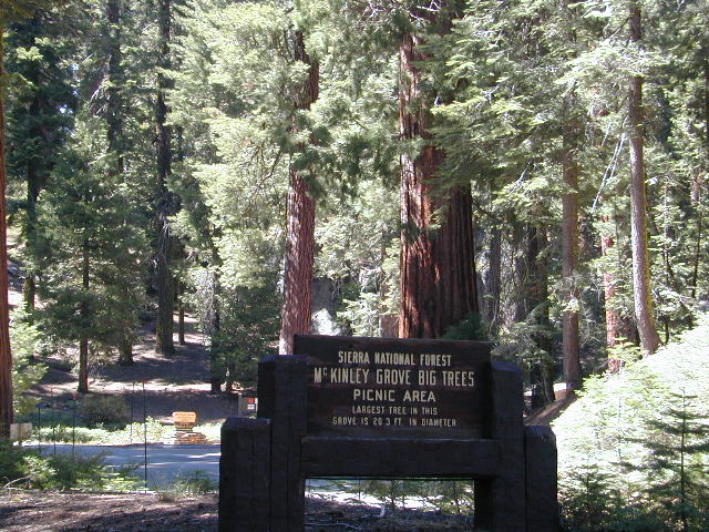
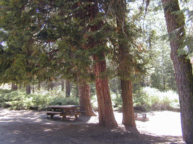
Mc Kinley Grove is a small grouping of Sequoia trees in the Central Sierra Nevada; Located off Hwy 168 & way down Dinkey Creek Road (Sierra Rd #40). deep inside Sierra National Forest, past the Dinkey Creek Campground turn off. It’s a good stretch break and picnic stop on your way to Wishon & Courtright Reservoirs.
Anza Borrego Desert State Park & Borrego Springs Campgrounds
Anza Borrego Desert is the largest of the California State Parks. Borrego Palm Canyon Campground is the official name of this popular palm oasis & developed campground located very close to Borrego Springs CA. Hike or bike to town. There is also a private RV Park named Palm Canyon Resort in town, just to confuse you.
Desert wildflowers blooms, popular hiking & biking trails, plus mud caves & slot canyons draw plenty visitors here, mostly in the winter months. Summer high temps exceed 90 degrees for months at a time.
There are hundreds of miles of dirt roads to explore, and one could easily spend every weekend for a full year, checking out all there is to see in this vast desert, where elevations range from near sea level to 5000′ peaks.
BORREGO PALM CANYON CAMPGROUND
main campground near Visitors Center, in town Borrego Springs, CA
120 camp sites for tents & RVs, flush toilets, overnight / day use fees reservations accepted
TAMARISK GROVE CAMPGROUND
27 camp sites, flush toilets, fee
on S-3 @ Highway 78 jct (closed June – Sept) reservations accepted (Oct-May)
Vern Whitaker Horse Camp
equestrian campground w/ corrals, 10 camp sites, flush toilets
elev, 960′, located N of Borrego Springs, near scenic and rugged Coyote Canyon. reservations accepted
Backcountry Campgrounds Anza
Arroyo Salado
16 miles east of Borrego Springs on County Road S-22
Blair Valley Camping Area
open car camping & RV spots, vault toilets
on SAN DIEGO County Rd S-2 near Highway 78 jct
Bow Willow Campground
elev, 950′, hwy access, 16 camp sites, pit toilets, overnight fee
near Sweeney Pass & badlands overlook; located on S-2, 9 miles N of Interstate 8
Canon Sin Nombre
off S-2 near Sweeney Pass; entrance near Badlands Overlook; slot canyon hikes
Coyote Canyon Camping
N of Borrego Springs via Di Giorgio Road
rugged backcountry dirt road, tent camping only
car camping near ocotillo gardens; 4×4 needed @ creek crossing & Sheep Canyon
Culp Valley Campgound
elev, 3400′, hwy access, 8 camp sites, pit toilets, free camp
located on S-22, atop Montezuma Grade
Culp Valley Boulders
elev, 3700′, dirt road access, primitive camp sites, free
located off S-22, 4×4 near Montezuma Grade
Fish Creek Campground
Hwy 78 near Ocotillo Wells & Split Mountain
elev, 280′, dirt road access, 8 camp sites, pit toilets, free camp
from hwy, go 12 milies south on Split Mountain Road
Yaqui Well
5 mi. south of Borrego Springs on County Road S-3 & right on Yaqui Pass Road, go 6 miles to camping area on right side
Yaqui Pass
5 mi. south of Borrego Springs on County Road S-3 & right on Yaqui Pass Road, go 4 miles to camping area on left side
Culp Valley trails, North Anza Borrego SP, SoCal Deserts
All Desert Campgrounds Nearby
AGUA CALIENTE HOT SPRINGS
(San Diego County Park)
88 camp sites for tents & RVs, flush toilets, overnight / day use fees, 760-765-1188
located on Co. Rd S-2, 22 miles N of Interstate 8 (closed June-Aug)
BOX CANYON RDMecca, CA – in between Joshua Tree NP and Anza Borrego Desert
BLM camping in Box Canyon & Mecca Hills Wilderness Park
LEAPIN LIZARD RV RANCH
(Private Campground Resort)
85 acres, 60 camp sites
located on Split Mountain Road, Ocotillo Wells, CA
OCOTILLO WELLS SVRA
(State Vehicular Recreation Area)
elev. 160′, 4×4 and off road camp sites for trailers & RVs
no water, no hook-ups, pit toilets, no fees, 760-767-5391
located on Highway 78 (closed June-Sept)
PALM CANYON RV RESORT
(Private Campground Resort)
located in town, Borrego Springs, CA
SALTON SEA SRA
(State Recreation Area & Campground)
Mecca Beach, Corvina Beach, Salt Creek Campgrounds
located on Highway 111 on east side of inland sea
SLAB CITY @ SALTON SEA
old Camp Dunlap in California desert badlands
free & open RV camping near Salton Sea
located off Highway 111 on east side of inland sea
TRUCKHAVEN HILLS
(OHV trails & camp spots)
elev. 300′, 4×4 and off road camp sites for car camping, touy hauler trailers & RVs
no water, no hook-ups, no fees,
located on S-22, East of Borrego Springs, CA
VALLECITO PARK
(San Diego County Park)
44 camp sites for tents & RVs, no hook-ups, toilets, overnight / day use fees, 760-765-1188
located on S-2, 22 miles N of Interstate 8 (closed June-Aug)
FREE CAMPING ANZA– Let us also remind you that this is the best place to camp in California for primitive car camping (camping outside of a developed campground). Open all year long – always! Super secluded, darkest skies, free and always located on the back roads. 4×4 is not required in all areas, so there are plenty of options. Blair Valley or Coyote Canyon Gardens are popular camp spots, but there are thousands of hidden canyons and washes in this giant State Park, just awaiting your tent. You’ll need a decent topographic map. For more info on free camping click here.
alphabetically listed; cross reference by lake or campground name. reservations may be accepted for certain locations; follow links.
Developed Lake Campgrounds
inside California
Most of the lake campgrounds listed below are traditional style campgrounds with easy access: paved driveways, toilets, tables, maybe piped water. Various agencies manage these park campsites and additional links are provided.
Some of the campgrounds may be more primitive than others, with long dirt road access, gravel driveways, and minimal facilities. This list includes a wide range of lakes, from reservable group camps, to private RV resorts to back road beauties. Even a few campgrounds without fees!
Higher elevation locations close-up for the seasonal winter snow, which can last from NOV-MAY (or later, depending on snowmelt).
no motor boats?
no RVs?
wilderness lake fishing?
trailhead access?
Each lake camp is different, so know what is available at the location before you get out there. Many spots do not have a boat ramp. Some lakes do not allow swimming. Some might be 4×4 access only, w/ hairy granite rock road, 12 miles long. If you require a general store within walking distance, then get the maps out, follow links and make sure.
Determining the ideal tent location will vary on whether you are an ‘early riser’ or late night person, otherwise known as the “up-til-wee-hours ’round the campfire” kinda camper.
Night Owl
OK, all you wine-o’s and silly drunks, try to be a considerate camper and place your tent near the campfire if you plan to be up late. You and your partying cohorts will not disturb those who had planned to get ‘a good nights sleep’ and can stumble to your tent close by with ease. Make sure that you have a large bush, boulder or tree on the east side of your tent, as this is where the dreaded sunlight comes in.
Early Riser
If you are the kinda person who welcomes the sunrise, sitting on a boulder with a healthy cup of fresh brewed coffee, then you probably don’t wanna hear folks up late around the campfire discussing philosophy, right next to your pillow. Ear plugs can be good to pack if you plan to camp with more than a few folks. Setting up your tent well away (like 100 feet) from all communal areas will help you get a decent nights sleep, allowing others to do their normal thing without even bugging you.
Light Sleeper
If you wake at the slightest footsteps (or car alarm) you might wanna find a distant camp for your bedding spot. Camp outside of a developed campground for the most secluded and quiet of nature experiences. If you cannot stand anyone snoring, then kindly ask your neighbors ahead of time and position your tent accordingly.
Sunrise: Determining East & the North Star
If you fear the morning sunlight like a true vampire, make sure that your tent is not in the direct line of fire at 6 am, just in case you planned to sleep in until 9 am.
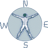
If you arrive at camp after dark & need to decipher where the sun comes up, just locate the North Star silly. Hmmm, sounds easy? Now where is that sucker. See the diagram below for gathering the astronomy part of the lesson.
Now, for all of you who didn’t get a decent high school education: Locating east can be easy if you always remember this small exercise. Standing up, point your face to the north, extend your right arm out sideways & this will be east . The same goes for left/west. South is right behind ya. The sun sit low in the winter months & follows more along the south horizon.
The familiar stars called the big dipper is a nice way to find the north star. Draw a line from the edge of cup — spilling out straight over to the brightest star.
SOUTHERN CALIFORNIA MTS:
Big Bear Area Camping; Crabflats is on dirt road – Road# 3N16
North of Green Valley Lake, off Hwy 18. Between Big Bear Lake & Lake Arrowhead, California.
OHV trails abundant in this region, so expect some 4x4s, dirt bikes and engine noise. Looking for peaceful camp, try Heart Bar Camp.
Crab Flats Campground
• Elevation: 6,200′
• Number of Sites: 28
• Camping Reservations: Yes
• Sites Available: 3 first come
• Vehicle Accessibility: RV 15′ max
• Length of Stay: 14 Days
• Water: No Piped; seasonal creek iffy
• Toilet: Vault
• Season: Open APR-NOV
• Fee: Yes
• Operated By: National Forest Service
• Closest Town: Lake Arrowhead, CA
San Bernardino National Forest
Big Bear Discovery Center
Big Bear Lake, CA
909-382-2790
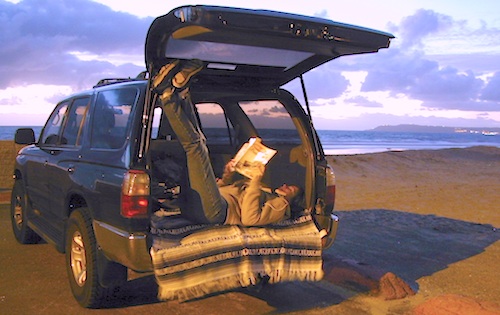
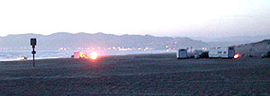
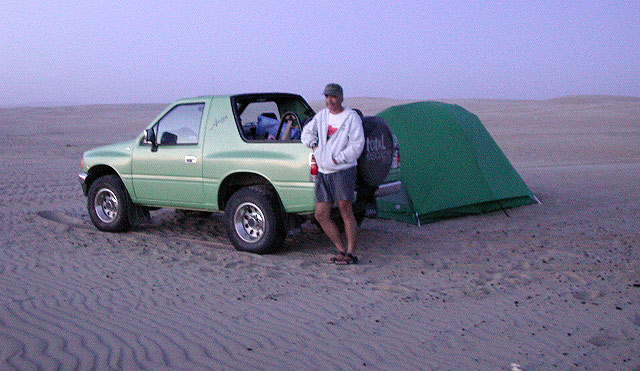
Pismo Beach Camping – Oceano Dunes SVRA (Pismo Dunes)
This might be the only place on the entire California coast where you can take your vehicle on the sand.Drive on the beach!
Open dispersed camping is available along Oceano Beach. Watch the high tide line and set camp well beyond that mark. A typical weekend is busy year round. Sand rails, quads, the beefy family SUV, or the ‘garage queen’ trucks. With all these motorized toys, you’re thinking either – yeah, or no way. Option B is listed below.
SAND DUNES
Off-Road playground, Oceano Park is also referred to as Pismo Dunes.
Oceano State Vehicle Recreation Area has open camping on the beach, with a toilet within walking distance. No tables, no fire rings or paved anything! This is where all the big boys with the big toys like to hang out. Toy box trailers, bon fires, crowds & exhaust fumes. This crew can be seen each weekend driving Hwy 166, over to Bako.
Option B:
a large 82 site coastal campground is better suited for RVers & tourists wanting to avoid dune buggies. Horseback riding, beach, bike trails, laundry, market, shops & restaurants all close by. State Park Campground within walking distance to downtown Pismo & the Pismo pier.
Beach Campgrounds along the coast are made up mostly of State Beaches & Parks. This is a popular and busy part of the California coastline for camping, all year long. Many RVers vacationing year round and big family events are held often. Tent camping is also available – but you will be surrounded by motorhomes, and paying a premium price for a camp spot. With the major highway US 101 zooming along the cliffs at shoreline, some of these campground are located within ear distance from the freeway and the railroad track. Ocean waves may overpower the traffic noise, but we aren’t guaranteeing anything. Early summer vacations tend to be foggy.
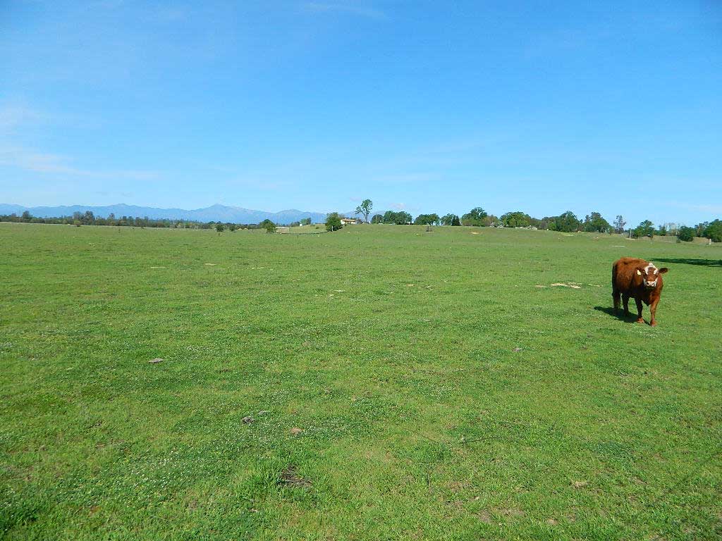
The Great Central Valley of California – the San Joaquin Valley (on the south side) & the Sacramento Valley (on the north) together make up some of the most fertile farmland on the whole West Coast. Agriculture thrives, water flows & smog settles.
This huge valley, bordered by the Pacific Ocean on the west & the Sierra Nevada mountain range on the east side, is the one of the biggest farm land regions of the U.S. The food that feeds the world is grown right here in the Center of California. Vegetables, rice, fruits, citrus, garlic, onions, nuts, you name it.
Since the capital city of Sacto has a “port of entry”, the California Delta & surrounding waterways, make for excellent fishing, boating & camping.
Unfortunately this low lying area is one of the worse smog basins on the west coast. The upper & lower Central Valley see the worst of it, as wind pushes the emissions right up against the mountains. Triple digit temperatures are common throughout the summer months. The super heat just magnifies the poor quality of air.
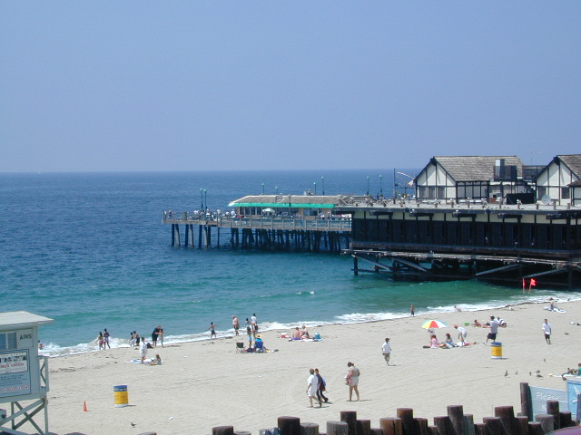
There are very few camping options along the Los Angeles coastline and what is available is geared toward RV campers and the dreaded, amusement parks. Orange County Coastline has the best camping near the Los Angeles region (without needing to smell the oil refineries). Ventura and Santa Barbara, both north of L.A. also have excellent camping beaches.
blue links lead to State Park pages with camp reservations.
SoCal Camping
Sunny and near perfect temperatures all year long, Southern California seriously pulls in the tourists. L.A. is a major metropolis city right next to the Pacific Ocean. With 22 million people residing in Southern California, and millions of visitors annually, this region is pretty busy all the time – even in winter months. Off season for camping might be November-March, when most of the precipitation falls for the year, but campground reservations are highly recommended all year long.
Dockweiler State Beach RV Park
Situated near LAX airport, the Chevron refinery and the main sewage treatment plant, this location can be stinky at times. Paved bike path along the beach leads north & south.
Tent camping directly on a sandy beach can be found at USAL BEACH – on remote reaches of the rugged Lost Coast, via long dirt roads (not recommended for RV or camper trailers). Numerous small, cheap, forested campgrounds can be found on the Kings Range (dirt) roads. The area is also known as Honeydew or the Emerald Triangle. The “emerald” comes from the color of the main economic staple, cannabis. Heed all warnings. Private Property signs and gates mean that you need to turn arund and look for camping elsewhere. (Before you hear the gun shots.)
The remainder of camp accommodations are State Parks and State Beaches on the Mendo coast, offering developed campgrounds and most are first come, first serve.
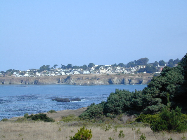
There are no campgrounds inside the popular, historic village of Mendocino, CA , but two state parks are within a mile to the north and south side of town: Van Damme Campground & Russian Gulch Campground. Local KOA and a few private RV parks make up the rest of the scenic coastline.
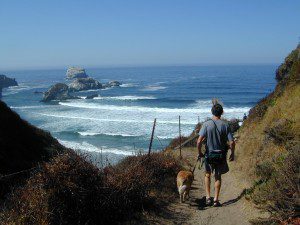
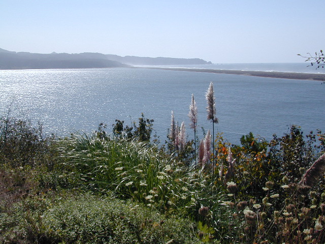
The sheer beauty of real weather, the clashing storms and ocean with the land. Cold and wet half the year (or more), Northern Cal has less people and more scenery. More nature, more land, more forests, more view points, more wild beauty – than the rest of the California coast.
Maybe more hippies too!
The fantastic coastlines of Northern California are forested, rugged, rocky and they receive a lot more rain than the rest of California. Coastal fog or deep cloud layers are common, even in warmer months.
Tall cliffs, large lagoons, rural towns, and foggy beaches. Beaches filled with small rocks. No sand? Minimal access to the coast in some areas.
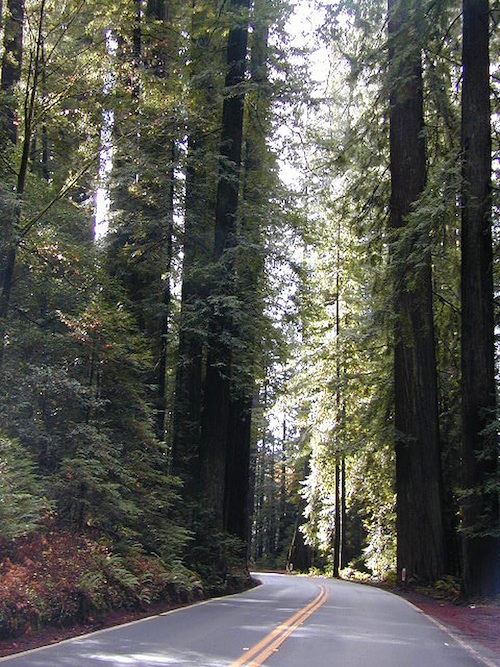
Super tall, coastal redwood trees thrive along this oceanfront wildness. They are located just a skip away from the sea. Most groves located miles inland, near US 101 highway. Close enough, but not out there on the windy beach, exposed with the elements.
NorCal Coast Campgrounds are located generally along river ways, near redwood forests and near paved roads. Redwood Campgrounds are all over up here. Literally, everywhere. Some camps are better suited for RV campers than others. A few parks have walk-in or hike-in access to camp sites.
Several redwood parks are 20 miles from the coast, so know the exact location before you book a campsite online. Driving “over to coast for a quick day trip” is no easy task, since routes can be narrow backroads with many curves. Pavement, if you’re lucky.
listed below:
campgrounds actually located at the coastline are labeled in bold text
When the weather is warm and sunny, people – flock to the hidden coves, rugged beaches, or they float, kayak, fish or raft on the rivers, or the enjoy long day hikes.
blue links lead to State Park pages with camp reservations.
Some redwoods parks are open year round, others only in summer months. Reservations for campgrounds is common along this desired vacation region of California. River kayakers, mountain bikers, tent campers, avid hikers, road trippers and RV campers.
camps actually located at the coastline are labeled in bold text
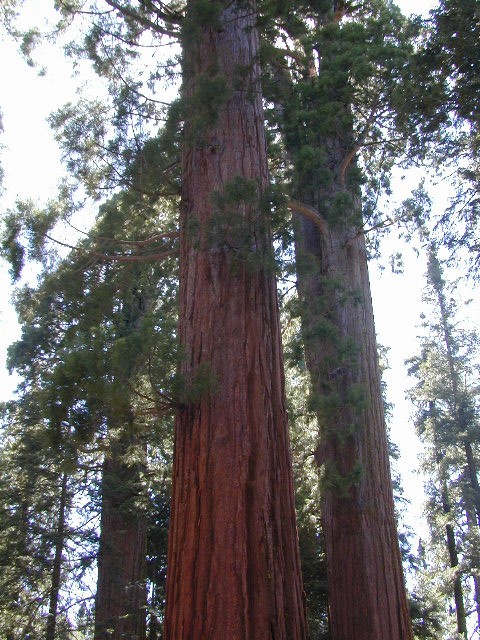
California Redwood forests are found along the NorthCoast; coastal redwoods. And in the Sierra Nevada mountains; those big redwoods are called Sequoias.
Lost Coast: Drive Dirt Roads – USAL ROAD# 431, this road is the hard left off HWY 1, just as it peels away from coast and heads into redwoods and US 101. Follow this dirt and gravel scenic wonder drive out to Usal Beach Campground, Sinkyone Wilderness and Shelter Cove. The pavement picks up again near Honeydew, a rugged 30-something miles north. Real 4×4 may be needed in wet weather.
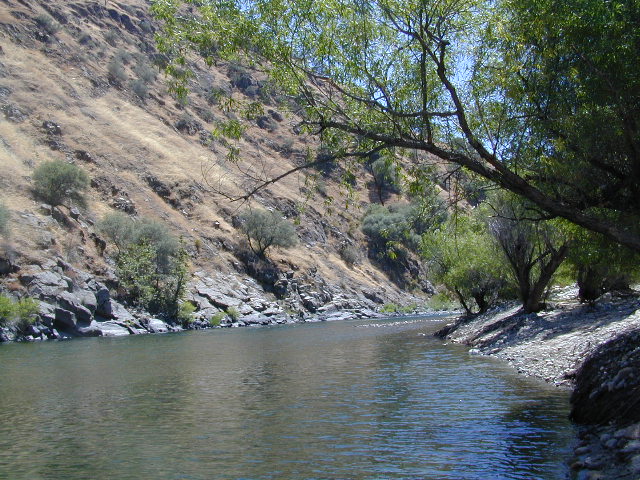
Low elevation Western Sierra: a big river at the beginning of Kings Canyon. Fishing, biking and hiking. The Kings Cyn National Park is directly east, upriver.
Oak woodlands, steep granite canyons, waterfall hikes, rock beaches, river fishing, mountain biking and wildflowers. Day time temperatures get triple-digit in summer months, so best time to visit is the rest of the year. Small RV accessible, paved road, river close – and best of all, open all year long!
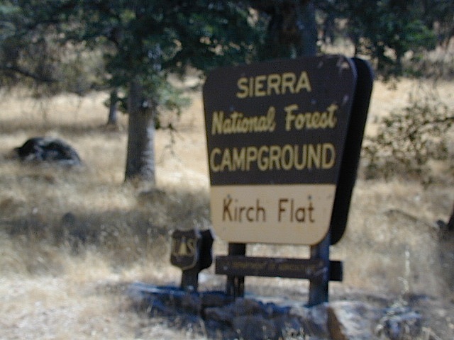
Kirch Flat Campground
Due EAST of Fresno, California in a large river canyon, Western Sierra Nevada
Located 18 miles up Trimmer Springs Road (paved), 5 miles above Pine Flat Lake. Sierra National Forest; River rafting take-out spot for Middle Kings River.
• Elevation: 1100′
• Number of Sites: 17
• Camp Fee: No
• Vehicle Accessibility: RV 22′ max
• Campsites Reservation: No
• Length of Stay: 14 Days
• Season: Open Year Round
• Trailheads: Kings River


 Open dispersed camping is available along Oceano Beach. Watch the high tide line and set camp well beyond that mark. A typical weekend is busy year round. Sand rails, quads, the beefy family SUV, or the ‘garage queen’ trucks. With all these motorized toys, you’re thinking either – yeah, or no way. Option B is listed below.


 Lost Coast Camping BLM


