Tag Archives: Death Valley

Silver State 508 Bicycle Race

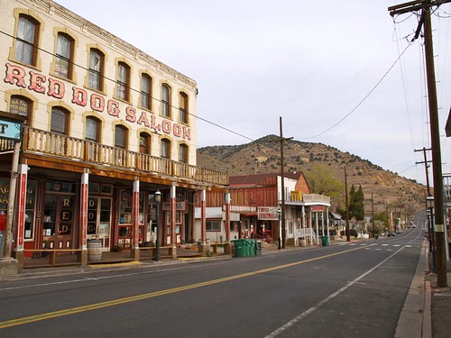
Virginia City

Silver State 508 Bike Race

Starting in 2014 Death Valley National Park  announced that there will be NO sporting events of any kind held within Death Valley National Park, so this particular event has been relocated to the high desert region of Reno, Nevada

Claimed as the “Toughest 48 hours in Sport”, a 508-mile bicycle race revered the world over for its epic mountain climbs, stark desert scenery, desolate roads, and its reputation as one of the toughest but most gratifying endurance challenges.

*NOTE: moved from the month of October to September

Annual event: September

RENO, NV

the508.com

Six Mile Canyon

Downhills

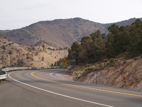
508 Bike Route

Wildrose Campground

Wildrose Campground – Death Valley

wildrose3

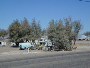
Wildrose is an all-season campground in Wildrose Canyon, on the western edges of Death Valley National Park. This canyon gets very windy, so bring your guy lines, stakes & ropes for securing your tent. Motorhome RVs can make it in here, since the narrow road is a paved route – but be warned it can be curvy and slow going with the climb in elevation. This camp stays cooler than anything on the desert valley floor, so in summer months it can fill up quickly. Further up the hill are both ThorndikeMahogany Flat Campgrounds (both close in winter, due to snow)

• Elevation: 4,100′
• Number of Sites: 30
• Vehicle Accessibility: Open to all
• Campsites Reservation: No
• Length of Stay: 30 Days
• Season: year round

wildrosecamp

Directions:

From Stovepipe Wells, follow Highway 190 W to Emigrant Canyon. Turn left on Wildrose Road and follow it thru the tight rocky canyon, climbing in elevation the whole way. Wildrose Campground is obvious and near the charcoal kilns turn off.

From Panamint Valley, take Wildrose Road up.


View Larger Map

Death Valley MAPS –

Death Valley Park – NatGeo
Death Valley Topo Map – Tom Harrison

Nearby attractions:

Death Valley National Park
Panamint Valley
Ballarat Ghost Town
Skidoo Town Site
Charcoal Kilns
Telescope Peak
Tuber Canyon
Tucki Mine

Camping for Thanksgiving

Turkey Casserole
Turkey Leftovers?

California Camping on Thanksgiving

If you’ve had it with the traditions, the big meal prep, or just sick of the family. Maybe you are a solo traveler, or a new transplant to California and need to explore more. Take a holiday away – for once this time.

Camping for turkey day? What a concept.

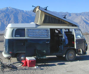
VWBus Death Valley
California is the perfect place for camping, all year long!


Stick to the lower elevations, look for canyons, and seek seclusion

California mountains often have snow during November. Avoid camping in snow @ 4000-5000′ elevation and above; Freezing temps above 3000-4000′ elevation.

Deserts, coastal regions and foothills are top choices for late Autumn car camping. Always check the weather ahead of departure, and have a plan B as an alternative. NorCal will be much wetter than the rest of the state.

MEALS: Prepare dinner meals ahead of trip departure. Bake turkey days before your trip and create meals based around that. Make mash potatoes at home and don’t forget to bring the butter. Pack pre-baked turkey for sandwiches, plus other quick snacks & meals for on-the-go travel.

seafood
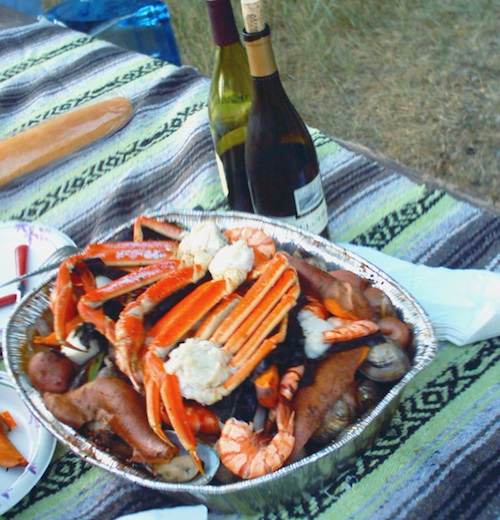
Non Traditional: Seafood Feast

Desert Camping is premium at this time of year. Luckily the eastern half of Southern Cal is desert. The lower the elevation, the better the temps will be overnight. Be prepared for wind when the ‘storm fronts’ approach, the winds do get a cranking! Dirt roads can become flowing washes during a good rainstorm, so know the weather forecast.

Coastal campgrounds may need advanced reservations. Be prepared for wet weather, especially up north. The redwoods groves are gorgeous anytime of year.

Gold County Reservoirs are prime areas for relaxing in nature, while everyone else is out shopping. Oak hills, rivers and canyons. RV campers love these large lakes; boating, fishing, mountain biking trails, kayak rentals, hiking near historic Gold Rush towns.

River Canyons of California are always beautiful destinations in the autumn months with fall leaves changing color. Many campgrounds can be found at lower elevation, river access areas.

California’s abundant Hot Springs are also top picks for holiday weekends.

Joshua Tree Campout

Joshua Tree National Park may be busy during this weekend. Instead try nearby Mecca: Box Canyon and Mecca Hills Wilderness, BLM desert lands near Interstate 10.

Anza Borrego Desert State Park is always a nice, easy and relatively close get-away for any holiday. Open camping on the backroads (for free) makes it one of the most attractive camping options in all of SoCal. Many dirt roads are accessible for passenger cars, if extreme caution is used. Don’t plan on driving more than a few miles on dirt.

froaders

Masses of off roaders love to camp out, especially on Thanksgiving weekend. Wheel all day, eat, drink, bon fires every night and rumor has it ‘they roast their big bird outdoors – deep in a dirt pit’. Really?

El Centro, Glamis, Imperial Dunes, Ocotillo Wells, Truckhaven Hills, Johnson Valley. All popular off roading areas in Southern California, so consider yourself warned.

Imperial Dunes

Mojave Desert, near US Hwy 395
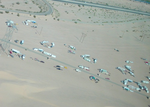
Jawbone Canyon expect to see RVs, toy-boxes and families outside enjoying the weekend. OHV style. Often the group tries to create a round corral with their huge convoy of vehicles, to keep thru traffic to a minimum around “their camp”. Just stay well away from those gear-heads. In general, it is a very busy area around Mojave up to Hwy 178 during the holidays. Try high desert Horse Canyon instead.

Bodie State Park
Bodie State Park

Tent Camping

Death Valley National Park is one of the best destinations for Thanksgiving, cuz Panamint Springs serves their free turkey dinner.

Did someone say FREE?

Leon at Mahogany

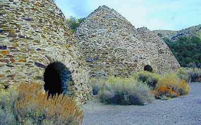
Death Valley Charcoal Kilns

Wildrose Charcoal Kilns – Death Valley

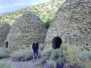
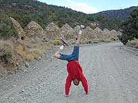
the 10 kilns are large
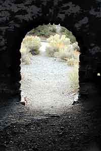
The acoustics are really cool inside these historic stone structures. Spending some time at this place humming, drumming & singing. Stand right in the center floor space for the best sound.

one window & one door

The western ranges of Death Valley National Park offer some interesting sites & hikes. This canyon called Wildrose is higher in elevation, a lot cooler than the valley floor, plus it does get pretty dang windy.


These bee-hive shaped kilns were used in the 1800’s for making charcoal, that was used in nearby mining operations. Standing 30′ high & 30′ around, these kilns were only used for a very short time (in the mining heyday) & are some of the best preserved charcoal kilns in the country.

wildrose rd
The Wildrose Charcoal kilns are located on the western side of Death Valley National Park. Access the Wildrose Canyon Road from Panamint Valley or from Death Valley Highway 190, take the Emigrant Canyon to Wildrose Canyon Rd up to the historic kilns. Last 3 mi of this road is unpaved and not recommended for RVs or trailers.


View Larger Map

Death Valley National Park Map

Nearby Panamint Valley is for serious off-roaders: Stone Canyon, Barker Ranch, Goler Wash.

Death Valley Campgrounds – Wildrose, ThorndikeMahogany Flat.
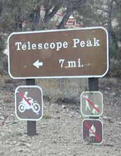
A popular day hike nearby is Telescope Peak, from Mahogany Flat campground, a 14 miles RT hike that leads to the mountain towering over Death Valley at over 11,000′.

FACTOID: Telescope Peak is the only place that you can see both the lowest point & the highest point in the continental USA.

no camping inside

wildone

Desert Hiking California

California desert region hikes

Anza Borrego Desert State Park
Approximately 20% of California’s land is desert, located in Mono, Inyo, Kern, Los Angeles, San Bernardino, San Diego, Imperial, Riverside Counties… most falling in the eastern portion of California. Almost all of the Baja California peninsula is desert, right down to THSDmapthe beaches on the Sea of Cortez. The Mojave joins in Sonoran desert in Joshua Tree National Park, which is reason enough to explore this fabulous landscape. Anza Borrego Desert has way more cacti and vegetation than the barren Death Valley terrain. But Death Valley offers abundant acreage, seclusion, hot springs, scenic canyons, mining history, the tallest mountain peaks and the lower point in the nation. Inyo has impressive mountains that sit just east of the Sierra Nevada and is a volcanic wonderland along Highway 395 with indian petroglyphs, cinder cones and ancient lava flows.

  • Anza Borrego Hikes – San Diego Back country: Blair Valley Indian Pictographs
  • Bodie Ghost Town – High desert mining camp, off Hwy 395
  • Darwin Falls Hike – High desert waterfall, near Death Valley
  • Death Valley Hiking
  • Fossil Falls – Lava Flow on Hwy 395
  • Hiking Las Vegas
  • Inscription Canyon – Mojave Desert, Barstow
  • Joshua Tree Hiking Trails
  • Mojave Desert Hiking
  • Panamint Valley & Canyons
  • Rainbow Basin – Mojave Desert, Barstow
  • Randsburg Mining Town
  • Telescope Peak Hike
  • Goat Trestle Anza Borrego Desert
    Goat Trestle Anza Borrego Desert

    California Desert Hiking Maps

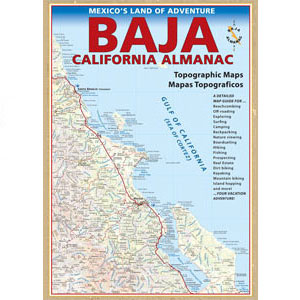
    bajaalmanac2010
    Baja Almanac

    Baja Map Set by NatGeo
    Bodie Ghost Town Map
    Death Valley Maps
    Inyo National Forest
    Jawbone Canyon Map
    Joshua Tree Maps
    Mojave Desert by Tom Harrison
    Mojave Map by NatGeo
    Mono Lake Map
    San Diego Backcountry Map
    Anza Borrego Desert Map
    Verdugo Mountains Map

    Thorndike Campground

    thorndike3

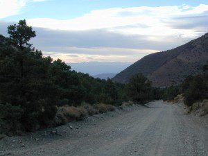
    Beyond the Wildrose Canyon and the charcoal kilns of west Death Valley NP, the high desert dirt road becomes rougher and steeper. Among junipers and pinyon pines sits this remote high-desert campground. High clearance vehicle may be needed to reach this camp at Thorndike – and 4WD is recommended during inclement weather (rain, flash floods or snow). And no RV, motorhomes or trailers should be driving up this way. This is the closest camp to the historic charcoal kilns, which are walking distance away.

    Mahogany Flat Campground is another 1000′ higher in on the ridge and Wildrose Campground is way down the canyon at 4000′. Wildrose is open all year long, while Thorndike & Mahogany get snow and close for the winter months.

    • Elevation: 7,400
    • Number of Sites: 10
    • Vehicle Accessibility: High Clearance Vehicle, recommended
    • Campsites Reservation: No
    • Length of Stay: 30 Days
    • Season: March – November

    DSCN0065
    Directions:

    From Stovepipe Wells, follow Highway 190 W to Emigrant Canyon. Turn left on Wildrose Road and follow it thru the tight rocky canyon, climbing in elevation the whole way, past Wildrose Campground, past charcoal kilns, to Thorndike Campground on Mahogany Flat Rd.

    From Panamint Valley, take Wildrose Road up. Turn right to Mahogany Flat Rd and proceed on the dirt road to the Campground.


    View Larger Map

    Death Valley MAPS –

    Death Valley Park – NatGeo
    Death Valley Topo Map – Tom Harrison

    Nearby attractions:

    Death Valley National Park
    Panamint Valley
    Ballarat Ghost Town
    Skidoo Town Site
    Charcoal Kilns
    Telescope Peak
    Tuber Canyon
    Tucki Mine

    Saline Valley Hot Springs

    Saline Valley Hot Springs
    Saline Valley Warm Springs
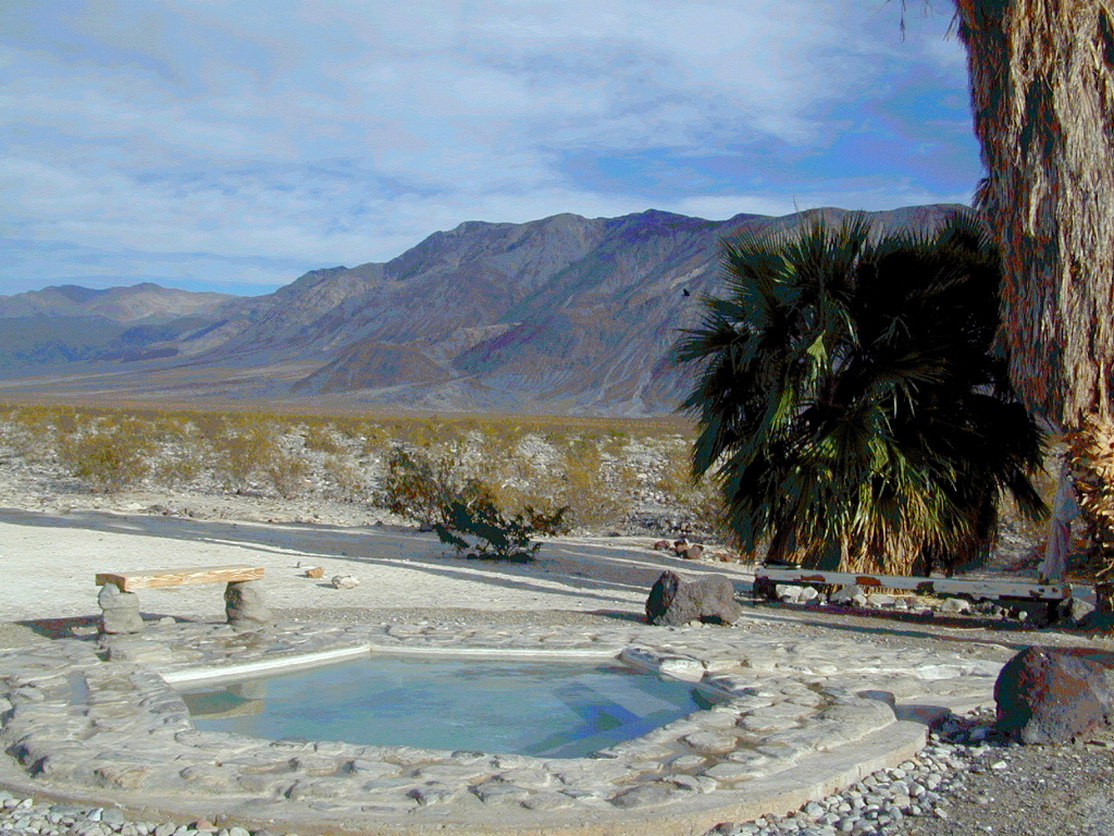
    NORTH Death Valley National Park, in a super remote desert valley located in the vast mountains in between Big Pine CA Route 168 & Death Valley (west) Highway 190.

    Inyo National Forest: Inyo mountains are a towering range of high elevation desert peaks running in between Owens Valley and Saline Valley.

    desert wilderness access: 4 dirt road routes lead into Saline Valley – 2 backcountry 4×4 trails from the upper reaches of the park and 2 main dirt roads. All routes require a high elevation pass, so snow is likely in winter months (Nov-May).

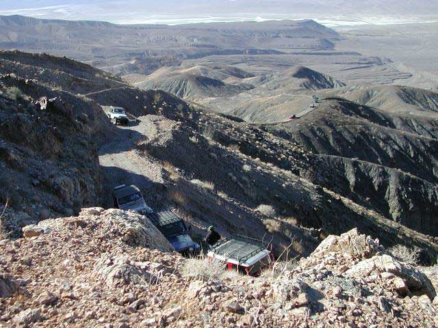
    Wilderness routes road conditions can change often, seasonally with winter snows, mud and summer thunderstorms. The most popular access are the main routes (both long dirt roads, subject to snow and closure at any time) – the North Pass (Big Pine) and the South Pass (Panamint). Detailed directions on those further below. Both backcountry roads Steele Pass and Lippincott Road, originate from the northern, desolate areas of the National Park and both require 4 wheel drive, with a recommended locking differential.
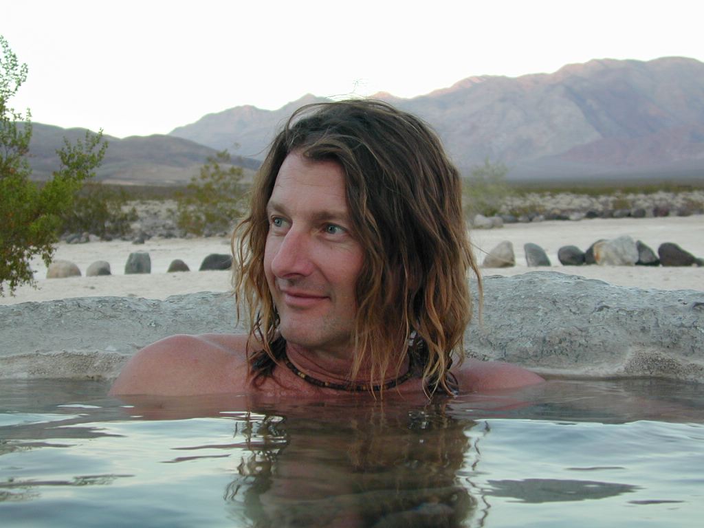
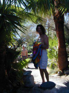
    No developed campground facilities. Clothing optional my ass — nudity is the norm here.

    Since the challenging drive in to this remote desert valley is so grueling and time consuming, plan to spend a minimum of 4 nights. Anything less is way too rushed to totally enjoy the experience.  Best way to enjoy this place is a full week off of work, and as much firewood, food and ice as you can haul. Some folks spend weeks camping here. The NPS limits your camping stay to 30 days! If you plan on driving out to Lone Pine for camping supplies and returning the same day, you best leave at dawn – cuz the entire round trip ‘beer run’ will take 6 hours or more.

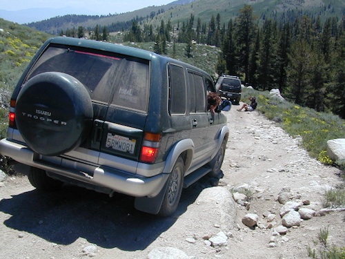
    High clearance vehicle a must & 4 wheel drive is highly recommended in all this region. All wheel drive wagons and passenger cars have been known to bottom out, break down and pop tires out here in the harsh conditions, so a first challenge may be to obtain a dependable and capable off-road vehicle.

    Topographic GPS & decent back road maps are highly advised. One way drive is easily 4 hours, from any paved highway. Pack like you’re gonna live out here, if need be. Warning: this is a very long off-road journey for any average camping trip. This isn’t a weekend kinda place. First timers beware – it’s a full day journey to travel here!

    Air Strip? The fly in option is a dirt landing strip called ‘Chicken Strip’, but National Park Service has yet to closed it.
    NORTH PASS to Saline Valley Road:

    from Big Pine, take Hwy 168 N from Hwy 395, turn right onto Death Valley Road (some maps may have this one listed as Waucoba Springs Road or just Waucoba Road). Proceed on the main route to the hard to read entrance sign marking the Saline Valley Road, past a few old structures and down to the main valley. Winter snow can be deep, so carry chains. 4×4 is best to access this remote valley, AWD high clearance might make it and normal passenger cars, 2WD SUVs should be warned about weather and access to the real world. Many times all mountain passes are snowed in – people do get trapped at Saline and cannot get out for weeks. So take that into account when requesting days off of work for this epic journey.

    SOUTH PASS to Saline Valley Road:

    from Olancha, take Highway 190 E, turn N off Hwy. 190 to Saline Valley Rd. Rugged 50+ mi. of hard core dirt roads. 4×4 and high clearance a must. Winter months expect snow, springtime rock slides and summers torrential downpours cause overflowing creeks w/ impassable washouts. Grapevine Canyon can be a challenging drive, but with patience and skill you can be down on the main valley floor in about an hour and a half (if you’re lucky). Did I mention the dozen or more miles of heavy washboard road conditions, at the base of the alluvial fan of mountain rock? Newbies and first timers should attempt the North Pass.

    ———————-

    Near the marsh, when you finally reach the sand dunes area, you know the turn off is close-by, so slow down and stop to read the landscape. Know that the hot springs are located above the sand dunes to the east slope of the red volcanic mountains. When you see the metal bat sign and the mass of palm trees in the lower grove, you know you’ve arrived.

    You’ve only truly arrived, when your whole body is immersed in hot water looking up at the stars and you learn to relax again. Breathe the deepest you have all year.

    CAUTION: Stopping for those vehicles distressed on the side of the road is also a common practice. Many people break down on this route, Jeeps slide off cliffs. Harsh landscapes, plus weather are unforgiving and people die, so realize that this camping trip is no walk in the park.

    Saline Valley Road Conditions & discussions can be found on
    Saline Valley Talk, the Saline Valley Message Board
    forum.salinepreservation.org

    Saline Preservation Association
    salinepreservation.org

    Trip Review from Student Reader
    studentreader.com/saline-valley
    natural hot springs

    nearby desert destinations –


    View Death Valley National Park in a larger map

    California 4×4 Roads

    Panamint Creeks

    West Coast 4×4 club holds annual trail runs in Panamint Valley.

    California 4×4 – here is search term popularized by the SUV & the anxious city driver who wants to hit some dirt. Gone are the days when peeling out in the back of the Ikea parking lot adventure. You seek real trails & cool spots & Total Escape is here to deliver.

    Take your muddy or dusty vehicle to work on Monday (unwashed), just to prove you did something adventurous this past weekend! Once they see the photos, the co-workers will be envious… cuz they watched TV (and wasted 17 hours).

    BTW, TV = nothingness

    This entire web site was started around California back roads & self guided tours. You finally found us! Gotta get the 4wheel drive SUV into action (at least once per year – so the differential oil wont get like glue) & this web site can help you find the secrets spots of California.

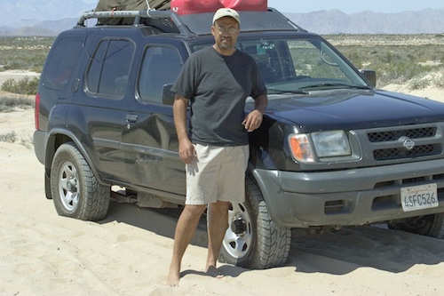
    Xterra Ken in Baja 2005
    Anza Borrego Desert & Los Padres National Forest has the most 4×4 trails in all the SoCal region. Big Bear forest has some, but the crowds are thick on any given weekend. Angeles has Azusa & Lyttle Creek; Idywild has a few virtually unknown spots. Mojave desert & the Eastern Sierra have plenty to see, volcanoes, ghost towns, old mines, petroglyphs, all reachable with stock SUV. Inyo high country has some incredible sights, but only accessible half the year. You will need 4 wheel drive part time or full time on these trails listed below. AWD doesn’t count! Clearance and 4 wheel traction are key for control w/ rock crawling and deep sand.

    Searching for the extreme, rock crawling, hard core 4×4 stuff, go to the off-road races — or take your time & plan your adventure well. Chances are you’ll need a small team of people to explore these black diamond routes, a good forest map, plus very capable 4 wheelin’ rigs.

    red mountain

    Red Mountain 4×4 Trail near Shaver Lake

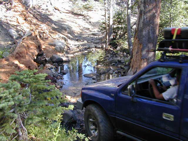
    Find California 4wheel drive roads below. Some of these routes will require a four wheel low range, with a transfer case. Do not attempt these with a new AWD SUV. Expect body damage on any 4WD trail.

    Anza Borrego Desert –

    Gold Country & Sierra Nevada 4×4 trails –

    Death Valley 4×4 Camps –

    Inyo NF 4×4 trails –

    Los Padres NF 4×4 trails –

    San Berdu NF 4×4 trails –

    • John Bull Trail, near Big Bear Lake CA
    • Deep Creek Trail, near Skyforest Lake Arrowhead CA
    • Gold Mountain Trail, near Big Bear Lake CA
    • Pipes Canyon, near Big Bear Lake CA

    San Diego 4×4 Trails –

    • Los Coyotes Indian Reservation, Lake Henshaw
    • Valley of the Moon, Jacumba CA

    baja roads 4x4

    Now, not every road is gonna need 4×4 all the time. Most of the dirt back roads can easily be passable in a 2WD in dry months, but forget that in winter or any good rain storm. Total Escape has compiled a huge list of Southern California Back Roads, for your viewing pleasure.

    California off road maps –

    Baker Creek
    Baker Creek, Inyo NF

    Death Valley Hot Springs

    Top Pool Volcano

    Death Valley
    Hot Mineral Springs


    Shoshone InnNorth Death Valley  –

    Saline Valley Hot Springs
    primitive springs. Very remote desert wilderness area, 60 mile rugged dirt road – high clearance vehicle required; 4×4 access year round. Clothing optional. Nudity out in nature is the norm!

    South Death Valley

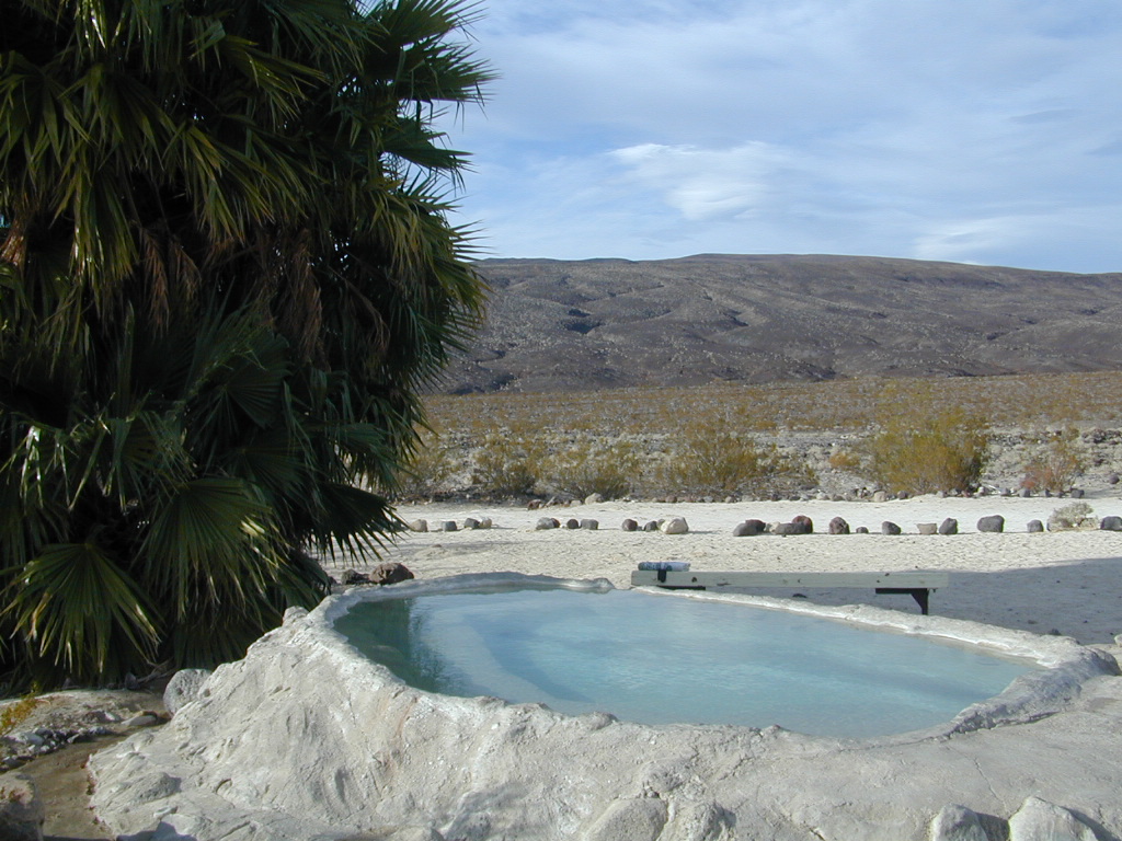
    Shoshone small hot springs resort camps. Swimsuits required.

    Tecopa Hot Springs county park hot springs w/ bath house, rustic resorts & RV parks. Swimsuits required.

    Furnace Creek, Stovepipe Wells and Panamint Springs are not hot springs destinations, although the names seems to imply they might be. The historic Inn at Furnace Creek in the center of the Death Valley National Park has palm trees and pure luxury – deluxe guest rooms, massage & spa services, pools and tennis, restaurants, but no mineral hot springs source. Death Valley Junction, home of the infamous Amargosa Opera House, does not have hot tubs, nor a pool, nor even a restaurant. South end of the park speaks more to the RV campers.

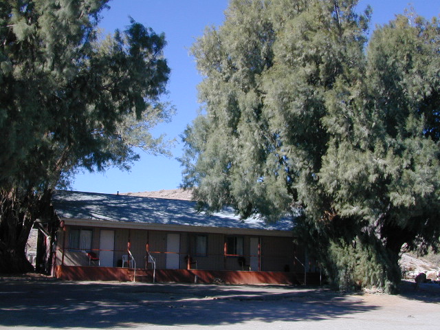
    Small town of Shoshone is a little more appealing (visually) than Tecopa Springs, so keep that in mind when wondering what to expect. Cabin rentals at Delights Hot Springs Resort are old, rustic and the whole place is a little “rough around the edges”.

    Shoshone Inn

    Tecopa Springs RV Campers Winter
    Tom Harrison Death Valley Map NatGeo Death Valley  Park


    View Larger Map

    Mahogany Flat Campground

    Mahogany Flat – Death Valley National Park

    mahgsign

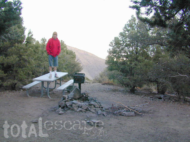
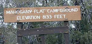
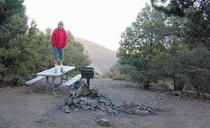
    If you want trees in your Death Valley visit, than this is it. Mahogany Flats Campground is located in a juniper forest on a ridge line of the Panamint Mountains. Often windy camp sites with the highest elevation campground in the area. If you seek to get away from the desert heat, this may be the best option. Spectacular views to the east, over the Death Valley basin. Access to hiking, backpacking, off roading, mountaineering opportunities. A great place to escape summer heat, but be warned of thunderstorms. Picnic table, fire ring, pit toilets – maintained with NPS.

    • Elevation: 8,133′
    • Number of Sites: 10
    • Vehicle Accessibility: High Clearance, recommended. No RVs or trailers. 4×4 needed in heavy rain or snow.
    • Campsites Reservation: No
    • Length of Stay: 30 Days
    • Season: March – November
    • Trailheads: Telescope Peak & Tuber Canyon

    greatspot_iDirections:

    From Stovepipe Wells, follow Highway 190 W to Emigrant Canyon. Turn left on Wildrose Road and follow it thru the tight rocky canyon, climbing in elevation the whole way.

    Passing Wildrose Campground where the pavement ends, past charcoal kilns, climbing in elevation past the pinyon pines at Thorndike Campground, up, up, way up Mahogany Flat Road.

    From Panamint Valley, take Wildrose Road up. Turn right to Mahogany Flat Rd and proceed on the dirt road to the top.

    View Larger Map

    The Telescope Peak mountain range is the only place in the lower 48, where you can see both the tallest peak (Mt Whitney) and the lowest point (Badwater Death Valley).

    Death Valley MAPS –

    Death Valley Park – NatGeo
    Death Valley Topo Map – Tom Harrison

    Nearby attractions:

    Death Valley National Park
    Panamint Valley
    Ballarat Ghost Town
    Skidoo Town Site
    Charcoal Kilns
    Telescope Peak
    Tuber Canyon
    Tucki Mine

    DSCN0053

    telescopehike