Group Camping can be reserved at Whiskey Creek Group Picnic Area
3 group camping sites with excellent views of the lake and mountains, on the northeastern shore of Whiskeytown Lake.
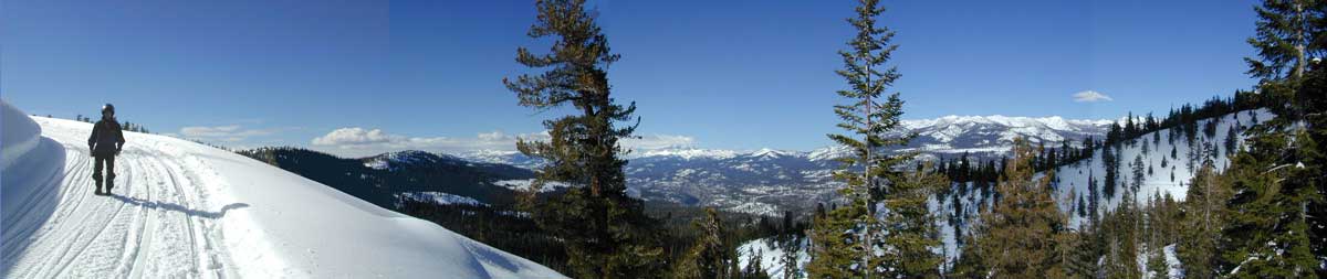
Salmon River @ Somes Bar:
Oak Bottom Campground NFS
elevation 700′
26 sites
No electricity, water or sewer hookups
Six Rivers National Forest – Oak Bottom Campground loops around a forested hillside with large trees providing ample shading for multiple sites within the campground. A variety of wildlife makes its home in the area.
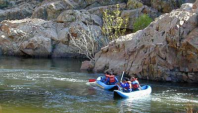
Located off the main highway, on a side road, with the epic Salmon River! This NFS campground is popular with whitewater enthusiasts in the spring. Rafters, kayakers. Many challenging rapids ranging from Class 3 to 5 are available. Swimming is also popular in the summer and numerous river access areas are a short drive or walk from the campground.
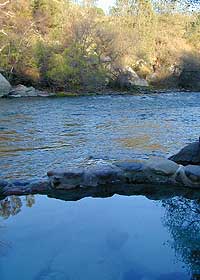
This place was the alternate choice to Miracle Hot Springs, but since that one is now closed – this is the main attraction out here, along the lower stretch of the Kern River.
USFS Forest Hobo Campground is about a mile away and it may be closed due to landslide repairs. There is also plenty primitive style camping options if you so choose.
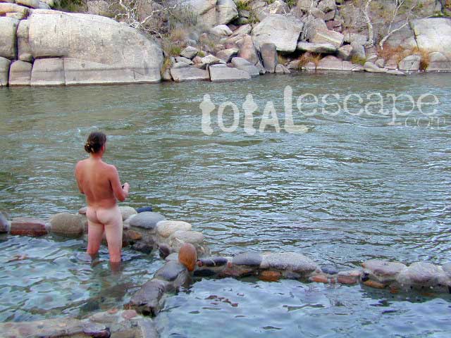
Remington is by far, one of the nicest primitive hot tubs in the whole region and easy to access. If you can find it, the rewards are great!! Can be crowded on weekends. If the dirt parking lot is totally full, come back later or wait it out. You can find travelers, mountain bikers, dirt bikers, hikers, backpackers, campers, off-roaders, RVers, burners, desert rats, military boys, local kids, LA couples, techno DJs from Russia – a wide variety of people soaking at this not-so-secret spot.
These unique hand-crafted stone tubs are located on the Lower Kern, overlooking the big river and the fish. 3 volunteer built cement & river rock hot spring pools sit adjacent to the Kern River. There is also another small cooler tub on the trail perched above the thick brush.
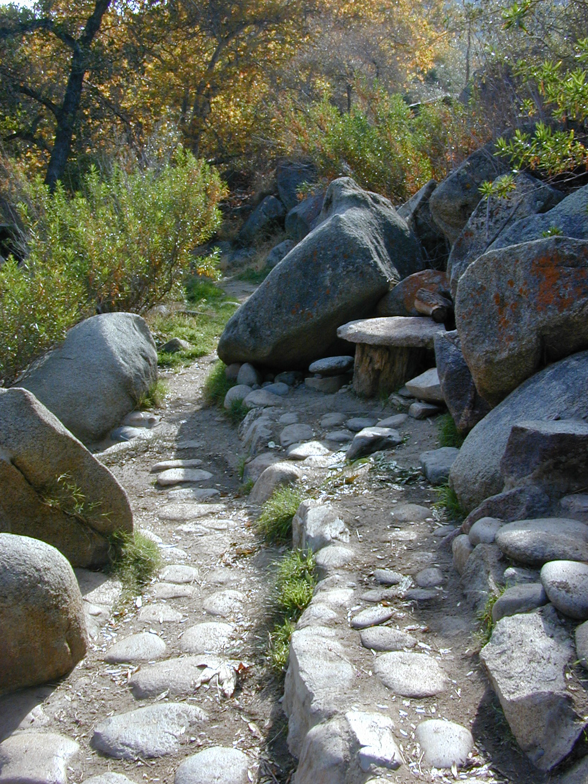
This prime recreation spot is located a few miles west of Hobo Campground (old Miracle Hot Springs) is sometimes busy: dirt parking lot, minimal sign & the tubs are not viewable from the road. From parking area you must hike down a steep grassy trail for about a mile.
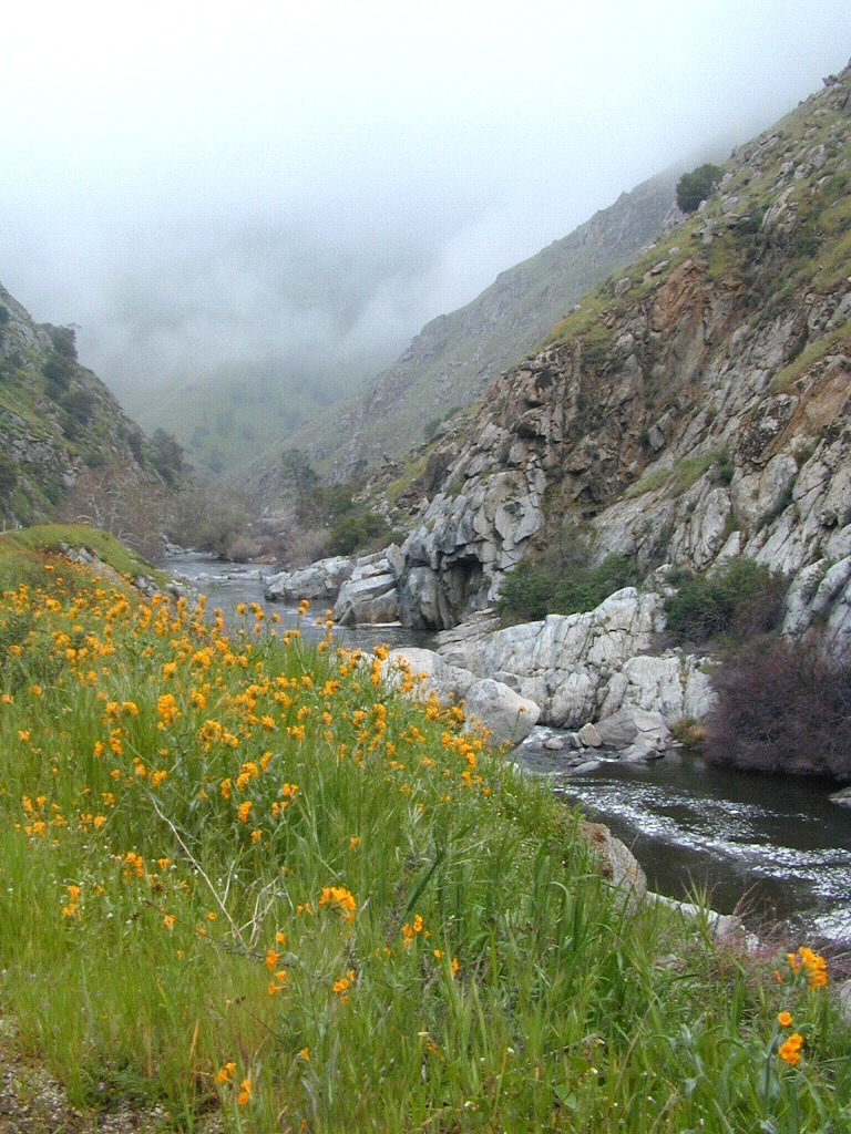
Bring towels, beverages & everything you will need from the vehicle, as turning around to go back & get everything half way down will prove to be a challenging trail up. Boulders & oaks on steep hillsides. A few campsites down along main trail. Wildflowers here are wonderful in Spring (April-May). Please pick up litter & keep this place beautiful.
West of Kernville & Lake Isabella, CA
along Kern River in the Lower Kern Canyon Gorge, Southern Sierra Nevada mountains
Remington primitive hot springs are located inside the lower Kern Canyon, southwestern part of Sequoia National Forest. Take Highway 178 east to the 4 lane portion, look for Borel Road right turn which climbs a steep hill up to Old Kern Canyon Road. At this stop sign you will see a sign for Remington Trail (3.5 miles) pointing to the right.
Remington Trailhead (signed) & dirt parking lot across from trail, is located on Old Kern Canyon Rd, which runs parallel to the 4-laner Hwy. 178 on the opposite side of the Kern River. The well known Kern Canyon Road is also labeled as “Cort 214” on GoogleMaps.
Remington Ridge Trail #32E51 – Mountain bike, hike and horseback trail
Breckenridge Road #28S06, access via Havilah, CA. Breckenridge has pine forest at higher elevation, and is the tallest mountain to the south of Kern River.
Minimal camping spots with very little privacy at the main dirt parking lot at Remington Hot Springs. The best tent camping is located down on the trails, so you may choose to hike-in to the secluded oaks to the sandy beach camps below. No facilities at Remington, no tables, no toilets, no electricity, so come very prepared to “rough it”.
USFS Sandy Flat Campground and Hobo Campground are a few miles away (to the east), on the same Kern Cyn Road; Breckenridge Campground is on a tall pine forested ridge just to the south, but requires a long drive around the mountain, or a super rugged 4WD vehicle for a steep dirt road.
Folks seeking more seclusion can choose to primitive camp along the narrow paved road leading to the west. Motorhome campers like the option of road side boondocking with great views; several level pullouts can accommodate most any camper. 4×4 camping is closer to Lake Isabella @ Keyesville or BLM River Camping. Primitive camp spots on numerous dirt roads are located in this Lower Kern River area, but you will need to check with Sequoia National Forest ranger for gate closures, fire permit & fire current restrictions.
Best of both worlds, way back in the boonies – two primitive tubs soaking perched on a soggy hill next to a big river, developed campground below, and a small resort w/ cabins, camping, restaurant and private soaking areas on the other side of the river.
15 mi. NE of Huntington Lake off Kaiser Pass Rd. Huntington Lake & Hwy. 168
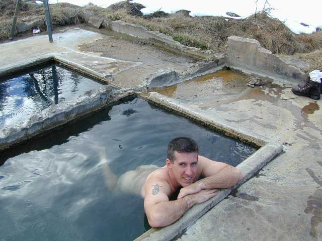
Two squared cement tubs overlooking the San Joaquin River, deep in the Sierra Nevada Mountains.
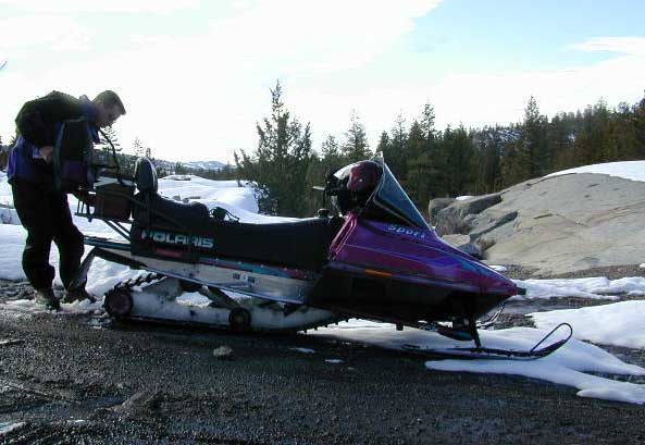
The coolest thing about this primitive hot springs is that it is a great destination for a one day snowmobile adventure. Rentals are in the nearby community of Lakeshore & the plowed paths are fairly easy to follow. If you plan on visiting the springs, you must not play around in the meadow much, there is plenty great Sierra scenery to be had. The snomo trip is a good 5 hours round trip with a lunch break & dip at mineral spring tubs.
backpacking
boating
camping
cross country skiing
fishing
hiking
horseback
kayaking
mountain biking
mountaineering
snow mobiling
stargazing
swimming
Sierra Snow-Mobilin’
Winter: road is closed half the year due to heavy snow. Summer: snow is gone and the road is open.
KAISER PASS ROAD Large motorhomes, RVs are not allowed on this long, steep, narrow paved route.
Max vehicle length: 25 feet
Take Hwy.168, turn right on Kaiser Pass Rd, just past the big ski resort. Pass the large meadow & follow signs to Mono Springs & Lake Edison. Make sure not to miss the left turn or you may end up at Florence Lake.
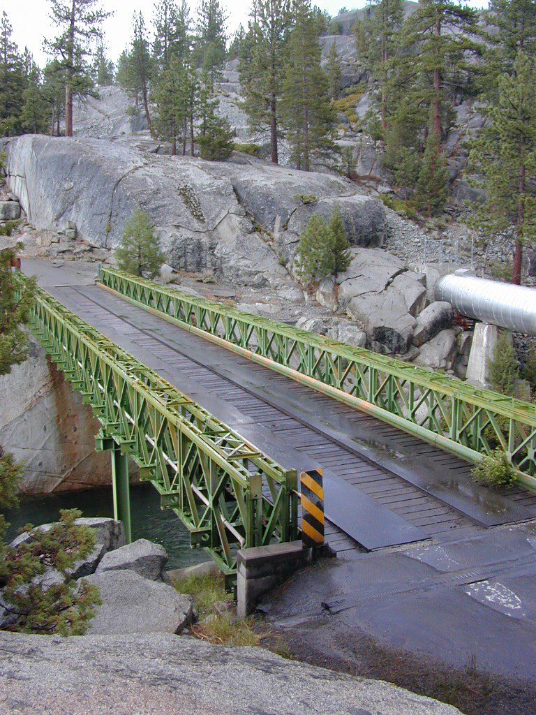
Parking near the green bridge over the San Joaquin River & hike over to the tubs on the hillsides. If there are other vehicles parked here, expect to see naked people nearby; Soaking should never be rushed. Clothing is optional – in California.
Mono Hot Springs Campground NFS
• Elevation: 6700′
• Number of Sites: 30
• Vehicle Accessibility: RV 25′
• Camp Fee: Yes
• Campsite Reservation: Yes
• Toilet: Vault
• Length of Stay: 14 Days
• Season: June – September
• Trailheads: Ansel Adams & John Muir Wilderness
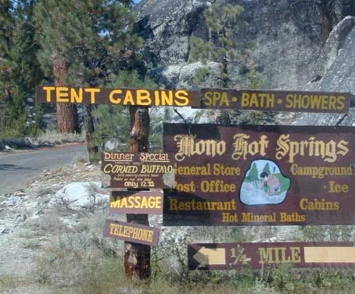
NOTE: This USFS Campground, should not to be confused with the neighboring business, a privately run camp called –
Saline Valley Hot Springs
Saline Valley Warm Springs
NORTH Death Valley National Park, in a super remote desert valley located in the vast mountains in between Big Pine CA Route 168 & Death Valley (west) Highway 190.
Inyo National Forest: Inyo mountains are a towering range of high elevation desert peaks running in between Owens Valley and Saline Valley.
desert wilderness access: 4 dirt road routes lead into Saline Valley – 2 backcountry 4×4 trails from the upper reaches of the park and 2 main dirt roads. All routes require a high elevation pass, so snow is likely in winter months (Nov-May).
Wilderness routes road conditions can change often, seasonally with winter snows, mud and summer thunderstorms. The most popular access are the main routes (both long dirt roads, subject to snow and closure at any time) – the North Pass (Big Pine) and the South Pass (Panamint). Detailed directions on those further below. Both backcountry roads Steele Pass and Lippincott Road, originate from the northern, desolate areas of the National Park and both require 4 wheel drive, with a recommended locking differential. No developed campground facilities. Clothing optional my ass — nudity is the norm here.
Since the challenging drive in to this remote desert valley is so grueling and time consuming, plan to spend a minimum of 4 nights. Anything less is way too rushed to totally enjoy the experience. Best way to enjoy this place is a full week off of work, and as much firewood, food and ice as you can haul. Some folks spend weeks camping here. The NPS limits your camping stay to 30 days! If you plan on driving out to Lone Pine for camping supplies and returning the same day, you best leave at dawn – cuz the entire round trip ‘beer run’ will take 6 hours or more.
High clearance vehicle a must & 4 wheel drive is highly recommended in all this region. All wheel drive wagons and passenger cars have been known to bottom out, break down and pop tires out here in the harsh conditions, so a first challenge may be to obtain a dependable and capable off-road vehicle.
Topographic GPS & decent back road maps are highly advised. One way drive is easily 4 hours, from any paved highway. Pack like you’re gonna live out here, if need be. Warning: this is a very long off-road journey for any average camping trip. This isn’t a weekend kinda place. First timers beware – it’s a full day journey to travel here!
Air Strip? The fly in option is a dirt landing strip called ‘Chicken Strip’, but National Park Service has yet to closed it.
NORTH PASS to Saline Valley Road:
from Big Pine, take Hwy 168 N from Hwy 395, turn right onto Death Valley Road (some maps may have this one listed as Waucoba Springs Road or just Waucoba Road). Proceed on the main route to the hard to read entrance sign marking the Saline Valley Road, past a few old structures and down to the main valley. Winter snow can be deep, so carry chains. 4×4 is best to access this remote valley, AWD high clearance might make it and normal passenger cars, 2WD SUVs should be warned about weather and access to the real world. Many times all mountain passes are snowed in – people do get trapped at Saline and cannot get out for weeks. So take that into account when requesting days off of work for this epic journey.
SOUTH PASS to Saline Valley Road:
from Olancha, take Highway 190 E, turn N off Hwy. 190 to Saline Valley Rd. Rugged 50+ mi. of hard core dirt roads. 4×4 and high clearance a must. Winter months expect snow, springtime rock slides and summers torrential downpours cause overflowing creeks w/ impassable washouts. Grapevine Canyon can be a challenging drive, but with patience and skill you can be down on the main valley floor in about an hour and a half (if you’re lucky). Did I mention the dozen or more miles of heavy washboard road conditions, at the base of the alluvial fan of mountain rock? Newbies and first timers should attempt the North Pass.
———————-
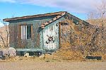
Near the marsh, when you finally reach the sand dunes area, you know the turn off is close-by, so slow down and stop to read the landscape. Know that the hot springs are located above the sand dunes to the east slope of the red volcanic mountains. When you see the metal bat sign and the mass of palm trees in the lower grove, you know you’ve arrived.
You’ve only truly arrived, when your whole body is immersed in hot water looking up at the stars and you learn to relax again. Breathe the deepest you have all year.
CAUTION: Stopping for those vehicles distressed on the side of the road is also a common practice. Many people break down on this route, Jeeps slide off cliffs. Harsh landscapes, plus weather are unforgiving and people die, so realize that this camping trip is no walk in the park.
Saline Valley Road Conditions & discussions can be found on Saline Valley Talk, the Saline Valley Message Board forum.salinepreservation.org
Kern River Valley is one of the all time favorite Sierra Nevada destinations for SoCal escapees. First, it is the southern most ‘big river’ action for the Sierra range. The drive up from Los Angeles is easy access; only a coupe of hours. California Highway 178 leads from Bakersfield up the mountain to Lake Isabella (exit at 155 for Kernville destinations). The 178 continues east past the rural communities of Onyx, Canebrake, Weldon, and then on to the Northern Mojave desert & US Highway 395
Second, Kern has an abundance of outdoor recreation, from fishing to boating, river rafting to kayaking, backpacking, mountain biking, rock climbing, horseback riding, hiking, camping, & soaking. Kernville is the “recreation headquarters” for the region, where you can find rafting outfitters, camping supplies and rental equipment.
Third, the mountain scenery is very diverse – with the dry shores of Lake Isabella, the granite lined Kern River, or the ridges with towering cedar forests, plenty sugar pines, plus a few Sequoia groves; Tons of dirt back roads to explore, granite & gorges for the rock climbers, prime wilderness access & several primitive hot springs.
The whole area is encompassed by the Sequoia National Forestwith wilderness areas to the North & East. Giant Sequoia National Monument is located along the Western Divide Hwy in the northern portion of the National Forest.
Whether you’re an RVer wanting a developed campground near town, a fisherman needing a primitive site right on the river, or a backpacker seeking the high country, the Kern has a little bit of everything. High elevations beyond 8000′ ridge lines, or the lush Lower Kern under 2000′ with granite boulders lining, Kern has it. 4 wheelers will love the extensive network of dirt back roads, or maybe the OHV areas of Keysville. Lake Isabella has numerous oak lined campgrounds & boat rentals available too. Summer is not the best time to visit as the temperatures soar to 100 degrees & the city crowds come in full force to the Kern Valley. Springtime, the best season to visit runs from March to May, or Autumn cools for September to December.
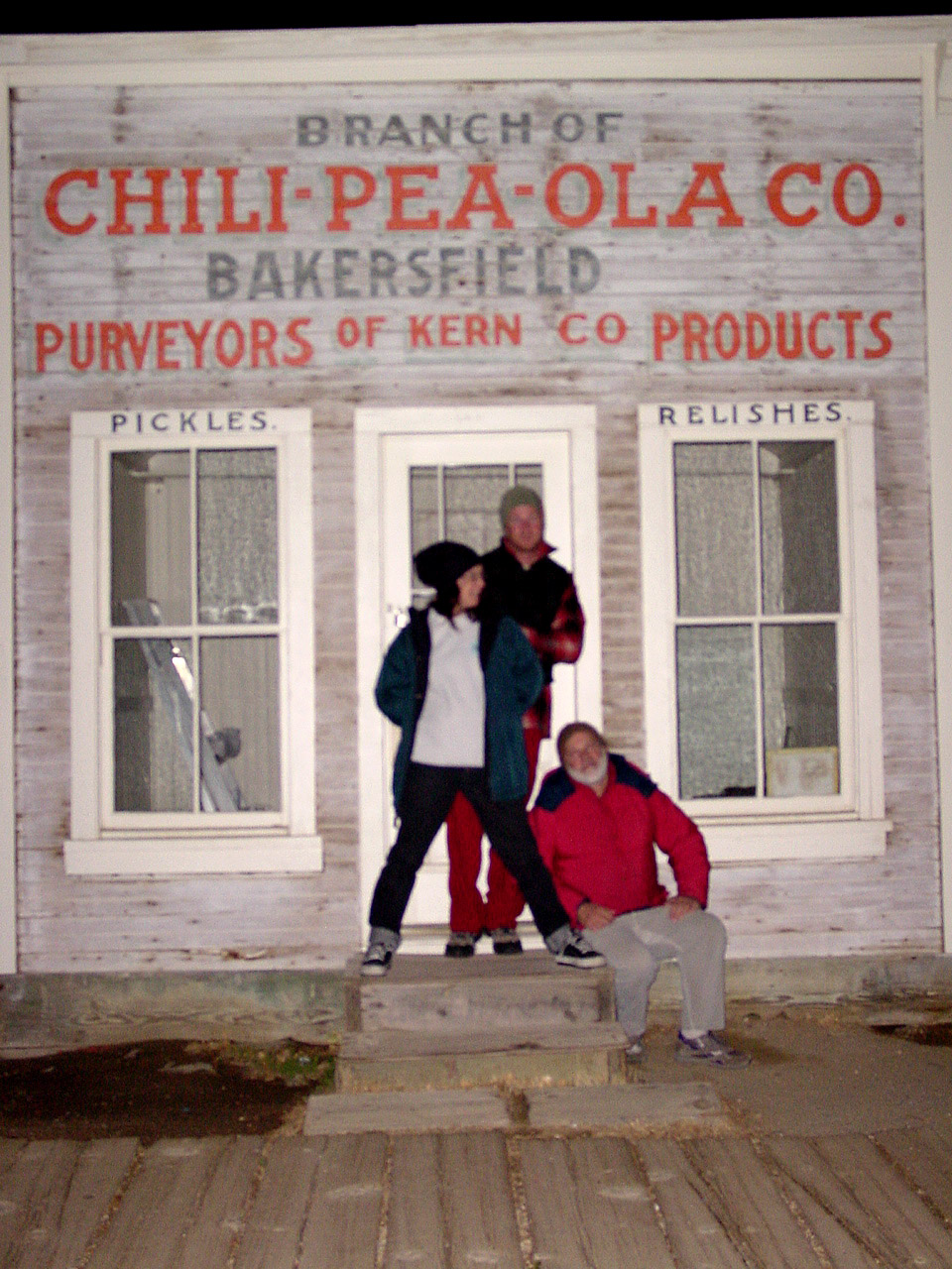
Many old west towns are still in existence in California, but few are as unique as the Randsburg Mining Camp in the Northern Mojave desert, where Hwy 395 meets the 14. The sleepy desert town is a hub of activity ( on weekends) for car clubs, dirt bikers, of-roaders & travelers passing through. Mid week you’ll see the locals and fewer tourists.
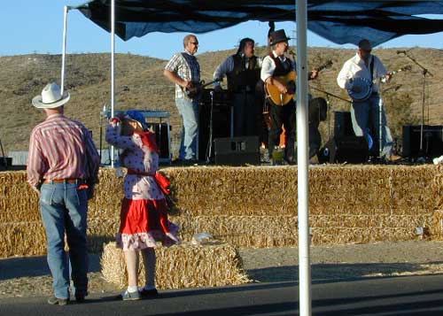
This high desert annual event is on the third Saturday in September every year, music street fair is the biggest day of the year for local residents & tourists alike. Historic sights, donkeys, horses, cowboys, live music, food & all the fun you can imagine in the middle of nowhere. One day only!


