Tag Archives: elevation

Los Angeles Forest

angeles crest

Angeles Crest Mountains
Los Angeles Forests Hiking Maps

If you’re feeling trapped in the smoggy LA Basin & need a quick escape to nature this is your place to find a good nature trail, a hiking trailhead, a picnic spot or camp site. Whether or not you are looking for a mountain bike trail after work, or a weekend of camping under the stars surrounded by natural settings, we can get you to your preferred destination with all the local maps of this region.

Angeles forest map: Angeles Forest Highway & Angeles Crest Highway 2 both lead into the Angeles National Forest. Off roading routes, hiking & backpacking, equestrian trails, dirt back roads, mountain peaks, campgrounds or picnic grounds.

Angeles National Forest Map

Angeles Forest NatGeo Mapangeles map

Angeles Front Country Map

Angeles High Country Map

Mount Baldy Trail Map

Cucamonga Wilderness Map

Malibu Creek Map

Topanga Canyon Map

Zuma Canyon Map

Los Padres National Forest Maps

Sespe Wilderness Map

Dick Smith Wilderness MapOHV trails

PCT Pacific Crest Trail Maps

San Bernardino National Forest Map

San Bernardino Mountains Maps

Big Bear Trail Map

San Gorgonio Hiking Map

San Jacinto Hiking Map

Los Padres HIkes

Yosemite Lakes

yosemite camping lake
Lakes in & around Yosemite

These are picnic lakes, hiking lakes and camping lakes that are located inside Yosemite National Park or the surrounding areas bordering the granite wonderland.

Tioga
Tioga Tent Camping

San Jacinto Wilderness

Jacinto Maps

Southern California / San Jacinto Wilderness Area / San Jacinto Mountain / Palm Springs Mountain Hike

The well-photographed snowy mountain backdrop behind the desert deluxe resort-land known as Palm Springs, Mount San Jacinto is the second tallest peak in Southern Cal.

Mighty San Gorgonio peak, across to the east – on the other side of the valley, is the very highest mountain in this desert region. Granite Jacinto peak is located in between the mountains of Idyllwild and the low deserts of Palm Springs.

32,248 acres

Mount San Jacinto – 10,834′ elevation

San Bernardino National Forest

JACINTO PARK access –

Palm Springs via Tram

Book tickets online!

Nearest towns:
Idyllwild CA
Pine Cove CA

jacinto peak

Day hikes, picnic in the forest, backpacking, horseback rodes w/ SUPER easy access via the fantastic Palm Spring Tram ride, up to 8000′ elevation.

The San Jacinto Wilderness is managed by 2 different agencies: The National Forest Service and California Department of Parks & Recreation.

If you are camping overnight in the forest, you must get your wilderness permit from the agency that administers the area where you plan to spend the night. Day-use permits can be obtained on the day of your trip by visiting one of the ranger stations below. Day-use permits issued by either agency are honored by both, except during the busy summer months when permits to enter the Wilderness via Devil’s Slide Trail can be obtained only from the National Forest Service.

Camping permits can be obtained in advance by mail, in person, or online w/ PDF. National Forest Service accepts requests up to 90 days in advance; Mount San Jacinto State Park accepts them up to 56 days in advance. You can also get them on the day of your trip, if any are available at that time.


USDA National Forest Service
San Jacinto Ranger District
54270 Pine Crest Ave
Idyllwild, CA 92549
951-659-2117

Mount San Jacinto State Wilderness
25905 Highway 243
Idyllwild, CA 92549
951-659-2607

regional trail maps –

San Jacinto Hiking Maps

Mount San Jacinto State Park is surrounded by San Jacinto Wilderness

More San Jacinto Wilderness Info & Links –

summitpost.org/jacinto-peak
San Jacinto Peak Wiki
USDA San Jacinto Wilderness
Mount San Jacinto State Park

John Muir Wilderness

John Muir Hiking / John Muir Map

High Sierra Hiking

California Wilderness Area Acres Topographical Maps
John Muir Wilderness

elevations: 4000′-14,496′

584,000 John Muir Wilderness Maps
Inyo National Forest

JMT

High Sierra Nevada / Eastern Sierra

Rugged Sierra Nevada high country. The highest peaks in the Sierra Nevada mountains can be found inside this Wilderness. Many peaks are well above 13,000 feet. Granite, glaciated basins, big snow, alpine lakes, meadows, wildflowers, streams, creeks, cliffs, jagged peaks. Mount Whitney stands as the tallest mountain in the lower 48 states.

John Muir Trail Maps
– JMT Topo Map

lacontedivide
Le Conte Divide, Sierra Nevada California – 12,000′ elevation peaks

Eastern access via steep granite hiking, off US Hwy 395 (Bishop, Independence, Lone Pine)
Western access backpacking thru Kings Canyon National Park, Hwy 180
or Sequoia National Park, Hwy 198 (Mineral King, Three Rivers)
or Sierra National Forest, Hwy 168 (Lake Edison, Florence Lake, Courtright Reservoir)
North access via backcountry Yosemite National Park, Hwy 120
or Mammoth Area towns (Lee Vining, June Lake, Mammoth Lakes)

Hundreds of miles of hiking trails, some of the highest peaks in the nation. Trails open to equestrian and foot traffic only. Trailhead quotas limit the amount of day hikers and backpackers that an access the Wilderness daily. Wilderness permit required: Inyo National Forest Permits

Eastern Sierra Visitor Center
Inyo Visitors Office

JM Topo Trails

USDA National Forest
USFS, NPS, BLM

NFS NPS

Eastern Sierra Interagency Office
US Hwy 395 @ SR 136
Lone Pine, CA 93545
760-876-6200

JMT
JOHN MUIR TRAIL- John Muir Wilderness

nearby towns, parks & resorts:

Aspendell
Big Pine
Bishop, CA
Courtright Reservoir
Florence Lake
Independence, CA
Kings Canyon National Park
Lake Edison
Lone Pine, CA
Mammoth Lakes
Olancha, CA
Tom’s Place
Wishon Reservoir
Yosemite National Park

www.flickr.com

Cold Creek Campground

Cold Creek Camp

Truckee Campgrounds, Tahoe NF

Cold Creek Campground: N of Truckee, CA

DSCN0046

A small developed campground along forested Highway 89, with raging creek, fishing spots, and hiking trails and mountain biking trails nearby. Paved, level camp sites, small RVs okay w/ access to the numerous Sierra Nevada destinations with several lakes and reservoirs nearby.

This is a popular overnight stop “in route” for many campers and bikers traveling further on to the Northern Sierra Nevada mountains. You can exit off Interstate 80 @ Truckee, and be at this camp in minutes. Car camp, tent camping, a few spaces for small motorhomes. Plenty hiking and mountain biking trails.

Cold Creek Campground, California

on the Cold Stream;
Campground open May-October
(depending on snow)

High Sierra / Tahoe Truckee Camping

13 camp sites on Cold Stream @ 5800′ elevation; vault toilets, river and piped water, bear boxes; first come, first served camping

Max Camper Length: 22′

Rangers Office: 530-265-4531

The highway traffic noise makes this place a ‘short and sweet’ one nighter top pick, great for those camping in route to another destination. Another developed camp is on the opposite side of the highway, less than a mile north called Cottonwood Campground.

Free Camping nearby.
If you are seeking primitive camping near this area, start with Little Truckee Summit at the lakes turn off road on SR 89 – about 2 miles south of the Cold Creek Campground.

Tahioe USDA MapTake Tahoe Forest Road #5, a major paved road, approximately 12 miles back to the big meadows. Look for the unsigned dirt roads on left side of road nearing Webber Lake. The largest lake in the region, Independence Lake, is a paved side route off to the south. Further back on Road #5 the pavement ends at Jackson Meadows Reservoir. Very rough rocky road out to Bowman Lake w/ several developed campgrounds in the vicinity.


Tahoe trailheads lead out to –
alpine fishing lakes
mountain peaks
Treasure Mountain 7085′
Tahoe National Forest 
OHV Area @ Prosser Reservoir

NEARBY TOWNS:

ROAD CONDITIONS:

Tahoe and Truckee are known for their brutal winters and deep snows pack. Call CalTrans ahead of your departure if you are even slightly expecting any kind of precipitation. Truckee – winter road conditions


View Larger Map

Castle Crags Wilderness

NorCal Hiking
Castle Crags State Park
CastleCrags Wilderness

12,232 acres
Northern California Mountains
South of Dunsmuir, CA
Interstate 5
exit #724 – Castella

backpacking, camping, creek fishing, hiking, mountaineering, lakes, rock climbing, snowshoeing, swimming, waterfalls

About an hour north of Redding, you can see those impressive peaks off to the left above the lush forest. Way up off the west side of I-5, lies a hiking paradise of scenic lakes, waterfalls and wildflowers. Opposite the freeway from Mount Shasta; Just south of Lake Siskiyou.castle crags

Castle Crags Wilderness neighbors the Castle Crags State Park, which is surrounded by Shasta-Trinity National Forest. This area is named for 6,000′ tall glacier-polished peaks and pointed crags. Due to their relatively low elevation, year-round recreation, hiking, backpacking, and rock climbing are popular spring through fall. Snowshoeing near Castle Lake is excellent.

Castle Crags State Park
530-235-2684

Castle Crags State Park Campground
76 developed campsites
6 environmental campsites

Max Camper Length: 27′
Max Trailer Length: 21′

28 miles of hiking trails (2.7 mi access trail to Castle Crags Wilderness)
The Pacific Crest Trail also passes through the park.
Dogs not allowed on park trails.

Shasta-Trinity National Forest
Mount Shasta Ranger District
204 West Alma
Mt. Shasta, CA 96067
530-926-4511

Climbing at the Crags:
the Cosmic Wall & beyond

regional history: The northwest area contains the largest glacial cirque, Castle Lake, which is near where the Modoc War’s 1855 Battle of Castle Crags took place. Now a historical landmark, the battle was fought on a ridge saddle between the lake and what is known as Battle Rock. The Wintu tribe inhabited the area, they called the crags the Abode of the Devil and the Spanish explorers called it Castle del Diablo (Castle of the Devil.) read more on wiki

nearby towns –


View Larger Map

Lily Pad Campground

Lilypad Campground @ Lake Wishon Reservoir
Sierra National Forest, California

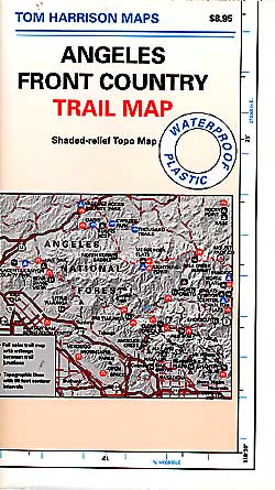
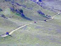
The long journey up the mountain into the Sierra National Forest is only for the true adventure seekers. First off, get a good forest map. Second, plan several days if not a full week off of work to explore this region in depth. It is a long drive from most anywhere in California, and this spot is way, way tucked back in there right up against the High Sierra peaks and wildness.

East of in Fresno, historic village of Clovis is a good lunch stop in route. Drive up mountain on Hwy. 168, turn right at Shaver Lake on to Dinkey Creek Rd. Now you will clock the mileage 28.7 miles to the camp. Drive past McKinley Grove and past Dinkey Creek. Follow signs to Wishon Reservoir. This campground is located adjacent to the road before you reach the dam.

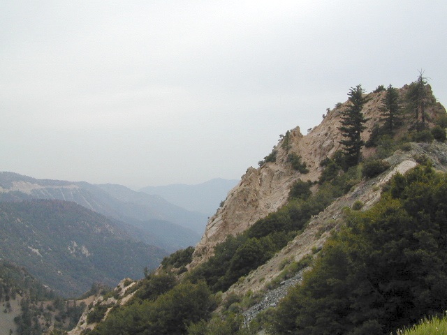
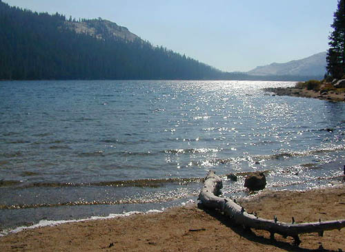
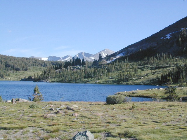
All this travel time will have you asking ‘is it worth it’? The answer is ‘yes’….. if you want an uncrowded lake with plenty of wilderness surrounding you. Granite rock and forest all around. Lake Wishon is a hydroelectric reservoir operated by PG&E

Lily Pad Campground

Central Sierra Camping – Wishon Lake

High Sierra Rangers Office: 559-855-5355

• Elevation: 6,500′
• Number of Sites: 15
• Camping Reservations: No
• Sites Available: First come, First serve
• Vehicle Accessibility: 35′ limit on RVs & trailers
• Length of Stay: 14 Days
• Toilet: Vault
• Water: Piped
• Season: Closed in Winter Snow
• Fee: Yes

camp sites at lake

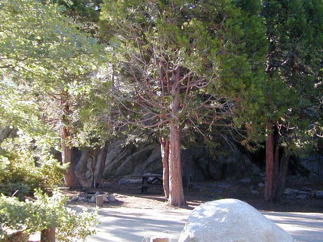
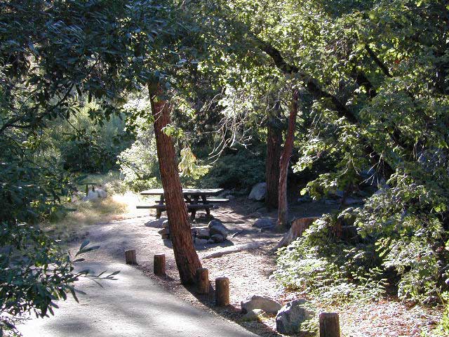
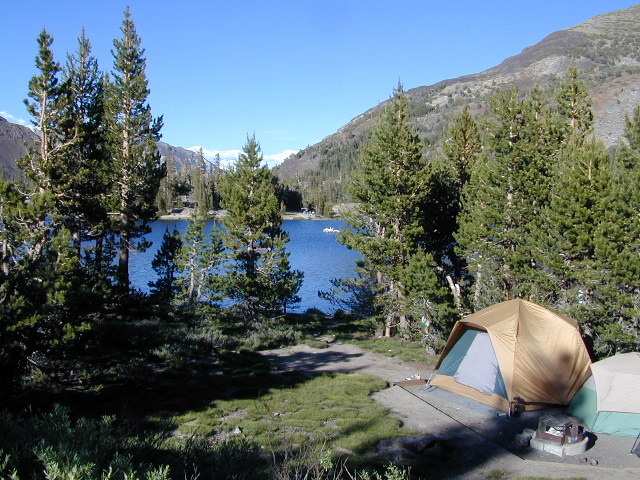
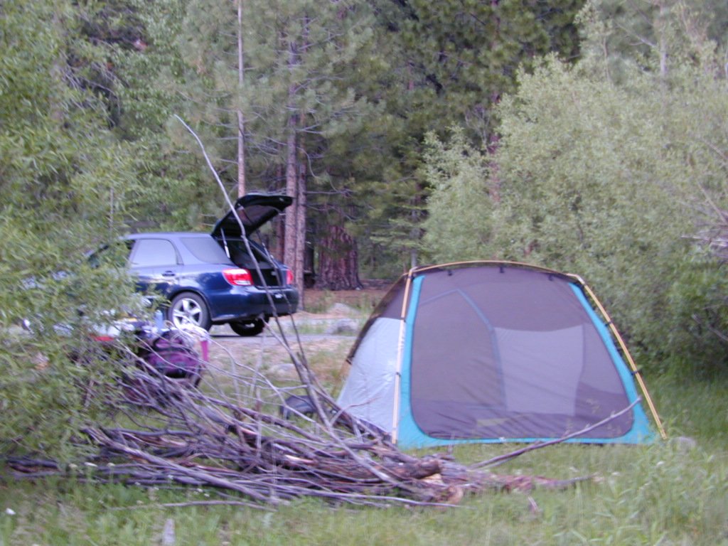
Large granite boulder coves provide cubby-hole privacy w/ shady trees and well spaced camp sites. Very unique design with paved driveways, adequate for handicapped camping with some sites with better access than others. 4 camp sites are considered walk-in sites.

Lake views from camps are only a mere climb up to the top of the nearest granite, which will show you just how close you are sleeping to the big water.

As with any Sierra location, holiday and summer weekends are the most busy. Tourists, family campers and RVers are all out enjoying the sunshine. Mid-week camping is good for fishing, relaxing w/ peace and quiet. Off season is best for having the place to yourself.

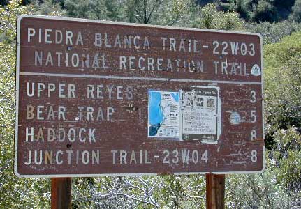
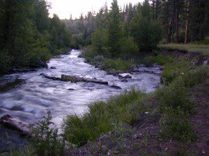
Outdoor recreation in the area include – hiking, camping, backpacking, rock climbing, mountaineering, sightseeing, kayaking, canoeing, mountain biking, off-roading, creek fishing, lake fishing.


Neighboring Wishon Village has a small general store, RV park w/ wifi & boat rentals.