Tag Archives: family

Lighted Tractor Parade, Ferndale

John Deere Power!

Ferndale Tree Lighting

Ferndale’s Lighted Tractor Parade

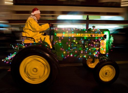
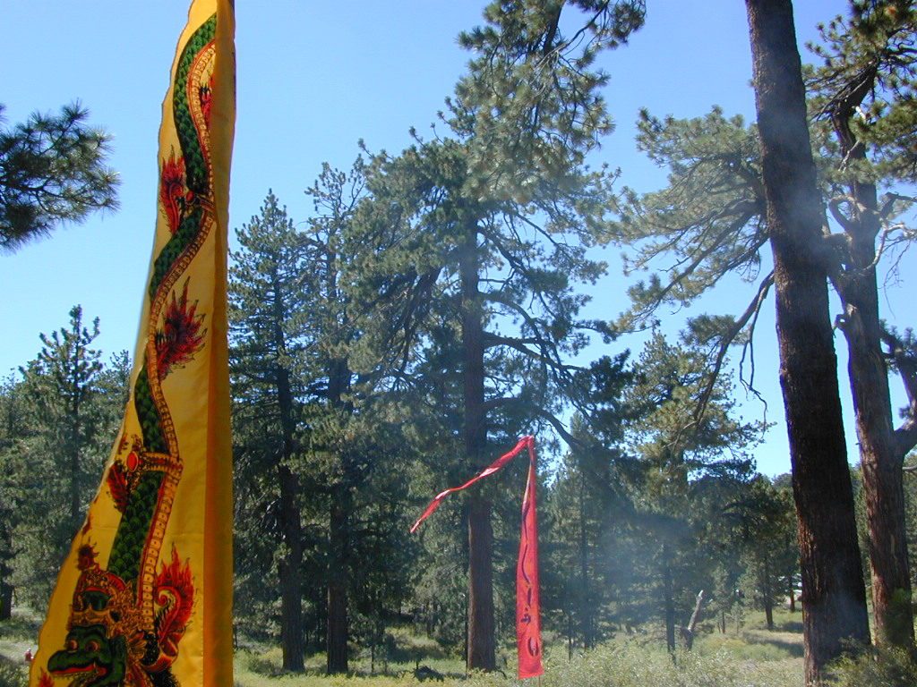
Local farmers and ranchers parade fancifully decorated tractors and tractor-drawn wagons depicting holiday scenes down the Victorian Village’s historic Main Street. Sparkling country Christmas celebrations include the Tallest Living Tree Lighting, shopping and dining downtown. Romantic Christmas destination on the Northern California Redwood Coast!

Annual event: December
Ferndale, CA
707-786-4477

visitferndale.com/annual-events


Ferndale, CA 1998

Christmas: 2011

December Nights, Balboa Park

December Nights-Balboa Park, San Diego

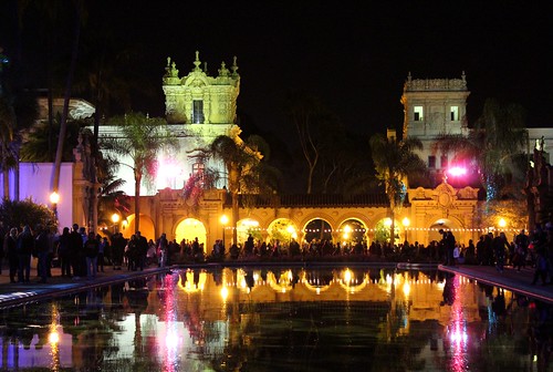
Balboa Park Christmas Lights
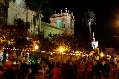
December Nights in Balboa Park, San Diego

Balboa Park December Nights
Southern California’s premier holiday festival

“Christmas on the Prado” is now called December Nights

40 years running; Friday and Saturday night in early December

The event brings families and friends together to spread holiday joy, learn more about the cultural value of Balboa Park and kick-off the “most wonderful time of the year.”

Participating Balboa Park museums open their doors free of charge from 5-9 pm both evenings and more than 350,000 visitors are expected to experience the joy of San Diego’s largest free community festival. Those who attend will participate in a truly multicultural experience, enjoying food, music and entertainment from around the world.

Revelers can watch top-notch musical and dance performances, enjoy delicious and diverse food choices and help spread a heavy dose of holiday cheer.

Well-known traditions include food from around the globe at the International Christmas Festival at the House of Pacific Relations Cottages; the annual Santa Lucia Procession at the Plaza de California; unique gift shopping at the museum stores and with the artisans of Spanish Village; and musical and dance presentations from the San Diego Junior Theatre, San Diego Civic Youth Ballet, Del Cerro Baptist’s Christmas Story Tree, and more.

Annual event; multiple nights
San Diego, CA
619-239-0512

fleetscience.org/events/balboa-park-december-nights

balboaparkconservancy.org/project/december-nights

December Nights at Balboa Park

Holiday Lights Train

Santa Cruz Holiday Lights Train

Holiday Lights Train Ride

Santa Cruz Holiday Train

Departs from the Santa Cruz Beach Boardwalk

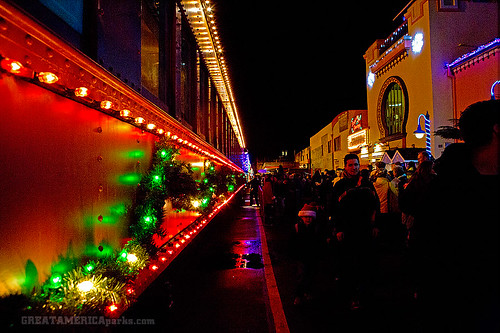
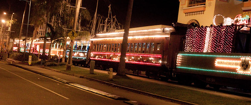
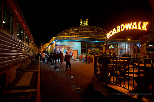
Vintage excursion cars, adorned with thousands of colorful lights, roll through the streets of Santa Cruz as passengers lend their voices to holiday carols, sip hot spiced cider and listen to musical entertainment while Santa visits the little ones, or the young at heart! Continue the merriment with your choice of arcade games, mini-golf or laser tag at Santa’s Kingdom at the Santa Cruz Beach Boardwalk. Bring the whole family for festive fun.

Annual event: December
multiple days

Santa Cruz, CA

roaringcamp.com


Santa Cruz Holiday Lights Train

train at the Boardwalk

Reyes Adobe Days

Reyes Adobe Days: like the Harvest Festival but with 0% 'Lil Sebastian.

Agoura Hills – Reyes Adobe Days

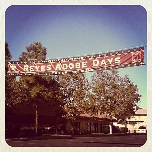
Reyes Adobe Days is held in the City of Agoura Hills, California. Carshow, parade & 5k run. The parade starts at Forest Cove Lane and travels along Thousand Oaks Boulevard to the Reyes Adobe Historical Site.

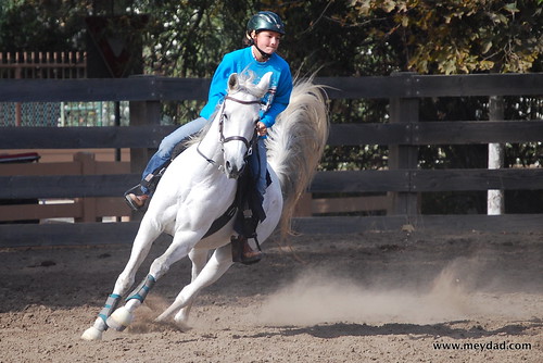
Families can experience California culture, past and present, with free museum tours, a music stage, interactive historical demonstrations, children’s history scavenger hunt, horse competition, pony rides, inflatables and carnival games, Victorian games, beer garden and food vendors.

30400 Rainbow Crest Drive
(next to Reyes Adobe Park)
Agoura Hills, California

Annual event; October
818-597-7361

reyesadobedays.org


Arabian Horse

California Camping River

map river | hiking river | map gorge

California Rivers & River Topo Maps

Tent Camp Yosemite Valley

There are many gorgeous rivers in California that are perfect for camping and fishing, but none are located in Southern California. None! Yep, you read that right. If you think about it, the golden state is about half desert! The majority of our natural water in our state is coming from the north – so take this as a warning: you might need to drive a few hours to find your ideal river camp.

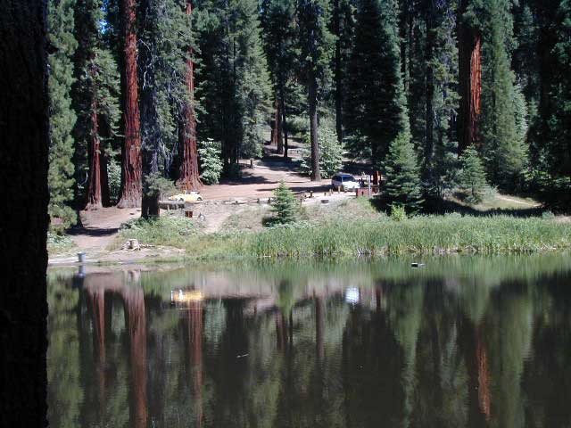
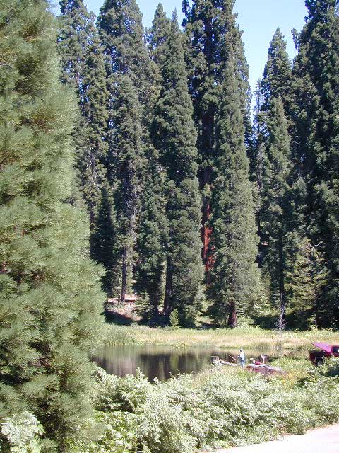
The easy-to-access waterways are found mostly along highways in the Sierra Nevada – or way up in NorCal. Deep granite gorges carved out by glaciers, surrounded by forested peaks is only half the appeal. High elevation lakes, waterfalls, big trees, abundant wildlife, and the alpine villages are all part of the Sierra Nevada experience.  Raft, kayak, fly fish, hike, bike or just camp out next to a big, rushing, flowing river. Our selection of California maps will get you narrowed down to a specific region, so you can find that perfect river campground, or explore and discover the back roads – for the most seclusion.

NorCal Rivers:

Burney Falls
Burney Falls, is part of the Pit River

EEL RIVER
KLAMATH RIVER
Klamath NF Map
MAD RIVER – NFS Campground
MATTOLE RIVER
McCLOUD RIVER

NAPA RIVER
NAVARRO RIVER
NEW RIVER
NOYO RIVER
PIT RIVER
RUSSIAN RIVER
SACRAMENTO RIVER CAMPING
SALMON RIVER
6 RIVERS NATIONAL FOREST MAP
SMITH RIVER
TRINITY RIVER
VAN DUZEN RIVER

MiddleForkFeather
Middle Fork of Feather River, Berry Creek, CA

Sierra Nevada Rivers:

AMERICAN RIVER
AMERICAN RIVER – El Dorado NF Map
CONSUMNES RIVER – Stanislaus NF Map

FEATHER RIVER
FEATHER RIVER Recreation Map
FEATHER RIVER – Plumas NF Map

Kern River Hot Tub
Kern River Hot Tub

KAWEAH RIVER – Sequoia
KERN RIVER CAMPING
KERN RIVER – Sequoia
KINGS RIVER California
KINGS RIVER CAMPING
KINGS RIVER – Sequoia Kings Canyon Map
KINGS CANYON NP
MERCED RIVER – Sierra
MERCED RIVER – Yosemite Map
MOKELUMNE RIVER – El Dorado NF Map
OWENS RIVER – Inyo NF Map
SAN JOAQUIN RIVER – Sierra
SOUTH YUBA RIVER Recreation Map
STANISLAUS RIVER – Sonora Pass
STANISLAUS RIVER – Stanislaus NF Map
SUSAN RIVER – Lassen
TULE RIVER – Sequoia

YUBA RIVER – North Gold Country
YUBA RIVER – Tahoe NF Map

Central Coast Rivers:

BIG SUR RIVER
SALINAS RIVER

SoCal Rivers:

COLORADO RIVER CAMPING
Colorado River Jet Ski
LAKE HAVASU
LAKE MEAD (NV) Recreation Map
LAKE MOHAVE

SANTA YNEZ RIVER @ Lake Cachuma – Santa Barbara Mountains
SESPE RIVER – more creek than river, Los Padres NF & SESPE WILDERNESS

Colorado River California


LOCAL TIPS
River Destinations in California

califrepublic

calmrivers
Lower Kern River – Calm but Dangerous

KERN RIVER: The Kern River is one of the most popular of all the Sierra rivers due to its proximity to SoCal. Hurried, stressed-out, Angelinos (LA) can be at this destination in under 3 hours – which makes it a very busy place most months.

So, let it be told, that summer is not the best time to enjoy the Kern. If you do plan a summer outting, make sure you head for the Upper Kern (10+ mi N of Kernville & Lake Isabella) or the North Fork of the Kern (out in Monache Meadows) where 4×4 is often needed.

The Lower Kern River has only 2 developed campgrounds: Hobo (closed for damage 2019) and Sandy Flat (open all year). Numerous primitive camp spots are available along Old Kern Canyon Rd, which parallels the Hwy 178 on the south side. None of which are located at the rivers edges. Remington Hot Springs is a popular spot for soaking. Fishing trails, mountain biking trails and hiking trails, all over. Fire danger is great in this area, so pay extra close attention to signs and fire restrictions.

Kern River above Lake Isabella and Kernville is a better choice for camping availability.

Beer at River

YOSEMITE RIVER: Yosemite National Park –
Merced River & Tuolumne River

NPSEverybody loves Yosemite! This is the most popular park in the whole state; maybe the whole nation.

The majority of campers want to stay “right on the river” when they visit Yosemite NP, but that is just plain old impossible, since reservations go fast and there is only so much room for everyone in this enclosed, narrow, precious valley.

This particular park has some major floods (1997 & 2005) that wiped out bridges, road ways; all the old wooden cabins (at Yosemite Lodge) are gone and only half of the campgrounds are still available. Yosemite has had 11 winter floods since 1916 that have caused substantial damage to property. That number is expected to increase, as winter precipitation is getting less predictable.

Reservations are taken for camping and cabins – far in advance; like one year. No joke!

3 Yosemite Campgrounds are located next to the Merced River (inside spectacular Yosemite Valley)

hikehike

Way up in the Yosemite high country, which is only open a few months outta the year, the beautiful Tuolumne Meadows Campground is located next to lush meadows and the scenic Tuolumne River. All Yosemite campsites must be reserved well in advance, so visit links above – if you are serious about a Yosemite camping trip anytime soon.

check

Mokelumne

MOKELUMNE RIVER: Way up the road, deep in the western Sierra, Gold Country. Small NFS campgrounds, right on the river; Access is long, narrow paved, switch-back road, not suitable for RVs or trailers.

STANISLAUS RIVER: The Sonora Pass, the fishing is very decent way back in this granite gorge. Highway 108 is only open a few months outta the year, due to deep snow & rock slides – so time is of the essence. Summer time is prime vacation weather up here. Several campgrounds are located right on the river, or on the major feeder streams. Or you can opt for secluded primitive camping on the back roads. Find Sonora camping in Stanislaus National Forest.

YUBA RIVER: The biggest play time river in the northern Gold Country, this runs along Hwy 49 near Downieville and also has a major South Fork for the best swimming holes and primitive camping in this region. Tubing, rafting, kayaking, fishing, camping, gold panning, you name it, Yuba has it. Look for more on the South Yuba Recreation Map, or the USDA issued Tahoe National Forest Map

FEATHER RIVER: Top fishing river in the Lassen to Oroville area. Chester and Lake Almanor in the upper reaches. High Bridge Campground is nice paved-camp-site camping; a forested spot where you can fish 2 rivers on the same day. A Plumas NF or Lassen NF map would be quite helpful for this region. Lower down the mountain, lower Feather Rivers which include all 4 forks which feed Lake Oroville – West Fork (Paradise, CA), North Fork, Middle Fork Feather, (Berry Creek, CA) and the South Fork (Lumpkin). Lots of waterways and creeks worth exploring in between Chico and the mountain town of Quincy.

KINGS RIVER: This one particular river is the longest in the Sierra Nevada mountain range, pulling snow melt from the upper reaches of the High Country and Mount Whitney. The river area just to the West of the National Park, over to Pine Flat Reservoir, is all prime for outdoor recreation. Several river rafting companies work this stretch of river.

CAMP FOUR & A HALF CABIN RENTAL
NFS KINGS RIVER
NFSrangers

hikehike

Kings River Rafters

River Beach Campground
Trinity River Camping, Douglas City, CA
riverrunsclear
Sierra Nevada Rivers are the dreams that Summers are made of.


Oroville Salmon Festival

Lake Oroville

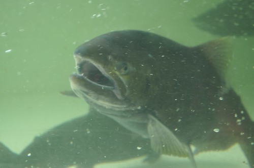
Lake Oroville Salmon Festival
Salmon Fest in O’ville

Feather River Fish Hatchery, Feather River Nature Center and Riverbend Park

On the Feather River between Historic Downtown Oroville and the Fish Hatchery, the town bursts with fish-flavored activities during the annual Salmon Festival. Friday night starts @ Feather River Nature Center for dinner & dance. Saturday brings on the fun, food, music and vendors on Main Street. Lots of great local info – salmon recipes, water/drought, fishing and environmental issues.  Big pancake breakfast, a farmer’s market, live music, a craft fair, clowns, rides for the kids. Hatchery tours. The Bounty of Butte County will be located atop Myers Street, next to the Municipal Auditorium leading into Salmon Court. FREE to attend and tastes sold as desired. There will be food demonstrations, local food vendors, restaurant tastings and so much more.

Annual event; September
530-538-2542

Oroville, CA

salmonfestoroville.org

Oro Hatch

Oro Hatch - 14

Historic Downtown Oroville

St. Anthony’s Celebration

 Pismo Beach Sunshine

Pismo Beach Summer Events

St. Anthony of Lisbon Portuguese Celebration

Pismo has loads of things to do in summer. Saint Anthony’s celebrates the cultural contribution of the area’s Portuguese descendants. Event held at 390 Bello St. Pismo Beach, CA

Annual event; August
805-773-0527

Pismo Beach CA

facebook.com/StAnthonyCelebrationOfPismoBeachInc/

Oxnard Salsa Festival

Oxnard Festival Dancing

Salsa Festival of Oxnard

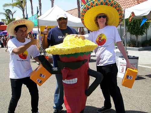
25+ years of Salsa @ the annual Oxnard Salsa Festival, on the Ventura coastline. Spicy food, hot music & cool ocean breezes welcome you to the regions biggest Latin celebration. Salsa tasting & competition. Live music, dancing & great Mexican foods.

Annual event; July

OXNARD CA

oxnardsalsafestival.com


P1000046

Oxnard Salsa Fesival 2009

Balch Park

Balch Park / Sequoia Park

Balch Park Campground

BALCH PARK campground is on a first come basis; no campground reservations needed.

2021 – THIS CAMPGROUND IS CLOSED indefinitely,
due to the Castle Fire 2020

Balch Park open May to October
Park info # 559 539-3896

Hedrick Pond lined w/ Sequoia trees

Balch County Park is right in the middle of Mountain Home State Forest, which is within the bigger Sequoia National Forest (aka Giant Sequoia National Monument). But don’t let all the bureaucracy mislead you, this is an ideal park and location, well worth your trip. The campground is the most developed one within the area – with paved roads, RV spaces, flush toilets and a fee to go along with all that. Even gotta fishing pond.

  • Bears are a big deal in these neck of the woods. Please store all your food properly to avoid a un-welcomed visitor
  • A Sequoia Grove is nearby with plenty of creeks & meadows.
  • Trailers not recommended due to the long curvy road leading up the mountain.

Balch Park & Campground NOT TO BE CONFUSED with utility company residences of BALCH CAMP between Pine Flat & Blackrock Reservoirs
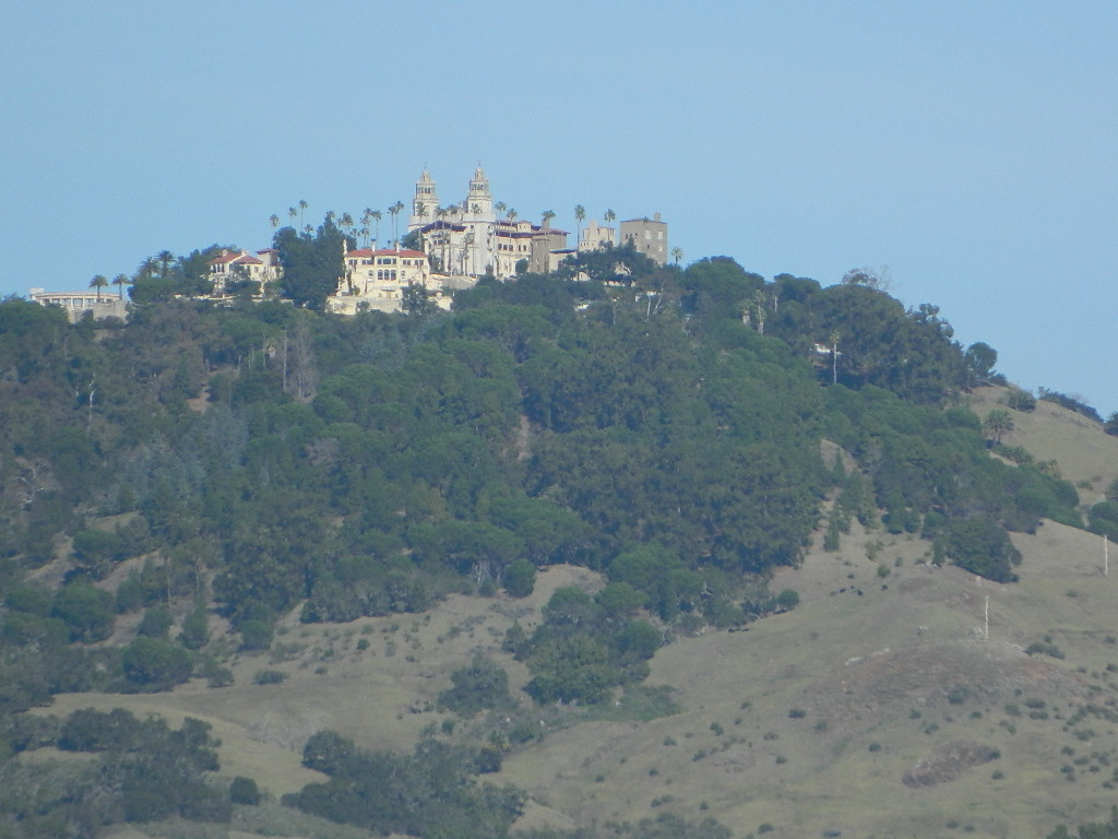

View Larger Map

Helpful Maps:

Nearby cities & towns:

campground elev. spots veg toilet water fee
Balch Park
559-539-3896
6500′ 71 pines flush piped yes no reservations
first come basis

DSCN0021

Cool Places to See in Cali

Cool Places in California

Off the Beaten Path
inside California

California Day Trips


58 counties
58 Counties in Calif
poppy desert
California Poppy Park

MUSEUMS: County museums, gardens and small town historical societies can be found linked on the individual town pages.

tejonpass
Tejon Pass (1991) Cristo Umbrellas

califrepublic

Shopping Tourists
tourist attractions and vacations

Hearst Castle

California National Parks
California National Forests
California Rivers
California State Parks

Carlsbad Flower Fields
North county San Diego annual bloom event every Spring (March & April)

Covered Bridges of California

Gilroy Garlic Capital

Hearst Castle
Central Coast rural and rugged coastline, south of Big Sur, California. Very touristy destination; Tickets for tours required.

Central Coast California
San Simeon SP. Central Coast of California

minerdude

Historical Re-Enactments @ Riley’s Farm
A real working apple orchard near Los Angeles; offering living history programs; re-enactments of scenes from the American Revolution, Civil War & Old West. Dinner, holiday shows, restaurant & tavern.

Lake List of California

McWay Falls on Big Sur Coast

Monterey Bay Aquarium
This is the premier ocean museum and largest tanks on the California Coast.

Mystery Spot
Defy gravity, geological puzzling; Interstate 236 Santa Cruz coastal redwoods

Santa Cruz Boardwalk

Winchester Mystery House
6 acre, 160 room 45 million dollar Victorian mansion with bizarre architectural features

Oregon City Bridge

edwards crossing
Edwards Crossing 1898
Subway Cave California

Mount Pinos

Mt. Pinos

Sierra Views from Pinos
Originally uploaded by danamight

Mount Pinos Recreation Area

The Mt Pinos Recreation Area is located on the border of Southern and Central California, inside Los Padres National Forest. After passing Frazier Park, the winding, paved, mountain road starts atop Cuddy Valley and is approximately 12 miles from Interstate 5 @ Tejon Pass. The 8831′ peak is the tallest in Kern County and is a popular spot for both summer and winter recreation: cross country skiing, snow shoeing, backpacking, hiking, mountain biking. The snow gates often close during heavy snow.

Mount Pinos Road starts atop Cuddy Valley Rd, at the “Y” – where it intersects with Mil Potrero Highway, which heads out to Pine Mountain Club, California.

One mile up the Mount Pinos route, you will find McGill trailhead on the right side (it is popular w/ mountain bikers) and then the first snow gate at Burbank Rd. Another 4 miles up hill, you come to the only set of dirt roads accessible on this range. A left turn will take you winding thru pine forest to the valley below. 4×4 is not required, but a National Forest map could be very handy. Unfortunately all the private properties at the bottom have locked gates & no thru access to Cuddy Valley is allowed. Although it is an awesome drive to just go exploring in the woods, there is no way out (once you get down the hill), so you must return the same way you came.

Back on the main route, shortly after the dirt roads is McGill Campground on the right side & another snow gate. In another mile and a half you will reach Mt Pinos Campground on the left side; the entrance is easy to miss. From here you are less than 2 miles from the end of the main road.

Mountain Bike, Hike, Backpack, Camp, XC Ski, Snow Sled

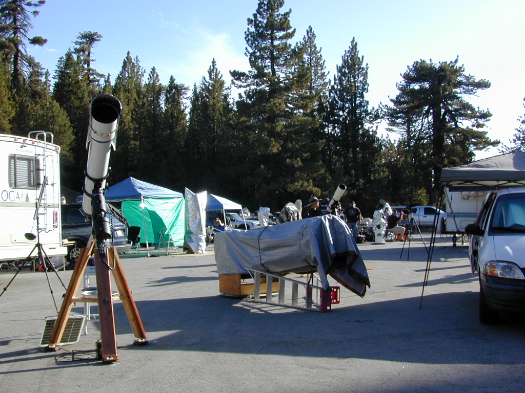
Darkest Skies for Stargazing in Southern California

The huge paved parking lot is the dead end (2 miles from the peak of Pinos) – very popular with astronomers, mountain bikers, plus the families and snow sledders in winter (if the gates are open). A National Ski Patrol’s Nordic Base, the only building you will see up this way. At 8300′ elevation, the large parking area is perfect overnight spot for amateur astronomers, so be considerate when visiting night. New moon (no moon) weekends APR-OCT are optimal viewing months. In busy summer months you can often find motorhome campers all set up with expensive equipment tracking the heavens all night long. Please be respectful of their hobby & eyes; Turn off headlights when you approach the parking area at night.

hiker

There is also a hike-in, freebie camp ground called Chula Vista; an easy quarter mile walk from the parking lot to 12 camp sites & a pit toilet. Mountain bikes dig this area too. A large meadow here blooms with wild irises in summer, only sometimes.


Trail 21W03 Mt Pinos

Originally uploaded by danamight

ROAD CONDITIONS to Mount Pinos, call the rangers 661-245-3731

Pinos – Peak to Peak Hike

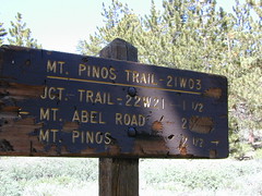
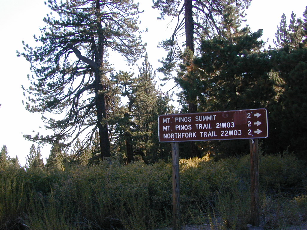
The trailhead for Pinos Summit starts at this parking lot. It is a 2 mile moderate, but steep hike on an old fire road. The neighboring peak to the west is called Mount Abel @ 8286′ elevation (aka Cerro Noroeste). The infamous peak to peak hike along the ridge line from Mt Pinos to Mt Abel is 6.5 miles one way – and very popular in summer months. This hike requires 4-6 hours & a car shuttle should be arranged in advance. The Chumash Wilderness sits between Mount Pinos and the tiny community of Pine Mountain, which can be seen below on many places along the hike.

camp

There are 3 developed campgrounds in the Mount Pinos Recreation Area:

McGill Campground accepts reservations online. Campgrounds are often closed during winter months, due to snow. (Oct-April)

DARK NIGHT SKIES: Amateur Astronomers unite!

thebigboys
Pinos star gazers out in force
summitsign
Hiking Trails to Mount Pinos, California


drummersout
Drummers Solstice Campout

flagspinos

LOS PADRES MAPS:

Los Padres National Forest Map

Los Padres Forest Topo Atlas

NatGeo Los Padres East Map 

Sespe Wilderness Trail Map

Dick Smith Wilderness Map

NEAREST TOWNS:

Chumash Wilderness
Mt Abel trailhead looking East to the Mount Pinos range. Pine Mountain Club, and the Sierra Nevada mountains can both be seen from this vantage point

see the neighboring mountain peak, Mount Abel

Camp O Alto @ Cerro Noroeste

All Lake Campgrounds

davisatsunset

California Lakes A-Z

alphabetically listed; cross reference by lake or campground name. reservations may be accepted for certain locations; follow links.

Developed Lake Campgrounds
inside California

lake campgrounds

lakes mountains foothills camp  boating fishing hiking State Parks NFS

Most of the lake campgrounds listed below are traditional style campgrounds with easy access: paved driveways, toilets, tables, maybe piped water. Various agencies manage these park campsites and additional links are provided.

Some of the campgrounds may be more primitive than others, with long dirt road access, gravel driveways, and minimal facilities. This list includes a wide range of lakes, from reservable group camps, to private RV resorts to back road beauties. Even a few campgrounds without fees!

Higher elevation locations close-up for the seasonal winter snow, which can last from NOV-MAY (or later, depending on snowmelt).

  • no motor boats?
  • no RVs?
  • wilderness lake fishing?
  • trailhead access?

Each lake camp is different, so know what is available at the location before you get out there. Many spots do not have a boat ramp. Some lakes do not allow swimming. Some might be 4×4 access only, w/ hairy granite rock road, 12 miles long. If you require a general store within walking distance, then get the maps out, follow links and make sure.

ACORN CAMPGROUND
New Hogan Lake, Valley Springs, Stockton CA

ALMANOR CAMPGROUND
Lake Almanor, Westwood, Chester, California

ANTELOPE LAKE – Plumas NF, Indian Valley, Greenville, CA

Anthony Chabot Park
Lake Chabot Campground

East Bay San Francisco, Oakland, Alameda, CA

ANTLERS RV CAMPGROUND
Lake Shasta, Lakehead, O’Brien CA, Interstate 5

ASPEN GROUP CAMP
Jackson Meadow Reservoir, Tahoe NF, Truckee, California

ASPEN GROVE CAMPGROUND NFS
Eagle Lake, Lassen NF, Susanville, California

ASPEN HOLLOW GROUP CAMP NFS
Sequoia, Kings Canyon National Park, Hume Lake

AUBURN SRA BOAT-IN CAMPING State Park
Auburn State Recreation Area, Gold Country
Folsom Lake, American Arm, Auburn, CA

lakes

BAILEY COVE CAMPGROUND
Lake Shasta, California

BASS LAKE – Sierra National Forest, South of Yosemite NP NFS

BEAR RIVER GROUP CAMP
Lower Bear Reservoir, Eldorado National Forest

BENBOW LAKE STATE RECREATION AREA State Park
Mendocino Benbow Lake, NorCal Redwoods US 101

BERGER CAMPGROUND NFS
Packer Lake @ Lakes Basin Recreation Area, Yuba River, North Gold Country California; Sierra City, Downieville CA

BIG COVE CAMPGROUND
Frenchman Lake, Feather River, Plumas NF, Portola CA

BIG SILVER GROUP CAMP
Union Valley Reservoir, US Hwy 50, Placerville, Gold Country

BLACK BUTTE LAKE – North Sac Valley, NorCal

BLACK OAK CAMPGROUNDNFS
Stumpy Meadows Reservoir, Eldorado NF
East of Georgetown, CA

BLACKROCK RESERVOIR
North fork of Kings River, Sierra NF
Western Sierra Nevada

BLUE LAKES, South of Lake Tahoe
PGE Campgrounds @ Carson Pass, Hwy 88

  • Blue Lake Dam
  • Lower Blue Lake Campground
  • Middle Creek Campground
  • Upper Blue Lake Campground

BLUE LAKE DISPERSED CAMPGROUND
i80 Donner Pass, Truckee, CA
PGE Campground, first come
4×4 roads and hike-in access only jeep30 hike

BOCA RESERVOIR – Tahoe NF, Truckee, California NFS

BOULDER GULCH CAMPGROUND NFS
Kern Canyon, Lake Isabella, California

BOWMAN LAKE (5665′ elev)
Tahoe National Forest, N of Donner Pass

  • BOWMAN LAKE CAMPGROUND

BRANNAN ISLAND STATE RECREATION AREA State Park
Sacramento River @ California Delta, Lodi CA

Indian Rock Beach, Bucks Lake California

BUCKS LAKE – North Sierra, Plumas National Forest

BURNEY FALLS STATE PARK CAMPGROUND State Park
Lake Britton SRA, Burney, California

BUSHAY CAMPGROUND
Lake Mendocino, California

coolsprings

BUTT VALLEY Reservoir – PG&E Campgrounds
West of Lake Almanor

BUTTE LAKE – Lassen Volcanic National Park NPS

  • BUTTE LAKE CAMPGROUND
  • BUTTE LAKE GROUP CAMP
  • BUTTE LAKE STOCK CORRALhorses

lakes

CARR LAKE CAMPGROUND
North of Donner Pass, Tahoe NF
hike-in camp sites

Castaic Lake RV Park
North Los Angeles County, Castiac, CA Interstate 5

CHEKAKA CAMPGROUND
Lake Mendocino, Wine Country California, US Hwy 101

CHERRY LAKE (wildfire 2013)
West of Yosemite NP

  • CHERRY VALLEY CAMPGROUND

CHILCOOT CAMPGROUND
South of Frenchman Lake, East Plumas NF, Feather River, Portola CA

Chowchilla Recreation Area
Eastman Lake, Central Valley, Fresno CA

CHRISTIE CAMPGROUND
Eagle Lake, south shore; Plumas NF, Susanville, California

CLEAR LAKE SP – Wine Country, California State Park

CODORNIZ RECREATION AREA
Eastman Lake, San Joaquin Valley, Central Valley

COLLEGE CAMPGROUND NFS
Huntington Lake, Western Sierra Nevada

CONVICT LAKE CAMPGROUND NFS
Eastern Sierra, US Hwy 395, Mammoth Lakes

COTTONWOOD SPRINGS CAMPGROUND
Frenchman Lake, Feather River, North Sierra Nevada

COURTRIGHT RESERVOIR hikesNFS
Le Conte Divide, John Muir Wilderness
Sierra NF, Western Sierra Nevada

CROWLEY LAKE
Eastern Sierra, South of Mammoth Lakes

CRYSTAL LAKE
Angeles National Forest, Azusa, CA

lakes

DE VALLE LAKE SRA
Central Valley Reservoir

D.L. BLISS SP State Park
DL BLISS CAMPGROUND
DL Bliss State Park, Lake Tahoe, California

DINKEY CREEK
Dinkey Creek CA; near Dinkey Lakes Wilderness Area
Sierra NF, south of Shaver Lake CA

DONNER STATE PARK State Park
Donner Lake, Sierra Nevada, Donner Pass
, Tahoe NF, Truckee, CA

  • Donner Memorial State Park Campground

lakes

EAGLE LAKE – Lassen NF, Susanville, California

EASTMAN LAKE – California Central Valley, Fresno CA

CAMP EDISON @ SHAVER
EDISON CAMPGROUND
California Edison Campground
@ Shaver Lake, CA, Western Sierra

ELLERY CREEK
McCloud Arm of Shasta Lake, California

EMERALD BAY SP State Park
South Lake Tahoe California

lakes

FALLEN LEAF CAMPGROUND 
South Lake Tahoe California

FASHODA CAMPGROUND NFS
Union Valley Reservoir, Mid-Sierra, ElDorado NF

FAUCHERIE GROUP CAMP
Faucherie Lake, Donner Pass Area, Tahoe NF,  Truckee, California

FAWN CAMPGROUND
Trinity Alps Highway 3, NorCal, Trinity Lake CA

FIR COVE CAMPGROUND NFS
Ruth Lake, Mad River CA @ Hwy 36, Six River NF

FISH LAKE CAMPGROUND
Hwy 96, Six River National Forest, Orleans CA

Florence Lake Picnic

FLORENCE LAKE
Sierra National Forest

  • JACKASS MEADOW CAMPGROUND

FOLSOM LAKE SRA State Park
Folsom State Recreation Area, Sacramento CA

FORKS CAMPGROUND
Bass Lake, Sierra NF, South Yosemite

FREMONT CAMPGROUND
near Lake CachumaSanta Barbara Camping

FRENCH MEADOWS RESERVOIR – American River

  • LEWIS CAMPGROUND

FRENCHMAN LAKE – Plumas NF, Feather River, Portola CA

FULLER LAKE
Donner Pass, Tahoe NF
No more Campground; Day Use Only
see – RUCKER LAKE for camping

lakes

GLORY HOLE RECREATION AREA
GLORY HOLE CAMPGROUND

New Melones Reservoir
Angels Camp, California Gold Country

GOLD LAKE, CALIFORNIA
Lakes Basin Recaretion Area, Northern Sierra

GREEN VALLEY CAMPGROUND NFS
Green Valley Lake, Big Bear Lake Area, San Bernardino NF

GRIZZLY CAMPGROUND
Lake Davis, Plumas National Forest, Portola CA

lakes

LAKE HAVASU
Colorado River @ California – Arizona border

HAYWARD FLAT
Trinity Lake, NorCal Highway 3, Weaverville CA

LAKE HEMET
Idyllwild, CA – RV Camping, Southern California

HETCH HETCHY RESERVOIR
NPS Campground, West of Yosemite NP

HIGHLANDS LAKES
Ebbetts Pass Hwy 4, Sierra Nevada

HORSE CREEK
Lake Kaweah, South Sequoia National Park, Three Rivers CA

HUME LAKE – Kings Canyon & Sequoia NP, Hume Lake

HUNGRY GULCH CAMPGROUND NFS
Lake Isabella, Kern River, Kernville CA

HUNTINGTON LAKE – Western Sierra Nevada NFS

HUTCHINS CAMPGROUND
Bucks Lake, CA, Plumas National Forest

Bucks Lake Campgrounds

lakes

ICE HOUSE CAMPGROUNDNFS
Ice House Reservoir, US Hwy 50, El Dorado NF

INDEPENDENCE LAKE 6949′
N of Donner Pass; N of Truckee, CA

  • INDEPENDENCE LAKE CAMPGROUND

ISLAND PARK CAMPGROUND
Pine Flat Reservoir, Kings River, Sierra NF

JACKSON FLAT GROUP CAMPNFS
Jackson Lake, Angeles NF, Wrightwood CA

jacksoncreek
Jackson Creek Campground, Bowman Lake. N Donner Pass, Interstate 80

JACKSON MEADOWS Reservoir – Tahoe NF, Truckee

  • ASPEN GROUP CAMP
  • EAST MEADOW CAMPGROUND
  • FINDLEY CAMPGROUND
  • FIR TOP CAMPGROUND
  • JACKSON POINT
  • PASS CREEK CAMP
  • WOODCAMP

JUANITA LAKE GROUP CAMP
near Butte Valley Wildlife Area, Klamath NF, Weed CA

JUNE LAKE CAMPGROUND NFS
June Lake Loop, Hwy 158, June Lake, CA Eastern Sierra

JUNIPER LAKE – Lassen Volcanic NP NPS

  • JUNIPER LAKE GROUP CAMP
  • JUNIPER LAKE STOCK CORRAL
    Equestrian Camping

Lassen Lakes

KASPIAN CAMPGROUND
hiking trail to Barker Peak @ Lake Tahoe CA

LAKE KAWEAH
just outside Sequoia NP, Three Rivers, CA

KIDD LAKE GROUP CAMPGROUND
i80 Donner Pass @ Soda Springs, CA
kayak, canoe, hike-in camp sites

KINGS BEACH SRA
State Recreation Area Lake Tahoe CA

lakes

LAKE ALMANOR – Northern Sierra Nevada

LAKE BERRYESSA – Wine Country California

  • OAK SHORES CAMPGROUND

LAKE BRITTON  Burney Falls Park State Park

LAKE CACHUMA – Santa Barbara Mountains NFS

LAKE DAVIS – Plumas National Forest, Portola, CA bike

LAKE EDISON – Sierra NF, John Muir Wilderness hikes

LAKE ISABELLA – Kern River, South Sierra Nevada NFS

LAKE MENDOCINO – North Wine Country CA, US Hwy 101

LAKE MOJAVE
Lake Mohave National Recreation Area
Colorado River 4×4 Camping, AZ, CA, NV

LAKE OROVILLE SRA State Park
Oroville Lake State Recreation Area
Loafer Creek, Equestrian Camp, Feather River Oroville CA

LAKE PERRIS SRA State Park
Inland Empire, Southern California

LAKE PILLSBURY
Mendocino NF, N of Ukiah, CA

  • Fuller Grove Campground (currently closed)
  • Oak Flat Creek Campground (currently closed)
  • Poigie Point Campground (currently closed)
  • Sunset Campground (currently closed)
  • Trout Creek Campground (currently closed)

LAKE SONOMA – Wine Country California, Geyserville

LAKE SPAULDING
PG&E Campground, Donner Pass, Interstate 80

tahoe emerald bay
The Gem of the Sierra Nevada – Lake Tahoe

LAKE TAHOE – Sierra Nevada Mountains State Park NFS

LAKE VALLEY Reservoir 
Donner Pass, Tahoe NF

  • LODGEPOLE CAMPGROUND

LAKES BASIN CAMPGROUND NFS
Lakes Basin Recreation Area, North Gold Country

LAKESHORE EAST
Shasta Lake, Northern California

LAKESIDE CAMPGROUND NFS
Prosser Reservoir, OHV Camping, Truckee, California

LEWIS CAMPGROUND
French Meadows Reservoir, American River, W of Lake Tahoe

LIBERTY GLEN CAMPGROUND
Lake Sonoma, Wine Country California

Lake Davis Trails
Lake Davis Trails – hike, bike, horseback

LIGHTNING TREE CAMPGROUND NFS
Lake Davis, Plumas National Forest, Susanville, California

LINDSEY LAKE CAMPGROUND
North of i80 Donner Pass, Tahoe NF

LODGEPOLE CAMPGROUND
Lake Valley Reservoir 
i80 Donner Pass, Tahoe NF

LOGGER FLAT CAMPGROUND
near Hume Lake, near Sequoia & Kings National Parks NPS

LONE ROCK NFS
Antelope Lake, Plumas NF, Indian Valley, Greenville, CA

LONG POINT NFS
Antelope Lake, Plumas NF, Indian Valley, Greenville, CA

LOON LAKE CAMPGROUND NFS
ElDorado NF High Country, Georgetown, CA

LOON LAKE CHALET NFS
ElDorado NF High Country, Georgetown, CA

LOS ALAMOS CAMPGROUND
Pyramid Lake, North Los Angeles, Interstate 5
(no campgrounds on the lakeshore)

LOWER TWIN LAKES NFS
Twin Lakes CA, BRIDGEPORT, Eastern Sierra

LUNDY LAKE CAMPGROUND
Eastern Sierra, East of Yosemite NP

LUPINE CAMPGROUNDNFS
Bass Lake, Sierra NF, South Yosemite

lakes

MAMMOTH POOL RESERVOIR Sierra NF, South of Yosemite NP

MANZANITA LAKE – Lassen Volcanic NP NPS

MARY SMITH CAMPGROUND
Lewiston Lake, Trinity River, Lewiston CA

MEADOW LAKE CAMPGROUND
i80 Donner Pass, Truckee, CA
PGE Campground, high clearance vehicles only

MEEKS BAY CAMPGROUND
Lake Tahoe California, west shore

LAKE MENDOCINO
Lake Campground Mendocino, Ukiah CA, US Hwy 101

MERRILL CAMPGROUND
Eagle Lake Recreation Area, Susanville CA

MESA CAMPGROUND
Silverwood Lake State Recreation Area, Cajon Pass L.A.

MILLERTON LAKE SRA State Park
Millerton Lake Campground, Fresno CA

MODESTO RESERVOIR REGIONAL PARK
Western Sierra Foothills, Modesto, Merced, Central Valley

MONO LAKE, CALIFORNIA
Eastern Sierra, US Hwy 395 @ Lee Vining, CA

lakes

NELSON POINT
Shasta Lake, Northern California

NEVADA BEACH CAMPGROUND
Lake Tahoe, south shore @ Nevada state line, US Hwy 50

bullards bar California
Bullards Bar, Sierra Nevada Mountains
Dark Day Campground, Bullards Bar

NEW BULLARDS BAR RESERVOIR
Hwy 49, North Gold Country

NEW HOGAN LAKE – Valley Springs, Gold Country

NEW MELONES Reservoir – Angels Camp, Gold Country

NORTH FORK CAMPGROUND
Bass Lake, Sierra National Forest, Yosemite South

NORTH SHORE
Lake Arrowhead, San Bernardino National Forest

lakes

OAK KNOLL CAMPGROUND
New Hogan Reservoir, San Andreas, Gold Country

OAK SHORES
Lake Berryessa, RV Camping in Wine Country

OH RIDGE
June Lake, California, Eastern Sierra

June Lake Loop, Eastern Sierra

lakes

PACKER LAKE
North Sierra Nevada, Lakes Basin Recreation Area

  • Berger Campground
  • Packsaddle Campground

PAHA CAMPGROUND
Twin Lakes, Bridgeport CA, Eastern Sierra

PARADISE COVE
Lake Isabella, Kern River California

LAKE PILLSBURY
Mendocino National Forest, N of Ukiah, CA

PINECREST LAKE
Sonora Pass, Hwy 108, Stanislaus National Forest

PINE FLAT RESERVOIR Kings River, Sierra NF

PINE POINT
Shasta Lake, Shasta National Forest

PIONEER POINT
Lake Isabella, Kern River, South Sierra

PROSSER Reservoir –  Truckee Camping w/ OHV Trails

PYRAMID LAKE – North Los Angeles, Interstate 5
(no campground on the lakeshore)

ROUND VALLEY Reservoir
North Sierra @ Indian Valley, Greenville, CA

  • ROUND VALLEY CAMPGROUND

RUCKER LAKE CAMPGROUND
i80 Donner Pass, Tahoe NF

RUTH LAKE –  Mad River, Six River NF NFS

  • FIR COVE CAMPGROUND

lakes

SAGE HILL
Lake Cachuma, Santa Barbara Mountains

SALTON SEA SRA State Park
Salton Sea State Recreation Area, Imperial Valley Desert

SAN LUIS RESERVOIR SRA State Park
Central California, Interstate 5 @ Hwy 152

SARDINE LAKE
Lakes Basin Recreation Area, North Gold Country

SHASTA LAKE – Northern California NFS

SILVER LAKE @ BUCKS
Plumas NF w/ dirt road, Bucks Lake Wilderness & PCT

SILVER LAKE @ CARSON
Carson Pass – Hwy 88, El Dorado NF, Markleeville CA

SILVER LAKE @ JUNE NFS
June Lake Loop – Hwy 158, Eastern Sierra

SILVER LAKE @ LASSEN
Lassn NF, E of Lassen Volcanic National Park

SILVERWOOD LAKE SRA State Park
Cajon Pass, San Bernardino NF, Southern California

SNAG LAKE
North Sierra Nevada, Lakes Basin Recreation Area

SNAKE LAKE CAMPGROUND
Plumas NF, in between Bucks Lake and Quincy, CA

SOUTH SHORE CAMPGROUND
Lower Bear River Reservoir, El Dorado National Forest

SPAULDING LAKE CAMPGROUND
i80 (freeway close) Donner Pass, Tahoe NF

STONY GORGE Reservoir – North Valley

LAKE SUCCESS
Tule River, Porterville, CA

SUGAR PINE POINT SP State Park
Lake Tahoe California, west shore

SUGAR PINE ReservoirNFS
American River, Tahoe National Forest
NE of Foresthill, CA

  • Giant Gap Campground
  • Shirttail Creek Campground
  • Forbes Group Campground

SUGARLOAF RIDGE SP State Park
Sugarloaf Ridge State Park, Santa Rosa, Wine Country

SUMMIT LAKE – Lassen Volcanic National Park NPS

SUNSET CAMPGROUND NFS
Union Valley Reservoir, El Dorado NF, US Hwy 50

SWEETWATER CAMPGROUND NFS
Mammoth Pool Reservoir, Sierra NF, North Fork CA

Mammoth Pool Reservoir

lakes

TAHOE SRA Campground State Park
Tahoe State Recreation Area, Lake Tahoe California

TANNERY GULCH NFS
Trinity Lake, Shasta Trinity NF

TRIMMER CAMPGROUND NFS
Pine Flat Reservoir, Kings River, Sierra National Forest

Trinity KOA Kampground
Trinity Lake, Hwy 3, Northern California

TRINITY LAKE – Shasta Trinity NF, Weaverville CA NFS

TROUT CREEK CAMPGROUND
Lake Pillsbury, Mendocino National Forest

TRUMBULL LAKE
Virginia Lakes, US Hwy 395, Eastern Sierra

TURLOCK LAKE SRA State Park
Turlock Lake State Recreation Area, Central Valley

TUTTLETOWN RECREATION AREA
New Melones Reservoir, Angels Camp, Gold Country

TWIN LAKES – Eastern Sierra, Bridgeport CA NFS

%

The Geminids Meteor Shower

palomar cabin

Geminid Meteor Shower

One of the better winter star shows. This well known meteor shower peaks in mid December, right in the middle of Christmas Rush. It’s a nice time to plan a desert camping trip around or a weekend away in the mountains. Look in the southern part of the nights sky these shootings stars.

The meteors from this shower are slow moving, can be seen in December and usually peak around the 13th – 14th of the month, with the date of highest intensity being the morning of the 14th. The shower is thought to be intensifying every year and recent showers have seen 120–160 meteors per hour under optimal conditions, generally around 02:00 to 03:00 local time.

The meteors in this shower appear to come from a radiant in the constellation Gemini (hence the shower’s name). However, they can appear almost anywhere in the night sky, and often appear yellowish in hue. Well north of the equator, the radiant rises about sunset, reaching a usable elevation from the local evening hours onwards.

http://en.wikipedia.org/wiki/Geminids

Annual event; December

xmascabins

How to best view a Meteor Shower

California Deserts

California Christmas Cabins

San Diego Beach Camping

Coastal Cliffs San Diego

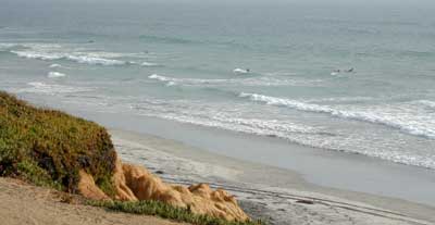
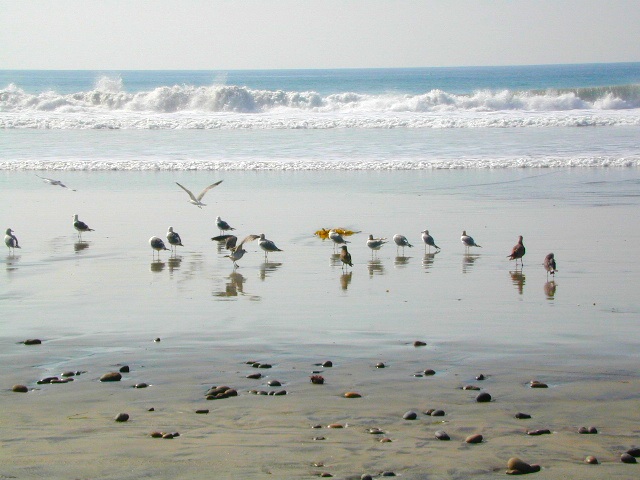
San Diego Coastal Campgrounds
Mission Bay & North County
SD Beach RV Parks & Camping

RV camps camp

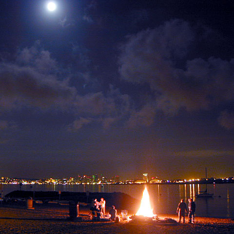
San Diego’s mild climate means camping is available all year round. Winter storms can get windy and rainy, but most campgrounds are still open. From north county where the coastal cliffs overlook the ocean, to downtown bay side marinas w/ RV camping, to camping right on the sand w/ ocean crashing just feet away. Bike paths are common around downtown San Diego, so you can bring your bike or skates.

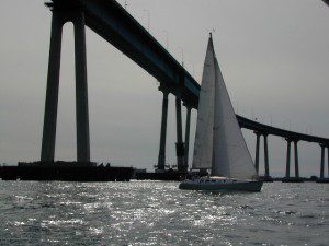
San Diego has 2 BAYS, both located along Interstate 5: The main bay downtown is called San Diego Bay (one of the deepest on the west coast) and the other a few miles north, is named Mission Bay (a man-made coastal waterway w/ green parks and paved bike trails).

Reservations are required at almost ALL coastal campgrounds, especially around holidays, any 3 day weekends, and all summer long. Tons of tourists flock to Southern California and this is a very popular coastline – with busy little cities and crowded beach towns. Beware: if you are seeking secluded camping – this would not be the place.

Best Beaches

listed from south to north

Carlsbad Cliffs

There are numerous private RV resorts, some quite large, like KOA and GoodSam parks located in and around San Diego county. Most are metro-close and not located on the beach. This list is primarily coastal camping options for the San Diego region.

camping SoCal

Seagulls at Cardiff

see also
San Diego Campground Camping

see a list of all
San Diego cities & towns

baybridge

San Diego Camping

Redwood Beach Camping

NorCal Redwood Coastal Camping

Redwood Campgrounds

Del Norte County, Northern California

redwood101

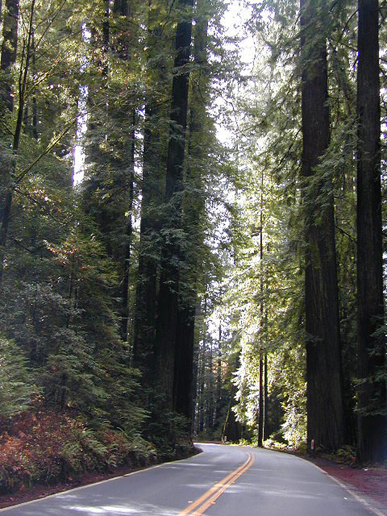
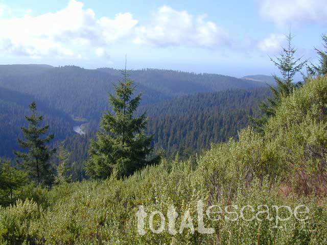
There are a few special places in California where redwood trees grow right down to the shore, but it is rare. Searching for place to pitch a tent (under the redwoods at the coast) is possible, but a bit harder to find than you might imagine. State Parks usually offer the standard paved camp site. Maybe need to drive dirt roads to find redwood seclusion.

Crescent City Camping

redwoodmap

Klamath Coast Camping

blue links lead to State Park pages with camp reservations.

State Park

Redwood Park Campgrounds State Parks

Redwood National Park National Park
Camping 

  • Demartin Campground
  • Flint Ridge Campground
  • Mill Creek Campground
  • Nickel Creek Campground (backcountry)

Eureka RV Campgrounds

redwood camping norcal

If you are seeking free or dirt cheap, primitive camping on the coast, then LOST COAST CAMPING on the Mendocino border is one option. Or head east, inland to the abundant National Forest. Dirt roads of the Six Rivers National Forest offer old logging roads, creeks, and secluded places to pitch a tent. Campfire permits are needed for dispersed camping, or ‘boondocking’ as some call it.

Dirt back roads can get muddy during the wet season, so know your vehicles capability and if you are unsure, check with the local rangers over the phone (preferably a ‘field ranger’) before venturing out. Remember that rain and mud are the norm, most of the year.

Fog is typical of the region. Enjoy the sunshine – when you can!

see more towns nearby –

Smith River
Crescent City
Klamath
Orick
Trinidad
Arcata
Eureka
Scotia
Ferndale
Petrolia
Garberville
Redway
Shelter Cove

Spicer Reservoir

spicer terrain


Spicer Meadow Reservoir

Spicer Meadows, Spicer Reservoir, Rd #7N01
Spicer Lake, Stanislaus National Forest

lake elevation 6418′
227 surface acres

public boat ramp
hiking trail around lake
more lakes nearby

Ebbetts Pass Sierra Hwy 4

Ancient volcanic peaks mix with Sierra Nevada granite rock, pine forests and fresh, clear, clean mountain water! California, of course.

Stanislaus Forest Road #7N01 leads down from Highway 4 to this popular series of alpine lakes and reservoirs. Camping, fishing, hiking and mountain biking. Sailing, canoeing, kayaking, swimming, floating and fishing are also popular water activities.

Rules of the Reservoir:
10 mph speed limit on Western Arm.
No motorized boating in Eastern Arm.
Camp only in developed Campgrounds.

NFS
2 NFS Campgrounds at west end of lake:

  • Spicer Campground (60 sites)
  • Spicer Group Camp (75 people max)
  • Campgrounds only open June-September. Some campsites at the campground are wheelchair accessible.

    Additionally, Stanislaus River Campground w/ only 8 sites, is located just off the main access road #7N01, right near the river.

    spicer lake shore

    Spicer #7N01

    Numerous smaller lakes in the region make this a hot spot for summer vacations. Union and Utica Reservoirs (both with dirt road access) are good for kayaking and canoes, while power or sail boats prefer the larger Spicer Lake. Summit Lake and Elephant Rock Lake are perfect for quite picnics and day hikes. Trails (many unmarked) connect the lakes to each other. Area gets buried with snow in winter, so these roads are generally only open half the year.

    More reservoirs and lakes nearby:
    Highland Lakes
    Mosquito Lakes
    Lake Alpine, CA
    (all along Hwy 4)

    Stanislaus National Forest Map USDA
    Stanislaus National Forest Map USDA

    Nearby mountain towns:
    ARNOLD, CA
    BEAR VALLEY, CA
    Lake Alpine, CA