Tag Archives: hiking

Cold Creek Campground

Cold Creek Camp

Truckee Campgrounds, Tahoe NF

Cold Creek Campground: N of Truckee, CA

DSCN0046

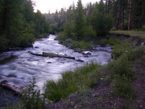
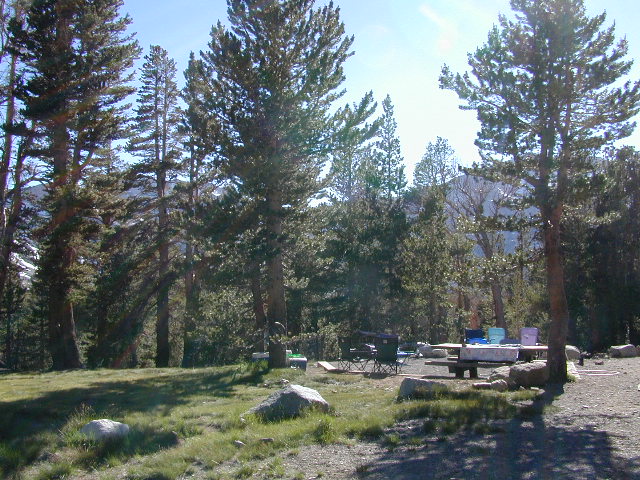
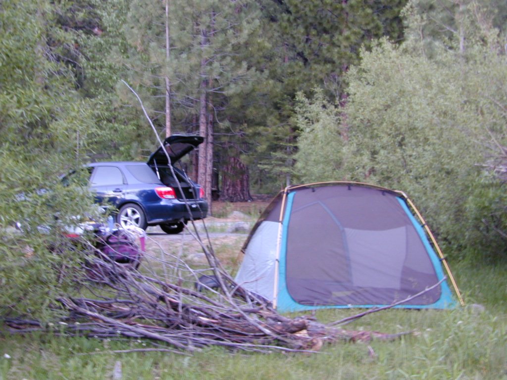
A small developed campground along forested Highway 89, with raging creek, fishing spots, and hiking trails and mountain biking trails nearby. Paved, level camp sites, small RVs okay w/ access to the numerous Sierra Nevada destinations with several lakes and reservoirs nearby.

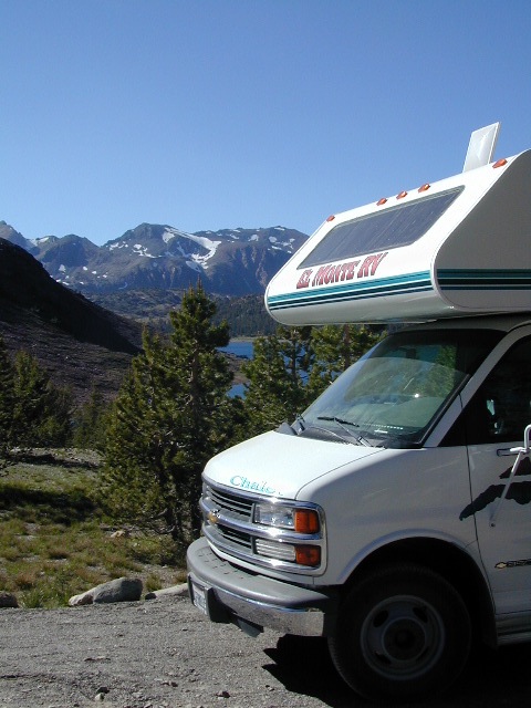
This is a popular overnight stop “in route” for many campers and bikers traveling further on to the Northern Sierra Nevada mountains. You can exit off Interstate 80 @ Truckee, and be at this camp in minutes. Car camp, tent camping, a few spaces for small motorhomes. Plenty hiking and mountain biking trails.

Cold Creek Campground, California
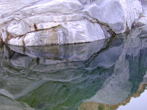
on the Cold Stream;
Campground open May-October
(depending on snow)

High Sierra / Tahoe Truckee Camping

13 camp sites on Cold Stream @ 5800′ elevation; vault toilets, river and piped water, bear boxes; first come, first served camping

Max Camper Length: 22′

Rangers Office: 530-265-4531

The highway traffic noise makes this place a ‘short and sweet’ one nighter top pick, great for those camping in route to another destination. Another developed camp is on the opposite side of the highway, less than a mile north called Cottonwood Campground.

Free Camping nearby.
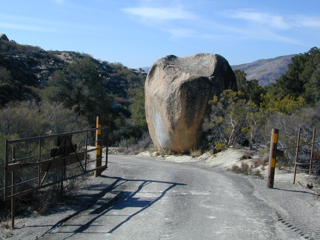
If you are seeking primitive camping near this area, start with Little Truckee Summit at the lakes turn off road on SR 89 – about 2 miles south of the Cold Creek Campground.

Tahioe USDA Map
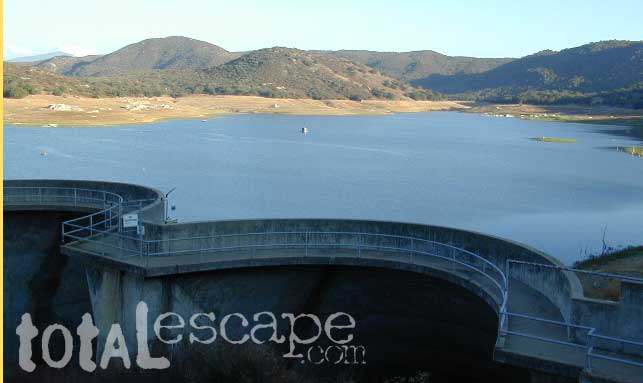
Take Tahoe Forest Road #5, a major paved road, approximately 12 miles back to the big meadows. Look for the unsigned dirt roads on left side of road nearing Webber Lake. The largest lake in the region, Independence Lake, is a paved side route off to the south. Further back on Road #5 the pavement ends at Jackson Meadows Reservoir. Very rough rocky road out to Bowman Lake w/ several developed campgrounds in the vicinity.


Tahoe trailheads lead out to –
alpine fishing lakes
mountain peaks
Treasure Mountain 7085′
Tahoe National Forest 
OHV Area @ Prosser Reservoir

NEARBY TOWNS:

ROAD CONDITIONS:

Tahoe and Truckee are known for their brutal winters and deep snows pack. Call CalTrans ahead of your departure if you are even slightly expecting any kind of precipitation. Truckee – winter road conditions


View Larger Map

Castle Crags Wilderness

NorCal Hiking
Castle Crags State Park
CastleCrags Wilderness

12,232 acres
Northern California Mountains
South of Dunsmuir, CA
Interstate 5
exit #724 – Castella

backpacking, camping, creek fishing, hiking, mountaineering, lakes, rock climbing, snowshoeing, swimming, waterfalls

About an hour north of Redding, you can see those impressive peaks off to the left above the lush forest. Way up off the west side of I-5, lies a hiking paradise of scenic lakes, waterfalls and wildflowers. Opposite the freeway from Mount Shasta; Just south of Lake Siskiyou.castle crags

Castle Crags Wilderness neighbors the Castle Crags State Park, which is surrounded by Shasta-Trinity National Forest. This area is named for 6,000′ tall glacier-polished peaks and pointed crags. Due to their relatively low elevation, year-round recreation, hiking, backpacking, and rock climbing are popular spring through fall. Snowshoeing near Castle Lake is excellent.

Castle Crags State Park
530-235-2684

Castle Crags State Park Campground
76 developed campsites
6 environmental campsites

Max Camper Length: 27′
Max Trailer Length: 21′

28 miles of hiking trails (2.7 mi access trail to Castle Crags Wilderness)
The Pacific Crest Trail also passes through the park.
Dogs not allowed on park trails.

Shasta-Trinity National Forest
Mount Shasta Ranger District
204 West Alma
Mt. Shasta, CA 96067
530-926-4511

Climbing at the Crags:
the Cosmic Wall & beyond

regional history: The northwest area contains the largest glacial cirque, Castle Lake, which is near where the Modoc War’s 1855 Battle of Castle Crags took place. Now a historical landmark, the battle was fought on a ridge saddle between the lake and what is known as Battle Rock. The Wintu tribe inhabited the area, they called the crags the Abode of the Devil and the Spanish explorers called it Castle del Diablo (Castle of the Devil.) read more on wiki

nearby towns –


View Larger Map

Silver Peak Wilderness

Hiking the Southern Big Sur Coastline

faded public lands
Sun-bleached, wooden Los Padres sign – near Salmon Creek trailhead.

Silver Peak Wilderness, Big Sur Coast

Central California Coast

31,555 acres

8 miles South of Gorda, CA
along Pacific Coast Hwy 1
near Big Sur, CA
Los Padres National ForestBig Sur Wilderness Map

Backpacking and hiking trails on the Pacific Coast, steep terrain next to ocean. Coastal redwood canyons, oaks hills, great views. The neighboring Ventana Wilderness is located just north of Silver Peak hiking trails.

Southern Redwood Botanical Area

Silver Peak –3,590′ elevation
Alder Peak –3,744′

trailheads

  • Salmon Creek Trail #5E09
  • Hwy 1 @ connection Trail #5E10
  • Alder Creek Trail #5E09

mm

mile markers along Pacific Coast Highway 1
(Monterey County)

  • Cruickshank Trailhead – 6.5 mm
  • Soda Springs Trailhead – 3.8 mm
  • Buckeye Trailhead – 2.4 mm
  • Salmon Creek Trailhead – 2.2 mm

developed campgrounds nearby –

nearby towns –

Ocean View Hikes Big Sur


View Larger Map

Oak Foothills

Hot Springs Hikes

Soaker

California Hikes to Hot Springs

California has many natural hot springs, most requiring a drive into the mountains. Some are rustic resorts, some are developed campgrounds, most are located on paved roads. The very remote tubs are the ones hidden in the secluded wilderness  – only accessible by foot.

campfires Plan to camp overnight? Fire Permits are required if you plan to build a campfire or use a camp stove.

HIKE-IN ONLY HOT SPRINGS

hikes

Buckeye Hot Springs requires a steep half mile trail down to the creek edge.  N of Bridgeport. Eastern Sierra @ Buckeye Creek Road #017.

Deep Creek Hot Springs is a SoCal favorite, but with that convenience comes the crowds. Located on the desert side of the mountains from Lake Arrowhead.

Gaviota Hot Springs is a short hike along a lush canyon. Close to US Hwy 101 and located in between Goleta and Solvang.

Kern River Gorge, Sequoia NF – Both Jordan Hot Springs & Kern Hot Springs accessible only by backpacking many miles, from Jerky Trailhead. Backpack and horseback access only. Golden Trout Wilderness.

Remington HRemingtonot Springs requires a steep but short half mile trail down to the river edge. Lower Kern River. Old Kern Canyon Road @ Remington Trailhead# 32E51 – Remington Ridge Trail is a multi-use trail. Bike, hike, horseback on oaks hills. Wildflowers in Spring.

Sespe Hot Springs requires an 18 mile round trip hike. Usually enjoyed as an overnight backpacking trip. A very challenging and long trek as a day hike. Los Padres National Forest.

Sykes Hot Springs requires a strenuous 10-mile hike from Big Sur Station. Hike inside of Los Padres NF. Usually enjoyed as an overnight backpacking trip, or a very long day hike for the fittest of folks.

gaviota pools

California hikes

Kern Hot SpringsRemington tubs overlooking the Lower Kern River

Gaviota Hot Springs

Las Cruces Hot Springs
also known as Gaviota Hot Springs,
and as Gaviota State Park Hot Springs

Top Pool

W of Santa Barbara, W of Goleta, CA
North of Gaviota State Park

US 101

US Hwy 101 @ PCH 1 exit
follow frontage road on south side of the 101


View Gaviota Hot Springs in a larger map

This soaking spot is a convenient stop for those traveling the 101 on the California Central Coast. The hot pools are located in an overgrown canyon, about half mile up the hill from the parking area. The natural earthen pools tend to be warm, mushy, and smelly (like sulfur) but never super hot.

These are old, historic, volunteer built pools that are not maintained regularly, so keep that in mind when comparing this location to other well-manicured springs. Many of the locals that care for these sacred spaces only get paid back by reckless visitors with litter, graffiti and vandalism. If you want places like this to stay open, we must do our part to ensure that we leave it better tan we found it.

Parking fee, lot managed by California State Park. Gate closes at dark.

gaviota park signs

1 mile hike round trip

Poison oak, snake and ticks can be a problem at this location, so do be on the lookout.

swampy pool

hiking trails from here –
Gaviota Peak (fire road) and Campbell Trail (unmaintained)

Ishi Wilderness

Bridge and Chute from top of Black Rock

NorCal Ishi Wilderness

41,840 acres
20 miles N of Chico, CA
Lassen National Forest

  • Barkley Mountain (elev. 4488′)
  • Black Rock Campground
  • Deer Creek
  • Flat Iron Mountain (elev. 4400′)
  • Iron Mountain (elev. 3274′)
  • Indian Ridge Campground
  • Mill Creek
  • Peligreen Place
  • Pine Creek
  • Pinnacle Peak (elev. 3293′)
  • South Antelope Campground
  • Twentymile Hollow

Up in the mountains behind Chico sits a rugged landscape of deep canyons lined with bizarre rock formations and roaring mountain creeks. Wilderness encompasses lower elevations – ranging from 1500′ – 3500′  – making this outdoor destination a winter haven, when the rest of the backcountry is covered in several feet of snow. One of the most historic wilderness areas in the state, as the aboriginal existence of the Native Americans came to an end in this area.

COHASSET ROAD climbs up the volcanic fin of Cohasset Ridge into the pine forests high above the valley floor. The paved road becomes dirt and the road name changes to Ponderosa Way (Lassen Road# 28N29). The Ishi Wilderness can also be accessed from the north side via Highway 32, near the Tehama State Game Refuge.


View Larger Map

  • backpacking trails
  • hiking trails
  • fishing creeks
  • horseback trails
  • wildlife viewing


Ishi Wilderness mapIshi Wilderness Map

Ishi Wilderness


Agua Caliente Hot Springs

Agua Caliente Springs

Agua Caliente County Park
Agua Caliente Anza Borrego Desert
Agua Caliente Hot Springs

East San Diego County
N of Ocotillo, CA

Anza Borrego Desert MapAgua Caliente Hot Springs County Park is a remote 910-acre San Diego County Park next to the Anza Borrego Desert. A developed hot springs, picnic area & a large campground. This desert destination is perfect for California winter recreation, offering a small air strip for small plane pilots.

Located North of Interstate 8 on San Diego Road S-2 on the south end of Anza-Borrego Desert State Park. Local mountain’s seismic forces created the fault that runs beneath this region & forces water up to tRV campground Anza
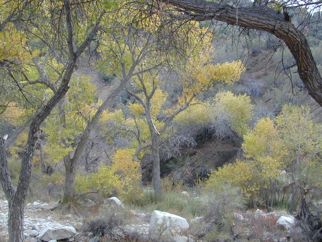
he desert surface. A decent water supply also supports plant life & wildlife.

For minimal crowds AVOID THIS PLACE on holiday weekends or peak winter months. Spring & Autumn are excellent times to visit here, but watch the weather forecast for any heat waves. Who wants to soak when it’s 100 degrees outside?

2 natural hot mineral pools:

  • large outdoor pool is kept at natural 96 degrees
  • glass walled indoor pool is heated & has bubbling jets
  • spring-fed, warm showers are available
  • hiking trails, horseshoe & shuffleboard

Indoor Pool

Agua Caliente Campground

140 campsites – tent sites & RV hookups w/ dump station. Shady trees only at some camp sites. Indoor pool, outdoor pools, maybe a hike-in primitive tub too. Individual campsites may be reserved up to 12 weeks in advance 858-565-3600

  • Anza Borrego Desert Map
  • San Diego Backcountry Map

  • View Larger Map

    Anza Borrego Hot Springs
    Several nice camp spots line this canyon on the north side.

    Trinity Alps Trailheads

    Trinity Alps Wilderness Trailheads
    NorCal Hiking Vacations

    Meadow on Trinity Alps Long Canyon Trail

    Northern California, Trinity Lakes
    Shasta Trinity National Forest

    • backpacking
    • camping
    • fishing lakes
    • hiking trails
    • horseback trails
    • waterfalls

    Trinity Alps Wilderness

    hike


    Trinity Wilderness trailhead locations –

    trailheads from Highway 3:

    • Scott Mountain (PCT access)
    • Bear Creek
    • Eagle Creek
    • Stoddard Lake
    • Boulder Creek
    • Big Flat
    • Swift Creektrinityalps_lg

    trailheads from Highway 299:

    • Canyon Creek
    • Hobo Gulch
    • French Creek
    • Green Mountain
    • Jim Jam Ridge
    • East Fork
    • New River
    • Grizzly Camp

    trailheads from Highway 96:

    • Tish Tang
    • Red Cap Lake
    • Bear Hole
    • Mill Creek Lake
    • Salmon Summit

    trailheads from north @ Salmon River, Cecilville Rd #1C02:

    • Hidden Horse
    • Trail Creek
    • Carter Meadows Summit (PCT access)
    • Middle Boulder

    Trinity Alps Wilderness Trail
    Overview @ SummitPost

    Mineral King Camping

    DSCN0019

    Mineral King is a magnificent canyon in the southern portion of Sequoia National Park, east of  Visalia, CA. So magical indeed that Disney tried to purchase the rugged scenic lands for a wilderness ski theme park in 1960. Thankfully that project never happened, due to strong opposition from preservationists. Mineral King became part of Sequoia National Park in 1978.

    Mineral King is the Great Western Divide, where high peaks separate the foothills from the taller Eastern Sierra range. Upper Kern River Canyon lies beneath as the main south drainage from the very tallest peak, Mount Whitney @ 14,494′

    sierra topo maps

    Mineral King Road is a paved off shoot from Highway 198, just to the east of the town of  Three Rivers, CA. The road is steep and curvy and 25 miles long. No gasoline at all. No RV motorhomes or trailers are permitted to travel this scenic and amazing back road. Certain portions of the road are dirt and usually graded, but most of the route is paved.  Snow closes the road in winter months – NOV-MAY.

    We usually get less than a half year to enjoy this special place, so make plans in advance to fit this destination into your schedule JUNE-JULY-AUG-SEPT.

    And do not even think of trying to cram spectacular Mineral King into an already packed Sequoia Park weekend trip. The Giant tree Sequoia groves, Hume Lake and Kings Canyon are over an hour north (hwy 198), to other side of the park.

    If you have a full week to hang out in the Sequoia National Park area, then obviously Crystal Cave and Mineral King should be on the list, but keep in mind taht each destination will take a full day to drive to and explore.

    Driving the distance on Mineral King Road, the wonders abound on every curve. Wildlife, waterfalls, water flowing and the dense forests.

    Atwell Mill Campground is located at an old wood mill site and has a good hike to a footbridge at Kaweah River. There is a small cabin community called Silver City which caters to summer crowds and family campers. Only open during the warm season.

    At the very end of Mineral King Road is the gravel parking. Step out into high elevation (7830′ above sea level), breathe deep and enjoy the granite bowl of alpine bliss with creeks, meadows, wildflowers, picnic spots, hiking trails and scenery everywhere. Mid day sunshine can be bright. Black bears and marmots are very common.

    Cold Springs Campground is the last developed campground, located next to a raging creek. The hike-in sites are the best choice for seclusion at this camp.

    South Fork Campground is the smallest of the campgrounds in this area; located in the foothills at 3600′ elevation, open all year. From Highway 198 (W of the town of Three Rivers), take South Fork Drive 13 paved miles to camp.

    KaweahFalls

    mineral king backpacking

    Mineral King is a favorite destination among backpackers as it gives instant access to many high country trailheads with mostly paved road driving. Located deep in the forest at end of a long road, near the center of the Sierra Nevada range gives ample hiking in every direction. The hikes are steep and challenging, but the rewards are solitude, true wildness and grandeur scenery. Although inviting, these steep passes might not be adequate for beginner backpackers, so please keep that in mind when planning. Fishing lakes, day hikes, horseback trails, waterfalls, creeks, and jagged mountain peaks.

    From Mineral King you can access the these popular spots – PCT, the Great Western Divide, the Golden Trout Wilderness, Sequoia National Park, Kings Canyon High Country, Keasarge Pass, John Muir Wilderness.

    top maps for the region –

    Sespe Wilderness

    Sespe Wilderness & Hiking Trails

    Los Padres National Forest
    Campgrounds & Trailheads

    Sespe Wilderness is located in the mountains W of Interstate 5, North of Los Angeles. The chaparral region lies in between Lockwood Valley and the Santa Clara River Valley (Hwy 126). Higher elevation Mount Pinos lies to north side of Sespe and Ojai Valley to the south. The infamous 4×4 Miller Jeep Trail is located on the north side near Alamo Mountain, which is also accessible via Hungry Valley.

    The 2006 Day Fire burnt a good portion of the Sespe Wilderness, so you can expect to see some black and toasted areas. Sespe Creek is also referred to as Sespe River. and certain waterways may dry up during drier months. Piru Creek, Alder Creek, Aqua Blanca Creek, Tarr Creek, Mutau Creek, Snowy Creek are several worthy of note. Expect heat and high temperature in the summer & fall month, and possible campfire restrictions during extreme wildfire season.

    219,700 acres
    6 areas of hiking trails

    Los Padres National Forest
    Lockwood Ranger Station
    661-245-3731

    Sespe Trail Map
    Sespe Trails, Tom Harrison Topographic Map

    Sespe hiking trailheads located at –

    Highway 126 – Fillmore, CA
    Sespe Condor Sanctuary – Dough Flat Trailhead

    Highway 150 – Ojai, CA
    Sisar Canyon Day Hike / Road #4N15

    Highway 33 – Ojai, CA
    Rose Valley Road #6N31, Rose Valley Falls, Day Hike
    Piedras Blanca Trailhead for the National Recreation Trail
    Pine Mountain Rd # – Reyes Peak Trailhead

    Lockwood Valley Road – Frazier Park, CA
    Reyes Creek, Camp Shiedeck – Pine Mountain Trailhead
    Half Moon Mutau Flat Trailhead, Sespe Hot Springs

    Interstate 5 Tejon Pass @ Hungry Valley
    Hard Luck Trailhead


    rd7N03

    Los Padres Campgrounds near Sespe Wilderness

    • Frazier Park Camping
    • Ojai Campgrounds
    • Twin Pines Campground, Road # 18N01
      Alamo Mountain via Hungry Valley OHV
    • Lockwood Creek Campground
    • Half Moon Campground, Lockwood #7N03
    • Thorn Meadows Campground, Lockwood #7N03
    • Dome Springs Campground, Lockwood #8N40
    • Reyes Creek Campground, Lockwood Valley Rd
    • Pine Mountain Road @ Reyes Peak (dispersed)
    • Nettle Springs Campground, Cuyama Hwy 33
    • Ozena Campground (closed)letswalk
    • Tinta Campground, Hwy 33
    • Rancho Nuevo Camp, Hwy 33
    • Rose Valley Campground, Hwy 33
    • Wheeler Gorge Campground, Hwy 33


    nearby parks & lakes –

    nearby towns –

    Backpackers at Sespe Hot Springs

    Saddlebag Lake Campground

    Saddlebag Lake, Yosemite East Side

    Inyo National Forest @ Tioga Pass, Hwy 120

    Yosemite High Elevation Campground

    Yosemite Lake View Camp Sites

    Tioga Pass camping on the eastern side of Yosemite National Park, just outside park boundaries is Inyo National Forest lands. Snow is usually epic up here and some of the deepest on the range of light.

    Several prime campgrounds line this popular Sierra pass, highway 120. Most camps are located along the busy highway just outside the National Park gate. Behold, this prime choice destination is a few miles back off the highway, at the end of a graded dirt road. Smaller RVs okay.

    Saddle Bag Lake

    High altitude, tree line, thin air, snow melt everywhere, spectacular elevations and dark skies make this an awesome stargazing spot. Summer is busy with trailers, boat rentals, horses and day hikers. Locals and fishermen use this small campground often, so tourists should feel lucky to find such a rare camp here. First come, First serve, when it is open (only half the year).

    Elevation: 10,000′
    Number of Sites: 19
    Camping Reservations: No
    Sites Available: First come, First serve
    Vehicle Accessibility: Vehicle limit 22 ft. max.
    Length of Stay: 14 Days
    Water: Piped; lake, creek nearby
    Toilet: Vault
    Season: Closed during winter & spring
    Fee: Yes
    Operated By: National Forest Service
    Closest Town: Lee Vining, CA

    Inyo National Forest
    Bishop Ranger Station
    760-873-2400

    RV Camper Lake

    Indian Flats Campground

    Temecula Camping / Warner Springs Campground

    San Diego Mountains – Cleveland National Forest

    Indian Flats Campground

    Indian Flat Campground is located on the seasonal San Luis Rey River in rural North San Diego County.  From I-15 @ Temecula, CA travel eastbound on Highway 79. Look for the tiny turn off  (on left side) for forest road #9N05, sorta near glider airport located west of Warner Springs. This poorly paved backcountry route (half dirt/mud at times) is also known as both Indian Flats Road or Lost Valley Road.

    Graded dirt road (paved in some portions) travel is approximately 6.5 miles to campground, look for gate and turn off on the left side. When you see the giant boulder near the entrance, you’ll know you’ve made it to the right place.

    Oak trees and a few pines, plenty shade, boulders and mountain scenery, this is a great small campground that is well away from everything in Southern California.  Seasonal creek-sized river and boulder waterfall often dries up in late summer. This means a wet spring is the best time to visit this camp. Hiking, mountain biking trails and hammock spots. Pacific Crest Trail access.

    Cleveland National Forest
    Palomar Ranger District
    760-788-0250

    ClevelandMap_07

    Elevation: 3,600′
    Number of Sites: 17
    Camping Reservations: None
    Sites Available: First come, First serve
    Vehicle Accessibility: Length 15′ max.
    Length of Stay: 14 Days
    Water: No Piped; Seasonal creek nearby
    Toilet: Vault
    Season: Closed for mud & snow during winter months
    Fee: Yes
    Operated By: National Forest Service
    Closest Town: Warner Springs, CA

    Indian Flat
    Indian Flat Campground Entrance

    Jennie Lakes Wilderness

    horse meadow trails

    Sequoia / Kings Canyon / Mitchell Peak

    outta print

    USDA MAP may be out of print 2017

    Jennie Lakes Wilderness is located in between two popular National Parks, via the paved back roads off Sequoia Generals Highway 198. Monarch Wilderness is north of Jennie Lakes, bordering Kings Canyon.

    10,500 acres
    26 miles of trail

    Two lakes, Jennie Ellis Lake and Weaver Lake, set among granite outcroppings. Majority of the wWilderness is above 7,000 feet w/ red fir, lodgepole pine, and western white pine forest near treeline; abundance of spring wildflowers fill meadows. The two main lakes and Rowell Meadow are primary destinations for most backpackers wanting to camp overnight.


    Sequoia National Park

    Kings Canyon National Park

    Monarch Wilderness

    Impressive granite canyons, super steep. LOts of rugged rocky terrain, lower elevation to peaks of 11,000′. KINGS RIVER – Longest raging river in the Sierra, headwaters originating near Mount Whitney.

    Road#14S11 – Big Meadows Road

    National Forest & Wilderness Permits –

    USDA Sequoia NF

    More Wilderness Info & Links –

    sierrawild.gov/wilderness/jennie-lakes
    summitpost.org/jennie-lakes
    Jennie Lakes Wilderness Wiki

    Marvin Pass trailhead
    Marvin Pass trailhead, 12 miles down Rd#14S11

    Another Big Meadows?
    Indeed, southern SEQ NF, on the East Kern Plateau.

    Dome Land Wilderness

    Southern Sierra Nevada Mountain / Domeland / Dome Lands
    Kern Plateau, Sequoia National Forest

    Dome Land Wilderness

    130,081 acres

    55 miles of trails (hiking & horseback)

    Located at the southern end of the Kern Plateau about 20 miles east of Kernville, granite domes give this area its name. Domeland Wilderness is a unique geologic area with semi-arid to arid mountainous regions. Elevations ranging from 3,000′ to 9,730′ – it is surrounded by National Forest, where the Sierra mountains meet the North Mojave Desert. The Wilderness is the southernmost habitat for the Golden Trout. The South Fork of the Kern and tributary streams attract many fishermen. Vegetation is mostly mixed conifer and piñon (pinyon pine).

    The Domeland Wilderness is located at the southern end of the Kern Plateau. This land was first protected by the Wilderness Act of 1964 as a 62,695 acre wilderness and was later expanded to 130,081 acres in 1984 to include the delicate transition ecosystems that meet to the east, south, and north of the original wilderness. These new additions, now jointly managed by the Bureau of Land Management and Sequoia National Forest, are rugged and dry.

    Though it is considered within the Sierra range, the Domeland Wilderness includes the overlap of several ecosystems to form unique plant and animal communities. The banks of the South Fork of the Kern River offer important riparian habitats of cottonwoods and meadows which stand in sharp contrast against the characteristic smooth domes and bold granite outcroppings. Domes that range from the size of a cottage to football fields across and spear-like jagged spires can be found in the Domeland. This range is one of the driest in the Sierra with the semi-arid mountains of the north and east crumbling into desert.

    Notable Wildfires: Dome Fire 1996. Manter Fire in 2000.

    Dome Land trailhead locations:

    East side access near Rockhouse Meadow and at the Long Valley Campground (BLM). Access is via Nine Mile Canyon Road (J41) from US Highway 395 or Chimney Peak Road (graded dirt road) via State Highway 178 , the main route that passes Lake Isabella.

    West side trailheads are at Big Meadow and Taylor Meadow. Two trails from Big Meadow can be reached from Kernville via Tulare County Road M99, Sherman Pass, and Cherry Hill Roads. Leading to Manter Meadow, the upper Big Meadow Trail is a rugged hike while the lower Big Meadow Trail follows more gentle terrain. The trail from Taylor Meadow (southeast of Big Meadow) also leads to Manter Meadow. North side access is available from the Blackrock/ Sherman Pass Road via the Dark Canyon and Woodpecker trails.

    dome land mapManter Meadow is popular along with other camp sites located at Little Manter Meadow, Woodpecker Meadow, Rockhouse Meadow, and in the Bartolas Country at the south end of the Wilderness.

    Dome Land Wilderness Map USDA


    surrounding lands & forests –

    Sequoia National Forest
    Ridgecrest Desert BLM

    nearby towns –

    National Forest & Wilderness Permits –

    USDA Sequoia NF

    More Dome Land Wilderness Info & Links –

    sierrawild.gov/wilderness/domeland
    summitpost.org/domeland-wilderness
    Dome Land Wiki

    Golden Trout Wilderness

    Golden Trout Wilderness Area

    granite Upper Kern River is Mount Whitney snow melt
    • 303,511 acres
    • elevation range 1,000′ – ­13,000′
    • pine forest, chaparral
    • granite walls, domes
    • 379 miles of trail
    • summers are busy
    • snow in winter
    • best in early spring
    • wood fires may be restricted
    • portable stoves permitted
    • water plentiful
    • rock climbing & mountaineering
    • fishing
    • backpacking
    • primitive hot springs
    • waterfalls, swimming holes
    • wilderness permits required for overnight
    Golden Trout Wilderness surrounds the mighty gorge of the Upper Kern Canyon, south of Mount Whitney.
    Inside

    TULARE COUNTY

    bordering

    Inyo National Forest

    Sequoia National Forest

    Eastern Sierra Interagency Center
    760-876-6200

    Golden Trout / South Sierra Wilderness Map USDA

    Golden Trout Trail Map

    Located in the South Sierra Nevada mountains alongside the Southern Sierra Wilderness. Inside the remote rugged peaks of a deep, granite crevasse known as the Upper Kern River with ancient Sequoia forest to the west and to the eats, some of the tallest peaks in the Sierra range. This wild land area is home to the California golden trout and is the main water flow southward from the tallest peak in the lower 48  – Mount Whitney on the Eastern Sierra front.

    Sequoia National Forest
    Monache Meadows
    Inyo National Forest
    Mountain Home State Forest
    Sequoia National Park
    Mineral King

    Golden Trout Wilderness

    Roads, campgrounds and trailheads surrounding Golden Trout Wilderness

    Eastern Sierra –

    Horseshoe Meadows Road (paved) leads up to high elevation meadows from the high deserts of Lone Pine, CA. Pacific Crest Trail (PCT) access; Mount Whitney and John Muir Wilderness are to the north. Equestrian corrals and horse trails. Camping is limited to a one night stay at any of the 3 campgrounds up here.

    Golden Trout Trailhead Campground: elevation 10,000′ / 12 walk-in sites / closed winter
    Horseshoe Meadows Campground: elevation 10,000′ / 18 walk-in sites / closed winter
    Cottonwood Equestrian Camp: elevation 10,000′ / 10 horse corrals / closed winter

    Forks of  the Kern –

    Fork of the Kern / Loyds Meadow Road #22S82 – This main paved road connects the Kern River (Sierra Hwy Road #99) to the lower elevation, granite slopes of the Western Divide, and the route dead ends at Jerky Meadow parking lot. Camp 1-6 are primitive camp areas located on dirt side roads and 4×4 might be required on some of them. Obtain a campfire permit from rangers in Kernville. Fishing, camping, waterfalls and swimming holes are popular in this region. The big developed camp along this road, is located 10 miles up, in a pine filled valley on Peppermint Creek on the west side of the street and is within the Giant Sequoia National Monument.

    Lower Peppermint Campground: elevation 5300′ / 17 camp sites / open year round

    Lloyd Meadows @ Sequoia Forest Road# 20S67 – is the Forks of the Kern Trailhead & the dirt road that accesses it, is very popular among equestrian campers.

    Western Divide Highway –

    Road #20S79 leads from Western Divide Hwy to Lewis trailhead.
    Road #20S50 leads from Western Divide Hwy to 2 hiking trailheads.

    Sequoia National Park, Three Rivers, CA –topo maps

    South Fork Road leads up Kaweah River at Southfork trailhead.
    Mineral King Road is only open seasonally, access to high country lakes and trailheads.


    SEQUOIA AREA MAPS –

    Golden Trout Wilderness Maps
    Sequoia National Forest Map USDA
    Inyo National Forest Map USDA
    Mineral King Map
    Sequoia & Kings Canyon NP Map
    NatGeo Sequoia Kings Map

    Golden Trout Wilderness trailheads:

    east side –
    Cottonwood Trailhead (near Lone Pine)
    Blackrock Trailhead (Monache Mdws)

    south side –
    Jerky Trailhead
    Forks of the Kern Trailhead
    Lewis Camp Trailhead (Western Divide)
    Summit Trailhead (Western Divide)
    Clicks Creek Trailhead (Western Divide)
    Camp Wishon Trailhead (Western Divide)

    west side –
    South Fork Trailhead (Three Rivers)
    Atwell Mill Trailhead (Silver City)
    Franklin Pass Trailhead (Mineral King)

    List of nearby towns:

    San Diego Lake

    sutherland Reservoir

    Lakes in San Diego CA
    San Diego County Lakes & Reservoirs

    Salton Sea, way out past Anza Borrego desert is indeed surreal, but nothing too spectacular

    Baja mountain camping at Laguna Hanson. Baja California Norte
    Lake Dixon in North County San Diego, near Escondido, CA

    Barrett Lake, near Tecate CA
    w/ plenty of off-roading trails @ Corral Canyon OHV Park

        • south of Interstate 8
        • steep slopes & granite boulders
        • vegetation is chaparral & coastal sage
        • elevations range – 1,600′ – 3,681′
        • wood fires prohibited
        • portable stoves permitted
        • groups limit – 15 people
        • visitor permit required
    hikes NFS camping

    Looking for alpine lakes, dense forest and dramatic mountain scenery? 

    Of course you are. That’s why half the population relocated to California, to endlessly search for summer vacation destinations in alpine bliss and stay overnight next to a secluded mountain lake. You’ll need to leave SoCal to find these beauties, but they are out there if you have the time to travel and spend a week enjoying one. Midweek, the fish are all yours. Check out our huge California Lake List.

    Miracle Hot Springs

    MIRACLE HOT SPRINGS on Lower Kern River is now closed!

    Kern Soakers

    Hidden well by the dense vegetation, this multi-tub location provides a peaceful setting along the Kern River. Located on the Old Kern Canyon Road, (aka Old Kern Road) that parallels the main 4-laner Highway 178. The broken and dismantled tubs are inside a grouping of granite boulders, overlooking the Lower Kern River.  NFS Campground is walking distance away. Week days you can have the place to yourself for picnics, river fishing and hiking. Mountain biking and hiking trails at Remington trailhead.

    DanaMite’s Tip: This place has no operating hot pools unless you plan to physically dam up a tub with a few found rocks. Rangers do not like this practice. If you wanna camp at Hobo Campground you can walk over & hike around to check it out. Worth a look.

    Camping available next door at Hobo Campground. A few primitive spots are located on the Old Kern Canyon Rd. Free car camping, and some sites big enough for level RV camping. See the rangers at the Sequoia Mapslake for Sequoia National Forest ranger and fire permit and check fire current restrictions.

    Remington Hot Springs is only 2 miles down river, but it does require a short hike and it gets very busy on weekends!

    nearby towns:

    Bodfish, CA
    Kernville, CA
    Lake Isabella, CA
    Wofford Heights, CA
    Alta Sierra, CA

    Thousand Lakes Wilderness

    NorCal hiking & backpacking

    Thousand Lakes California

    Although the name suggests more, the number of lakes in this region is approximately seven: Eiler Lake and Box Lake are the 2 largest lakes within the Wilderness boundary. Logan Lake and North Battle Creek Reservoir are on the outskirts. Trout fishing is a popular recreation sport all around Lassen. Thousand Lakes Wilderness is part of the Cascade Range in northern California. 16,335 acres and 21 miles of trails, all managed by Lassen National Forest. The area lies midway between the mountain town of Burney and Lassen Volcanic National Park.

    Volcanic activity and glaciers have combined to create the Lassen topography. Dominated by Crater Peak 8677′, which is the highest point in Lassen National Forest, this area is a reminder of the glacial action that eroded the original, much larger Thousand Lakes Volcano and created the many small lakes and ponds scattered throughout the region. Wildlife includes black-tailed deer, black bear, pika, pine marten, northern goshawk, spotted owl, pileated woodpecker, and Clark’s nutcracker. Even elk have been known to visit occasionally.

    Lassen National Forest
    Lassen Volcanic National Park


    View Larger Map

    Thousand Lakes Wilderness

    Roads and trailheads surrounding Thousand Lakes Wilderness and the Wild Woods

    Lassen Forest Road #16 – Ashpan Winter Recreation Area @ Hwy 44, leads to hikes on the west side of the Wilderness. Bunchgrass trailhead and Magee trailhead. LaTour State Forest, Ashpan Butte, Huckleberry Mountain, Fredonyer Peak, Crater Peak, and Whittington Butte. Lassen Route 16 is a graded dirt road that connects to Tamarack Road #4M001 at Burney Creek, near the north side of the Wilderness.

    Road #32N17 – access to North Battle Creek Reservoir
    Road #32N16
    Road #32N24

    Thousand Lakes Wilderness Map
    Road #32N31 – access to North Battle Creek Reservoir

    Road #32N18 leads to PG&E North Battle Creek Reservoir
    North Battle Creek Campground: elevation 5600? / 15 camp sites / open Apr-Oct

    Road #26 on the north side of the Wilderness, connects Hwy 89 @ Hat Creek, west to Road #32N22. Cypress trailhead is located on a side route nearby.

    Road #32N23 is up on Burney Mountain elev. 7863′, another hang glider launch site.

    Road #33N25 leads to the Tamarack trailhead
    Road #34N78 off Hwy 44, near Logan Lake and route leads to McElroy Flat

    Road #32N35 behind Burney connects to Hat Creek (the back way).


    LASSEN AREA MAPS –

    Lassen National Forest Map
    Thousand Lakes Wilderness Map


    List of Thousand Lakes Wilderness trailheads:

    Bunchgrass Trailhead
    Magee Trailhead
    Cypress Trailhead
    Tamarack Trailhead


    List of nearby towns:

    Guadalupe Canyon Hot Springs

    Guadalupe Canyon Baja Hot Springs

    Canon de Guadalupe

    Baja Hot Springs Camping Resort


    Baja California Hot Tub

    40 miles SW of Mexicali – Laguna Salada off Mexican Highway 2

    Guadalupe Canyon Oasis
    Palm Canyon Hot Spring Camping Resort
    619-639-7597


    Off road destination, palm canyon in Baja California Norte
    East of San Diego
    SW of El Centro / Mexicali

    Imagine a palm oasis canyon in a remote area of the Baja desert; Cool springs that feed the lush landscape with huge boulders & cliff diving waterfalls. With each campsite featuring it’s very own custom hot springs tub. This place was a paradise 20 years ago, but is now over-developed w/ large groups, parties and camping families. If you can handle the 30+ miles of unimproved dirt roads, this spot is worth a visit mid-week. Winter months are prime time to visit the desert. Temperatures are moderate, days are pleasant & midweek has minimal tourists. Avoid holiday weekends as crowds a can get rowdy and disrupt the peaceful setting. Summer is triple digit heat for months. This canyon is hard to reach and inside a third world country, but well worth the distant journey.

    Baja MapsPlenty of great hiking and petroglyph canyons, cool pools and waterfalls, granite boulders, soothing warm waters & gorgeous desert scenery. Summers are usually roasting out here, so plan your vacation accordingly. Palalpas (built for shade) add to the charm & unique look. Each campsite is unique & has a different lay out. Reservations are recommended.

    A family run set of campgrounds within a steep palm canyon. Hot Springs are piped to individual pools at each campsite for a maximum of privacy. A cold creek runs through the canyon as well, feeding the palm grove below & waterfalls way up canyon. A desert oasis set upon the slopes of the Sierra Juarez Mountains in Baja.

    getting there is a journey –

    Recommended high clearance vehicle, sport utility vehicle, or truck. The last 35 miles of the trip is through rough & rugged sandy roads.

    nearest towns –

    Guided tours to Guadalupe Canyon can be booked thru Baja Trek. We are no longer offering Baja California trips with Total Escape Adventures

    Baja hot spring photos from Total Escape Adventures trips –
    FEB 2000
    NOV 2000
    APR 2001
    NOV 2001
    NOV 2002

    Lazy Afternoon in Baja

    Pool Reflections 5

    Deep Creek Hot Springs

    Deep Creek Hike-in Hot Springs

    Deep Creek Canyon

    Several hot spring pools line this desert canyon on the SW side of Deep Creek. There are smaller hot tubs, as well a large warm tub that is big enough to swim in. The vegetation around the springs and main creek is fairly lush for this desert terrain. A variety of trees, including willows, plus small meadows and grasslands add to the visual balance of this land. Deep Creek is one of the popular Southern California hot springs due to its proximity to the big, urban areas.

    East of Lake Arrowhead; South West of I-15 @ Hesperia & Victorville

    Deep Creek Hot Springs is a hike in only site.

    San Bernardino National Forest
    Big Bear Map

    option A: Bowen Ranch, 2 mile hike
    Bowen Ranch parking area, pay a fee to the crazy man and have the shortest hike to springs. The word ‘ranch” is used to describe a small shack with some junker cars. No entry after 10PM and the man at this private property is not a friendly ranger, nor is he a pleasant person to deal with (which is why we list 2 other parking options).

    Interstate 15, exit Bear Valley in Victorville. Go East on Bear Valley 10 miles to Central. Turn right on Central. Just beyond the top of the hill turn left on Ocotillo, which becomes a dirt road. Turn right on Bowen Ranch Road and continue until you get to Bowen Ranch. National Forest Trail #3W02 the Goat Trail (aka Bowen trail) is 2 miles, the steepest and shortest route into the desert creek canyon.

    Bowen Ranch Trail, as seen from opposite side of canyon

    option B: PCT Trail Route, 6 mile hike
    Interstate 15, exit Hesperia & take Main St. @ Y veer left- Rock Springs Rd., right on Deep Creek Road and follow it up to Mojave River at the Saddle Dike Embankment. Park near the dam; Look for Pacific Crest Trail sign for hike up canyon to the hot springs.

    option C: Bradford Ridge, 3 mile hike
    Lake Arrowhead hike-in way via the Bradford Ridge Path. Take Highway 173 East, which becomes a wide graded dirt road heading toward the desert. From the shooting (rifle) range where the pavement ends, clock your trip meter on your vehicle 3 miles further down the road. Park at small pull out on the left side. Near the sign that says ‘Narrow Bridge’, where a gated old fire is directly across. Trail head was not marked. If you are into hiking, this option is for you. Narrow sandy ridge trails, single track. Bring flashlights for a successful hike out at night.


    View Larger Map


    DeepCreek

    Deep Creek Forum – deepcreekhotsprings.net
    Deep Creek Volunteers – deepcreekvolunteers.com
    NFS link – http://www.fs.usda.gov/recarea/sbnf/recarea/?recid=34152