Tag Archives: historic

Gold Country RV

camptruck
RV
RVdump

49er RV Ranch
Columbia State Historic Park
Columbia CA
209 532-4978

Angels Camp RV & Camping Resort
3069 Highway 49 South
Angels Camp, CA 95222
209-736-0404
888-398-0404

American River Resort
6019 New River Rd
Coloma, CA 95613
530 622-6700wildflower

Coloma Resort & RV Park
American River
6921 Mt. Murphy Road
Coloma, CA
800 238-2298
530 621-2267

Colusa Sacramento River SRA
Farming Town w/ Fishing
N of Sacramento, CA

Far Horizons 49er Village RV Resort
Plymouth, CA
800-339-6981

Glory Hole Campground
Glory Hole Recreation Area

Gold Country
New Melones Lake, CAcanoe

Golden Pines RV Resort & Campground
Camp Connell, CA
209 795-2820

Harmony Ridge Resort
10492 Harmony Ridge Rd
Nevada City, CA
800 273-0556
530 265-9313

High Sierra RV Park & Campground
40389 Hwy 41
Oakhurst CA
559 683-7662

Columbia State Historic Park
11255 Jackson Street
Columbia CA
209-588-9128

Lake Francis Resort
Northern Gold Country
Dobbins, CA
888 993-7344
530 692-1700

Rollins Lake / Rollins Reservoir –boatramp

Long Ravine Resort
Rollins Lake Campground

530 346-6166

Orchard Springs Campground
530 346-0073

Peninsula Camping & Boating Resort
530 477-9413

melones flora
New Melones Reservoir, Angles Camp, CA

Lake Tulloch RV Campground & Marina
Lake Tulloch
Jamestown, CA
800 894-2267

Plasse’s RV Resort
30001 Plasse Rd.
Sutter Creek, CA 95685
209 258-8814

Scotts Flat Lake Camping
530 265-530

Tuttletown Campground
Tuttletown Recreation Area

Gold Country
New Melones Lake, CA

Willow Creek RV Campground
North Gold Country
17548 Hwy 49
Camptonville, CA 95922
530 288-0646

Yosemite Pines RV Resort & Campground
20450 Old Highway 120
Groveland, CA 95321

colfaxtraindepot
Colfax Train Depot

Marin Camping Point Reyes

Marin County Camping

Point Reyes Peninsula / Pt Reyes Campgrounds

Ocean View CampsitesOne of the most visited coastlines in the world, San Francisco – where 2 peninsulas almost meet – at the mouth of the “hidden bay”.

This is the Golden Gate to California and the Wild West.

So, you wanna escape the tourist masses… and camp out, overlooking an amazing place?

(put on your hiking boots)

lighthouse
Pt Reyes Lighthouse

Nope, the Lighthouse doesn’t have a campground! There are no camping facilities at Muir Woods National Monument, nor Muir Beach. No camping at Stinson Beach, nor Bolinas.

canoeThe Tule Elk Reserve has no camping at all. Tomales Bay State Park no longer has car camping or RV camping available; hike-in or boat-in
camping, maybe.

What is available for campground camping on “the Point” is listed below, with phone numbers and links for more info.

foggy seashore

POINT REYES, CALIFORNIA

Point Reyes National Seashore Campground
reservations required
hike-in, bike-in, and boat-in camp sites only
415-464-5100
415-464-5137

Mount Tamalpais State Park Campground State Parks
reservations required
415-388-2070camp

  • Alice Eastwood Campground
  • Frank Valley Campground
  • Horse Camp Campground
  • Pantoll Campground
  • Steep Ravine Campground
  • Steep Ravine Cabins

Marin Headlands Camping
reservations required; no pets & no RVshiker
415-331-1540

Samuel P. Taylor Redwood State Park State Parks
reservations recommended; open year round
415-488-9897

  • Devils Gulch Horse Camp
  • Historic Camp Taylor
  • Madrone Group Camp
  • Car Camping / Tent Camp
  • RV max 27′
  • Cabin Rentals @ SPT

DSCN4484

Cycling, hiking, backpacking, mountain biking, kayaking and boating are all popular outdoor recreation activities.

Small towns located on the Point Reyes peninsula do have a few private campgrounds, some of which can accommodate motorhomes. Follow towns links for those.

RV camping

There are no RV parks, camper trailers or motorhomes allowed in campgrounds on the steep coastal region of Point Reyes. Most of the narrow, winding roads are forbidden for motorhome travels. No shoulder, no guard rails, on many curvy roads. Great viewpoints are best when you STOP to look, off the roadway.

hike NPS

Golden Gate National Recreation Area NPS

Point Reyes National Seashore

Stinson Beach Park

Tomales Bay State Park State Park

Tule Elk Reserve

dockside

nearby towns – 


24N10 – Plumas NF

Lake Davis Loop Drive

Lake Davis Loop: Plumas Forest Road #24N10

Plumas National Forest

also known as the Beckwourth Taylorsville Road

5,800′ elevation
Portola, CA

Lake Davis

Lake Davis Loop is a 20 mile circle around the lake. Drive or mountain bike route. Scenic drive on dirt roads, or an easy bike ride. Average ride time 2 hours for biking.

A flat, easy loop around Lake Davis is best in summer months, as snow usually closes this area in winter. The whole route is a mix of paved, dirt and gravel road. There are picnic areas along the way, lake views, bird and wildlife viewing, wildflowers.

NFSlogo


Numerous primitive camp sites and secondary dirt roads fork in various directions, off of this main loop.  Volcanic ridges line the west side of the lake, dense forest and seclusion can be found all around. Bald eagles fly overhead and wild life is abundant.

  • boat
  • camp
  • fish
  • hike
  • mountain bike
  • stargaze
  • wildlife

CROCKER GUARD STATION

campCrocker Station is for rent and reservations are required. This wooden 2-story home was built in 1912 for Forest Service personnel, and later staffed as a fire station until the 1980s.

Situated at 5700′ elevation, its alpine beauty and cooler temps make it a much sought after, especially in summertime. Located a few miles from the lake and 10 miles northeast of Portola, California. There is a small campground next door called Crocker Campground. A dirt road access to Crocker Meadow is quickest from lake, but the paved route around is longer.

Camp 5 sign

DIRECTIONS:
From California SR 70 (Highway 70) in Portola take West Street approximately 7 miles to the Lake Davis Dam. Park at the information kiosk and get acquainted with maps and the area info.

Drive or bike the lake loop. Travel 1.7 miles west to Forest Service Road 24N10, travel on that for 8.1 miles until you reach the junction with County Road 112. Then turn east and continue around the lake, past the Grizzly Campground a half mile, turn South on Country Road 126 and continue back to the dam.


View Larger Map

Plumas National Forest
Plumas Map USDA


DSCN0077


California Covered Bridge

Covered Bridges of California

Oregon City Bridge
Oregon City Bridge, off Cherokee Rd, N Oroville, CA

Overland pioneers and miners flooded the Sierra Nevada mountains after 1848, when gold was discovered, transforming the natural landscape and native life of California – in horrendous ways. Industrius, eager and using the abundance of natural resources available to build homes, divert creeks, and construct a new way of life. Mining for precious metals was not a hobby, it was a ‘way of life’ for many who sought westward locales. Most traversed a continent on foot with covered wagons to get out here.

Many early bridges made of wood have disappeared in California. Historic places, such as these few wooden bridges of the West, need to be protected and preserved. So no carving your initials; spray paint (tagging), littering – nor bullet holes.

Felton Covered Bridge
Santa Cruz Mountains & Redwoods
Railway Train Rides
Felton, CA

Bridgeport Covered Bridge
(built in 1862)
South Fork of the Yuba River
Northern Gold Country Hwy 49
Nevada City & Downieville, CA

Honey Run Bridge
on Butte Creek @ Skyway
Historic Landmark from 1894
in between Chico & Paradise, CA

Knights Ferry BridgeState Park
State Historic Park

on Sacramento River
North of Sacramento, CA

oregoncitymarker

Oregon City Bridge
(see photo at top of page)
Oregon Gulch, North Lake Oroville
via Table Mountain @ Cherokee Road
North of Oroville CA

Oregon Covered Bridge
Middle Fork of the Yuba River
Northern Gold Country Hwy 49
in between Nevada City & Downieville, CA

Woodson Bridge SRAState Park
State Recreation Area

Woodson Bridge Campground Campgrounds
on Sacramento River, in betweenRV camping
Chico & Corning, CA

Honey Run Bridge
HoneyRun Bridge of Butte County, California

Volcanic Buttes of Chico
Volcanic Buttes of Chico California

Sacramento River Camping

The Sacramento River of Northern California

The main artery from the North; the Big River of California

Sac River California

Mighty Mount Shasta snowmelt flows south, bound to meet the giant Lake Shasta, which merges with the Pit River and numerous other major waterways, becoming the big Sacramento River. Running right down the center of the North Sacramento Valley to merge into the California Delta. Shipping channel links the State Capital city of Sacramento with the San Francisco Bay and the Pacific Ocean. Agriculture and wildlife depend on this river heavily.

tent camping camp sites, campground camping, RV camps, dump stations, marinas, bait, gasoline, public boat ramps, boating, fishing, kayak rentals

Redding Winters

CAMPGROUND PARKS below listed from NORTH to SOUTH

JGW RV Park
Riverland Drive
South Redding, CA

Sacramento River RV Park
Riverland Drive
South Redding, CA

Wildlife Refuge
Sacramento River National Wildlife Refuge
Willows, CA
~ Camping is not permitted on the Sacramento NWR. Along the Sacramento River, camping is permitted on GRAVEL BARS for up to 7 days during a 30 day period. For waterfowl hunting, overnight stay is permitted in a vehicle or RV in designated areas. Tents are prohibited. No person may build or maintain fires except in portable gas stoves.

Orchards

Chico Area

Lake Red Bluff Recreation Area
Red Bluff, CA

Driftwood RV & Fishing Resort
@ Mill Creek Park
Los Molinos, CA

Hidden Harbor Marina & RV Park
Los Molinos, CA

River’s Rest Resort
Los Molinos, CA

Woodson Bridge RV Park
Corning, CA

State Parks
Woodson Bridge State Recreation Area
Historic State Park w/ Campground
South Avenue (A9)
Corning, CA

Bidwell-Sacramento River State Park
Chico, CA

Colusa Landing & RV
Butte Slough Road
Colusa, CA

State Parks
Colusa-Sacramento River State Recreation Area
Colusa SRA Camping

Camping Colusa
Tent Camping Colusa SRA

California Delta Region

State Parks
Brannan Island State Park
Rio Vista, CA

Sandy Beach Solano County Park
2333 Beach Drive
Rio Vista, CA

Vieira’s Resort
California Delta
Isleton, CA

State Parks
Old Sacramento State Historic Park
Downtown
Sacramento, CA

Sacramento Hostel, see more budget lodging

Redwood Hotels

Sierra Lodges, Sequoia Cabins & California Redwood Inns

alta sierra

Rent a cabin in the redwood forest of the north coast of California, or get a weekend retreat in the Sequoia, deep in the Sierra Nevada. Redwood inns, cottages & yurts can be found in the Central Coast region. Big Sur redwoods & Santa Cruz redwoods. Rustic hostels, historic Sierra lodges, or mountain cabins can be found in the Sierras, from Alta Sierra near Kernville, to Yosemite National Park.

Places to stay overnight in the Redwoods, or close by –

If you seek big lodges made from redwood timbers, those are the historic inns, located all over California. Redwood was harvested in California since 1850, right after gold was discovered and the masses flooded in. State officials have limited harvesting of ancient redwoods in Northern California in 1988. Logging and agricultural farms have already wiped out 96% of redwood forest that once covered California.

Sequoia Cabins

Sierra Cabins near Sequoia Groves

Sequoia trees naturally grow in the Sierra Nevada mountains, on the west side of the range. Several parks & forests make up what is known as “the Sequoias” – in the Southern Sierra, Sequoia National Forest; Giant Sequoia National Monument; Mountain Home State Forest; Central Sierra is home to Sequoia National Park & neighboring Kings Canyon NP; Sierra National Forest & Yosemite NP. Yep, all those areas have Sequoia groves!

See all the Sequoia & Redwood Groves in California!

California Cabin Rentals near to Sequoia groves –

Sequoia cabin rentals

TOPO MAPS of California Redwoods –

  • Sequoia Maps by NatGeo
  • Yosemite NP Maps
  • NorCal Redwoods Map
  • If you are searching for tallest species, the Coastal Redwoods located on the shores of Northern California, then you can find them over here – NorCal Redwoods

    Mojave Road Map

    Mojave Road Trail

    The Mojave Road

    Mojave Desert Back Roads

    The historic Mojave Road spans the high desert region of east California – crossing the Colorado River westward to roughly Los Angeles. Now a network of dirt and paved routes follow the original overland trade route. Click the plaque photo below to read more.

    The Mojave Road

    The rugged, dirt road cuts right through the middle of the Mojave National Preserve. Mid Hills, Kelso Depot, Cima.

    mojave topo maps

    Joshua Trees, mountains, boulders, sand dunes, railroad history. The high desert is abundant with wildlife, plant life, lava tubes, caverns, camping, and dirt roads. Plus wild windy weather.

    Mojave Loop

    MOJAVE PARK
    Located on the way to Vegas, NV – or the Grand Canyon in Arizona. Mojave NP is in the triangle space in between Interstate 15 and Interstate 40, on the eastern side of southern California. Freeway close, free camping in the Mojave does indeed exist, if you know where to look.

    Mojave Map by Trails Illustrated NatGeo 

    NatGeo Map Mojave California

    National Geographic acquired Trails Illustrated Maps more than a dozen years ago. Ever since these plastic topo maps have gone 2 sided, full-color w/ more details featured than ever before. Updated regularly. Waterproof plastic, perfect for outdoor desert travels.

    Mitchell Cavern, called Providence Mountains SRA, has camping, but it is situated up on an exposed bluff overlooking the freeway. Location gets windy as hell. Better campground is at Hole in the Wall, or even better, Mid Hills Camp.

    Mojave Peaks

    Primitive, free camping can be found off of Kelbaker Road, but be warned: dirt roads can get deeply rutted and impassible during extreme wet weather. 4WD may be required sometimes.

    • CAMPGROUND CAMPING
    • FREE CAMPING
    • GROUP CAMPING
    • HIKING TRAILS
    • HISTORIC MONUMENTS
    • HORSE CAMPING
    • HORSEBACK TRAILS
    • JOSHUA TREES
    • LAVA TUBES
    • MINING HISTORY
    • MOUNTAIN BIKE TRAILS
    • OFF ROAD CAMPING
    • RAILROAD HISTORY
    • RANCHES
    • RV CAMPING
    • SAND DUNES
    • VOLCANIC TERRAIN

    Mojave Desert Map by Tom Harrison

    Mojave Road Map

    One of the first readily available topographic style maps of the Mojave desert. Waterproof plastic, Tom Harrison brand maps are perfect for any type of backcountry travel, on foot, on horse, or off-road.

    Campsites

    AAA & NPS: one-page freebie; excellent overview map created by the Automobile Association of Southern California w/ the National Park Service. Handed out at Visitors Center and ranger stations (1990s)

    BLM Maps of Mojave: OHV (off highway vehicle) maps can be found at the local Bureau of Land Management ranger stations:

    Benchmark California Atlas

    California Atlas
    Best map for statewide coverage!

    This premium full state atlas has the whole, massive Mojave desert covered, which extends north into Death Valley National Park and south to Joshua Tree National Park.

    Mojave Desert Books


    California Romantic Resorts

    Ahwahnee Yosemite Valley
    The Ahwahnee, Yosemite Valley

    Favorite romantic places in California. Stay overnight, have dinner nearby & make a night of it, or perhaps a whole weekend. Certain places may require a 2-night minimum stay, especially on weekends or any holiday weeks. A wide variety of destinations are listed below, from rustic mountain cabins, to palm oasis hot springs, to historic lodges located in a spectacular scenic setting.

    Neighboring lodges or nearby small towns could have equally as nice accommodations, perhaps still affordable, quaint, uncrowded, and “undiscovered” by the masses. Call the innkeeper and ask questions. They should be thrilled to hear from you.

    SnowMo CaliforniaWINTER NOTE: Some of these remote locations may not be open year-round, due to snowy weather, so please confirm by phone before you make the drive. Tioga Pass Resort may require a snow-mobile to access.

    romantic holiday vacations

    mid-winter escapes

    valentine romance ideas

    California Romance (starts here)

    desert California

    Hotel Del Coronado near San Diego

    Julian Historic Hotel, Julian CA

    Beachcomber Motel, San Clemente, CA

    Benton Hot Springs, N of Bishop, CA

    Blue Lantern Inn in Dana Point Marina

    Cambria, on Moonstone Beach, Central Coast

    Camp Nelson Lodge, Giant Sequoia NM

    Carmel-by-the-Sea, Monterey Bay California

    Downieville River Inn, N Yuba River, Downieville CA

    Furnace Creek Inn, historic Death Valley NP

    La Fonda Hotel, Baja California

    Laguna Beach – all of it, pretty much

    Lantern Inn, hiking trails, Paradise, California

    Lido Palms Resort Spa, Desert Hot Springs, CA

    Lucia Lodge, Cottages on cliffs, North Big Sur

    cottages miranda

    Miranda Gardens, Redwood Cottages, NorCal

    Panamint Springs Resort, Death Valley, CA

    Rainbow Lodge, granite/river near Donner Pass

    Sardine Lake Resort & Cabins, North Sierra

    Tioga Pass Resort, Eastside Yosemite

    Treebones Resort, Yurt Camping in Big Sur

    Wine Country Towns $$$ – Napa Co / Sonoma Co

    sardineresort

    see also –

    California Lighthouses

    Lodge Resorts

    NFS Rental Cabins & Fire Lookouts

    Redwood Hotels

    This new California Lodge List will grow as DanaMite finds more ideal places, deep in wilds of California.

    Sierra Nevada Lakes

    Fort Churchill Camping

    Desert camping south of Reno? Well there ain’t much to choose from out here. Walker Lake near Hamilton, NV looked dismal, so keep driving northbound and hope for the best.

    Maybe one of the canyons near the reservation has a level pull out along the highway. Just far enough off the main road to hear the midnight traffic, just barely.

    Fort Churchill, Nevada

    churchill terrain

    Fort Churchill was one of the original US Army forts built to help with the flood of overland pioneers making their way to California. Adobe structures in ruin, plus the sagebrush wetlands and cottonwoods along the river make for ideal scenery. A Pony Express route too!

    Shall we call it the first of the California Welcome Centers?
    Or an invasion of the “wildness” of the Sierra Nevada, and the West Coast.

    From the year 1800 on – trappers, hunters, miners, ranchers, prospectors, surveyors, homesteaders – and basically everyone was headed westward, across the continent. The secrets of the golden state were unfolding worldwide. After gold & silver were discovered in the hills, the real rush to Alta California began.

    California [population boom] history

    Nevada California border

    US Highway 95A

    ALT95 – The Yerrington Cutoff

    Ideal “in route camping” if traveling near Reno, south of Interstate 80. You gotta be off on the side route through Yerrington, Nevada to reach this convenient road side campground. Big trucks stick to the main highway, but this rural 2-laner cuts thru residential, reservations, and ranch lands. Rural backroads are abundant and most are private property.

    Fort Churchill State Historic Park
    Ranger Office
    10000 Highway 95A
    Silver Springs, NV 89429
    775-577-2345

    Nevada Desert Camping

    OPEN ALL YEAR LONG

    Driving on rural Nevada Highway 95A you can find the park headquarters and fort on the west side of the road. The camping is on the opposite (east) side of the highway, down an embankment, near the Carson River. A very small brown sign with the word CAMPING (reflects at night) and you may see it – if you aren’t driving 70 mph.

    DESERT CAR CAMPING – VEGAS TO RENO

    In Route Camp

    Perfect refuge for weary travelers, along the long, lonely, desert highways of Nevada. RV campers will like the wide dirt road w/ some level spots, accommodating the largest of motorhomes w/ dump station nearby. Trucks w/ trailers are often seen sleeping along the roadside at this location. Equestrian river access w/ horse trailers too.

    Cottonwoods in some of the lower spots, but mostly sage brush, rabbits and open skies. This is the Carson River Basin, so dirt roads w/ mud and potholes are common. No street light near here. In the dark, the primitive roads are manageable, but the signs are minimal.

    elevation 4250′
    SNOW is minimal in WINTER months (DEC-MARCH)

    Desperate tent campers (willing to drive dirt for a bit) can find the “scout camp”. Most nights are filled with the cries of the coyotes in the distance. Park rangers patrol in the morning to collect camp fees. Or you can find the park headquarters, across the highway.

    fortchurchill

    NO CAMP RESERVATIONS
    Primitive campground has 20 sites suitable for travel trailers, motor homes or tents. Campsites include a table and fire ring, w/ camping limit of 14 days. Group camping is also available.

    churchillruins

    Gold Country California

    Gold Country Sierra Nevada

    historic murphys hotel

    1849:
    California Gold Rush began

    These foothill regions below are the rivers & mountains of the infamous California Gold Rush of the mid-1800’s. Many mountain dirt roads will lead to your secluded, private camp site, near a creek or river. Or plan on camping in a developed Campground near a recreation lake lined with amenities, pine trees & oaks. River rafting & kayaking can be found throughout this area, as well as backpacking, mountain biking and hiking trails. Fishing is very popular as well.

    Waterfalls, back roads, granite features, historic mining camps, big fishing rivers all abound. Wilderness backpacking in the High Sierra can be accessed by Hwy 108 (Sonora Pass) Hwy 4 (Ebbetts Pass) Hwy 88 (Carson Pass), Sierra US Route Hwy 50 & Interstate 80. Numerous small towns populate Historic Highway 49 for every tourists need – meals, laundry, grocery, coffee, lodging & shopping.

    waterfalls Sierra Nevada

    Gold Country California forest & parks –

    Hwy 4 Ebbetts Pass & Hwy 108 Sonora Pass

    Stanislaus National Forest
    Columbia State Park

    Arnold, Columbia, Dardanelle, Jamestown, Long Barn, Mi-Wuk, Murphys, Pinecrest, Sonora, Strawberry, Twain Harte

    Sierra Nevada

    Hwy 4 Ebbetts Pass & Hwy 88 Carson Pass, US Hwy 50

    El Dorado National Forest

    Amador City, Bear Valley, Georgetown, Jackson, Kirkwood, Meyers, Placerville

    Sierra Nevada

    Interstate 80 Donner Pass

    Tahoe National Forest

    Alta, Colfax, Foresthill, Grass Valley, Norden, Sierraville, Soda Springs, Tahoe City, Tahoma, Truckee

    Sierra Nevada

    North Hwy 49 Yuba River

    Malakoff Diggins State Park

    Downieville, Nevada City

    red brick alley

    Victorian Christmas, Nevada City

    Nevada City Victorian Christmas

    Victorian Christmas
    in Gold Country California

    This annual, festive holiday tradition takes place 2 Wednesday evenings and 3 Sunday afternoons in the month of December. Features holiday activities for all ages:  carriage rides, live entertainment, savory yuletide treats and libations, and Father Christmas!

    It’s a magical setting of hilly streets outlined with twinkling white lights and authentic gas lamps, wandering minstrels and carolers dressed in Victorian attire, and a myriad of visitors sharing holiday cheer and good tidings.

    Annual event: December
    Nevada City, CA
    530-265-2692

    nevadacitychamber.com/nevada-city-events/victorian-christmas/

    Nevada City Victorian Christmas

    Victorian Christmas Tree

    Shopping Villages in California

    Gold Country Village

    Shopping Towns and Downtown Villages

    Men bored shopping
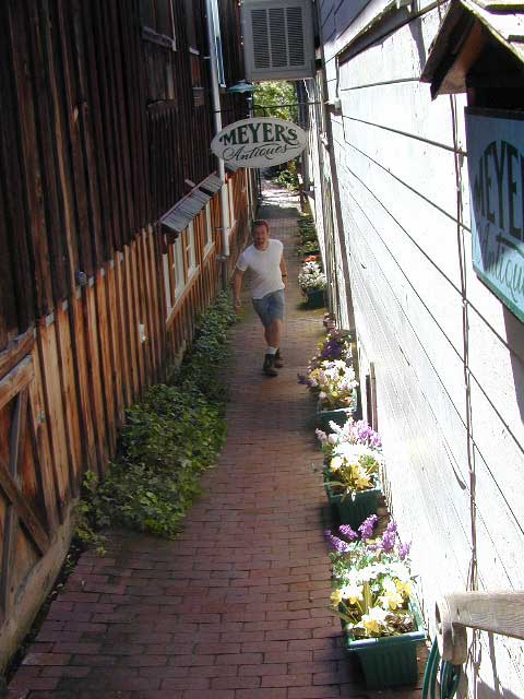
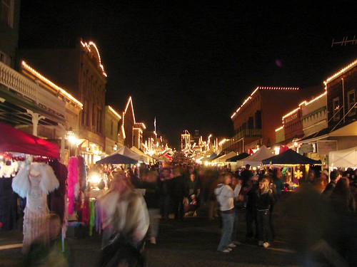
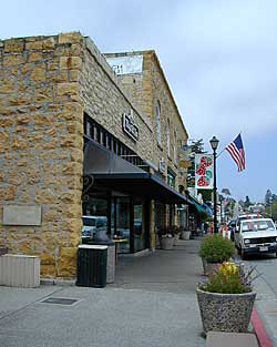
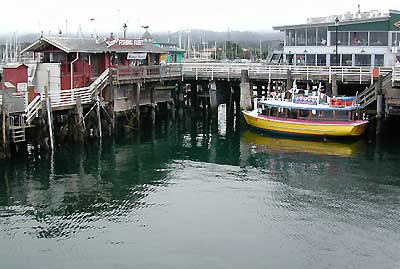
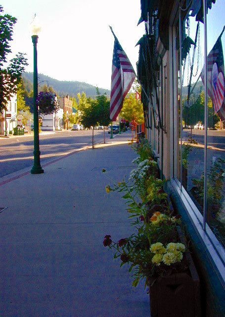
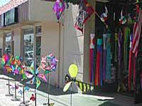
Listed on this page are California cities and towns that are well known for their shopping – downtown villages, boutiques, art galleries, gift shops, antique stores, shopping plazas, factory outlets, malls and restaurants.

    Road trip weekends, all local – for super unique Christmas presents or romantic Valentine’s gifts.