Tag Archives: in-route

Los Coyotes

los coyotes SD

Los Coyotes Camping
Los Coyotes Reservation Campground

North County San Diego
Camping SD

Way out there, on your way to the Borrego desert, past Warner Springs somewhere is this little gem of a location. Near the southern slopes of Palomar Mountain, on the edge of Cleveland National Forest.

Los Coyotes Band of Indians Tribal Campground

open to the public

Great rural location, in-route to many destinations in Southern Cal. Temecula wine country, Warner Springs, Culp Valley, Anza Borrego Desert State Park, Borrego Springs.

Campground is a popular spot with locals, so note that some weekends can get rowdy. Ask about a more secluded camp site option if needed. There is plenty of primitive land out here.

Oak trees and boulder hills, dirt roads, near Hot Springs Mountain. North San Diego County.

Los Coyotes Band of Cahuilla & Cupeño Indians

Warner Springs, CA 92086
RECREATIONAL# 760-782-0712
ADMIN# 760-782-0711

payherebooth

snowx
Hot Springs Mountain SD

Fort Churchill Camping

Desert camping south of Reno? Well there ain’t much to choose from out here. Walker Lake near Hamilton, NV looked dismal, so keep driving northbound and hope for the best.

Maybe one of the canyons near the reservation has a level pull out along the highway. Just far enough off the main road to hear the midnight traffic, just barely.

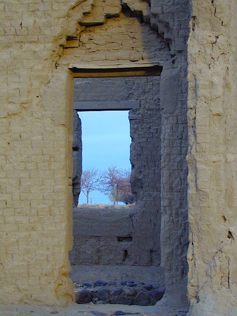
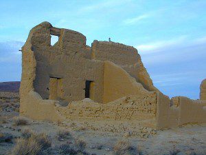
Fort Churchill, Nevada

churchill terrain

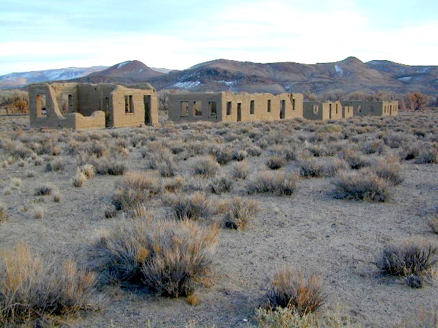
Fort Churchill was one of the original US Army forts built to help with the flood of overland pioneers making their way to California. Adobe structures in ruin, plus the sagebrush wetlands and cottonwoods along the river make for ideal scenery. A Pony Express route too!

Shall we call it the first of the California Welcome Centers?
Or an invasion of the “wildness” of the Sierra Nevada, and the West Coast.

From the year 1800 on – trappers, hunters, miners, ranchers, prospectors, surveyors, homesteaders – and basically everyone was headed westward, across the continent. The secrets of the golden state were unfolding worldwide. After gold & silver were discovered in the hills, the real rush to Alta California began.

California [population boom] history

Nevada California border

US Highway 95A

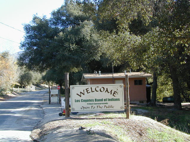
ALT95 – The Yerrington Cutoff

Ideal “in route camping” if traveling near Reno, south of Interstate 80. You gotta be off on the side route through Yerrington, Nevada to reach this convenient road side campground. Big trucks stick to the main highway, but this rural 2-laner cuts thru residential, reservations, and ranch lands. Rural backroads are abundant and most are private property.

Fort Churchill State Historic Park
Ranger Office
10000 Highway 95A
Silver Springs, NV 89429
775-577-2345

Nevada Desert Camping

OPEN ALL YEAR LONG

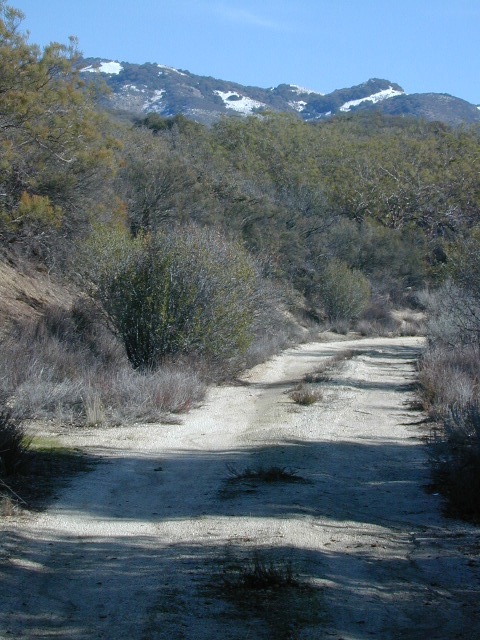
Driving on rural Nevada Highway 95A you can find the park headquarters and fort on the west side of the road. The camping is on the opposite (east) side of the highway, down an embankment, near the Carson River. A very small brown sign with the word CAMPING (reflects at night) and you may see it – if you aren’t driving 70 mph.

DESERT CAR CAMPING – VEGAS TO RENO

In Route Camp

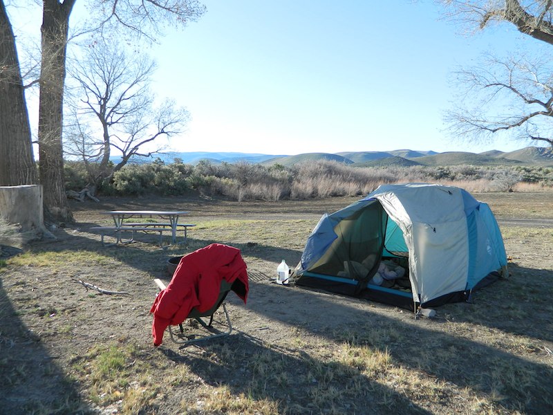
Perfect refuge for weary travelers, along the long, lonely, desert highways of Nevada. RV campers will like the wide dirt road w/ some level spots, accommodating the largest of motorhomes w/ dump station nearby. Trucks w/ trailers are often seen sleeping along the roadside at this location. Equestrian river access w/ horse trailers too.

Cottonwoods in some of the lower spots, but mostly sage brush, rabbits and open skies. This is the Carson River Basin, so dirt roads w/ mud and potholes are common. No street light near here. In the dark, the primitive roads are manageable, but the signs are minimal.

elevation 4250′
SNOW is minimal in WINTER months (DEC-MARCH)

Desperate tent campers (willing to drive dirt for a bit) can find the “scout camp”. Most nights are filled with the cries of the coyotes in the distance. Park rangers patrol in the morning to collect camp fees. Or you can find the park headquarters, across the highway.

fortchurchill

NO CAMP RESERVATIONS
Primitive campground has 20 sites suitable for travel trailers, motor homes or tents. Campsites include a table and fire ring, w/ camping limit of 14 days. Group camping is also available.

churchillruins

Turtle Mountain Road

Turtle Mountain Rd

Turtle Mountain Road
BLM Road # NS477

off U.S. Highway 95
in between Needles & Blythe, California

BLM: Bureau of Land Management – Desert Camping

Several miles south of the town of Needles numerous desert washes cross the highway with dirt roads leading off into both directions. Turtle Mountain is just one dirt road to explore in this region, but there are many more unmarked, secluded roads. This region is perfect for “campers in-route” traveling who need a quick overnight camp spot (off the freeway).

Turtle Mountain Road is a one lane dirt road that runs next to a wash, in between Turtle Mountain Wilderness and Stepladder Mountain Wilderness. Leading approx 12 miles from US Highway 95 to the northern edge of the desert wilderness. The Turtle Mountain route continues westward to meet Water Road with Old Woman Mountain Wilderness nearby. Sunflower Springs Road continues north to Essex @ Interstate 40

BLM signage along US Hwy 95 is minimal. Look for vertical brown markers w/ reflectors, numbers or names. Driving slower than typical traffic, coast at 50 mph and keep your eyes peeled to the west side. Turtle Mountain Rd is marked at the pavement, but the marker is very small.

Eastern California Desert Wildflowers

Exploring the eastern side of Southern California, one can find the Colorado River and Arizona border region an excellent destination for winter camping. Springtime offers wildflower blooms, open camping and decent weather with sunny 70 degree days. Wildflowers and BLM beauty awaits those who venture off the paved routes.

Pink Cactus Bloom

Palo Verde trees line the washes and much vegetation can be seen throughout this remote region. Cacti include the cholla, ocotillo, barrel, beavertail, just to name a few. Wildflower blooms here are just as good as Anza Borrego Desert SP.

MARCH & APRIL are both prime months for the desert bloom

BLM Desert Camping

Drive more than a mile from the highway if you plan to camp in peace and quiet, as the overnight truck traffic goes all hours.

RV accessible camp spots are few and far in between. They can be found in large, level pullouts close to the main road, but you will be hearing traffic zoom by. Some dirt roads are in better shape than others; Seasonal storms in the low desert can wash out even paved roads. 4×4 may be needed in some areas.

Open camping in this desert is free and there is plenty of room to spread out. Imagine not seeing anyone pass by your camp or drive down your road for days. Camping in a sandy wash may seem appealing, but you best know the weather forecast and if rain is at all predicted nearby, be prepared to break camp (in the middle of the night) before a flash flood hits.

The Needles BLM Rangers Office is located on US Hwy 95, on the south edge of town and they can provide maps and more information. BLM California Deserts

Needles BLM Office
1303 S. US Hwy 95
Needles, CA 92363
760-326-7000

Lake Havasu BLM Office
2610 Sweetwater Avenue
Lake Havasu City, AZ 86406
928-505-1200