Tag Archives: Ishi Wilderness

Hole in the Ground

mill creek days

Hole in the Ground, California

Hole-in-the-Ground Campground NFS NFSlogo
Lassen National Forest
dirt road access #28N06, off Hwy 172 @ Mill Creek, CA
South of Highway 36, near jct Hwy 89hiker

• Elevation: 4,300′
• Number of Sites: 13
• Vehicle Accessibility: No trailers
• Campsite Fee: Yes
• Campsite Reservation: No
• Campsite Water: hand-pump well
• Toilet: vault
• Length of Stay: 14 Days
• Season: April – October
• Trailheads: Mill Creek Trail

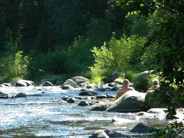
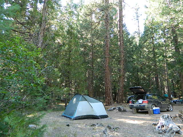
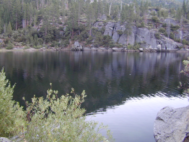
Shady pines campground situated near the wild and raging Mill Creek, on the south side of Mount Lassen. Outside of the Lassen National Park, this NFS camp offers a real backwoods feel and more seclusion. Easy foot access to Mill Creek and also the Ishi Wilderness.

Picnic tables and metal campfire rings provided at these campsites. Summers can be busy, but mid week you may have the whole place to yourself. NOTE: 3 miles dirt road access Lassen Forest Road #28N06. Trailers and large RVs are not recommended on this dirt road.

campsite 8

holeinthegroundsign

campfire fish camp

nearby towns – 

Lassen National Forest NFS

Lassen National Park NPS

NFSNFS web link USDA

yet another?

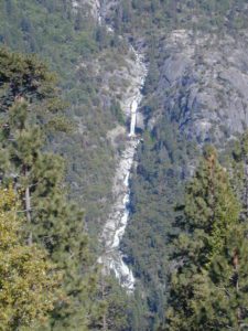
Hole in the Ground, is also the name of a remote wilderness canyon deep in the Sierra Nevada mountains. Located on the Upper Kern River – in Grasshopper Flat near Hockett Peak (8551′ elev). All inside the Golden Trout Wilderness;  accessible only by horseback or hiking trail. Find it on foot @ Jerky Trailhead on National Forest Road# 22S82

driftwood

holes_in_rock
Hole in the Rock
holeinrockbackside
Backside Hole in the Wall, Mojave NP

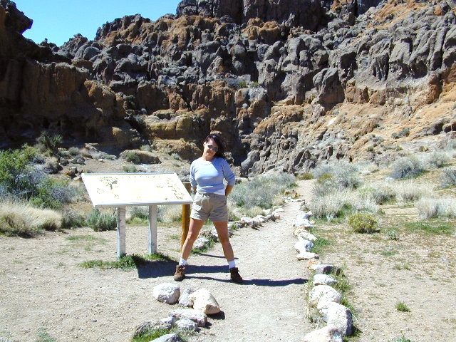
Hole in the Wall, California

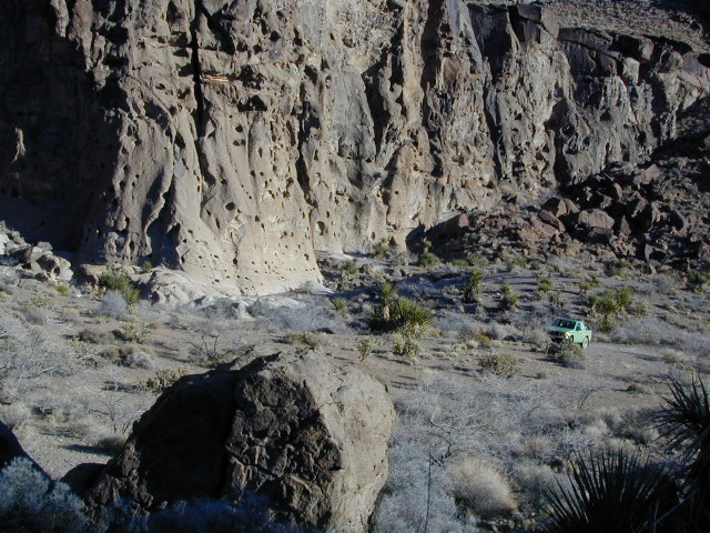
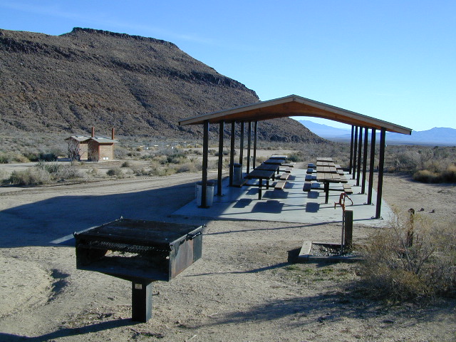
Similarly named, Hole in the Wall Campground is a popular spot in the Mojave National Preserve. Group facilities, horse corrals, developed campgrounds, centrally located, yet close to Interstate 40.

Stop by the “Hole in the Wall” Information Center (760) 252-6104, for more info and maps. The most popular hike, the Ring Trail, will leads thru rock face (above) to the campground on Black Canyon Road, on the other side of this huge rock wall.

Mid Hills Campground (nearby) has better choice on secluded camping, but rougher road to access. Mojave desert has abundant camping, so there is plenty space for everyone!

mojavehikes
Mojave Hikes @ Hole in the Wall


Black Rock Campground

Black Rock, California

At least 5 camping grounds called Black Rock around California.

Sierra Blackrock Reservoir

desert

SouthernCal Desert

Black Rock Campground @ Joshua Tree National Park

NPS

This popular camp is in Southern California, near the town of Yucca Valley, California. This is a NPS Campground w/ fee, reservations are recommended. Open all year long.

Joshua Tree National Park is nearby, but the campground is not located inside the park. It is however, a close to the town of Yucca Valley.

Black Rock Campground NPS
760-367-3001

• Elevation: 4,000′
• Number of Sites: 100
• Vehicle Accessibility: RV 40′
• Campsites Reservation: Yes
• Length of Stay: 14 Days
• Season: Open all year
• Trailheads: Warren Peak, High View Nature Loop, Panorama Loop

joshuatrees

Black Rock Horse Camp located next door, can accommodate up to 20 horses w/ corrals and room for RVs. With California Hiking & Riding Trail, group camp and equestrian facilities.

horseback


Sierra Nevada Mountains

LGVR
La Porte camping at the big Reservoir.

LGVR has a Black Rock Campground NFSlogoand boat ramp @ 5000′ elevation in Plumas National Forest. This is the only campground on the western shore of Little Grass Valley Reservoir – La Porte Road, La Porte, CA


northkings
North fork of Kings River , upstream.

Black Rock Lake (also known as Black Rock Reservoir) is located in the lower Kings Canyon region. North fork of the Kings River in Sierra National Forest; West of Kings Canyon National Park.NFSlogo

Sierra Forest Road #11S12 – a one lane, paved road – narrow, steep, RVs and trailers are not allowed.  Small campground, granite rocks, fishing, no boating.

gorgeview
Road #11S12, gorge view

NorthernCal

In the rugged volcanic canyons above Chico, CA – the Ishi Wilderness splits the landscape into volcanic rock ridges. Geologically, one of the oldest rocks in the Lassen National Forest. A small, rustic campground is way back in here – and if you are adventurous w/ a proper vehicle and bored – you could to go find it.

Black Rock Campground NFS

• Elevation: 2,100′
• Number of Sites: 6
• Vehicle Accessibility: High Clearance, maybe 4WD
• Camp Fee: No
• Campsites Reservation: No
• Length of Stay: 14 Days
• Vegetation: Oaks
• Season: Open all year
• Trailheads: Ishi Wilderness, Mill Creek Rim

hiker

Very long dirt road. Minimal facilities. Rustic and remote. No RVs.

Access from Highway 36, East of Red Bluff. Take Ponderosa Way.

Access from Cohassett Road in Chico. Cohassett Road all the way – up to Campbell Ridge, and then take Ponderosa Way.

Ponderosa Way is Lassen Forest Road #28N29, a dirt road access of 20+ miles. Unmaintained most of the year. Landslides and erosion are common on long dirt roads, so take caution and call ahead for road conditions.

In this wild canyon area, there are no services, maybe limited cell phone signal too. Beautiful views of the Ishi Wilderness, Mill Creek Rim and great swimming holes on Mill Creek.

This campground is not easy to reach. High clearance required on this route, but 4×4 is usually recommended.

You may need a chain saw depending on the time of year. Flash floods are possible in drainage from Mount Lassen, so check the weather forecast.

  • backpacking
  • camping
  • fishing
  • hiking
  • horseback
  • hunting
  • mountain biking
  • OHV trails
  • swimming

see more on Mill Creek California


butterfly

Black Rock City is a reference to the Burning Man festival

Annual event held in late August, on a dry lake bed in Nevada. Black Rock Desert BLM land, north of Reno, NV

4x4

Also similarly named Black Canyons & Black Mountains –

(located in Mojave Desert)

Black Canyon Road near Barstow, CA. Rainbow Basin, Owl Canyon Campground, Inscription Canyon petroglyphs. BLM Barstow

Black Mountain Wilderness

horseback

blackrockgroup
Mojave National Preserve Group Campground

Black Canyon Group Campground – high desert camping; near the Hole-in-the-Wall hiking trail in the Mojave National Preserve.
760 252-6108

  • group camping
  • equestrian camps
  • picnic areas
  • hiking trails
  • freeway close
mojavehikes
Mojave Hikes @ Hole in the Wall

Ishi Wilderness

Bridge and Chute from top of Black Rock

NorCal Ishi Wilderness

41,840 acres
20 miles N of Chico, CA
Lassen National Forest

  • Barkley Mountain (elev. 4488′)
  • Black Rock Campground
  • Deer Creek
  • Flat Iron Mountain (elev. 4400′)
  • Iron Mountain (elev. 3274′)
  • Indian Ridge Campground
  • Mill Creek
  • Peligreen Place
  • Pine Creek
  • Pinnacle Peak (elev. 3293′)
  • South Antelope Campground
  • Twentymile Hollow

Up in the mountains behind Chico sits a rugged landscape of deep canyons lined with bizarre rock formations and roaring mountain creeks. Wilderness encompasses lower elevations – ranging from 1500′ – 3500′  – making this outdoor destination a winter haven, when the rest of the backcountry is covered in several feet of snow. One of the most historic wilderness areas in the state, as the aboriginal existence of the Native Americans came to an end in this area.

COHASSET ROAD climbs up the volcanic fin of Cohasset Ridge into the pine forests high above the valley floor. The paved road becomes dirt and the road name changes to Ponderosa Way (Lassen Road# 28N29). The Ishi Wilderness can also be accessed from the north side via Highway 32, near the Tehama State Game Refuge.


View Larger Map

  • backpacking trails
  • hiking trails
  • fishing creeks
  • horseback trails
  • wildlife viewing


Ishi Wilderness mapIshi Wilderness Map

Ishi Wilderness