California has no shortage of 4 wheel drive vehicles, but how many of them actually use them for what they were intended? If you’ve had your 4WD for a while and are itching to get to know the local trails, then grab yourself a few good OHV maps & head for the hills.
If you are a total novice and think you might want to get familiar with routes, what your vehicle can and cannot do, and learn the ropes from the pros, then you might want to discover the friendly folks in your local 4×4 club. Below we list as many legitimate groups we can find, with or without web sites. If your club is not listed, then please contact us & we might add it.
Anza Borrego Desert Washes
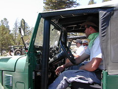
Off roaders (with running rigs) can enjoy pre-planned back road trips with various 4×4 Groups in California:
Being the largest State Park inside California, Anza Borrego has certain advantages. Lots of land to explore, abundant dirt roads, free camping and a very diverse terrain. Located in SoCal, this desert has lots to offer the outdoor enthusiasts, all year round.
Anza Borrego Desert
with hundreds of miles of dirt roads to explore
SUV / 2WD / AWD / 4WD / 4×4 / OHV
The Anza Borrego desert, in east San Diego County, is quite large and very easily accessible from Southern California. The park spans mid-elevation, mountain foothills (3000′ elevation) down to dry lake beds near sea level. Large, vast and varied terrain – and full of vegetation in certain spots. Borrego Desert Wildflower blooms attract thousands of visitors between March-May each Spring.
While the majority of the dirt roads inside the ANZA DESERT are passable with a regular passenger car (on most days), some specific areas and routes are indeed considered “too hairy” and may require a 4 wheel drive. Rains change landscape fast in this region, so know before you go.
FLASH FOOD WARNING: Wet weather (anywhere nearby) can make a mild, soft, sandy wash into a wild, flowing river. On occasion desert washes are ‘washed out’ during big rain, often becoming mini rivers that can swallow your vehicle; Road and weather conditions can change suddenly in the California deserts. Wind can also play a huge factor in a selecting a decent camp site. Know the weather report in advance and always be on the watch for big clouds on mountains to the west.
Deep sand washes, steep sandy hillsides, boulder passes, rock yards to boulder hopping, soggy bottoms to straddling ruts, the deserts of SoCal are indeed fun and challenging. Enjoy your public lands responsibly and pick up some litter, stay on the trail and do not target shoot inside park boundaries.
To find these off-roading areas: OHV routes, camp areas and gear heads galore. Or try avoid them. Keep reading.
Anza Borrego Desert State Park itself is NOT AN OFF ROAD PARK. If you want the free-for-all, open, OFF-ROAD areas, with sand dunes and terrain to explore, then the list above should help. Some places can be secluded and private for camping, and only one Jeep may pass by (for the whole weekend).
On the other end of the spectrum, most OHV camping areas are closer to paved routes and busy w/ motorized activity. On weekends, traffic, events and crowds are the norm. ATV, dirt bikes, buggies, quads, jeeps, families, RVs. Often, a big noisy scene.
Seeking to travel to distant places to avoid crowds? then this site can help point to the best destinations. Follow links, browse images, get a decent topo map – and discover private desert camping for free.
most w/ 2WD access; high clearance vehicle is preferred (and as usual, 4WD may be needed in storm conditions). Not all 4×4 routes will be signed. Signs get washed away in desert areas, so don’t count on them. Have a good hard-copy, topo map handy – just in case.
The Tom Harrison Map of Anza Borrego Desert is actually called the San Diego Backcountry Recreation Map and is by far the best seller of the region.
Wilderness Press makes an excellent topographic map for the Borrego Desert, with all the details on terrain and info for camping, hiking & off roading.
MORE AREA MAPS
The infamous west coast backpacking route, the Pacific Crest Hiking Trail runs above the desert (a few thousand feet), on the ridges of Mount Laguna.
Cleveland National Forest borders the west side of Anza Borrego Desert, on the rugged steep slopes of the big mountains (7000′ elev). More Maps links are provided:
Wetlands in the desert? Not that rare, water does flow downhill. Some established well-traveled roads may have added gravel to the soggy marsh areas, but many water crossings are bare, and vulnerable to erosion. Try to avoid driving in and around water. DRIVE SLOW through water where route crossing is obvious. Wildlife need these water sources to survive, so don’t muck it up.
Palm canyons and large boulders are numerous in this desert, water sources scarce. Camping near palms can be limited to walking distance. Several palm oasis camps along San Diego County Road S-2, some RV accessible. Even the county-run Hot Springs Park has some palms. Of course, Palm Canyon is the State Park Campground. Visitors Center headquarters in downtown Borrego Springs has the most popular hikes, hotels, restaurants, with abundant campground camping. Very walk-able town. Super hot during summer, triple digits!
back roads: weekends
Weekends are always busier than week days, in general, all over Cali. Keep that in mind when seeking seclusion. Camping in Anza Borrego desert is always best at least 2 miles off the pavement, well away from the traffic on the highway and for those masses seeking the easy camping.
Campfires always require a metal bucket in Anza!
OPEN-CAMPING: camping outside of developed campgrounds, also referred to as ‘primitive camping’ is quite common in Anza Borrego desert. Many Borrego Camping Areas are accessible with regular cars, close to main roads and usually have no bath rooms, or facilities. The further you drive from the pavement, the more likely you are to encounter obstacles like boulders, deep ruts, soft sand and uneven terrain.
elevation 5800′ – Canyon Creek connects Lake Faucherie, Sawmill Lake and Bowman Reservoir in the Sierra, Tahoe National Forest. 20+ miles of backroad travel, off I-80.
While many consider Faucherie to be the most beautiful scenic lake, Sawmill Lake just downstream a couple of miles is still quite attractive – with dense forests and a granite mountain backdrop. Sawmill is especially nice for those who like to primitive camp, ouside of developed campgrounds. Way off the interstate @ Hwy 20, tucked in way back behind Bowman Lake a few miles, you can find Sawmill Lake.
Fishing and camping, kayaking and canoeing are all popular recreation around this lake. A trailhead on the northend of the lake leads out to even more alpine lakes (a day hike “lake loop” or backpacking option). The Pacific Crest Trail is also routed nearby.
No motorized boats or watercraft allowed. No boat ramps, no pavement, no picnic tables, no bathrooms, no fees.
4×4 Lake
Fishing Lake
Free Camping Lake
The north shoreline is abundant with dispersed campsites: metal fire rings and a clearing only; no picnic tables, no toilets. Self sufficient campers only. Campfire permits, a water bucket and a shovel are required. During extreme fire restrictions campfires may not be allowed. Check with local rangers for up to date info.
Most campsites are drive up and park, while others closer to the shoreline have only walk-in access. Hauling your gear down hill won’t seem unthinkable once you’ve seen the lakeside views. There is even a camp below the dam, next to the waterfall.
The main access Road #843-037 is very rocky and 4x4s love to frequent the area. The backroads here are best suite for truck travel, high clearance vehicles, off-roaders and SUVs. No small RVs or trailers. Passenger cars are not recommended. The access roads around the lake and up to the lake are dusty and rugged. The road below the dam is quite rough w/ rocks.
The water at Sawmill Lake is crystal clear snowmelt. The lakes around here are managed by Nevada Irrigation District, so this is why there are no engines allowed on the lake. This canyon area closes to public entry during winter months (NOV-APRIL), due to deep snow.
Several miles south of the town of Needles numerous desert washes cross the highway with dirt roads leading off into both directions. Turtle Mountain is just one dirt road to explore in this region, but there are many more unmarked, secluded roads. This region is perfect for “campers in-route” traveling who need a quick overnight camp spot (off the freeway).
Turtle Mountain Road is a one lane dirt road that runs next to a wash, in between Turtle Mountain Wilderness and Stepladder Mountain Wilderness. Leading approx 12 miles from US Highway 95 to the northern edge of the desert wilderness. The Turtle Mountain route continues westward to meet Water Road with Old Woman Mountain Wilderness nearby. Sunflower Springs Road continues north to Essex @ Interstate 40
BLM signage along US Hwy 95 is minimal. Look for vertical brown markers w/ reflectors, numbers or names. Driving slower than typical traffic, coast at 50 mph and keep your eyes peeled to the west side. Turtle Mountain Rd is marked at the pavement, but the marker is very small.
Eastern California Desert Wildflowers
Exploring the eastern side of Southern California, one can find the Colorado River and Arizona border region an excellent destination for winter camping. Springtime offers wildflower blooms, open camping and decent weather with sunny 70 degree days. Wildflowers and BLM beauty awaits those who venture off the paved routes.
Palo Verde trees line the washes and much vegetation can be seen throughout this remote region. Cacti include the cholla, ocotillo, barrel, beavertail, just to name a few. Wildflower blooms here are just as good as Anza Borrego Desert SP.
MARCH & APRIL are both prime months for the desert bloom
Drive more than a mile from the highway if you plan to camp in peace and quiet, as the overnight truck traffic goes all hours.
RV accessible camp spots are few and far in between. They can be found in large, level pullouts close to the main road, but you will be hearing traffic zoom by. Some dirt roads are in better shape than others; Seasonal storms in the low desert can wash out even paved roads. 4×4 may be needed in some areas.
Open camping in this desert is free and there is plenty of room to spread out. Imagine not seeing anyone pass by your camp or drive down your road for days. Camping in a sandy wash may seem appealing, but you best know the weather forecast and if rain is at all predicted nearby, be prepared to break camp (in the middle of the night) before a flash flood hits.
The Needles BLM Rangers Office is located on US Hwy 95, on the south edge of town and they can provide maps and more information.
Needles BLM Office
1303 S. US Hwy 95
Needles, CA 92363
760-326-7000
Lake Havasu BLM Office
2610 Sweetwater Avenue
Lake Havasu City, AZ 86406
928-505-1200


 SDBKCO Recreation Map


