Tag Archives: kern

Hot Springs Hikes

Soaker

California Hikes to Hot Springs

California has many natural hot springs, most requiring a drive into the mountains. Some are rustic resorts, some are developed campgrounds, most are located on paved roads. The very remote tubs are the ones hidden in the secluded wilderness  – only accessible by foot.

campfires Plan to camp overnight? Fire Permits are required if you plan to build a campfire or use a camp stove.

HIKE-IN ONLY HOT SPRINGS

hikes

Buckeye Hot Springs requires a steep half mile trail down to the creek edge.  N of Bridgeport. Eastern Sierra @ Buckeye Creek Road #017.

Deep Creek Hot Springs is a SoCal favorite, but with that convenience comes the crowds. Located on the desert side of the mountains from Lake Arrowhead.

Gaviota Hot Springs is a short hike along a lush canyon. Close to US Hwy 101 and located in between Goleta and Solvang.

Kern River Gorge, Sequoia NF – Both Jordan Hot Springs & Kern Hot Springs accessible only by backpacking many miles, from Jerky Trailhead. Backpack and horseback access only. Golden Trout Wilderness.

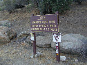
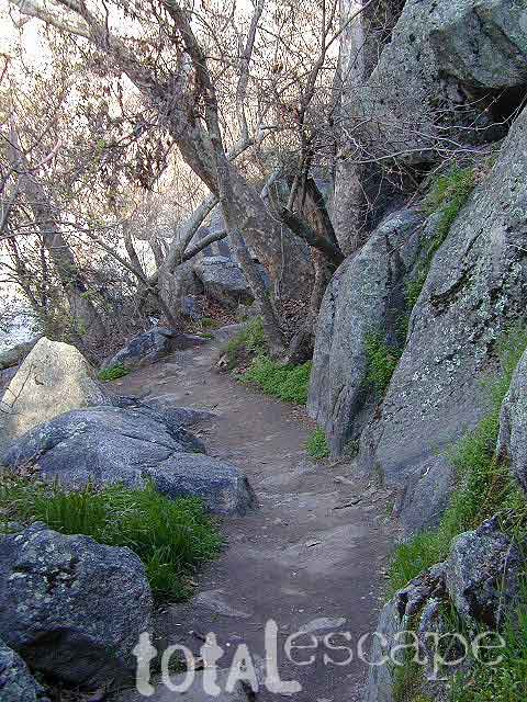
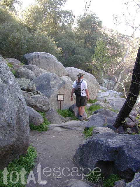
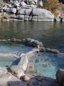
Remington HRemingtonot Springs requires a steep but short half mile trail down to the river edge. Lower Kern River. Old Kern Canyon Road @ Remington Trailhead# 32E51 – Remington Ridge Trail is a multi-use trail. Bike, hike, horseback on oaks hills. Wildflowers in Spring.

Sespe Hot Springs requires an 18 mile round trip hike. Usually enjoyed as an overnight backpacking trip. A very challenging and long trek as a day hike. Los Padres National Forest.

Sykes Hot Springs requires a strenuous 10-mile hike from Big Sur Station. Hike inside of Los Padres NF. Usually enjoyed as an overnight backpacking trip, or a very long day hike for the fittest of folks.

gaviota pools

California hikes

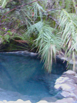
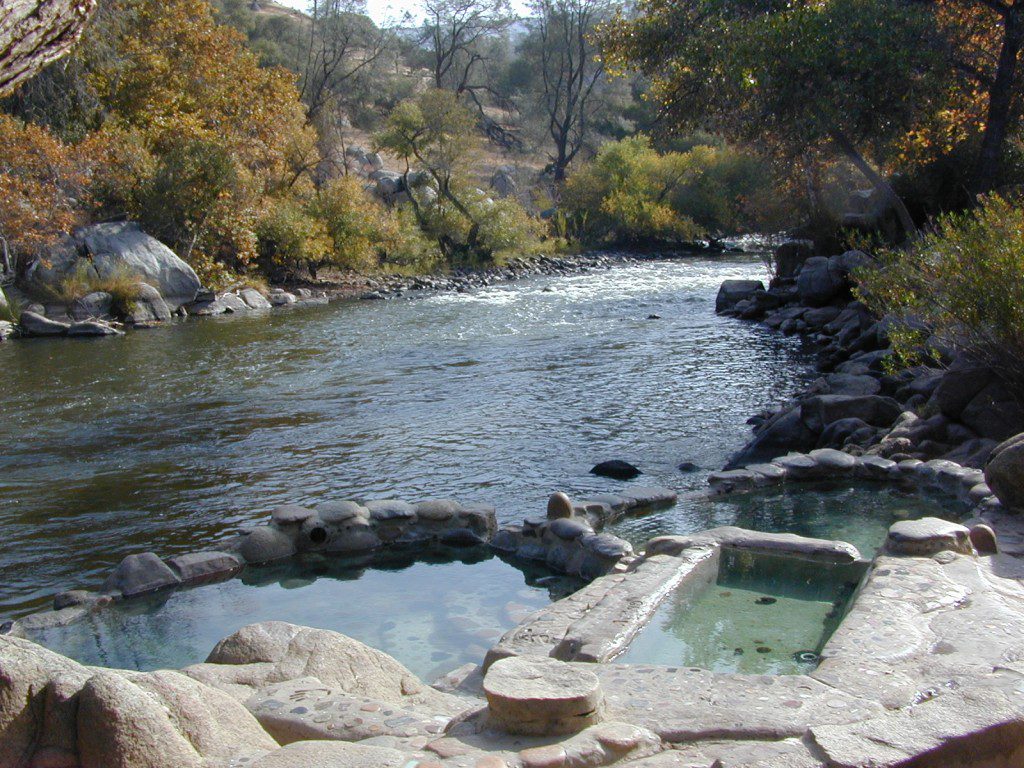
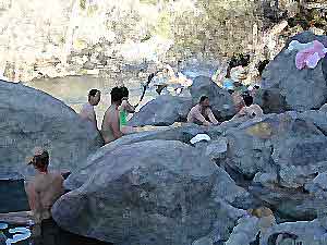
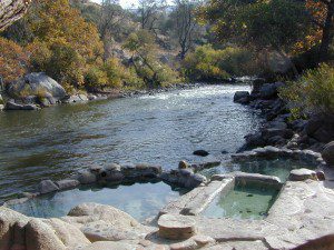
Kern Hot SpringsRemington tubs overlooking the Lower Kern River

Kern River Hot Springs

Kern Hot Springs

Kern River Hot Tub

From Lake Isabella down to Bako, along Hwy 178, numerous natural hot springs can be found in this lower Kern river canyon. Old Kern Canyon Road has plenty of primitive spots to camp along the road, way above the Kern River. This Southern Sierra Nevada scenic route, a 20 mi winding narrow paved road, is the old highway that leads up to Bodfish CA.

At least a dozen dispersed camp sites can be found along the Old Kern Cyn Rd, some spots with views over canyon, some hidden & shady, many spots are level & large – suitable for RVs. No facilities, no fees, just a flat, dispersed site. Campfire permits are required for fires outside of developed Campgrounds & fire restrictions are often high, so no fires are allowed much of the year. Most of the gates on the Lower Kern are now locked & only accessible by Forest Service personnel, ranchers or local rafting companies with permits.

2 developed Lower Kern Campgrounds are located on the Old Kern Canyon Road, which parallels the 4 lane portion of the highway: Hobo Campground & Sandy Flat Campgrounds, if you really need a picnic table & bathroom. You can reserve camps by clicking the links.

Miracle Hot Springs – next to Hobo Campground. This hot tub park is closed for good. A few portable bathrooms, picnic tables & trash bins, the hiking trails clear; 2 shallow pools partially filled. Maybe enough room to soak your butt, but not fully submerse yourself. Someone really needs to renovate this place! Update 2012 – the signs for Miracle are now completely gone.

Remington Hot Springs

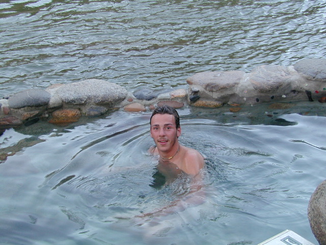
This one is by far the most popular now that Miracle is gone. The hike-in only access doesn’t deter people much and many choose to set camp overnight close by. The local authorities are always making the rounds to double check on the area – which is good for security and bad for the 2 AM party animals.

Kern recreation

Democrat Hot Springs

private resort now open? Heck, I dunno. (2017, democrathotsprings.com is down. They might be trying to promote a River Festival held in May.)

The hotel and cottages were constructed to accommodate guests that came in stage coaches to dine and relax during the early 1900’s. Five springs on the property flow at 115 degrees into large soaking tubs and a swimming pool. Closed to the public for more than thirty years, the resort is once again ready to be brought to life for groups and private events only.

Kern recreation

The hot springs listed below are Private Property, so don’t get caught – and don’t get shot:

Delonegha Hot Springs

Concrete tubs were built by homesteaders, later a hotel and boarding house were constructed. Stage coaches from the San Joaquin Valley took 2 days to get visitors to this area. The hotel closed in 1912, when more accessible areas of Democrat and Hobo were built. Remaining cement tubs run along a rock peninsula overlooking the Kern River; water temperatures average 112 degrees. This private property is fenced.

Scovern Hot Springs

Also known as the Hot Springs House. 1902 mud baths were being offered and the wooden tubs were replaced by galvanized tubs. A swimming pool and bath houses were added when the Scoverns bought the property in 1929. Bath house burned to the ground in 1971 and only a vacant lot remains. Steam can still be seen in the fields across from the springs, where water runs at 140 gallons a minute @ 115 degrees.

NEARBY TOWNS –

ALTA SIERRA CA

KERNVILLE CA

LAKE ISABELLA CA

WOFFORD HEIGHTS CA

MAP OF THE KERN RIVER –

Sequoia National Forest Map
Kern Hot Springs

West Kern

festivals kern

CA Kern / western Kern county

Kern County is known for its oil, its agriculture, and outdoor recreation. The Kern River is the highlight of the region with lush, green and grey granite canyons, a big reservoir & the Sequoia trees just up the road. On the western side of Kern County are small towns like Frazier Park, the golfing cabin community of Pine Mountain Club, plus the oil meccas of Maricopa and Taft. Expansive Lockwood Valley enters into Ventura County. Cuyama River borders Santa Barbara & SLO counties.

Much of the western Kern area is rural ranch land, desert or forest. Los Padres National Forest, Chumash Wilderness, Bittercreek Wildlife Refuge, Wind Wolves Preserve, Buena Vista Reservoir, Ballinger Canyon, Hungry Valley and Fort Tejon State Park all call this region home, right on the mighty tangent of the San Andreas fault line. The San Emigdio range and the surrounding mountains of Mt Pinos and Mount Able design a perpendicular range to the Central Cali coastline, connecting the huge Mojave desert to the ocean. Cerro Noroeste is a very scenic drive.

The 17 mile long Quatal Canyon, where the indian camp of Mahu Tasen hosts a Bear Dance every summer is also a wild place of bird watching, camping and hunting. The indian word for Mount Pinos is “Iwihinmu” – a sacred spot for Chumash Indians, as well as others; Chumash call it the ‘center of the world’. Locals respond regularly with music, hikes, star gazing, drum circles (seasonally) and local festivals (annually) .

PHOTOS: Los Padres Photos | Miller Jeep Trail Off Roading Photos

Drum Camp Pinos | Drumming Cerro Noroeste

Tecuya Ridge

Tecuya Ridge, Cuddy Valley 4×4 trails can keep you busy for a whole weekend of back road exploring.

boating, camping, dirt biking, fishing, hiking, horseback, hunting, mountain biking, off roading, skydiving, xc skiing

DSCN0029

Quatal Canyon

Old West Days in Randsburg CA

bands

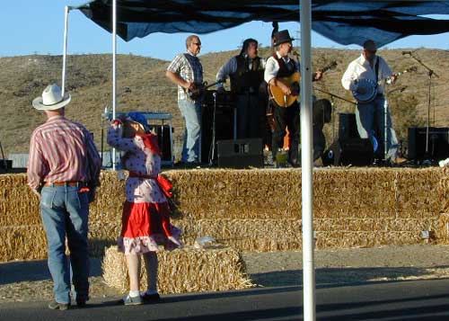
Old West Days in Randsburg

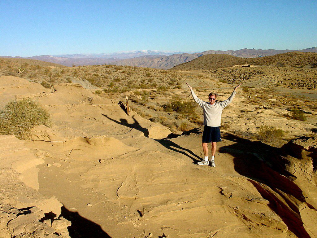
Many old west towns are still in existence in California, but few are as unique as the Randsburg Mining Camp in the Northern Mojave desert, where Hwy 395 meets the 14. The sleepy desert town is a hub of activity ( on weekends) for car clubs, dirt bikers, of-roaders & travelers passing through. Mid week you’ll see the locals and fewer tourists.Green Shack


This high desert annual event is on the third Saturday in September every year, music street fair is the biggest day of the year for local residents & tourists alike. Historic sights, donkeys, horses, cowboys, live music, food & all the fun you can imagine in the middle of nowhere. One day only!

Sponsored by the Rand Desert Museum

Annual event: September
760-793-3147

Randsburg, CA

JLRansb14


Post Office Cat


Night Time Entertaining Ourselves

Jennie Lakes Wilderness

horse meadow trails

Sequoia / Kings Canyon / Mitchell Peak

outta print

USDA MAP may be out of print 2017

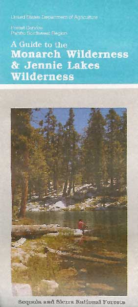
Jennie Lakes Wilderness is located in between two popular National Parks, via the paved back roads off Sequoia Generals Highway 198. Monarch Wilderness is north of Jennie Lakes, bordering Kings Canyon.

10,500 acres
26 miles of trail

Two lakes, Jennie Ellis Lake and Weaver Lake, set among granite outcroppings. Majority of the wWilderness is above 7,000 feet w/ red fir, lodgepole pine, and western white pine forest near treeline; abundance of spring wildflowers fill meadows. The two main lakes and Rowell Meadow are primary destinations for most backpackers wanting to camp overnight.


Sequoia National Park

Kings Canyon National Park

Monarch Wilderness

Impressive granite canyons, super steep. LOts of rugged rocky terrain, lower elevation to peaks of 11,000′. KINGS RIVER – Longest raging river in the Sierra, headwaters originating near Mount Whitney.

Road#14S11 – Big Meadows Road

National Forest & Wilderness Permits –

USDA Sequoia NF

More Wilderness Info & Links –

sierrawild.gov/wilderness/jennie-lakes
summitpost.org/jennie-lakes
Jennie Lakes Wilderness Wiki

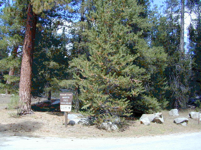
Marvin Pass trailhead
Marvin Pass trailhead, 12 miles down Rd#14S11

Another Big Meadows?
Indeed, southern SEQ NF, on the East Kern Plateau.

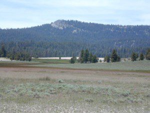
Golden Trout Wilderness

Golden Trout Wilderness Area

granite Upper Kern River is Mount Whitney snow melt
  • 303,511 acres
  • elevation range 1,000′ – ­13,000′
  • pine forest, chaparral
  • granite walls, domes
  • 379 miles of trail
  • summers are busy
  • snow in winter
  • best in early spring
  • wood fires may be restricted
  • portable stoves permitted
  • water plentiful
  • rock climbing & mountaineering
  • fishing
  • backpacking
  • primitive hot springs
  • waterfalls, swimming holes
  • wilderness permits required for overnight
Golden Trout Wilderness surrounds the mighty gorge of the Upper Kern Canyon, south of Mount Whitney.
Inside

TULARE COUNTY

bordering

Inyo National Forest

Sequoia National Forest

Eastern Sierra Interagency Center
760-876-6200

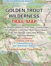
Golden Trout / South Sierra Wilderness Map USDA

Golden Trout Trail Map

Located in the South Sierra Nevada mountains alongside the Southern Sierra Wilderness. Inside the remote rugged peaks of a deep, granite crevasse known as the Upper Kern River with ancient Sequoia forest to the west and to the eats, some of the tallest peaks in the Sierra range. This wild land area is home to the California golden trout and is the main water flow southward from the tallest peak in the lower 48  – Mount Whitney on the Eastern Sierra front.

Sequoia National Forest
Monache Meadows
Inyo National Forest
Mountain Home State Forest
Sequoia National Park
Mineral King

Golden Trout Wilderness

Roads, campgrounds and trailheads surrounding Golden Trout Wilderness

Eastern Sierra –

Horseshoe Meadows Road (paved) leads up to high elevation meadows from the high deserts of Lone Pine, CA. Pacific Crest Trail (PCT) access; Mount Whitney and John Muir Wilderness are to the north. Equestrian corrals and horse trails. Camping is limited to a one night stay at any of the 3 campgrounds up here.

Golden Trout Trailhead Campground: elevation 10,000′ / 12 walk-in sites / closed winter
Horseshoe Meadows Campground: elevation 10,000′ / 18 walk-in sites / closed winter
Cottonwood Equestrian Camp: elevation 10,000′ / 10 horse corrals / closed winter

Forks of  the Kern –

Fork of the Kern / Loyds Meadow Road #22S82 – This main paved road connects the Kern River (Sierra Hwy Road #99) to the lower elevation, granite slopes of the Western Divide, and the route dead ends at Jerky Meadow parking lot. Camp 1-6 are primitive camp areas located on dirt side roads and 4×4 might be required on some of them. Obtain a campfire permit from rangers in Kernville. Fishing, camping, waterfalls and swimming holes are popular in this region. The big developed camp along this road, is located 10 miles up, in a pine filled valley on Peppermint Creek on the west side of the street and is within the Giant Sequoia National Monument.

Lower Peppermint Campground: elevation 5300′ / 17 camp sites / open year round

Lloyd Meadows @ Sequoia Forest Road# 20S67 – is the Forks of the Kern Trailhead & the dirt road that accesses it, is very popular among equestrian campers.

Western Divide Highway –

Road #20S79 leads from Western Divide Hwy to Lewis trailhead.
Road #20S50 leads from Western Divide Hwy to 2 hiking trailheads.

Sequoia National Park, Three Rivers, CA –topo maps

South Fork Road leads up Kaweah River at Southfork trailhead.
Mineral King Road is only open seasonally, access to high country lakes and trailheads.


SEQUOIA AREA MAPS –

Golden Trout Wilderness Maps
Sequoia National Forest Map USDA
Inyo National Forest Map USDA
Mineral King Map
Sequoia & Kings Canyon NP Map
NatGeo Sequoia Kings Map

Golden Trout Wilderness trailheads:

east side –
Cottonwood Trailhead (near Lone Pine)
Blackrock Trailhead (Monache Mdws)

south side –
Jerky Trailhead
Forks of the Kern Trailhead
Lewis Camp Trailhead (Western Divide)
Summit Trailhead (Western Divide)
Clicks Creek Trailhead (Western Divide)
Camp Wishon Trailhead (Western Divide)

west side –
South Fork Trailhead (Three Rivers)
Atwell Mill Trailhead (Silver City)
Franklin Pass Trailhead (Mineral King)

List of nearby towns:

Miracle Hot Springs

MIRACLE HOT SPRINGS on Lower Kern River is now closed!

Kern Soakers

Hidden well by the dense vegetation, this multi-tub location provides a peaceful setting along the Kern River. Located on the Old Kern Canyon Road, (aka Old Kern Road) that parallels the main 4-laner Highway 178. The broken and dismantled tubs are inside a grouping of granite boulders, overlooking the Lower Kern River.  NFS Campground is walking distance away. Week days you can have the place to yourself for picnics, river fishing and hiking. Mountain biking and hiking trails at Remington trailhead.

DanaMite’s Tip: This place has no operating hot pools unless you plan to physically dam up a tub with a few found rocks. Rangers do not like this practice. If you wanna camp at Hobo Campground you can walk over & hike around to check it out. Worth a look.

Camping available next door at Hobo Campground. A few primitive spots are located on the Old Kern Canyon Rd. Free car camping, and some sites big enough for level RV camping. See the rangers at the Sequoia Mapslake for Sequoia National Forest ranger and fire permit and check fire current restrictions.

Remington Hot Springs is only 2 miles down river, but it does require a short hike and it gets very busy on weekends!

nearby towns:

Bodfish, CA
Kernville, CA
Lake Isabella, CA
Wofford Heights, CA
Alta Sierra, CA