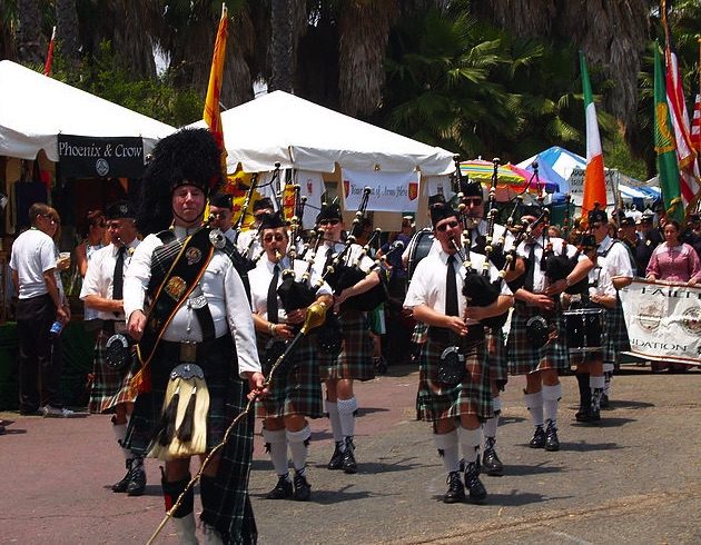
The Largest Irish Festival in the West. Live music, vendors, food and games. St. Patrick’s Day Parade.
The Pike in Long Beach
95 South Pine Ave.
Long Beach, CA
Annual event; June

The Largest Irish Festival in the West. Live music, vendors, food and games. St. Patrick’s Day Parade.
The Pike in Long Beach
95 South Pine Ave.
Long Beach, CA
Annual event; June

Auto race where the road course carved out of the downtown city streets of Long Beach, California
Annual event: April
LONG BEACH CA
888-827-7333

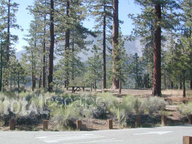
San Bernardino National Forest: Heart Bar Campground
![]()
At Hwy 38 & Forest Road #1N02 is a huge, pine forested valley, right next to San Gorgonio Wilderness. Heartbar Campground, Heart Bar Horse Camps, RV Dispersed Sites. Highway 38 – SE of Big Bear Lake, California; Mountain Bike, Hiking & Equestrian Trails with ridges of 10,000′ elevation. SAN GORGONIO peak nearby. Best high elevation scenery for SoCal by far.
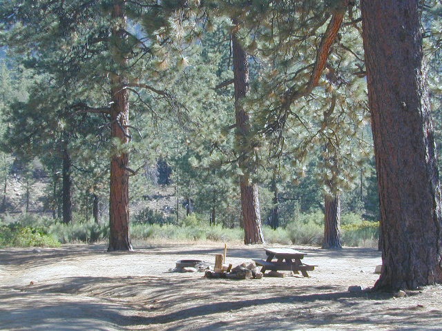
This gorgeous valley is a developed recreation area w/ 89 camp sites, plus big equestrian area. Picnic, hiking, mountain biking, horseback trails, plenty RV spots, even a creek. (Oooops I meant the Santa Ana River) Highway 38 is kinda the long way into Big Bear Lake, up thru Angelus Oaks. Locals call this stretch of the highway Barton Flats.
![]()
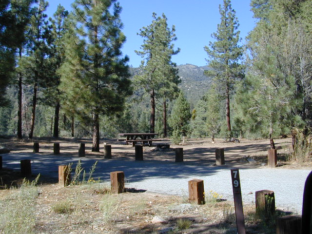
Bring the Horses & RVs
Leading out the back way of HeartBar, past the horse camp – is a nice one lane dirt road, narrow in spots, with random, primitive camp sites along the roadway. Authorities refer to these spots as yellow post camp sites.

Big Bear Discovery Center
at Big Bear Lake
909-382-2790

nearby mountain communities:
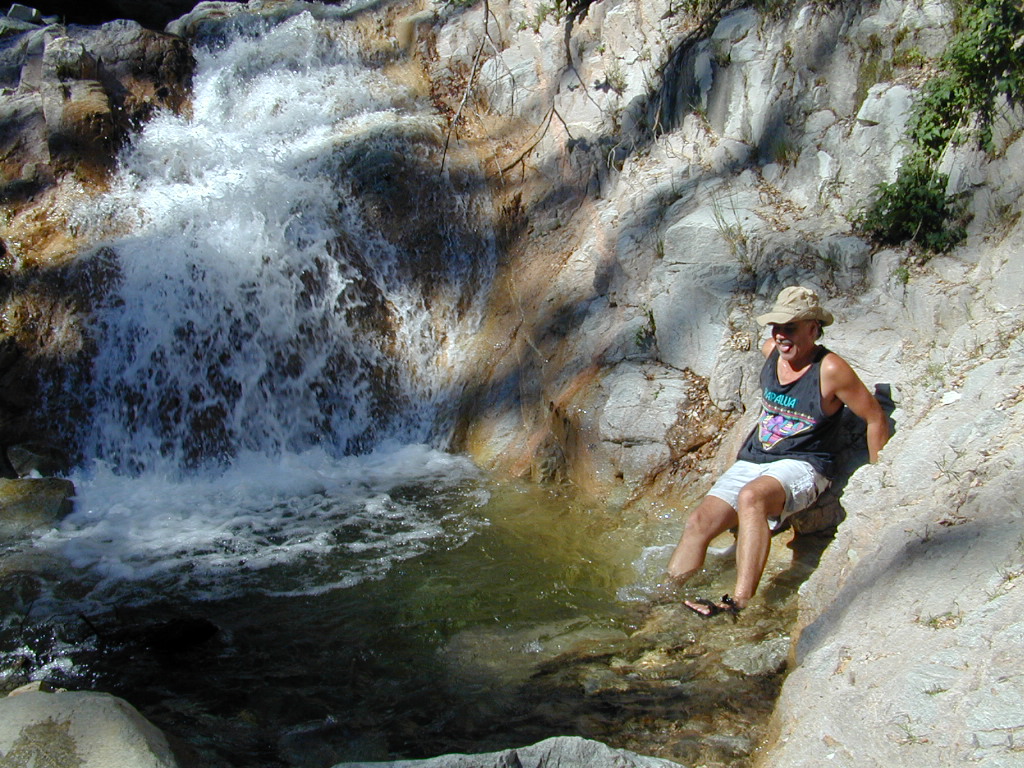
Forest Falls is well worth a stop for a quick picnic or hike – and head dunk. Weekends can be busy and crowded. Since this location is close to Southern California and the population centers, expect weekends to be busy in the Big Bear mountains. Plan a trip for week days to experience less people, and more nature.
The Great Basin meets California, at the Eastern Sierra Nevada Mountains

East of Yosemite NP
Lee Vining, CA

Rumor has it this lake basin could be the ancient super volcano of the region. MonoLake is located on the north end of the Long Valley Caldera, a volcanic ridge which stretches down to Bishop and parallels Mammoth Mountain & US 395.
Huge shallow lake with a very turbulent history. Signs and plaques throughout the lake shore give info on ancient history of the lake, the wildlife, and regional detail. Majestic views of the Sierra Mountains, with sparse vegetation, lunar type landscape. Eerie with storm clouds; Beware of bad weather. Kayakers love this lake too!

Canoeing
Hiking
Hot Springs
Kayaking
Picnic
Primitive Hot Springs
Stargazing
Volcanic Landscape
Mono Lake Camping
Camping is closeby, but not located on the fragile lakeshore.
![]()
Dispersed camping (FREE) is allowed in Mono Basin National Forest Scenic Area, the region that surrounds the Tufa State Natural Reserve. Campfire permits are required. Contact the park listed below for all the details on the camping policy.
![]()
Camps include National Forest Campgrounds in Lee Vining Canyon (8 miles), June Lake Loop (15 mi), Lundy Lake (12 mi). Private RV parks can be found in nearby Lee Vining and further south, at Lake Crowley.
[PDF download]
Camping In The Mono Basin
by LeeVining.com
Inyo National Forest USDA
Camping Mono Lake Ranger District
local links:
Mono Lake Tufa State Natural Reserve
California State Park
760-647-6331
Mono County Tourism
MonoCounty.org
760-924-3699
Mono Lake Committee
MonoLake.org
Bookstore @ 3rd, Lee Vining
760-647-6595

nearby interests:
Yosemite National Park
Inyo National Forest
Toiyabe National Forest
Benton Hot Springs
Bodie Ghost Town
Convict Lake
Mono Craters – Panum Crater & Crater Mountain
Long Valley Caldera
Lundy Lake
California Aspen Groves
Autumn Colors Camping

regional maps:
NatGeo Mammoth Lakes & Mono Map
nearby towns w/ lodging:
Benton Hot Springs
Bridgeport, CA
Lee Vining, CA
June Lake, CA
Mammoth Lakes, CA
another two bite the dust
localhikes.com – GONE
latrails.com – GONE
Millard Falls
2 mi RT; 1200′ elevation; oaks.
Arroyo Seco District –
of Angeles National Forest
818-790-1151
Altadena CA
From Interstate 210 in San Gabriel Valley, exit Lake Ave., go N & turn left/west onto Loma Alta Dr. & to Chaney Trail & follow signed dirt road
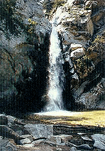
Sturtevant Falls
5 mi RT; 4600′ elevation; oaks, creek-crossings.
Santa Anita District –
of Angeles National Forest
818-899-1900
inside Big Santa Anita Canyon
From Interstate 210 in San Gabriel Valley, exit Santa Anita Ave.Go North/East, through neighborhood & up mountain to paved parking lot.
More hikes on Angeles Forest
nearby towns –
Angeles Maps – hiking, OHV & mountain biking –

Interstate 5 California (Kern & LA County)
Tejon is the largest and oldest privately owned ranch land in California. It spans from the northern slopes of the great central valley to the tops of the oak sided mountains. The Tejon Pass 4144′ elevation, is Interstate 5. The golden state freeway zooms by connecting north Los Angeles to the Central Valley…. at 80mph. Watch for CHP near here. It’s easy to go down hill at 90 and not even realize it.
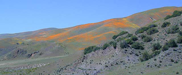
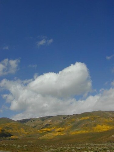
The old portion of this mountain pass is known as the Historic Ridge Route, and many overgrown miles can still be traveled on the back road. Off road and motorbike trails join up with old sections of crumbling highway between Lake Castiac and Pyramid. The artist Christo erected 1760 yellow umbrellas along these hillsides between Gorman and Tejon, back in 1991. Awesome wildflowers bloom throughout Tejon, Lebec to Gorman each spring from late March thru May.
Angeles National Forest is on the east side of the freeway w/ Castiac Lake and Los PadresNational Forest is on the west side, with Pyramid Lake. Back roads camping and total seclusion is prime pickins in this region, if you have a decent map and are willing to drive a little
Family campgrounds, RV astronomy sites, 4×4 camps on dirt roads, off road parks, walk in campground to alpine meadows, ridge line forest camps, backpacking, horsepacking, mountain biking, hiking. Numerous campgrounds can easily be found by driving 30 minutes from the “Frazier Park Mountain Road” exit off the freeway. Most folks aim for Mount Pinos, but the whole Los Padres forest is devine.
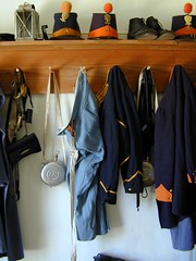
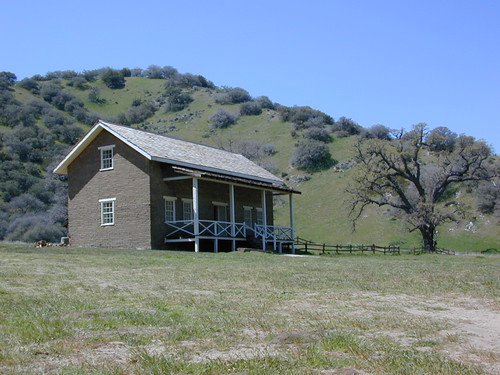
The fort location was established by the U.S. Army in 1854 and was designed to protect Native Americans. Restored adobes and museum feature exhibits on military life and local history. They also hold living history events performed by volunteers in costume. The park has a number of 400 year-old valley oak trees. Mister Peter Lebeck was killed by a grizzly here and there is even a tree to prove it.
Tejon Industrial Complex: This is the first large scale development in a master planned laid out by the privately owned Tejon Ranch Corporation. Another trucker stop on the opposite side of the freeway is already underway. In-N-Out Burger, Starbucks, McDonalds, IKEA distribution center, gasoline @ the bottom of the Grapevine. 30 miles south of Bakersfield & just down the hill from Lebec.
towns nearby –
 Angeles Forest Map |
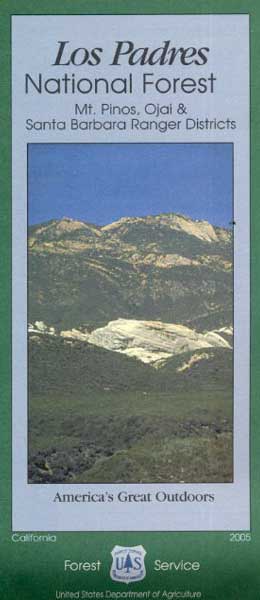 Los Padres Forest Map: South |
Headed to Kern River ?
KERN COUNTY RD 184 = LAVAL ROAD: Wheeler Ridge. This is your freeway exit northbound if you wanna bypass Bako city traffic, on the way to Lake Isabella & Kernville.
Gas up in Lamont, it’s cheaper on the north end of town. Great little taco shops abound. Best bypass thru the farm belt to the Sierra Nevada.