Tag Archives: maps

Your Public Lands

west coast public land

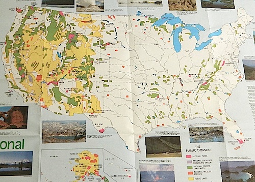
Access to wild land, open spaces, parks, forests, lakes, mountain peaks, public land – USDA National Forests, National Parks, State Parks, BLM. There is more public land available in the west half of the U.S., than anywhere else in the nation. This is one of the top reasons people relocate to the West Coast.

California’s Public Lands for Recreation

Federal lands, government managed parks, USDA National Forests, National Parks, National Wildlife Refuge, BLM, State Parks, State Forests, County Parks, Regional Open Spaces

containfire

Campfire Restrictions in California

Sierra Rivers

State Park / National Park / National Forest / BLM / SHP / SVRA / OHV
what’s the difference?
a simple explanation of your public lands & what you can expect to do on them

National Forest Campground
NPS

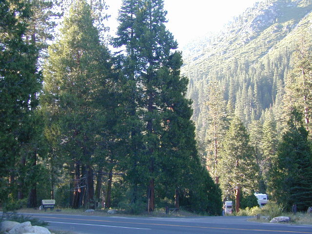
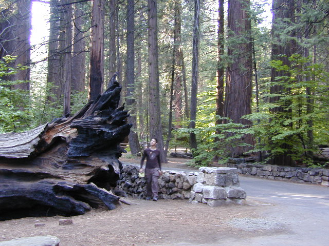
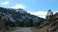
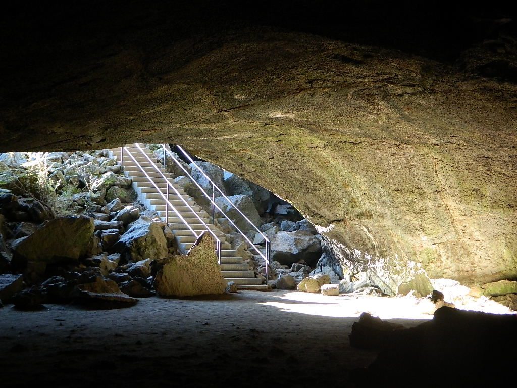
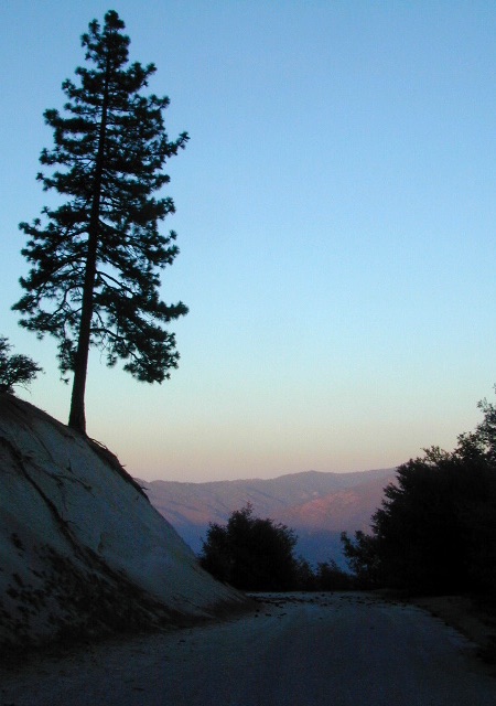
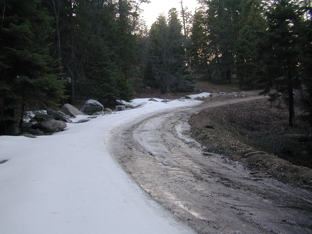
California National Parks – most National Parks are so crowded you can’t even enjoy the experience in the summer time. Try the off-season times for your best stay. Neighboring National Forests are a much better bet for abundant space, privacy & less taxing on the wallet for fees. These popular (NPS) parks are subject to federal budget cuts and closures.

NF boundary

NFS

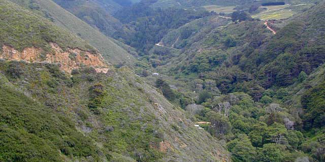
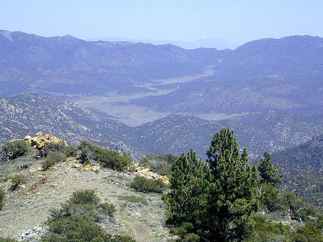
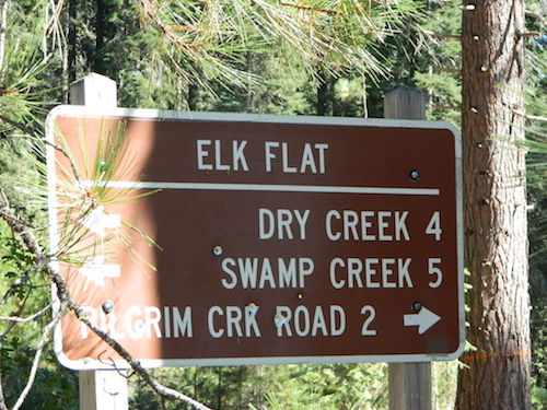
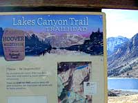
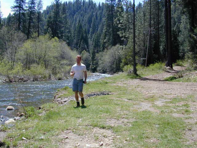
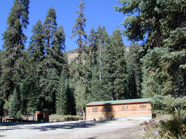
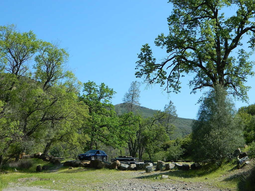
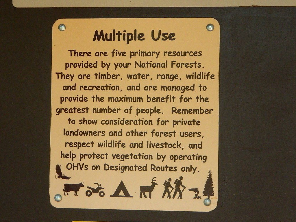
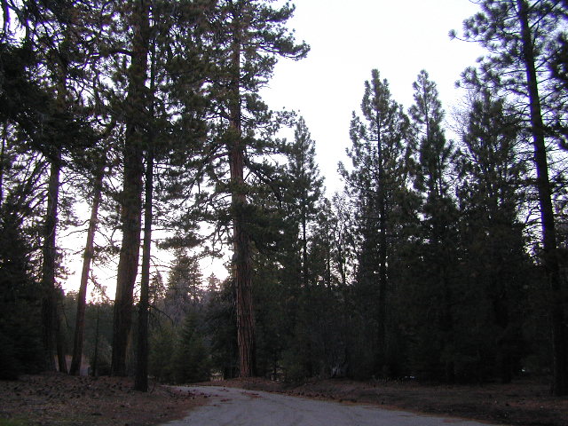
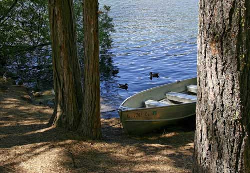
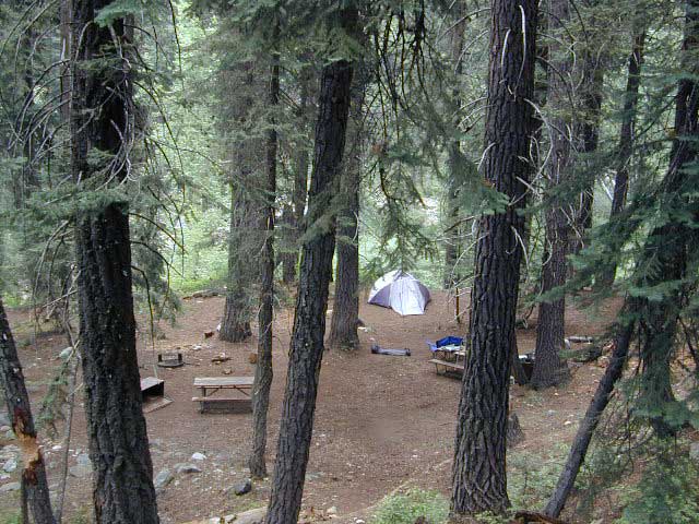
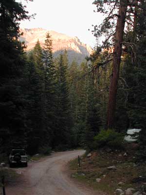
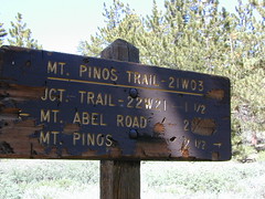
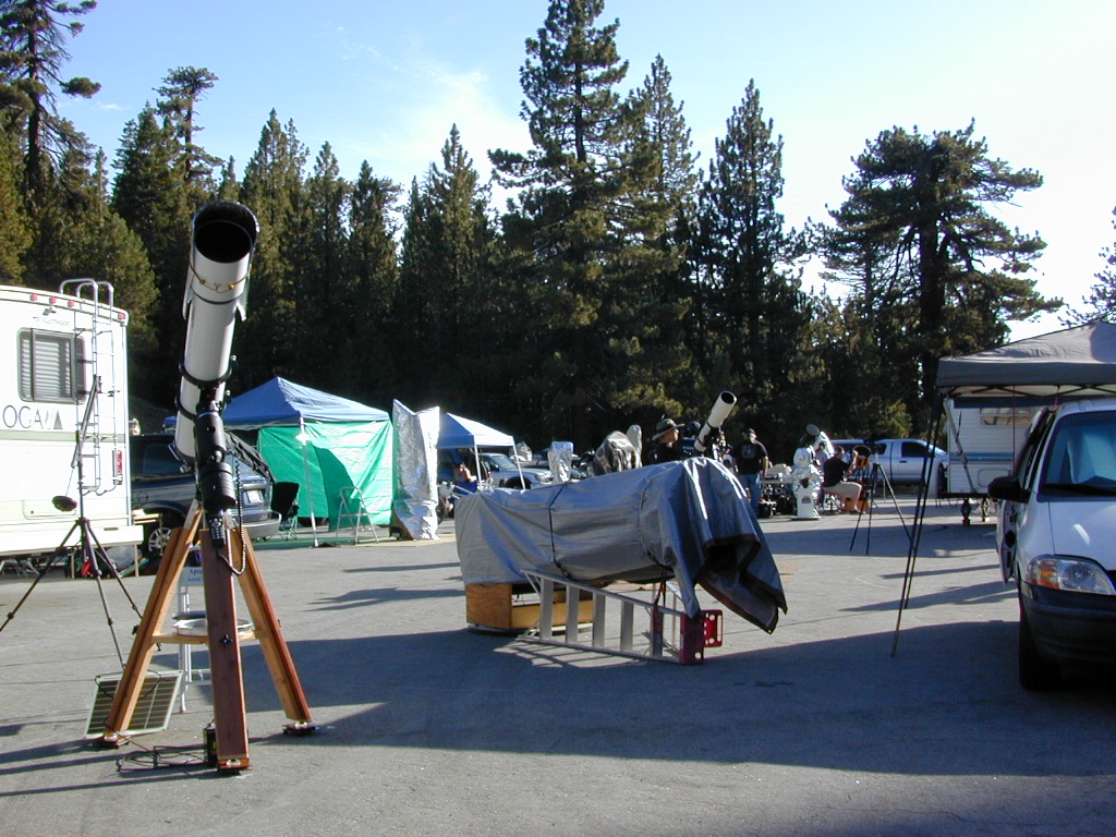
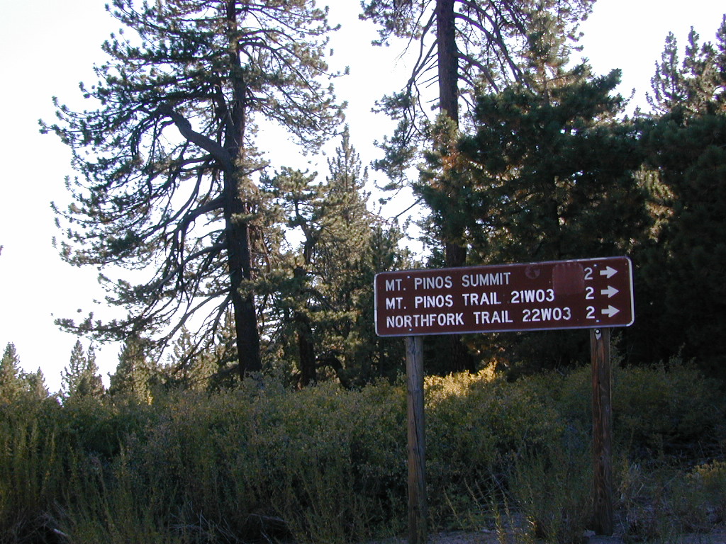
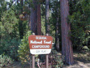
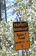
California National Forests – protected wilderness areas throughout state are surrounded by National Forests (NFS), and most National Parks (NPS) are surrounded by National Forests. Tons of small campgrounds & primitive spots for real seclusion. Get a free fire permit & camp almost anywhere you want. Use that SUV exploring the many dirt backroads & find that perfect camp spot (for free).

California State Parks

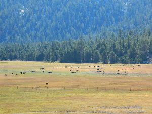
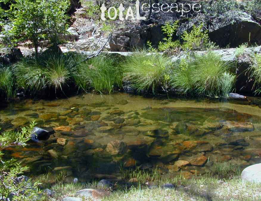
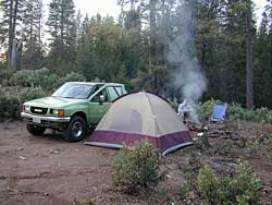
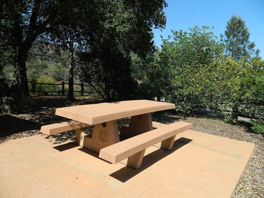
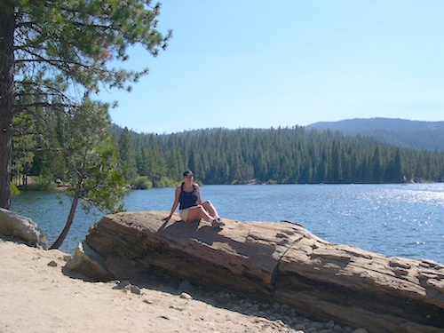
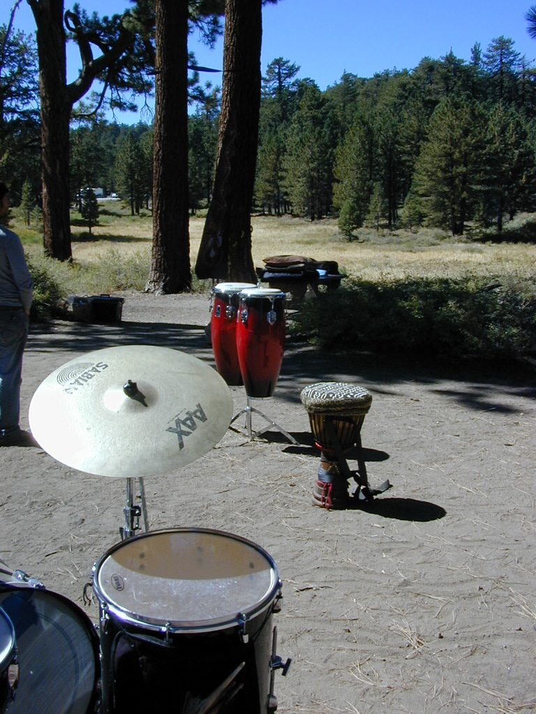
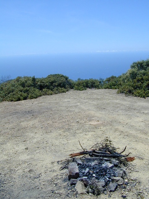
California State Parks – local California parks with a lot to offer the day hikers, picnicking family, tent camper or RV camper. From warm dry deserts soaking in a hot springs to the foggy coastal redwoods, these state run parks encompass a large section of California terrain. These parks are subject to state budget cuts and closures.
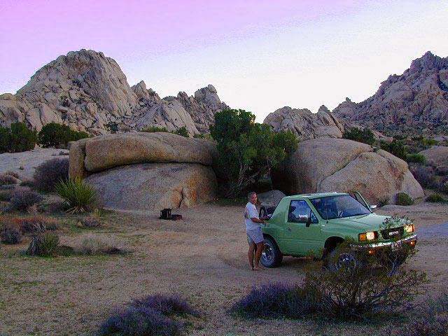
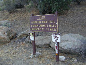
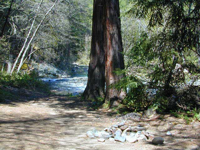
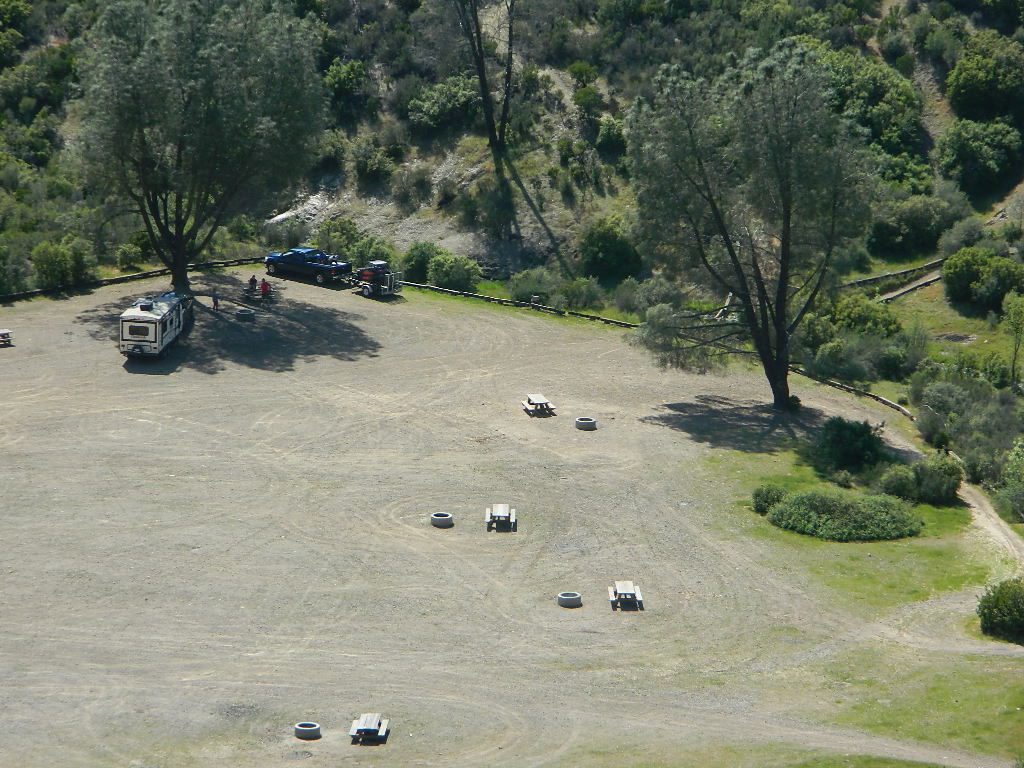
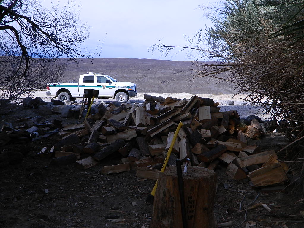
BLMBLM: Bureau of Land Management – mostly desert regions on the east side of California. A few coastal redwoods, some river canyons in the Sierra Nevada, many off road areas (OHV) in various mountain ranges. These federal lands are open spaces, generally a free for all on recreation.  Allowable = off roading, target shooting, open camping, campfires, bonfires. Geared toward OHV use, RVs and hunting.

Fire Safe Spot

All California Parks & Forests

hikes

California Lakes List

lake

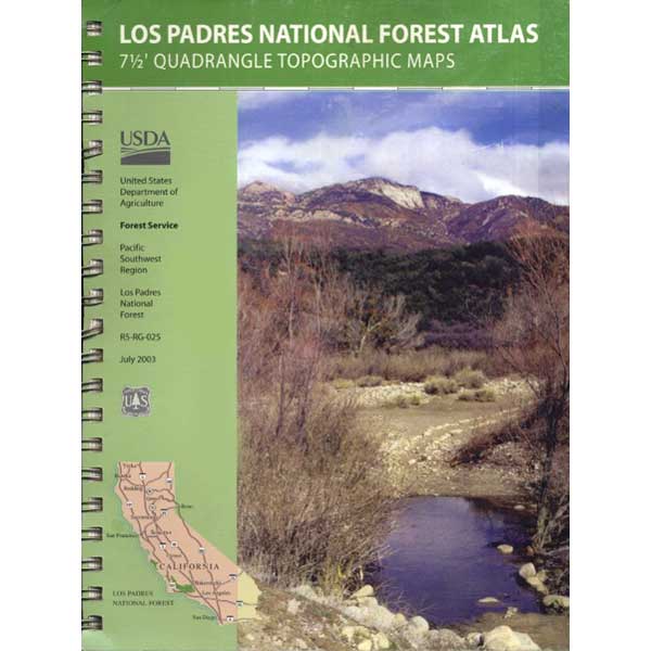
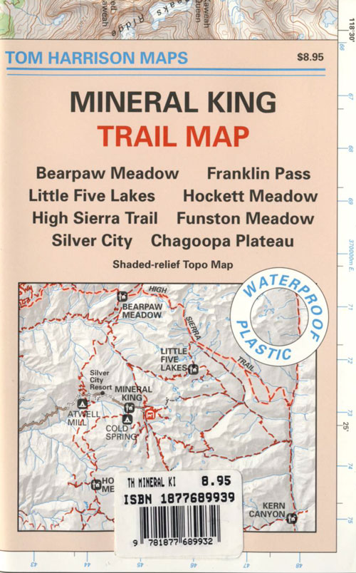
California Topo Maps

topo maps

rangers

California Terrain & Destinations

  • Coastal California – Southern California beach camping is crowded & sparse, because of developed cities. Central Coast & Northern California offer many more choices in this category.
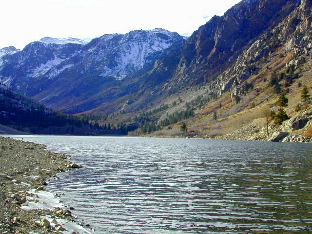
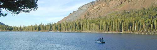
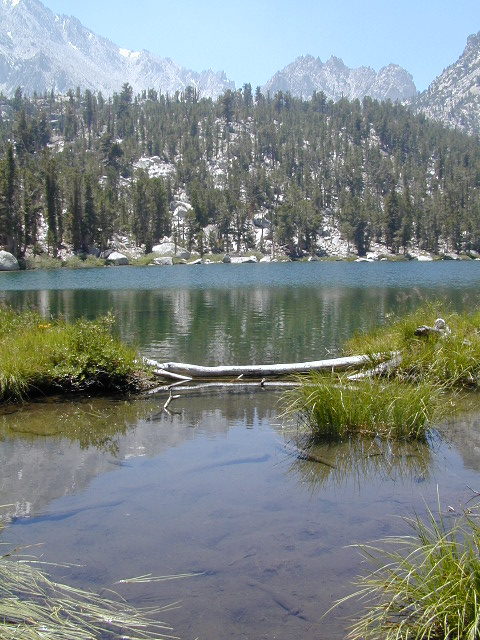
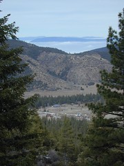
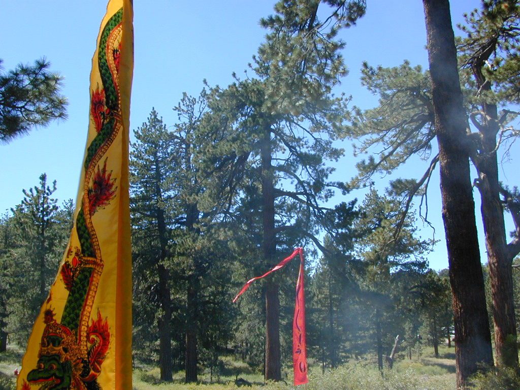
  • California Mountains – pine forest, mixed oaks & a variety of vegetation. Water sources such as lakes, stream & waterfalls make this choice the perfect camping spots. Granite peaks, high elevations wilderness areas throughout state & surrounded National Parks. Plenty backpacking options & dirt road primitive spots for the ultimate in privacy.
  • Countryside in California – coastal hills or mountain foothills. These rolling hillsides offer small creeks, oak trees & plenty of wide open spaces. Lakes & Reservoirs are located within these regions. Most campgrounds are fairly close driving distance to towns or cities. Wine country or gold country, California has it.
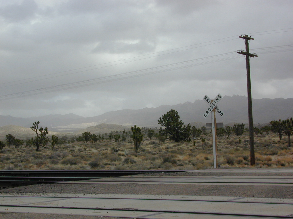
  • California Deserts – perfect for every season except summer, these vast spaces will humble just about anyone. Primitive camping galore & designated areas for real off-roading.
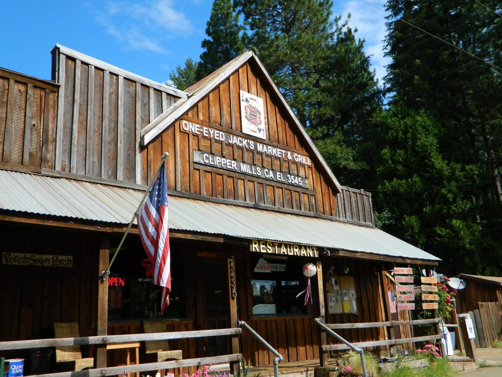
  • City CA / Urban Villages – not the best for really getting away from crowds, but can be an excellent opportunity to visit a city without spending big bucks on lodging. Or could just be a perfect one-nighter for getting familiar with camping. Most campsites are located in the foothill area behind suburbs, in county parks or even coastal.
  • California A to Z: Small Towns – 700 and counting; extensive list of destinations, focusing primarily on the back roads and outdoor recreation hubs
  • California by County – Find every county on Cali, and which towns are located inside of them

Yosemite Lake View Camp Sites

Lassen Forest Roads

Lassen Backroads

Lassen National Forest roads and trailheads, surrounding Lassen NP

Lassen Forest

Lassen National Park is completely encompassed by National Forest land with dirt roads, off road trails, serene lakes, secluded camp sites, hiking trailheads and wilderness access

California State Route 89 (highway 89) runs north/south thru the middle of the park and closes for months due to winter snow.

California State Route 36 (highway 36) runs east/west on the south side of the National Park, connecting Red Bluff to Susanville, CA

California State Route 44 (highway 44) runs east/west on the north side of the National Park, connecting Redding to Susanville, CA

camp

East of Lassen National Park

Lassen Forest Road #10
Echo Lake, Silver Lake, Caribou Lake. Campgrounds, trailheads, backpacking, day hikes, parking, equestrian.

Crater Lake on the north side of Hwy 44

Lassen Forest Road #318
Juniper Lake Road (aka Chester Juniper Lake Rd)
N of Chester, CA
paved first 5 miles, then becomes graded dirt road for another 5.

Benner Creek runs along the first half of this route w/ Banner Creek Campground: elevation 5562′ / 9 camp sites / open May-Nov

Juniper Lake at end of road w/ NPS campground
elevation 6792′ / 18 camp sites / open June-Sept

Lassen Forest Road #312
Warner Valley Road (aka Drakesbad Road)
N of Chester, CA
10 miles long, paved most of the way, then becomes graded dirt road out to Drakesbad meadow.

Lassen Forest Road #311
W of Chester, CA

Wilson Lake Road, connects Hwy 36 to Road #312
Domingo Springs Campground: elevation 5060′ / 18 camp sites / open May-Nov

fish

Lassen Road #29N18
W of Chester, CA
Loop route off Forest Road #311 w/ North Fork of the Feather River, leading to Elizabeth Lake trailhead

Lassen Road #29N19
W of Chester, CA
Graded dirt road w/easy access. Connects Forest Road #311 to highway, paralleling Hwy 36. Lost Creek runs along this route w/ Willow Springs Campground: elevation 5100′ / 14 camp sites / open May-Nov

West of Lassen National Park

Lassen Forest Road #17
W of Lassen NP
North-South dirt road that connects highway 36 to highway 44.

Heart Lake trailhead
At the south end on Hwy 36 is Battle Creek Campground: elevation 4800′ / 50 camp sites / open April-Oct

Lassen Forest Road #29N22
Mineral Road connects Hwy 89 to Viola on Hwy 44
McGowan Lake Winter Recreation Area at South entrance of Lassen National Park

nlassen
Camping North Lassen

North of Lassen National Park

Lassen Forest Road #32N13
Lassen Forest Road #32N22 (PCT crosses this route)
Twin Bridges networks dirt roads @ Hat Creek.
near Old Station Visitors Center (junction Hwy 89 & 44).

Hat Creek and Cave Campground on highway 89, Big Pine Campground off highway; Numerous dirt back roads for dispersed camping, near the viewpoint on highway 44

Road #32N20
Road #32N56 – road just south of Subway Cave near Old Station, off SR Hwy 44 lead to small Baker Lake.

Road #32N92Y side route leading from Hwy 44 to Road #32N21 along Butte Creek.
Butte Lake Ranger Station and Butte Lake Campground: elevation 5600′ / 20 camp sites /open May-Oct

Road #32N09 connects Forest Road #10 to Widow Lake trailhead and Butte Lake.
Road #32N60 is Bogart Winter Recreation Area, at Hwy 44

Hat Creek Lassen Road #18 runs north/south along Hat Creek Rim. Dirt road parallels Hat Creek Valley on the east side of Hwy 89
Road #22 connects Hwy 89 to Hat Creek Rim. A popular hang glider launch area after the University of California Radio Astronomy Observatory, then the road continues eastbound to cross Pittville Rd #111 and ends up at Little Valley

Lassen NF Road #111 is Pittville Rd, runs north/south paralleling Hat Creek Rim to the east side. This 30 mile long route connects Hwy 44 to Pitt River at Hwy 299 near Fall River Mills, CA

LASSEN MAPS

Lassen Camping for Free, Mill Creek @ 172
Lassen Camping for Free on Mill Creek

campfire

see also – Thousand Lakes Wilderness & Lassen Lakes

Kelbaker Road

signage

Kelbaker Road, Mojave NP

Kelbaker Road is one of the well-traveled back roads in the Mojave Desert connecting two major Eastern California routes of Interstate system. The I-40 to the south and the I-15 to the north, spanning 50 miles from one to the other.

Kelbaker Rd continues south to T up w/ historic Route 66 near Amboy, CA. Gasoline is very iffy in Amboy, so remember gas up in Barstow.

This region is super scenic portion of Kelbaker Road, which cuts thru the western edge of Mojave National Preserve. The Kelbaker pavement reaches to an elevation of 4024′ at Granite Pass, about 6 miles north of the exit @ interstate 40. Boulder outcroppings, bare mountain peaks, secluded cove camp sites w/ dirt roads, and old mines all over. Joshua tree forest and pinyon pine forest encircle the Mid Hills region.

4x4
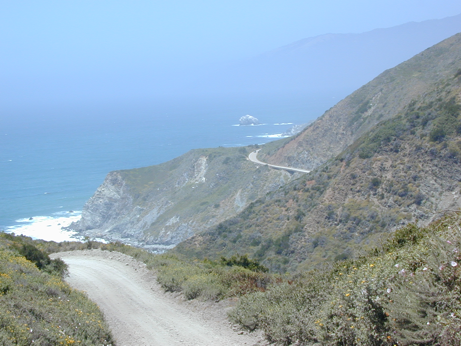
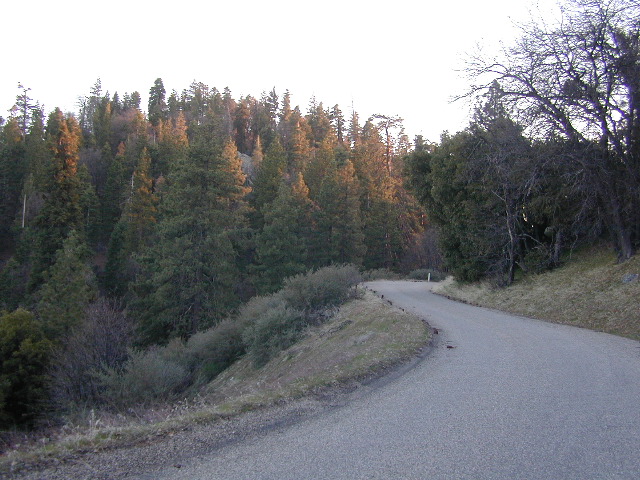
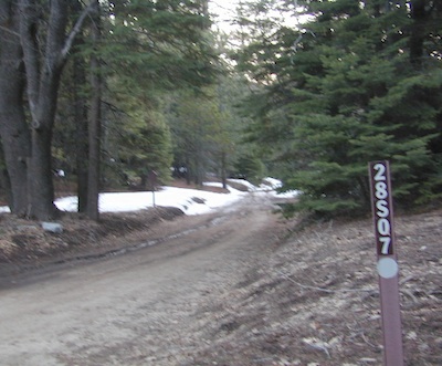
Some roads are suitable for passenger cars, but many are NOT. Dirt slides, erosion gullies, wash outs and rocks are common on these roads, so drive slow and pay attention. Have a spotter get out and take a look at the road conditions. Have a stroll, in the dark w/ the flashlights.

Or risk bottoming out, getting stuck in a deep rut. RVs should be very cautious. Daylight arrival is usually key for getting a perfect camp site, unless of course, you had it way-pointed on the GPS. Bingo! But the torrential thunderstorms, rearranged the valley since then, so use your brains.

There are private property ranches, active railroad tracks & BLM lands along the Kelbaker route. Some of the boundaries of NPS have been extended, so best to bring a decent topo map.

map file case

MOJAVE DESERT
topo maps

Free camping is abundant in this desert region, but it’s all primitive w/ no facilities and all are on dirt roads when your turn off Kelbaker. Some of the best camping areas are around 4000 feet (above sea level), so serious wind and even snow is quite possible in the winter months. Go prepared w/ plenty firewood.

Historic Mojave Trail (aka Mojave Road) is out this way. Dirt bikes, off roaders love this trail that connects the Colorado River @ Avi Casino to Afton Canyon near Barstow.

wildflower
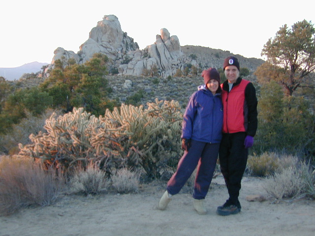
WILDFLOWERS – joshua tree, yucca, barrel cactus
Higher elevation deserts bloom in late Spring, generally March thru May. Perfect rainfall timing in the autumn, can determine wild blooms and flora months later. Providence Mountains SRA can be a good location for wildflower viewing.

depot desert

Kelso, CA

Kelso Depot:  historic spot, centered around the old train depot, which has been restored and has become the new visitors center and museum. Totally worth a 2 hour stop and HIKING/WALKING stretch break. The road heads north from Kelso and the name changes to: Kelbaker-Cima Road

train

Cima, CA

mojave dirt roadsCima Store, 20 miles to the north is one of the few businesses in this region. Post Office next door, maybe. Cima Road connects to I-15 in approximately 15 miles north. Kelbaker Road splits again and it heads up to I-15 @ Baker, CA

See more in this Mojave area —

Kelbaker Rd
Kelbaker Road and Railroad Tracks
Hole in the Rock
Hole in the Rock, Mojave NP
Mojave Scenery
Mojave Mid Hills boulder peaks

The Office

The Renovated Kelso Depot

Los Padres Topo

Los Padres Monterey

Los Padres National Forest Maps

Los Padres atlas
Los Padres National Forest USDA Topographic Atlas

7 minute QUADS (topo maps) inside a spiral bound book. Covers both north & south part of Los Padres National Forest. This map book can be found at ranger station – Los Padres USFS or click the book above to take you to the Total Escape Map Shop!

Los Padres Monterey Los Padres Ojai

Waterproof plastic map; USDA National Forest Service Maps

Additional topo maps for Los Padres region –

Forests

see more about Los Padres National Forest

Big Sur Coast

dirtbikeshiker

Links for Los Padres National Forest destinations

hwy33overlook
North of Ojai, CA – Highway 33 winds up to Los Padres NF

Hiking Trails Los Angeles

Los Angeles Hikes, Angeles National Forest, Angeles Crest, Baldy, Wrightwood, Palmdale, Tujunga, Frazier, and Malibu Coast

DSCN0048
You relocated to California for college or your career – and to enjoy the outdoors more, but you ended up in the Los Angeles Basin instead, breathing smog daily. You will need to escape – soon, for sanity sake.

check

Total Escape – this is your new favorite web site on California outdoors. Bookmark it dude. And be proud to love nature!

PCT hikes – Pacific Crest Trail
The world renowned  hiking trail that runs the entire length of the entire West Coast US. Canada to Baja, by way of Washington, Oregon and California – all on foot.

More PCT MAPS: Pacific Crest Trail Maps

Mount Pinos Recreation Area

Los Angeles Hiking Maps

th_angeles_d

Angeles Front Country
Angeles High Country
Angeles National Forest
Channel Islands Map
Cucamonga Wilderness
Dick Smith Wilderness
Joshua Tree Park Map
Los Padres National Forest Map
Malibu Creek Map
Mojave Preserve Map
Mount Baldy Map
Mount Wilson Trail Map
Pacific Crest Trail Maps
Point Mugu Map
San Bernardino National Forest Map
San Berdoo Mountains Maps
San Diego Backcountry Map
San Gorgonio Wilderness Map
San Jacinto Wilderness Map
Sespe Wilderness Map
Topanga Trail Map
Verdugo Mountains Trail Map
Zuma / Trancas Canyons Map

pinetree

And when you finally get bored with hiking only in Southern California, there’s a whole lot more California to explore – up state!

NORCAL – Well beyond San Francisco and Yosemite, there are meadows to be found. Seclusion and tranquility in nature, without the crowds. Too many dirt roads to drive and dozens of rivers to see. Waterfalls abound, with wildflowers and amazing scenery all around. Small towns to discover!

Fly fishing rivers, kayaking lakes, wineries, organic farms, geysers, volcanoes, caves, old bridges and so much more to find in NorCal.

DanaMite loves to cover the real nooks and crannies of California, just for you – right here on Total Escape.

hiker

California Parks List

California Parks and Recreation

State Parks, State Forests, State Recreation Area, National Parks, National Monuments, National Forests – What is the Difference?

public lands

Forest, Park, Reserve, Monument, Recreation Area, BLM, Nature Preserve… arghh!

Don’t let all the park and forest names confuse you. It is all California and it is your public land! No bikes on trails, No gathering wood, No dogs here, No camping there; Now what?

Below is our overview graph for all California parks and forests – the basic concepts & the rules broken down for anyone to understand. Permits may be needed in certain areas. Only the government officials understand the true nature of all the ridiculous red tape.

CA Wilderness Areas California Wilderness Back country lands very protected from roads and human impact. Off limits to vehicles & mountain bikes. Only accessible by backpacking, hiking or horseback. Endangered species; Hard to reach terrains in the High Sierra. Overnight visits may require a wilderness permit.
CA National Parks California
National Parks – NPS: National Park Service
Federal lands are national parks, preserves & monuments; highly regarded as some of the most scenic in world & protected.  Very popular places and crowds often in summer. Limited use areas for camping & recreation. No mountain biking on trails. No dogs on trails. Try off-season. Drive thru entrance fees.
NM: California
National Monument
Located within the National Park System & more specific to a region. Historic buildings, geological features and deserts ruins qualify. Some National Monuments become National Parks. Many locations have entrance fees.
NRA: National Recreation Area Located within the National Park System & somewhat specific to a waterways, coastlines, lakes and reservoirs. Some locations have entrance fees.
NSA:
National Scenic Area National Seashore
Located within the National Park System & is basically scenic area worth preserving. Usually no entrance fees.
California National Parks
California USFS:
CA National Forests
USDA Forest Service
Areas of forest lands throughout state; some surround the National Parks. 18 national forests make up 20 million acres of federal land. Multiple use areas: snow skiing, mining, grazing, off-roading. OHV & SVRA Tons of small campgrounds, recreation & primitive spots for real seclusion. Best bet for finding a spot away from the crowds. Get a free fire permit & camp on back roads. No entrance fees, some parking or day use fees; SoCal requires an Adventure Pass.
California State Parks
California SP:
California State Parks
California Department of Parks & Recreation manages more than 260 parks. These smaller parks are located near cities with historical parks, as well as remote wild state land & coastal beaches. Entrance fees, day use, picnic and some have campgrounds. State Parks charge fees for day use, parking and overnight camping.
California SF: California State Forest California Demonstration Forests, areas to be protected. Redwoods & Sequoia Groves; fragile eco-systems. Handle with care. May charge entrance fee or day use fee.
California SRA:
State Recreation Areas
California Department of Parks and Recreation. Lakes, Reservoirs, Rivers. Many have boat rentals and active marina. Recreation lakes charge entrance, day use, parking or boat launch fees.
California OHV & SVRA: Off Hwy Vehicle Area and State Vehicle Recreation Areas Off Roading folks and dirt bikes can have their fun wheelin. Lands set aside for OHV use; dune buggies, quads & 4×4 enthusiasts. Most in desert regions; forest lands. Developed campgrounds large enough to accommodate RVs and trailers. Fees may apply in these off-road areas for day use or camping.
California County Parks Desert hot springs, oak foothills and campgrounds, local hills w/ hikes, parks close to urban regions. Back roads & rural land protected from freeways & development. May require parking or entrance fees. Find these listed on the California A-Z town pages
City Parks in California Urban Parks & Recreation, inside the city limits. Usually no entrance fees. Find these on California A-Z town pages
blm camps
BLM: public lands Bureau of Land Management All public lands that do not fall into the above categories. Little to no fees for day use, recreation or overnight camping. Plenty of desert & off roading areas. Some forest lands, certain lakes. Small campgrounds or open camping allowed. Fees may apply in developed campgrounds. Camp overnight almost anywhere out here for free, with a ranger issued camp fire permit.

califrepublic


Sequoia – which one?
Sequoia National Park
Sequoia National Forest
Giant Sequoia National Monument

Imagine that the Southern Sierra mountains is home to 3 different public parks named Sequoia. Yep, it’s true. Sequoia National Park, Sequoia National Forest, and Giant Sequoia National Monument. Other parks that have Sequoia groves are – Mountain Home State Forest, Calaveras Big Trees State Park, as well as Yosemite National Park.

As far as the Coastal Redwoods, most are included under State Parks. Find these parks on the Central Coast Big Sur and Santa Cruz mountains, plus Marin County, and all along the north coast US Hwy 101 from Mendocino to the Oregon border. Numerous redwoods parks are located along rivers.

we break it all down here on
Big, Tall, Old Trees

The super scenic Big Sur coastline is home to Julia Pfieffer Burns State Park and to the similarly named Pfieffer Big Sur State Park. Leave it to park personnel, state officials or the non-locals to create such a confusing naming system within our most-visited state.

hiker

Park Maps & Topos  topo maps

National Forest Atlas
National Forest Maps
National Park Maps
State Park Maps
BLM Maps

Lava Blue Lake
Lava Rock @ Blue Lake in Modoc County
holcombcamp
Holcomb Valley Camp, Big Bear Lake, CA
Wilderness with Horses Sierra Ski Maps Camping California Wilderness Rangers Snow Ski Topo Maps Mountain Biking Maps
Wilderness Hikes Wilderness Hiking Maps Wilderness Topo Maps Sierra Fishing Maps Sierra Topo Maps California Hiking Maps
holeinthegroundsign
Lassen Camping near a creek in Northern California

California Outdoor Recreation:
All parks, forests, preserves, monuments, public lands, lakes, rivers, wilderness, historical sites and museums can be found listed separately on our super duper local A-Z town pages

fout springs
Fout Springs, near Stonyford, Northern California

dirtbikes

Mountain Biking Sequoia

Bald Mountain Lookout

Mountain Biking Kern & Biking Camps in Sequoia

Mountain biking has become a popular sport especially in California. We’ve got so much great terrain, so close to home (the urban sprawl), that this outdoor hobby is bound to get you back in shape, fast. Start slow to avoid burnout and injury. The weather is awesome, just go. Plan a camping weekend & bring your bike!

Remington

KERN RIVER AREA

Parks & Forests in Sequoia region of the Sierra Nevada –

Big Meadow Kern

SEQUOIA PARK BIKING

Obvious (but humorous) information on bike riding or mountain biking in Sequoia NP. Upon doing research for this page, noticed a heck of a lotta folks typing in the phrase

Sequoia National Park Bike Trail

I laugh…. but plenty people are searching for bike trails near Sequoia groves, inside the most protected of lands, the National Parks.

NPSFirstly, most National Parks in California do not allow bikes on hiking trails. The Sierra Nevada has NO National Parks that allow mountain biking on their trails. (official words are: Biking is allowed on the main roads in the parks but is prohibited on park trails.)

Yuk. Who wants to ride on asphalt in the wild?

Yosemite & Lake Almanor both have nice paved bike paths. But you may want dirt trails for biking. Be it mellow mountain biking on forest roads, or the hard core Downie-droppers.

California Wilderness Areas are the same rules, but even tighter. So that brings us to Sequoia National Forest. Yes, indeed California National Forests allow mountain bikes on most trails, in most cases. The popular trails might even get small brown signs showing bikes that are allowed.

Second, there are no bike rentals inside Sequoia National Park (or Kings), so you must bring yours in, or better yet ride in. I dare you. Although you cannot take said bike on a dirt trail, so you’ll need to stick to pavement only. The main highway (Hwy 198) has got to be one of the curviest, narrow, fern lined ridge routes of the region. You would be a fool to ride this area, as a senior citizen w/ a 40 foot motorhome or a speeding SUV may take you out on a curve. Seriously! You better be in great shape if you plan to descend into Kings Cyn. That route is just as dangerous if not more so. These 2 National Parks – Sequoia & kings, both get a lotta traffic. Year round.

Thirdly – here is the biggest tip of the whole topic. In between Kings Canyon & Sequoia National Parks is a slice of Sequoia National Forest land. (Meaning you can ride bikes or mountain bikes here) Most call it Big Meadows Road # 14S11 & there is plenty camping all down this road – 12 miles with spur roads in every direction. A nice chunk of forest with rocks, meadows, camps & dirt roads. Granite & great scenery. What more could you ask for? More forest roads than single track trails tho and please watch for equestrian traffic. The dead end of this road leads out to 2 Wilderness areas, so be prepared to navigate with a good map in hand. No bikes are allowed in the Wilderness, remember?

Maps for biking in the Sequoia –

For Sequoia/Redwood Parks with less people and more open biking trails, try these –

Wanna see some great riders & bikes in action?
California Mountain Bike Races

Bear Meadow
Camp Site at Bear Meadow, Sequoia National Forest  

Stanislaus Campgrounds

Stanislaus Camping / Sonora Pass Camping

dardanelleNFS
NFS Dardanelle Campground along Sonora Pass Highway

camp

Sierra Nevada  Campgrounds inside the Stanislaus National Forest

Hwy 4, Stanislaus National Forest Camping

campground elev spots veg toilet water notes
Big Meadow Campground 6200′ 30 pines flush piped Hi Sierra; no RV hookups
Bloomfield Campground 7800′ 20 pines vault pump Mokelumne River fishing
Board’s Crossing Camp 3800′ 5 pines vault creek Stanislaus River fishing
Hermit Valley Campground 7100′ 8 pines vault creek June-Oct
Lake Alpine Campground 7300′ 25 pines flush piped June-Oct
Mosquito Lakes Camp 8260′ 8 pines vault lake Sierra river fishing
Pacific Valley Campground 7600′ 9 pines vault no meadow, June-Oct
Sand Flat Campground 5900′ 6 pines vault creek 4WD camp, June-Oct
Silvertip Campground 7300′ 23 pines flush piped June-Oct
Silver Valley Campground 7400′ 21 pines flush piped June-Oct
Stanislaus River Campground 6200′ 25 pines vault pump Sierra river fishing

Hwy 120, Groveland Yosemite Camping

campground elev spots veg toilet water notes
Lost Claim Campground 3100′ 10 pines vault pump May-Sep
Lumsden Campground 1500′ 11 mixed vault creek Tuolumne River fishing
Lumsden Bridge Camp 1500′ 9 mixed vault creek Tuolumne River fishing
South Fork Campground 1500′ 8 vault creek Tuolumne River fishing

Hwy 108, Sonora Pass Camping Stanislaus

campground elev spots veg toilet water notes
Crandall OHV Camp 5000′ disp no no May-Oct
Dardanelle RV Park & Cabins 5700′ park pines flush piped 209-965-4355
Boulder Flat Campground 5600′ 20 pines vault piped Stanislaus River
Cascade Creek Campground 6000′ 12 pines vault creek May-Oct
Deadman Campground 6200′ 17 pines vault piped Stanislaus River fishing
Herring Creek Campground 7350′ 7 pines pit creek May-Oct
Mill Creek Campground 6200′ 19 pines vault creek May-Oct
Niagara Creek Campground 6600′ 10 pines vault creek May-Oct
Niagara Creek OHV Camp 6600′ 10 pines vault creek 4×4 camps, May-Oct
Sand Bar Flat Campground 3000′ 10 pines vault piped Stanislaus River fishing
Trout Creek Campground 5400′ disp. chem creek equestrian, May-Oct

GOLD COUNTRY CALIFORNIA Hwy 49

pinetree

see also
Calaveras Big Trees State Park

Calaveras Big Trees

butterfly

nearby towns –

hiker

maps of this Sierra Nevada region –

Creekside Camping

California Creek Camping

California Camping CreeksClear cool stream waters flow from snow melt at 10,000′ elevation, down to these pristine camps at under 4000′ on both sides of the Sierra. The further you drive up the mountain, the better it gets. Where the Eastern Sierra side tends to be more dramatic desert like with sage brush, the western range is much more lush with ferns & dense trees.

Everyone dreams of it. The perfect camp, along the creek. Maybe a waterfall or two, a shady hammock spot & plenty of trees, a flat tent spot, maybe a view. A big, sturdy, rock fire ring (without a bunch of broken glass in it).

This dreamy camp isn’t only in your imagination, nor is it at the local county campground a few miles from home. This kinda beauty & rare finds are out there, deep in the back woods, the mountains. You gotta know where to look & what to bring in order to have a good, easy, relaxing time.

These secluded sites really are around in your favorite forest, way back there. Best of all, they are free.

forest mapsHaving the opportunity to camp in your very own private, secluded spot, along dirt roads, outside of the annoying rules and fees of a developed campground is a privilege. Use these lands wisely and be a responsible camper. Camp eco-wise! Respecting the land, knowing some basics and following fire safety precautions is all mandatory. A topographic hiking map or a National Forest map is optional, but highly recommended.

Creekside Camping CaliforniaCreek water can make an easy refrigerator if the cooler is full. Chill that bottle of wine, keep the watermelon cool .. just don’t forget about it. (cuz that kinda litter maybe a welcomed good surprise for the next camper.) Secure your wet creek valuables. Even a heavy watermelon can float! Put some rocks around items or tye them in a mesh bag, with rope, something to keep them from getting away in the swift water.

There is nothing that beats a good detailed forest map of where you are going. If you are the type of person who can never make a straight B-line for home on Sunday afternoon, and find yourself wandering just for the sake of wandering – then it’s best to have a larger state wide map like this beauty from Benchmark Maps.

California Creekside Camp Sites

Small Campgrounds on a Creek

Primitive Style – Dispersed Camping secluded camp sites

If you are the kinda sport who can really rough it, you may learn to love it. After your first real back woods camping experience, the privacy, serenity and beauty of the land will inspire and relax you so much, that the drawback on the lack of toilet won’t bother you.

Make a new hobby of learning how to stay away from the crowds. The less cars you see at camp, the better. Learn to be immersed within nature and enjoy your space outside. Unwind, next to the creek in the shade, with a chair and read for hours, or bring the sketchbook, or just daydream as butterflies go floating by.

  • Remember to be camp clean, California is black bear country.
  • You’ll need a free camp fire permit; pick up at the local rangers station.
  • Classic camp potty info.  Proper disposal of human waste is important.
  • Use biodegradable soaps when outside.

Streamside Camping Basics

what you need:

capable vehicle – SUV or Truck, high clearance is best. 4×4 is NOT required. AWD wagons should be more cautious when venturing out on the back roads. 2WD is fine for most graded dirt roads, but way out exploring dirt roads, deep mud and snow is quite possible.

destination – Pick a locale. A general area you wanna check out. Not a quickie overnight deal, but an enjoyable lazy multi-day camping trip.

exploration – Narrow down a canyon or river that you have always wanted to explore. The Sierra Nevada & NorCal is the place to concentrate your efforts, as SoCal is near desert climate w/ way too much development.

more maps please – National Forest map or similar backroads Map/Atlas. Large topo maps may be too detailed, but will do okay for finding dirt roads (& backpacker trailheads also).

The more homework you do before hand, the better chances of finding that secret camp spot, especially on holiday weekends. Go ahead & call the forest rangers. Have your decent topo maps handy, along with pen and paper. That’s what they are there for. Have a list of questions on specific areas you want more info on. If you do the prep work well in advance, it makes a more enjoyable camp trip. Cuz you’ll be less worried about finding the ultimate places (before dark, or before the other guy does). With your new profound Wilderness Vision, you will have not only a plan B ready, but a plan C as well.

what to look for:

getting permits – If you really wanna camp like this, all secluded on the dirt back roads without the hordes of other campers nearby…. you’ll need a capable vehicle, a camp fire permit & the understanding of the concept “totally self sufficient campers”. This means bringing your own water, a bucket, a shovel, maybe some firewood, plus packing out all your own garbage, plus any litter left over by the last campers. It’s the least you can do, not having to make reservations. Visit the FireSafe page

it’s on your map – After you have a general area narrowed down, some place you always wanted to go, then it’s time to get your maps out & start reading them. Or at least staring at them – maybe over a meal, whenever you have free time to study it. Look for dirt roads, the further off the paved roads is not necessarily the better. Some of the best camp sites are within a few short miles from the pavement, so get them maps out & start visualizing.

gas up – Make sure you fuel your vehicle before you head into remote areas (like the ones we are mentioning). Maybe even an extra can of gasoline too, just in case.

the blue lines – You’ll know a decent road when you see it. When you start planning at home, you need to concentrate of what dirt roads are along what water sources. And will these streams be flowing at this time of year? Many are seasonal creeks & can dry up in summer. The most likely place to find great water flow is to look for the streams flowing directly into a major river or Lake/ Reservoir.

Are you willing to clean up your camp, before & after, leaving it pristine?
Yes indeed, it is free to camp outside of developed campgrounds.

Finding a Creek & Reading a Map

California Reference

shasta back roads

California Information Centers w/ Helpful Links, Tips, Weather & Road Advice


SIERRA HWYS / Sierra Passes:
Annual Highway Closures in the snowy Sierra Nevada Mountains

snow

California Road Conditions

 caltrans
Cal-Trans Road Conditions
800-427-7623
All CHP Offices
Web cams on California freeways

Nevada Road Conditions
702-793-1313

Oregon Road Conditions
503-588-2941

California Travel Timelines

California Back Roads Info

L.A. Road Closures
Department of Public Works Los Angeles

North State Road Conditions & Web Cams
Siskiyou County California

Weather Bureau
530-221-5613

California Mountain Roads –
Snow Chain Requirements

R1 – Chains are required on all vehicles except passenger vehicles and light-duty trucks under 6,000 pounds gross weight and equipped with snow tires on at least two drive wheels. Chains must be carried by vehicles using snow tires. All vehicles towing trailers must have chains on one drive axle. Trailers with brakes must have chains on at least one axle.

R2 – Chains or traction devices are required on all vehicles except four-wheel/all-wheel drive vehicles with snow-tread tires on all four wheels. NOTE: four-wheel/all-wheel drive vehicles must carry traction devices in chain control areas.

R3 – Chains required. Chains or traction devices are required on all vehicles, no exceptions.

The most common chain controls are R-1 and R-2. Highways will often be closed before an R-3 control is imposed, but winter weather conditions can change any road condition, hour by hour.

California Information Centers

check

California Office Of Tourism
1121 L St., Suite 103, Sacramento, CA 95814

California Welcome Centers
various locations, usually near freeway & factory outlet malls

California Bureau of Land Management
BLM

California Department of Fish and Game
916-445-0411

California National Forests NFS
USFS

CaliforniaNational Parks NPS
NPS

California State Parks calsp
SP, SHP, SRA

Eastern Sierra Interagency Center 
US Highway 395 @ Death Valley turn off
760-876-6200
2 miles south of Lone Pine CA
@ junction of Hwy 395 & SR 136

Kelso Depot Visitors Center
Mojave National Preserve
760 252-6108
Kelbaker Road, Kelso, CA

Old Station Visitor Information Center
13435 Brian’s Way
Highway 44/89, Old Station, CA 96071
530-335-7517
Hat Creek, East Lassen NF

California State Transportation

CA Trains – Amtrak, MetroLink, Coaster, BART, Skunk

California Statewide Bus Lines – Amtrak bus, Greyhound & FlixBus

train

California off road links

California 4×4 Groups
Cal 4-Wheel

Total Escape Back Roads

dirtbikes

California Travel Tours

California by Bicycle
California 4×4 Tours
California by Helicopter
California by Horseback
California by Llama
Lake Tahoe Tours
Palm Springs Tram
Vegas Outdoor Tours

hiker

California Maps: Parks, Wilderness, OHV trails

longwayup
Breckenridge Mountain, eastern, paved access from Breckenridge Road #28S06, Sequoia National Forest, Kern County California
gorgeview
Sierra National Forest Road #11S12 – Big Creek, granite gorge view. Dirt road connecting Wishon Reservoir to the Kings River, on the Western side of the Sierra Nevada
Road 64 South Warner
Exploring Modoc Road 64 (aka South Warner Rd) located back behind Blue Lake Campground. Excellent horse camping opportunities next to South Warner Wilderness.

California Roads

observatorio
Observatory @ San Pedro Martir, Baja California Norte – Pine Forest Camping Laguna Hanson, Parque Nacional Constitution de 1857; located off Hwy 3 east of Ensenada
signage
Kelbaker Road, Mojave Desert – paved connector and main route between Interstate 15 and Interstate 40. Mojave Desert National Preserve
newarmypass
Backpacking, Equestrian and Hiking Trailheads to the High Country Eastern Sierra. Cottonwood Lakes, Inyo National Forest @ US Highway 395

Lundy Lake California

Lunar Lundy Lake

Eastern Sierra
Lundy Lake

Lundy Canyon is located at the very northern boundaries of the Inyo National Forest, bordering the Humboldt Toiyabe National Forest & Virginia Lakes. Mill Creek flows down Lundy Canyon from the Sierra Nevada; Lundy is a small lake in a deep, rugged canyon with wilderness trailheads, East of Yosemite National Park.

Lundy Lake
West of Mono Lake, California
US 395
Lee Vining, CA

elevation: 7800′
Seasonal access, closed for winter

backpack, camp, canoe, fish, hike, kayak
aspen groves, autumn colors
wildflowers, waterfalls


Frozen Edge

camp

Lundy Campgrounds

  • Lundy Canyon Campground
    Mono County Dept of Public Works
    760-932-5440
    36 camp sites w/ picnic tables, fire-rings & bear boxes
  • Lundy Lake Resort
    Bait, tackle, general store, fishing lake, boat ramp.
    626-309-0415
    21 camp sites, 8 cabins, 3 camp huts, 5 RV camp sites

camping

National ForestsThere is not any NFS Campgrounds in this Lundy Canyon, but plenty can be found nearby at Lee Vining Canyon, at junction US 395 & Hwy 120.

Mono Lake also has camping at the county park. And free camping (boondocking) can be found – all up and down US 395

Lakes Canyon Trailhead

hikerLakes Canyon Trailhead

Backpackers & Horse Packer Trains have excellent access to the Hoover Wilderness in the High Sierras. Plus this prime Lundy Canyon location is situated at the back door of Yosemite NP.

Mono County Tourism
800-845-7922

Reflections

Lundy Area Maps:
Hoover Wilderness Trail Map (Tom Harrison)
Inyo National Forest Map (USDA)
Yosemite High Country Map (Tom Harrison)


View Larger Map

Links for Lundy Canyon:

Lundy Lake Road
Lundy Lake Rd, the paved road up climbs the steep canyon to an elevation of over 7500′

El Dorado Camping

Primitive Camping in El Dorado County

Camping Rivers

More & more people are venturing off the beaten path. Tourist flocks to Gold Country, and many do not even leave Highway 49. Get up the mountains, higher than the foothills.camp

Getting outta the developed campgrounds to discover the joys of dispersed back woods camping is a new adventure, not to be taken lightly.

With truck or SUV ownership come some great rewards! Order a good map & go find some dirt roads. Waterfalls, dense forests, secluded creekside camp sites & more await you. Obtaining a camp fire permit is mandatory for this style of camping.

campfire

fish

Campfires are often banned in California, due to extreme wildfire danger. Since the gold mining foothills are usually oak and dry grass, with large steep river canyons, extra caution should be given. Always know the fire conditions before you build a campfire. Caldor Camping

Discover the hidden back roads: like Caldor Road off of Grizzly Flat Rd. – above Placerville CA

Hey, now this is what we’re talking about. Plenty of great dispersed camping down by the Cosumnes River & Consumnes Mine Rd. There are hundreds of miles of small roads to discover back behind this historic mining area. Rivers, waterfalls & decent fishing too. Make sure you clean up some litter. This is the only price you pay for the beauty, serenity, peace & quiet & no neighbor campers next to you.

hiker

Out exploring these parts, you may run into a dead end road that peters out at some Private Property, which is usually signed & fenced. Make nice with the old crazy miner dude & turn your ass around politely, everything will be okay as soon as you are not within gun shot of him. Yes, there still are plenty of small time mining experts tucked away back here in the hills.

river camping
Premium and secluded river side camp sites in El Dorado National Forest

Plenty creeks and rivers run throughout this central Sierra region, so you can fish all day – until your hearts desire. River rafting and river kayaking opportunities are also great reasons to get wet.

canoe

Several mountain reservoirs around offer camping and boating too. Eldorado lakes are listed below.

  • Caples Lake @ Carson Pass
  • Ice House Reservoir
  • Jenkinson Lake – US Hwy 50
  • Kirkwood Lake
  • Lower Bear River Reservoir – South Shore Campground
  • Salt Springs Reservoir
  • Silver Lake @ Carson Pass
  • Union Valley Reservoir

mountains

nearby towns –

El Dorado Forest Maps –

Group Campgrounds Eastern Sierra

agnewmdws

Group Campgrounds in the Inyo National Forest camping

These group camping facilities are available by advanced reservation only; open for summer and usually closed during winter months .

campground elev spots veg toilet water notes
Agnew Meadow Horse Camp 8400′ 4 pines chem piped Group & Equestrian
Mammoth
Aspen Group 8100′ 4 aspen flush piped Rock Creek
Big Pine Canyon Group 7600′ 1 pines vault piped W of Big Pine; May-Oct
Bishop Park Group 7500′ 21 oaks flush piped Group Camping; May-Oct
Fossil Group Camp 7220′ 11 pines vault no Hwy 168; E of Big Pine
Juniper Group Camp 7000′ 5 juniper vault piped Hwy 168; E of Big Pine
Obsidian Flat Group 6000′ 50 pines vault no Group Camp Mammoth
Pumice Flat Group 7700′ 17 pines flush piped June-Sept; Mammoth
Rock Creek Lake Group 7600′ 1 aspen flush piped Group Camping; May-Oct

RESERVATIONS REQUIRED

Call ranger station to reserve.
Inyo National Forest
351 Pacu Lane #200
Bishop, CA 93514
760-873-2400

see developed tent & RV Campgrounds – Inyo National Forest

rockcreekcliffs

Obsidian near Hwy 395 & Mammoth
Eastern Sierra Obsidian Dome – near US Hwy 395 & Mammoth Lakes, CA

Eastern Sierra maps –

Topo maps, wilderness hiking maps, fishing maps
Equestrian trails, 4×4 routes, OHV maps –

lake mary

southforkbishop

Bishop Creek near Aspendell, CA

Wishon Reservoir

Lake Wishon – Sierra NF

Western Sierra Nevada Lake
Central Sierra California

lake wishon

East of Fresno, CA
East of Shaver Lake

EB from Fresno, Hwy 168 up to Shaver, w/ another 30+ miles on paved backroads
(Dinkey Creek Rd & then McKinley Grove Rd)
Way, way back, beyond Dinkey

You gotta really wanna BE at places like this. Magical High Sierra mountains – California’s finest. Sheer beauty surrounds this lake w/ granite domes, granite cliffs, granite trails, forests, peaks and plenty hiking, fishing, water and boating. It does take planning (way ahead) to make it out here, cuz the area is only accessible during summer months. Typical of high altitude lakes, snow buries them annually and the roads get closed off to the public (usually NOV-MAY is winter). Some backcountry routes become snowmobiling trails during winter, and the Sierra National Forest has plenty of great snomo action (if snow is deep).

Wishon Lake, California
elevation: 6600′

High Sierra Granite Reservoir with pines trees and rocky, granite shoreline. Not nearly as amazing as its cousin w/ the domes to the north, Courtright, Wishon has less granite & less wind, but more accessible backroads to explore, plus more car camping options. Both lakes are part of the Helms Creek hydro-electric project (dams) that make up the PG&E water infrastructure out in these parts – The Kings River Drainage System.

Backpacker trailheads, Woodchuck, Rancheria & Crown Valley all lead to dead end dirt roads – with nothing but solitude for miles & miles. Some might be passenger car accessible. Winter weather changes dirt road conditions (often).

The Kings River Geological Area is nearby, as well as both the John Muir Wilderness & Dinkey Lakes Wilderness.

Wishon Sierra Nevada

Large Reservoir with 8,000-10,000′ high sierra mountain peaks surrounding. Pine forests, views, fishing, camping, hiking in every direction, secluded dirt roads. Perfect high elevation trailheads, next to John Muir Wilderness. Great for backpackers!

All boating, but no waterski or jet ski.
One public boat ramp. Fishing boat rentals available.

WARNING: Water level changes daily.


lake area recreation:

Backpacking
Boating
Campground Camping
Dinkey Lakes Wilderness
Fishing
Hiking
Horse Pack Trips
John Muir Wilderness
Mountain Biking
Primitive Camping
Sierra National Forest
Snowmobiling the Sierras
Spanish Lake 4×4 Route

bridgewishon

Wishon is a summer vacation paradise for trout fishing, hiking, backpacking and back road exploring.

CLOSED FOR WINTER: NOV-APRIL = Snow closes the road for winter. For all you hardcore campers and hikers, you must call ahead to see if roads are open. It is rural forest, well traveled, but snow storms will shut everything down out here (for many months). Although, in some mild winters you can drive as far as Dinkey Creek on pavement. Gates are locked beyond that.

Central Sierra Wishon Lake Camping

LilyPad Campground @ Wishon Lake

Upper Kings Group Campground (by reservation only)

helpful numbers:

High Sierra Rangers Office: 559-855-5355
Pineridge and Kings River Ranger Districts
29688 Auberry Road, Prather, CA 93651

Dinkey Creek Ranger Station
(June thru September)
559-841-3404

Wishon Village RV
66500 McKinley Grove Road, Shaver Lake, CA 93664
559-865-5361

Engineering

Other places nearby


Black Rock Lake
Sierra Forest Road #11S12
Courtright Lake
Dusy Ershim 4×4 Trail

Dinkey Creek Campground
Dorabelle Campground
Gigantea Campground
McKinley Sequoia Grove
Sawmill Campground (dirt road)

Free, primitive or open camping abundant on the dirt backroads in Sierra National Forest. 4 wheel drive is not required for most routes, but a high clearance rig would help. Some gravel roads are graded annually and suitable for passenger cars – during summer months and only for about the first mile or two, off of the main road (pavement). Mud and snow are common on backroads!

Aspens @ Wishon, Western Sierra
nearby towns:
Fresno, CA
Huntington Lake
Lakeshore
Pine Flat
Prather
Shaver Lake


Sierra National Forest Map
Dinkey Lakes Map
Dinkey Lakes Map
John Muir Wilderness Trail Maps Sierra Nevada Topo Map

Wilderness Wishon California

wish on

NOT TO BE CONFUSED WITH:
Wishon in Giant Sequoia & Wishon @ Bass Lake

There is another popular camp spot called Wishon Camp – on the Western Divide Highway, much further south in the Sequoia National Forest.

Wishon Campground on the Tule River in the Giant Sequoia National Monument. Just up from Springville, CA

And also, the Bass Lake Wishon; there is another WISHON Campground at popular Bass Lake, South of Yosemite NP.

California Locations

La Porte Road
One Eyed Jacks Market & Grill – on La Porte Road. Clipper Mills, CA

Abundant on California Locations

califrepublic

depot desert
Kelso Depot, Mojave National Preserve

train

Subway Cave California

ranger

bridge kings
Kings River, California

hiker

kongsberg_town


Campgrounds in Mendocino

Mendocino Campgrounds

Camping in Northern California / Camp Mendo

foutspicnic

2018 & 2019
Hit especially hard by wildfires recently. Certain campgrounds and roads are closed to the public, due to the significant fire damage.

Mendocino National Forest has an abundance of small campgrounds and 4×4 camps, many of which, due to snow & elevation, can only be accessed in summer months. Many developed campgrounds are located on dirt roads, so know the road conditions before you get out there.

NOTE: all camps 2000′ elevation or lower are OPEN ALL YEAR LONG
Red text for OHV = off road use, dirt bikes, quads, 4x4s, trailers.

campground elev spots veg toilet water notes
Atchison Campground 4300′ 6 mixed yes creek road# 22N11
dispersed
Bear Creek Campground 2000′ 16 yes creek CLOSED
Cedar Camp Campground 4300′ 5 pines yes no No trailers, June-Oct
Davis Flat Campground 1700′ 28 vault no Fouts Springs OHV
Deer Valley Campground 3700′ 13 yes no Upper Lake
OHV
Dixie Glade Campground 3700′ 8 mixed yes no CLOSED
Eel River Campground 1500′ 16 oaks vault piped bike trails
Fouts Campground 1700′ 11 mixed vault piped Fouts Springs OHV
Georges Valley Campground 5000′ 3 no no Yolla Bolly Wilderness
Green Springs Campground 6000′ 4 pines yes spring Yolla Bolly Wilderness
Hammerhorn Lake Campground 3500′ 9 pines vault piped 1 handicap spot
Howard Lake Campground 3500′ 12 vault lake high clearance vehicle
Kingsley Glade Campground 4500′ 4 vault piped June-Oct
Letts Lake Campground 4500′ 44 no CLOSED
Little Doe Campground 3600′ 13 pines vault no June-Oct
Little Stony Campground 1500′ 8 pines vault no OHV trails
Lower Nye Campground 3300′ 6 mixed vault no May-Sept
Middle Creek Campground 2000′ 12 yes no Upper Lake
OHV
Mill Creek Campground 1700′ 5 yes no Fouts Springs OHV
Mill Valley Campground 4200′ 16 vault piped OHV trails
Navy Camp Campground 1800′ 20 vault piped PG&E Camp @
Lake Pillsbury
North Fork Campground 1700′ 10 oaks yes creek Snow Mountain
Oak Flat Campground 1700′ 12 pines yes no Lake Pillsbury
Old Mill Campground 3700′ 10 pines yes no narrow road
Plaskett Meadows Campground 6000′ 35 pines yes piped Plaskett Ridge
Penny Pines Campground 3600′ 5 pines yes piped Upper Lake OHV
Pogie Point Campground 1900′ 50 oaks yes piped Lake Pillsbury
Soldier Ridge Campground 6000′ 3 no no Yolla Bolly Wilderness
South Fork Campground 1700′ 4 vault creek Stony Creek, OHV
Sugar Spring Campground 5400′ 3 vault no Burnt Creek / Eel River
Sugarfoot Glade Campground 4200′ 4 mixed vault creek May-Nov
Sunset Campground 1800′ 54 mixed vault creek May-Nov
Surveyor Camp 3900′ 2 yes no OHV, Rd# 7
Sycamore Grove Camp 300′ 30 mixed yes no Red Bluff,
open all yr
Three Prong Campground 4800′ 6 pine vault piped June-Oct
Wells Cabin Campground 6300′ 15 pines vault piped July-Oct
Whitlock Campground 4300′ 4 mixed vault piped June-Oct

OFF-ROADERS NOTE: 3 OHV camps are located in higher elevations; the rest are 2000′ or lower and open year round. Always check with National Forest for road closures and conditions.

Mill Creek Camp @ Mendo
Mill Creek Camp @ Fouts Springs

Mendocino Ranger Stations can be found on link below

NFSMendocino National Forest


MENDO GROUP CAMPGROUNDS
(reservations required)

GRAY PINE GROUP CAMP @ Stonyford

MASTERSON GROUP CAMP @  Plaskett Lakegroup campground

multiuse_sign

cement_table

group camps Mendocino

Mendocino & North Coast Maps

28S06 – Sequoia NF

breckenviews
Southern Sierra views from Breckenridge

Breckenridge Road: Forest Rd# 28S06 – Sequoia National Forest

breckenridge

Also known as Kern County Rd# 218 (or old Benchmark Atlases have it marked as road #28S03).

Breckenridge Mountain is the southern most portion of Sequoia National Forest, a 7500′ peak between Kern River & Tehachapi, CA. Breckenridge Road can also be reached just N of Lamont, CA. Meadows, pine forest & a few secondary dirt roads. The 30 mile narrow route thru Breckenridge Mountain ridge line is paved the whole way from Caliente Bodfish Rd (County Rd# 483) @ Havilah Canyon all the way to Hwy 58, but often closes in winter months due to snowfall.

28S07
Camp Road # 28S07

Breckenridge Campground, via dirt road# 28S07, is the only developed campground up here. It is very forested, has 8 basic camp sites @ elevation 6600′. Windy and cold, sometimes.

breckendusk

Side route# 28S62 leads 5 mi, out to a fire lookout tower.
#28S22 leads to Munzer Meadow.

breckensign

Southern Sequoia National Forest

NFSlogo


longwayup

nearby towns:

snowispossible
Snow is possible, above 5000′ elevation

regional maps:

Sequoia Lakes

XTERRA KEN

Sequoia National Park Lakes

Southern Sierra Nevada Lakes

A decent list of California Lakes, Reservoirs and Ponds, in the Sequoia region of the Southern Sierra mountains ….spanning from the Kern River to the Kings River. Some are well known recreation lakes with boating available, while others are secluded lakes or small ponds. Enjoy nature – it’s free!boatramp

camp canoe

onatrunk

Hiking Lakes around Sequoia NP

hikerAll the hikes listed here are to super remote alpine lakes w/ granite mountain peaks all around. The Sierra gems are located in the steep, granite, high altitudes, that require hours of strenuous hiking and backcountry skills. These are not paved granny trails by any means. They are the total opposite.

Long, steep trails, with the freshest thin air. Know your physical conditioning (or lack thereof) before taking on a 10 mile day hike. It will wipe you out!!! Backpackers should obtain a wilderness permit before venturing overnight into the back country.

Mineral King Canyon, backpacking or day hikes to high country alpine lakes
Base camp: Cold Springs Campground fish

  • Franklin Lakes
  • Amphitheater Lake
  • Columbine Lake
  • Big Five Lakes

Lodgepole Lakes in Sequoia National Park.
Beyond the waterfalls, in the high country backpacking or day hikes –

  • Moose Lake
  • Big Bird Lake
  • Pear Lake
  • Heather Lake
  • Aster Lake
  • Emerald Lake

Kings Canyon Lakes, Kings Cyn NP at the very end of Hwy 180.
Backpack or day hike trails, from moderate elevation canyon to alpine high country w/ rivers, waterfalls and lakes –

gilbert lake
Gilbert Lake near Keasarge Pass – High Sierra Hiking

NFSlogo

Parks & Forests in Sequoia / Sierra Nevada –

back road maps & hiking trail maps of this Sequoia area –4x4

Lake Isabella, Kern River Canyon

see also –campfire

McKinley Grove, near Dinkey Creek & Wishon Reservoir

All Sequoia Groves in California

Sequoia Camping on the Back Roads


Cold Springs Campground

Cold Springs

Mineral King Campground, Sequoia NP

NPSSequoia National Park: Cold Springs Campground in Mineral King Area

A large developed camp ground with bear lockers, a raging creek, some walk in sites, & access to the Sierra Nevada high country trails.  This is the last real campground in the main valley, everything beyond this spot is pure alpine highcountry.

9000′-13,000′ peaks – in the Southern Sierra Nevada mountains. Car camp, tent camping or bring a backpack and climb to pristine lakes and into the real Wilderness.

Cold Springs Campground, California

on the East Fork of the Kaweah River, closest campground to the hiker trailheads @ Mineral King Valley. Mineral King Road open May-October (depending on snow)

Atop the mighty canyon sits mountain passes, peaks and lakes above 10,000′ elevation. A rocky alpine valley of wonder and water, granite, dark skies and a good night sleep. Black bears and hikers are everywhere, anytime.

This sweet spot river campground has more than 25 camp sites, but there is not a lot to choose from way back here on the dead end back road known as Mineral King in California.  Just up the road a piece from Silver City. Nearest real town is Three Rivers near Sequoia NP south gate, California State Route 198.

Western Sierra /

Sequoia South Camping –

37 camp sites in Mineral King @ 7500′ elevation
vault toilets, river and piped water, bear boxes
first come, first served camping

Max Camper Length: 0
(RV, motorhomes, camper trailers are not allowed)

Rangers Office: 559-565-3768

Cold Springs Campground has several campsites right on a river with other sites set up a steep forested hills. There are good number of walk-in camp sites at the end of this campground, ideal for backpackers arriving late at night. The actual walk is more like a hike, so be prepared to carry your stuff a mile down a steep forested trail. You will be rewarded with a great camp spot, near the river, away from the parking lot and noise of the car campers above. Tar Gap hiking trail leads out of Coldsprings campground and straight into the back country.

Coldsprings Camp & Atwell Mill are the only options for local tent camping.
Strapping on a backpack and heading for the high country is what most visitors do, as this is an ideal high country trailhead accessible from the western reaches of the Sierra Nevada range.

Mineral King trailheads lead out to – 
alpine fishing lakes
mountain peaks
Great Western Divide
Kings Kern Divide
Kern Canyon Wilderness
South Sierra Wilderness
Golden Trout Wilderness
Sequoia National Park
Kings Canyon NP
Sequoia National Forest
Mountain Home State Forest
Giant Sequoia National Monument
John Muir Wilderness
ROAD CONDITIONS:

East of Three Rivers, CA on Highway 198 – Mineral King Road peels off to the right, south east to a vast 30 mile long canyon. This mostly paved route closes for winter months when snow is present and rock slides are common. There is a few miles of unpaved, graded 2 lane road, but the majority is paved. Late spring (May) is typically the opening season for this road. RVs, buses, and trailers are not allowed on this narrow, winding road!

MineralKing

BIG TREES NOTE: Although this gorgeous, secluded canyon is located within Sequoia National Park, there are no Sequoia redwood trees in this particular canyon. And you might need to drive an hour up the other mountain to reach them. Just a consideration. If you have your heart set on the seeing the big trees, go do that on another trip. Mineral King is a journey and after your drive that road you will understand a few times.

HIKER PARKING: The NPS rangers station is walking distance from Cold Springs Campground. A beautiful meadow walk to the east of the campground. Bears are known to frequent the area, so locking all food in the provided metal bear lockers is a must.

Badgers are a problem too. Them critters eat radiator hoses – no joke! A good roll of chicken wire could be needed if you plan to leave your car unattended for any length of time.

View Mineral King Camping in a larger map

Mount Pinos

Mt. Pinos

Sierra Views from Pinos
Originally uploaded by danamight

Mount Pinos Recreation Area

The Mt Pinos Recreation Area is located on the border of Southern and Central California, inside Los Padres National Forest. After passing Frazier Park, the winding, paved, mountain road starts atop Cuddy Valley and is approximately 12 miles from Interstate 5 @ Tejon Pass. The 8831′ peak is the tallest in Kern County and is a popular spot for both summer and winter recreation: cross country skiing, snow shoeing, backpacking, hiking, mountain biking. The snow gates often close during heavy snow.

Mount Pinos Road starts atop Cuddy Valley Rd, at the “Y” – where it intersects with Mil Potrero Highway, which heads out to Pine Mountain Club, California.

One mile up the Mount Pinos route, you will find McGill trailhead on the right side (it is popular w/ mountain bikers) and then the first snow gate at Burbank Rd. Another 4 miles up hill, you come to the only set of dirt roads accessible on this range. A left turn will take you winding thru pine forest to the valley below. 4×4 is not required, but a National Forest map could be very handy. Unfortunately all the private properties at the bottom have locked gates & no thru access to Cuddy Valley is allowed. Although it is an awesome drive to just go exploring in the woods, there is no way out (once you get down the hill), so you must return the same way you came.

Back on the main route, shortly after the dirt roads is McGill Campground on the right side & another snow gate. In another mile and a half you will reach Mt Pinos Campground on the left side; the entrance is easy to miss. From here you are less than 2 miles from the end of the main road.

Mountain Bike, Hike, Backpack, Camp, XC Ski, Snow Sled

Darkest Skies for Stargazing in Southern California

The huge paved parking lot is the dead end (2 miles from the peak of Pinos) – very popular with astronomers, mountain bikers, plus the families and snow sledders in winter (if the gates are open). A National Ski Patrol’s Nordic Base, the only building you will see up this way. At 8300′ elevation, the large parking area is perfect overnight spot for amateur astronomers, so be considerate when visiting night. New moon (no moon) weekends APR-OCT are optimal viewing months. In busy summer months you can often find motorhome campers all set up with expensive equipment tracking the heavens all night long. Please be respectful of their hobby & eyes; Turn off headlights when you approach the parking area at night.

hiker

There is also a hike-in, freebie camp ground called Chula Vista; an easy quarter mile walk from the parking lot to 12 camp sites & a pit toilet. Mountain bikes dig this area too. A large meadow here blooms with wild irises in summer, only sometimes.


Trail 21W03 Mt Pinos

Originally uploaded by danamight

ROAD CONDITIONS to Mount Pinos, call the rangers 661-245-3731

Pinos – Peak to Peak Hike

The trailhead for Pinos Summit starts at this parking lot. It is a 2 mile moderate, but steep hike on an old fire road. The neighboring peak to the west is called Mount Abel @ 8286′ elevation (aka Cerro Noroeste). The infamous peak to peak hike along the ridge line from Mt Pinos to Mt Abel is 6.5 miles one way – and very popular in summer months. This hike requires 4-6 hours & a car shuttle should be arranged in advance. The Chumash Wilderness sits between Mount Pinos and the tiny community of Pine Mountain, which can be seen below on many places along the hike.

camp

There are 3 developed campgrounds in the Mount Pinos Recreation Area:

McGill Campground accepts reservations online. Campgrounds are often closed during winter months, due to snow. (Oct-April)

DARK NIGHT SKIES: Amateur Astronomers unite!

thebigboys
Pinos star gazers out in force
summitsign
Hiking Trails to Mount Pinos, California


drummersout
Drummers Solstice Campout

flagspinos

LOS PADRES MAPS:

Los Padres National Forest Map

Los Padres Forest Topo Atlas

NatGeo Los Padres East Map 

Sespe Wilderness Trail Map

Dick Smith Wilderness Map

NEAREST TOWNS:

Chumash Wilderness
Mt Abel trailhead looking East to the Mount Pinos range. Pine Mountain Club, and the Sierra Nevada mountains can both be seen from this vantage point

see the neighboring mountain peak, Mount Abel

Camp O Alto @ Cerro Noroeste