Tahoe Maps: trail maps
lake camp, hike, mountain bike, off-road, ski, snowmobile
Tahoe Trail Maps / Tahoe National Forest

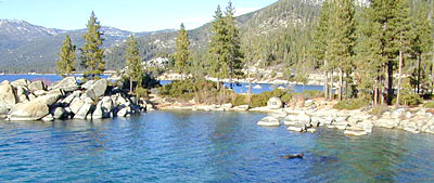
Numerous State Parks dot the shoreline at Tahoe, while the National Forest lands and Wilderness Areas span most of the peaks above. Camping, backpacking, boating, kayaking, fishing, climbing, mountaineering, mountain biking, snow skiing, snowmobiling are all popular recreation in this Sierra region. US Highway 50 and Interstate 80 are the main western access routes to Lake Tahoe. US Hwy 395 leads to Tahoe, up from the Eastern Sierra and Southern California.
Wanna find every waterfall or every creek to fish? This is the place that will help you find them. Easily, with good old fashion printed maps. Hard copies, some waterproof & tear resistant, most with topographical data and all roads, trails, campgrounds and parks. Whether or not you water ski or cross country ski, these maps will save your ass – when you are way back there in the boonies.
Tahoe’s Rubicon Trail connects the historic Gold Country to the alpine lake via granite wilderness sky ways above 7000′ elevation, but a real 4×4 and overnights are required. The back roads and trails are endless in these parts of the Central Sierra Nevada mountains.
- Tahoe Rim Trail Map
- Lake Tahoe Basin Map
- NatGeo Lake Tahoe Map
- Tahoe National Forest Map
- Desolation Wilderness Maps

Nearby attractions surrounding Lake Tahoe –
Tahoe National Forest
Tahoe Rim Trail
Rubicon 4×4 Trail
Lakes Basin Recreation Area
Sierra Buttes
Desolation Wilderness
Grover Hot Springs
Blue Lakes
Hope Valley
