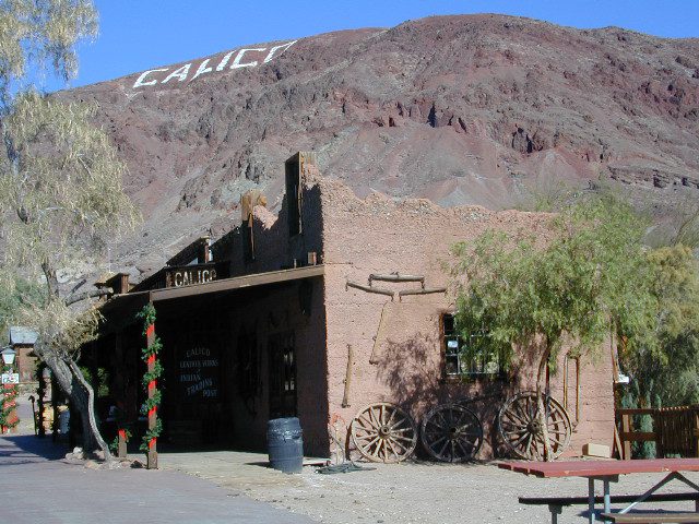
If you find yourself traveling through the giant Mojave desert during the day, keep Calico Ghost Town in mind. Whether you are headed to Vegas or Utah, you can always take a “stretch break” from the freeway driving, to see the historic cemetery, grab a bite to eat or browse gift shops. Calico is an old, abandon, mining camp turned into a commercialized theme park – just a few exits after Barstow, on Interstate 15.
Numerous festivals are held annually at this historic silver mining camp in the desert.
FEBRUARY Calico’s California Days
educational displays about California’s history, games and contests for the entire family, live entertainment, a chuck wagon chili cook-off and more.
SEPTEMBER Calico Days
a weekend experience revisiting life in the Old West during the 1800s. We line up gun-fighting shows and musical entertainment along with other festivities, including a miner’s triathlon, burro race, costume contest, pie-eating contest and loads of activities for the kiddos.
OCTOBER Calico Ghost Haunt trick-or-treating, costume contests, pumpkin carving, kids’ carnival tent, live entertainment stage shows, scare sets and haunted attractions; plus a Campsite Decorating Contest.
DECEMBERHoliday Fest decorated for the holiday season, this iconic ghost town features dining, shopping and costumed characters, as well as live music
Kelbaker Road is one of the well-traveled back roads in the Mojave Desert connecting two major Eastern California routes of Interstate system. The I-40 to the south and the I-15 to the north, spanning 50 miles from one to the other.
Kelbaker Rd continues south to T up w/ historic Route 66 near Amboy, CA. Gasoline is very iffy in Amboy, so remember gas up in Barstow.
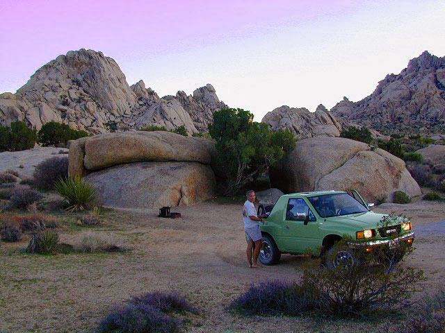
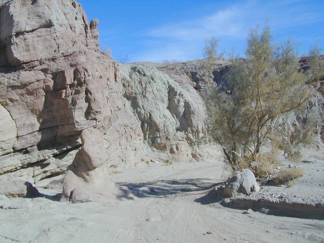
This region is super scenic portion of Kelbaker Road, which cuts thru the western edge of Mojave National Preserve. The Kelbaker pavement reaches to an elevation of 4024′ at Granite Pass, about 6 miles north of the exit @ interstate 40. Boulder outcroppings, bare mountain peaks, secluded cove camp sites w/ dirt roads, and old mines all over. Joshua tree forest and pinyon pine forest encircle the Mid Hills region.
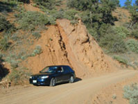
Some roads are suitable for passenger cars, but many are NOT. Dirt slides, erosion gullies, wash outs and rocks are common on these roads, so drive slow and pay attention. Have a spotter get out and take a look at the road conditions. Have a stroll, in the dark w/ the flashlights.
Or risk bottoming out, getting stuck in a deep rut. RVs should be very cautious. Daylight arrival is usually key for getting a perfect camp site, unless of course, you had it way-pointed on the GPS. Bingo! But the torrential thunderstorms, rearranged the valley since then, so use your brains.
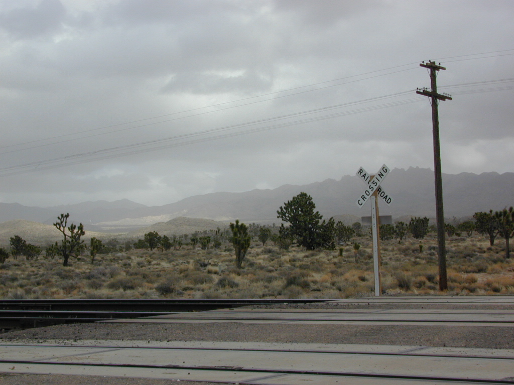
There are private property ranches, active railroad tracks & BLM lands along the Kelbaker route. Some of the boundaries of NPS have been extended, so best to bring a decent topo map.
Free camping is abundant in this desert region, but it’s all primitive w/ no facilities and all are on dirt roads when your turn off Kelbaker. Some of the best camping areas are around 4000 feet (above sea level), so serious wind and even snow is quite possible in the winter months. Go prepared w/ plenty firewood.
Historic Mojave Trail (aka Mojave Road) is out this way. Dirt bikes, off roaders love this trail that connects the Colorado River @ Avi Casino to Afton Canyon near Barstow.
WILDFLOWERS – joshua tree, yucca, barrel cactus
Higher elevation deserts bloom in late Spring, generally March thru May. Perfect rainfall timing in the autumn, can determine wild blooms and flora months later. Providence Mountains SRA can be a good location for wildflower viewing.
Kelso, CA
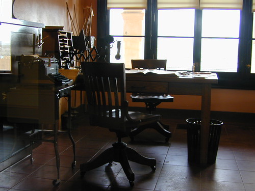
Kelso Depot: historic spot, centered around the old train depot, which has been restored and has become the new visitors center and museum. Totally worth a 2 hour stop and HIKING/WALKING stretch break. The road heads north from Kelso and the name changes to: Kelbaker-Cima Road
Cima, CA
Cima Store, 20 miles to the north is one of the few businesses in this region. Post Office next door, maybe. Cima Road connects to I-15 in approximately 15 miles north. Kelbaker Road splits again and it heads up to I-15 @ Baker, CA
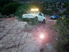
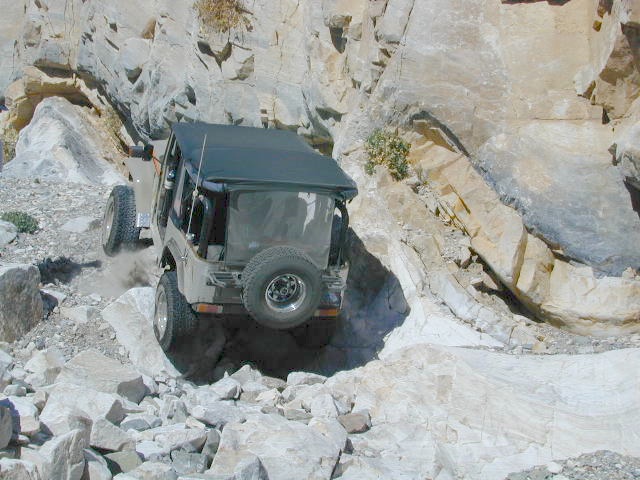
When people hear the phrase “off road” a hundred things can come to mind. Granola types envision rednecks, guns & beer cans tearing up the wilderness; while teen boys may like dirt bikes or motocross races; your co-worker digs the rock crawling rigs (on TV); your lesbian pals like to do desert & ghost town exploring in their Jeep & a million families like to camp out with RV & toys in tow. The quads, the sand rails, the rock crawling machines, the custom built buggies. Trophy trucks, rally racing Subies, 4WD camper vans, dirt bikes, the standard stock SUV, some w/ 4-wheel drive and who can forget the ever-freaking-popular jeaps. Sunday drivers sightseeing or hard core dare devil racers can be found in the realm of off-road: Off pavement.
They are ALL off roaders! And they are all unique, custom & no two created equal. There is certainty of it & the passionate fans will tell you. The off roading interest has gained popularity as more & more recreation vehicles become available to the main stream market. And TV shows promote these awesome rigs, the sport of dirt racing, rock crawling & the fantastic terrain. (And if you still watch television, that will soon change!)
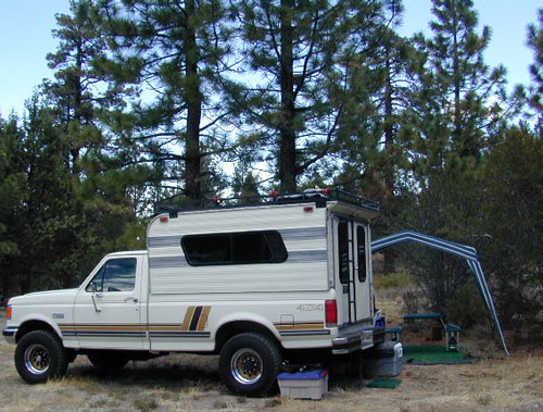
Baby boomers seek retirement vacations: compact 4WD camper vans, or smaller RVs capable of trailering an off-road machine; Fathers look for ways to entertain family out of doors, or escape on solo trips (for sanity sake). The off-road sport and interest has literally exploded over the past 20 years w/ media, hobby, competitions & after market products – along with the rising gas & tire prices.
Plan better trips, learn to really read a topographic map, depart for your trip over-prepared and find new, amazing destinations all over California. Use Total Escape often and get a bumper sticker for your rig!
Many folks drive dirt roads just to get to a trailhead and go hiking, mountain biking or rock climbing. Many backpackers trailheads are indeed located miles off pavement on forest dirt roads.
Some outdoor enthusiasts crave seclusion: peace and quite, away from city life, city folks, all noise… well away from the crowds. Preferring to camp outside of developed campgrounds, which means free camping (mostly on dirt roads). Campfire permits are always required. Many excellent, hidden camp sites can be found on rugged, unpaved back roads – some requiring 4 wheel drive, others not.
Gear Heads: those who value ‘vehicle time’ over ‘real nature’ will literally SIT inside their rigs (almost all day) – enjoying scenery from a safe distance. Picnic spot, viewpoint, yes, but rarely ever seeking out a hike, or a waterfall. Should a break-down occur, these dedicated guys will have their heads under the hoods or crawling underneath, for hours if needbe. Always be prepared with food in the cooler.
And believe it or not, some off-roaders will not even tent camp! They do not sleep on the ground. They prefer a local lodge in the nearest small town or they could own a luxury RV (towing a trailer w/ the overbuilt Jeep). Talk about gas guzlers.
Backcountry routes may be signed – high clearance needed, or not. Black diamond, double diamond trail. Yikes 4×4 required, what! Did we miss a sign or take a wrong turn?
SIGNS are not always reliable on the back roads.
Small Signs: get shot at, run over, blown over and washed away with erosion… so best have a hard copy map (at all times).
In Trinity, locals have been known to remove forest road signs to confuse tourists and prevent traffic in certain directions. I can’t imagine why. Cough, cough, Hyampom!
PVT – private property
This brings us to private ROADS & LAND. Just because a dirt road is located in a forest or rural region doesn’t mean it is open to the public. Generally private lands are well marked w/ ‘No Trespassing’ notices, some fenced and gated. In Baja and in ranching areas in general, public access may be allowed to pass through. Inquire at a local ranger stations for the area you wish to explore.
Litter removal 101 should be the norm; Don’t Trash California! Teach your children well. Respect the land and always Tread Lightly! Find more about ECO – CAMPING
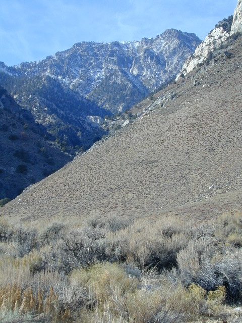
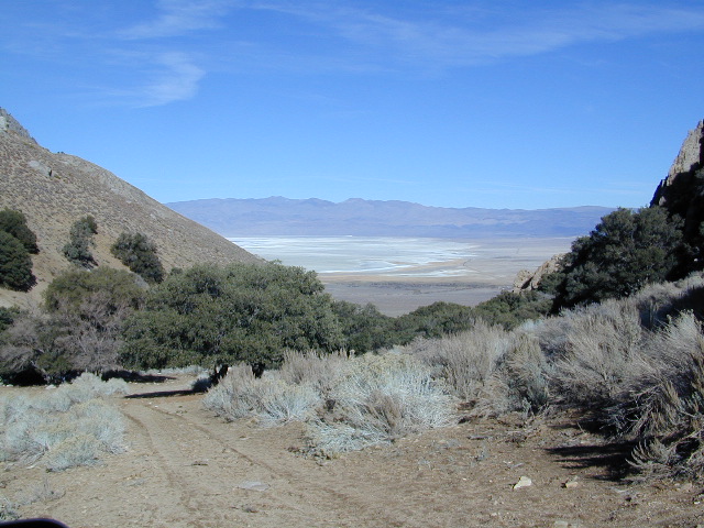
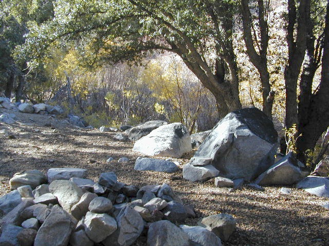
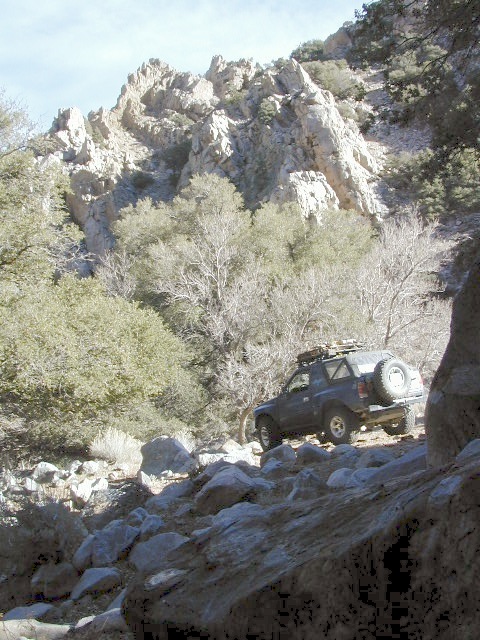
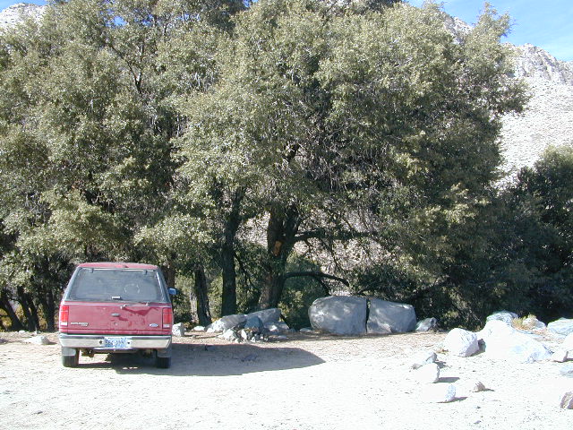
Just south of Olancha, off US Hwy 395 is a dirt road that takes you 5 miles up to an oak canyon lined with rocks. There are several primitive camp sites along the Walker Creek. A high clearance vehicle may be needed in some sections, but 4×4 is not required. Small RVs might attempt this, but if the first mile frightens you, turn around while you’re ahead.
This private, shaded, creek area is perfect for those traveling Highway 395, looking for a quick and free camp spot near Olancha, CA
Shady picnic or camp spots above 4000′ elevation.
Hiking trails at the end of the road lead deep into the mountains. One on the right takes you to waterfalls. The trail on the left will take you to meet up with the Sage Flat Trail, which leads up to Olancha Pass, Summit Meadows & a small lake, in the South Sierra Wilderness. The Pacific Crest Trail runs the ridges here, just west of Monache Meadows, which is at 8000′ elevation, way above here – up on top.
US 395 highway – the dirt road turn off is very close to a gas station, and it maybe be signed, or not. The gas stop may be in business, or perhaps not. This is rural California, wide open desert and things come and go quickly.
On a good topo map, located Olancha Creek and Summit Creek to the south. Walker Creek is the canyon in between those two, just so know where you are going and can visualize. This one is an easy-to-miss dirt road turn off – especially if you are going over 50 mph.
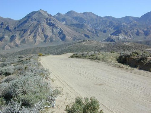
This is the North Mojave Desert, along Hwy 14, between the 395 junction & the town of MOJAVE CA. Jawbone Cyn is just south of Redrock Canyon State Park. Jawbone Canyon is big with off-roaders, so you’ll see plenty toy boxes & RVs w/ trailers out here. Open camping on desert washes; deep eroded canyons, minimal vegetation. The Dove Springs OHV area is closeby (on the other side of Red Rock, Randsburg ghost town is riding distance, and there is an information center & store w/ gas along the highway… Jawbone Store. 60 mph stretch. Blink & you will miss it.
Jawbone Canyon has open dispersed camping on dirt backroads. Many campsites suitable for motorhomes, toy boxes & trailers. Sandy washes & tight canyons are abundant. Very popular off-roading area, usually frequented by offroaders, ATV, dirt bikes & any other rig you can wheel. Busy on holiday weekends & very popular in winter months.
Jawbone Canyon dirt road climbs up from the rocky deserts to the joshua trees @ South Kelso Valley, passing the Bright Star Wilderness & Kelso Peak @ 5080′ elevation. The route eventually comes out at Hwy 178 just east of Lake Isabella, California. (This Kelso should not to be confused w/ Kelso, the train depot in the middle of the Mojave.)
Jawbone Store
Jawbone Information Center: 760-373-1146
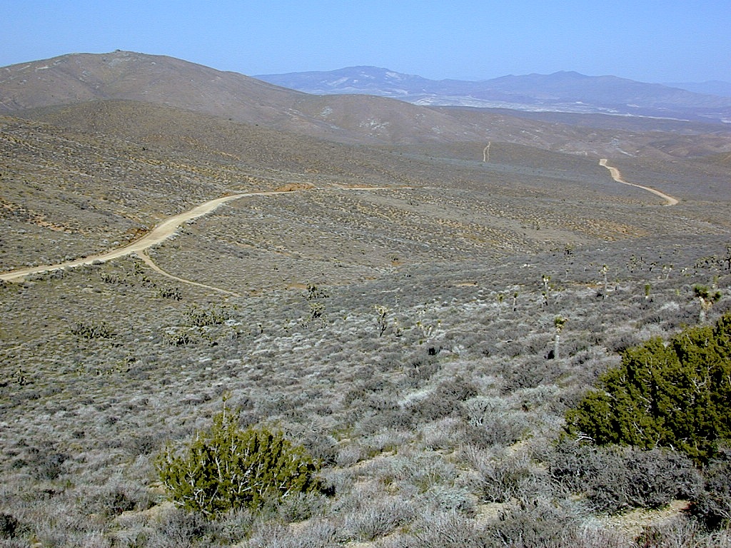
There are many desert canyons to explore in this region. ATV, dirt bike, 4×4, or just a high clearance SUV will get you most places you wanna go. Routes include: Alphie Cyn, Butterbredt Cyn, Kelso Valley Rd, Dove Springs Canyon, Bird Springs Canyon, Horse Canyon, Last Chance Cyn, Sage Canyon & Cow Heaven Canyon. Bright Star Wilderness is back here near South Kelso Valley , but no OHV use is allowed on these precious peaks. Kelso Valley Road will lead past the Bright Star Wilderness, along Kelso Creek, up to Lake Isabella & Hwy 178 w/ the South Fork of the Kern River. See the photos in the Saabaru.
The dirt route thru Horse Canyon leads past joshua trees, climbing in elevation to pinyon pines, up to the Pacific Crest Trail along the Scodie Mountains & dead ends at the small, historic McIver Springs cabin w/ wood burning stove and is well worth the venture. (PCT intersects Hwy 178 at Walker Pass just a few miles North of here)
Across on the other side of the 395, is the Burro Schmidt Tunnel is hand dug oddity – way up behind Last Chance Canyon & is totally a family tourist destination these days.
Jennie Lakes Wilderness is located in between two popular National Parks, via the paved back roads off Sequoia Generals Highway 198. Monarch Wilderness is north of Jennie Lakes, bordering Kings Canyon.
10,500 acres
26 miles of trail
Two lakes, Jennie Ellis Lake and Weaver Lake, set among granite outcroppings. Majority of the wWilderness is above 7,000 feet w/ red fir, lodgepole pine, and western white pine forest near treeline; abundance of spring wildflowers fill meadows. The two main lakes and Rowell Meadow are primary destinations for most backpackers wanting to camp overnight.
Impressive granite canyons, super steep. LOts of rugged rocky terrain, lower elevation to peaks of 11,000′. KINGS RIVER – Longest raging river in the Sierra, headwaters originating near Mount Whitney.


 Some roads are suitable for passenger cars, but many are NOT. Dirt slides, erosion gullies, wash outs and rocks are common on these roads, so drive slow and pay attention. Have a spotter get out and take a look at the road conditions. Have a stroll, in the dark w/ the flashlights.
 WILDFLOWERS – joshua tree, yucca, barrel cactus