Tag Archives: National Forest

Dispersed Camping Sequoia

bone creek

Sequoia maps

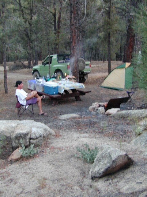
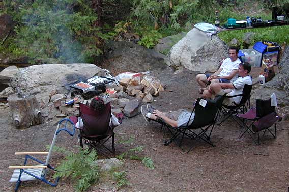
Open Camping in Sequoia National Forest – Forest Road Camping

Seeking secluded campsites? This is one of the best areas to camp in pine forest w/ privacy, relatively close to Southern California. Plenty of primitive car camping on the dirt roads throughout this whole Sequoia & Kern River area.

nfs primitive back roads mountain biking hiking mountains

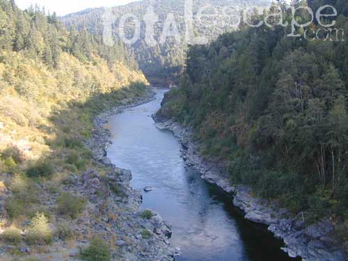
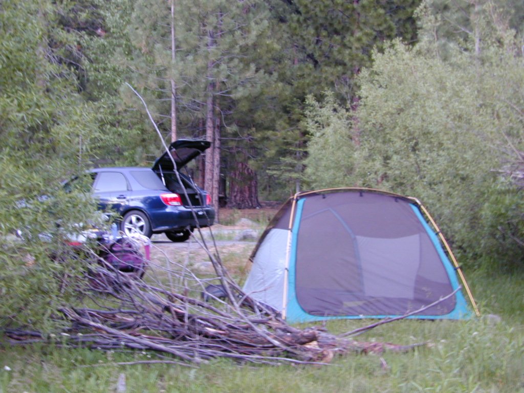
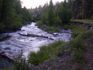
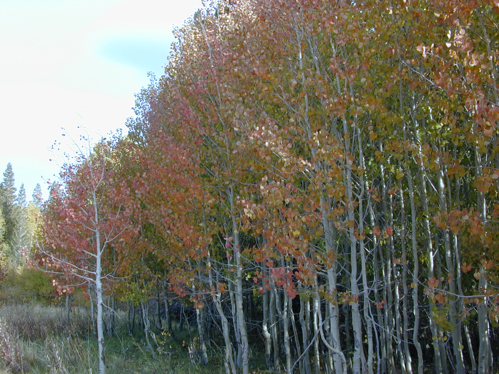
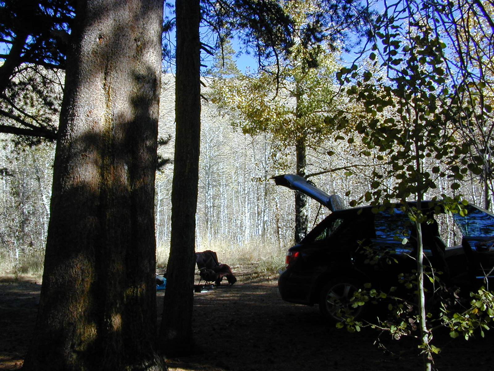
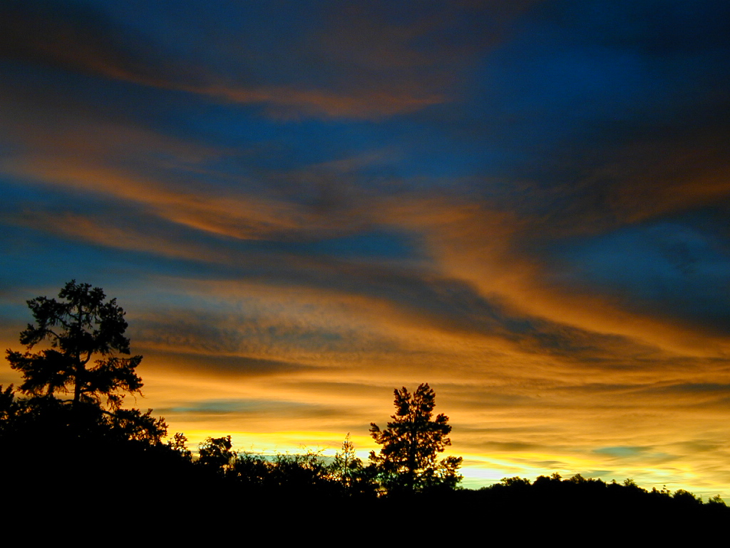
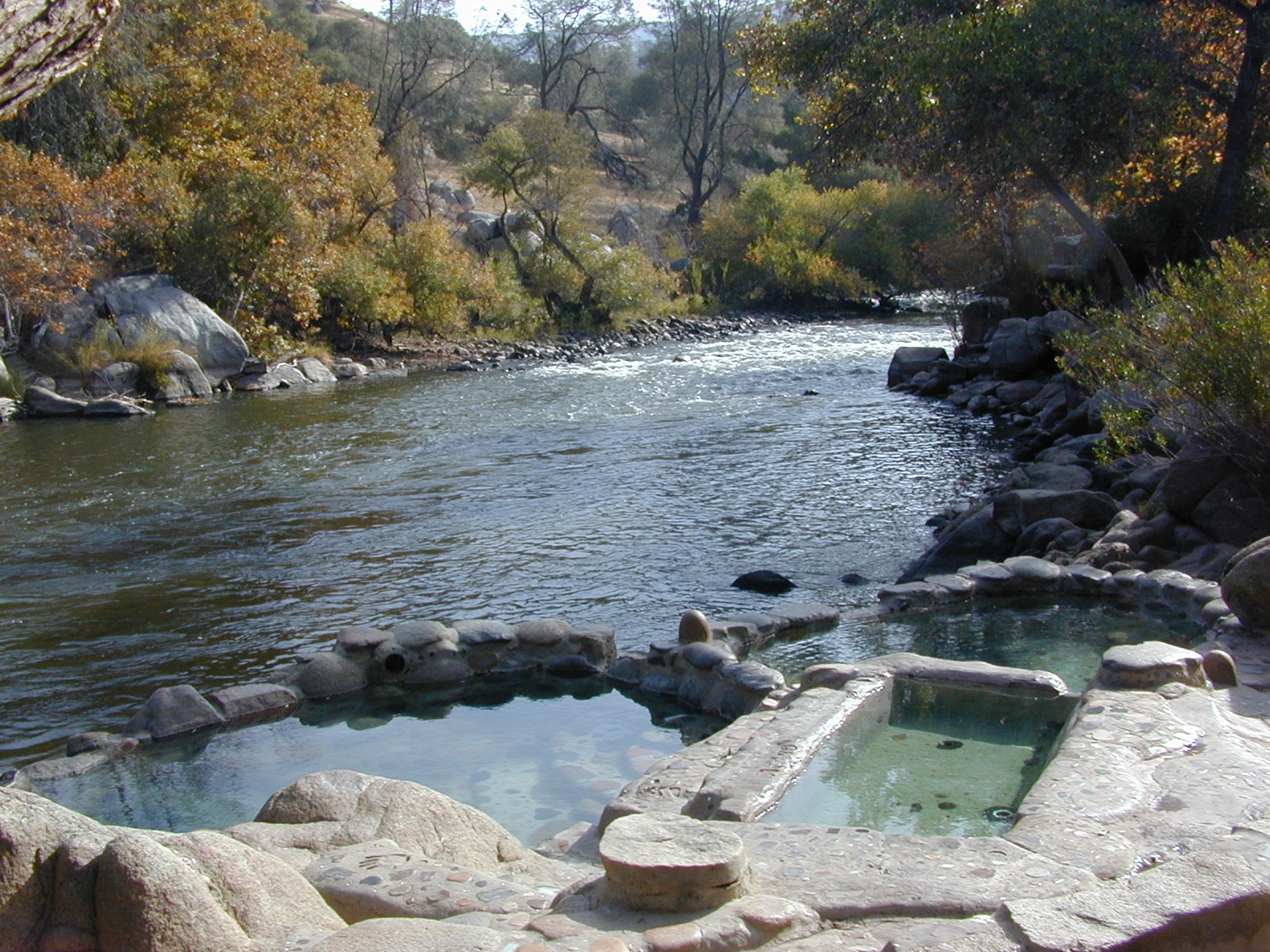
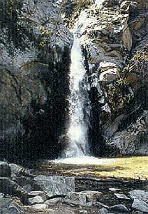
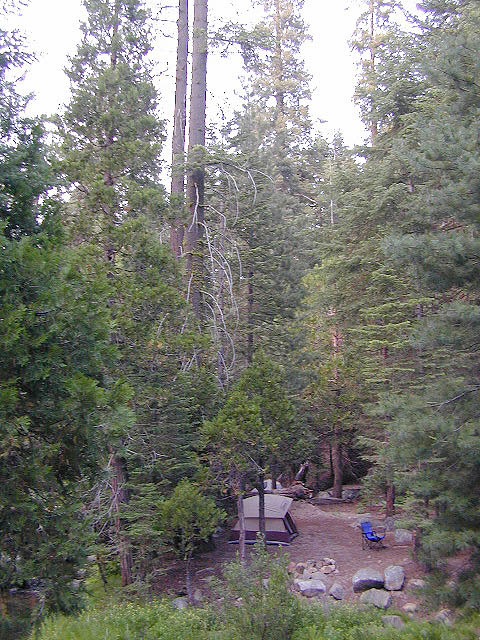
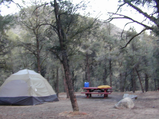
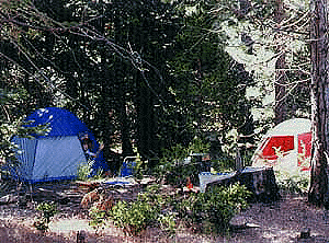
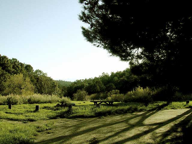
No facilities. No picnic tables, no toilet, no fees. Just a rock campfire ring & a clearing. Previously used sites have already been established usually near streams. Try to use these first, if at all possible. It takes a bit of exploring but you will find the perfect spot. Don’t even attempt to try to find these kinds of camp spots at night. They are often buried deep in the forest with no visible markers what-so-ever. But in trade, you will be lulled to sleep by your own private mini waterfall & no RV generators. Many of these back roads are closed & gated during winter months due to snow & rock slides.

No amenities are available in this neck of the woods, but plenty of seclusion & wilderness. Check official Wilderness rules for proper knowledge of the area restrictions. You must get a free camp fire permit from the ranger station in order to build a fire outside of a developed campground. A large shovel, plus bucket w/ water are a bare minimum for the privilege of camping like this. Certain dry seasons (summers into autumn) have very strict camp fire restrictions. Check with the ranger to see the latest on building campfires on the back roads. camping

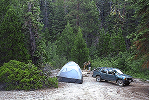
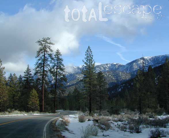
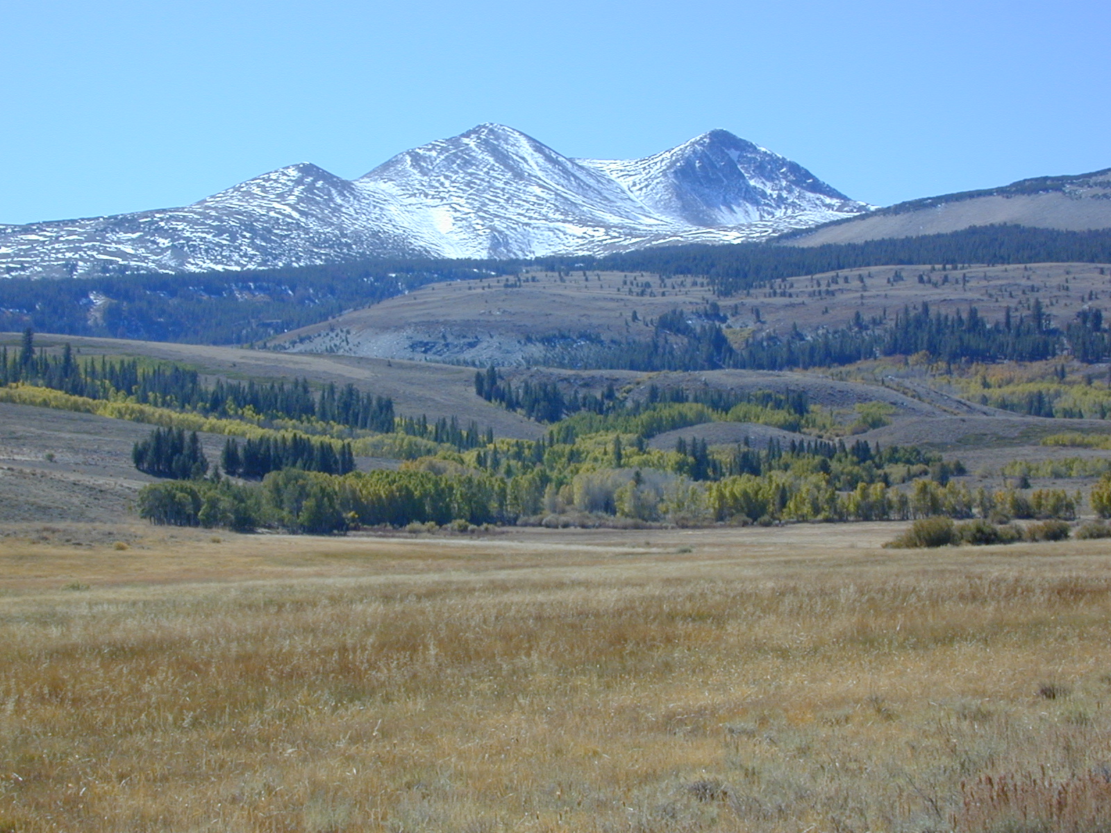
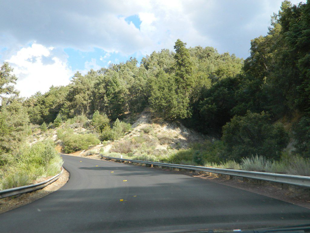
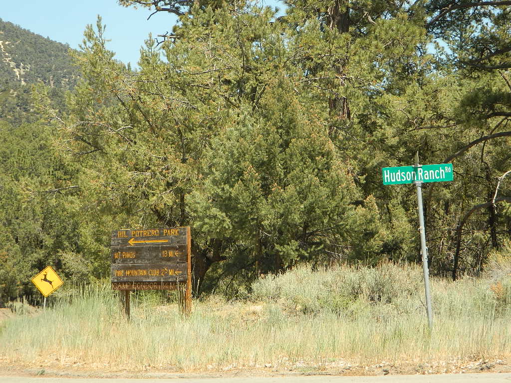
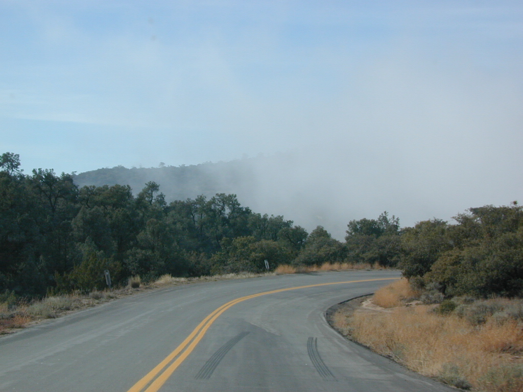
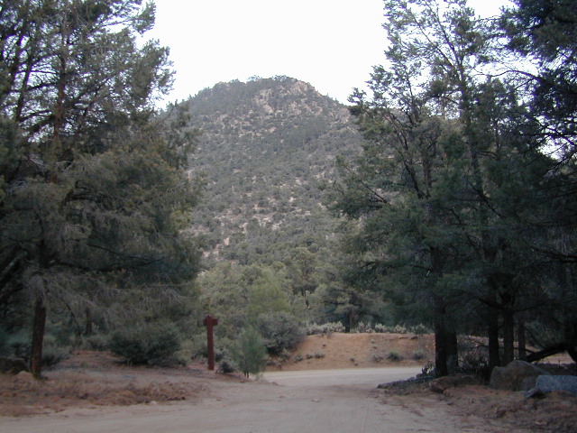
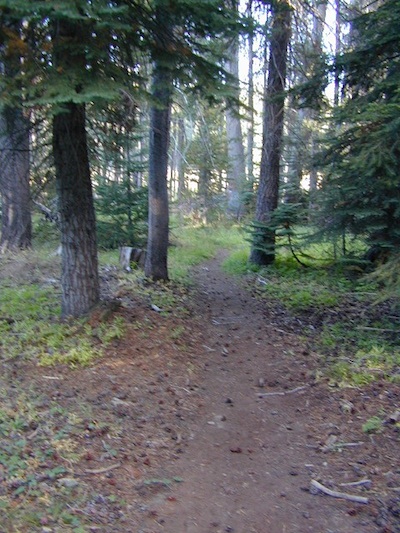
A Sequoia Forest Service Map is highly advised for this area. There are so many dirt roads for dispersed primitive camping on the back roads. Due to weather & erosion, some roads may require 4×4 or high clearance, so come prepared with a plan B.

Camping Checklist to make sure you’ll have what you need. The drive up from the Los Angeles area averages 3-4 hours and is well worth the trip. Once you’ve found that perfect spot, take detailed note of it, for the next time you visit the area. Then, you will be able to get there easily in the middle of the night, if need be.

Backroad Camping Sequoia: Follow the forest road numbers with your Sequoia map to discover amazing back road camping options. Your own private stream or meadow. Secluded campsites with your own mini waterfall.

overview

see also –
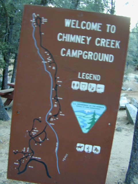
Sequoia Campground Camping

monache mdw

Long Valley Campground

Secluded Camp Sites

Long Valley Campground BLM

Southern Sierra Nevada
secluded camp, fishing & hiking trails
(free campground, open all year long)

South Fork of Kern River & DomeLand Wilderness

20+ miles from the nearest paved road; a remote camp on Long Valley Loop Road, off Canebrake Road. Both are dirt roads: high clearance vehicle recommended!

High Desert meets the Sierra Mountains

Back in the dry pinyon hills east of Kernville, beyond Sherman’s Pass; high above the Mojave desert and north of Canebrake & Highway 178. Long dirt roads, remote campground w/ fishing & hiking trails. Wilderness access.

hiking fishing trails horse trails back roads back roads sierra mountains

Chimney Peak Back Country Byway
Canebrake, California

These dirt back roads listed above skirt the edge of Dome Land Wilderness & Sequoia National Forest winding through BLM Land bordering the Mojave. The byway networks recreation areas between Kennedy Meadows and Canebrake, east of Lake Isabella. Eastern Kern County, California.

backpacking
camping
fishing
hiking
horseback trails
mountain biking
rock climbing
stargazing
wildflowers

Trailheads Domeland

People come way out here for the seclusion – the peace & the quiet. Mid-week you can have the whole place to yourself. Abundant hiking trails & fishing access. Into the Dome Land Wilderness you will find incredible scenery and diverse terrain – giant granite domes, waterfall canyons, and the South Fork of the Kern River (3 mi hike to river). PCTThe infamous Pacific Crest Trail passes close to Long Valley Campground, but Chimney Creek Campground is much closer to the PCT.

BLM Camping

Long Valley Campground

• Elevation: 5200′
• Number of Sites: 13
• Vehicle Accessibility: High Clearance Vehicle
• Facilities: picnic tables, fire rings, vault toilet
• Campsites Reservation: No
• Camp Fee: None
• Length of Stay: 14 Days
• Season: Open all year
• Operated by: BLM
• Trailheads: S. Fork Kern River & Domeland Wilderness

Bureau of Land Management
BLM Bakersfield Field Office
661-391-6000
Find a BLM page w/ map & info

Recent Domeland Wild Fires:
Manter Fire (2000)
McNally Fire (2002)

Long Valley Loop
Long Valley Loop Road (2001)

2016 NOTE: The part of the LOOP of Long Valley Loop Road that connects this campground to Kennedy Meadows (to the north) is CLOSED due to a huge washout. The Long Valley campground is accessible from the south side, from Hwy 178 @ Canebrake – and requires many miles of dirt road driving. High clearance vehicles are recommended; 4×4 needed in wet weather or snow.

towns nearby:

CANEBRAKE
KENNEDY MEADOWS
KERNVILLE
LAKE ISABELLA
MOJAVE

High Desert Sagebrush
High Desert Sagebrush & Dirt Roads
Wildfire Burn
Manter Wildfire Burn Area (2001)

Chimney Creek Campground

campmap

Chimney Creek Campground
BLM Kern / Mojave

High mountain desert camp is mislabeled on some maps as “Chimney Peak Campground” or “Chimney Rock Campground”. Pinyon pine forest on Chimney Creek, near hiking trailheads, wildflowers and Chimney Peak Wilderness. Southern Sierra ridge near Mojave Desert and California SR 178.

peakpinyons

Canebrake Road is a graded dirt road that makes up part of Chimney Peak Back Country Byway. This rural route is a major graded dirt road located north of Highway 178 – which connects Canebrake to Long Valley up near Kennedy Meadows. Pacific Crest Trail passes next to this campground in the Southern Sierra mountains. The campground turn off is way east of Lake Isabella Hwy 178 is (near Walker Pass & PCT) and follow dirt road north to Kennedy Meadows in the far eastern reaches of Sequoia National Forest

Chimney Peak BLM
• Elevation: 5,700′
• Number of Sites: 32
• Camping Reservations: No
• Sites Available: First come, First serve
• Vehicle Accessibility: RV limit 28′ max
• Length of Stay: 14 Days
• Water: Piped (April – Sept)
• Toilet: Vault
• Season: Open all year
• Fee: No
• Operated By: BLM
• Closest Town: Lake Isabella, CA

Bureau of Land Management
BLM Bakersfield Ranger Station
661-391-6000

Lamont Peak
Lamont Peak – elev 7510′

nearby destinations –
Camp Kern Backroads

Chimney Peak Wilderness
Lamont Peak
Long Valley Campground
Dome Land Wilderness
Owens Peak Wilderness
Jawbone Canyon
Sequoia National Forest
Sacatar Trail Wilderness
Kiavah Wilderness
Kennedy Meadows
Lake Isabella
Kern River
Monache Meadows


View Chimney Creek Campground in a larger map

Sawmill Lake Sierra

primitive camp spots

Sawmill Lake, California


N of Donner Pass, Sierra Nevada

elevation 5800′Canyon Creek connects Lake Faucherie, Sawmill Lake and Bowman Reservoir in the Sierra, Tahoe National Forest. 20+ miles of backroad travel, off I-80.

While many consider Faucherie to be the most beautiful scenic lake, Sawmill Lake just downstream a couple of miles is still quite attractive – with dense forests and a granite mountain backdrop. Sawmill is especially nice for those who like to primitive camp, ouside of developed campgrounds. Way off the interstate @ Hwy 20, tucked in way back behind Bowman Lake a few miles, you can find Sawmill Lake.

Sawmill Lake California

Fishing and camping, kayaking and canoeing are all popular recreation around this lake. A trailhead on the northend of the lake leads out to even more alpine lakes (a day hike “lake loop” or backpacking option). The Pacific Crest Trail is also routed nearby.

No motorized boats or watercraft allowed. No boat ramps, no pavement, no picnic tables, no bathrooms, no fees.

4×4 Lake
Fishing Lake
Free Camping Lake

The north shoreline is abundant with dispersed campsites: metal fire rings and a clearing only; no picnic tables, no toilets. Self sufficient campers only. Campfire permits, a water bucket and a shovel are required. During extreme fire restrictions campfires may not be allowed. Check with local rangers for up to date info.

Tahoe National Forest
Truckee Ranger Station
530-587-3558

National Forest Lake & Forest Lake Fishing Kayak lake hiking lake

Most campsites are drive up and park, while others closer to the shoreline have only walk-in access. Hauling your gear down hill won’t seem unthinkable once you’ve seen the lakeside views. There is even a camp below the dam, next to the waterfall.

waterfallfromdam

The main access Road #843-037 is very rocky and 4x4s love to frequent the area. The backroads here are best suite for truck travel, high clearance vehicles, off-roaders and SUVs. No small RVs or trailers. Passenger cars are not recommended. The access roads around the lake and up to the lake are dusty and rugged. The road below the dam is quite rough w/ rocks.

For more driving details, please see entry on Canyon Creek Campground.

road at dam
The water at Sawmill Lake is crystal clear snowmelt. The lakes around here are managed by Nevada Irrigation District, so this is why there are no engines allowed on the lake. This canyon area closes to public entry during winter months (NOV-APRIL), due to deep snow.

clear water

Gold Country California

Gold Country Sierra Nevada

historic murphys hotel

1849:
California Gold Rush began

These foothill regions below are the rivers & mountains of the infamous California Gold Rush of the mid-1800’s. Many mountain dirt roads will lead to your secluded, private camp site, near a creek or river. Or plan on camping in a developed Campground near a recreation lake lined with amenities, pine trees & oaks. River rafting & kayaking can be found throughout this area, as well as backpacking, mountain biking and hiking trails. Fishing is very popular as well.

Waterfalls, back roads, granite features, historic mining camps, big fishing rivers all abound. Wilderness backpacking in the High Sierra can be accessed by Hwy 108 (Sonora Pass) Hwy 4 (Ebbetts Pass) Hwy 88 (Carson Pass), Sierra US Route Hwy 50 & Interstate 80. Numerous small towns populate Historic Highway 49 for every tourists need – meals, laundry, grocery, coffee, lodging & shopping.

waterfalls Sierra Nevada

Gold Country California forest & parks –

Hwy 4 Ebbetts Pass & Hwy 108 Sonora Pass

Stanislaus National Forest
Columbia State Park

Arnold, Columbia, Dardanelle, Jamestown, Long Barn, Mi-Wuk, Murphys, Pinecrest, Sonora, Strawberry, Twain Harte

Sierra Nevada

Hwy 4 Ebbetts Pass & Hwy 88 Carson Pass, US Hwy 50

El Dorado National Forest

Amador City, Bear Valley, Georgetown, Jackson, Kirkwood, Meyers, Placerville

Sierra Nevada

Interstate 80 Donner Pass

Tahoe National Forest

Alta, Colfax, Foresthill, Grass Valley, Norden, Sierraville, Soda Springs, Tahoe City, Tahoma, Truckee

Sierra Nevada

North Hwy 49 Yuba River

Malakoff Diggins State Park

Downieville, Nevada City

red brick alley

23S64 – Sequoia NF

Sequoia Creeks

Bear Meadow: Forest Rd# 23S64 – Packsaddle Creek, Sequoia National Forest

For the more adventurous & ones seeking some seclusion, Bear Meadow is located up the dirt road a bit from Thompson Camp Spring . From Forest Road #23S16 @ Thompson Camp Spring – continue straight on the dirt road #23S64, cross over the one lane wooden bridge; within a mile, turn left into a secluded creek side camping area. Note: Bears are common here (hence the name Bear Meadow)!

Packsaddle Creek runs thru this forest. Very primitive area with rutted dirt roads & sometimes overgrown; there are several campsites back in here for the ones who seek the wild. (Yes, bears & wild animals are very common way back here). If you continue on straight on the main dirt road Packsaddle Meadow also has camping spots & small corral. The last time we were out this way (2002-ish), the dirt road does not connect with highway to the west, as indicated on the map; due to landslide.

Sequoia National Forest

Sequoia National Forest MAP

Closest small towns are:

Sierra Creeks

Toad Spring Campground

Toadsprings

Los Padres National Forest; Toad Spring Campground

Atop Quatal Canyon on Forest Rd #9N09
– less than a mile off of Cerro Noroeste Road; just west of Apache Saddle. Cerro Noroeste Road name has changed to Harris Ranch Road (2015), so make sure to check on several maps before venturing out, just so you know.

5700′ elevation w/ 5 camp sites.
picnic tables, fire rings & no toilet. OHV trails nearby

Red dirt Quatal Canyon, next to the Chumash Wilderness & the Apache Saddle, a small campground is an oasis for the wildlife. A year round drippy, soggy natural springs feeds the meadow & trickles down the dirt road. Great birdwatching, hiking, native wildflowers & hunting.

OHV use is quite common; Quatal Cyn trails,  a long desert wash to explore. Short side canyons to the right, off of main road (9N09). Many routes may require a high clearance vehicle, but not 4×4, unless it’s raining or wet or snowy. You’ll need a Los Padres Forest map to get the most enjoyment out of this confusing landscape.  The multi-colored, eroded badlands makes great day hikes. Chumash Cliffs & Mount Abel 8286′.

Ballinger Canyon OHV Park is about 20 miles away, via Quatal Cyn & then 5 miles N on Hwy 33


View Larger Map

LOS PADRES NATIONAL FOREST MAPS – USDA
LOS PADRES EAST MAP – NatGeo
LOS PADRES WEST MAP – NatGeo

towns nearby:

PINE MOUNTAIN CA

VENTUCOPA CA

Hiking Sequoia National Forest

Kern River Trails & Kernville Hiking

Sequoia National Forest Trails

Hiking Trails
Hundreds of trails meandering throughout this forest. Granite domes to huge Sequoia trees. Most secluded areas are found in the Eastern Section in the Dome Land Wilderness.

Dome Land Wilderness

Golden Trout Wilderness

South Sierra Wilderness

Sequoia Hiking Maps, Wilderness Maps, OHV Maps

Sequoia National Forest Hiking

lower kern river
the lush Lower Kern River on a misty Spring day

Upper Kern Hiking

Lower Kern River Hikes

Sequoia National Forest & the Lower Sierra Nevada Mountains extend from the Tehachapi ranges to the Kings River Canyon; from the Great Central Valley to the Mojave desert.

Sequoia National Forest MAP

Dome Land Wilderness MAP

Golden Trout Wilderness MAPS

Kern River Valley communities include:

Sequoia Mountain communities include:

Lower Kern Camp

San Diego Hiking Trails

San Diego hikes, SD hiking, San Diego Mountains

Anza Borrego Desert Slot Canyons

Back a couple of decades ago, inspiration and research for creating this very web site began in the deserted hills behind San Diego. Escaping the city at every chance, some feel the rat race more than others. Luckily the desert is close and there is plenty of space for everyone. California boulders and badlands, hot springs, pine meadows, great views, oak forests creeks, coastal cliffs and lush canyons near downtown, SD does have some awesome hiking trails – even a few waterfalls too.

LagunaMdws

San Diego County Parks Map w/ links
descanso_sign
SD small towns w/ hiking trails nearby
signjulian

San Diego Hiking Maps

ClevelandMap_07

Central Coast California

Central Coast Mountains / Central Coast Cali

Within 40 miles from the Santa Barbara coast are mountains that reach near 9000′ elevation, the tallest in Kern County. Mount Pinos & Mt Able, as well as the Sespe, Dick Smith, San Rafael, Matilija & Chumash Wilderness Areas, make up this southern portion of Los Padres National Forest. There are plenty of tiny, primitive campgrounds that offer seclusion for RVs & car campers. 4×4 camps, OHV routes & parks, plus numerous Wilderness areas that will suit everyone’s need for the outdoors. A great drive for accessing this area is Hwy 33 North from Ojai.

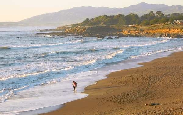
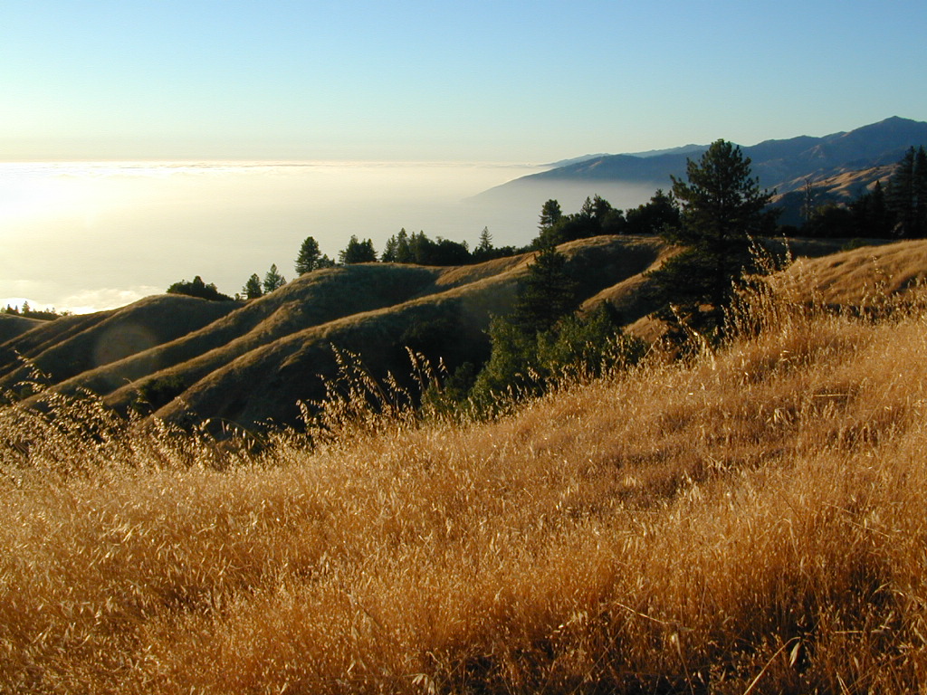
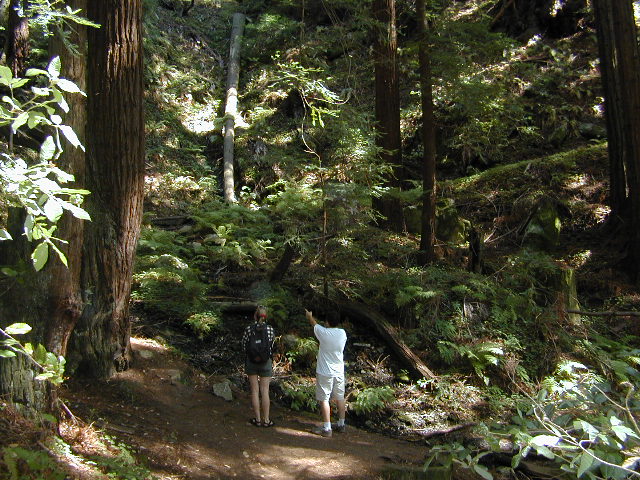
Further up the coast is the northern section of Los Padres National Forest – which is the mountainous back drop to the magnificent Big Sur coastline. If you are seeking to camp near Big Sur without the fees of a developed Campground, these dirt road ridge lines may be your saving grace… if you don’t mind roughing it. Views over the ocean & coastline are even more spectacular than from Hwy 1, but campfire restriction can be tight in summer & fall months. There are plenty lodging opportunities, historic lodges, cabins or luxury RV parks, located in the small towns along the coast.

Both Los Padres forest north & south are open all year long for recreation & camping. Only one town in this region, Pine Mountain Club, gets considerable amounts of snow (roads may be impassable without chains, AWD or 4×4). Central Coast icon Big Sur with Hwy 1 is prone to mud & rock slides during heavy rains, so plan for alternate routes & check road conditions w/ CalTrans when traveling during inclement weather.

Central Coast forest & parks –

Los Padres National Forest
Andrew Molera State Park
Julia Pfieffer Burns State Park
Limekiln State Park
Pfieffer Big Sur State Park
San Simeon State Park

Moonstone Beach Cambria

Central Coast maps & trails –

Central Coast towns nearby –
Big Sur, Cambria, Frazier Park, Gorda, Gorman, Ojai, New Cuyama, Pine Mountain, San Simeon, Ventucopa

Milpotrero

California North Coast

Northern CA Coast / Northern Coast of California

The redwood north coast of California is very forested region with many rivers & streams running throughout. Fishing, kayaking, rafting, camping & backpacking are all superb here. The wilderness rules, as the majority of the landscape is wild & untouched by development. Mountain ranges near the north California coast span in elevation from 1000′ to 8000′. The Klamath River, Eel River & Trinity River are the predominate waterways in this region, with designated National Forest lining their canyons. There are over 10 parks along the coast that feature the redwood trees as the main attraction. The ones listed below are the inland, mountainous areas of Northern California.

klamath river

Mendocino National Forest

Clear Lake, Kelseyville, Ukiah

north coast CA

Redwood National Park

Klamath, Orick

north coast CA

Six Rivers National Forests

north coast CA

Smith River Recreation Area

Crescent City, Orleans

SUV Trail

Baker Creek
Baker Creek, Inyo NF

Since sport utility vehicles were invented for California yuppies, it makes perfect sense that this California market also has the awesome terrain to use these rugged rigs. After the first shopping cart door ding or windshield crack, most folks are open to taking their utilitarian vehicles on dirt roads, but some will only dream about it.

big bear joshua trees

Here at Total Escape, we are here to change all that. The fear of outdoors, the unknown, the capability, the driving skill. Your SUV is a good reason to be outdoors in the golden state, at bare minimum. No excuses. Enjoy the California you never knew – and sometimes that means getting off the pavement. Yes, more than 2 miles.

SUV trail – any path, dirt road or route that can be driven on; high clearance vehicle are often necessary, 4×4 needed on occasion. National Forests, canyons, deserts, mountains, country lane style drives, some classic routes skirt the wilderness boundaries. We have it all for ya here. Rock crawling Rubicon adventures, all the way down to the leisurely ‘Sunday drive’ thru a forest to a meadow for a picnic. 

Jeep trails, forest roads, graded roads, gravel roads, back roads, dirt roads, 4×4 routes, OHV (off highway vehicle) trails.

MAPS will get you out there!
suv road trip
Dust, dirt, mud, snow. Beyond the county line, way back there, where you can discover ghost towns, old mines in the desert, hot springs, historic lodges, petroglyphs, river gorges, fire lookouts, waterfalls, and so much more.

Get motivated and travel in your SUV:

cattle roads

SUV camping

sierra roads

Cold Creek Campground

Cold Creek Camp

Truckee Campgrounds, Tahoe NF

Cold Creek Campground: N of Truckee, CA

DSCN0046

A small developed campground along forested Highway 89, with raging creek, fishing spots, and hiking trails and mountain biking trails nearby. Paved, level camp sites, small RVs okay w/ access to the numerous Sierra Nevada destinations with several lakes and reservoirs nearby.

This is a popular overnight stop “in route” for many campers and bikers traveling further on to the Northern Sierra Nevada mountains. You can exit off Interstate 80 @ Truckee, and be at this camp in minutes. Car camp, tent camping, a few spaces for small motorhomes. Plenty hiking and mountain biking trails.

Cold Creek Campground, California

on the Cold Stream;
Campground open May-October
(depending on snow)

High Sierra / Tahoe Truckee Camping

13 camp sites on Cold Stream @ 5800′ elevation; vault toilets, river and piped water, bear boxes; first come, first served camping

Max Camper Length: 22′

Rangers Office: 530-265-4531

The highway traffic noise makes this place a ‘short and sweet’ one nighter top pick, great for those camping in route to another destination. Another developed camp is on the opposite side of the highway, less than a mile north called Cottonwood Campground.

Free Camping nearby.
If you are seeking primitive camping near this area, start with Little Truckee Summit at the lakes turn off road on SR 89 – about 2 miles south of the Cold Creek Campground.

Tahioe USDA MapTake Tahoe Forest Road #5, a major paved road, approximately 12 miles back to the big meadows. Look for the unsigned dirt roads on left side of road nearing Webber Lake. The largest lake in the region, Independence Lake, is a paved side route off to the south. Further back on Road #5 the pavement ends at Jackson Meadows Reservoir. Very rough rocky road out to Bowman Lake w/ several developed campgrounds in the vicinity.


Tahoe trailheads lead out to –
alpine fishing lakes
mountain peaks
Treasure Mountain 7085′
Tahoe National Forest 
OHV Area @ Prosser Reservoir

NEARBY TOWNS:

ROAD CONDITIONS:

Tahoe and Truckee are known for their brutal winters and deep snows pack. Call CalTrans ahead of your departure if you are even slightly expecting any kind of precipitation. Truckee – winter road conditions


View Larger Map

Hoover Wilderness

Dunderberg Meadow

 Dunderberg Peak capped with snow about half the year @ 12,374′ elevation. Dunderberg Meadow is a side route off Green Creek Rd. Upper Summer Meadow Rd is another side route off Green Creek Rd.

Eastern Sierra Hoover Wilderness

East Yosemite National Park

48,601 acres
10 miles South of Bridgeport, CA
Toiyabe National Forest Autumn Eastern Sierrasand Inyo National Forest

Hoover Wilderness spans  the mountain ranges from Sonora Pass to Tioga Pass, with high elevation peaks ranging from 10,000 to over 12,000′ elevation. Emigrant Wilderness lies to the west of Hoover, with Yosemite National Park & Inyo National Forest to the south.

  • Twenty Lakes Basin
  • Virginia Pass
  • Virginia Lakes Basin
  • Lundy Pass
  • Bond Pass
  • Hoover Lakes
  • Return Creek
  • Little Walker River
  • West Walker River
  • Matterhorn Peak – 12,264′ elev

towns nearby –

Aspen groves in the Eastern Sierra are some of the best autumn colors in the whole state. Fall car camping includes nighttime temps in the teens w/ fishing and hunting nearby.

PCT trails, Eastern SierraPacific Crest Trail passes partially through Hoover Wilderness inside  Yosemite National Park.

Hoover trails are not all dirt road access, but most are. There are 2 major trail heads along Highway 120 inside Yosemite NP, which lead north to Hoover.

Hoover trailheads –

California SR Highway 120 (Yosemite NP):

off US Highway 395:Hoover Trail Map

Twin Lakes area:

  • Robinson Creek
  • Horse Creek
  • Cattle Creek
  • Tamarack Lake
  • Buckeye

Little Walker River area:

  • Bort Canyon
  • Emma Lake
  • Molybdenite Creek

California SR Highway 108 (Sonora Pass):

hoover wilderness map

Green Creek Road is a signed dirt road on US Highway 395, near Virginia Creek Settlement and across from the Bodie ghost town turn off. Green Creek Campground  (a developed NFS campground) also has trailhead parking for Hoover hiking trails. Primitive free camp site can be found all along this major graded dirt road.

Many developed campgrounds in the surrounding areas – Saddlebag, Lundy, Virginia, Green Creek, Twin Lakes, Buckeye, Obsidian. Off Sonora Pass, Levitt Lake usually gets the most snow depth around and is only acessible in summer months. Super remote primitive camping for those with a high clearance vehicle.

FRee Camping Green Creek


Cerro Noroeste Road

Fresh Blacktop 2011

Scenic Drive California: Cerro Noroeste

Tejon Pass, Frazier Mountain, Tecuya, San Emigdio, Mount Pinos, Apache Saddle, Mount Abel, Quatal Canyon, BitterCreek, Klipstein Canyon

Los Padres NF – Cerro Noroeste Road #9N05

One of the best driving roads in Central California!

Motorcycles love this route.

Los Padres National Forest stretches from Ojai to Monterey, mostly along the California Central Coast. If you are traveling on Interstate 5 (atop the Grapevine, Tejon Pass) and you wanted to head westbound,  then you really want to take this scenic route.

Exit Frazier Park Rd @ Lebec, on the top of the Grapevine (Interstate 5 N of jct Hwy 138). Proceed westbound thru the Frazier Park stop sign (5 mi), up the hill past the turn off for Lockwood Valley Road. Frazier Mountain Park Road now becomes Cuddy Valley Rd, continue up to pine trees. Turn right on Mil Potrero Highway & drive thru Pine Mountain Club (4-8 mi). Continuing past the golf course, heading up to Apache Saddle.

Approximately 6000′ at a forested intersection is the ‘saddle’ with ranger station. The paved road is now considered Cerro Noroeste Road.

A left turn will bring you up to Cerro Noroeste 8286′ elevation. (10 mi/closed in winter) This mountain peak is also known as Mount Abel.

At the saddle, continuing straight (veering right) through the P&J forest (pinyon and juniper) to the gorgeous rolling hills, fog & cloudscape countryside of ..

HUDSON RANCH ROAD

WTF? Recently county authorities have renamed Cerro Noroeste Rd to Hudson Ranch Rd, which has many locals infuriated and of course, keeping visitors confused. There is a popular Hudson Ranch up near Napa Wine Country, but this is not named after that location. Rumor has it that one local family complained to Kern County about the difficulty of spelling ‘Cerro Noroeste’ for outsiders. Go figure! Want a local roadway name changed? Easier process than imagined – just file a suggestion w/ Kern County.

HUDSON RANCH ROAD

Bitter Creek Wildlife Area & Highway 166 (23 mi) are all out this way. Sports cars & motorcyclists love this route, so do hikers & hunters. Every weekend you can find hundreds of bikes cruising this scenic byway.

Best Sunset Drives
Numerous forest roads can be found out this way. Quatal Canyon #9N09 is a great side route to explore if you like long dirt roads, red dirt, lupine & pinyon pines. Chumash Wilderness backcountry access is way back in this super scenic canyon. Toad Spring Campground is a small site located near the top of the canyon, only half mile off the pavement.

Forest Road #9N27 leads up to Caballo Campground & even further out to the steep ridge line, Marion Campground & Blue Ridge 4×4 trail. Across from the Apache Saddle Ranger Station, San Emigdio dirt road #9N34 climbs to 7400′ elevation and has a great viewpoint. Unsigned San Emigdio 4×4 trail starts at the viewpoint and heads east.

Way out west on Cerro Noroeste Road is Valle Vista Campground, with new a outhouse. This small campground is perched on the edges of red cliffs overlooking the great Central Valley of California.

Klipstein Canyon, a side route/short cut to Taft, offers decent wildflower displays in springtime. San Andreas faultline uplift is also evident on this detour. Road Closed barriers seem insignificant, as many drivers just skoot around them.

CerroNoroeste

nearby towns:

Pine Mountain Club, CA
Frazier Park, CA
Ventucopa, CA
Taft, CA
New Cuyama, CA

Kern River Hot Springs

Kern Hot Springs

Kern River Hot Tub

From Lake Isabella down to Bako, along Hwy 178, numerous natural hot springs can be found in this lower Kern river canyon. Old Kern Canyon Road has plenty of primitive spots to camp along the road, way above the Kern River. This Southern Sierra Nevada scenic route, a 20 mi winding narrow paved road, is the old highway that leads up to Bodfish CA.

At least a dozen dispersed camp sites can be found along the Old Kern Cyn Rd, some spots with views over canyon, some hidden & shady, many spots are level & large – suitable for RVs. No facilities, no fees, just a flat, dispersed site. Campfire permits are required for fires outside of developed Campgrounds & fire restrictions are often high, so no fires are allowed much of the year. Most of the gates on the Lower Kern are now locked & only accessible by Forest Service personnel, ranchers or local rafting companies with permits.

2 developed Lower Kern Campgrounds are located on the Old Kern Canyon Road, which parallels the 4 lane portion of the highway: Hobo Campground & Sandy Flat Campgrounds, if you really need a picnic table & bathroom. You can reserve camps by clicking the links.

Miracle Hot Springs – next to Hobo Campground. This hot tub park is closed for good. A few portable bathrooms, picnic tables & trash bins, the hiking trails clear; 2 shallow pools partially filled. Maybe enough room to soak your butt, but not fully submerse yourself. Someone really needs to renovate this place! Update 2012 – the signs for Miracle are now completely gone.

Remington Hot Springs

This one is by far the most popular now that Miracle is gone. The hike-in only access doesn’t deter people much and many choose to set camp overnight close by. The local authorities are always making the rounds to double check on the area – which is good for security and bad for the 2 AM party animals.

Kern recreation

Democrat Hot Springs

private resort now open? Heck, I dunno. (2017, democrathotsprings.com is down. They might be trying to promote a River Festival held in May.)

The hotel and cottages were constructed to accommodate guests that came in stage coaches to dine and relax during the early 1900’s. Five springs on the property flow at 115 degrees into large soaking tubs and a swimming pool. Closed to the public for more than thirty years, the resort is once again ready to be brought to life for groups and private events only.

Kern recreation

The hot springs listed below are Private Property, so don’t get caught – and don’t get shot:

Delonegha Hot Springs

Concrete tubs were built by homesteaders, later a hotel and boarding house were constructed. Stage coaches from the San Joaquin Valley took 2 days to get visitors to this area. The hotel closed in 1912, when more accessible areas of Democrat and Hobo were built. Remaining cement tubs run along a rock peninsula overlooking the Kern River; water temperatures average 112 degrees. This private property is fenced.

Scovern Hot Springs

Also known as the Hot Springs House. 1902 mud baths were being offered and the wooden tubs were replaced by galvanized tubs. A swimming pool and bath houses were added when the Scoverns bought the property in 1929. Bath house burned to the ground in 1971 and only a vacant lot remains. Steam can still be seen in the fields across from the springs, where water runs at 140 gallons a minute @ 115 degrees.


NEARBY TOWNS –

ALTA SIERRA CA

KERNVILLE CA

LAKE ISABELLA CA

WOFFORD HEIGHTS CA

MAP OF THE KERN RIVER –

Sequoia National Forest Map

Kern Hot Springs

Trinity Alps Trailheads

Trinity Alps Wilderness Trailheads
NorCal Hiking Vacations

Meadow on Trinity Alps Long Canyon Trail

Northern California, Trinity Lakes
Shasta Trinity National Forest

  • backpacking
  • camping
  • fishing lakes
  • hiking trails
  • horseback trails
  • waterfalls

Trinity Alps Wilderness

hike


Trinity Wilderness trailhead locations –

trailheads from Highway 3:

  • Scott Mountain (PCT access)
  • Bear Creek
  • Eagle Creek
  • Stoddard Lake
  • Boulder Creek
  • Big Flat
  • Swift Creektrinityalps_lg

trailheads from Highway 299:

  • Canyon Creek
  • Hobo Gulch
  • French Creek
  • Green Mountain
  • Jim Jam Ridge
  • East Fork
  • New River
  • Grizzly Camp

trailheads from Highway 96:

  • Tish Tang
  • Red Cap Lake
  • Bear Hole
  • Mill Creek Lake
  • Salmon Summit

trailheads from north @ Salmon River, Cecilville Rd #1C02:

  • Hidden Horse
  • Trail Creek
  • Carter Meadows Summit (PCT access)
  • Middle Boulder

Trinity Alps Wilderness Trail
Overview @ SummitPost

West Kern

festivals kern

CA Kern / western Kern county

Kern County is known for its oil, its agriculture, and outdoor recreation. The Kern River is the highlight of the region with lush, green and grey granite canyons, a big reservoir & the Sequoia trees just up the road. On the western side of Kern County are small towns like Frazier Park, the golfing cabin community of Pine Mountain Club, plus the oil meccas of Maricopa and Taft. Expansive Lockwood Valley enters into Ventura County. Cuyama River borders Santa Barbara & SLO counties.

Much of the western Kern area is rural ranch land, desert or forest. Los Padres National Forest, Chumash Wilderness, Bittercreek Wildlife Refuge, Wind Wolves Preserve, Buena Vista Reservoir, Ballinger Canyon, Hungry Valley and Fort Tejon State Park all call this region home, right on the mighty tangent of the San Andreas fault line. The San Emigdio range and the surrounding mountains of Mt Pinos and Mount Able design a perpendicular range to the Central Cali coastline, connecting the huge Mojave desert to the ocean. Cerro Noroeste is a very scenic drive.

The 17 mile long Quatal Canyon, where the indian camp of Mahu Tasen hosts a Bear Dance every summer is also a wild place of bird watching, camping and hunting. The indian word for Mount Pinos is “Iwihinmu” – a sacred spot for Chumash Indians, as well as others; Chumash call it the ‘center of the world’. Locals respond regularly with music, hikes, star gazing, drum circles (seasonally) and local festivals (annually) .

PHOTOS: Los Padres Photos | Miller Jeep Trail Off Roading Photos

Drum Camp Pinos | Drumming Cerro Noroeste

Tecuya Ridge

Tecuya Ridge, Cuddy Valley 4×4 trails can keep you busy for a whole weekend of back road exploring.

boating, camping, dirt biking, fishing, hiking, horseback, hunting, mountain biking, off roading, skydiving, xc skiing

DSCN0029

Quatal Canyon

Sturtevant Falls

Santa Anita Canyon, Sturtevant Falls

a day hike in the San Gabriel Mountains

Day hikes near Los Angeles, CA

Santa Anita Canyon, Angeles National Forest
From the 210 freeway, in San Gabriel Valley. East of Pasadena, exit Santa Anita Ave.
Head North/East, through neighborhood, where road becomes Chantry Flats Rd (aka, Forest Road #2N40)
proceed up the mountain to paved parking lot @ Chantry Flat. Falls Trailhead #11W14

  • 5 miles RT hike
  • 4600′ elevation
  • steep canyon w/ creek crossings
  • falls and creek subject to seasonal dry up; water flow varies
  • backpack camping only, no developed campground


more photos on trailhead


View Larger Map

Ventana Wilderness

ventana hikes

Central Coast California
Backpacking Big Sur

Ventana Wilderness is a 40 mile stretch of protected land located in the Santa Lucia Mountains on the Big Sur coastline in between the Monterey peninsula and the Nacimeinto-Fergusson Road #4004. Fort Hunter Liggett lies to the east side and the Pacific Ocean to the west. Ancient volcano peaks called “cones” line the pine ridges – Ventana Cone,  Ventana Double Cone, South Ventana Cone, Black Cone & Cone Peak.

240,026 acres
Cone Peak – 5155′ elevation
Los Padres National Forest
San Antoni River
Sykes Hot Springs
Tassajara Creek
Tassajara Hot Springs

campgrounds bordering area –

hiking trailheads –

  • Cone Peak
  • Escondido
  • China Camp
  • Arroyo Seco
  • Bottchers Gap

redwood hikes

nearby towns –

Central Coast Big Sur Maps

ventana map

Los Padres Forest Maps

NatGeo Big Sur Topographic Map

Pinnacles National Monument Map

Ventana Wilderness Topo Map

Smaller Silver Peak Wilderness (31,555 acres) is also featured on the same map, situated south of Ventana and north of the San Simeon Hearst Castle area.


Ventana Wilderness Alliance
Ventana Wildlife Society